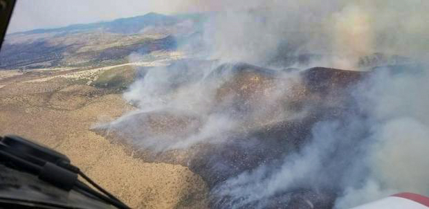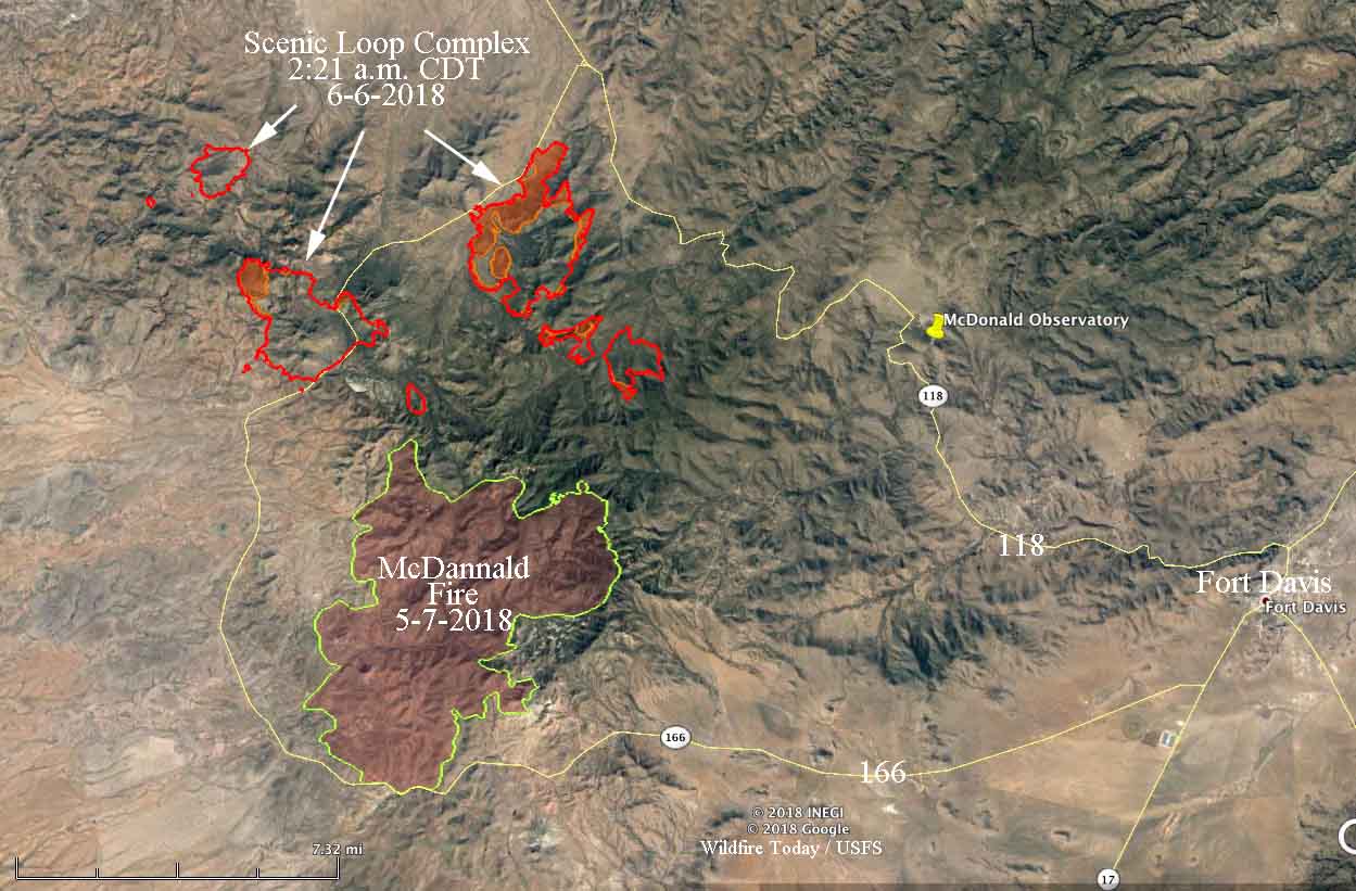
A thunderstorm on June 3 that pelted the Davis Mountains in west Texas with lightning started 18 wildfires. Rain that followed may have put some of them out and others could have burned together, but remaining are at least 7 fires ranging between 11 and 3,541 acres, for a total burned area of approximately 8,134 acres.
The fires are spreading through rough terrain and currently are not a threat to any subdivisions. They are 14 miles west of Fort Davis, 6 miles west of the McDonald Observatory, and as close as half a mile north of the McDannald Fire that burned 19,000 acres north of Highway 166 in the first part of May.

The Lone Star State Type 2 Incident Management Team is in unified command with the County of Jeff Davis to manage the fires. A Type 1 Incident Management Team has been ordered.
Currently firefighters are being supported by helicopters, as well as Very Large, Large, and Single Engine Air Tankers. Multiple hand crews are en route.
An Austin firefighter captured this image of the #DavisMountain fires in West Texas at the #ScenicLoopComplex. (Courtesy: @AaronWernsman) https://t.co/em4xxzNrMe pic.twitter.com/wSu1ECtxIS
— Spectrum News Austin (@SpecNewsATX) June 6, 2018
Scenic Loop Complex wildfires? #Texas #USA?? 05 June 2018 Nat. col. + IR highlights #Copernicus #Sentinel-2B?️ Full-size: https://t.co/8Zv8PigToC #wildfire #ScenicLoopComplex pic.twitter.com/LhosKl9qgP
— Pierre Markuse (@Pierre_Markuse) June 6, 2018
