Tag: smoke
Wildfire smoke affects air quality in California and Oregon
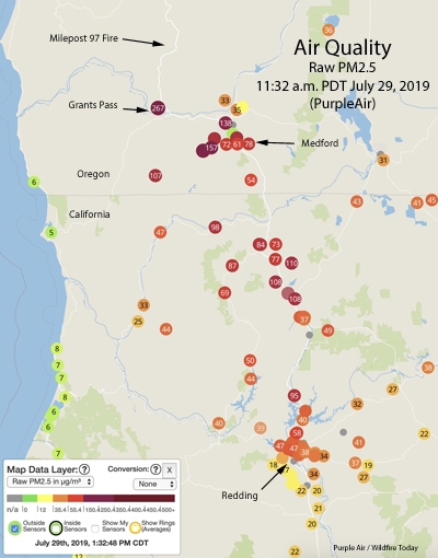
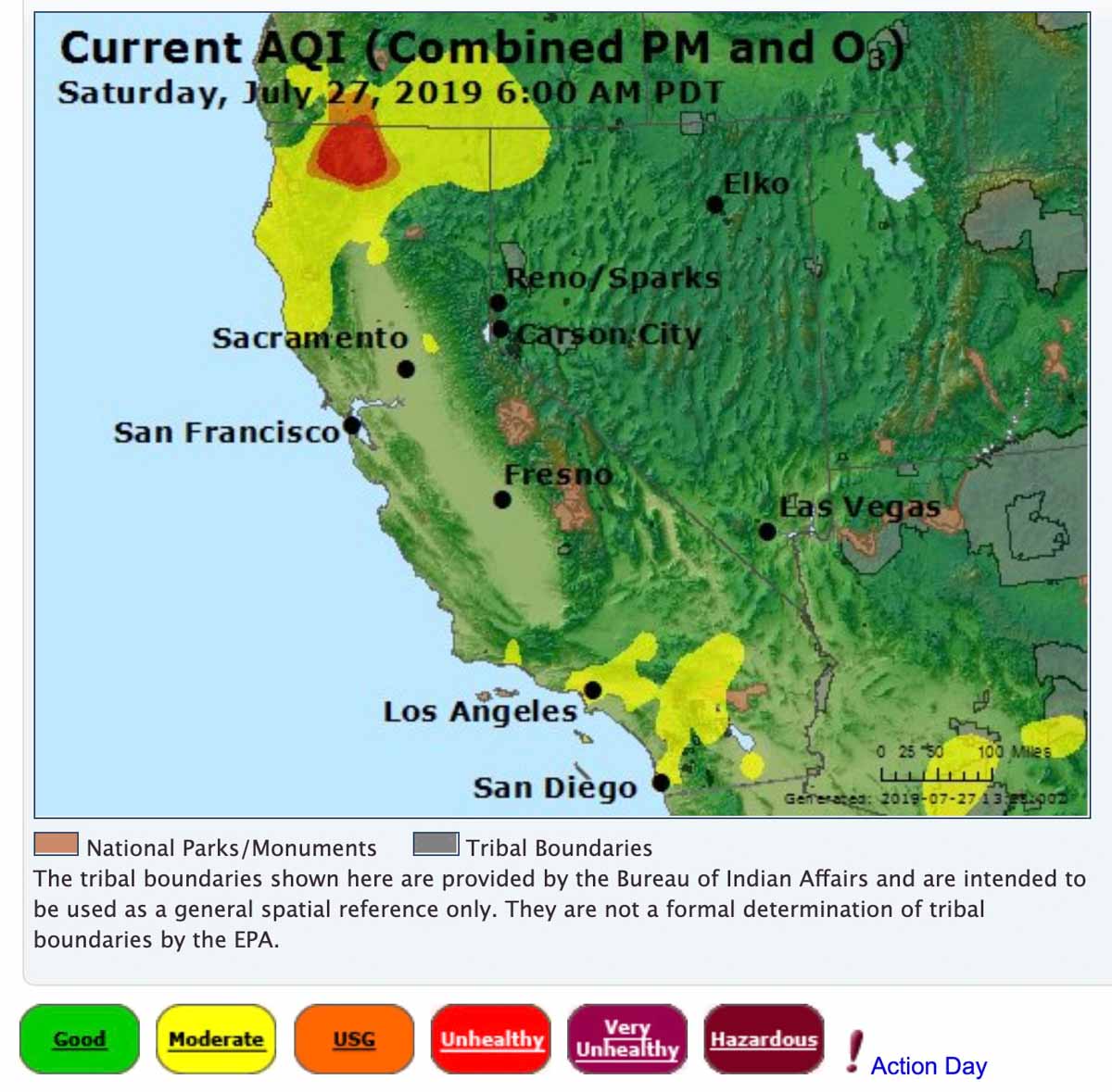
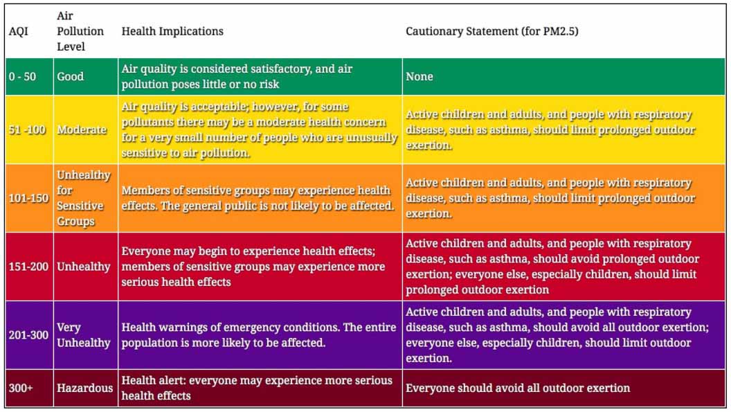
Smoke from the Milepost 97 Fire south of Canyonville, Oregon is significantly affecting air quality in Southwest Oregon and Northern California. In some areas near Medford, Oregon it has reached the “Very Unhealthy” air pollution level which could affect the entire population, especially anyone active and people with respiratory disease.
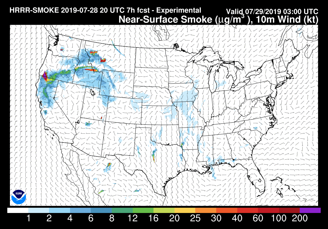
Smoke from Milepost 97 Fire spreads in Southern Oregon and Northern California
(UPDATED at 3:56 p.m. PDT July 27, 2019)
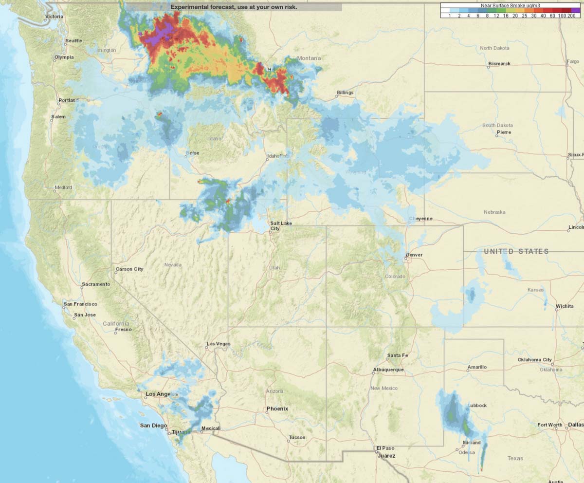
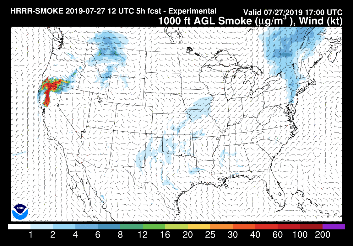
Below is an updated forecast for the distribution of smoke from the Milepost 97 Fire in Southwest Oregon. One difference from the previous version further down in this article is that not only is it proceeding further south approaching the San Francisco Bay Area, but some of the smoke will be spreading into southern Idaho. The forecast is for 6 p.m. PDT July 27, 2019.

(Originally published at 7:15 a.m. PDT July 27, 2019)
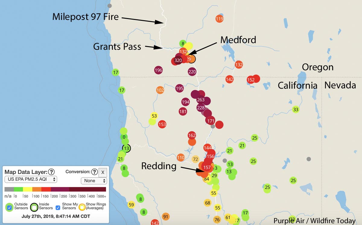
Smoke from the 8,878-acre Milepost 97 fire near Canyonville, Oregon is affecting the air quality in Southern Oregon and Northern California.
Some of the cities in Oregon affected are Grants Pass, Medford, and Ashland. And in California, Yreka, Weed, Mt. Shasta, and Redding.
Click here for more information about the Milepost 97 Fire near Canyonville, Oregon.
California adopts emergency rule to protect outdoor workers from wildfire smoke
Firefighters are exempt

On July 18 California’s Department of Industrial Relations’ (DIR) Occupational Safety and Health Standards Board adopted an emergency regulation to protect workers from hazards associated with wildfire smoke. The regulation is expected to go into effect in early August.
The emergency regulation will be effective for one year and applies to workplaces where the current Air Quality Index (AQI) for airborne particulate matter (PM) is 151 or greater, and where employers should reasonably anticipate that employees could be exposed to wildfire smoke.
Under the new regulation, employers must take the following steps to protect workers who may be exposed to wildfire smoke:
- Identify harmful exposure to airborne particulate matter from wildfire smoke before each shift and periodically thereafter by checking the AQI for PM 2.5 in regions where workers are located.
- Reduce harmful exposure to wildfire smoke if feasible, for example, by relocating work to an enclosed building with filtered air or to an outdoor location where the AQI for PM 2.5 is 150 or lower.
- If employers cannot reduce workers’ harmful exposure to wildfire smoke so that the AQI for PM 2.5 is 150 or lower, they must provide respirators such as N95 masks to all employees for voluntary use, training on the new regulation, information about the health effects of wildfire smoke, and the safe use and maintenance of respirators.
This new regulation exempts employees exposed to a current AQI for PM2.5 of 151 or greater for an hour or less during a shift, and firefighters engaged in wildland firefighting.
This emergency rule making process began last December, after the Standards Board received a petition to protect workers from wildfire smoke before this year’s wildfire season. The Standards Board has requested that Cal/OSHA conduct a follow-up comprehensive review of the regulation with an advisory committee using the regular rule making process in order to adopt permanent regulations. The emergency regulation will remain in effect during that process. Meeting details and documents will be posted on Cal/OSHA’s website.
Wildfires produce heavy smoke in Alaska, Canada, and the Midwest
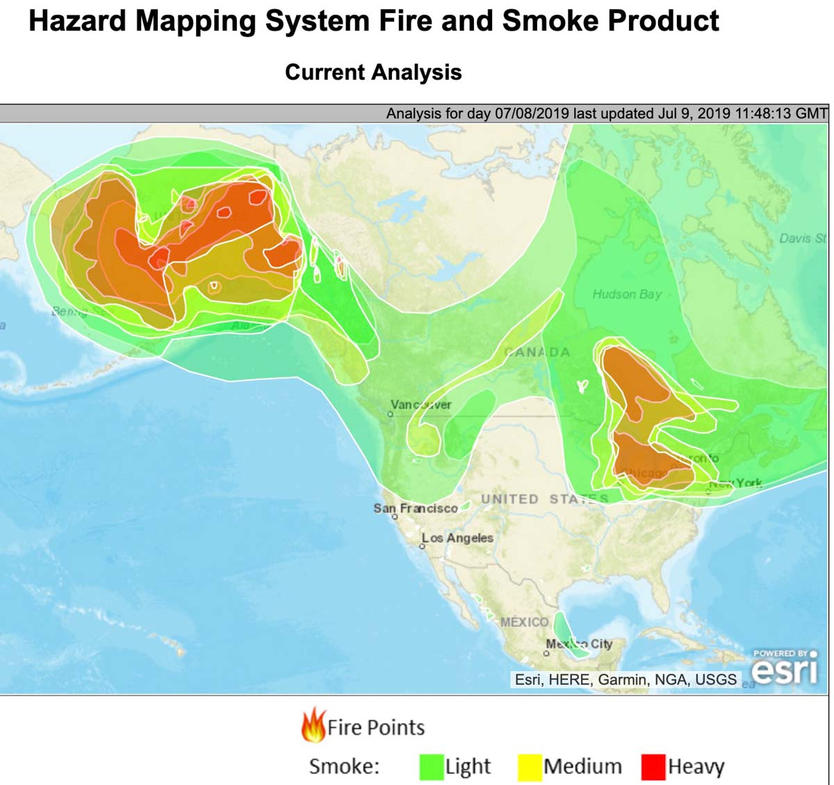
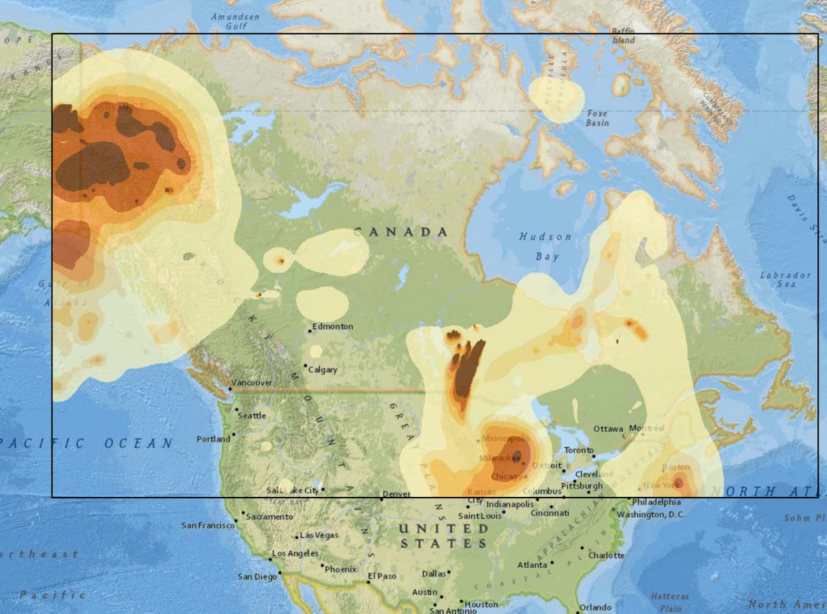
Wildfires in Alaska and Ontario are creating large quantities of smoke that is affecting not only those areas but Yukon, British Columbia, Quebec, Washington, Oregon, Idaho, and the Midwestern states. Tuesday morning the smoke is unusually noticeable in Milwaukee, Grand Rapids, Chicago, Detroit, Cleveland, and Toronto.
The NOAA map above shows the extent of smoke at 6:48 a.m. MDT July 9. The one below produced by the Canadian government is the forecast for 6 p.m. MDT July 10 but only covers the area within the black border.
Smoke advisory and Red Flag Warnings, July 4, 2019
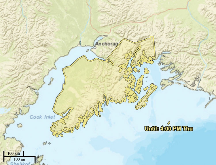
A Dense Smoke Advisory has been issued for the Kenai Peninsula and areas west of Anchorage, Alaska for dense smoke from the Swan Lake Fire that could reduce visibility to one-quarter mile or less.
Red Flag Warnings have been issued for areas in Western Colorado and Eastern Utah until 9 p.m. CDT Thursday. Forecasters expect 10 to 20 mph southwest winds gusting to 35, and relative humidity of 9 to 14 percent.

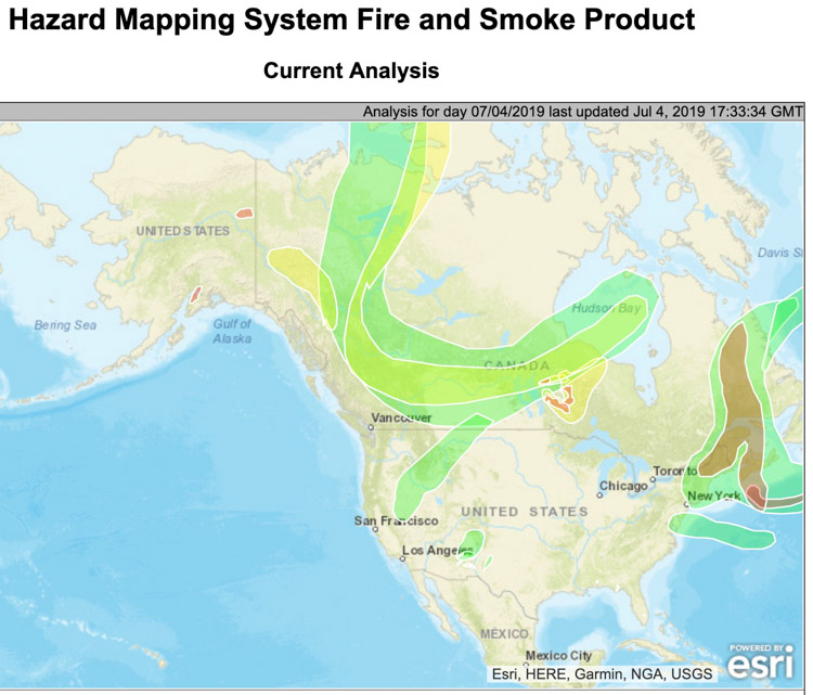
(Red Flag Warnings can be modified throughout the day as NWS offices around the country update and revise their weather forecasts.)
