Update on the Fire and Smoke Model Evaluation Experiment

fire Manning Creek burn
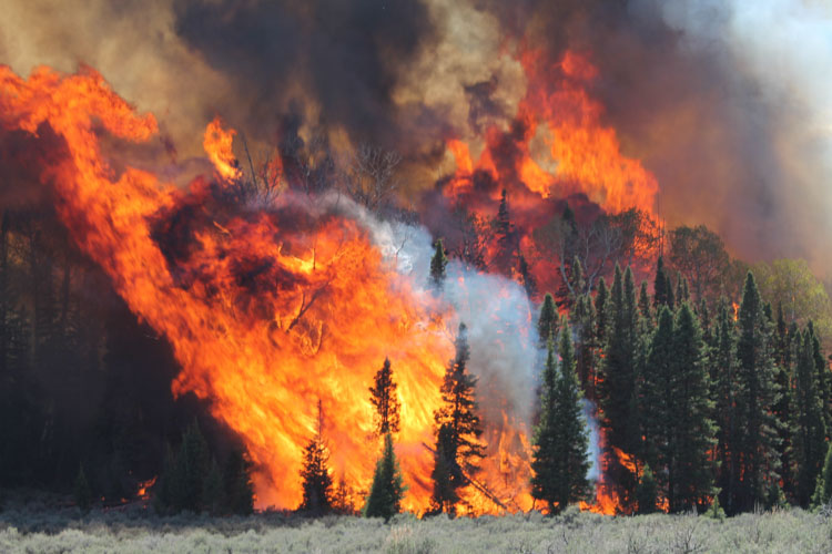
Manning Creek burn on June 20, 2019. (Photo by Roger Ottmar)

The Fire and Smoke Model Experiment (FASMEE) is a large, multi-agency effort funded by the Joint Fire Science Program and the U.S. Forest Service to identify and collect critical fuel, fire behavior, and other measurements that will be used to advance scientific understanding as well as operational and research modeling capabilities associated with wildland fire. The goal is to allow managers to increase the use of wildfire and prescribed fire.

On June 20, 2019, FASMEE completed data collection on Manning Creek, the first of two large, operational stand-replacement burns in a dense mixed conifer-aspen forest as part of FASMEE’s Phase 2 Southwest Campaign (Phase 1 was a planning phase and other campaigns are possible). The burn was conducted by the Richfield Ranger District located on the Fishlake National Forest in Utah. Over 40 scientists participated using ground sampling methods, drones carrying state of the art imagery and air quality sampling instrumentation, fire hardened video and still cameras, and LiDAR to collect a suite of data including fuel loading, fuel consumption, fire behavior, plume dynamics, and smoke data. Readers can view video and photographic imagery captured during the Manning Creek fire at https://fasmee.net/study-sites/manning-creek

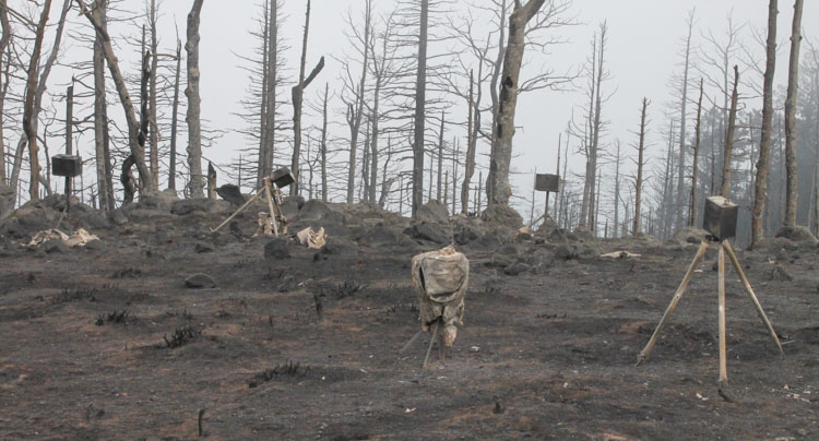
Richfield Ranger District personnel will conduct a second stand replacement research fire this fall near Annabella Reservoir with over 120 scientists participating. In addition to the suite of instruments and sampling techniques deployed during the first research burn, two fixed wing aircraft including NASA/NOAA’s FIREX-AQ DC8 will be sampling plume smoke and heat release. Additional LiDAR and radar units have been acquired to better identify plume dynamics, with cameras and thermocouples added within the fire perimeter to capture data on soil heating and aspen regeneration.
fire Manning Creek burn
Manning Creek burn on June 20, 2019. (Photo by Brett Butler)
drone fire Manning Creek burn
A wildland firefighter flies a drone over the Manning Creek burn on June 20, 2019. (Photo by Adam Watts)


Evacuations lifted at Gun Range Fire

The fire burned 365 acres at Bountiful and Centerville, Utah August 30

Gun Range Fire
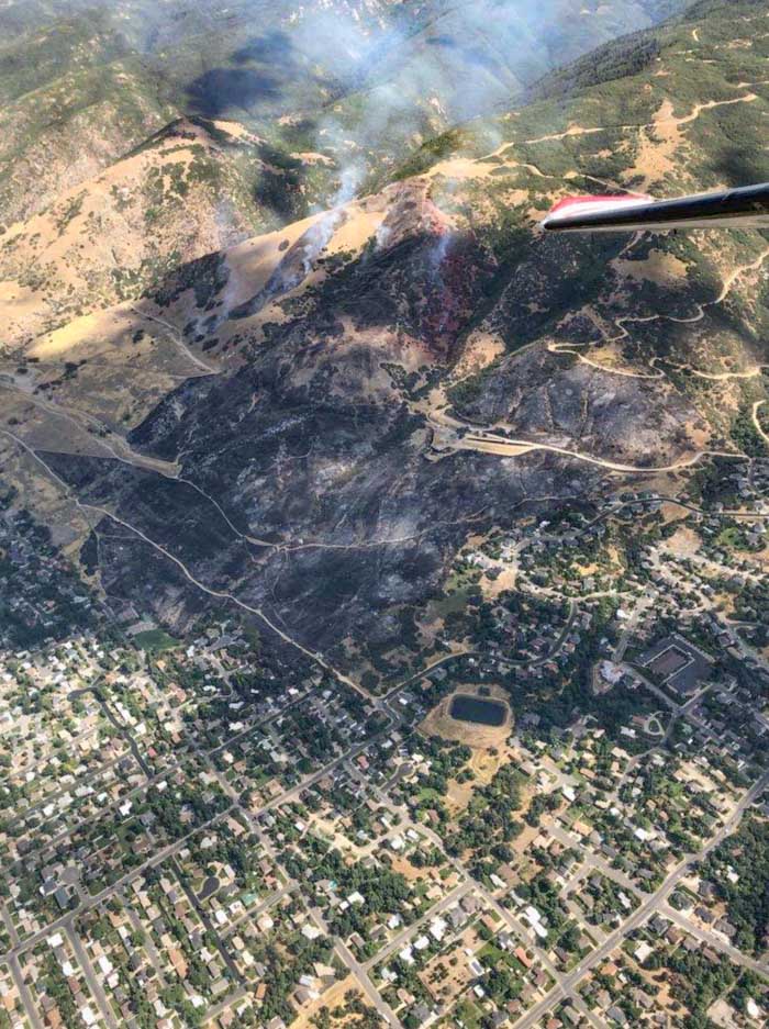
The Gun Range Fire started August 30, 2019 in a wildland-urban interface. Photo provided by Utah Fire Info.

The last of the evacuation orders were lifted Saturday morning by the Bountiful Police Department for the areas near the Gun Range Fire that burned 365 acres near Bountiful and Centerville, Utah Friday.

Officials with the Uinta-Wasatch-Cache National Forest said the fire started from an abandoned campfire believed to have originated above the Lions Gun Range in Bountiful. Authorities are searching for two individuals in a small SUV.

The photo above shows that the fire, which destroyed three homes, occurred in a wildland-urban interface. It appears that firefighters succeeded in keeping that number lower than it could have been.


More information about the Gun Range Fire at Bountiful.

Fire at Bountiful Utah forces hundreds to evacuate

The Gun Range Fire was reported at about 1 a.m. on Friday

Gun Range Fire
Gun Range Fire. Photo by Davis County Sheriff Search and Rescue.

(Originally published at 11:59 a.m. MDT August 30, 2019)

A fire that started after midnight Friday east of Bountiful and Centerville, Utah forced the evacuation of 400 homes. The blaze was named Gun Range Fire because it is near the Lions Gun Range in Bountiful. Most wildfires are named after the location where they started.

Map Gun Range Fire
Map of the Gun Range Fire based on heat data from a satellite at 4:24 a.m. MDT August 30, 2019. The red line is the approximate perimeter.

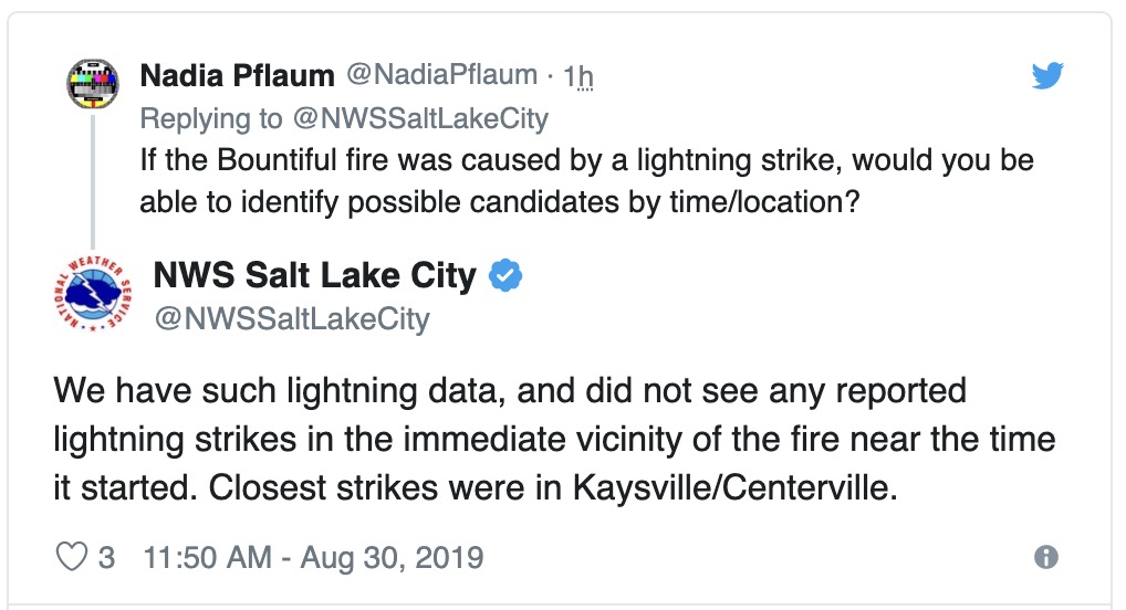
By 10 a.m. evacuations in Centerville had been lifted but the order in Bountiful was still in effect. Fire officials estimated the fire had burned 150 to 300 acres, destroyed three homes, and damaged five others. The cause of the fire is under investigation.

NWS Gun Range Fire

Kim Osborn, the public information officer for the Northern Utah Interagency Fire Center said several hotshot crews, air tankers, and helicopters are on the scene.

Other fires that have occurred recently in that general part of Utah include the 6,451-acre Goose Point Fire, the 7,900-acre Shelter Pass Fire, the 450-acre Alaska Fire, and the 167-acre Round Peak Fire  — all since July 17, 2019.

Traffic camera keeps recording while surrounded by fire

Utah traffic camera fire swept over
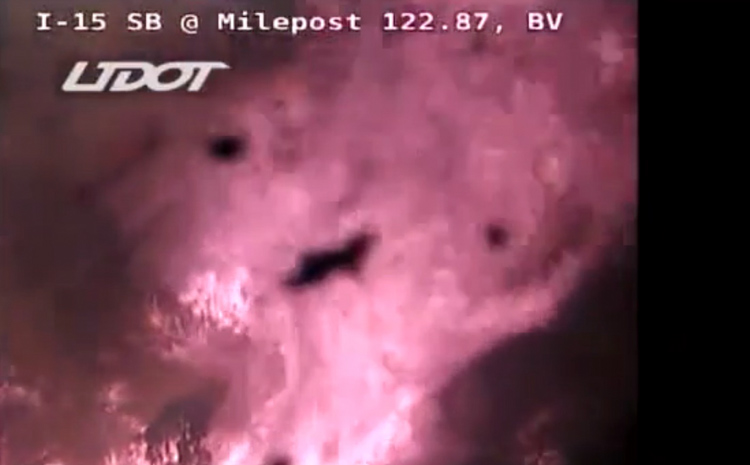
The Utah DOT camera at milepost 122 continued to transmit while it was engulfed by a wildfire. Screenshot from the video below.

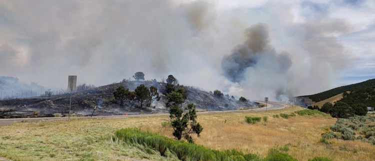
A highway traffic camera kept transmitting as the Milepost 122 fire swept over the site. It happened 10 miles north of Beaver, Utah on August 22 as the Milepost 122 Fire burned across Interstate 15.

The fire burned about 1,200 acres and closed the Interstate for a while.

Utah milepost 122 wildfire
Milepost 122 fire. Photo credit: Stephanie Schenck.

Goose Point Fire burns over 6,000 acres southwest of Provo, Utah

Posted on Categories UncategorizedTags

Firefighters fought fire with fire

Goose Point Fire Provo, Utah burnout
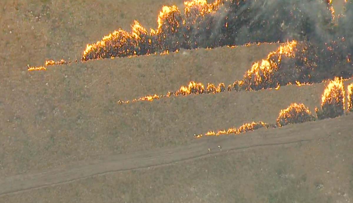
Firefighters burn out from a dozer line on the Goose Point Fire southwest of Provo, Utah. Screenshot from KSL 5 TV video.

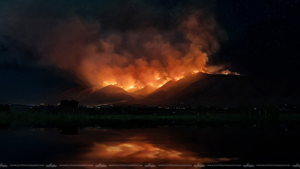
The Goose Point Fire grew quickly when it started late Wednesday afternoon on West Mountain 11 miles southwest of Provo, Utah. After it burned through the night, firefighters on Thursday worked with dozers to fight fire with fire — burning the fuel between dozer lines and the main fire. At 11:00 a.m. Thursday firefighters using GPS equipment mapped it at 6,451 acres and soon thereafter stopped the spread.

The preliminary cause is machinery that was operating in the area, according to Dave Vickers, an area fire management officer with the Utah Division of Forestry, Fire and State Lands.

Goose Point Fire Provo, Utah
Goose Point Fire on West Mountain. Photo by Jocelyn Marie Cooley.
map Goose Point Fire Provo, Utah
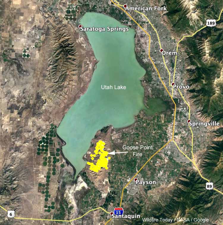
Map showing the location of the Goose Point Fire southwest of Provo, Utah.

The KSL 5 TV video footage below has some excellent shots of the Goose Point Fire.

Researchers study and film the depths and heights of a forest fire

The scientists captured video that is mesmerizing

Forest Service fire research
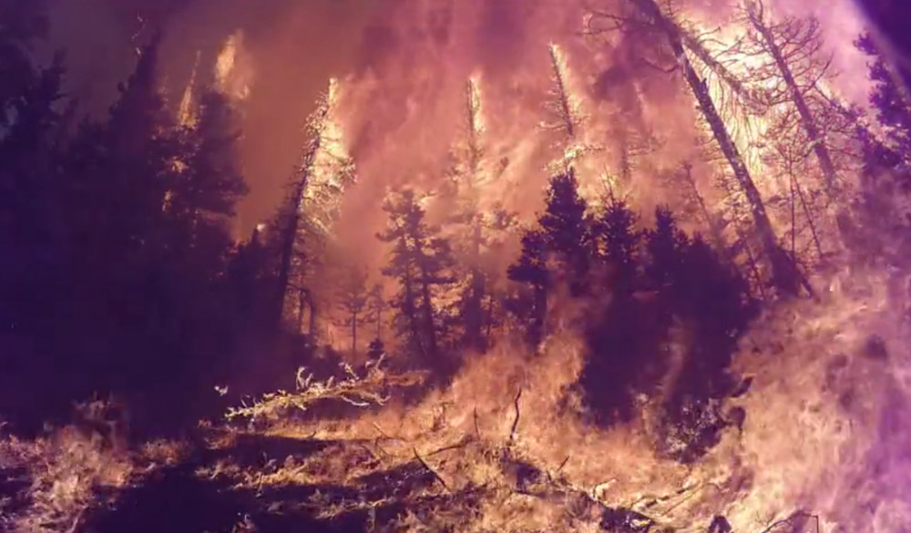
Screenshot from the USFS video below filmed in the fire.

By: Gail Keirn, Rocky Mountain Research Station-Fort Collins, Colorado; Matt Burks, Pacific Northwest Research Station-Corvallis, Oregon; John Zapell, Fishlake National Forest-Richfield, Utah
July 29th, 2019

Forest fires often reach or exceed temperatures of 2,000° Fahrenheit—that’s equivalent to one-fifth the temperature of the surface of the sun. What is the impact of such high temperatures on the soil and plants of our forests? And how do the intensity and heat of a wildfire impact its behavior, smoke and the surrounding weather?

Answering these questions is challenging since it is hard to predict when and where fires will occur. Therefore, USDA Forest Service scientists and others with the interagency Fire and Smoke Model Evaluation Experiment, or FASMEE, teamed up with the Fishlake National Forest Richfield Ranger District to study a prescribed fire from start to finish.

After months of planning and preparation, Fishlake National Forest fire crews ignited more than 2,000 acres of Utah forest in an effort to consume living upper canopy vegetation and initiate growth of new vegetation. This June 2019 prescribed fire was designed to restore aspen ecosystems by removing conifer trees and stimulating the regrowth of aspen.

Researchers at the Pacific Northwest Research Station and Rocky Mountain Research Station, as well as other FASMEE participants, saw the fire as a unique opportunity for study. Prior to the fire, Forest Service research experts took measurements of the forest vegetation and fuel loads. They also set up special fire-proof equipment to record and measure the heat of the fire throughout the project. Embedded below is a video recorded during the burn.

Forest Service fire research
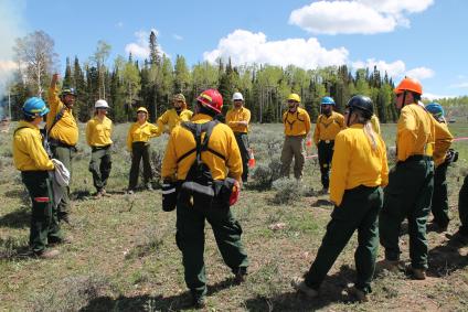
Researchers prepare for the start of a prescribed fire at Fishlake National Forest. More than 40 scientists from multiple agencies participated in the effort, gathering a variety of data on the fire itself and its impacts. USDA Forest Service photo.

During the fire, scientists used LiDAR, radar, aircraft and satellite imagery, weather and atmospheric measurements, and ground monitoring to study the fuel (dead materials) consumed, fire behavior and the fire’s impact on living vegetation. Scientists will continue to monitor the area to determine how vegetation recovers after fire.

“More than 40 scientists from multiple agencies participated in the effort, gathering a variety of data on the fire itself and its impacts,” said Pacific Northwest research forester Roger Ottmar, one of the lead scientists for the project. “The data is invaluable to our efforts to predict fire behavior, smoke impacts and the short- and long-term effects of extreme fires.”

Over the next several months, scientists will gather more data as the landscape recovers, comparing burn severity maps generated from remote sensors with observed plant regrowth. Other data from the fire is already being used to validate and improve models that predict fire and smoke severity, as well as to improve firefighter safety standards and guidelines.

Building upon this success, experts are planning a similar project for later this fall to continue studying and learning about fire.

Thanks and a tip of the hat go out to Rick. Typos or errors, report them HERE.