World’s largest tropical wetland burned this year

Record-breaking wildfires between January and June burned an ecological foothold — and biodiversity haven — spanning across Brazil, Bolivia, and Paraguay this year, just four years after similar fires burned 13,300 acres of the preserve.

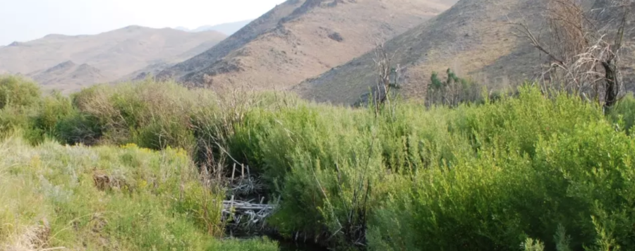
The Pantanal is considered the world’s largest tropical wetland area, the world’s largest flooded grasslands, and one of the most important areas of freshwater in the world.

NASA captured some of the intense fires’ burn scars in satellite imagery.

“Fire season in southern Brazil usually starts in July and peaks in August and September,” NASA said. “The false-color images emphasize the burn scars (brown) from several of the fires. Unburned vegetation is green. Near- and short-wave infrared bands help penetrate some of the smoke to reveal the hot spots associated with active fires, which appear orange.”

Pantanal fires
Pantanal fires June 2024

The repeated fires have left the environment in a state of constant recovery — and nearby communities are struggling.

“We were just trying to recover from the 2020 fire, which devastated our Pantanal. We had not fully recovered and now we are facing this again,” said a volunteer firefighter with the Baia Negra Environmental Protection Area’s Association of Women Producers.

A recent report from MapBiomas Brazil, a collaborative initiative including NGOs, universities, and technology companies, sheds light on a major cause of the fires: surface water loss.

Edge effects
Edge effects on the native vegetation and continuous habitat — including exposure to wind and solar radiation, susceptibility to fire, increased predation rates, and

The Pantanal is the biome in Brazil that has dried up the most between 1985 and 2023. The report said annual water surface for the area last year was just under 944,000 acres — only 2 percent of the wetland biome was covered by water. The total is reportedly 61 percent under the historical average. The area was 50 percent drier in 2023 than it was in 2018 when the area’s last major flood happened.

“In 2024, we didn’t have a flood peak,” said Eduardo Rosa with  MapBiomas. “The year has seen a peak drought, which should last until September. The Pantanal in extreme drought is already facing fires that are difficult to control.”

The report also found that the entire Amazon region suffered a severe drought with a decrease of 8.2 million acres of water surface.

Up to 25% of Brazil’s native vegetation may be degraded

A new platform from the MapBiomas network shows that between 1986 and 2021 Brazil had between 11 and 25 percent of its native vegetation susceptible to degradation. This corresponds to an area ranging from 60.3 million hectares to 135 million hectares.

Fire effects over time
Visualized fire effects over 7 years, resulting from a single burn or multiple burns.

About 64 percent of Brazil — more than half the country — is covered by native vegetation. The beta version of MapBiomas’ degradation vectors platform makes it possible to generate unprecedented scenarios of the impact of factors that can cause degradation on native vegetation across  Brazil.

“This is the first time that degradation can be assessed in a broader way and in all Brazilian biomes,” says Tasso Azevedo, general coordinator of MapBiomas. “But we know that this degradation process occurs in other types of cover, such as agriculture and pasture, as well as soils and water, where we also intend to advance with this information in MapBiomas in the coming years.”

  ➤ View the main highlights [PDF] of the Degradation module

The degradation vectors considered by the MapBiomas team in this first edition of the platform include the size and isolation of the native vegetation fragments, their edge areas, the frequency of fire and the time since the last burn, as well as the age of the secondary vegetation.

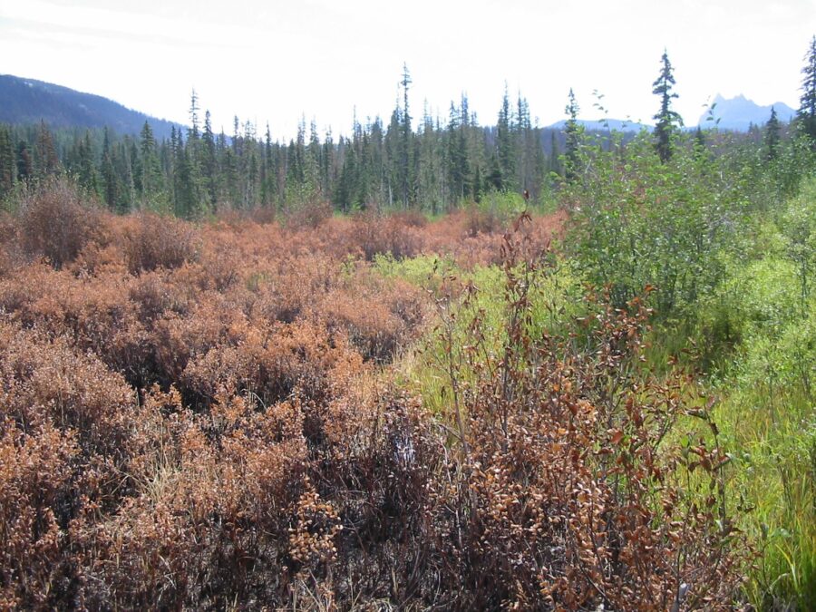
Pantanal: fire as a factor in degradation

In the Pantanal, the degraded area can vary from 800,000 hectares (6.8 percent) to 2.1 million hectares (almost 19 percent). Although it is a biome that coexists with fire, the incidence of fires in the last five years has meant that 9 percent of the Pantanal’s forest formations, which are fire-sensitive areas, have been damaged.

Eduardo Rosa with the MapBiomas’ Pantanal team says some of the vectors of degradation in the Pantanal beyond this analysis must consider the entire biome’s surroundings, since all the rivers that naturally irrigate the Pantanal plain are born in plateau areas. “The removal of native vegetation for agricultural and livestock expansion unprotects the soil and interferes with the distribution of water and sediment. The quantity and quality of water that reaches the plains also depends on dams and hydroelectric plants that alter the natural flow of water,” he says. “Climate issues relating to rainfall and temperature regulate droughts and floods, and the increase in periods of drought has hampered the resilience of the Pantanal ecosystem.”


Humans mimicking beavers to combat wildfires and restore wetlands

Researchers in Colorado have built hundreds of dam-like structures in hopes of mimicking a fraction of the success the state’s beavers have had throughout history. Ashley Hom with the U.S. Forest Service co-leads Colorado’s largest beaver-based restoration project — along with many partners. In just two years, this team built 316 beaver mimicry structures, about half of which were BDAs, or beaver dam analogues — manmade structures that imitate beaver dams. Many of them were constructed by volunteers, according to a story by Julie Cleveland.

These BDAs are built using wooden fenceposts and willows that act as a low-cost and low-maintenance structure to protect areas from wildfire while maintaining or improving water quality.

The loss of keystone beaver populations has caused a negative impact on watersheds throughout the western United States. Dams that beavers create slow the flow of spring run-off while raising the water table to keep the landscape wet. Without beavers and their dams, streambanks have eroded, causing snowmelt and run-off to drain too quickly from the landscape.

Beaver dam on Baugh Creek near Hailey, Idaho. USFWS photo

“As beavers create and maintain wetlands, the outcomes are vast,” Cleveland wrote. “A lack of beavers has resulted in an increased intensity of drought and wildfires in the West as fires spread rapidly across parched landscapes. Wetlands act as natural fuelbreaks, giving firefighters a chance for containment.”

The effectiveness of beavers against wildfires has been seen in real-time. The 2018 Sharp Flats Fire burned more than 60,000 acres in Idaho, but seemingly left one area untouched.

Loading beavers for transport
Idaho Fish and Game officers load a beaver into a wooden box before he’s loaded on a plane and dropped into the Idaho backcountry. IDFG photo

Nearly 70 years beforehand, Idaho Fish and Game had rounded up and relocated beavers, sometimes by parachute, throughout the state, including the Baugh Creek area.

Beavers in wooden boxes drop from a plane into the Frank Church Wilderness to start a new life.
Beavers in wooden boxes drop from a plane into the Frank Church Wilderness to start a new life. IDFG photo

The Sharp Flats Fire burned all of the land around Baugh Creek, but the beavers’ dams and the wetland they created were left unburned.

The contrast was so stark that researchers at Boise State University and Utah State University teamed up with NASA to start building tools to measure the benefits of beaver reintroduction in other areas of the country.


Post-burn image of the Sharps Flat burn, image by NASA.
Post-burn image of the Sharp Flats burn, image by NASA.

Watch the below video to see what researchers are paying attention to after beavers make their way back to wetlands — beaver rewilding as measured by NASA:


Alert reader Tom Jones sent over some photos he took of the beaver habitat on the B&B Fire in Oregon.

“We were with the NW Oregon type 2 team in September 2003,” wrote Tom. “Robert Alvarado was the Human Resource Specialist (HRSP) and I was the FBAN. Robert liked to go out on the line and talk with the crews to see how they were doing. I went to the line every day, so he would go with me. Each morning after briefing he would ask me, ‘What kind of adventure are we going to have today?’ The last two photos are of me and Robert at Marion Lake.”

Beavers' Fireline, B&B Complex 15. September 2003. Tom Jones photo.
Beavers’ fireline, B&B Complex 15. September 2003. Tom Jones photo.
Beaver Swamp Burned, B&B Complex, September 2003. Photo by Tom Jones.
Beaver swamp burned, B&B Complex, September 2003. Photo by Tom Jones.
Robert Alvarado and BeaverLine, 2003 photo by Tom Jones.
Fireline put in by beavers on the B&B Complex in Oregon. 2003 photo by Tom Jones.
Robert Alvarado at Marion Lake on the B&B Complex in Oregon. 2003 photo by Tom Jones.
FBAN Tom Jones with the NWOregon type 2 team in September 2003 on the B&B Complex. Photo by Robert Alvarado.
FBAN Tom Jones with the NW Oregon type 2 team in September 2003 on the B&B Complex. Photo by Robert Alvarado. (I didn’t know there were crocodiles in Marion Lake, did you?)

from Wikipedia:  The B&B Complex was a linked pair of wildfires that together burned 90,769 acres (367.33 km2) in  Oregon in the summer of 2003. The complex began as two separate fires, the Bear Butte Fire and the Booth Fire; the two fires were reported on the same day and eventually burned together, forming a single fire area that stretched along the crest of the Cascade Mountains between Mt. Jefferson and Mt. Washington. On the western side of the Cascades, the fire consumed mostly Douglas-fir and western hemlock. On the eastern side of the mountains, the fire burned mostly Ponderosa pine, lodgepole, and jack pine. Most of the burned area was on USFS land, including 40,419 acres (163.57 km2) within the Mt. Jefferson Wilderness. The fire also burned forest land on the Warm Springs Indian Reservation and small areas of state and private land. Firefighters worked on the fires for 34 days.

THANKS, Tom, for the great photos and another
piece of Beaver history in the Beaver State!
 ~ Kelly Andersson