AAR completed for the Lion Fire near Meeker, Colorado

Lion Fire Map Meeker Colorado wildfire
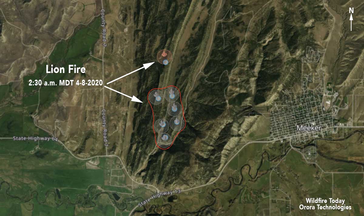
Map showing the approximate location of the Lion Fire 1.5 miles west of Meeker, Colorado. Data from Orora Technologies detected from 2:12 p.m. MDT April 7, to 2:30 a.m. MDT April 8, 2020.

An informal After Action Review has been produced for the Lion Fire that burned about 229 acres west of Meeker, Colorado on April 7. The fire was attacked by the Meeker Volunteer Fire Department, Bureau of Land Management, and the Colorado Division of Fire Prevention and Control. By the end of the day firefighters had stopped the spread. Investigators determined that it started near a mobile home which was consumed in the fire. Several outbuildings and vehicles were also destroyed, according to Meeker Fire Chief Luke Pelloni.

Below is the ARR, distributed by the Zone Fire Management Officer:


As many of you know we had the Lion Fire last week just west of Meeker involving multiple jurisdictions/agencies.  I was tasked with letting you all know how things went as far as COVID-19 measures and mitigation’s.

We have taken multiple steps in our station to limit and minimize exposure to firefighters as we are entering fire season.  I believe there have been lots of good discussions and decisions made in regards to COVID-19.  However, just like in everything we do the plan looks good on paper until the smoke is flying in the air.  Listed below are some of the lessons learned from on the ground experiences last week.

  1. Social distancing is very tough in stressful situations.  The crew discussed social distancing before leaving for the fire and to try and abide by the guidelines, upon arrival multiple structures/vehicles were burning and instincts to protect life and property take over.
  2. When evacuating public, maintaining distance is difficult when property/landowners are panicked and looking for answers and guidance.
  3. When working with multiple agencies the COVID-19 mitigation measures and messages have varied widely and are hard to enforce or maintain.
  4. Briefings are hard to conduct in the field with large crowds and maintain the appropriate distance that is recommended.  We usually don’t have microphones or platforms in initial attack so harder to hear and voice critical information to multiple crews.
  5. Once dispatched we utilized four vehicles with eight firefighters.  This idea seemed like a good idea until arrival and the parking and safety areas for vehicles was minimal.  It added a bit of cluster you could say to the initial arrival to the incident.
  6. Upon arrival personnel jumped into different trucks and engines to engage on the fire creating more “contaminated” surfaces by different people at different times of the incident.
  7. It is very difficult to keep equipment sanitized throughout an incident (examples: truck radios, hand tools, chainsaws, steering wheels, compartment doors, etc.)
  8. A few individuals did wear masks and experienced a harder time communicating to one another thus decreasing the distance between individuals.  The people who did wear masks seemed to be touching their faces and adjusting masks more.

These are a few of the lessons or experiences that we noticed on our first wildfire of the year.  I think we are taking adequate measures to address issues and potential situations that crews will experience this summer.  I think the list above will be some of the issues or challenges that firefighters will encounter on incidents.  One concern I have is the ability to sanitize and clean work areas.  We have spent an entire day trying to purchase items but our current credit card procedures are making that difficult to achieve.  If anyone has any questions or concerns feel free to give me a shout anytime.  Hope everyone is safe and making it through these interesting times.

End of AAR
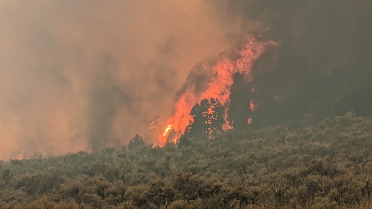

Lion Fire
Lion Fire. Photo by Rio Blanco Co Sheriff’s Office April 7, 2020.

Lion Fire burns more than 200 acres near Meeker, Colorado

Lion Fire
Lion Fire. Photo by Rio Blanco Co. Sheriff’s Office April 7, 2020.

The Lion Fire burned 229 acres near Lions Canyon Road 1.5 miles west of Meeker, Colorado on Tuesday. After being reported at about 1:30 p.m., it was attacked by the Meeker Volunteer Fire Department, BLM, and the Colorado Division of Fire Prevention and Control.

By Tuesday evening firefighters had stopped the spread and were expected to be back on Wednesday to mop up.

Investigators determined that it started near a mobile home which was consumed in the fire. Several outbuildings and vehicles were also destroyed, according to Meeker Fire Chief Luke Pelloni.

At Wildfire Today we are giving a trial to a new mapping system created by Orora Technologies. It collects fire detection data from a growing list of satellites, eight at last count, and identifies heat generated by fires. On the map below the circles indicate that heat was detected somewhere within the circle. The red line automatically circumscribes a collection of detections, but is probably larger than the actual size of the burned area. In this example the heat was detected by the SUOMI-NPP satellite. We suggested that the size of the red polygon be automatically calculated, and they added it to their things to do list. The company has plans to launch their own satellites which would produce fire data more frequently.

Lion Fire Map Meeker Colorado wildfire
Map showing the approximate location of the Lion Fire 1.5 miles west of Meeker, Colorado. Data from Orora Technologies detected from 2:12 p.m. MDT April 7, to 2:30 a.m. MDT April 8, 2020.

Lion Fire update, October 6, 2017

Above: A firing operation on the Lion Fire October 5, 2017. USFS photo.

(Originally published at 8:27 a.m. PDT October 6, 2017)

Firefighters in the Sequoia National Forest are using strategic fire as one of their main tools on the Lion Fire 30 miles northeast of Porterville, California in the Golden Trout Wilderness.

On Thursday a helicopter using a plastic sphere dispenser ignited fire on a rocky 9,000 to 10,000-foot elevation ridge, letting it back down the very steep slope toward the valley below. The incident management team reported Friday morning that the fire had grown to 8,100 acres, an increase of 250 acres over the previous day.

map perimeter of the Lion Fire
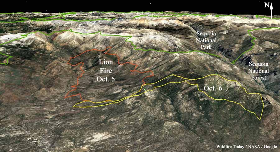
3-D map showing the approximate perimeter of the Lion Fire based on satellite data from October 5 and 6 2017.

Resources assigned include 8 hand crews, 3 helicopters, and 2 engines for a total of 221 personnel.

As promised Thursday the National Interagency Coordination Center stopped listing the Lion Fire Friday on their daily Situation Report because of a lack of “significant activity” even though it doubled in size on Wednesday. The fire is not being totally suppressed, but is being managed to protect private property.

Perimeter of the Lion Fire October 5, 2017
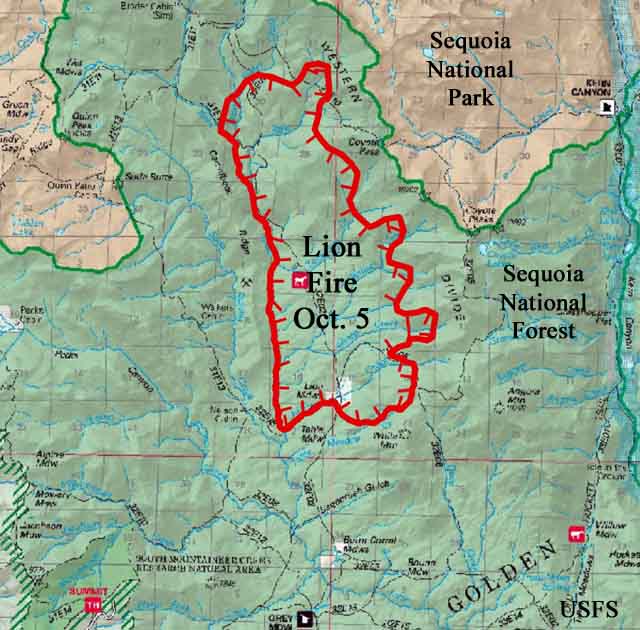
Perimeter of the Lion Fire October 5, 2017. USFS map with large black text added by Wildfire Today.
Lion Fire
Lion Fire. USFS photo, uploaded October 3, 2017.


Lion Fire in Sequoia NF doubles in size

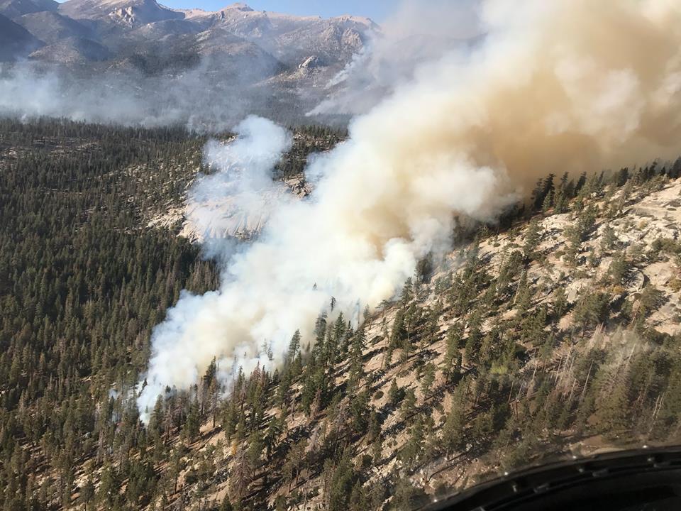
Above: Lion Fire in Sequoia National Forest. Photo uploaded to Inciweb October 5, 2017.

(Originally published at 11:22 a.m. PDT October 5, 2017)

After burning for 11 days since it started on September 24, the Lion Fire roared through the Sequoia National Forest Tuesday and Wednesday, doubling in size to 7,850 acres.

The fire is 10 miles northeast of Camp Nelson and 30 miles northeast of Porterville, California in the Golden Trout Wilderness.

Firefighters are working to protect the structures at the privately owned R.M. Pyles Boys Camp.

The Lion Fire is not being fully suppressed. Most of the current spread has been in an area that burned in the 2011 Lion Fire.

“This fire is spreading mostly through ground fuels in this remote part of the Wilderness,” stated District Ranger Eric LaPrice. “Efforts to contain the fire will be made along routes where firefighters can work safely while avoiding stands of dead trees and inaccessible terrain.”

Smoke is expected to settle into the valleys in the late evening and early morning hours due to inversion patterns that normally hold the smoke in low-lying areas.

A weather station about 8 miles southwest of the fire recorded single digit humidities Wednesday night into mid-day on Thursday. During that period west to northwest winds were blowing at 4 to 11 mph with gusts of 11 to 16 mph.

Oddly, the National Interagency Fire Center’s Situation Report said Thursday, while showing a 4,050-acre increase in size, “Last report unless significant activity occurs.” We might be confused about how NIFC defines “significant activity”. But they often distribute less information about fires that are not being suppressed.