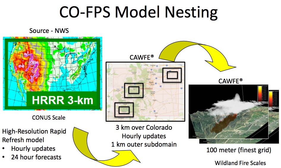
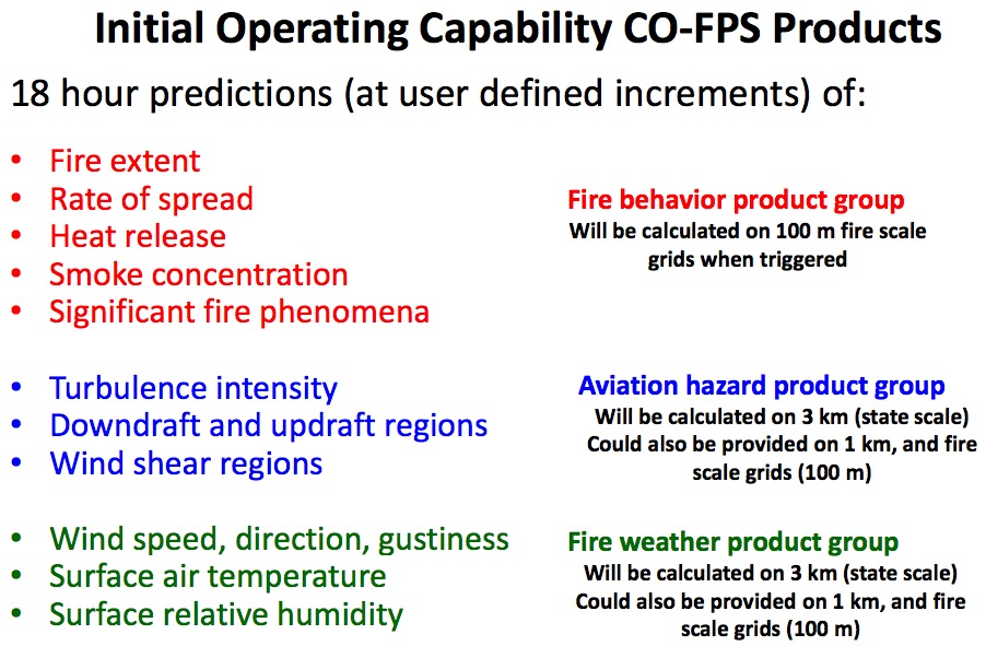
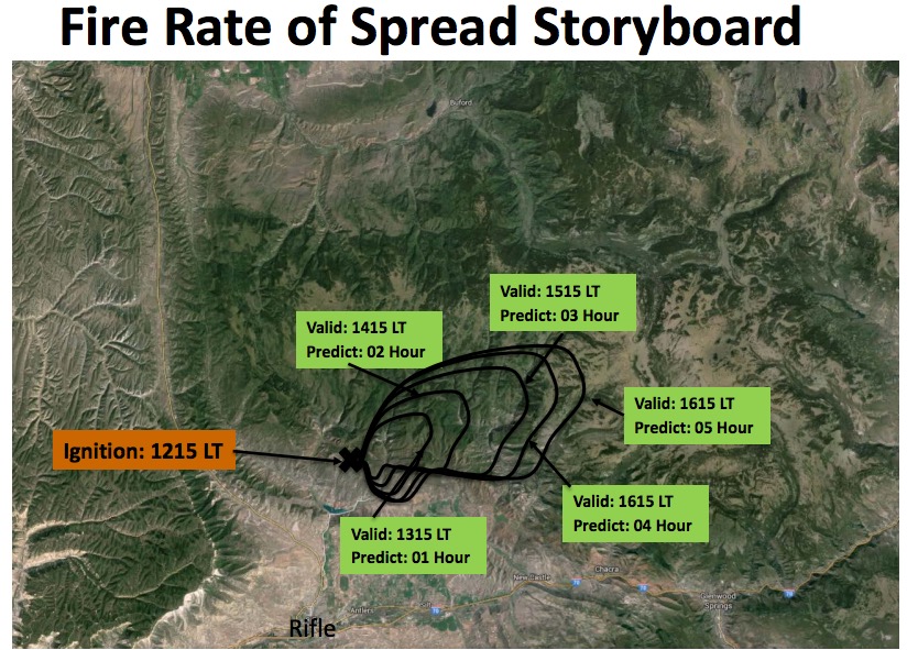
The decision support system that Colorado is developing is expected to provide frequently updated fine-scale predictions of weather that affects wildfires, and the behavior of going fires. It will use heat detected by satellites and hourly weather forecast updates from the National Weather Service to produce maps showing fire managers where multiple fires are expected to spread in the next 12 to 18 hours.
Much of the work is being done under contract for the state by the National Center for Atmospheric Research, a federally funded program headquartered in Boulder, in cooperation with the University Corporation for Atmospheric Research. The organizations have distributed a detailed briefing document on the development schedule and a time line for deliverables, which you can read HERE (1.9 MB).
Below are a few images from the document.
—————
We have criticized the state of Colorado for not having their crap together for organizing and planning for the management of wildfires or for on-the-ground fire suppression, but they are developing some significant resources for gathering intelligence with their new fixed wing aircraft and now with this decision support system that will provide frequently updated predictions of fire spread using state of the art technology.
Their next logical step is to develop a management system and the firefighting resources to make use of this wealth of information. While there are some firefighting organizations that could use this data to their advantage and convert it to actions on the fire ground, at this stage it’s like *putting lipstick on a pig, at least within the Colorado Division of Fire Prevention and Control.
*In 1992 Ann Richards, the former Governor of Texas, said at a South Dakota barbecue, “You can put lipstick on a hog and call it Monique, but it is still a pig”.
Thanks and a tip of the hat go out to Bean.


Maybe this will help explain it.
https://cdpsdocs.state.co.us/dfpc/Website/CoE/COFPS/Stakeholder_Meeting_2_Rifle_Jan15_no_video.pdf
yup. sounds a lot like wfdss. and in my opinion, relying on satellites is about as dependable as relying on aircraft.
Are you familiar with the products of both systems?
It seems a lot like WFDSS. It’s pretty hard to compare as I’ve never seen a product from CO-FPS. Lot’s of people are familiar with WFDSS which is entering it’s tenth year of operation.
john is right though. The biggest limitation is knowing “Where is the fire?” Satellite, either MODIS or VIIRS helps, but there’s some very big limitations like resolution, and no where near real-time updates. Real-time communication with Colorado’s new planes is an intriguing data source, I will be watching how that comes to fruition.
But otherwise WFDSS uses many similar, if not the same, data as CO-FPS. WFDSS uses NDFD forecast data, uses the weather stations in WIMS, LandFire landscape data, and a plethora of related data whether from WMS services or the system database such as retardant avoidance, jurisdiction, MODIS and VIIRS, just to name a few.
There is a suite of spatial fire behavior models. The numbers of analyses run last year where in the thousands. WFDSS model outputs are available in the WFDSS mapping application itself, or can be exported to Google earth.
So from what I’ve read about CO-FPS, it does sound quite similar.
NWCG has similar program;
In June 2005, the National Fire and Aviation Executive Board chartered The Wildland Fire Decision Support System (WFDSS) to replace WFSA in 2009 with a system that has the following capabilities:
Develops a scalable decision support system for agency administrators
Uses appropriate fire behavior modeling, economic principles, and information technology
Supports effective wildland fire decisions consistent with Resource and Fire Management Plans
WFDSS will also replace the Wildland Fire Implementation Plan (WFIP) and Long-Term Incident Planning (LTIP) processes.
WFDSS has the following advantages over the existing systems:
Enables spatial data layering
Reduces text, increases use of map displays
Reduces input requirements
Begins process at time of discovery
Removes alternative comparison and decision tree development
Combines desktop applications for fire modeling into a web-based system for easier data (link is external) acquisition.
Provides an easy way for fire managers and analysts to accurately document their decision-making process by allowing results of analyses to be attached to the decision point (link is external) and included in the final incident report.
Provides one decision process and documentation system for all types of wildland fires.
Is a web-based application for easier sharing of analyses and reports across all levels of the federal wildland fire organization.
Introduces economic principles into the fire decision process.
Pre-loads information from the following sources to allow pre-planning:
Land Management Plans/Fire Management Plans
Other sources
Preplanned decision criteria
Local spatial data files
Provides scalability for incident complexity
Can be ended at any level, can progress through levels, or jump to appropriate level
Can be used for single or multiple fire situations.
http://famit.nwcg.gov/applications/WFDSS
https://wfdss.usgs.gov/wfdss/WFDSS_About.shtml
Are you familiar with both systems? Are the technology and the products similar?