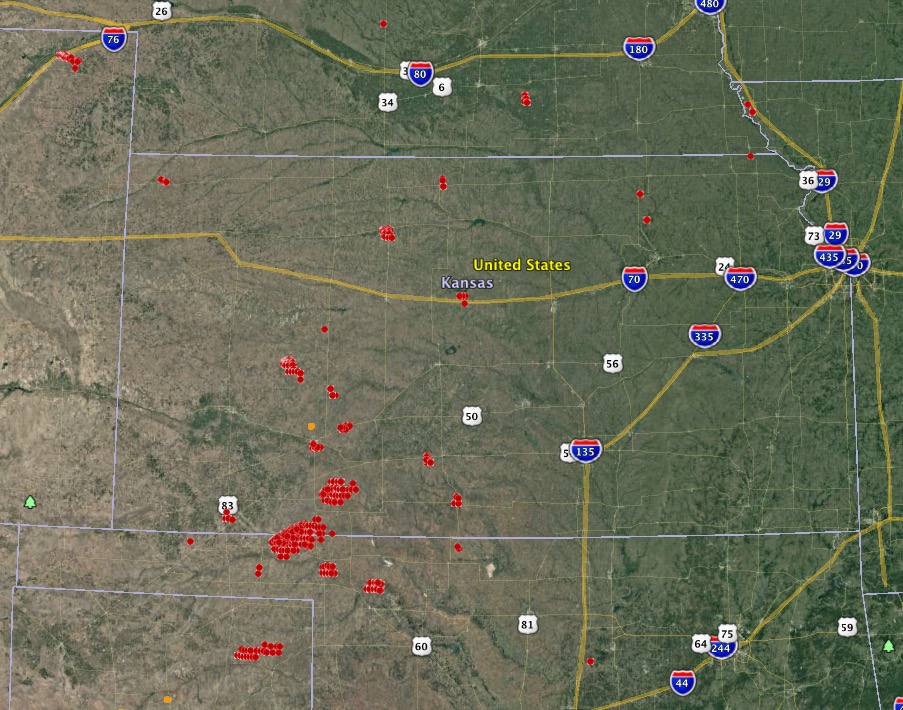
Above: Large wildfires (red) in Kansas as detected by a satellite at about 1 p.m. MST March 6, 2017.
(UPDATED at 5:43 p.m. MST March 6, 2017)
Below is an updated map showing growth of some of the fires in Kansas, especially the one 17 miles southeast of Meade, Kansas that burned from Oklahoma into the state. That one, using very rough satellite data, appears to be more than 130,000 acres.

There was a report, as yet unconfirmed, that in Kansas a tornado moved over a going fire.
****
(Originally published at 4:17 p.m. MST March 6, 2017)
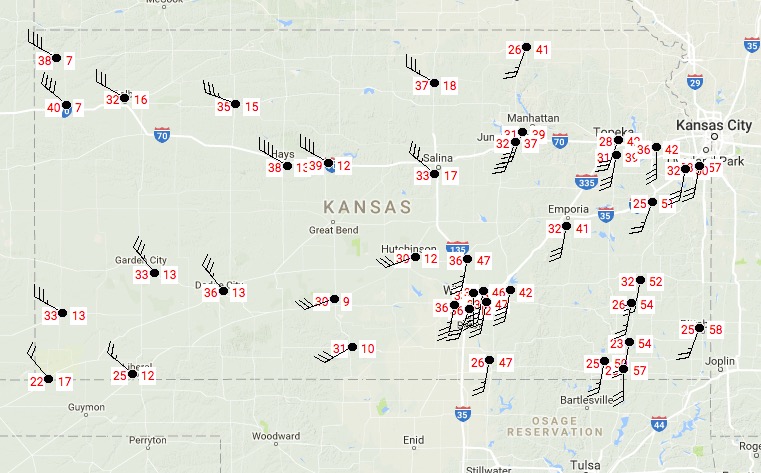
Strong winds along with relative humidities in the teens and twenties are causing problems for firefighters in the western half of Kansas. The passage of a cold front is bringing sustained wind speeds of 30 to 40 mph with maximum gusts in the 40’s and 50’s.
On the map above we identified and very roughly mapped four of the largest fires. The acreages shown are estimates based on satellite detections of heat at about 1 p.m. MST on Monday. One of them has burned from Oklahoma into Kansas.
- 53,000 acres; 17 miles southeast of Meade, Kansas. It is in Meade and Beaver Counties in Kansas, and Clark County in Oklahoma.
- 6,500 acres; in Clark County 23 miles east of Meade, Kansas.
- 7,000 acres; in Lane County Kansas 10 miles southeast of Dighton, Kansas.
- 4,000 acres; in Rooks County Kansas just southwest of Stockton, Kansas. Residents in part of the city have been ordered to evacuate.
A fire in Logan County in the northeast corner of Colorado has burned 6,000 acres 20 miles northeast of Sterling.

Before the cold front passed the fires were driven by a southwest wind (see the animated radar map below). As the front passes the wind is shifting 90 degrees to come out of the northwest. This could be a very, VERY dangerous situation for firefighters on the south side of the fires, as the right flank turns into the head of the fire.
Find the front: Fires are transitioning from burning towards the NE to burning towards the SE behind the front… #kswx #ksfire #kansas pic.twitter.com/q1w6qoDWZC
— Katie Western (@KatieTheWXLady) March 6, 2017
With high radar reflectivity, very stout pyrocumulus developed on column headed towards Ashland #kswx #ksfire pic.twitter.com/fPtrd98iop
— Chip Redmond (@wx_chip) March 6, 2017


Type II IMT from SD will be taking over today. Fire in Clark County estimated at 351k acres. Reno county fire roared back to life late last night.
Also 6,000 acres in Reno County, burning through WUI in fuel of native grass, eastern redcedar.
Channel 13 out of Topeka live streaming a tornado hitting the grass fire near Silver Lake. Firefighters being evacuated.
New starts
South of Wilson Lake. Wilson, KS is being evacuated. Fire crossed I-70 and it is closed in both directions
Just north of Silver Lake in Shawnee County KS.