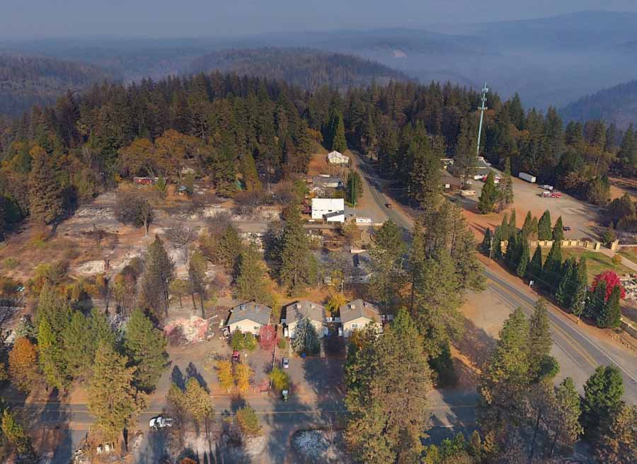
Pamela Ren Larson and Dennis Wagner of the Arizona Republic studied nearly 5,000 small communities around the West to find out how how many of them are facing large-scale wildfire risk similar to Paradise, California where 19,000 structures burned and 85 people were killed in the Camp Fire. After finding 526 places that have a higher wildfire potential than Paradise, nine reporters set out to report on nine communities in eight states.
Click on the tweet below to reveal the detailed thread which is an introduction to the very detailed reporting that you will see when you click on the links therein. Here is a link to the main story.
About six months ago, I began an enormous project: To find other places like Paradise, California, at risk of wildfire in the West. With wildfire season getting longer, we set out to find these high-hazard communities, ahead of the fire. (THREAD)
— Pamela Ren Larson (@PamReporting) July 24, 2019

Profoundly arrogant of you to dismiss the realizations of California’s wild fire professionals about the explosive rapid expansion of the camp fire at Paradise. What fire training do you have?
True, many lessons should be learned for future preparations. True, many things may have been missed before hand.
For you to say in such a cavalier way “this didn’t need to happen” indicates an undeveloped level of emotional maturity and a lacking of compassion. Perhaps you have not lived long enough or experienced enough real suffering to have any deep understanding of the subject you profess to know so much about.
I was at Paradise. I am no fire expert. I am simply an equipment operator. Have you ever faced a wild fire?
I hope your study can offer some real input to those professionals who have dedicated their personal and professional lives to protecting life and property.
I suggest you start by apologizing for your arrogance and admitting you are an inexperienced novice treading in the arena of professionals, many of whom have buried comrades lost in the line of duty.
John Ivey
A prime example of small communities facing a greater risk is southern California’s San Diego County, bordering Mexico. It’s where I was born, and where I started my Fire career in 1967, as a CDF wildland firefighter. Even then communities burned along with their wildland interface. The devastating 1970’s Laguna Fire was a prime example. Yet fire-prone areas were rebuilt, and many more communities sprung-up or expanded, to the point of being future fire losses. Even today (7/26/2019), building continues while ignoring the danger https://www.10news.com/news/local-news/conservation-groups-sue-san-diego-county-over-otay-ranch-development?utm_source=maropost&utm_medium=email&category=homepage_showcase .
Super piece of work! Sadly, I expect most folks will bury their head in the sand and pull it out covered in ashes. Fuel reduction in the WUI is expensive in the short term, and folks ignore it because they believe a big red fire truck will save them and defend their stuff….It’s long past time to be using the term defensible space and focus on Cohen’s Home Ignition Zone and responsible climate adapted forest ownership…end of rant.
10’s & 18’s
Very interesting. I live in an orange community. One factor I didn’t see considered in the study was the potential for wind-driven fire events. I found this recent paper on differences between wind driven fire and fuel driven fire and differences in potential management actions to be informative: https://link.springer.com/article/10.1186/s42408-019-0041-0
I am not sure I agree that all of these places are as likely to burn as Paradise. Paradise and the Concown Basin are located in an area that has an exceptionally high frequency of days that have the right circumstances to burn down a town (i.e., high potential for wind driven fire). The local name of the wind event under which the Camp Fire burned is the Jarbo Gap Winds. The Jarbo are caused when winds are funneled down the Feather River Canyon in the fall and according to Wikipedia, “Meteorological records show 36 days since 2003 with gusts of 100 mph or more, and as high as 200 mph. Paradise is in the path of these winds.” This does not consider all of the days with 50-99 MPH winds. There’s a low spot (i.e., gap) above Pulga, between Concow and the Feather River watersheds, just about where the Feather River makes a turn…this is where the winds jump out of the Feather River Canyon and head straight for Paradise.
Although many towns are at high risk of fire due to high fuel loads, I am wondering how many have predictable annual wind events similar to the Jarbo? I think this would be an important variable to consider in determining community wildfire risk and the appropriate management strategy.
Santa Ana winds should be considered.
Brill. Pulitzer Prize.