
A 911 report said the suspect was attempting to steal a helicopter
Continue readingQuick summary of wildfires in Washington and Oregon

There are at least five large significant wildfires currently burning in Washington and Oregon. Here is a quick and dirty summary. The acreages were as of Saturday evening, but all were putting up large smoke plumes Sunday easily seen from a satellite.
Working north to south, starting in Washington:
Cub Creek 2 Fire
4,690 acres, 5 miles north of Winthrop, Washington. Numerous residences are threatened. Evacuations are in effect, including for pack animals, mules from the Okanogan-Wenatchee National Forest who were relocated to their winter pasture.
 pack mules on the Oka-Wen
The north flank of the Cub Creek 2 remains unchecked. Retardant from very large air tankers, water scooping planes, and helicopters with buckets are providing support to firefighters in all locations of the fire. It is burning north pushed by diurnal winds during the day and smoke pushed down south during the late evening and morning.
Cedar Creek Fire
4,080 acres, 12 air miles northwest of Winthrop, Washington, very close to Highway 20. The western perimeter of the fire has burned onto a ridgeline with sparse fuels, slowing the spread. On the southern portion of the fire, growth has been minimal as it burns in subalpine areas with minimal vegetation. The northeastern portion remains the most active.
Summit Trail Fire
2,031 acres, 17 miles west of Inchelium. It has only been burning for three days. On Saturday crews continued to build direct fire line. There was fire growth on the north-northwest side of the fire, and crews scouted Upper Ridge Creek Road, developing a plan to prep and hold the fire along the road.
Due to limited resources the fire continued to spread Saturday to the northeast at a moderate rate of spread, but that pace increased Sunday.
And in Oregon:
Jack Fire
16,764 acres, on both sides of Highway 138, 9 miles northwest of Clearwater. South of Highway 138, firefighters continue burnout operations to build primary line on the west and southwest flanks. On the southeast side, crews will continue to use heavy machinery to clear and brush out roads used as control lines.
Bootleg Fire
298,662 acres, 30 miles northeast of Klamath Falls. The Bootleg Fire continued to push further into Lake County for a distance of five miles on the north side and ten on the east side. It remains about four to five miles north of Highway 140. It was extremely active again on Sunday, as can be seen in the satellite photo above.
Bootleg Fire grows to nearly 300,000 acres
In Southern Oregon, 30 miles northeast of Klamath Falls
Continue readingTamarack Fire prompts more evacuations
The fire has burned about 23,000 acres near Woodfords and Markleeville in Northern California
Continue readingFirefighter suffers serious burns while fighting fire in Montana
He was on an engine crew when the wind shifted
Continue readingTamarack Fire spreads five miles after being monitored for 13 days
Evacuations are in effect and structures have burned south of Woodfords, California
Continue readingAviation fuel shortage could affect aerial firefighting
 Coulson Aviation’s fuel trucks for their CH-47 helicopters. Coulson photo.
The lingering effects of the pandemic have left a symptom that may affect aerial firefighting. The logistics system for Jet A aviation fuel atrophied when air travel dropped sharply. Now that business and leisure travel have rebounded, competition is heating up for what is now a limited amount of fuel that is being distributed. Larger airports served by aviation fuel pipelines are in better shape than smaller facilities that depend on a person driving truck to their location.
Fire Aviation talked to over a dozen people in the aerial firefighting community and confirmed that one air tanker base that serves large air tankers came very close to running out of Jet A, but a truck arrived just in time. We were not able to confirm one report that another large base did run out.
One place where a fuel shortage could show up is at base heliports on wildland fires. The contractors who supply helicopters have their own fuel trucks, but if the product becomes scarce they might have to travel a farther distance to refill the tanks on the trucks. And the larger the helicopter, the more fuel they need. An example is the tanker trucks Coulson Aviation drives to fires which likely hold thousands of gallons to keep their CH-47 helicopters running . (See the photo at the top of this article.)
As of Thursday all of the bases for large air tankers in Washington and Oregon had a supply of fuel, but several smaller airports that serve Single Engine Air Tankers were having problems.
The airport at Lake County, Oregon 28 miles from the 236,000-acre Bootleg Fire exhausted their supply of Jet A earlier this week, the Lake County Sheriff’s Office reported.
“The Lake County Airport ran out of Jet A fuel July 11, 2021,” the Sheriff’s Office said in a press release Wednesday July 14. “Several surrounding airports also ran out of Jet A fuel and turned to the Lake County Airport for support. The Airport Manager had put in an order July 5, but because of a national shortage, the Lake County Airport was unable to get fuel until today. The Lake County Commissioners contacted State Representative E. Werner Reschke and the Department of Energy in an effort to find fuel for the Airport. The team made countless phone calls and sent emails to regional suppliers, airports and many other sources trying to fill the immediate order.”
The Lake County airport received 3,500 gallons on Wednesday and expected another 8,500 gallons Friday.
The Los Angeles Times interviewed Chris Kunkle, vice president of operations for the Central Coast Jet Center in Santa Maria, Calif., in Santa Barbara County, the home of an air tanker base that can serve air tankers of any size, including DC-10s.
“In the blink of an eye, we can have a fire here within our response area that can bring in one to three DC-10s and a bunch of variable-sized air tankers,” he said. “We can go from a couple thousand gallons a day to 50,000 to 60,000 gallons.”
He said he likes to keep 60,000 gallons at the airport, but is having trouble with limited deliveries. He fears running out if a large fire breaks out in the area.
Fire Aviation asked a spokesperson for the National Interagency Fire Center several questions about the fuel shortage issue, including if any air tanker or helicopter bases in the Western U.S. have recently run out of aviation fuel.
“The agencies that manage airtanker bases are aware of potential issues regarding the availability of jet fuel at smaller, rural airports in the West,” the National Interagency Fire Center said in a statement issued July 16. “However, there have been no significant impacts to wildland fire aviation operations. We continue to monitor the situation and consult with our aviation partners and industry representatives. As a contingency, at some locations we have identified alternate airports and airtanker bases that could be utilized should fuel supplies become low or run out.”
Dixie Fire very active Friday near Tobin, California
Updated at 7:08 a.m. PDT July 17, 2021

The updated map of the Dixie Fire west of the Feather River in Northern California shows that it spread northeast for two to three miles Friday and Friday night. At 9:35 p.m. Friday CAL FIRE reported that it had burned 8,754 acres, but it may have grown for another 1,000 acres or so.
The weather forecast for the fire area Saturday afternoon calls for sunny skies and 92 degrees, 10 to 13 mph southwest winds, and relative humidity in the mid-teens. Sunday will look about the same but with partly cloudy skies in the afternoon and a chance of thundershowers in the evening.
(To see all articles on Wildfire Today about the Dixie Fire, including the most recent, click HERE.)
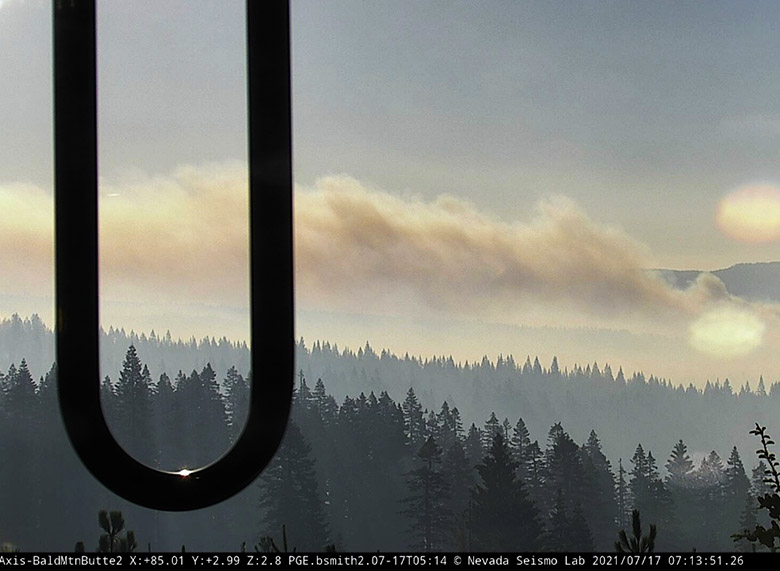
The Dixie Fire is west of Highway 70 in Feather River Canyon, 13 air miles northeast of Paradise and 24 miles north-northeast of Oroville.
6:42 p.m. PDT July 16, 2021
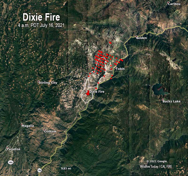
Since the Dixie Fire started at 5:12 p.m. on July 13 near the community of Merlin west of the Feather River in Northern California, it has burned 7,947 acres. As you can see in the satellite photo below it has been very active Friday afternoon, sending a large plume of smoke northwest which may be heavily affecting Chester, Caribou, Westwood, and possibly Susanville.
CAL FIRE reported Friday morning that terrain and winds pushed the fire further north into Tobin Ridge, but the west and south sides of the fire were at that time holding within containment lines.
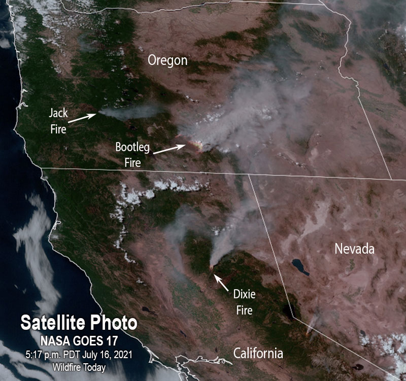
The Dixie Fire is west of Highway 70 in Feather River Canyon, 13 air miles northeast of Paradise and 24 miles north-northeast of Oroville.
Resources assigned to the fire Friday morning included 39 hand crews, 10 helicopters, 86 engines, 18 dozers, and 9 water tenders for a total of 1,018 personnel.
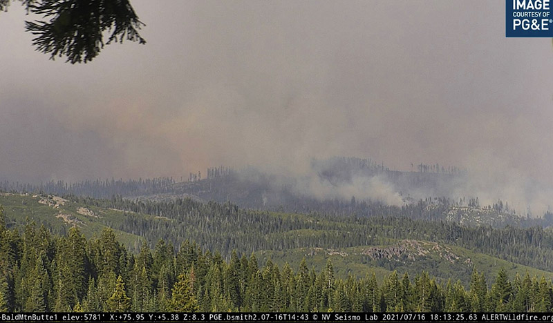
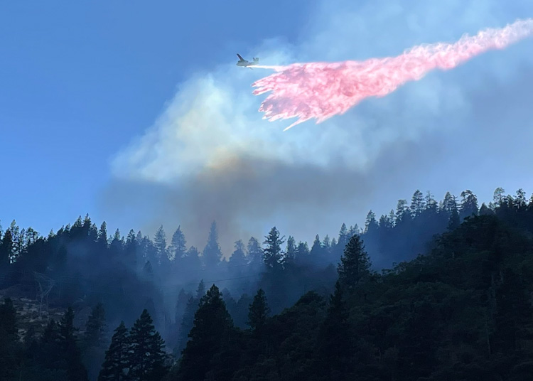 An S2T drops on the Dixie Fire in Butte County, California July 13, 2021 shortly after it started. Photo by CAL FIRE.
It looks like an inmate crew got a ride on a Union Pacific Fire Train:
#DixieFire pic.twitter.com/3tAWzNplwa
— David Swanson (@SwansonPhotog) July 16, 2021
If you want to go down a rat hole to learn more about fire trains, jump in to see all articles on Wildfire Today tagged Fire Train.
Two all-women fire crews at Yosemite and Grand Teton national parks
Funded by a grant from REI Co-op and the National Park Foundation
Continue readingSo far the drought is far worse than last year

As @NOAANCElclimate pointed out, the Drought Monitor shows that the severity of the drought is far worse than it was at about the same date in 2020. Most of the areas in the 11 western states are in Severe, Extreme, or Exceptional Drought.
So far this year the 49 states outside Alaska have burned almost 2.2 million acres, about the same that burned in all of 2019. The 10-year all-year average for those 49 states is 6.4 million acres. In 2020 9.9 million acres burned in the lower 49 states.

A year-to-date average would be helpful. The National Situation Report gives a number, but unfortunately it includes Alaska which is extremely variable. Fires there can be very large, burning for weeks or months usually with little to no suppression. In the last 10 years the acres burned in Alaska ranged from 181,169 in 2020 to 5,111,404 acres in 2015, with the higher number being 28 times the lower. In 2015 more acres burned there than in the other 49 states combined. Therefore, a year to date average that includes Alaska is virtually meaningless if you want to draw conclusions about the status of the wildfire season in the lower 49 states.
