
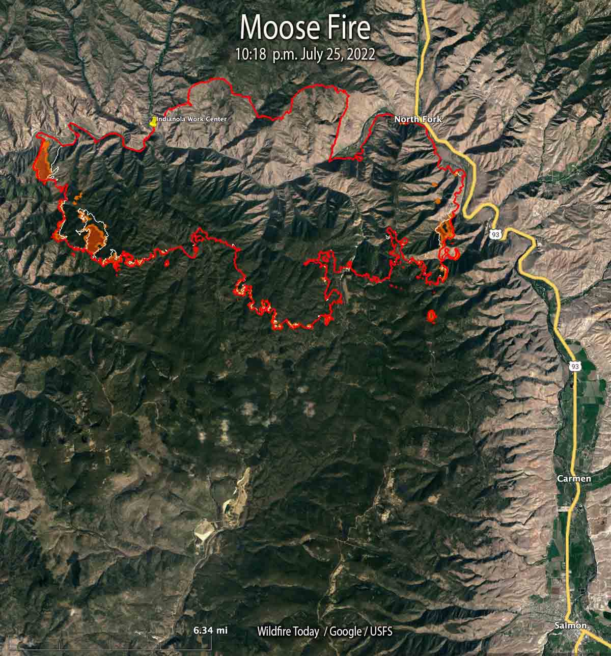
Most of the growth on the Salmon Fire 10 miles northwest of Salmon, Idaho has been south of the Salmon River in recent days. It was mapped Monday night at 37,264 acres, a 24-hour growth of more than 1,500 acres.
On the east side, fire activity was high in Bobcat Gulch and the Napoleon Hill area in the late afternoon Monday and through the night. Spot fires occurred one mile south of Napoleon Hill as the fire was pushed by winds out of the north. The south side of the fire generally is holding in place with no new growth in the Moose Creek area. The fire is still spreading on the west side south of the river.
On the south side where the strategy is to “confine”, not “contain”, heavy equipment task forces are constructing and reinforcing indirect fire line six to nine miles south of the fire from Morning Glory west to Leesburg, and further west into Panther Creek, then to the Salmon River.
One of these indirect firelines being constructed is five miles south of the southeast corner of the fire, south of Moose Creek Road.
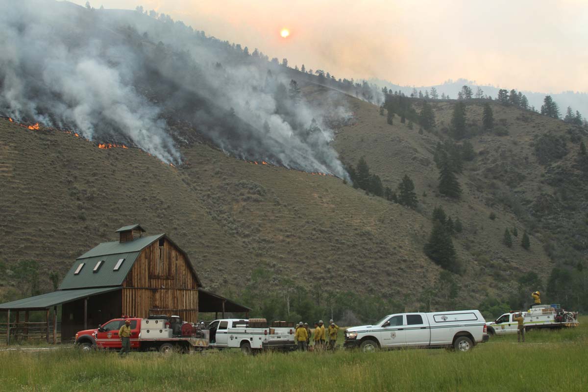
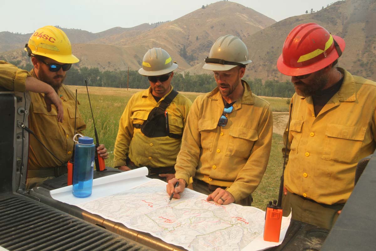
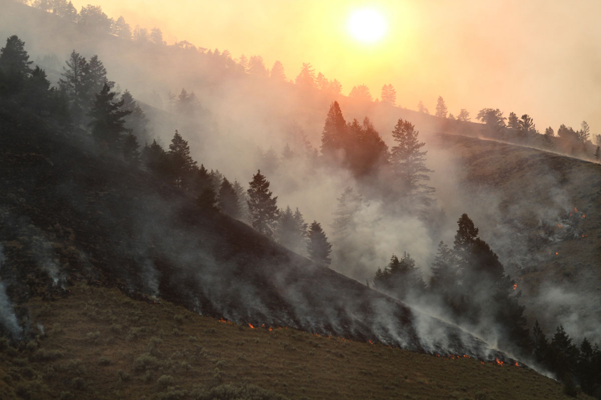
The photos below were taken July 23 by Mike McMillan for the US Forest Service.

Was working on the S-C when the two helirapellers were burnt over and killed on the Salmon River Breaks. I think that made a big difference in where crews were placed in subsequent fires in that country, especially the 2012 Mustang.
The Salmon River continues to kill firefighters, and yet every couple years IMTs decide to make a stand. Slope reversals and spotting allow for very little firefighter success yet we try (and kill people) every year. Maybe we treat the Salmon river like AK- point protection and let it buck? Lots of firefighters would live another day.
I was there in 1979. Floated on air mattresses down from fire camp, to Shoup, and drank whiskey with the “mayor” of Shoup. Caught a ride back to camp. I guess that was our CISM, as we were given a day off after a burn fatality (Kyle Pattee) on the Ship Island Fire. We (Payette HS and Sawtooth HS) were on the knob above where they were located, and some of us dug holes for our faces after burning out the knob. The Sector Boss had instructed the crews to “burn down the ridgeline to the river” if the fire made a run. The crew bosses knew that was not going to happen, and took action to hunker in place. Unfortunately, that Salmon River country has seen a lot of firefighters die over the years.
Is the fire still threatening the hot springs at horse springs, in Montana ?
So has the Moose Fire burned into the old Clear Creek Fire scar yet? That’s the fire where they built a ginormous firebreak that was visible from space to protect Salmon (cough, cough) from the fire. The place names in the story are all familiar and a lot of folks spent the summer of 2000 up there when tours of duty were a lot more loose. At the time this was considered a “mega-fire” at about 130K acres. In retrospect is seems to be just another large fire by today’s standards.
Not yet but it will probably bump up against it. I was here in 2000, that was quite a fire.
Hi Bill — Thanks very much for the link to the map showing all the currently planned indirect lines. I’ve been trying to find something like this for a few days.
Does anyone have any info about the Shoup area or Pine Creek? Friends used to own the store at Shoup and I was associated for many years with the former Girl Scout camp at Pine Creek Ranch. I am assuming that Pine Creek Ranch may be history at this point.
Hasn’t reached Shoup yet. They’re doing structure protection on the Pine Creek Ranch.
Thanks very much for the info about Shoup and Pine Creek Ranch. So many memories there, not just for me, but for thousands of campers from over the years since the 50s.