Firefighter dies on Moose Fire

Near Challis, Idaho

On Thursday September 22 the Forest Supervisor of the Salmon-Challis National Forest released a statement about the September 20 death of Gerardo Rincon who passed away while assigned to the Moose Fire in Idaho:


It is with immense sorrow that we share the news of the passing of Gerardo Rincon of North Reforestation Inc. Gerardo suffered a medical emergency during the early morning hours of September 20th. He was a crew boss of a Type 2 crew that was assigned to the Moose Fire.

Gerardo served as a wildland firefighter since 1994. During his 28-year career he was a Type 2 firefighter, engine captain, and crew boss. He was highly recognized for his performance by his employers and crew members enjoyed working for him during many fire assignments.

Tragedies of this nature serve as a reminder of the honorable work and sacrifices made by women and men like Gerardo. They commit themselves daily to supporting and protecting communities around the country.

Our condolences go out to the entire Rincon family, their co-workers at North Reforestation Inc., and the firefighting community, their friends, and all those who knew and loved them. We are beyond grateful for their years of dedication and service to the wildfire community.

The Forest is working closely with the incident management team and the Wildland Firefighter Foundation to return Gerardo to his home in Oregon early Saturday morning, September 24th. There will be a procession from the Jones and Casey Funeral Home though downtown Salmon and to the Lemhi County Airport beginning at 9:00 am.

A viewing is scheduled for Wednesday, September 28th at the Farnstrom’s Mortuary in Independence, Oregon from 5-8 pm. A funeral mass will occur on September 29th at St. Patrick’s Catholic Church followed by a burial at Hilltop Cemetery.

/s/ Charles A. Mark
Forest Supervisor

(end of statement)


North Reforestation wrote on their Facebook page that Mr. Rincon’s remains will arrive on Flight 802 at 11:30 a.m. Saturday at Corvallis Municipal Airport, 5695 SW Airport Ave, Corvallis, OR. They wrote, “If anyone wants to be part of the procession on this Saturday as Gerardo arrives in Oregon, it will start at the airport and end at Farnstroms.”

North Reforestation is based in Monmouth, Oregon, just west of Independence.

The Moose Fire which started July 17, received rain Wednesday and Thursday. It has burned more than 130,000 acres northwest of Challis, Idaho.

Our sincere condolences go out to the family, friends, and coworkers of Mr. Rincon.


Thanks and a tip of the hat go out to Tom and Pete.

A quick look at seven fires in the Central Idaho area

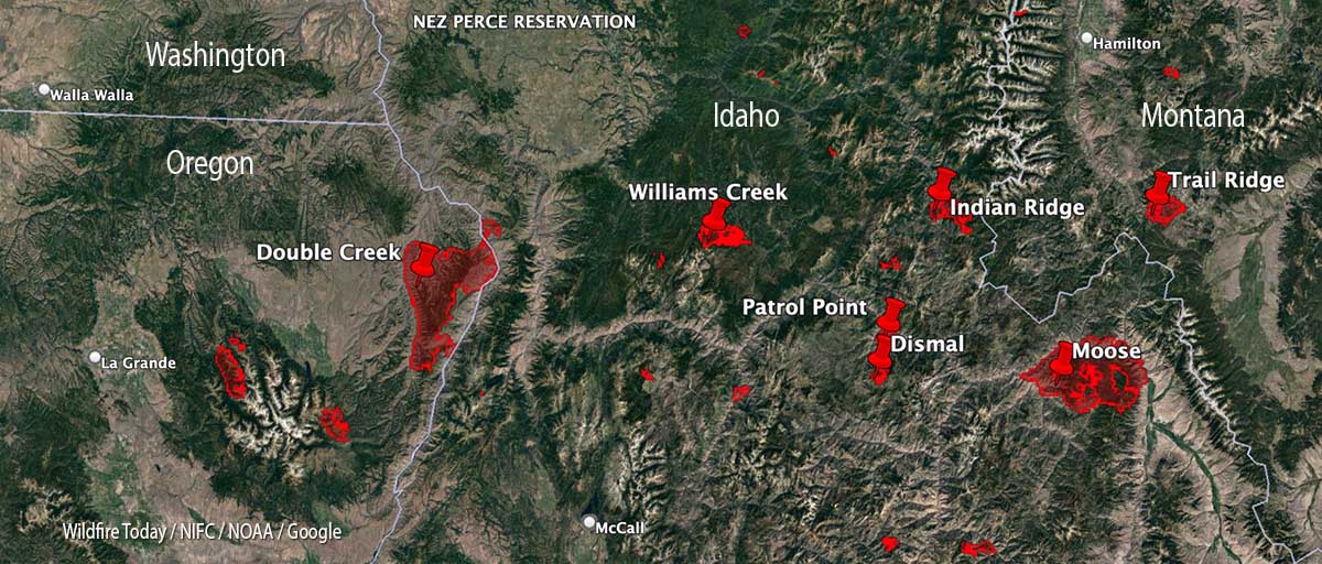
Map of fires, central Idaho, Sept. 9, 2022
Map of fires in central Idaho, Sept. 9, 2022.

With 35 large uncontained wildfires currently burning in the United States, and many, many more in various categories, we can’t report extensively on all of them, so today we will take a slice of geography and look briefly at seven fires spreading in the Central Idaho area, and extend it just a bit into Oregon and Montana.

Moose (Idaho)
The largest of these seven fires is the Moose, which has been chewing through eastern Idaho since July 17. As far as the cause, the Salmon National Forest says, after almost two months, it is “human caused,” which only eliminates the causes of volcano and lightning. Nine structures have been destroyed. On Friday 650 personnel are assigned to the 125,000-acre blaze which is 5 miles northwest of Salmon, ID. A satellite overflight Friday afternoon only found large heat sources in the southeast portion and that is where an additional 15,000 acres burned Wednesday night, prompting evacuations near Salmon.

Crews reengaged the fire and began preparing new contingency lines along the west edge of the city. Several water pumps, five log decks, and some portable water storage tanks (nicknamed pumpkins because of their shape and color) were destroyed Wednesday.  No firefighters were injured. Nearly 500 acres of the city’s Municipal Watershed burned that night, something the various incident management teams had been trying to protect since July.

Cooler temperatures, higher relative humidity, and thick smoke contributed to minimal fire behavior across the fire Thursday.

Indian Ridge (Idaho)
Northwest of the Moose Fire near the Montana border is the lightning-caused 8,670-acre Indian Ridge Fire on the Bitterroot National Forest. It is in the Selway-Bitterroot Wilderness 30 miles southwest of Darby, Montana. The fire has been active this week primarily along the western and northern flanks and north of Indian Creek as it burns through steep, rugged, remote terrain with heavy surface fuels and dead standing timber.

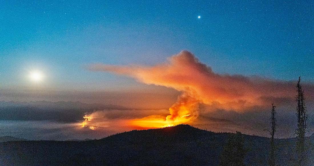
Indian Ridge Fire
Indian Ridge Fire the night of August 18, 2022. InciWeb.

The fire is not being fully suppressed. Their daily reporting says, “Fire managers are utilizing a point protection strategy to prevent any critical wilderness infrastructure from being negatively impacted by the fire.”

Dismal and Patrol Point
These two fires are very close to merging after significant growth since September 6, and combined have burned an estimated 23,000 acres. They are about 50 miles northwest of Salmon, Idaho. Smoke and the unavailability of infrared mapping aircraft have made it difficult to determine the current perimeters, but there is a lot of new burned acreage between the two fires. Recent low humidity and strong winds are in part responsible for the recent growth.

Areas that fire managers intend to protect include Cold Meadows Guard Station, Root Ranch, and Lantz Bar.

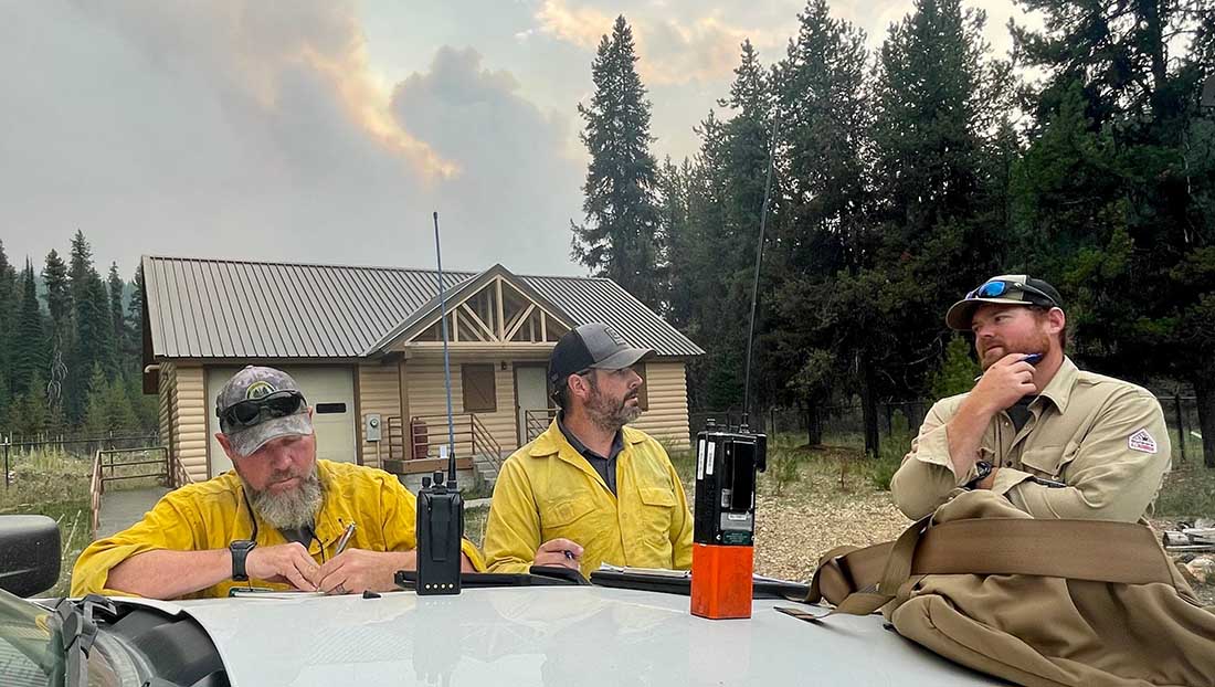
Fire personnel on the Williams Creek Fire
Fire personnel on the Williams Creek Fire in Idaho. InciWeb, posted 9-8-2022.

Williams Creek
The 11,881-acre fire is 5 miles west of Orogrande, near Wildhorse Lake, 7 miles southwest of Elk City, and 8 miles north-northwest of Dixie.

“Resources will continue to engage the fire in Orogrande and the Crooked River corridor, addressing and extinguishing hot spots and conducting damage assessments,” said a September 9 update from the Incident Management Team. “The fire and associated winds did impact structures and outbuildings; crews are still assessing the extent of the damage. Fallen trees, burned snags, and downed power lines continue to present safety hazards.”

Double Creek (Oregon)
The 137,000-acre lightning-caused Double Creek Fire is in Oregon just west of the Idaho border. It has burned to the Snake River in the Pittsburg Landing area. A River Group has been established to assess and protect structures along the waterway. The fire is being fully suppressed and crews are looking for locations to establish the control line farther from Lower Imnaha Road where topography allows. Two structures have been destroyed.

Trail Ridge (Montana)

The 13,000-acre Trail Ridge fire is on the Beaverhead-Deerlodge National Forest in Western Montana about 5 miles east of the Idaho Border and 4 miles southeast of Sula, MT. The cooler weather experienced Thursday and Friday was helpful in slowing the spread of the fire and decreasing the severity of fire behavior. It is burning above 7,000 feet elevation near the Continental Divide and there is no current or expected threat to private land and property. It is not being fully suppressed.

Moose Fire grows to 37,264 acres

Northwest of Salmon, Idaho

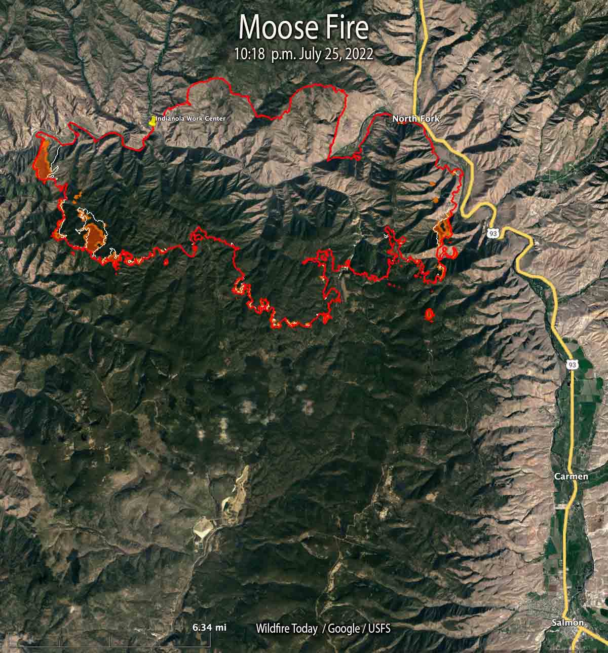
Moose Fire map 10:18 p.m. MDT July 25, 2022
Moose Fire map. The red line was the perimeter at 10:18 p.m. MDT July 25, 2022. The white line was the perimeter about 48 hours before. The brown areas had extreme heat when the fire was mapped.

Most of the growth on the Salmon Fire 10 miles northwest of Salmon, Idaho has been south of the Salmon River in recent days. It was mapped Monday night at 37,264 acres, a 24-hour growth of more than 1,500 acres.

On the east side, fire activity was high in Bobcat Gulch and the Napoleon Hill area in the late afternoon Monday and through the night. Spot fires occurred one mile south of Napoleon Hill as the fire was pushed by winds out of the north. The south side of the fire generally is holding in place with no new growth in the Moose Creek area. The fire is still spreading on the west side south of the river.

On the south side where the strategy is to “confine”, not “contain”, heavy equipment task forces are constructing and reinforcing indirect fire line six to nine miles south of the fire from Morning Glory west to Leesburg, and further west into Panther Creek, then to the Salmon River.

One of these indirect firelines being constructed is five miles south of the southeast corner of the fire, south of Moose Creek Road.

The photos below were taken July 23 by Mike McMillan for the US Forest Service.

Moose Fire Salmon Idaho
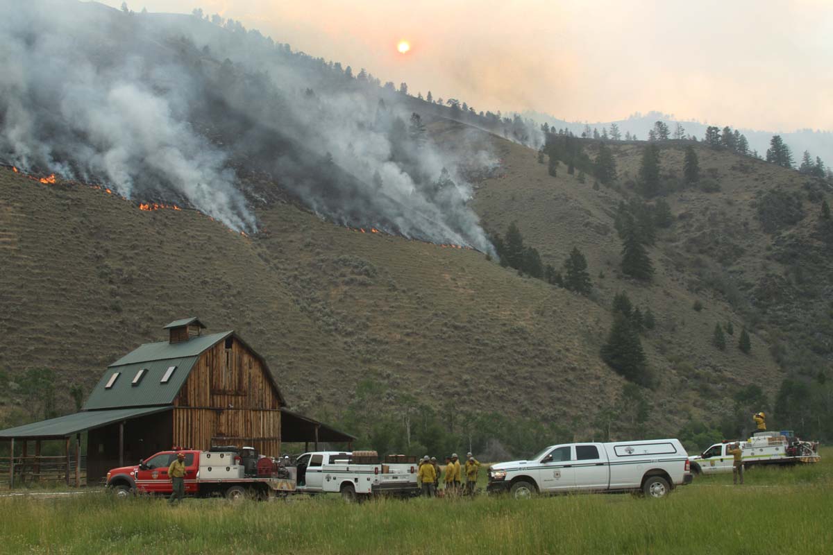
Firefighters on the Moose Fire prepare to defend structures along Hwy 93 corridor, July 23, 2022. Photo by Mike McMillan-USFS
Moose Fire Salmon Idaho
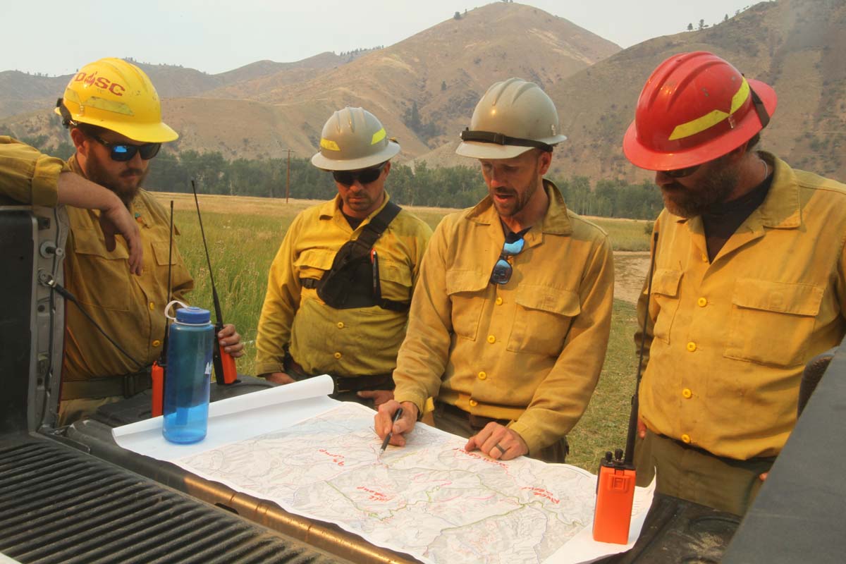
Firefighters on the Moose Fire, July 23, 2022. Photo by Mike McMillan-USFS
Moose Fire Salmon Idaho
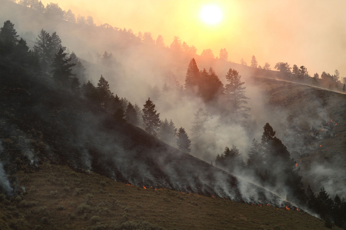
Moose Fire backs down a slope, July 23, 2022. Photo by Mike McMillan-USFS


Moose Fire near Idaho-Montana border grows to more than 28,000 acres

Most of the 5,000 acres of growth was on the west and east sides

12:12 p.m. MDT July 23, 2022

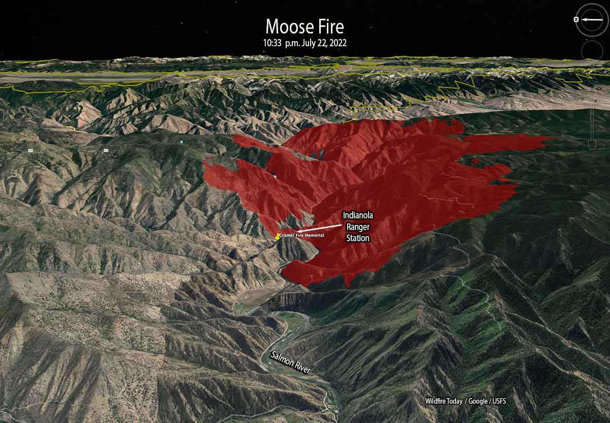
Moose Fire 3-D map 10:33 p.m. July 22, 2022
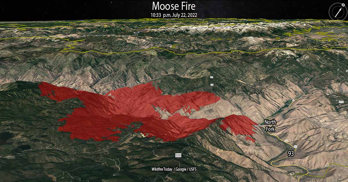
Moose Fire 3-D map looking northwest at 10:33 p.m. July 22, 2022.

Most of the 5,000 acres of growth of the Moose Fire in eastern Idaho Friday was on the west and east sides, spreading for about a mile to the east and west. Friday night the fire burned actively, spreading west as far as Kayak Camp. In the North Fork area it reached the west bank of the Salmon River. Two miles of the east flank are on the steep slopes west of and above US Highway 93.

Friday’s Red Flag weather conditions increased fire activity along the top of Napoleon Ridge. North of the Salmon River, firefighters succeeded in holding fire line built during the last several days.

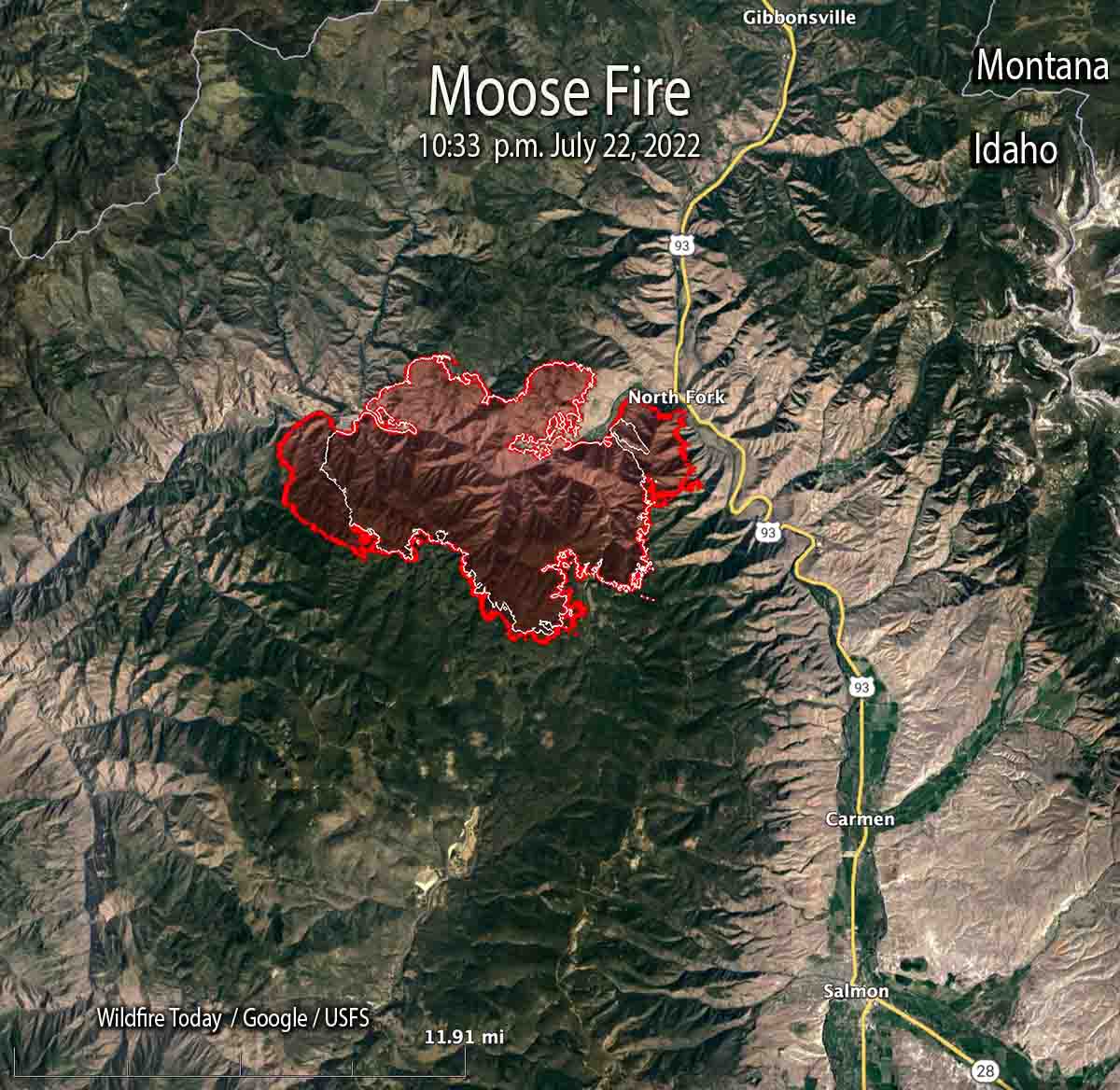
At 10:33 p.m. Friday it was mapped at 28,839 acres. At that time it was 12 miles northwest of Salmon, Idaho and 10 miles west of the Idaho/Montana border.

Moose Fire map 10:33 p.m. July 22, 2022
Map of the Moose Fire. The red line was the perimeter at 10:33 p.m. July 22, 2022. The white line was the perimeter 24 hours before.

Two pilots were killed Thursday July 21 when their Chinook helicopter crashed into the Salmon River while working on the fire. They were identified as Thomas Hayes, 41, of Post Falls, Idaho, and Jared Bird, 36, of Anchorage, Alaska. The National Transportation Safety Board will conduct an investigation.

A spokesperson for the Salmon Challis National Forest said the cause of the fire is undetermined.

Moose Fire 3-D map 10:33 p.m. July 22, 2022
Moose Fire 3-D map looking east at 10:33 p.m. July 22, 2022.

On Saturday firefighters will be holding and improving line around the north end of the fire and protecting structures along Salmon River Road and Highway 93.  On the southeast side, crews and heavy equipment will work on building an indirect line along Diamond Creek Road from the Highway 93 corridor up into Five Corners.

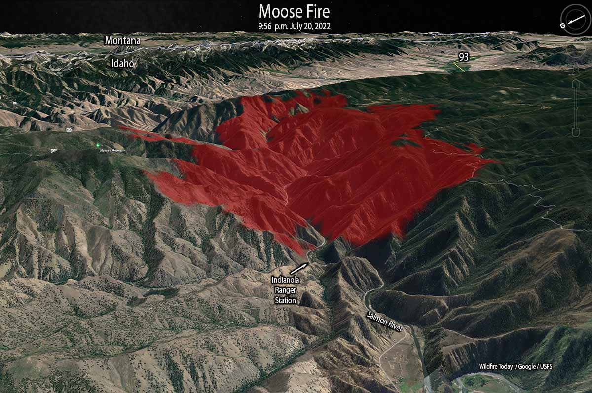
At the site of the Indianola Ranger Station along the Salmon River (see map above) there is a memorial to two firefighters who were killed while working on the Cramer Fire July 22, 2003 — Jeff Allen and Shane Heath, members of the Indianola Helitack Crew. More information HERE and HERE.

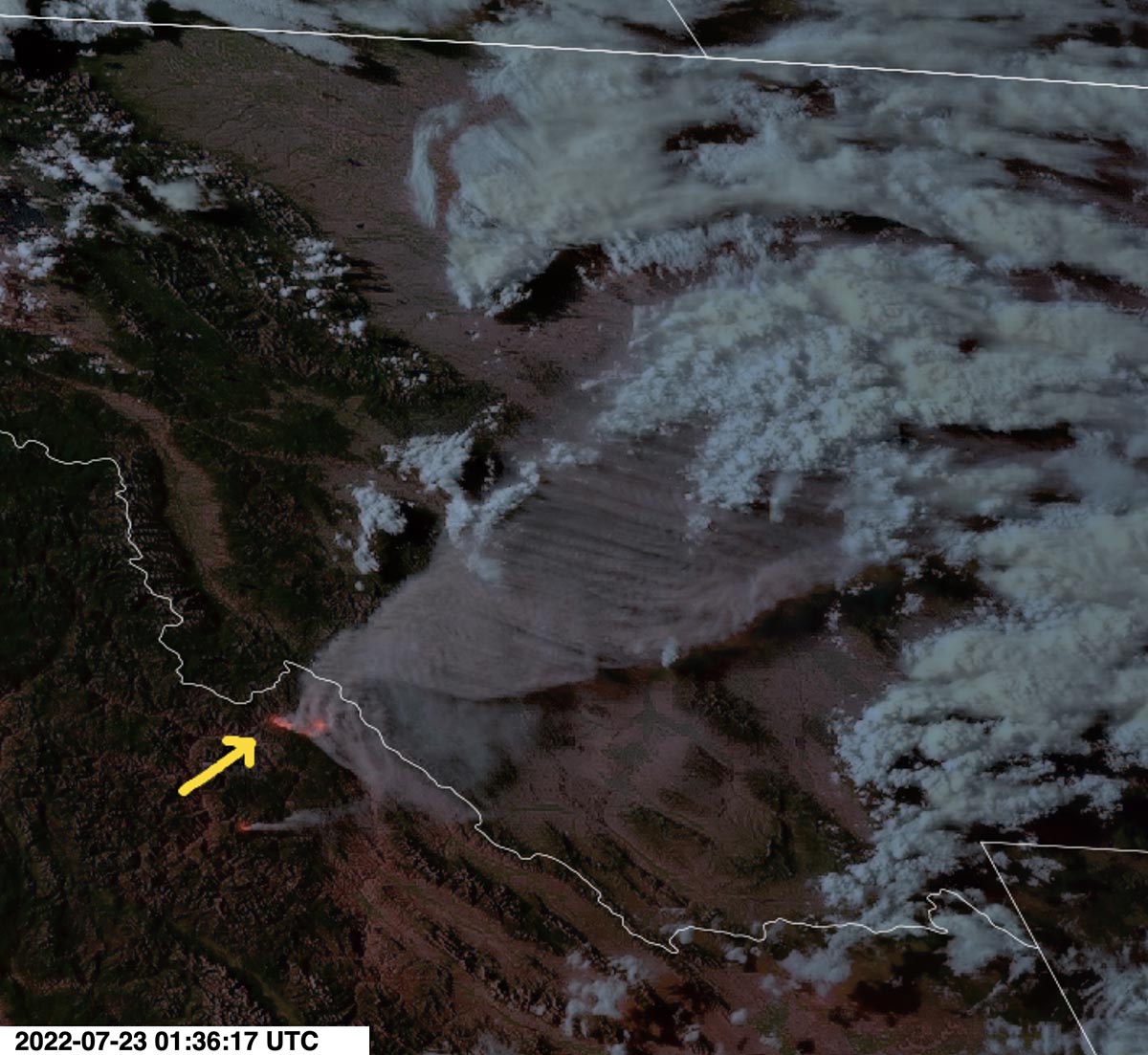
Moose Fire photo GOES 17 satellite
Smoke produced by the Moose Fire in eastern Idaho, as seen from the GOES 17 satellite at 7:36 MDT July 22, 2022.

Weather conditions are expected to moderate Saturday with quieter winds, however it will still be hot and dry for several days.

Helicopter crashes into Salmon River while working on Moose Fire

Updated 3:56 p.m. MDT July 22, 2022

More information is available about the helicopter crash in Idaho.

Both pilots have died, the U.S. Forest Service said on Friday.

Mary Cernicek with the Salmon-Challis National Forest said Thomas Hayes, 41, of Post Falls, Idaho, and Jared Bird, 36, of Anchorage, Alaska, died from injuries they sustained when their CH-47D Series Chinook crashed in the Salmon River about 3:30 p.m. Thursday.

The pilots were employees of the Anchorage-based ROTAK Helicopter Services and were working on the Moose Fire northwest of Salmon, Idaho.


7:52 a.m. MDT July 22, 2022

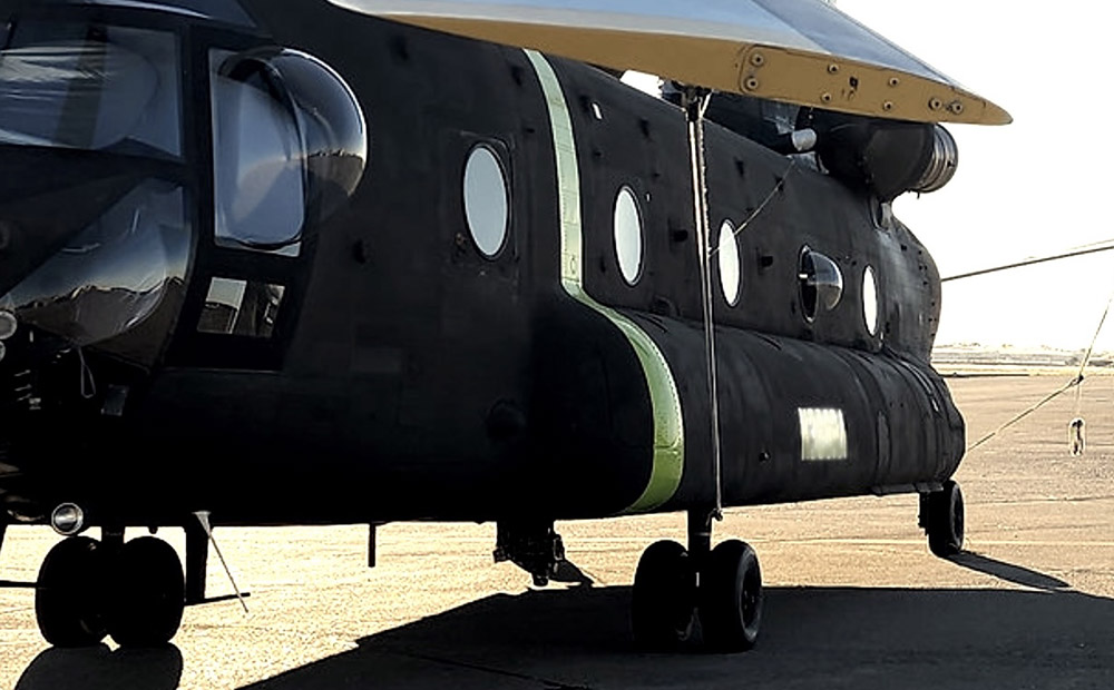
CH-47D
CH-47D. ROTAK photo.

Thursday afternoon a CH-47D Chinook helicopter operated by ROTAK Helicopter Services crashed into the Salmon River while working on the Moose Fire northwest of Salmon, Idaho. The US Forest Service reported Friday morning there were two fatalities.

The company released a brief statement Thursday evening.

It is with heavy hearts that we confirm that on July 21, 2022, at approximately 3:30 p.m. a CH-47D series “Chinook” helicopter operated by ROTAK Helicopter Service with two pilots on board was involved in an accident near Salmon, Idaho. Emergency medical teams are responding to the scene. ROTAK is working closely with all appropriate agencies and will issue a full statement as information is confirmed.

We send out our sincere condolences to the families, friends, and co-workers of the two that were killed.


Growth of the fire
The Moose Fire grew incrementally on Friday, showing growth on all sides, primarily south of the Salmon River on the west and east sides. Very little growth occurred north of the river.

A mapping flight Thursday night determined it had burned 23,620 acres, an increase of nearly 3,000 acres. Much of that difference was due to an overnight change in procedure, a decision to not consider in the acreage the unburned islands in the interior. Previously the size of those islands had been subtracted from the total exterior perimeter.

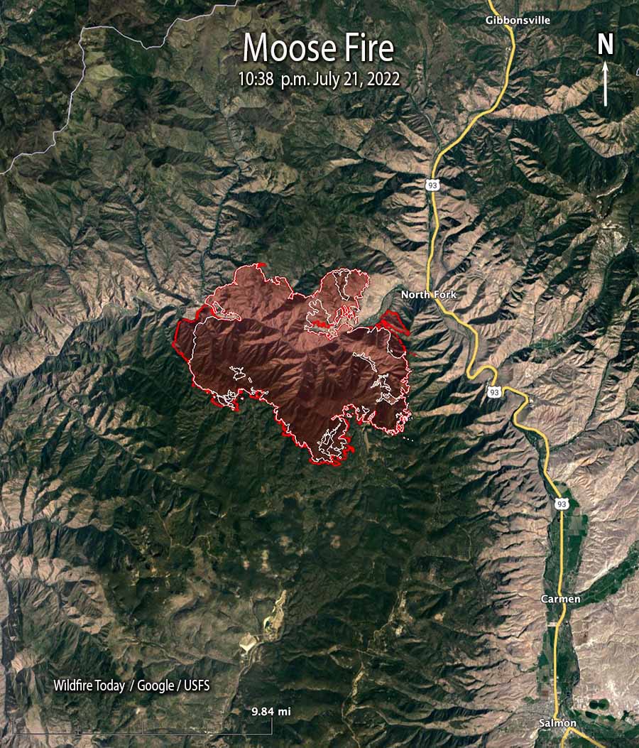
Moose Fire map 10:38 p.m. July 21, 2022
Moose Fire map. The red line was the perimeter at 10:38 p.m. July 21, 2022. The white line was the perimeter about 24 hours previously.

Weather
The forecast for Friday afternoon is for increasing winds, gusting out of the west and then northwest at 31 mph with the relative humidity in the mid-teens. After sunset the wind will drop to about 6 mph out of the north. Saturday should bring 5 to 8 mph winds out of the south shifting to the north, with 13 percent relative humidity.

Firefighters expect the weather on Friday could lead to spread south of the Salmon River west towards Spring Creek, east towards North Fork, and spotting to the north side of the river.

Resources
Resources assigned to the fire Thursday evening included 18 hand crews, 25 fire engines, and 7 helicopters for a total of 517 personnel, a 24-hour increase of 141 individuals.

Structures
There are no reports of structures burning, but 301 are threatened. Evacuation information is available at the Lemhi County website.

Moose Fire burns tens of thousands of acres north of Salmon, Idaho

Both sides of the Salmon River

Moose Fire map, 9:56 p.m. July 20, 2022
Moose Fire map, 3-D, looking east at 9:56 p.m. July 20, 2022.

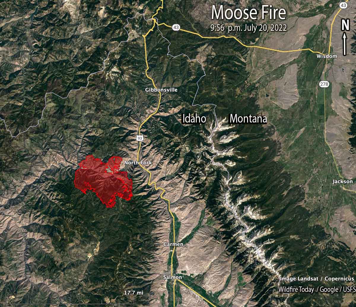
The Moose Fire 12 air miles northwest of Salmon, Idaho was very active Wednesday afternoon on both sides of the Salmon River, on the west, south, and east flanks. A mapping flight Wednesday night found that it had grown to more than 20,600 acres and was 2 miles west of North Fork and Highway 93.

Fire officials said the potential remains for the fire to reach the Highway 93 corridor. Additionally, the fire continues to grow to the west along the south side of the Salmon River, beyond East Boulder Creek.

Moose Fire map, 9:56 p.m. July 20, 2022
Moose Fire map, 9:56 p.m. July 20, 2022.

Fire crews are constructing direct and indirect fire line on the north side of the fire north of the Salmon River, working from Ulysses Mountain to the west and the east toward the river. On Wednesday burn out operations were completed near the mountain and crews secured and improved the line into the evening.

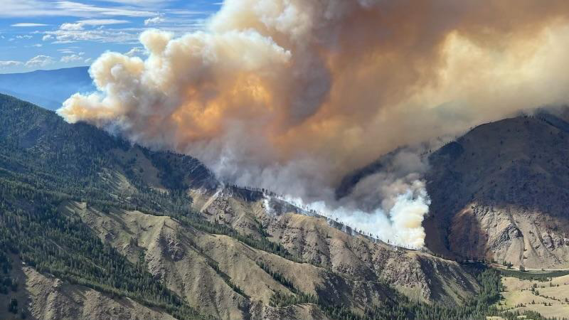
Moose Fire, July 17, 2022
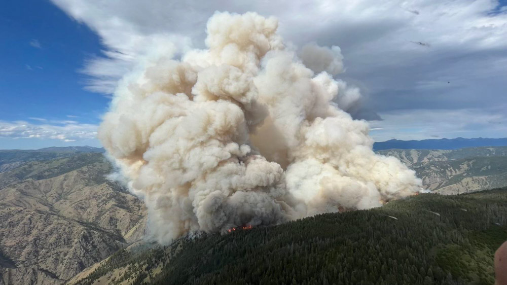
Moose Fire, July 17, 2022. InciWeb

South of the river firefighters are expecting to use indirect line, natural features, or roads to stop the spread.

Evacuation information is available at the Lemhi County website.

Continued dry, hot, and windy conditions are expected Thursday with humidities near 10 percent and 15 mph winds out of the west gusting to 22 mph. The forecast for Friday predicts humidity in the mid-teens with stronger winds, 22 mph gusting to 31 out of the west switching to the northwest in the late afternoon. Fire growth on Thursday and Friday could be considerable, but conditions will moderate on Saturday and Sunday.

Another blaze, the Hog Trough Fire 53 air miles to the north-northeast, has burned about 350 acres 15 miles east-southeast of Grantsdale, Montana.

Moose and Hog Trough Fires
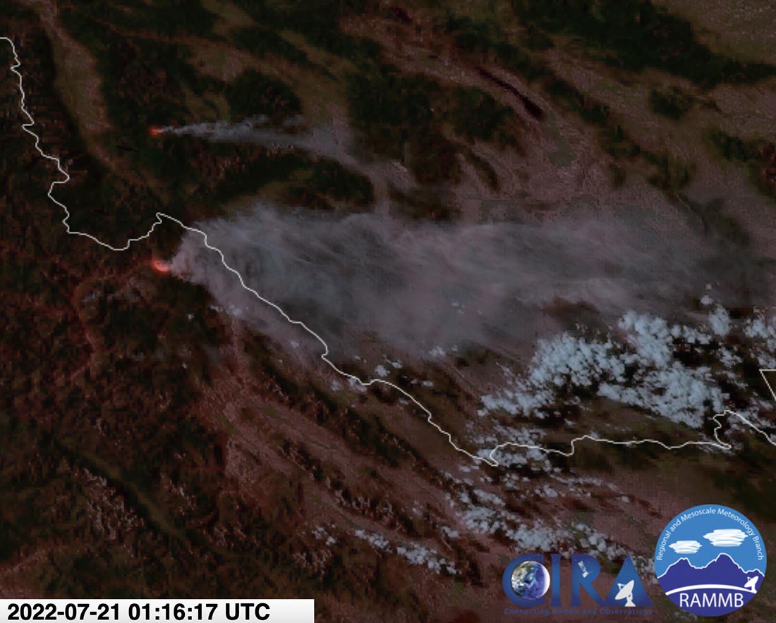
Moose and Hog Trough Fires, satellite photo at 7:16 p.m. MDT July 20, 2022. The Hog Trough Fire is the northernmost, and is smaller.

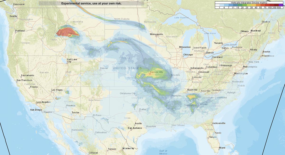
The forecast for smoke from the two fires predicts it will be moving primarily to the northeast and east Thursday afternoon and evening, possibly affecting Salmon, Butte, Bozeman, Livingston, Dillon, and points further east and southeast.

Smoke forecast 8 p.m. MDT July 21, 2022
Smoke forecast for 8 p.m. MDT July 21, 2022. NOAA.

A Type 1 Incident Management Team has been activated. Other resources assigned include 18 hand crews, 25 fire engines, and 9 helicopters for a total of 517 personnel.

Moose Fire, July 17, 2022
Moose Fire, July 17, 2022. InciWeb