Smoke from Whiskey Fire predicted to impact Flagstaff

smoke forecast Flagstaff Whiskey Fire
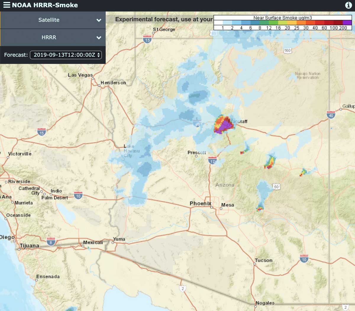
Near surface smoke forecast for 6 p.m. MDT September 13, 2019. Click to enlarge.

(9:52 a.m. MDT September 13, 2019)

Forecasts predict that smoke from the Whiskey Fire 10 miles southwest of the Flagstaff Airport will move into the city Friday afternoon. (see maps)

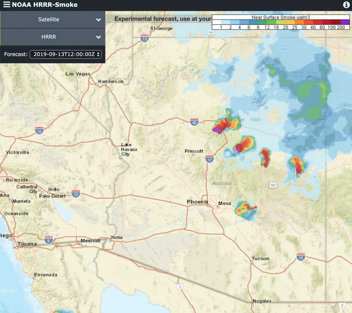
Thursday and Thursday night the wind from the east and northeast moved smoke from the fire off to the southwest but that direction is predicted to change shortly after noon Friday to come from the south and southwest, pushing the smoke into the Flagstaff area. If the fire activity continues on Saturday the smoke is expected to continue to impact the city.
smoke forecast Flagstaff Whiskey Fire
Near surface smoke forecast for 6 p.m. MDT September 14, 2019, assuming significant activity on the fires continues.

The Whiskey Fire started September 2 on the Coconino National Forest and is being managed rather than completely suppressed. Thursday firefighters began conducting firing operations along Forest Road 231 to ensure the wildfire stays in its containment area. Today, Friday, the plan is to moderate but continue the firing operations through the weekend, according to information released by the Forest Service.

The agency said smoke may affect Flagstaff, Munds Park, Mountainaire, Kachina Village, Forest Highlands, Doney Park, Mormon Lake Village, Highway 89A Corridor, Sedona, Village of Oak Creek, and portions of Interstate 40.

The fire has burned 3,500 acres.
map whiskey fire flagstaff arizona
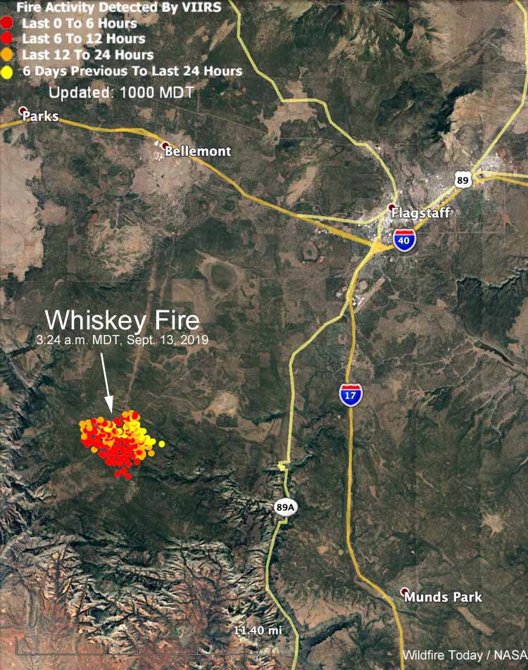
Map showing heat detected by a satellite during an overflight at 3:24 a.m. MDT September 13, 2019.
Whiskey Fire
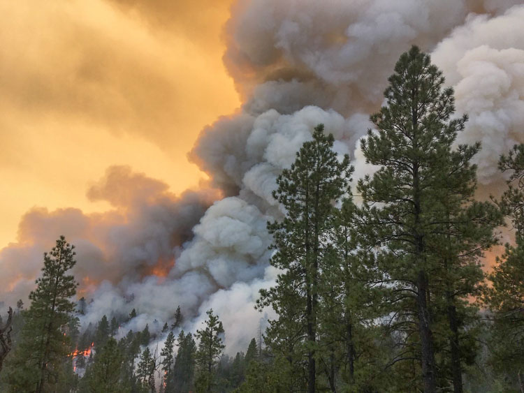
Whiskey Fire. Forest Service photo distributed September 13, 2019.

Bringing home Braden

Braden Varney family dozer operator fatality California
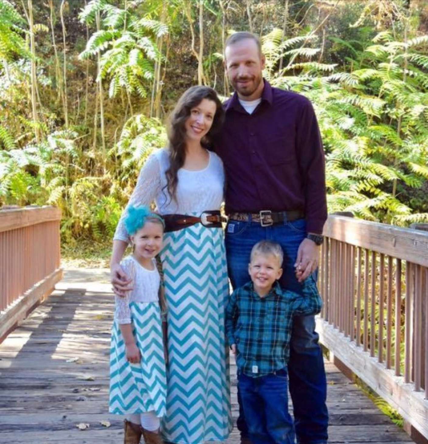
This image of the Varney family — Braden and Jessica with children Maleah and Nolan — was seen around the world with news stories about Braden’s death. Photo courtesy Cal Fire

The San Francisco Chronicle has a story you have to read, about a CAL FIRE firefighter, his wife, and two small children. Braden Varney died July 14, 2018 while building fireline with his dozer at the Ferguson Fire on the west edge of Yosemite National Park in California. No one else was around  when the 21-ton machine with Braden inside rolled 300 feet down a steep slope. Removing his remains proved to be very challenging, and progress came to a halt at one point when the fire burned through the recovery site.

The article is HERE. Be sure and view the six-minute video.

Thanks and a tip of the hat go out to Tom. Typos or errors, report them HERE.

Video of extreme firefighting at the 2018 Ranch Fire

Ranch Fire Clear Lake California
Screenshot from video of the Ranch Fire shot by 564 Fire in 2018.

A photographer who specializes fires shot some incredible video of firefighters dealing with what must have been hundreds of spot fires in a meadow of dead grass. In the dry, windy weather they spread immediately after burning embers blown by the wind fell into the abundant fuel. There were far more rapidly spreading spot fires than the resources on scene could pick up, so they had to withdraw and come up with another plan.

It was shot by 564 Fire at the Ranch Fire, part of the Mendocino Complex of Fires that burned near Clear Lake in northern California in July and August of 2018. The total size of the complex, which included the River and Ranch Fires, was 459,123 acres. The video was uploaded to YouTube June 18, 2019.

Mendocino Complex fire Ranch California map
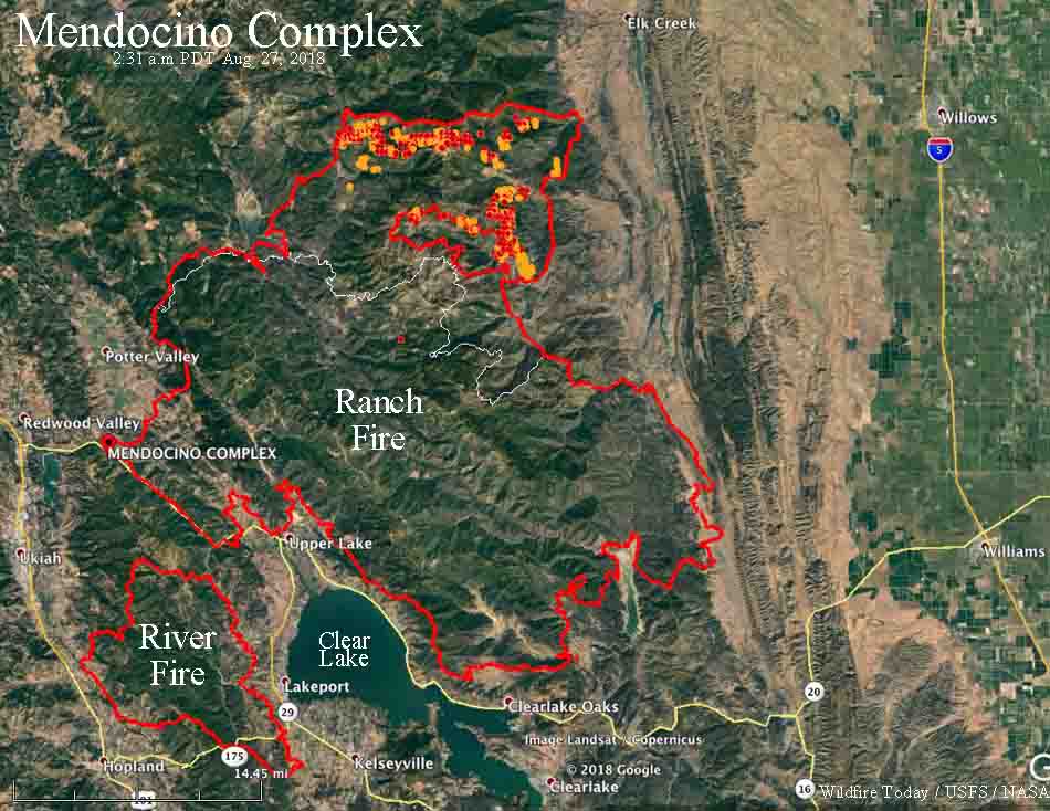
The red line on the map was the perimeter of the Ranch Fire at 9:15 p.m. PDT August 26, 2018. The white line was the perimeter on August 14. The red and yellow dots represent heat detected by a satellite in the 24 hour period ending at 2:31 a.m. PDT August 27, 2018.

Walker Fire slowed by cooler weather

Wednesday morning the fire was under a layer of low clouds, but the forecast calls for a return to warmer and drier conditions, with strong winds on Saturday

Above: The Walker Fire was beneath a layer of clouds at 7:46 Wednesday morning. Two photos stitched together, Dyer Mountain camera, Nevada Seismo Lab.

(Originally published at 8:45 a.m. PDT Sept. 11, 2019)

The growth of the Walker Fire 17 miles south of Susanville, California slowed Tuesday due to cooler weather. The temperature reached a high of only 54 degrees while it plummeted to 38 degrees by 6:15 Wednesday morning at the Pierce weather station 5 miles north of the fire. The relative humidity after midnight was in the 80s, which can slow fire behavior, giving firefighters a chance to gain more containment.

As you can see in the photo above, the fire was under a layer of clouds at 7:46 a.m. Wednesday. Two new cameras at Dyer Mountain occasionally are pointed southeast toward the fire.

(Click here to see all articles about the Walker Fire on Wildfire Today, including the most recent.)

Much of the growth of the fire Tuesday was on the east and south portions, with the largest area of activity being around Papoose Peak. The perimeter grew by 981 acres to bring the total up to 48,321 acres

Take a flyover tour of the Walker Fire

The weather forecast for the fire area calls for a return to warmer and drier  conditions, with strong winds on Saturday. No rain is in the forecast until Monday, September 16.

Never Forget

Never Forget 9/11

Today we are thinking about the 2,977 victims killed in the September 11 attacks. Of those, 412 were emergency workers in New York City who responded to the World Trade Center. This included:

  • 343 firefighters (including a chaplain and two paramedics) of the New York City Fire Department (FDNY);
  • 37 police officers of the Port Authority of New York and New Jersey Police Department (PAPD);
  • 23 police officers of the New York City Police Department (NYPD);
  • 8 emergency medical technicians and paramedics from private emergency medical services; and,
  • 1 patrolman from the New York Fire Patrol

(source:  Wikipedia)