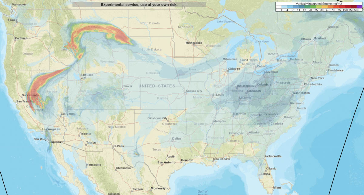
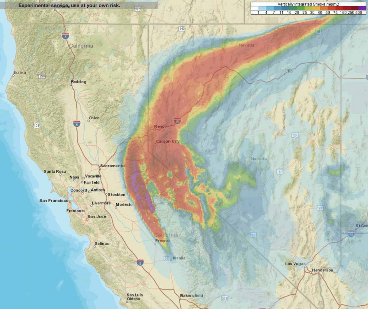
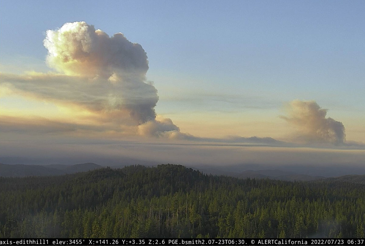
NOAA has produced a forecast for the distribution of vertically integrated wildfire smoke at 7 a.m. MDT Sunday July 24. Locations to be hit the hardest are areas in Northern California, Northern Nevada, Eastern Idaho, and Montana.
News and opinion about wildland fire

NOAA has produced a forecast for the distribution of vertically integrated wildfire smoke at 7 a.m. MDT Sunday July 24. Locations to be hit the hardest are areas in Northern California, Northern Nevada, Eastern Idaho, and Montana.
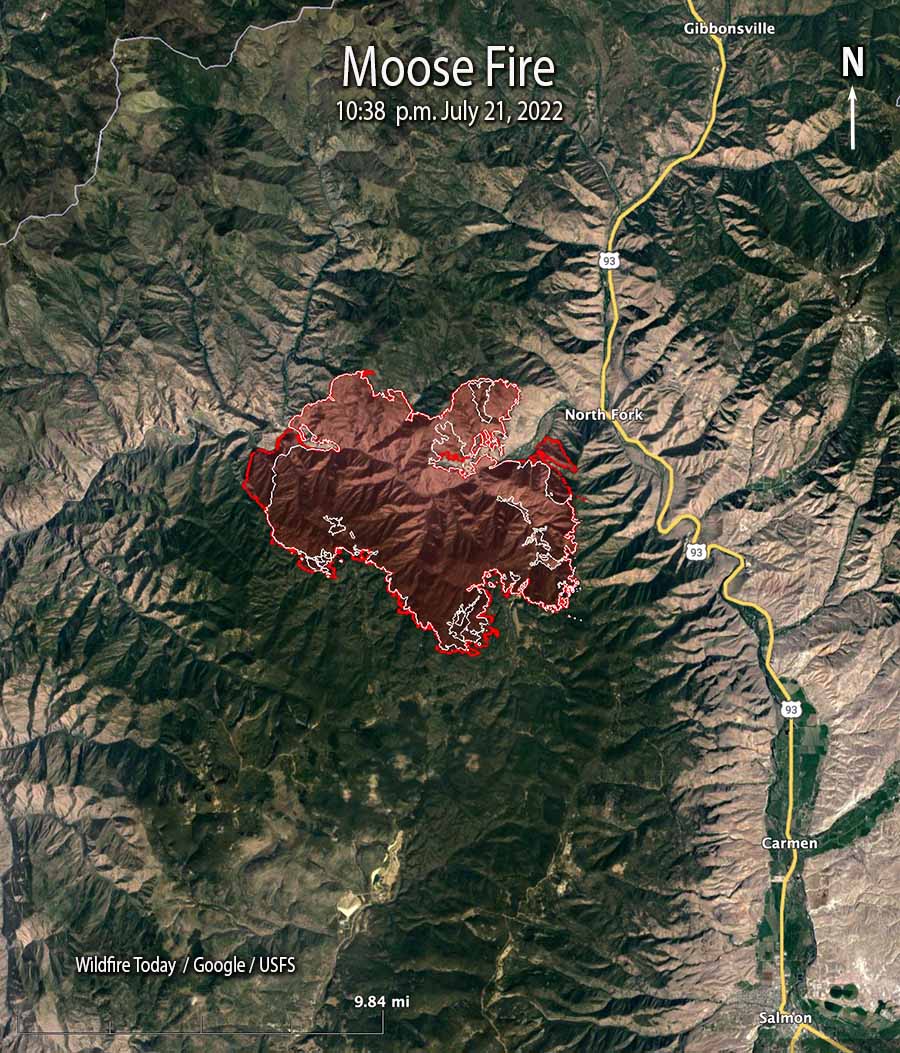
Most of the 5,000 acres of growth was on the west and east sides
12:12 p.m. MDT July 23, 2022
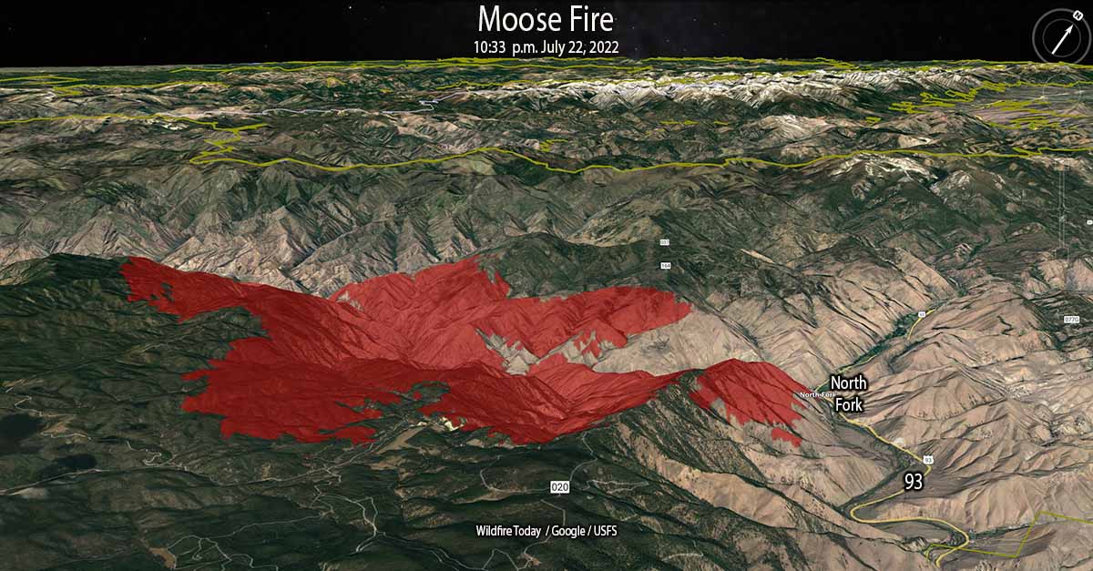
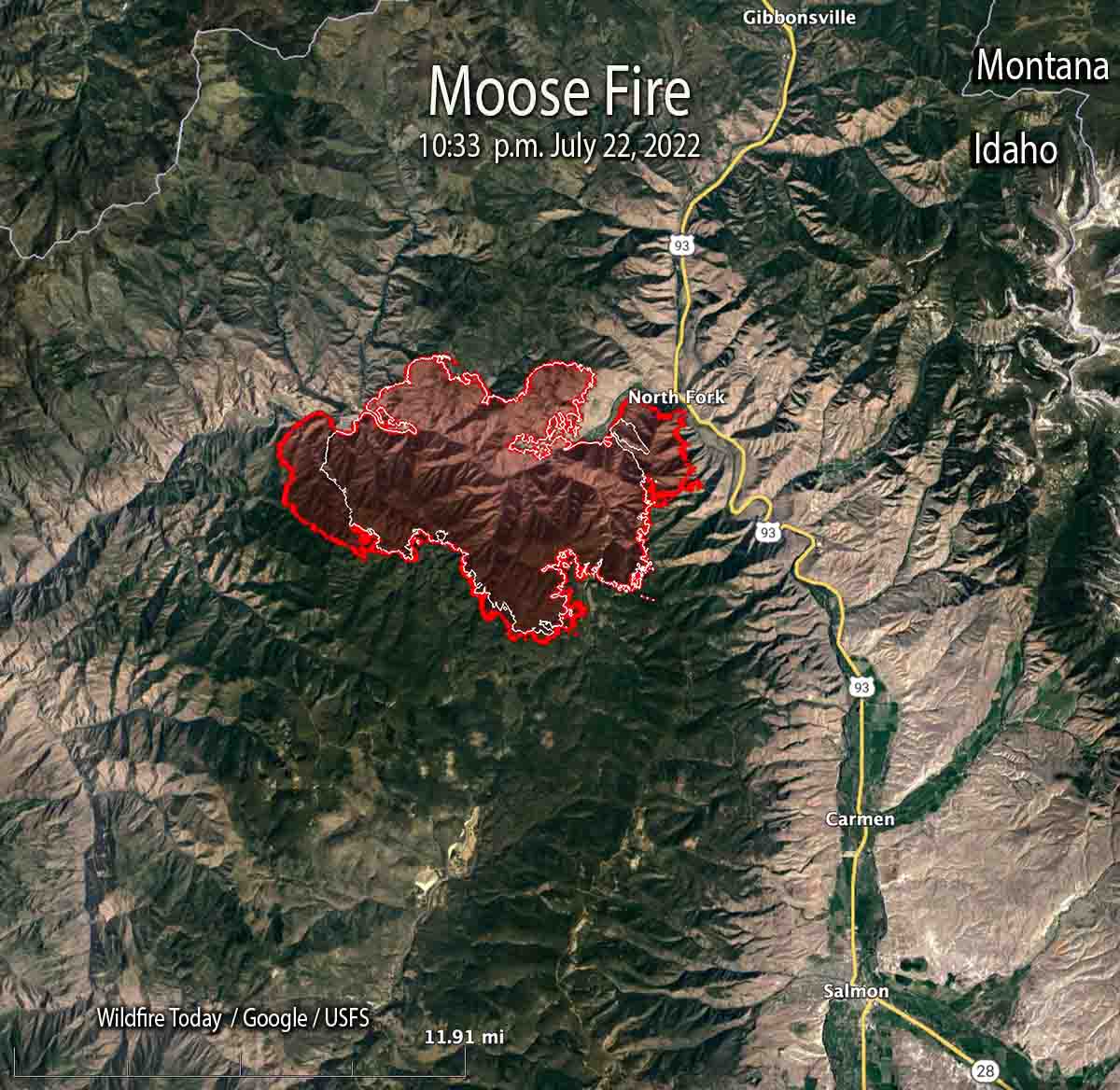
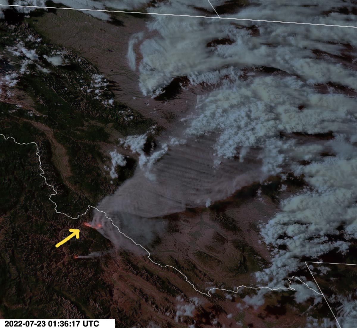
Most of the 5,000 acres of growth of the Moose Fire in eastern Idaho Friday was on the west and east sides, spreading for about a mile to the east and west. Friday night the fire burned actively, spreading west as far as Kayak Camp. In the North Fork area it reached the west bank of the Salmon River. Two miles of the east flank are on the steep slopes west of and above US Highway 93.
Friday’s Red Flag weather conditions increased fire activity along the top of Napoleon Ridge. North of the Salmon River, firefighters succeeded in holding fire line built during the last several days.
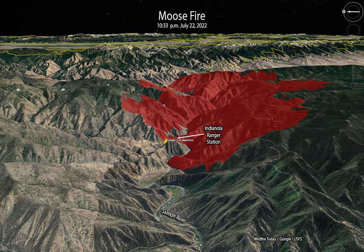
At 10:33 p.m. Friday it was mapped at 28,839 acres. At that time it was 12 miles northwest of Salmon, Idaho and 10 miles west of the Idaho/Montana border.
Two pilots were killed Thursday July 21 when their Chinook helicopter crashed into the Salmon River while working on the fire. They were identified as Thomas Hayes, 41, of Post Falls, Idaho, and Jared Bird, 36, of Anchorage, Alaska. The National Transportation Safety Board will conduct an investigation.
A spokesperson for the Salmon Challis National Forest said the cause of the fire is undetermined.
On Saturday firefighters will be holding and improving line around the north end of the fire and protecting structures along Salmon River Road and Highway 93. On the southeast side, crews and heavy equipment will work on building an indirect line along Diamond Creek Road from the Highway 93 corridor up into Five Corners.
At the site of the Indianola Ranger Station along the Salmon River (see map above) there is a memorial to two firefighters who were killed while working on the Cramer Fire July 22, 2003 — Jeff Allen and Shane Heath, members of the Indianola Helitack Crew. More information HERE and HERE.
Weather conditions are expected to moderate Saturday with quieter winds, however it will still be hot and dry for several days.
Updated 8:36 p.m. PDT July 23, 2022
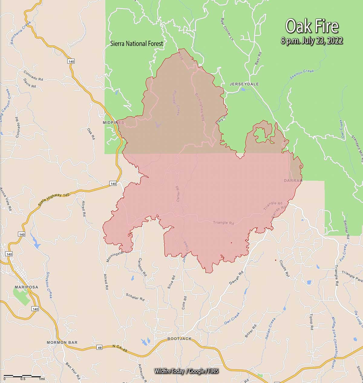
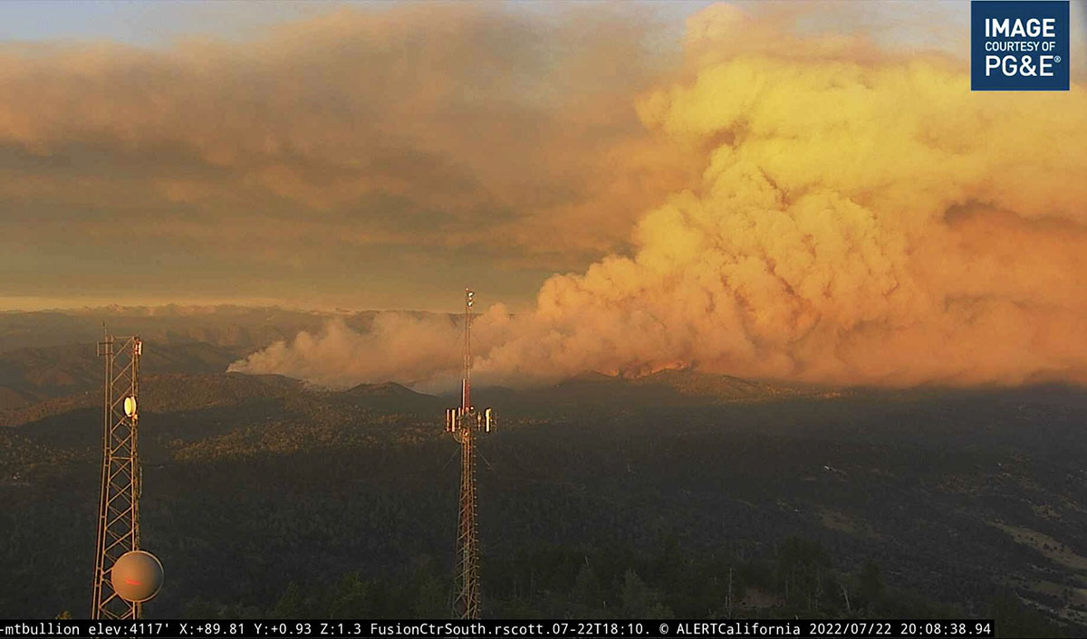
The Oak Fire has spread to the east quite significantly, crossing Jerseydale Road about two miles south of Jerseydale in the vicinity of Wild Dove Lane.
To see all articles on Wildfire Today about the Oak Fire, including the most recent, click HERE.
That puts it less than a mile west of the footprint of the very large Ferguson Fire which burned more than 96,000 acres in 2018. It was caused by a hot catalytic converter on a vehicle that parked in dry grass July 13, 2018 along Highway 140 near the Savage Trading Post.
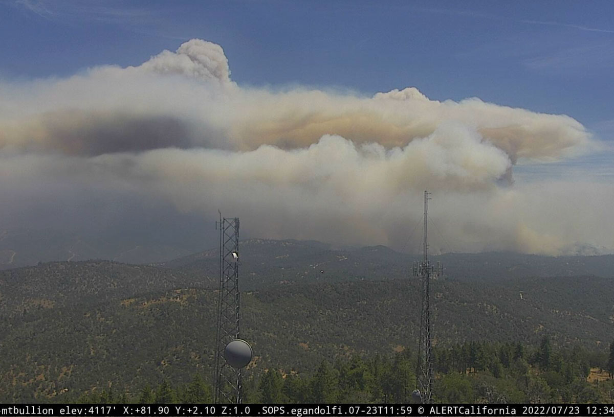
The Oak Fire is exhibiting extreme fire behavior, igniting spot fires far ahead of the main fire.
CAL FIRE announced that at 6:45 p.m. it had burned 11,900 acres.
Updated 5:00 p.m. PDT july 23, 2022
At approximately 4:20 p.m. Air Attack reported that the latest mapping of the Oak Fire showed had grown to 11,500 acres.
Updated 12:58 p.m. PDT July 23, 2022
At 11:15 a.m. Saturday the Oak Fire was mapped by Air Attack at 9,100 acres.
CAL FIRE confirms 10 structures have been destroyed. That number will likely increase.
Updated at 8:35 a.m. PDT July 23, 2022
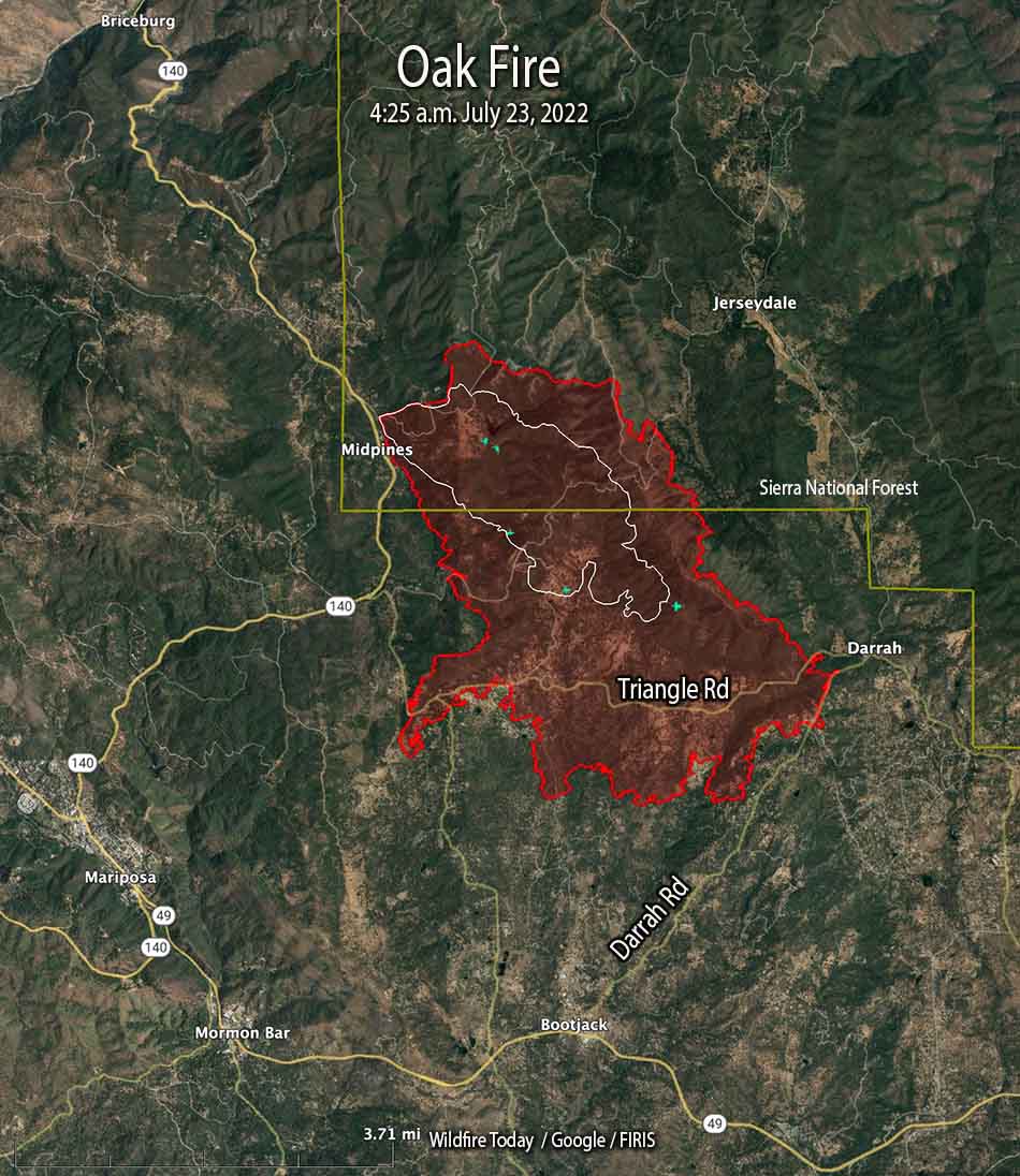
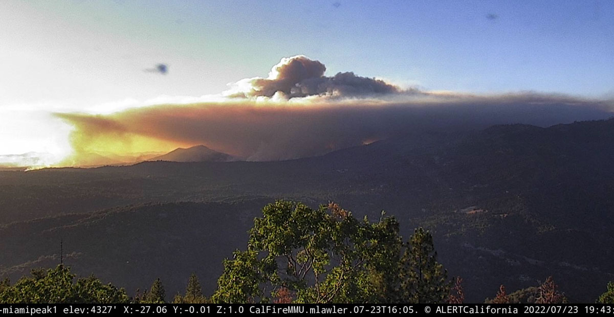
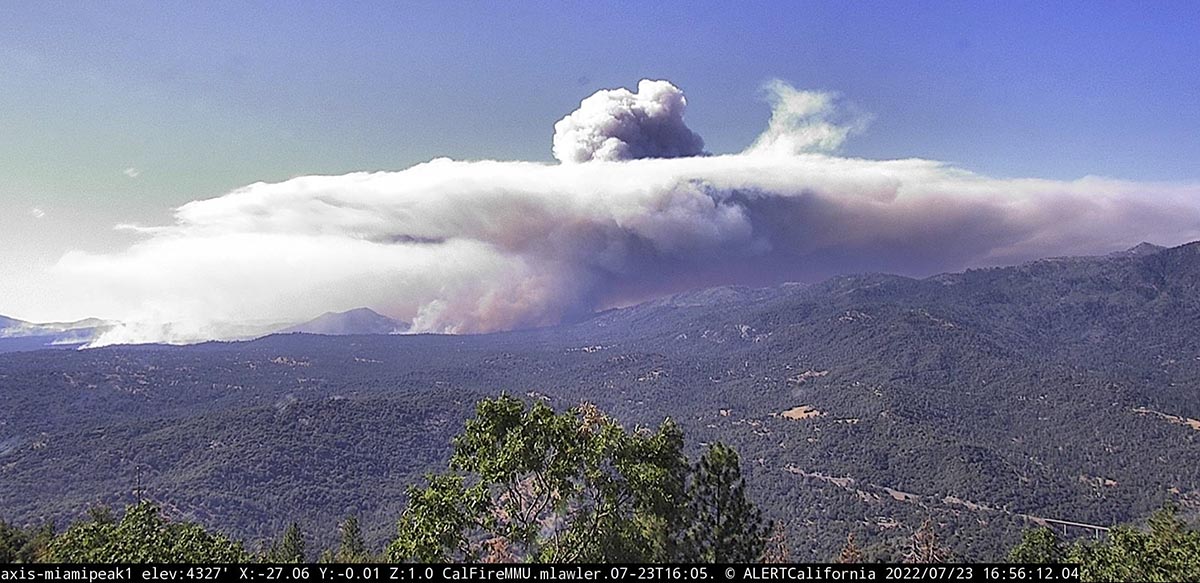
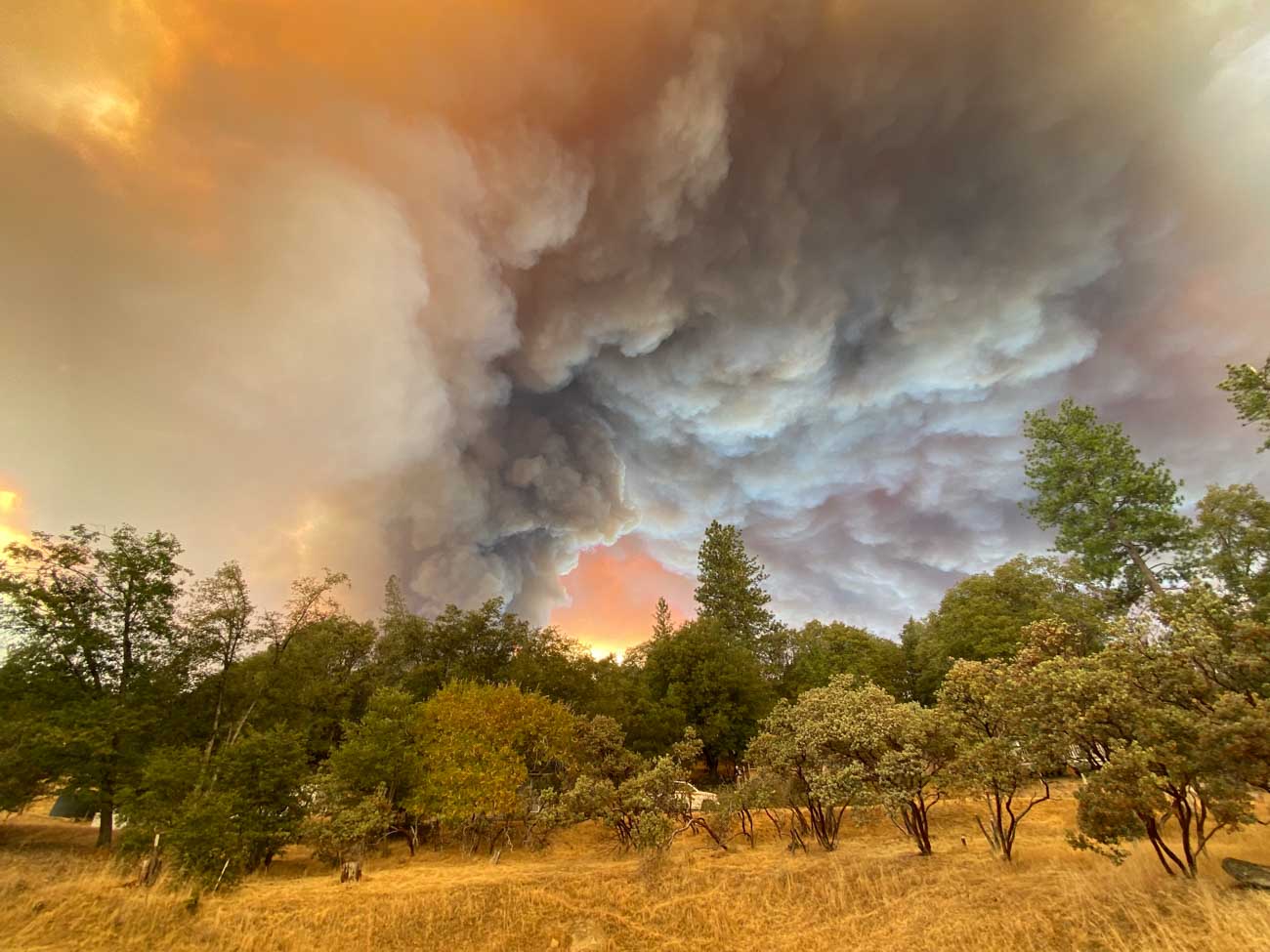
The Oak Fire at Midpines, California was active throughout much of Friday night, growing by about 2,200 acres between 10 p.m. and 4:25 a.m. Saturday when it was mapped by FIRIS at 6,555 acres. Half an hour after sunrise it was putting up two smoke columns that were quite some distance apart, with one of them creating enough energy to be capped by a pyrocumulus cloud.
Just to be clear — wildfires normally lay down at night, providing an opportunity for firefighters to move in closer and put in direct fireline. It is not common for a fire to be burning so actively soon after dawn that it is creating multiple smoke columns, especially a pyrocumulus column.
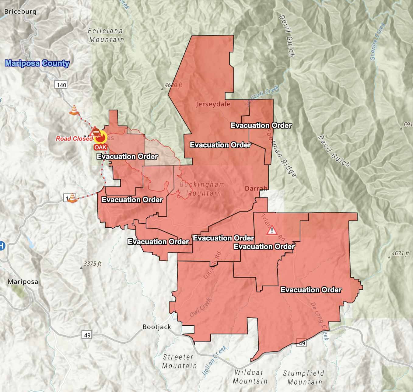
The Mariposa County Sheriff has ordered evacuations as far south as Highway 49 and east to Jerseydale. Their map is available online. As we wrote earlier, this is a dangerous fire.
The Oak Fire is spreading rapidly. When it was mapped at 4:25 a.m. Saturday it had spread south across Triangle Road and reached Darrah Road. At that time it was about a half mile west of the community of Darrah. Firefighters were planning a burning operation between Triangle Road and Darrah Road west of the town.
Weather
The spot weather forecast for the area predicts hot and dry conditions to persist into next week. Winds will be generally light, except becoming gusty in the afternoons. On Saturday, mostly sunny skies, 90 to 94 degrees, 9 to 13 percent relative humidity, and 6 to 12 mph ridgetop winds from the south to southwest gusting to 20 mph in the afternoon. Saturday night will see poor humidity recovery, 26 to 31 percent, with very light winds. For Sunday, 10 to 14 percent RH with afternoon ridgetop winds out of the west at 4 to 8 mph.
10:36 p.m. PDT July 22, 2022
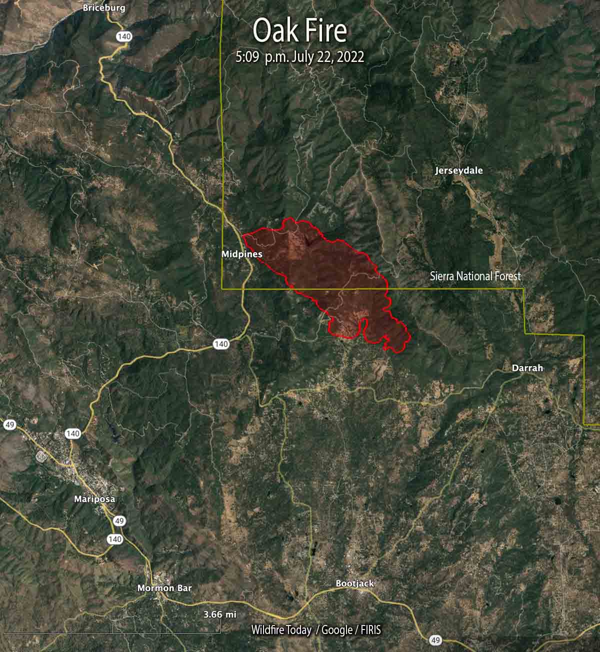
The Oak Fire that started Friday afternoon in Central California has been growing rapidly in Mariposa County. The County Sheriff has ordered evacuations for several areas east and southeast of Midpines. At 10 p.m. Friday it was about 4 miles northeast of Mariposa.
This is a dangerous fire. Residents should not hesitate to evacuate if there is any doubt about their safety.
At 5:09 p.m. it was mapped at 1,745 acres; at about 10 p.m. CAL FIRE reported it had grown to 4,350 acres.
This weekend we are continuing an occasional weekend feature we started a few weeks ago. This post can serve as the beginning of an open thread where our readers can talk about issues that we have, or have not, gotten into yet. This is literally an off-topic thread. You have the floor.
The usual rules about commenting apply. And remember, no personal attacks or politics, please.
Let’s enjoy a wide-ranging conversation!
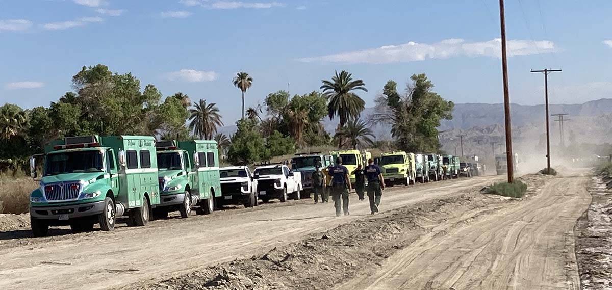
(Oh, and send us pics of staging areas — date, location, and photographer’s name would be nice.)
About 1,000 feet wide

The Bordeaux region in Southwest France has experienced many fires in the last few weeks that have burned a total of about 50,000 acres (20,000 Ha). Thinking that it will stop future fires, officials are building a large fire break three miles (5 K) long and about 1,000 feet (300 meters) wide.

In parts of the Western United States back in the 1960s building fire breaks was a common practice. Some were only one or two dozer blades wide scraped down to mineral soil, while others were wider. But in later decades firefighters realized that no firebreak is likely to stop a rapidly spreading blaze.
Fires become large most often because they are burning in copious amounts of vegetation (fuel) during strong winds. Under unusually hot, dry, and windy conditions burning embers are lofted into the air. As they are blown downwind they can ignite new fires, “spot fires”, hundreds of feet or even up to a mile away from the main fire. Usually these embers are small, but can be as large as tree branches or even a four-by-eight-foot sheet of plywood, both of which have come close to or even hit air tankers working over the fire.
Under extreme conditions nothing will stop a large fire unless it completely runs out of fuel over a very large area, or the weather changes. A 1,000-foot fire break can stop a slow moving fire, but not a conflagration of the type that wipes out dozens of structures.
Something that cannot be ignored is that removal of all vegetation can result in severe environmental damage.
In the United States land managers are now more prone to build fuel breaks. They do not attempt to remove all vegetation, but only reduce it to the point where it will slow the spread of a fire enough that firefighters, sometimes aided by aircraft dropping water or fire retardant, can safely move in close to the flanks, make a direct attack, anchor the heel, and work their way along the edges and eventually stop the head of the fire. Fuel breaks helped firefighters last year on the Caldor Fire near South Lake Tahoe in California.
The first video below describes the firebreak in France. The next one is an update on the wildfires in the southwest part of the country.
Updated 3:56 p.m. MDT July 22, 2022
More information is available about the helicopter crash in Idaho.
Both pilots have died, the U.S. Forest Service said on Friday.
Mary Cernicek with the Salmon-Challis National Forest said Thomas Hayes, 41, of Post Falls, Idaho, and Jared Bird, 36, of Anchorage, Alaska, died from injuries they sustained when their CH-47D Series Chinook crashed in the Salmon River about 3:30 p.m. Thursday.
The pilots were employees of the Anchorage-based ROTAK Helicopter Services and were working on the Moose Fire northwest of Salmon, Idaho.
7:52 a.m. MDT July 22, 2022
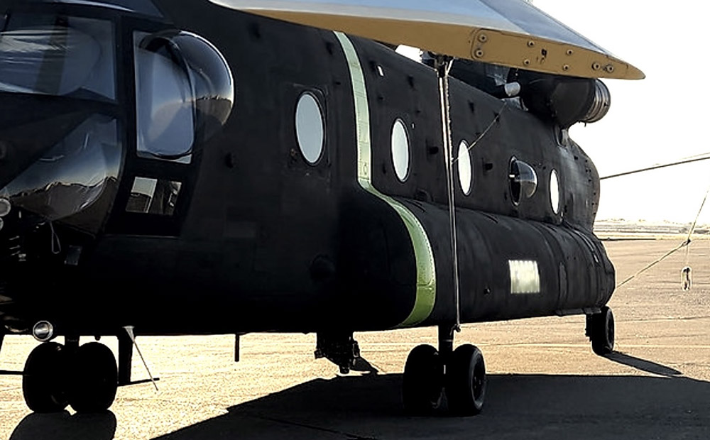
Thursday afternoon a CH-47D Chinook helicopter operated by ROTAK Helicopter Services crashed into the Salmon River while working on the Moose Fire northwest of Salmon, Idaho. The US Forest Service reported Friday morning there were two fatalities.
The company released a brief statement Thursday evening.
It is with heavy hearts that we confirm that on July 21, 2022, at approximately 3:30 p.m. a CH-47D series “Chinook” helicopter operated by ROTAK Helicopter Service with two pilots on board was involved in an accident near Salmon, Idaho. Emergency medical teams are responding to the scene. ROTAK is working closely with all appropriate agencies and will issue a full statement as information is confirmed.
We send out our sincere condolences to the families, friends, and co-workers of the two that were killed.
Growth of the fire
The Moose Fire grew incrementally on Friday, showing growth on all sides, primarily south of the Salmon River on the west and east sides. Very little growth occurred north of the river.
A mapping flight Thursday night determined it had burned 23,620 acres, an increase of nearly 3,000 acres. Much of that difference was due to an overnight change in procedure, a decision to not consider in the acreage the unburned islands in the interior. Previously the size of those islands had been subtracted from the total exterior perimeter.
Weather
The forecast for Friday afternoon is for increasing winds, gusting out of the west and then northwest at 31 mph with the relative humidity in the mid-teens. After sunset the wind will drop to about 6 mph out of the north. Saturday should bring 5 to 8 mph winds out of the south shifting to the north, with 13 percent relative humidity.
Firefighters expect the weather on Friday could lead to spread south of the Salmon River west towards Spring Creek, east towards North Fork, and spotting to the north side of the river.
Resources
Resources assigned to the fire Thursday evening included 18 hand crews, 25 fire engines, and 7 helicopters for a total of 517 personnel, a 24-hour increase of 141 individuals.
Structures
There are no reports of structures burning, but 301 are threatened. Evacuation information is available at the Lemhi County website.
