Politicians want to resume fireworks displays over the forest at Mount Rushmore

mount rushmore fireworks
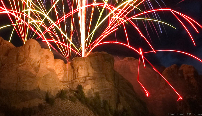
Photo showing Mount Rushmore fireworks with burning embers hitting the ground. Photo: South Dakota Tourism

It is possible that July 4 fireworks displays could again be seen at Mount Rushmore National Memorial in the Black Hills of South Dakota beginning next year. The last time fireworks rained down on the sculpture and the ponderosa pine forest below was in 2009.

President Trump sent out a tweet yesterday:

I am pleased to inform you that THE BIG FIREWORKS, after many years of not having any, are coming back to beautiful Mount Rushmore in South Dakota. Great work @GovKristiNoem and @SecBernhardt! #MAGA

Governor Kristi Noem distributed a press release, writing in part, “[T]he State of South Dakota and the U.S. Department of the Interior have agreed to bring fireworks back to Mount Rushmore National Memorial beginning with the 2020 Independence Day celebration.”

The Memorial is administered by the National Park Service which is part of the Department of the Interior. The DOI has signed a Memorandum of Agreement with the State of South Dakota, “to work to reinstate fireworks at Mount Rushmore for Fourth of July celebrations.”

According to the NPS it is not etched in stone that the fireworks will occur.

“The agreement”, said Maureen McGee-Ballinger, chief of interpretation and education at Mount Rushmore, “is the first step in a long process. The National Park Service will be working with the state, land management agencies, various specialists in a variety of fields, and will be exercising our authority under state and federal law to explore safe and available options in regards to the proposal. So, it’s a proposal. This is just the beginning of the process to look at that.”

For the last three months President Trump and the Governor of South Dakota, Kristi Noem, have been pushing to resume the fireworks over the faces of the Presidents. There is a report that the President joked that he would be in favor of it only if he could push the button to set them off.

From 1998 through 2009 fireworks were launched over the sculpture with strong support from local businesses that benefited from the thousands of spectators that crowded over the mountain roads to access the site.

During the first five years of the fireworks, Mount Rushmore was one of the seven Parks within the Northern Great Plains Fire Management organization for which I was the Fire Management Officer. Knowing that fireworks often start structure and vegetation fires, I argued against the project when it was first proposed. The park is not just the stone carving; it has 1,200 acres of timber within the boundary, and beyond that is the Black Hills National Forest.
Mount Rushmore
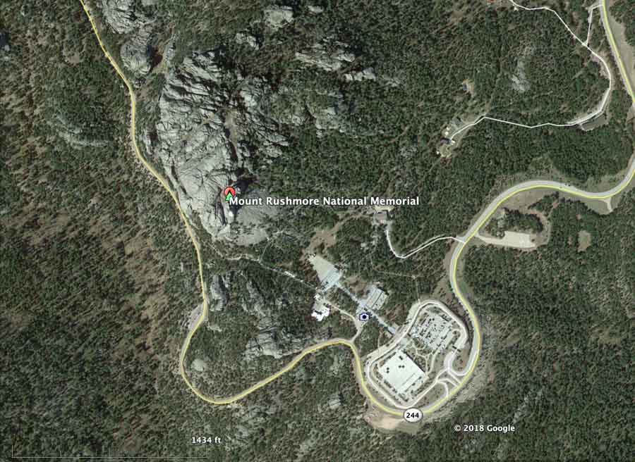
The sculpture at Mount Rushmore is at the icon in this satellite photo. Google Earth.

But the decision was made to begin the July 4 fireworks in 1998. As part of the planning team I developed fire-related criteria that became part of the go/no-go checklist that was fine-tuned over the years. One of the items on the list was a requirement that the Probability of Ignition be within certain parameters. If it was too high, the event would be cancelled or postponed. But there was tremendous pressure to make it happen. Tens of thousands of spectators usually attended, with many of them coming from long distances. It took many days to haul the fireworks up through the steep, rocky terrain and wire them up for the programmed display.

It was also my job to plan for suppression of the fires that started when burning embers hit the ground. We mobilized dozens of firefighters during the busy part of the fire season and had them positioned just outside the falling-debris zone. We had to restrict out of area fire assignments to be sure enough firefighters remained available for the show. After the aerial explosions ended, we would move in, search at night in the steep rocky terrain, and extinguish the fires. One year after searching through the dense timber on a moonless night, a hotshot crew got lost as they tried to return to their vehicles. We were pretty worried about them when they didn’t show up, but they eventually made it, about an hour later than expected.

In one of the first displays over a dozen fires started. They were all put out when they were small, but it was proven then to be an insane concept to shoot off literally tons of fireworks over a ponderosa pine forest in July.

In 2016 the USGS discovered that the ground and surface water at Mount Rushmore is contaminated with percholrate, a component of rocket fuels and explosives. They determined that the chemical came from the fireworks over that 12-year period.

Data from the USGS report showed that a maximum perchlorate concentration of 54 micrograms per liter was measured in a stream sample, which is about 270 times higher than that in samples collected from sites outside the memorial. The Centers for Disease Control says high levels of perchlorates can affect the thyroid gland, which in turn can alter the function of many organs in the body. The fetus and young children can be especially susceptible.

Aside from the impractical aspects of fires, cost, and ruining the water, the esthetics of the display were disrespectful and distasteful — explosions over the faces of Presidents Washington, Roosevelt, Jefferson, and Lincoln — raining down onto the sculpture, rocks, and forests. The show left on the sculpture and in the forest unexploded shells, wadding, ash, pieces of the devices, paper, and poisonous chemicals; stuff that can never be completely picked up in the steep, rocky, rugged terrain.
Mount Rushmore fireworks debris
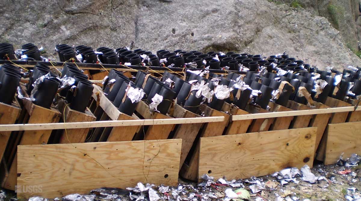
Some of the debris and trash at the launch site of the fireworks at Mount Rushmore.

Trivia of the day: President Trump has tweeted about “fireworks” 19 times. Most often to describe an upcoming episode of “The Apprentice”.

“Inside the Megafire” premiers May 8 on PBS

Inside the Megafire,” premiering Wednesday, May 8 at 9pm ET/8c and streaming online at PBS

In this episode, NOVA reports from the front line of the Camp Fire, the deadliest wildfire in California history, and follows scientists racing to understand what’s behind the recent rise in record-breaking megafires—from forestry practices, to climate change, to the physics of fire itself.

PROGRAM DESCRIPTION:

Just a few months after California’s devastating Carr Fire, another blaze became the deadliest and most destructive wildfire in the state’s history. As residents raced to evacuate, the Camp Fire devoured 150,000 acres and claimed 86 lives. But how did it get so big so fast? And why are megafires like these becoming more common? NOVA goes to the front lines of the deadliest fires of California’s 2018 fire season to hear from the people who had to flee—and the scientists racing to understand what’s behind these record-breaking infernos. Researchers take to the forest, and even a fire lab, to understand the increasing megafire threat. They explore the physics of fire itself, documenting how firestorms move and travel, and what causes phenomena like fire tornadoes. In the process, they decode the link between climate change, drought, and wildfire. And they show how those environmental factors—combined with a century of fire suppression in the American West and new residential developments in the forest—may have created an unprecedented risk.

PROGRAM PAGE:
(Full program will be available to stream here for several weeks, even for those who do not have a paid subscription to PBS)
https://www.pbs.org/wgbh/nova/video/inside-the-megafire/

30-SECOND TRAILER:
On Twitter: https://twitter.com/novapbs/status/1124373051666239488

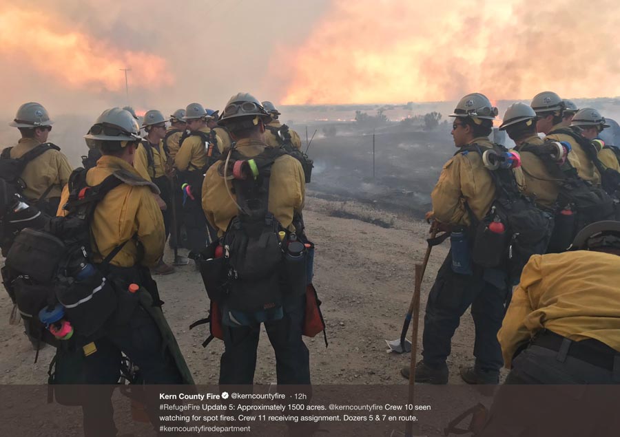
Refuge Fire burns 2,500 acres in Kern County, California

Refuge Fire

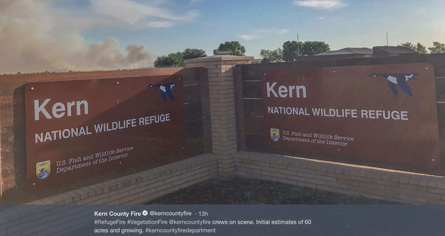
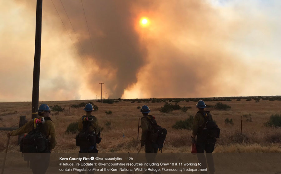
A wildfire in the Kern National Wildlife Refuge 36 miles northwest of Bakersfield, California had burned approximately 2,500 acres as of 10 p.m. PDT Tuesday night. The fire was reported at about 5 p.m. and at one point the Incident Commander said he had seen 100-foot flame lengths in the riparian area but by 10 p.m. firefighters were gaining some containment.

Wednesday morning the Kern County Fire Department announced that thanks to crews working throughout the night the fire was 100 percent contained and the size estimate remained at 2,500 acres.

map Refuge Fire
The red dot represents heat at the Refuge Fire detected by a satellite at 11:30 p.m. PDT May 7, 2019.

All of these photos and videos were taken by the Kern County Fire Department.

Refuge Fire

Refuge Fire

Oregon Lakes fire spreads during Red Flag Warning

Oregon Lakes Fire
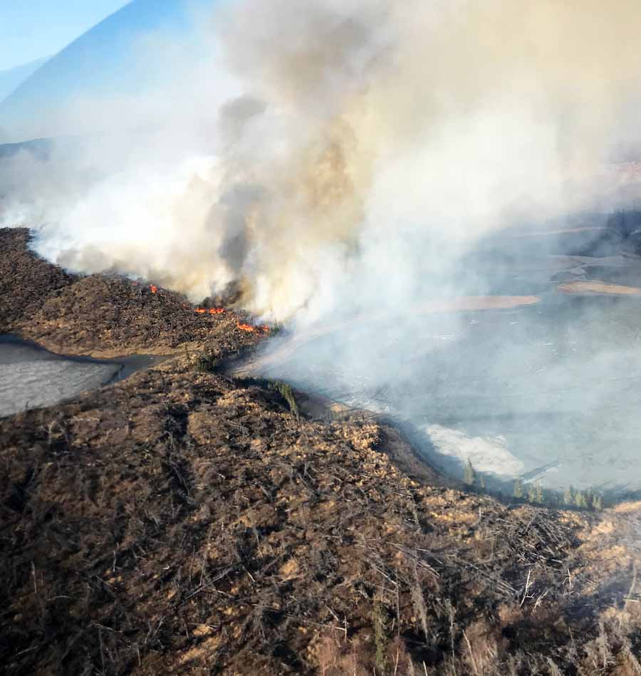
Oregon Lakes Fire, May 6, 2019. BLM Alaska Fire Service photo.

After being virtually dormant for a couple of days a Red Flag Warning, sunshine, and strong wind brought the Oregon Lakes Fire back to life Tuesday. As of Monday night the fire had burned 6,670 acres 10 miles southwest of Delta Junction, Alaska but judging from smoke seen in Tuesday’s satellite photo that number has likely increased.

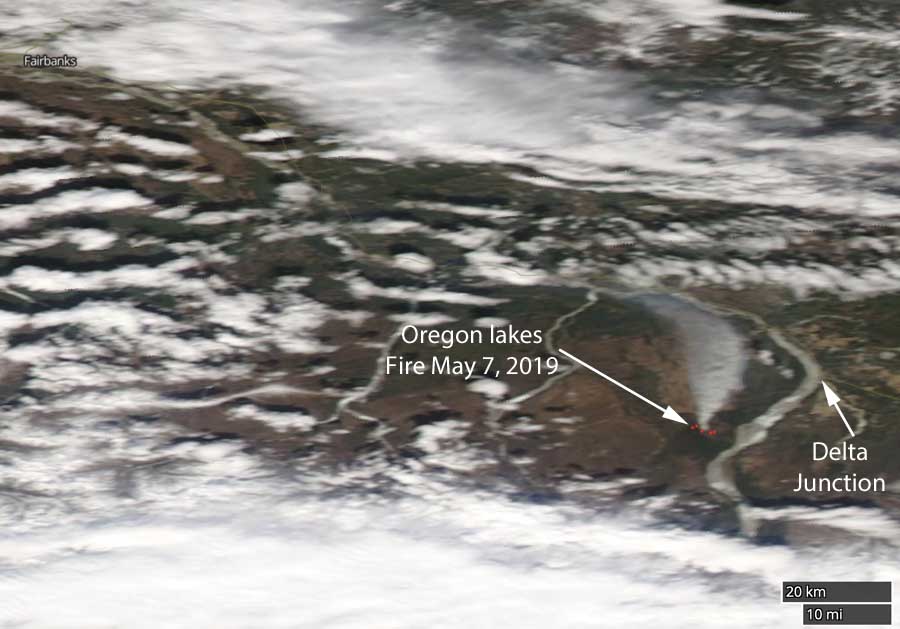
A hole in the clouds allowed the sun to warm and dry the fuels that got exposed to some rain earlier, and also a satellite took advantage to get an image for the first time since May 1.

Satellite photo Oregon Lakes Fire
Smoke can be seen in a satellite photo from May 7, 2019 showing the Oregon Lakes Fire 10 miles southwest of Delta Junction Alaska. The red dots indicate heat.

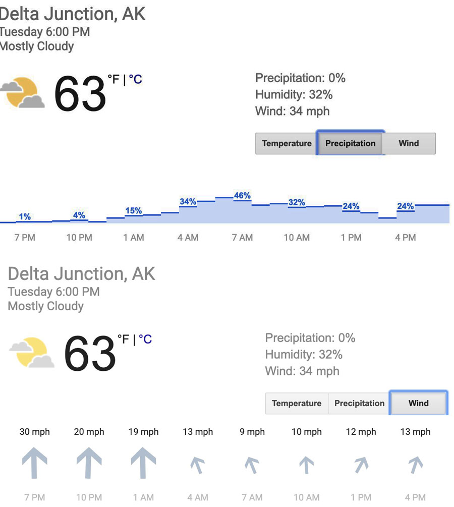
The weather forecast below for Delta Junction shows 30 mph south winds tapering off Tuesday night and a 46 percent chance of precipitation early Wednesday morning.

Delta Junction weather forecast
Weather forecast for Delta Junction from Tuesday afternoon through Wednesday afternoon, precipitation and wind.

The remote fire was reported at about 1 p.m. on April 30 and so far has been burning in an area that is off-limits to firefighters and low-flying fire suppression aircraft due to the likelihood of unexploded ordnance on the ground. It is burning mostly in tall, dry grass and downed trees from the 2013 Mississippi Fire on the west side of the braided Delta River.

Below is an excerpt from a Tuesday night update from the Incident Management Team:

The IMT will work with the BLM AFS Military Fire Management Zone, the U.S. Army Alaska Garrison, BLM Eastern Interior Field Office and the Alaska Division of Forestry (DOF) to determine the best course of action, especially with the forecasted increase in temperatures and wind. It is in a limited protection area and is not immediately threatening any structures, military targets or valuable resources. However, because it is burning in the Delta River drainage with known challenging weather patterns that could cause the fire to persist throughout the summer, the team is being activated to plan for an opportunity to launch suppression tactics once the fire moves out of the military impact areas. There will be an increase of people in the area as the IMT sets up a command post and stages firefighting resources in Delta Junction.

Report released for tree strike fatality on the 2018 Ferguson Fire

Captain Brian Hughes
Captain Brian Hughes. Photo courtesy of Brad Torchia.

The National Park Service has released the Serious Accident Investigation Factual Report for the accident in which Captain Brian Hughes of the Arrowhead Hotshots was killed last year. Captain Hughes died when a 105-foot tall Ponderosa Pine fell in an unexpected direction during a hazardous tree felling operation. It happened July 29, 2018 on the Ferguson Fire on the Sierra National Forest near Yosemite National Park in California.

Captain Hughes, number two in the chain of command on the crew, was in charge of the crew at the time since the Superintendent was at the Ferguson Fire Helibase at Mariposa Airport.

You can download the Factual Report and the Corrective Action Plan. Below are excerpts from both.


Excerpt from the Executive Summary:

…Brian returned to California in 2015 and became a captain of the Arrowhead Interagency Hotshot Crew. As a captain, Brian was a trusted leader and mentor who led by example, inspiring others to train hard and develop their skills. His crew looked up to him and loved him as a brother.

The Ferguson Fire was reported July 13.

[…]

The Arrowhead Hotshots arrived on scene July 16, having spent the previous month and a half working prescribed and wildland fires ranging from one to ten days long. The crew spent the next eight days working alongside other highly experienced hotshot crews to build and prepare a fire containment line for burnout operations designed to burn away the available fuel in a given area and keep the original fire from spreading.

By July 28, the day before the accident, the Ferguson Fire had grown to 53,657 acres and was burning across multiple jurisdictional boundaries. Hughes and IHC-1 Squad Leader were working along the edge of a spot fire on steep, rocky terrain in Division G and identified several hazard snags—dead trees that posed falling and fire risks. One stood out: a 57-inch wide, 105-foot tall ponderosa pine burning approximately 10 feet below its top and producing a steady stream of embers. With winds expected the next day, they agreed the snag posed a significant risk to keeping the fire contained and agreed it needed to come down.

The Arrowhead Hotshots lead sawyer started cutting the tree down on the morning of July 29 with help from Hughes, who temporarily stepped in for the sawyer’s less-experienced swamper. The rest of the crew staged in an area safely uphill.

Hughes and the sawyer intended for the tree to fall uphill into an opening between trees. Instead, the tree fell downhill, hitting the ground approximately 145 degrees from the intended lay. It grazed another standing dead snag as it fell and then rolled and/or bounced farther downhill, coming to rest against other snags and brush.

Hughes and the sawyer had discussed the felling operation in detail. Warnings were issued prior to cutting. They also identified two escape routes in case something went wrong.

As the tree began to fall, the sawyer saw which direction it was going and instinctively ran directly downhill, escaping injury.

Hughes however, had moved about 20 feet downhill before the tree fell and then ran into the primary escape route as the tree started falling and was fatally struck. He was found lying underneath the tree in a space between it and the ground.

Efforts to save Hughes’ life were made on scene by the sawyer, fellow firefighters, and paramedics on the ground and in the air. Despite these efforts, Hughes was pronounced dead as he was being flown to the Mariposa Helibase.


Excerpts (Actions) from the Corrective Action Plan: (The full plan includes responsible parties and due dates)

  • Propose to NWCG that beginning in Fiscal Year 19 the Hazard Tree and Tree Felling Subcommittee (HTTFSC) conduct an evaluation of the “Forest Service Chainsaw, Crosscut Saw and Axe Training-Developing a Thinking Sawyer” course for applicability within the interagency community as an updated NWCG S-212, Wildfire Chain Saws, course. Based on the evaluation NWCG could adopt the course as is or with modifications for S-212 and individual agencies could adopt and use as appropriate.
  • Propose to NWCG that beginning in Fiscal Year 19 the Hazard Tree and Tree Felling Subcommittee conduct an evaluation and gap analysis of tree falling options, felling procedures, training and current best practices and update applicable supervisory operations position training and position task books as appropriate, i.e. Single Resource Boss, Strike Team and Task Force Leader, and Division Supervisor.
  • Propose to NWCG the development of an Advanced Wildland Fire Chain Saws training course beginning in Fiscal Year 19 unless need negated by adoption of “Forest Service Chainsaw, Crosscut Saw, and Axe Training-Developing a Thinking Sawyer” course on interagency basis.
  • Propose to NWCG a Fiscal Year 19 review and revision, if necessary, to FAL3, FAL2, and FAL1 competency and currency evaluation processes managed by NWCG.
  • Propose USDA Forest Service National Technology and Development, in collaboration with the Western States Division of the National Institute For Occupational Safety and Health (NIOSH), conduct a study on effects of acute and cumulative fatigue on wildland firefighters and Incident Management personnel to include fatigue mitigation recommendations.
  • Complete assessment of effects of fatigue, stress, and sleep management on wildland firefighters and incident management personnel to include methods to prepare for and mitigate the effects of fatigue, cumulative stress, and traumatic stress.
  • Propose all wildland fire tree and chainsaw related accident reports since 2004 be reviewed, associated recommendations evaluated for redundancy or conflict, and the current implementation status of recommendations to assist in setting priority actions to reduce similar incidents.
  • Evaluate how changing environmental conditions, such as extensive tree mortality in the west, and more extreme wildfires, are being factored into procedural practices and implementation of wildland fire policy, strategies, and tactics by agency administrators and Incident Management Teams.
  • Assess and consider adoption of USDA, Forest Service Risk Informed Trade Off Analysis process incorporating geographically specific information on topography, fuels, and expected weather to inform decision makers during initial response and extended attack of wildfires.