Road 532 on the Little Bear Fire in New Mexico, June 13, 2012. Photo by Kari Greer.
A study conducted at the Yale School of Forestry & Environmental Studies looked at the increasing effects that wildfires are having on water supplies. It is titled, How Wildfires Are Polluting Rivers and Threatening Water Supplies. Below is an excerpt.
As hotter and dryer conditions spawn an increasing number of wildfires in North America and around the world, one of the overlooked impacts of these worsening conflagrations is on aquatic environments and drinking water supplies. Just as wildfires can have a regenerative effect on woodlands, so, too, can fires provide some benefits to streams and rivers in burned areas. But scientists are warning that intense and repeated fires can damage the ecology of waterways by exposing them to the sun’s heat, exacerbating flooding and erosion along denuded hillsides, and releasing toxins such as mercury that are often liberated from soil and tree trunks.
The effect of major wildfires on drinking water supplies can also be severe, as evidenced by fires that burned upstream of places such as Fort McMurray in Canada in 2016; Denver and Fort Collins, Colorado in 2002 and 2012; and Canberra, Australia in 2003. Water treatment plants in those places were overwhelmed by sedimentation, dissolved organic carbon, and chemicals that were released by fire.
With fires burning bigger, hotter, and more frequently, the threats to water supplies and aquatic systems are bound to escalate, according to Deborah Martin, a Colorado-based U.S. Geological Survey (USGS) scientist. She points out that an increasing number of regional, national, and global water assessments are now including wildfire in evaluating the risks to drinking water.
Five firefighters that worked on this engine were killed on the Esperanza Fire October 26, 2006 while protecting an unoccupied house. The firefighters did not know the location of the fire, and their Division Supervisor thought the crew was at a different, and safe, location. A similar situation occurred on the Yarnell Hill Fire in 2013 where 19 firefighters were killed. The crew did not know the location of the fire and others assumed they were in a different, and safe, location. Photo from the official Esperanza Fire fatality report.
A Senate Bill introduced in January of this year took an important step through the legislative process Tuesday. The Wildfire Management Technology Advancement Act, Senate Bill 2290, was approved unanimously by the Senate Energy and Natural Resources Committee. It still has to be acted upon in the House of Representatives and the full Senate but this unanimous vote in committee is a good sign. It was introduced by Senator Maria Cantwell (D-WA) and co-sponsored by Cory Gardner (R-CO).
If the bill passes and is actually implemented by the federal land management agencies it would generate progress toward what we have called the Holy Grail of Wildland Firefighter Safety, knowing the real time location of a fire and the resources assigned. Too many firefighters have been killed when one or both of these critical pieces of situational awareness were unknown. Recent examples with a total of 24 line of duty deaths were on the Yarnell Hill and Experanza Fires.
The technology to monitor in real time a fire and firefighting resources has existed for years. Various systems are being used already by a few state and local agencies. The military does it for their war fighters, monitoring the enemy and their own forces. If implemented on fires, it will save lives. Firefighters lives are as important as soldiers.
The key points, below, in the legislation as currently written, have requirements for the Secretaries of Interior and Agriculture. The completion dates will be established from the time the legislation is signed.
Establish a research, development, and testing program, or expand an applicable existing program, to assess unmanned aircraft system technologies, including optionally piloted aircraft, across the full range of wildland fire management operations. (within 180 days)
Develop consistent protocols and plans for the use on wildland fires of unmanned aircraft system technologies, including for the development of real-time maps of the location of wildland fires. (within 1 year)
Develop and operate a tracking system to remotely locate the positions of fire resources, including, at a minimum, any fire resources assigned to Federal Type 1 wildland fire incident management teams. (within 1 year)
Establish a system to track and monitor decisions made by state and federal wildland firefighting agencies to flag unusual costs, and those that endanger firefighters or deviate from an applicable fire management plan. (no time requirement)
Assign air resource advisors to Type 1 incidents. (no time requirement)
Establish a system to collect data on firefighter injuries that were treated by a doctor, and all deaths during the Work Capacity Test, vehicle crashes, and aircraft accidents. (no time requirement)
The two Secretaries will work with NASA to establish a “Rapid Response Erosion Database” and maps that would make it possible to evaluate changes in land cover and soil properties caused by wildland fires. (no time requirement)
The two Secretaries, NASA, the Secretary of Energy, and the National Laboratories shall establish and maintain a system to predict the locations of future wildfires for fire-prone areas of the United States. (no time requirement)
Conduct a study to determine the feasibility of operating aircraft at night when managing wildland fires. (within 1 year)
Cantwell Bill to Modernize Firefighting Technology Passes Committee
Legislation would bring state-of-the-art technology, including real-time mapping and GPS locators, to firelines across the country
Washington, D.C. — Today, at a business meeting of the Senate Energy and Natural Resources Committee, U.S. Senator Maria Cantwell (D-WA) – the committee’s top Democrat – secured passage of her bipartisan Wildfire Management Technology Advancement Act. The bill passed through committee unanimously.
The bill, co-sponsored by Senator Cory Gardner (R-CO), increases the use of technology to keep firefighters and communities safe, better reduce the risks from wildfires, and increase the effectiveness of wildfire response.
“We owe it to the brave men and women who risk their lives to fight wildfires to equip them with the best available technology, to keep them safe, and to ensure their efforts are effective,” said Senator Cantwell in her opening statement before the Senate Energy and Natural Resources Committee.
Included in the bill are measures to increase firefighter safety by providing crews on wildfires with GPS locators and using Unmanned Aircraft Systems to scout out and map wildfires in real-time. Wildfire Today refers to the simultaneous use of mapping aircraft and GPS locators as the ‘Holy Grail’ of firefighter safety. The bill also helps protect families and communities by assisting with smoke forecasting and planning for the impacts of smoke from wildfires.
(Originally published at 2:40 p.m. MDT October 3, 2018)
Precipitation 3 p.m. Sept. 30 to 3 p.m. Oct. 3. NWS. Click to enlarge.
(Originally published at 2:40 p.m. MDT October 3, 2018)
Quite a number of areas in the Western United States have received significant precipitation over the last 72 hours. The green, yellow, and red areas in the map above represent locations with more than one-third of an inch, which should impede the ignition or growth of wildfires.
The data in southern Arizona that shows two to four inches explains why rescues like the ones below were occurring in Phoenix.
A Phoenix Firefighter rescues a small girl from her van after being caught in flood waters that covered Tatum Blvd. north of Shea Blvd. in Phoenix. The remnants of Hurricane Rosa is bringing heavy rain to central Arizona. @USATODAY@azcentral #azwx pic.twitter.com/KWzraoHQGD
Phoenix Firefighter carries a motorist from his car after being caught in flood waters that covered Tatum Blvd. north of Shea Blvd. #Phoenix Remnants of Hurricane Rosa is bringing heavy rain to central Arizona.#azwx @azcentral@USATODAYpic.twitter.com/tDjDbRJV8X
They will also have scores of helicopters and single engine air tankers on contract
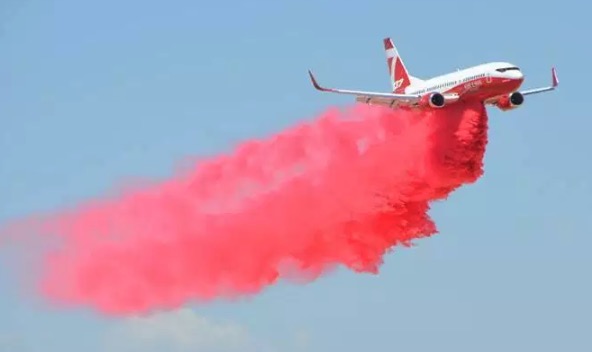
Air tanker 137, a 737-300, is slated to make its world firefighting debut in Australia. This photo was taken at the grid test near Lancaster, California, September 3, 2018. Coulson photo.
(This was first published at Fire Aviation)
Australia’s National Aerial Firefighting Centre (NAFC) has virtually settled on its lineup of the country’s firefighting aircraft for the 2018-2019 bushfire season which is getting underway. It was just a few years ago that they had no large air tankers, but this season they will have six privately owned large air tankers on contract, including three RJ85s, two C-130Qs, and one 737.
Large air tankers:
RJ85, T-165 (Aeroflite/Conair via FieldAir) based in Sydney (Richmond) – already in place;
B-737, T-137 (Coulson) based in Sydney (Richmond) – subject to regulatory approvals;
RJ85, T-166 (Aeroflite/Conair via FieldAir) based in Sydney (Richmond)/Dubbo;
C-130Q, T-134 (Coulson) based in Sydney (Richmond) – already in place. (This is an “extra” for the 2018-19 season only, considering the predicted above-normal potential of the fire season on the east coast of Australia);
RJ85, T-163 (Aeroflite/Conair via FieldAir) based in Melbourne (Avalon);
C-130Q, T-131 (Coulson) based in Melbourne (Avalon)
Coulson’s recently converted 737 just went through its first flight tests for the U.S. Interagency Airtanker Board in September, dropping retardant into a grid of hundreds of cups on the ground. For it to be used in Australia it must first receive their regulatory approvals.
Single Engine Air Tankers
In addition, NAFC will have 51 Single Engine Air Tankers (SEATs) on contract across the country, including 2 amphibious water-scooping Fire Bosses. Another 8 SEATs have been contracted directly by State agencies. The SEATs can also be supplemented by other aircraft on Call When Needed (CWN) arrangements if required.
Helicopters
There will be 77 Helicopters of all types for a variety of roles across the country. This includes six Erickson S-64E Air Cranes, as well as five Type 2 /Type 3 helicopters that will be specially equipped for intelligence gathering, with gimbaled sensors and on-board image processing, mapping, and transmission gear.
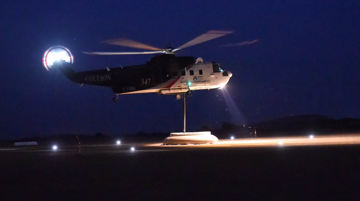
The S-61 snorkels from a dip tank in phase 2 of the night-flying trial, February, 2018.
This season one Type 1 helicopter (a Coulson S-61) based at Ballarat, Victoria and one Type 2 helicopter (a Kestrel Aviation Bell 412) based at Mangalore, Victoria will have a Night Vision Imaging Systems or Night Vision Goggles (NVIS/NVG) for water dropping. Several other Type 2 and Type 3 helicopters based in Victoria and New South Wales will be capable of NVIS mapping, reconnaissance, supervision and aerial ignition.
“We aim to continue and extend the helicopter NVIS firebombing trial in Victoria, operationalizing the learnings from the Victorian trial earlier this year, but it will be in small, careful steps” Richard Alder, General Manager of NAFC said. “At this stage”, he continued, “it is anticipated that night firebombing will only occur on fires where the aircraft crew has operated during the day – so at this stage there won’t be any initial attack at night.”
Night flying air tanker
Mr. Alder said they may experiment toward the end of the 2018/2019 bushfire season with a fixed wing large airtanker (the C-130Q, T-131) using NVIS/NVG, but there is much work still to be done to design the trial and obtain the necessary regulatory approvals.
(Originally published at 4:48 p.m. MDT October 1, 2018)
On October 1 the Predictive Services section at the National Interagency Fire Center issued their Wildland Fire Potential Outlook for October through January. The data represents the cumulative forecasts of the ten Geographic Area Predictive Services Units and the National Predictive Services Unit.
If their analysis is correct, the only areas with above normal wildfire activity in October will be California, Southern Idaho, and Northern Nevada. Those areas will shrink in November to just Central and Southern California, and in December to just Southern California and the Central Coast. In January only Hawaii will have above normal potential.
Below:
An excerpt from the NIFC narrative report for the next several months;
More of NIFC’s monthly graphical outlooks;
NOAA’s three-month temperature and precipitation forecasts; and,
Drought Monitor.
“October and November mark another transition in the western fire season as the focus typically shifts to California as occasional Foehn wind events develop. The Southeast also typically experiences a fall peak during this period. The fall season this year might not follow the traditional script, however. Expected long-range weather patterns for at least October do not support the development of a significant number of wind events. While they may occur, the total number of events should be less than average. Considering that expected precipitation will be below average during this period, this could be a big factor in keeping some of the impacts from having an elevated potential at bay. Across the Southeast, conditions have been very wet over the past several months. With the potential development of an El Niño, the wet pattern is not likely to change. This should result in overall Normal to Below Normal significant wildland fire potential throughout the remainder of the fall.
“Transitioning from November into December and January, all regions are expected to experience reduced fire activity with the arrival of winter. Brief periods of critical fire weather conditions could elevate fire potential during occasional wind events over areas that are not snow covered. Events such as this are generally short in duration. Areas to monitor are along the Rocky Mountain Front, the Great Basin, the Southwest, and the southern Great Plains (during January.) All of these areas were experiencing some measure of drought at the end of September though some improvement is expected along the Rocky Mountain Front in southern Colorado and New Mexico.”
A Border Patrol agent pleaded guilty Friday to starting the Sawmill Fire that burned 46,000 acres southeast of Tucson, Arizona in 2017. Dennis Dickey was holding an off duty party to celebrate his wife’s pregnancy at which the gender of his baby was revealed. On April 23 he mixed colored powder into a Tannerite exploding target which would show blue or pink smoke when shot with a rifle, according to his attorney, Sean Chapman, as reported by the Arizona Daily Star. The target exploded as planned and started what became the Sawmill Fire. A witness recorded a video of the explosion.
A news release from the U.S. attorney’s office says Agent Dickey will make an initial payment of $100,000, then make monthly payments after that. According to the Arizona Daily Star and the Green Valley News, he agreed in court to pay $500 a month for the next 20 years, which adds up to $120,000, for a total of $220,000. He also will be sentenced to 5 years of probation and agreed to participate in a public service announcement with the U.S. Forest Service concerning the cause of the Sawmill fire.
The off-duty agent could not be charged with arson since it was not a willful act. He pleaded guilty to a misdemeanor charge of causing a fire without a permit, which may allow him to keep his job as a Border Patrol Agent.
Agent Dickey said he attempted to put out the fire but when that failed, he reported it. At one point during the next week at least 799 firefighters were working to put out the fire, which ran up costs of approximately $8.2 million according to the May 5, 2017 national Situation Report.
A satellite photographed the darkened outline of the Sawmill Fire east of Green Valley, Arizona on April 26, 2017. The red dots represent heat.
On April 23, 2017, the day the fire started, the Hopkins weather station not far from where the fire began near Madera Canyon, recorded a high temperature of 80 degrees, 11 mph WSW winds gusting to 25, and 6 percent relative humidity. The weather station is at 7,100 feet and the location of the party where the fire started is most likely around 4,000 feet. If correct, this would put the temperature at the fire origin between 90 and 100 degrees.
In court, Agent Dickey told the judge, “It was a complete accident”.
Exploding targets consist of two ingredients that when mixed by the end user explode when shot by a high-velocity projectile. They have caused many fires since they became more popular in recent years, have been banned in some areas, and caused the death of one person. In June, 2013 a man attending a bachelor-bachelorette party in Minnesota was killed after shrapnel from the device struck him in the abdomen. The Missoulian reported that several years ago a woman in Ohio had her hand nearly blown off while taking a cellphone video of a man firing at an exploding target placed in a refrigerator about 150 feet away. In Georgia in 2016 David Pressley’s leg was blown off by an exploding target that he placed in a lawn mower.
After the ingredients are combined, the compound is illegal to transport and is classified as an explosive by the Bureau of Alcohol, Tobacco, Firearms, and Explosives and is subject to the regulatory requirements in 27 CFR, Part 555.