Understanding fire scars on trees

How does a tree damaged by a wildfire heal the wound?

Above: Annual rings of a Douglas-fir tree injured by two fires. The rings growing before the injury in 2003 were filled with resin to create a boundary from infection at the injury site. Wood grew over the dead cambium, enclosing the injury. Then the tree was injured in 2007 and woundwood again enclosed the injury. Note that the bark apparently remained intact both times. Photo: U.S. Forest Service.

From the U.S. Forest Service

When trees are injured they develop physical and chemical boundaries around the injury wound to resist infection. Trees also grow new wood to close over the injured place. Injuries caused by fires result in fire scars and we use the patterns of scarring among many trees to understand when and how often fires burn.  This research helps to understand the biological process of fire scar formation and use it to improve fire history analysis.

Fire history information is used to interpret the ecological role of fire and other disturbance events in ecosystems and is required in environmental assessments. Fire scars in different tree species don’t all look the same, which can lead to confusion about whether irregular growth in wood is a scar. This research examined the process fire scar formation and the anatomy of fire scars in conifer and hardwood trees.

In three species of trees that survived wildfires near Missoula, Montana (western larch, Douglas-fir, and ponderosa pine) we found that injuries happened even when bark was not charred. This was also true of oak trees we examined that burned in a prescribed fire in Ohio hardwood forests. It would be impossible to know that the tree had a scar by just looking at it. Where a tree’s bark was rough, both hardwoods and conifers sometimes had several small injuries next to crevices in bark where heat could get to living cells more easily. Hardwood trees produce chemicals to resist infection, mostly phenols. Conifer trees produce resin (terpenes) as a physical and chemical barrier to block infection.

larch fire scar
Disk taken from a western larch injured in a wildfire in 2003, showing the development of a fire scar in following years around the edges of the killed cambium as wood grows over and around the dead cambium. Photo: Ken Dudzik.

Key Findings

  • The stems of western larch, Douglas-fir, and ponderosa pine trees can be injured from fire even when the bark isn’t visibly charred. Heat alone causes the injuries, especially where bark is thinner.
  • Western larch, ponderosa pine, and Douglas-fir ordinarily make resin in cells called resin ducts. After an injury western larch and ponderosa pine produce many extra (traumatic) resin duct cells, and in turn these ducts produce and transport a lot of resin. Traumatic resin seems to be a better disinfectant than the usual resin. In larch traumatic resin ducts are especially large and effective at transportation. Douglas-fir trees don’t produce traumatic resin ducts, so after an injury they produce relatively less resin, and less effectively transport it. They tend to die more easily than larch or ponderosa after a fire.
  • In years following a fire, wood grows around the edges of the injury. The density of wood cells is higher at the edge of the injury and when they grow, the tree ring at that point is unusually wide. If the injury is small, within a few years it can close over and be invisible from the outside. Sometimes injuries are never visible from the outside.
  • Knowledge about why these differences occur in a particular species can help us understand how scars are formed, why some trees survive or die after injury, and determine whether irregularities in wood anatomy are likely to be a fire scar.
tree fire scar
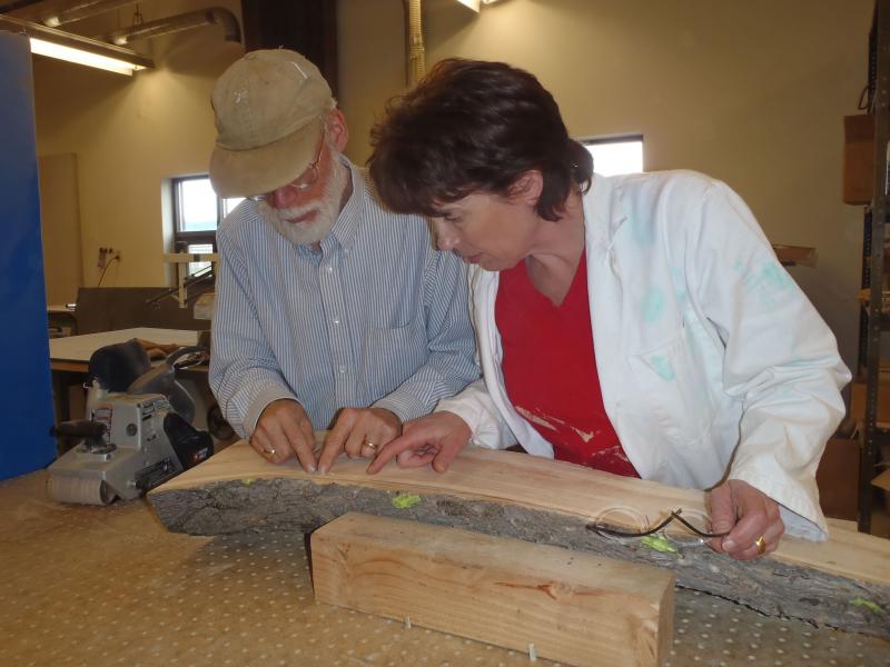
Kevin Smith (Northern Research Station) and Elaine Kennedy Sutherland (Rocky Mountain Research Station) examine a fire-caused injury up the length of a tree from the Lolo National Forest, Montana.

Live event to discuss wildfire wind tunnel studies

Above: The U.S. Forest Service tests burning pine straw in an IBHS wind tunnel earlier this year. Screen grab from IBHS video.

The Insurance Institute for Business and Home Safety (IBHS) will host a live wildfire-related event on Facebook Wednesday November 9 at 10:30 a.m. EST. They have not provided a ton of information about but it will “open up the curtain a bit on wildfire studies”. (Link to the IBHS Facebook Page.)

Dr. Steve Quaries will discuss the wildfire research that they have been doing in the huge wind tunnel. In 2011 using 105 huge fans and spark-generators, they launched embers at a structure to demonstrate what can happen when a wind-driven fire approaches a poorly prepared structure.

IBHS wind tunnel
The IBHS wind tunnel showing the 105 fans. IBHS photo.

The video below shows embers igniting flammable material on and around a structure in the IBHS wind tunnel.

Earlier this year the U.S. Forest Service used the facility to study the relationship between wildland fire rate of spread and wind speed used in the U.S. wildland fire behavior decision support systems. Previous experiments have been conducted in the Missoula Fire Sciences Laboratory wind tunnel that is more limited in size and wind speed than the IBHS wind tunnel.

This research is a collaborative effort with researchers at UNC Charlotte, University of Maryland, University of Texas Austin, and USDA Forest Service, and is funded by the Joint Fire Science Program.

Wildfire smoke map, November 7, 2016

Above: Wildfire smoke from fires in Tennessee, North Carolina, Georgia, and Kentucky, as seen from a satellite, November 7, 2016. NASA image.

Below is the wildfire smoke forecast for 7 p.m. ET, November 8, 2016.

Wildfire smoke forecast
Wildfire smoke forecast for 7 p.m. ET, November 8, 2016. NOAA. Click to enlarge.

For the latest articles at Wildfire Today about wildfire smoke check out the articles tagged “smoke”.

Wildfire crews create end-of-season video summaries

Above: Crow Peak Fire, south of Spearfish, SD, June 27 2016. Photo by Bill Gabbert

We have found five videos created by Hotshot Crews that show some of the highlights of their 2016 season fighting wildfires.

After you view them, take the poll at the bottom — which do you like best?

The first is from the Geronimo Hotshots.

Next, the Baker River Hotshots:

And, the Midewin Hotshots:

The Mad River Hotshots:

Wyoming Hotshots:

Take the poll

Which video do you like best? Let us know by choosing an answer in the poll below — then click on the hard to see “vote” box below.

Which of these 2016 Hotshot Crew videos do you like best?

  • Baker River (31%, 160 Votes)
  • Geronimo (24%, 125 Votes)
  • Midewin (22%, 116 Votes)
  • Wyoming (14%, 74 Votes)
  • Mad River (8%, 42 Votes)

Total Voters: 517

Loading ... Loading ...

The last day to take the poll will be July 1, 2017.

Sell Art Online

Very dry autumn brings numerous wildfires to the southeast

Currently there are 38 fires in the south that have each burned at least 100 acres.

Above: Local residents keep an eye on the Dicks Creek Fire near Sylva in western North Carolina. Photo by Jason Farmer, The Sylva Herald.

Most areas in the southeast United States have not received any significant rain in dozens of days. It has been more than 70 days for some locations in Kentucky, Tennessee, North Carolina, Georgia, Mississippi, Alabama, and South Carolina. This has resulted in many wildfires breaking out in recent weeks.

days since rain southeast
Southern Area Coordination Center.

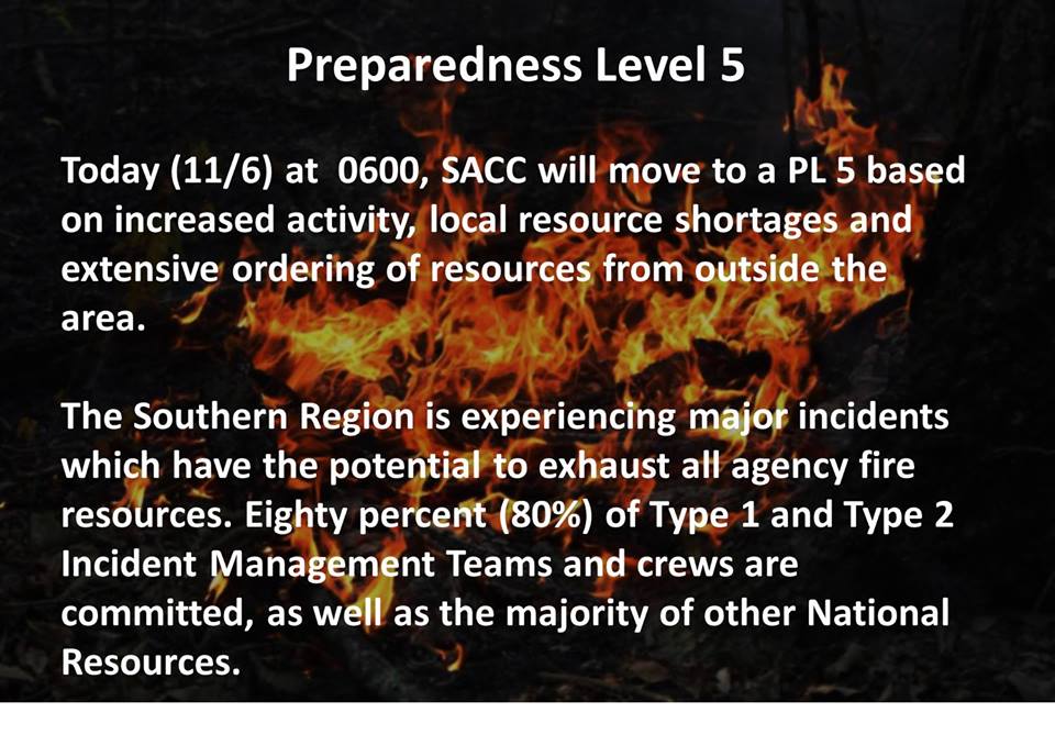
Currently there are 38 active fires in the Southern Geographic area that have each burned more than 100 acres, prompting the Southern Area Coordination Center to raise the preparedness level as high as it will go, to Level 5, something that does not happen very often.

southern area planning level 5
Graphic by the Southern Area Coordination Center

Large numbers of firefighting resources have moved into the south to help combat the blazes. The figures below include those that were en route, committed, or staged in the area as of Monday morning.

  • 5 Incident Management Teams (2 Type 1 and 3 Type 2)
  • 56 hand crews (8 Type 1, 22 Type 2, and 26 fire suppression modules)
  • 5 air tankers (3 large, and 2 Single Engine Air Tankers)
  • 29 helicopters (9 Type 1, 4 Type 2, and 16 Type 3)
  • 1,632 Overhead personnel

The audio in the video below is an interview with Mike Dueitt, the Incident Commander of a Type 1 Incident Management Team from the Southern Geographic Area currently managing multiple wildfires in North Carolina. The images in the video were taken October 24 through November 6, 2016.

These still photos were taken at or near the 532-acre Dicks Creek Fire, which is about 1.5 miles northwest of Sylva, North Carolina. They were all shot by Jason Farmer of the Sylva Herald. About 31 structures are threatened by the fire, which is being fought by 59 personnel.

wildfires western North Carolina
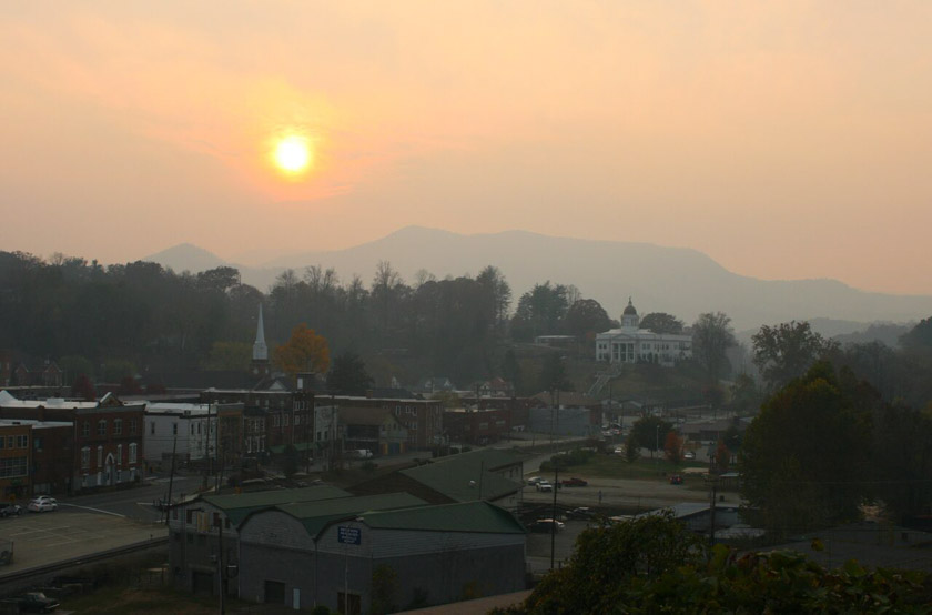
Smoky skies near Sylva, North Carolina. Photo by Jason Farmer, The Sylva Herald.

Continue reading “Very dry autumn brings numerous wildfires to the southeast”