The map shows the distribution of wildfire smoke across the United States and Canada at 3:38 p.m. MDT, July 26, 2013.
Author: Bill Gabbert
Wyoming: Hardluck fire could be active Friday
The Riverton, Wyoming National Weather Service office sent this tweet Friday morning:
#Wyoming #Wildfire Update: #Fairfield better contained. #Hardluck could be very active with significant smoke plume. http://t.co/MV3NXJOHjN
— NWS Riverton (@NWSRiverton) July 26, 2013
The Incident Management Team on the Hardluck fire reports that heavy dead and down bug killed stands of timber are contributing to enhanced fire behavior, which precludes any direct attack, in the interests of firefighter safety.

More details on last minutes of Granite Mountain 19
 ArizonaCentral.com has obtained copies of reports written by an Arizona Department of Public Safety helicopter crew which provide information about the last radio transmissions from the Granite Mountain Hotshots before the Hotshots were entrapped and killed on the Yarnell Hill Fire June 30 in Arizona.
According to the report, at 4:30 p.m. the crew was in a previously burned area, in the black, moving to Yarnell.
Below is an excerpt from the article about what happened next:
“…A short time later [someone on the crew] came back up on the radio advising they were heading to a ranch they had in sight,” the report reads. “It was shortly after that (a crew member) came back up on the radio sounding excited, out of breath.” The records indicate the hotshot repeatedly tried to contact Air Attack, circling the fire, with no response.
Commanders coordinating the aerial attack on the fire offered a direct reply shortly after, according to other members of the DPS crew.
“Whoever is yelling on the radio needs to stop,” the reports state.
Immediately afterward, a commander came on the radio and asked the hotshot crew to continue the transmission, according to the report.
“(A crew member) advised their escape route had been cut off and they were deploying their shelters,” the report states. “I heard numerous attempts by Air Attack trying to contact (the crew member) after this with no response.”
Moments later, a fire chief who was coordinating air operations drove up to the DPS helicopter where medics and crew members were waiting. They informed the operations chief what had just taken place.
“(The operations chief) advised me that he was on a separate channel and did not hear the traffic,” according to the report.
No more radio transmissions were heard from the Hotshot crew.
Fatality in New Mexico while taking Work Capacity Test
A firefighter taking the Work Capacity Test (WCT) at the Northern Pueblos Agency in Ohkay Owingeh, New Mexico collapsed and died Wednesday, July 24. According to the preliminary 24-hour report, Emergency Medical Personnel that were on scene monitoring the test immediately initiated CPR and other lifesaving measures with assistance from the Agency Staff. The patient was transported to the Espanola Hospital four miles away where he was pronounced dead.
The report does not specify if the individual was a firefighter or was attempting to qualify for another fire-related position.
Our sincere condolences go out to the person’s family and co-workers.
There are three versions of the WCT, for firefighters and those who will be in less strenuous jobs. Firefighters have to take the Arduous Pack Test version, which requires hiking 3 miles in less than 45 minutes while carrying 45 pounds.
According to the report “Wildland Firefighter Fatalities in the United States: 1990–2006” (NWCG 2007) 11 fire personnel died during that seven-year period while preparing for or taking the work capacity test. Another died in 2007. In 2011 a firefighter taking the test suffered a non-fatal but severe case of rhabdomyolysis, which if not treated early can lead to irreversible muscle damage, permanent disability, kidney failure possibly requiring lifelong dialysis, and even death.
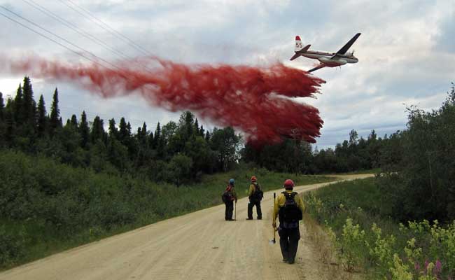
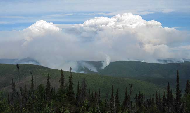
Photos: Stuart Creek and Lodgepole Fires

A couple of our readers graciously allowed us to publish some of their fire photographs. Thanks Benjamin and Pike Hotshots.
California: Aspen Fire
(UPDATE at 7:05 a.m. PDT, July 30, 2013)
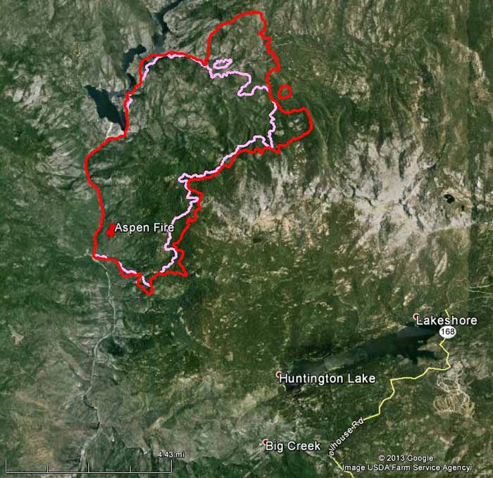
On the map of the Aspen Fire above, the red line is the perimeter at 1 a.m. July 30; the pink line is from about 24 hours before. On Monday the fire continued to spread on the south and east flanks, and moved over a mile on the north side.
Businesses remain open in the Shaver Lake, Huntington Lake, Lake Thomas Edison, Florence Lake and the Mono Hot Springs areas.
****
(UPDATE at 8:10 p.m. PDT, July 29, 2013)
Some of our web site visitors have told us the maps of the Aspen Fire on InciWeb are not very useful to them. So until that changes, we will at least occasionally post a map here that we hope fits the needs of the general public.
In the maps below, the red line is the fire perimeter at 10 p.m. PDT July 28, 2013. The pink line is the perimeter about two days before that.
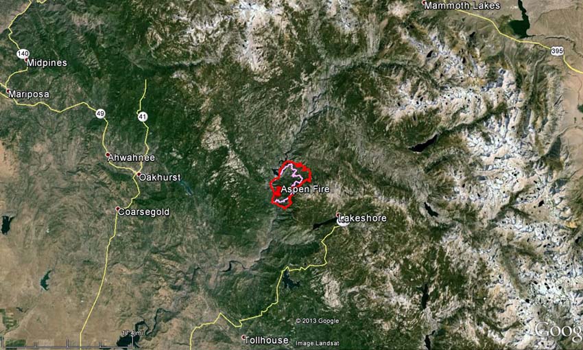
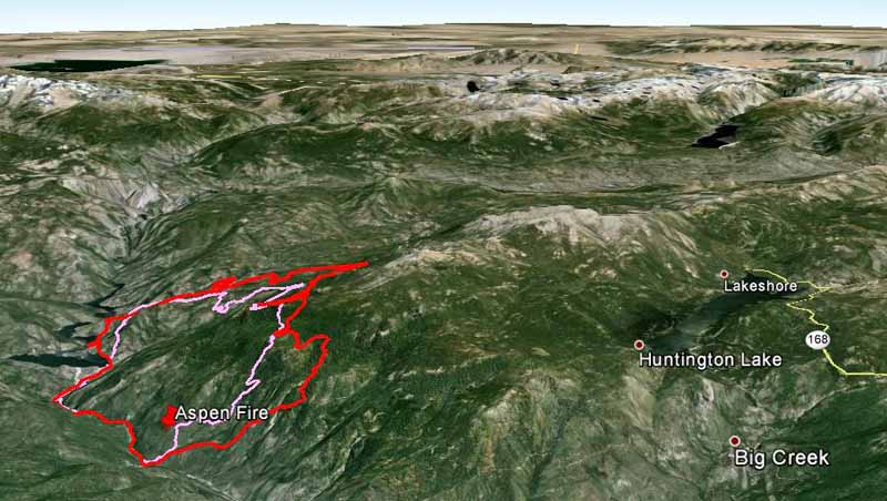
The fire has burned 11,000 acres. Monday, east winds promoted increased growth along the northern, eastern and southeastern perimeter of the fire. Helicopters worked the southern edge of the fire in the Aspen Creek drainage and other areas of heat. Fixed wing aircraft, including a Very Large Air Tanker (a DC-10) are pre-treating with retardant the Kaiser Creek area.
We have a photo of the DC-10, which is reloading at Santa Maria Air Tanker Base.
****
(UPDATE at 7:45 a.m. PDT, July 28, 2013)
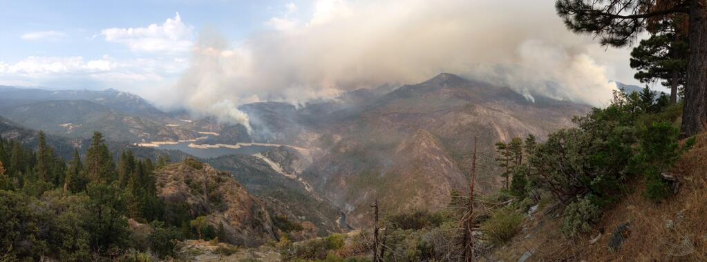
Over the past two days fire activity has been increasing in the late afternoon on the Aspen Fire when the smoke inversion layer lifts. It is expected to dissipate earlier on Sunday. On Saturday the smoke kept aircraft grounded until 3 p.m.
Continue reading “California: Aspen Fire”


