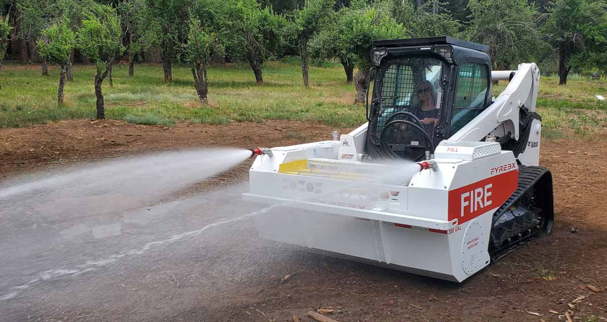
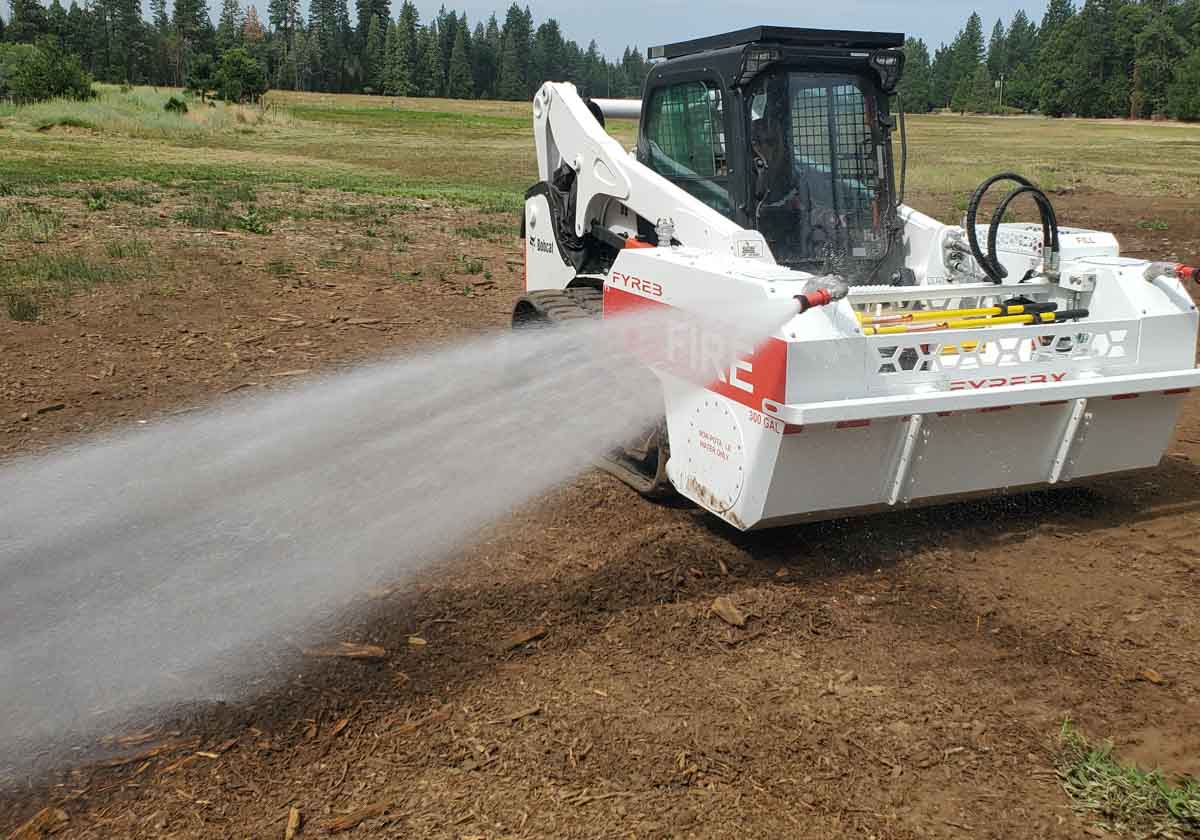
A company in Redding, California has developed an attachment for a skid steer loader, such as a Bobcat, that enables them to be converted to a firefighting apparatus.
The FYREBX has a 300-gallon water tank with a pump powered by the skid steer’s hydraulic system. It can flow water at 5 gallons per minute up to 250 gallons per minute. One person can apply water from the cab using the two nozzles on the device, or a hose can be connected operated by a firefighter on the ground.
The operator inside the cab can turn the hydraulic power to the pump on or off, but the controls for varying the pressure and volume of water are on the outside of the FYREBX.
FYREBX photo
There are various ways the tank can be refilled, including driving the skid steer into a body of water and lowering the unit so that the submersible pump can fill the tank.
Matthew Wilson, the company’s Vice President for Sales and Service, told Wildfire Today that they have sold units to forestry companies and are in talks with the US Air Force about a sale of multiple units to be used at Air Force bases on the West Coast. He said the California Department of Forestry and Fire Protection is also evaluating the FYREBX.
For the purchase price of $18,950, it comes with the equipment the US Forest Service requires for timber companies in a “fire box”, 3 shovels, 2 axes, 1 pulaski, mcleods, 1 fire extinguisher, 100 ft of 1.5″ wildland hose, and 200 feet of 3/4″ wildland hose, said Sean Henry, President of the company. An optional accessory is a compressed air foam system.
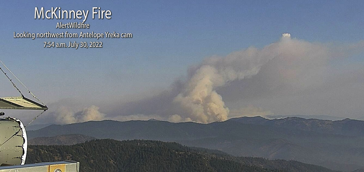
The AlertWildfire camera in Northern California on Herd Peak recorded the effect of what is likely outflow winds from a thunderstorm affecting smoke from the McKenney Fire. At the time on Sunday afternoon July 31, 2022 it had burned about 52,000 acres northwest of Yreka. It appears that the fire is spreading across the ground, but most likely it is just smoke.
To see all articles on Wildfire Today about the McKinney Fire, including the most recent, click HERE.
Rain on the fire
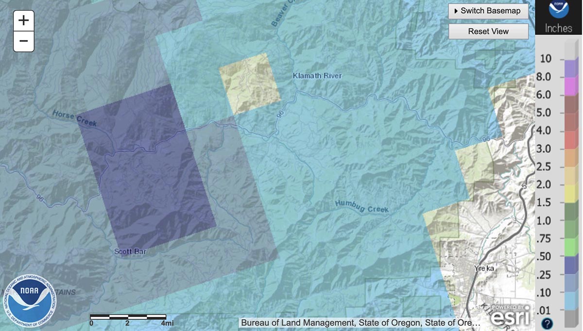
It was very spotty, but some locations on the McKinney Fire received rain Saturday night between 10 p.m. and 3 a.m. Sunday morning. The weather station on Mt. Baldy on the western edge of the fire received just over half an inch, Scott Barr three miles west of the fire got 0.19″, and Oak Knoll off Highway 96 received 0.01″. Several locations near Yreka recorded no precipitation.
There are very few weather stations in or near the fire area, but the National Weather Service produced the map below with estimated precipitation amounts based on radar observations.
Radar observed precip, for the 24-hour period ending at 5 a.m. PDT July 31, 2022. NWS.
The west side of the fire received the most precipitation, according to the radar, with much less on the east side. The radar data is just an estimate, but it appears possible that a good sized portion of the west side received at least a wetting rain, with much of that side experiencing between 0.10 and 0.50″. If this is the case, the east side should see more fire growth for at least the next day or so than on the west side.
Fire activity
The rain combined with an inversion Saturday evening to slow the fire, but activity increased in some locations around midnight. Crews were actively engaged in structure protection in the Klamath River area. Little progression was observed on the southeast side closest to Yreka.
The McKinney Fire was mapped Sunday afternoon at 52,499 acres. The China 2 Fire 15 miles west of the McKinney Fire has burned 1,652 acres on the south side of Highway 96.
Sunday
Priorities for Sunday are to continue structure preparation and protection in the Highway 96 corridor, and around the communities of Fort Jones and Yreka.
Homes destroyed
The Siskiyou County Sheriff’s Office has confirmed that several structures have been destroyed. Sheriff’s office Spokeswoman Courtney Kreider said residences along Highway 96 in the Klamath River drainage burned. She did not have a specific number.
Updated at 5:36 a.m. PDT July 31, 2022
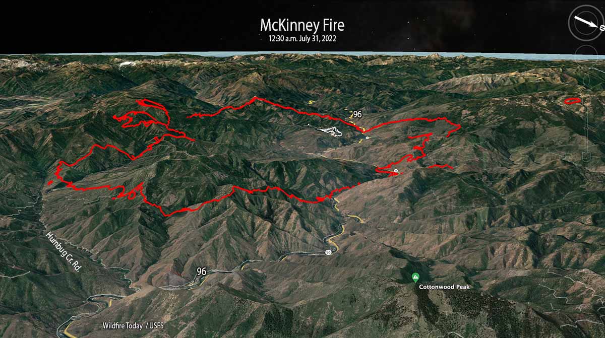
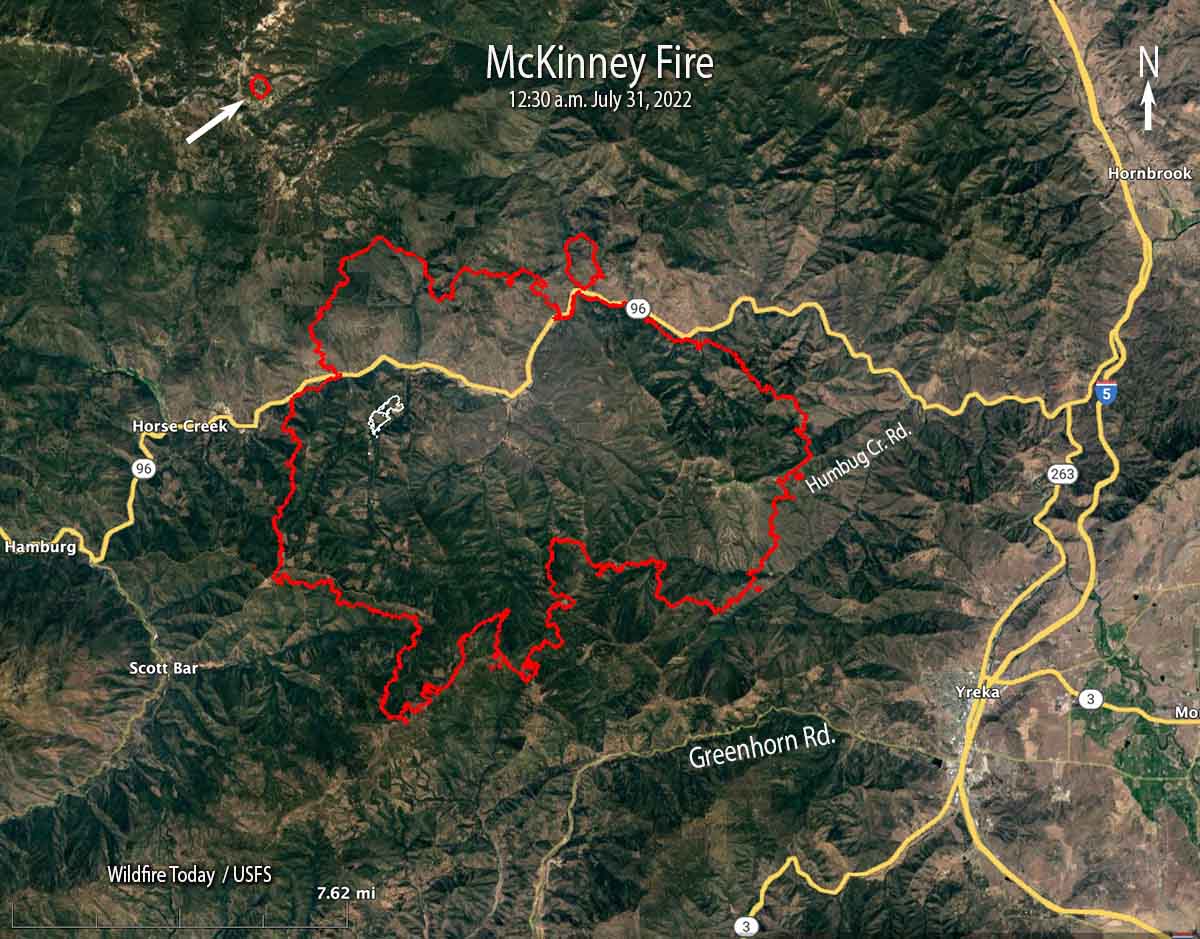
McKinney Fire 3-D map, looking west-southwest at 12:30 a.m. PDT July 31, 2022. The white lines were the perimeter at 5:19 p.m. on July 29.
The McKinney Fire in Northern California eight miles south of the Oregon state line was very active throughout the night. When it was mapped by an aircraft at 12:30 a.m. Sunday it had grown to 51,468 acres. During a satellite overflight at 3:38 a.m. about 90 percent of the heat detected was on the east and southeast sides.
This was the only complete mapping of the fire since noon on Saturday due to thunderstorms and lightning in the area which restricted flights of air tankers and helicopters.
McKinney Fire map at 12:30 a.m. PDT July 31, 2022. The white line was the perimeter at 5:19 p.m. on July 29.
At 12:30 a.m. Sunday it was 5 miles northwest of Yreka, 2 miles north of Greenhorn Road, 5 miles west of Highway 263, 4 miles east of Scott Bar, and 2 miles east of Horse Creek.
The mapping flight found a 75-acre fire burning four miles northwest of the McKinney Fire east of Condrey Mountain. It is unknown at this point if it a new fire or a spot from the McKinney.
Another fire 15 miles west of the McKinney Fire, the China 2 Fire, has burned approximately 1,000 acres south of Highway 96 in the Seiad Valley area.
Weather
Isolated and scattered thunderstorms with little or no rain are predicted for the area on Sunday with gusty outflow winds of 40-50 mph and cloud to ground lightning. Pyrocumulus could regenerate with potential for rapid fire growth and spread. There is a 5 percent chance of wetting rain. The relative humidity will be 15 to 25 percent.
Updated 6:41 p.m. PDT July 30, 2022
Saturday afternoon the area around the McKenny Fire northwest of Yreka, California was covered by cumulonimbus clouds, thunderstorms with lightning. This made it very difficult for air tankers, helicopters, or mapping aircraft to work over the blaze. Even the AlertWildfire cameras on mountain peaks late in the afternoon could see nothing but smoke. But satellite imagery peeking through breaks in the clouds detected intense heat from the fires.
The video below shows lightning and heat detected by a satellite during a 2-hour period ending at 6:21 p.m. PDT July 30 in Northern California and southwest Oregon. The red areas represent heat from the fires. The white line is the Oregon/California border. The white flashes are lightning.
Evacuations are in effect over a large area, ordered by the Siskiyou County Sheriff. Details can be found on their Facebook page. A Zonehaven Aware map is also available.
At 3 p.m. Saturday the US Forest Service estimated the fire had burned 30,000 to 40,000 acres.
Updated 1:20 p.m. PDT July 30, 2022
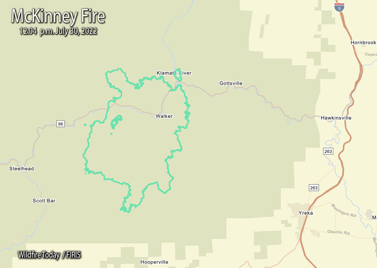
McKinney Fire map, 12:04 p.m July 30, 2022
The FIRIS aircraft mapped the McKinney Fire at an astounding 29,493 acres just after noon today. That explosive growth is less than 24 hours after it was reported at 2:15 p.m. Friday. (See map above)
This current map shows us that at 12:04 p.m. Saturday it was 9 miles west-northwest of Yreka, 3 miles northwest of Scott Bar, and 3 miles west of Gottsville.
During its first 22 hours it spread north 4 miles, east 5 miles, south 6 miles, and west about 2 miles.
9:48 a.m. PDT July 30, 2022
The McKinney Fire northwest of Yreka, California grew rapidly after it was reported Friday afternoon south of Highway 96 in the Klamath National Forest. Since then it has spread north across the highway and also to the south. At about 5 a.m. Saturday the Siskiyou County Sheriff said it was approximately four miles from Scott Bar after having been very active all night.
At about 8:45 a.m. on Saturday the Klamath National Forest estimated it had burned approximately 18,000 acres. The most recent perimeter map available is from Friday at 5:19 p.m., when it was only 65 acres. This current estimate from the Forest Service indicates it is 277 times larger. Additional perimeter mapping data was most likely prevented by lightning and thunderstorms in the area.
The fire was 14 miles northwest of Yreka when first reported, but grew closer overnight.
Evacuations are in effect over a large area, ordered by the Siskiyou County Sheriff. Details can be found on their Facebook page. A Zonehaven Aware map is also available.
BAe-146 air tanker drops on the Winding Fire in Northern California, July 18, 2022. AlertWildfire.
Today we are continuing an occasional weekend feature we started in June called Fire Traffic Area. This post serves as the beginning of an open thread where readers can leave comments about issues not yet covered — or maybe they have been covered. This is literally an off-topic thread. What do you think needs to be pointed out, asked, or discussed within the fire aviation community? You have the floor.
The usual rules about commenting apply. And remember, no personal attacks or politics, please.
N388RA Boeing CH-47D preparing to take off at Penticton Airport in British Columbia July 16, 2022. Image from VMC Aviation Videos. The helicopter crashed into the Salmon River July 21, 2022.
Today the US Forest Service confirmed reports that when the Boeing CH-47D helicopter crashed into the Salmon River July 21, 2022 while working on the Moose Fire in Idaho, firefighters swam across the river to extract and care for the two pilots. Unfortunately, both of the pilots died from their injuries.
Four teams from the FS are investigating the incident. In addition, the agency is providing Critical Incident Stress Management (CISM), clinician, and peer support to affected individuals. The National Transportation Safety Board is conducting an investigation to determine the cause of the crash.
The official “72-Hour Report” is below.
[pdf-embedder url=”https://fireaviation.com/wp-content/uploads/2022/07/USFS-72-Hour-Report_Moose_2022_Final_072822-copy.pdf” title=”USFS 72 Hour Report Moose fire helicopter crash”]
Airbus recently tested a roll-on/roll-off system to enable an Airbus A400M to drop water on a wildland fire; they say it can hold up to “20 tonnes of water.” A video shot at the test site in Spain showed the water exiting the aircraft out the rear cargo ramp.
Still image from the AIRBUS video, looking down, showing water flowing out of the rear cargo ramp on an Airbus A400M
Airbus provided some information about the system being tested:
The Airbus firefighting solution created for the A400M is a roll-on/roll-off (RORO) kit that requires no modification to the aircraft and therefore is interchangeable to any aircraft in the A400M fleet. The water is stored in a fixed tank in the cargo hold, and retained by two independent doors. These doors are connected to two flood pipes, so when the discharge is triggered, the water is expelled through two sections at the end of the ramp. The introduction of this RORO solution allows a rapid reaction to unforeseen fires and reconfiguration of the aircraft to any of its other roles.
It was tested at a minimum operating height of 150ft, flight speeds as low as 125 knots, and drops involving up to 20 tonnes of water in less than 10 seconds. Airbus also plans to test the system while flying at night.
Airbus’ video below describes the system.
The system is reminiscent of the Modular Airborne FireFighting System, MAFFS Generation 1 developed in the United States. After being rolled into a C-130, it dispensed retardant out the open cargo ramp. Due to retardant coming back into the C-130 during a drop and coating many parts of the aircraft, the next version, Generation 2, pumps the retardant out a port on the sealed left side troop door.
We have contacted Airbus for more details, asking how the water is forced out of the tank, if it is by compressed air, a pump, or simply gravity.
Below are more still images from the Airbus video.
Still image from the AIRBUS video Still image from the AIRBUS video Still image from the AIRBUS video Still image from the AIRBUS video
In November, 2021 we wrote about a company in France that is designing a retardant delivery system for an Airbus A330. With variants of the original aircraft capable of transporting 247 to 400 passengers, Kepplair Evolution’s plans call for the A330 air tanker to be able to carry up to 9,000 gallons, just shy of the 9,400-gallon capacity of a DC-10 very large air tanker.
Diagram of an Airbus A330 with a Kepplair KIOS retardant delivery system. Kepplair image.
In collaboration with Pr Dominique Legendre of the Toulouse institute of fluid mechanics (IMFT), Kepplair has built a 1/3 scale prototype of their KIOS system which they say validated the concept of the patent by specifying the control to be implemented to guarantee a constant flow. As part of the maturation program managed by IMFT and Toulouse Tech Transfer, further tests are being carried out to confirm the scaling up.
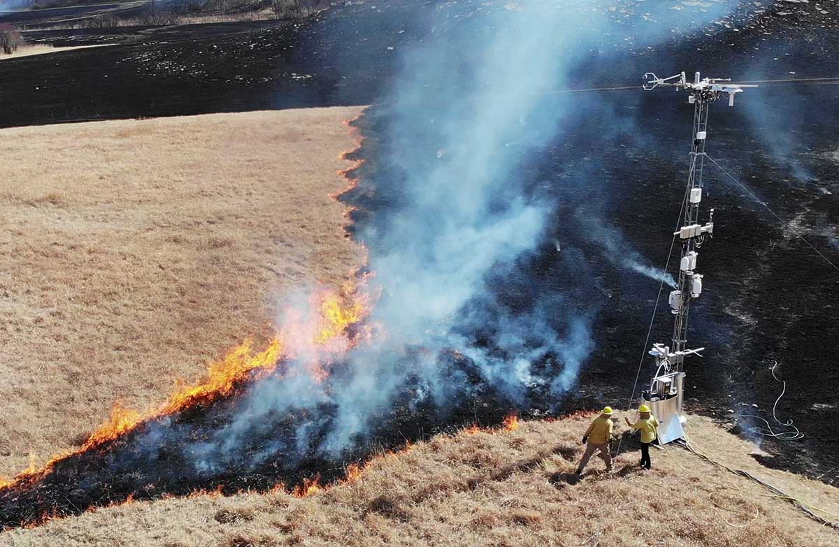
Argonne scientists monitor a controlled burn on the Konza prairie in Kansas using the Sage monitoring system. (Image by Rajesh Sankaran/Argonne National Laboratory.)
Scientists recently deployed a complex array of sensors during a prescribed fire at the Konza tallgrass prairie in Kansas to collect a vast trove of data. It was immediately processed at the site using advanced computing technologies provided by a new platform called Sage.
Sage offers a one-of-a-kind combination that involves multiple types of sensors with computing “at the edge”, as well as embedded machine learning algorithms that enable scientists to process the enormous amounts of data generated in the field without having to transfer it all back to the laboratory. Computing “at the edge” means that data is processed where it is collected, in the field, while machine learning algorithms are computer programs that train themselves how to recognize patterns.
Sage is funded by the National Science Foundation and developed by the Northwestern-Argonne Institute for Science and Engineering (NAISE), a partnership between Northwestern University and the U.S. Department of Energy’s Argonne National Laboratory.
Equipment used to monitor a controlled burn on the Konza prairie in Kansas using the Sage monitoring system. (Image by Rajesh Sankaran/Argonne National Laboratory.)
The advanced cyberinfrastructure deployed in Sage, which allows for on-the-spot detection, monitoring, and analysis of the burned area, could offer scientists and natural resources officials the ability to get ahead of forest fires with quickly analyzed, multi-instrumented data.
“When it comes to forest fires, time is absolutely of the essence,” said Argonne computational scientist and NAISE Fellow Rajesh (Raj) Sankaran. “Often, there’s no time to move data from the field — where high-speed connectivity might be an issue — to the lab. With Sage, we’re getting the pertinent information we need when we need it.”
The prescribed fire in the Konza prairie gave the researchers a large collection of data — almost 60 DVDs worth — full of information about the progression of smoke and fire. This data can be used to educate a machine learning algorithm that can make further determinations of the behavior of other fires in real time.
After the success of the Sage network in Kansas, future plans exist for the network to be deployed in California, Colorado, Illinois, and Texas as part of a network led by the National Ecological Observatory Network (NEON). Eventually, researchers hope to establish a continent-spanning network of smart sensors that could employ Sage technology.
“NEON is developing a mobile deployment platform that can complement land-based and aquatic sites all over the country,” Sankaran said. “Sage can play a supportive role in many different environments throughout the United States.”
The House of Representatives narrowly passed the legislation Friday. Now it goes to the Senate.
12:46 EDT, July 27, 2022
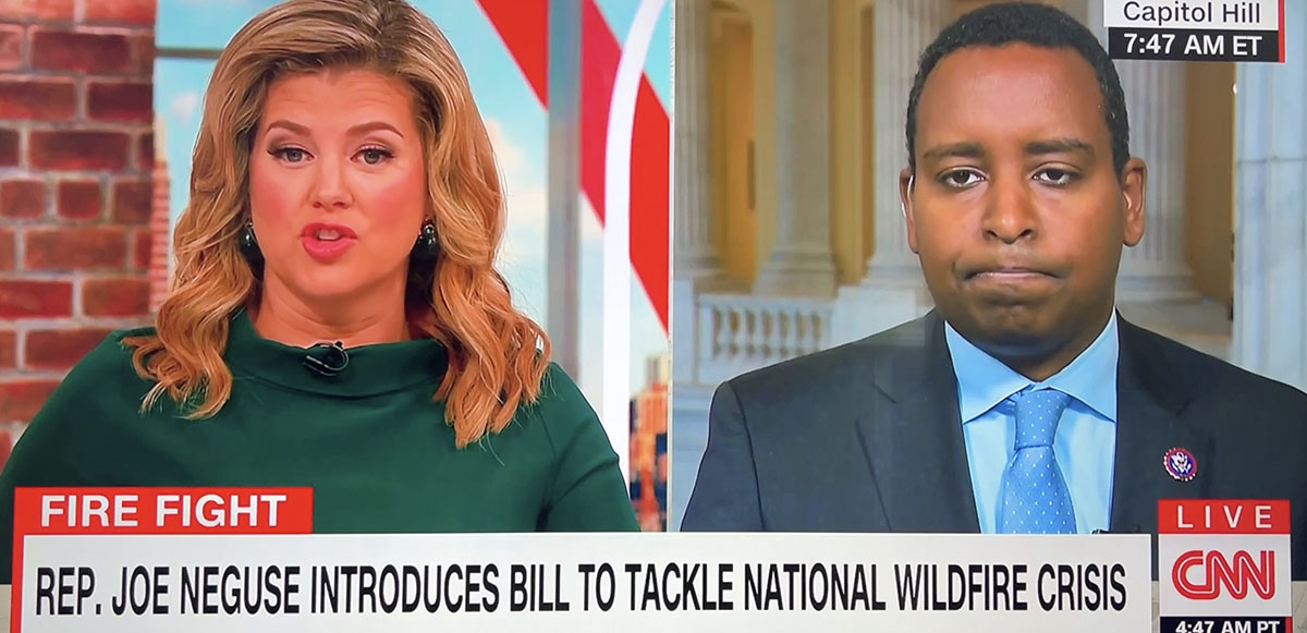
Rep. Joe Neguse interviewed on CNN July 27, 2022 about the Wildfire Response and Drought Resiliency Act.
In this video from CNN, Brianna Keilar interviews Colorado Rep. Joe Neguse about the Wildfire Response and Drought Resiliency Act, H.R. 5118, which would benefit wildland firefighters. It boosts their pay and benefits, helps the Forest Service fill gaps in fire management staff, and promotes bigger forest management projects to reduce hazardous fuels.
The bill is a conglomeration of half a dozen pieces of legislation, including the Tim Hart Wildland Firefighter Pay Parity Act (H.R. 5631), all rolled into one. It would require that the minimum basic pay for any Federal wildland firefighter position be no less than the pay for a GS-6 Step 3, which is $42,946 a year ($21.29 an hour). It would also stipulate that the salary be adjusted annually by not less than the change in the Consumer Price Index.
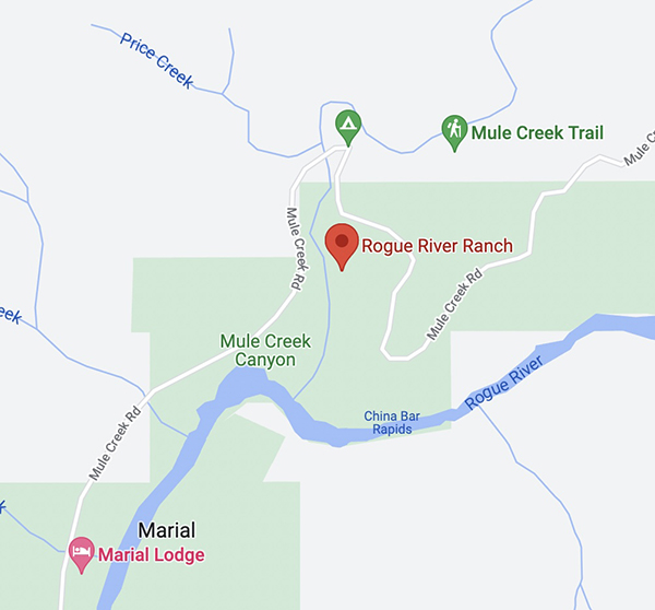
General area of the July 25 arson fires in Southwest Oregon.
On Monday a Bureau of Land Management employee reported that a man was walking down a road igniting vegetation fires in a remote area about 25 miles northwest of Grants Pass, Oregon.
From the AP:
Ground crews, assisted by local residents, and three helicopters quickly got the two fires under control, Curry County Sheriff John Ward said.
Meanwhile, three local residents located the suspect walking on the road near the fires and detained him.
“It was reported that the suspect became very combative with the three residents and had to be tied to a tree to subdue him.,” Ward said in a statement. “An ambulance crew was asked to respond due to some injuries that the suspect apparently received from falling down.”
Smith was transported to Three Rivers Hospital in Grants Pass and once he was medically cleared, transported by US Forest Service law enforcement to the Curry County Jail and held on Reckless Burning and two counts of First-Degree Arson. There was also a Detention Warrant in effect out of Lane County for probation violation.
Trennon Ray Smith. Lane County Sheriff’s Office.
????????? ???: We’re responding to a report of a small smoke column north of Marial in Josephine county.
Multiple engines, a water tender, bulldozer and our District Type 3 helicopter with our Helitack crew and 4MM, our severity Type 2 helicopter are en route. pic.twitter.com/ft2VDLCQnz