Risk assessment in the West

In 2018 Rick Stratton, a USFS fire planning program manager for the R6 Regional Office in Portland and Pyrologix provided a Quantitative Wildland Fire Risk Assessment for communities most at risk in the Pacific Northwest — and he listed the top 25.

Six years later he compared that assessment with what had actually happened, and 18 of the 25 communities had recorded significant/catastrophic wildland fires. His assessment illustrates a rapidly evolving wildland fire environment, in which entire communities are at risk. Below are some of Stratton’s slides.

Risk assessment presentation by Rick Stratton

How do interface disasters occur? Jack Cohen‘s work on wildland/urban interface fires demonstrated that in the beginning, the set-up for a disaster fire includes extreme fire conditions — much of which has been widespread across the West over the last decade or more. Abundant dry fuels, fire-friendly weather such as drought, extreme heat, low humidities, and high winds all contribute to a landscape ready for a fire disaster.

To that setting is added both wildland fire (with rapid spread) and urban fire — which includes multiple simultaneous ignitions and residential areas in which fire spreads from house to house to house, complicated by non-vegetation burning of cars, fences, decks, garages, stacked firewood, and often-hazardous materials typically found on interface industrial properties, workshops and garden sheds, or even gas stations. Frightened residents trying to evacuate on limited access routes, often with uncoordinated communications and plans, simply multiply the crisis.

How interface disasters occur
How interface disasters occur — Jack Cohen

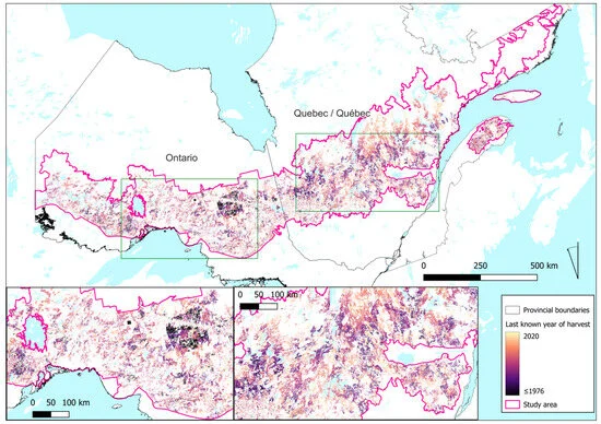
Pacific Northwest risk map: Clearly illustrated here is the band of interface-populated communities that runs down from the northeast corner of Washington to the southwest corner of Oregon — adjacent to and in forested areas.

Pacific Northwest risk map

Unlike the larger metro areas (Seattle, Portland), these communities are surrounded by rural and forested land, and consist mainly of smaller communities with limited suppression resources, and sometimes challenging water supply or prevention resources.

charted risk exposure

… and … 6 years later:

Interface fires in Northwest communities at risk fir catastrophic interface fire

Only a few of those ranked community exposure locations were NOT burned by a large interface fire. Ellensburg, Washington, suffered multiple fires, as did Spokane, Grants Pass, and Chelan.


Joe Stutler
Joe Stutler

A Western Region Co-Chair for the Wildland Fire Cohesive Strategy, Joe Stutler worked 35 years with the U.S. Forest Service. Since retiring, he’s worked for Northtree Fire International and as senior forester with Deschutes County for 8 years. He has worked as a hotshot, smokejumper, district and forest FMO, district  ranger, law enforcement officer, and regional fire operations specialist  for both R5 and R6. He put in 33 years as Type I and II Incident Commander and 6 years on National Area Command Teams. He has managed all-hazard and law enforcement assignments across the country and currently fills Command and General  positions on Type 1 IMTs and Area Command teams.

Here are a few of Joe Stutler’s thoughts on these risk assessments: I am wide-eyed at the accuracy of Rick Stratton’s predictions and the big fires that followed in 2018-2022.  Most of these high-ranking landscapes were in Fire Regimes 1 & 2, and those that have been burned by large intense wildfire have now reset to Condition Class 1.  But what about those that remain in Condition Class 3, like here in central Oregon and other places in the U.S.?

The wildland fire environment is rapidly changing, and this slide deck shows that to be true. The question is, what can we in the business of helping people understand it actually do about it?  The answer lies in  collectively and strategically communicating these issues.

From my world, I immediately think about how the Cohesive Strategy has been affirmed by the Wildland Fire Leadership Council (WFLC) AND the President’s Wildfire Mitigation and Management Commission as THE strategic framework that can be applied at and by every level (federal, tribal, state, local, and NGOs) to address wildland fire challenges to make substantial, meaningful progress toward landscape resiliency, community resiliency, and fire adaptation — and a safer, more effective, risk-based wildfire response.

The part that stands out to me (apart from the obvious needs to increase the pace and scale of landscape resiliency treatments and address the different response approaches and needs of the “urban firestorm” probability) is the need for doubling down toward the CS goal of fire-adapted communities.  The goal is described as “communities that are as prepared as possible to receive, respond to, and recover from wildland fire.”

This elevates the responsibility for preparedness to more than just our response as land management agencies and organizations, but to us as residents, responders, planners, emergency managers, governments, businesses, news outlets, and other organizations in communities.  We each have a responsibility to think about what RECEIVING FIRE, RESPONDING TO FIRE, and RECOVERING FROM FIRE means to each of these community affiliates — and start heading down the path of preparation. These are ripe for defining within communities and providing suggestions for action.  The definitions and suggestions will be different in every community, and we can organize and assist with these conversations, suggestions, and actionable solutions.

Many best practices have been applied and are underway across the West by all these entities, but the devastating destruction of entire communities over the last decade tells us that there is still much to do at the community level to prepare for wildland fire.  Even today, many communities across the West — and for that matter east of the Mississippi — still do not realize that not only is the wildfire risk high, but there is also high likelihood of loss given the rapidly changing wildland fire environment.  A changing climate (hotter, drier, windier conditions) alone is making “urban firestorms” a more prevalent reality, even in the East and South.

It’s clear that we need efforts toward all three goals of the Cohesive Strategy to make a difference and change the outcomes of wildland fire.  Our vision is a good place to start — “To safely and effectively extinguish fire, when needed; use fire where allowable; manage our natural resources; and collectively, learn to live with wildland fire.” If we as individuals are truly learning to live with wildland fire, we must consider what that looks like in the face of the research and outcomes that Rick Stratton shares and then apply the Cohesive Strategy for better fire outcomes.

Ignoring our responsibility to learn to live with wildland fire is a choice. And we now know what the outcomes of that are.

Canada’s record-breaking wildfires have widespread logging partly to blame

Quebec and Ontario’s environmentally crucial boreal forests had a tough wildfire season in 2023. The provinces had 12.8 million and 1.1 million acres burn, respectively.

The 44 million acres burned by wildfires across Canada have been attributed mainly to abnormal drought and high temperatures,  but a new study is pointing to another possible factor: the planting of millions of acres of immature trees after widespread logging. A recent study published by researchers at Australia’s Griffith University found more than 35 million acres of Canada’s forests have been lost to logging since 1976, including 20 million acres in Quebec and 14 million acres in Ontario.

The “loss” wasn’t caused by deforestation, which is “land that has been cleared of trees and permanently converted to another use” under Canada’s definition. Rather, the forest has been lost to forest degradation, or the conversion of naturally regenerating forest to plantations of planted trees.

“The Canadian Government claims that its forests have been managed according to the principles of sustainable forest management for many years,” the researchers said, “yet this notion of sustainability is tied mainly to maximizing wood production and ensuring the regeneration of commercially desirable tree species following logging,”

CanadaLogging
Overview of logged forest within the study area for the period ~1976 to 2020.

The decrease in the land area of older, more resilient forests across both Quebec and Ontario — and their subsequent replacement with immature trees — both lowered overall forest biodiversity and increased the prevalence of disturbances (wildfire, insect infestations, disease spread) over time.

“Logging has significantly increased the rate of disturbances in this region,” the report said. “This decrease in older forests when compared with historical natural conditions is accompanied by the resulting decline in structural attributes — such as large live and dead standing trees and coarse woody debris associated with older forests — which negatively affects biodiversity.”

The full study is online [HERE].

Quebec and Ontario’s environmentally crucial boreal forests had a tough wildfire season in 2023. The provinces had 12.8 million and 1.1 million acres burn, respectively.

The 44 million acres burned by wildfires across Canada have been attributed mainly to abnormal drought and high temperatures,  but a new study is pointing to another possible factor: the planting of millions of acres of immature trees after widespread logging. A recent study published by researchers at Australia’s Griffith University found more than 35 million acres of Canada’s forests have been lost to logging since 1976, including 20 million acres in Quebec and 14 million acres in Ontario.

Burning Alaskan permafrost increasing methane emissions

Posted on Categories ResearchTags , ,

The flames have died out on Alaska’s largest river delta, but emissions are still seeping out of the tundra’s ground.

A recent NASA study found that methane “hot spots” in the Yukon-Kuskokwim Delta are more likely to be found where wildfires burned into the tundra. The greenhouse gas reportedly originates from decomposing carbon stored in the tundra’s permafrost for thousands of years.

“We find that [methane] hotspots are roughly 29 percent more likely on average in tundra that burned within the last 50 years compared with  unburned areas, and that this effect is nearly tripled along burn scar perimeters that are delineated by surface water features,” the researchers said. “Our results indicate that the changes following tundra fire favor the complex environmental conditions needed to generate emission hotspots.”

Mackenzie Delta, Northwest Territories

The correlation also nearly tripled in areas where fires burned to the edge of a lake, stream, or other body of standing water, according to NASA. The highest ratio of methane hot spots occurred in recently burned wetlands. Researchers detected roughly 2 million hot spots across 11,583 square miles. The team believes more hot spots could soon emerge.

“By some projections, the fire risk in the Yukon-Kuskokwim Delta could quadruple by the end of the century due to warming conditions and increased lightning storms – the leading cause of tundra fires,” they said.

Alaska had two of its largest tundra fires ever in 2022. The East Fork Fire ignited on May 31 after a lightning strike, and burned more than 150,000 acres along the Yukon River. The Apoon Pass Fire, the second largest, burned 84,130 acres.

Previous research found that the majority of yearly methane emissions from Alaska’s tundra occur during the cold season between September and May, indicating that total emissions are sensitive to soil climate and snow depth.

Grassfires destroy far more homes than forest fires

A devastating series of wildfires that swept over forests in Idaho, Montana, and Washington more than a century ago — the Big Burn of 1910 — would forever change the nation’s perception of fire in forests. The lessons learned from that tragedy, however, may have been a bit misguided, according to new research.

Firefighters had been putting out fires for months in 1910 throughout the Western states. They’d finally begun to get ahead during the week of August 19, even beginning to dismiss some firefighters, according to the Forest History Society.

But then all hell broke loose. Hurricane-force winds roared across the states, turning numerous smoldering embers into firestorms.

“A forester wrote of flames shooting hundreds of feet in the air, fanned by a tornadic wind so violent that the flames flattened out ahead, swooping to earth in great darting curves, truly a veritable red demon from hell,” according to a summary document by the USFS.

1910 fires

What became known as the “Big Blowup of 1910” is largely remembered for killing 86 people (78 of whom were firefighters), burning 3 million acres, and completely destroying eight towns.

Wallace, Idaho -- the aftermath
Wallace, Idaho — the aftermath

The fire burned its way into the American conscious, one of the first widely reported wildfire tragedies in the nation’s budding national news system.

Three future Forest Service chiefs were directly involved in the Big Blowup, including W.B.Greeley, Henry Graves, and Ferdinand Silcox, and their experience would go on to shape decades of policy around aggressive fire suppression in U.S. forests. Not only has research shown aggressive suppression to be an ill-advised effort, but the heightened focus on fires in the nation’s forests may have also been misguided.

New research found rising wildfire risk for houses across the United States, with the number of homes within wildfire perimeters doubling since the 1990s, caused by both housing growth and more burned areas. Researchers also got a surprising finding from their study: grassland and shrubland fires destroyed far more houses than those lost to forest fires.

“This pattern was most pronounced in the Western U.S., which encompassed 69 percent of all the buildings destroyed by wildfires,” the researchers wrote. “There, 79.5 percent of all destroyed buildings were lost in grassland and shrubland fires. In the East, by contrast, 82.1 percent of destroyed buildings were lost in forest fires. In the West, even though forests had a high destruction rate (21.3 percent), only 2,367 buildings were destroyed by forest fires compared with 9,402 in grassland and shrubland fires.”

The researchers noted multiple potential reasons for the heightened number of homes destroyed by grassland and shrubland wildfires compared with forest wildfires, including the sheer acreage of grasslands and shrublands throughout the country. From 1990 to 2020, grassland and shrubland accounted for 64 percent of the total area burned by wildfires at ~91 million acres, while forests made up only 27 percent of burned areas at ~34 million acres.

Another reason is the difference in vegetation in the two environments. Wildfire management across grassland and shrublands requires frequent application of multiple types of risk-management strategies, including prescribed burning and fuel thinning, compared with forests — because of the quick recovery of fuel loads in grassland areas. The risk-management strategies, however, may not be advisable in all grasslands and shrublands, specifically those where fire-prone invasive species have replaced native vegetation.

In the West, 79.5 percent of all destroyed buildings were lost in grassland and shrubland fires.

Despite more homes being destroyed by grassland and shrubland wildfires, homes near forest wildfires reportedly have an above-average chance of being destroyed.

“Of the 151,725 buildings … that were exposed to wildfires from 2000 to 2013, 11.3 percent were destroyed,” researchers said. “However, buildings in evergreen and in mixed forests were almost twice as likely to be destroyed (20.1 and 22.9 percent, respectively). By contrast, the destruction rate for shrublands was similar to the average (12.7 percent), and rates for grasslands and deciduous forests were considerably lower (8.0 and 3.3 percent, respectively).”

Researchers believe this is the case partly because of forest wildfires’ higher intensity, but also couldn’t rule out the difference in the architecture of homes built in forests compared with homes built in grasslands and shrublands.

The study concluded by noting that stricter construction standards and land-use planning, specifically avoiding building in areas prone to fire, would help the Forest Service meet its goal of limiting wildfire risk for  newly developed housing.

Wildfire smoke toxicity worsened by heavy metals in soil, flame intensity

The job of wildland firefighters is grueling; long treks into the wild and countless hours of manual labor on the job take their toll. Because of this, gear is often reserved for the bare essentials like flame-resistant clothes, hard hats, and tools to cut a fireline.

Urban firefighters, on the other hand, are outfitted like armored tanks with gear that’s nearly triple the weight of what the wildland firefighter carries. The most obvious visual difference in their gear is a breathing apparatus, meant to protect structural firefighters from smoke. Despite this, cancer remains the largest killer of urban firefighters, in part because of the synthetic materials that burn inside buildings and release toxic chemicals into the air.

A self-contained breathing apparatus (SCBA) is a device worn to provide an autonomous supply of breathable gas in an atmosphere unsafe for breathing — which structural firefighters often encounter.

Development of a wildland fire respirator. Two versions are being tested, with the filter being carried on the chest hip. Department of Homeland Security photo.

A breathing apparatus or mask hasn’t historically been a staple of wildland firefighters’ gear, though some have been in testing for years. The added heavy carry capacity is one reason, along with the assumed lack of toxic chemical inhalation, since the fire’s burning in a natural area free from synthetic materials.

That assumption isn’t true, according to new research from Stanford University. Wildfire can actually create cancer-causing toxic heavy metals depending on where they burn and the severity of the flames.

“Soil-and plant-borne chromium is of particular concern,” the research team told WildfireToday. “Altered by fire, chromium is transformed into its toxic hexavalent state. We show that fire severity, geologic substrate, and ecosystem type influence landscape-scale production of hexavalent chromium in particulates during recent wildfires.”

The Stanford team researched soil and ash gathered from the 2019 Kincade Fire and the 2020 Hennessey Fire within the LNU Lightning Complex for their study. At the burn scars, the team measured the levels of chromium 6, which is known by most as the toxic chemical from the 2000 film Erin Brockovich, and they found dangerous levels of it in certain areas of the fire.

The chemical was present in heightened amounts where the soil had a greater concentration of metals from the area’s geology and had also been severely burned. Areas that weren’t on metal-rich geologies, or that had burned at a low severity, had either non-detectable chromium 6 levels or very low levels not of concern.

“Up until now, for wildfires at least, we’ve worried a lot about the fine particulate exposure … what we’ve been blind to is that those ultra-fine particles can differ in composition,” researcher Scott Fendorf said. “Even in wildfires that are completely removed from any dwellings, with certain geologies and certain vegetation types which are pretty common, we can see that the particles have these toxic metals in them.”

The team’s findings may not only help define the health risks wildland firefighters face in certain wildfires, but may also help in understanding what risks nearby populations may experience when inhaling air downwind of wildfires. In areas that experienced dry post-fire weather, chromium 6 was found to last on the soil’s surface in wind-dispersible particulates for up to a year after the fire was extinguished.

Researcher Alandra Marie Lopez hopes to further her research for this study and use the findings to examine what levels of chromium 6, if any, are found on landscapes post-prescribed burning. Additionally, the team hopes to use the research to create a risk analysis map to determine which areas and geologies after severe burns pose the greatest risk to human health.

Redwoods are sprouting 1000-year-old buds

When lightning ignited fires in California’s Big Basin Redwoods State Park north of Santa Cruz in August 2020, the fire spread quickly. Redwoods naturally resist burning, but these fires reached the canopies of trees over 300 feet tall. “It was shocking,” says Drew Peltier, a tree ecophysiologist at Northern Arizona University. “It really seemed like most of the trees were going to die.”

Yet many of them lived, according to a report in Science magazine, and in a paper published in Nature Plants, Peltier and his colleagues explain why:  The burned trees, despite losing their needles, mobilized their long-held energy reserves, the sugars that were produced from sunlight decades ago. The trees routed this energy into dormant buds under the bark.

“This is one of those papers that challenge our previous knowledge on tree growth,” says Adrian Rocha, an ecosystem ecologist at the University of Notre Dame. “It is amazing to learn that carbon taken up decades ago can be used to sustain its growth into the future.”

When the wildfires in 2020 burned through Big Basin Redwoods State Park, reported the San Francisco Chronicle, they left some of the oldest trees on the planet badly burned; researchers now have estimates of  just how old the energy reserves of those redwoods are. Researchers studying a stand of severely burned old-growth redwoods found the buds were more than 1,000 years old.

Mild fires burn through coastal redwood forests about every decade, and the giant trees resist flames in part because the bark is up to a foot thick on the lower trunks, and it contains tannic acids that are fire-resistant. But in 2020 even the uppermost branches of many trees burned and their ability to photosynthesize went up in smoke along with their needles. Giant sequoias — which are different from the redwoods — can live for up to 3000 years, but in 2020 about 10 to 14 percent of the giant sequoias in the Sierra Nevada that were at least four feet in diameter were killed in the Castle Fire on the Sequoia National Forest.

A single sprout pushing up through thick redwood bark in Big Basin Redwoods State Park, as seen in April 2021.

Courtesy of Drew Peltier/Northern Arizona University 2021

A sprout emerges from thick redwood bark in Big Basin Redwoods State Park — 2021 photo by Drew Peltier, Northern Arizona University

Fire managers weren’t sure the trees on the Sequoia and in Big Basin would make it, but visiting the state park a few months after the fires, Peltier and his colleagues found fresh growth emerging from the trunks of blackened redwoods. They knew that shorter-lived trees can store sugars for several years. Because redwoods can live for more than 2000 years, the researchers wondered whether the trees were drawing on much older energy reserves to grow these new sprouts.

Within about 5 months, ancient trees had mobilized old stores of carbohydrate to resprout.LISSY ENRIGHT/U.S. FOREST SERVICE
Within about 5 months, ancient trees had mobilized their old stores of carbohydrate to resprout. LISSY ENRIGHT/USFS photo

Melissa Enright with the USFS covered parts of 60 blackened tree trunks with black plastic to block out sunlight, ensuring that any new sprouts would grow with only stored energy, not new sugars produced from current photosynthesis. After 6 months, the team brought some sprouts back to the lab, and they radiocarbon-dated them to calculate the age of those sugars. At 21 years, they are the oldest energy reserves shown to be used by trees.  But the mix of carbohydrates contained some carbon that was much older, and Peltier calculated that the redwoods’ carbohydrates were photosynthesized nearly 6 decades ago.

“They allow these trees to be really fire-resilient because they have this big pool of old reserves to draw on,” Peltier says. These redwoods have formed new sprouts, but Peltier and other forest researchers wonder how the trees will cope with far less energy from photosynthesis, considering that it will be many years before the trees can grow as many needles as they had before.

“It is likely that other long-lived trees also harbor carbon reserves that are much older than previously recognized,” said Peltier. The carbon stores observed in the trees, he told a Forbes reporter, date back as far as 1500 years, and they may provide hope for other ancient trees “destroyed” by fire.