Demob begins on the Woodbury Fire

Woodbury Fire Phoenix Roosevelt
The Woodbury Fire visited the Superstition Wilderness, June 22, 2019. InciWeb.

The spread of the Woodbury Fire east of the Phoenix suburbs has slowed considerably, allowing fire managers to begin “right-sizing” the fire, according to information released by the Incident Management Team (IMT). Some firefighting resources are being demobilized.

The Southwest Area Type 1 IMT 2 is starting an initial transition of duties to the Arizona Central West Zone Type 3 IMT. The Type 3 team will assume command of the fire at 6:00 a.m. tomorrow, June 28th.

Below is a map of the Woodbury Fire.
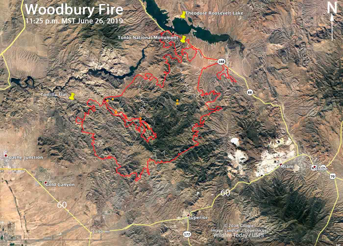
Map of the Woodbury Fire P
Map of the Woodbury Fire. The red line was the perimeter at 11:25 p.m. MDT June 26. The white line was the perimeter June 22, 2019. Click to enlarge.

The work remaining on the fire includes patrolling, securing, and monitoring firelines. Fish Creek, Pinyon Mountain and Two Bar Ridge have interior pockets of vegetation burning within the fire perimeter. These areas pose no threats to the fireline, however southwest winds will push smoke towards the Roosevelt area on Thursday.

An Unmanned Aerial System, or drone, was used Tuesday to fly over the eastern border of the fire to scout for hotspots. The aircraft detected heat within the fire perimeter and helicopters then dropped water and firefighters constructed line on the ground. The IMT used the drone again on Wednesday.
Woodbury Fire Phoenix Roosevelt
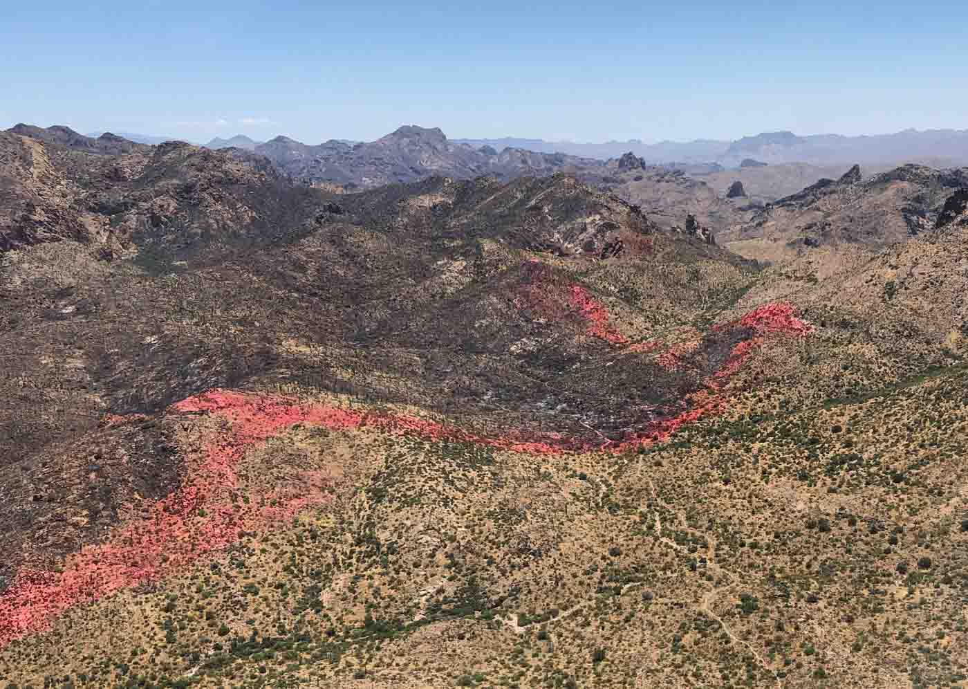
A line of fire retardant dropped by aircraft helped hold a section of the perimeter of the Woodbury Fire near Coffee Flat. Date unknown. InciWeb.

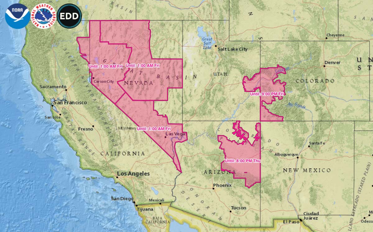
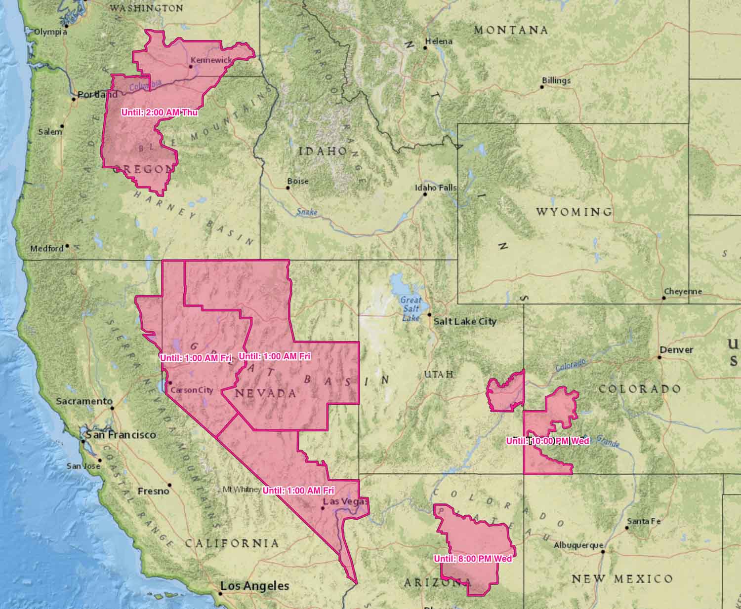
Red Flag Warnings for five states Thursday and Friday

Red Flag Warnings in effect Thursday and Friday wildfire danger
Red Flag Warnings in effect Thursday and Friday. Click to enlarge.

Red Flag Warnings are in effect for elevated wildfire danger in areas of California, Nevada, Arizona, Utah, and Colorado  As you can see on the map they expire at various times on Friday.

The forecast for those areas predict, generally, winds gusting above 35 mph and relative humidity in the low teens.

(Red Flag Warnings can be modified throughout the day as NWS offices around the country update and revise their weather forecasts.)

Rain slows spread of 42,000-acre Sawgrass Fire in Florida

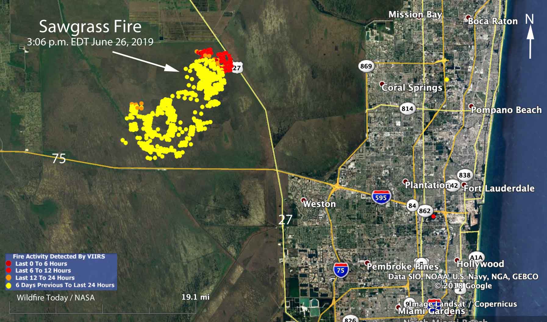
map Sawgrass Fire Florida
Map showing heat detected by a satellite over the Sawgrass Fire at 3:06 p.m. June 26, 2019. The red areas are the most recently burned.

Rain off and on throughout the day on Wednesday accompanied by 97 percent relative humidity slowed the spread of the Sawgrass Fire in South Florida nine miles northwest of Weston.

Friday evening the Florida Forest Service mapped the fire at 42,000 acres. An aircraft will fly it again Thursday morning to get an updated size.

The winds Wednesday on the fire were variable, but were mostly out of the west and northwest, contrary to the forecast which predicted east or northeast winds which would have pushed the smoke away from the densely populated areas on the east side of south Florida.

As you can see on the map, the satellite detected little or no heat on the south and west sides of the fire during the Wednesday afternoon overflight. Clouds in the area prevented any later heat data from the satellite. The fire has approached State Highway 27 and the high voltage power lines on the west side of the road. This could be a result of natural spread due to the west and northwest wind, or possibly combined with a firing operation by the ten firefighters and the Type 5 Incident Commander assigned to the incident.

A weather station 15 miles northeast of the fire recorded 0.05 inch of rain Wednesday, but a couple of stations to the southwest received two or more inches, indicating thunderstorms moving through the area. There is only a 15 percent chance of rain on Thursday, but precipitation is much more likely during each of the following seven days.

If the forecast turns out to be accurate, the demise of the Sawgrass Fire seems likely in the next few days.

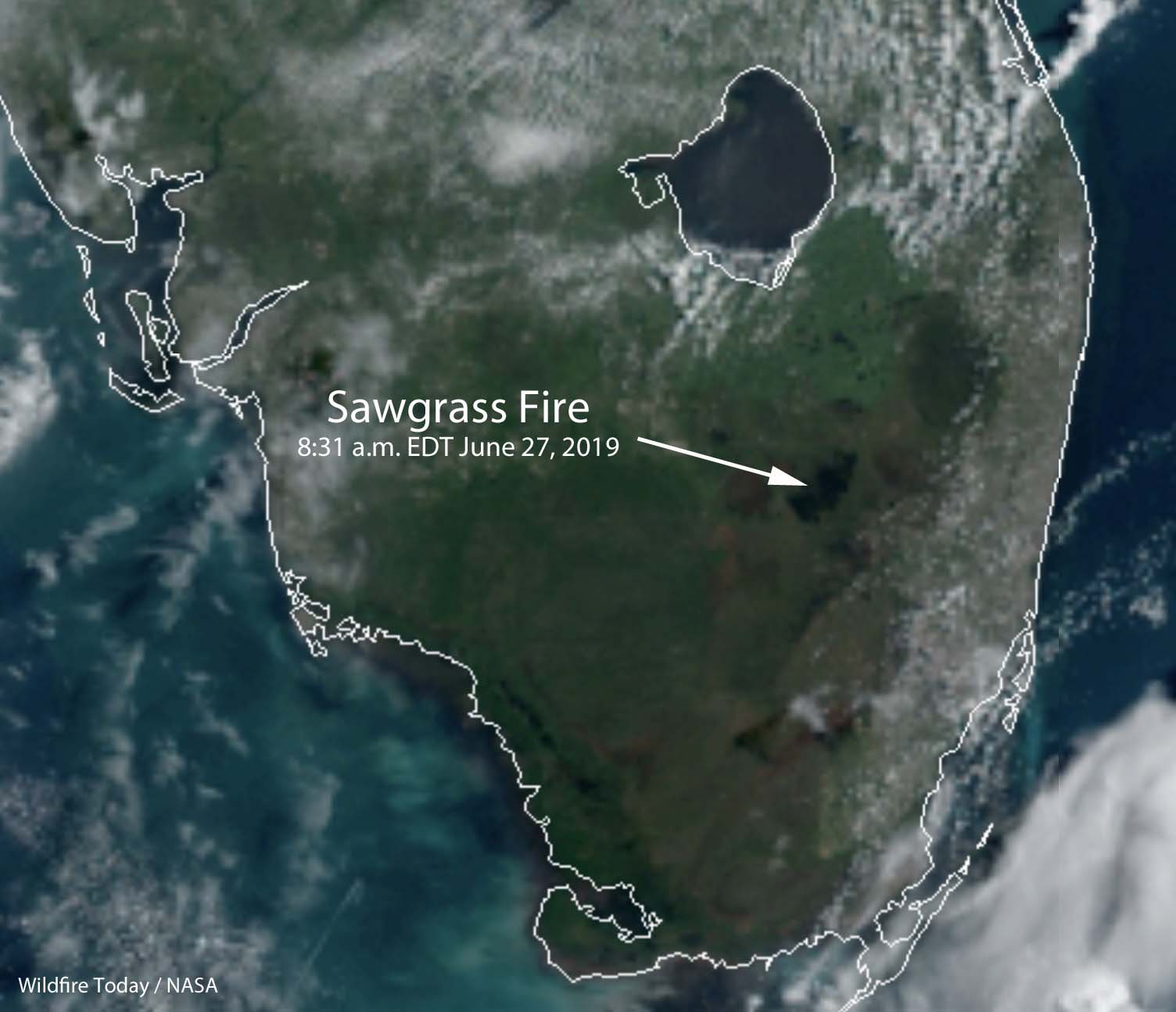
Satellite photo Sawgrass Fire
Satellite photo of South Florida at 8:31 a.m. EDT June 27. The area burned in the Sawgrass Fire is at the end of the arrow.

NWCG wants your thoughts about the document that replaced the Fireline Handbook

The National Wildfire Coordinating Group’s Operations and Training Committee wants you to take an online survey about the Wildland Fire Incident Management Field Guide, PMS 210, that replaced the Fireline Handbook in 2013.

Survey Question fireline handbook
Question number one in the survey.

Since it is Throwback Thursday, here is what we wrote about the transition April 29, 2013:


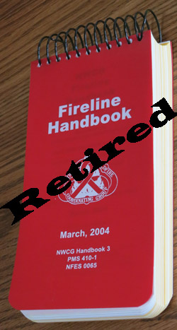
Fireline HandbookThe Fireline Handbook has been retired and replaced with an electronic file, a .pdf, called Wildland Fire Incident Management Field Guide (PMS 210).

May it rest in peace.

A memo released by the National Wildfire Coordinating Group (NWCG) suggests that the new 148-page document “can be printed locally in a standard 8½” x 11”, three-ring binder format.”

When it was first introduced, the Fireline Handbook, PMS 410-1, was appropriately named, fitting easily in your hand and pocket. Over several decades it became bloated as committees kept adding everything they could think of to it until it was over an inch thick and weighed almost a pound (15 ounces). It grew to 430 pages without the optional Fire Behavior Appendix and barely fit into a pants pocket. It was last updated in 2004.

The Fireline Handbook has become less valuable as other reference guides have been introduced, including the The Incident Response Pocket Guide (IRPG) and the Interagency Standards for Fire and Fire Aviation Operations, better known as the Red Book. The newer guides had some of the same information as the Fireline Handbook.

The Wildland Fire Incident Management Field Guide still has some information that is duplicated in the Incident Response Pocket Guide (IRPG) and FEMA’s National Incident Management System Emergency Responder Field Operating Guide (ERFOG), but according to the NWCG, which published the new guide, the documents have different purposes and user groups.

Wildfire Today first wrote about the possible demise of the Fireline Handbook in March, 2011.

Red Flag Warnings in effect June 26, 2019

Red Flag Warnings are in effect for elevated wildfire danger in areas of Washington, Oregon, California, Nevada, Utah, Colorado, and Arizona. As you can see on the map they expire at various times Wednesday, Thursday, or Friday.

Red Flag Warnings, June 26, 2019
Red Flag Warnings issued June 26, 2019. Click to enlarge.

(Red Flag Warnings can be modified throughout the day as NWS offices around the country update and revise their weather forecasts.)