Wildfire potential, May through August

If NIFC’s analysis is correct, wildfire activity along the west coast will grow substantially into the summer

wildfire potential

On May 1 the Predictive Services section at the National Interagency Fire Center issued their Wildland Fire Potential Outlook for May through August. The data represents the cumulative forecasts of the ten Geographic Area Predictive Services Units and the National Predictive Services Unit.

If NIFC’s analysis is correct, the wildfire potential in areas along the west coast will grow substantially into the summer.

The multi-year drought in California has been virtually neutralized due to substantial quantities of winter rain and snow. An area to watch will be the west sides of Oregon and Washington.

Below:

  • An excerpt from the NIFC narrative report for the next several months;
  • More of NIFC’s monthly graphical outlooks;
  • NOAA’s three-month temperature and precipitation forecasts; and,
  • Drought Monitor.

“Greenup is occurring across the nation entering May; fuels across the Southwest are now drying and curing and will become increasingly receptive to fire activity as the month progresses. Looking north, Alaska’s interior is becoming drier and increasing activity is expected. By late May and early June, California and the southern Great Basin will see an increase in activity as fine fuels dry and cure. In July, low and middle elevation fine fuels will dry across the remainder of the West and will gradually become receptive to fire activity from south to north. Unlike most years, there could be a delayed start to the season in the higher, timbered elevations due to preexisting weather conditions and slower than average snowpack melting rates. An exception to this could be along the Canadian Border with Washington, Idaho, and western Montana where below average snowpack and moderate drought conditions exist. These areas can expect an average start to the season with a potential for above normal activity. A normal transition out of fire season is expected across Alaska in July. The onset of the southwestern monsoon may be slightly delayed.

“August marks the beginning of the peak of the western fire season. Most of the country can expect Normal conditions. Exceptions will be along the West Coast. A heavy crop of grasses and fine fuels has developed across California and should elevate the potential as it cures and dries. Higher elevations in the Sierra will likely see a late entry into the season due to the record-setting snowpack and slow meltoff. The Pacific Northwest has entered a period of moderate drought. An early entry is possible across the Cascades and in the Okanogan. Elsewhere, some high elevations across the Great Basin and central Rockies could experience Below Normal potential and conditions.”

wildfire potential

Continue reading “Wildfire potential, May through August”

Canada may launch satellite to monitor wildfires

WildFireSat
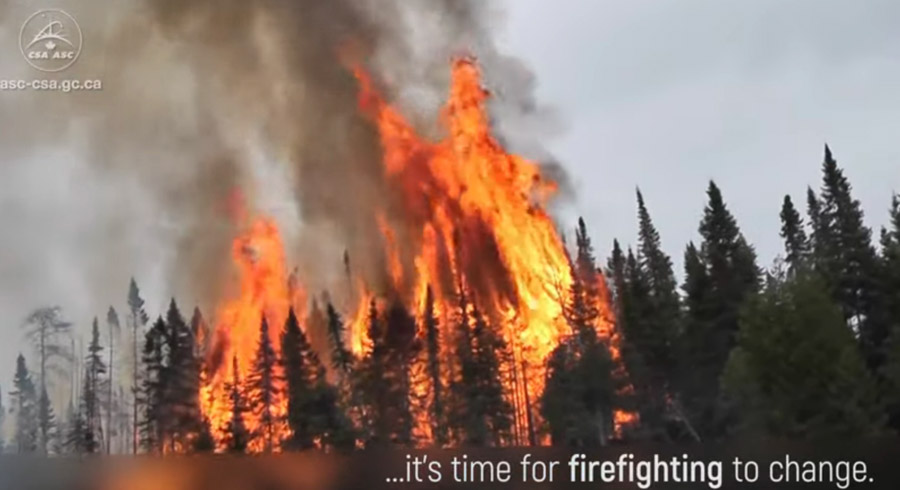
Screengrab from the Canadian Space Agency video below.

The Canadian Space Agency is considering launching a satellite that would monitor wildfires. The “WildFireSat” (WFS) would not detect them, but would monitor fire characteristics and emissions in support of international requirements for carbon reporting. The satellite would help to determine which sensors and frequency bands are most useful. Eventually this could develop into a constellation of satellites providing real-time coverage of wildfires not only in Canada but across the planet.

Below is an excerpt from the Notice of Proposed Procurement:

…It should be emphasized that WFS represents a wildfire monitoring capability and not a wildfire detection capability. A key mission objective of WFS is to monitor accurately the radiated power from wildfires to infer their characteristics and be able to improve fire management practices and report on carbon emission. The mission would confirm that the current selection of frequency bands and algorithms is adequate to retrieve fire characteristics with the desired accuracy.

As such, the WFS mission will serve as a stepping stone to accomplish the long-term objective of establishing a new, potentially commercial, fully operational 24/7 service in the future. WFS could help prepare the user community in Canada and possibly abroad, and thus create the customer-base that would be needed for a future global operational data service to be commercially viable.

Redding Hotshots involved in vehicle crash with multiple injuries

The crew is based in Redding, California

(UPDATED at 11:02 a.m. PDT May 1, 2019)

Stanton Florea, a spokesperson for the U.S.  Forest Service Pacific Southwest Region, confirmed that a total of 10 crewmembers on the Redding Interagency Hotshots were injured in the crash of their crew carrier yesterday, April 30.  At least one was transported from the scene by helicopter. Two crewmembers are still in the hospital.

The crew was engaged in chain saw training away from their base in Redding, and was en route back when the accident occurred.

(UPDATED at 7:27 a.m. PDT May 1, 2019)

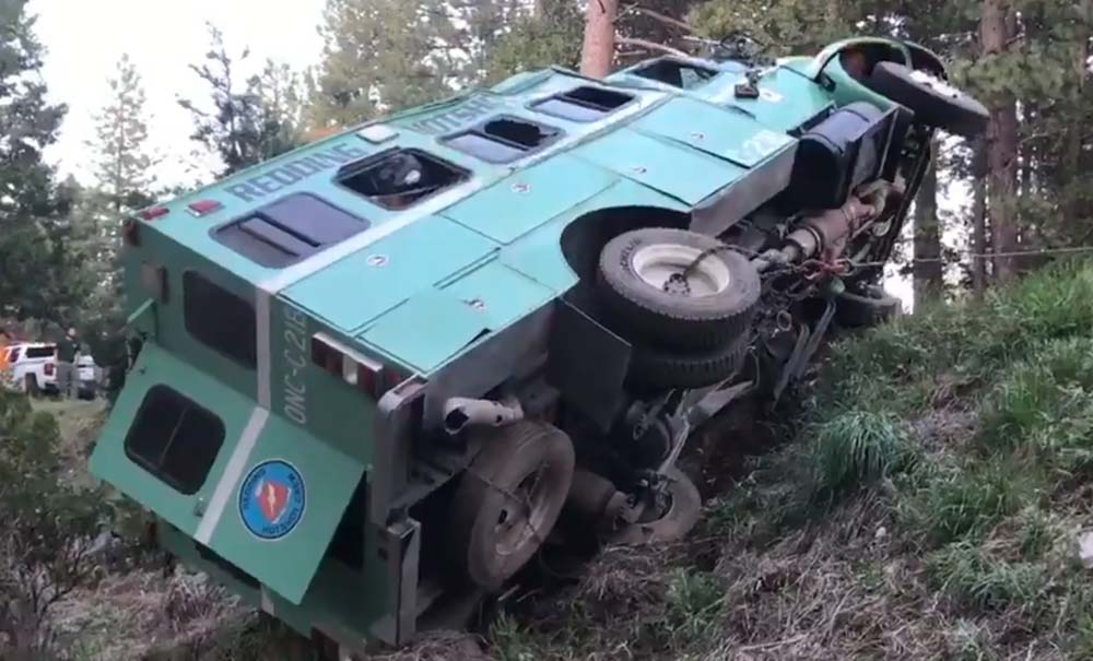
Redding Hotshots' Crew Carrier
The Redding Hotshots’ Crew Carrier. Screengrab from @KRCR Photog.

We will update this article as more of the details become available.

Redding Hotshots

The Redding Hotshots differ from the typical Hotshot Crew in that firefighters are detailed to the crew from other units. It is a Regional resource rather than being tied to a specific National Forest or Park like other Type 1 crews. In addition they receive a concentrated fire management training opportunity through supervising a squad of 3-7 crewmembers during fire suppression, prescribed fire and other emergency incidents.


(Originally published at 8:05 p.m. PDT April 30, 2019)

The Shasta County News Source is reporting that a vehicle carrying members of the U.S. Forest Service Redding Hotshots was involved in a two-vehicle accident in Burney, California, which is about 56 miles northeast of the crew’s base in Redding.

The report has numerous details which may have been gathered from monitored radio conversations.

The Incident Commander reported the crew carrier was off the road and on its side, and immediately declared it to be a Mass Casualty incident.

Two or possibly three of the injured were flown to hospitals, and approximately eight or nine others with minor injuries were transported in ground vehicles. It is believed that a person in the other vehicle, a Lexus, is included in the numbers.

The accident was reported at about 5:12 p.m. Tuesday April 30.

The details may change as the story evolves. We will update this article as more details emerge.

(Click here for an update on the accident.)

Thanks and a tip of the hat go out to Tom. Typos or errors, report them HERE.

Arkansas firefighter who had heart attack while responding, passes away

Posted on Categories UncategorizedTags
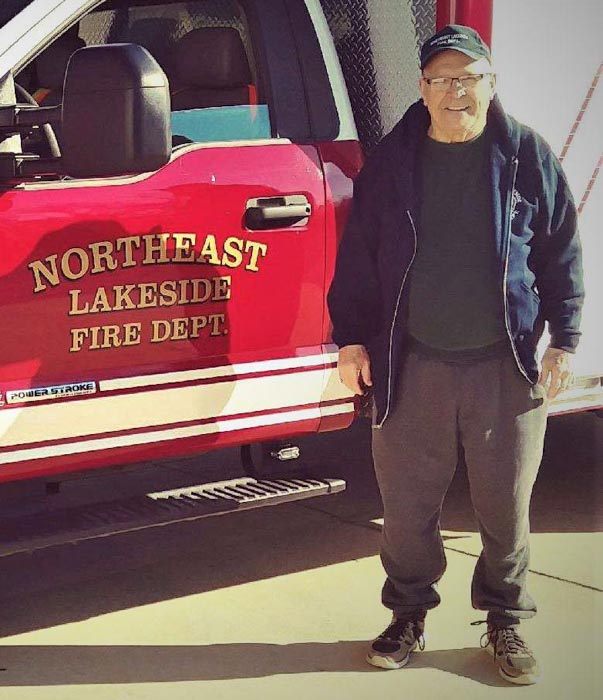
Michael Watkins
Michael Watkins. Northeast Lakeside FD photo.

The U.S. Fire Administration has received notice of a firefighter fatality:

Michael Watkins
Driver/Engineer
Northeast Lakeside Fire Department
Mountain Home, Arkansas

On April 21, 2019, Driver/Engineer Michael Watkins was responding to a brush fire when he suffered a heart attack. He was immediately taken to the hospital where he passed away on April 24, 2019 at the age of 75. He had been a firefighter for 5 years.

A celebration of Mr. Watkins’ life will be held May 4 at First United Methodist Church, 605 W 6th St, Mountain Home, Arkansas.

Our sincere condolences go out to his family, friends, and co-workers.

Pete Barry wins Lead by Example Award

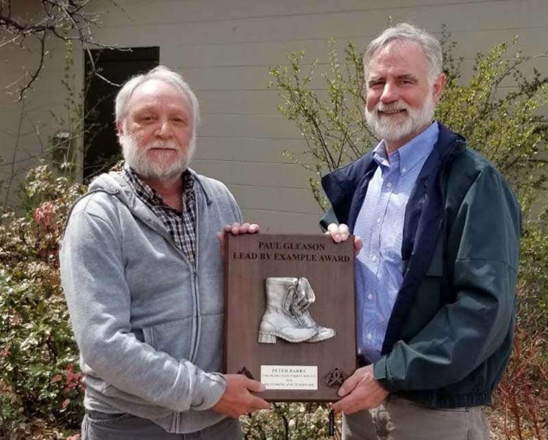
Peter Barry
Colorado State Forester Mike Lester, right, presents the Lead by Example Award to Pete Barry. CSFS photo.

Pete Barry of the Colorado State Forest Service has been selected as one of the recipients for the 2018 Paul Gleason Lead by Example Award.

The award was created by the National Wildfire Coordinating Group Leadership Committee to remember Paul Gleason’s contributions to the wildland fire service. During a career spanning five decades, Paul was a dedicated student of fire, a teacher of fire, and a leader of firefighters. The intent of this award is to recognize individuals or groups who exhibit this same spirit and who exemplify the wildland fire leadership values and principles. Pete’s work in support of the Wildland Fire Leadership Development Program has been a demonstration of mentoring and teamwork.

Pete was recognized for his involvement and mentorship of the student of fire initiative at Colorado State University. Pete’s efforts to advance Paul’s vision that firefighters realize the importance of being a student of fire are commendable. Creation and continued support of the CSU Student Firefighter Association, securing lasting funding for the Paul Gleason Scholarship, as well as connecting students studying wildfire science with land management agencies and fire departments directly aligns with that vision. Pete’s influence will be realized for years to come.

The award was also presented to three other individuals or groups for 2018:  Kim Lightley, Kim Kelly, and the BLM Boise Helitack Crew.

Winners of the award prior to 2018.

From Wildland Fire Leadership

NWS develops system for quickly notifying land managers when satellites detect wildfires

The NWS may one day issue watches and warnings based on the predicted spread of a dangerous wildfire.

The higher resolution and shorter time intervals between images on the more recently launched weather satellites has made it a reality for wildfires to be detected and local land managers notified within minutes.

The new GOES 16 and GOES 17 satellites can identify new wildfire ignitions more accurately than their predecessors. The higher resolution means the location can sometimes be pinned down to within less than a miles as long as the temperature reaches the threshold that triggers the software to paint it in the image.

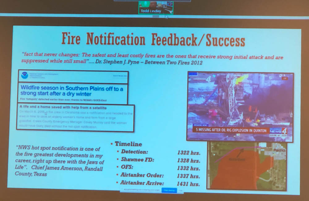
For a while the National Weather Service had occasionally notified land managers when they detected a wildfire but in 2016 as numerous blazes erupted in Oklahoma and Kansas the Oklahoma Forestry Services Fire Management Chief specifically asked for help to identify new fire starts. In an April 30, 2019 presentation  transmitted remotely to the International Association of Wildland Fire’s Fire Behavior and Fuels Conference in Albuquerque, T. Todd Lindley, Science and Operations Officer with the NWS, said that considering the fire storms brewing in the area on that day in 2016 that someone on their staff determined that, “We need to innovate today”.

detect wildfires satellite notify fire department
Cell phone photo of a slide from T. Todd Lindley’s remotely transmitted presentation April 30, 2019.

Within about four hours, Mr. Lindley said, they had developed a computer program that could enable a forecaster to send a notification to a land manager about a new fire very quickly, with just a few mouse clicks.

They have had success with the system, with 83 percent of notifications being received prior to local 911 calls.

And branching off of their ability to predict the tracks of thunderstorms and tornados and issuing watches and warnings, the NWS is experimenting with identifying the projected spread of a fire which could possibly lead to issuing watch and warning areas for wildfires.