Researchers have developed a fancy graphic presentation that explores the relationship between precipitation and the annual area burned in the Western United States. You should check it out.
They concluded that weather conditions DURING the fire season, humidity and rain, have far more effect on total acres burned than winter snow.
The figures and text (below) here are excerpts from the document.
“Wildfires have been increasing: but why? Is it the effect of increasing temperatures? Declining snowpack? Decreasing precipitation? In their recent paper, “Decreasing fire season precipitation increased recent western US forest wildfire activity,” Zachary Holden and his co-authors explore the relative influence of these factors. They first identified the variables related to temperature, snow, and precipitation that best predicted area burned:
“Temperature: vapor pressure deficit [VPD] (the difference between the maximum amount of water the air can hold and the amount it actually holds)
“Snow: maximum annual snow water equivalent [SWE], and
“Precipitation: wetting rain days [WRD], days with more than 1/10 inch of rain, in the months of May through September.”
The study of infamous fires and military battles can be a valuable learning opportunity for wildland firefighters. On a Staff Ride, finding out about leadership factors that affected the outcome can help participants benefit from the good decisions, and reduce the chances of making similar mistakes.
Today we have a guest article written by Heather Thurston.
Don Garwood, former Incident Management Team Incident Commander speaks to participants. Photo by Heather Thurston.
The Battle of San Pasqual: Decision Making Lessons Learned from the “Bloodiest Battle in California’s History”
By Fire Apparatus Engineer Heather Thurston, CAL FIRE – Monte Vista Unit
During the Mexican-American War President James Polk sent the U.S. 1st Dragoons, under the command of General Stephan Watts Kearny, 2000 miles from Fort Leavenworth, Kansas to California. On December 6, 1846 these troops engaged a group of Mexican cowboys known as the “Californios” in what would become known as the “bloodiest battle in California’s History”.
Located in Southern California off of Hwy 78 nestled between Escondido and Poway in the northeast part of San Diego County, the battlefield now provides a unique learning opportunity for wildland firefighters.
On a cool April morning in 2019, cadets from Rio Hondo College Wildland Fire Academy lined up in anticipation for the day while leaders and mentors introduced each other from several departments across southern California. Leaders from U.S. Forest Service, Bureau of Land Management, U.S. Marines, CAL FIRE, Lakeside Fire, Newport Beach Fire, and other local departments assembled, ready to share their experiences and learn from each other about the decisions made in 1846. The battle of San Pasqual provides learning opportunities that parallel common issues consistently encountered on the firefighter’s battlefield.
In the parking lot, students and mentors receive a safety briefing followed by an opening speech which was given to the American Republic soldiers by General Kearny. Participants are asked to imagine a cold foggy morning through Captain Johnson’s eyes. Photo by Heather Thurston.
Mounted troops of Captain Andres Pico’s rebellion have encamped and taken-up positions in the eastern portion of this valley with the intent of attacking and destroying coalition forces of the American Republic, now in armed conflict with the Californios/Republic of Mexico.
You are to reconnoiter as to exact location of enemy forces and perform action using advantages of terrain and nighttime operations to beat-up the enemy camp, so as to achieve capitulation—while minimizing casualties to the extent possible.
They have the capability of eliminating U.S. forces available for action, given their ability to exercise superior local firepower and maneuverability. They can reinforce with organic and out-of-theater assets.
With these words ringing in their heads, participants start the 1/4 mile walk to the day’s first stop. It was here that Captain Johnson took 12 Dragoons, the best of Kearny’s men, under the orders to “TROT” and recon as to the strength and readiness of their adversaries.
Both the Dragoons and the Californios were mounted calvary. The Californios had fresh horses and a few rifles but most of their fighting was done with lariats and long lances.
During their 2,000-mile journey, the longest march in U.S. Army history, most of the Dragoons’ horses died and the soldiers were left with mules and half-broken horses they rounded up around Warner Springs. Much of their gunpowder was wet which reduced the effectiveness of their carbines to clubs and pistols to hammers.
The attendees are asked to imagine a foggy cold morning and look through Captain Johnson’s eyes as he sees the shadow of two men on horses. Captain Johnson believes he sees an opportunity to capture and stop these men from warning the Californio troops of the American’s arrival. Capt. Johnson deviates from the plan and gives the order to “CHARGE”, beginning the grueling and violent, several day long battle that we now talk about 173 years later.
While hindsight is always 20/20, we now know these shadowed soldiers were bait, cleverly set by Captain Andres Pico, leader of the Californios, and they led the Americans into an ambush that led to destruction and chaos.
What allowed a much smaller and lesser armed force to dominate a trained, regular fighting unit consisting of heavily armed men? When compared to the fire fight, aren’t we also more intelligent, better armed, and better trained than the fire? How often do we make decisions and act on partial facts? What factors influence our margin of success or failure?
Exhaustion, stress, complacency, over confidence?
As the staff ride continues, the group moves up the hillside, to the second stand known as the “battlefield overlook”. U.S. Force Recon Marine Master Sergeant Zeran discusses the purpose and tactics of a military recon. Parallels are drawn between military recon tactics and those used to scout the fire line. How often do units scouting allow themselves to deviate from their original mission, drawn like a moth to the flame into the fire fight just like Capt. Johnson did?
After a short history lesson given by local Historian Stan “Gunboat” Smith in historical US Cavalry Uniform, students are paired with mentors for a short tactical exercise in clear communication and clear thinking under fire.
Discussion at Decision Rock. Photo by Heather Thurston.
The group then moves on to what is known as “Decision Rock”. Here, lessons of leader’s intent are discussed along with the planning and decision making cycle. When General Kearney hears Captain Johnston change the order from “trot” to the order of “CHARGE”, it is recorded in a soldiers journal that General Kearny sighs, “Oh heavens, that is not what I meant!”.
So the question is presented, “Who has the authority to alter tactics at the last minute?” When the time/decision wedge is narrow, how do we make sound and safe decisions with little information? It is emphasized here how unprepared Kearny’s troops were for the battle — their gunpowder wet, their feet bare or boots damaged from their travels, and the attitude that this confrontation would be of no consequence. Also, keeping in mind, the weather was so cold that the buglers could not bugle, effectively crippling the Americans communications. Still, they marched forward to the bloody battle.
Almost immediately after the CHARGE order was given, Capt. Johnson was shot by a Californio marksman and the command structure begins to break down for the Americans.
How should we design our units and train for the possibility of command casualty? General Kearny had the perception that this battle would be easy and his men were far superior than their adversary. How do we recover when the enemy outpaces and outperforms our expectations? Kearny was also working under the pressure from his command (the President of the United States) to engage. Do we allow expectations from Chief officers and the public to drive decision making?
In the riverbed where U.S. troops were ambushed by the Californios. Photo by Heather Thurston.
After a lunch break, participants are led into a riverbed. Once Captain Pico realized his troops were are getting boxed in by the US, he faked a retreat down into this riverbed.
Here, you can start to see more active participation by the academy cadets, as lessons learned from their studies into incidents such as the Yarnell Hill Fire start to connect and draw a parallel to the decision making processes of this battle. Instructors reiterate leadership lessons that had been touched on throughout the day and how they all led to the battle that happened on this very ground.
Finally, participants are at the final stop at the Pioneer Cemetery. After a moment of reflection on mortality, students, mentors, and instructors alike are asked to draw conclusions about the battle’s relevance today. A voice inside me says, “Be hungry for your history”, meaning learn these lessons from others’ mistakes when the time/decision making wedge is wide. Be able to detach from the chaos and fog of our “war”, and make sound and battle-tested tactical decisions. Don’t ever let your guard down. Just when you believe you are stronger, smarter, and more prepared, you are in fact most vulnerable to complacency. And above all, never stop learning.
Discussion at Pioneer Cemetery. Photo by Heather Thurston.
Seven hours after the fire started the military approved the use of an AS139 helicopter to assist firefighters.
Hundreds of villagers attacked a wildfire in northwest Ireland April 22, 2019. Screengrab from Kevin Mcbride video.
A large wildfire burned hundreds of acres April 22 in northwest Ireland. It started at about 6 a.m. in Annagry in West Donegal and quickly spread to the neighboring villages of Loughanure and Belcruit and towards Dungloe. At 1 p.m. the Minister of State with Responsibility for Defense, Paul Kehoe, approved the use of an AW139 helicopter from the Irish Air Corps to assist firefighters. Donegal County Council also hired a private company with a smaller helicopter to drop water.
Hundreds of villagers swarmed to the fire with hand tools in attempts to stop the blaze. There were no reports of injuries or structures being destroyed. By evening the spread had been stopped.
The Irish Sun reported that one firefighter said, “This is unreal stuff. I have battled a lot of gorse fires over the years but this is amongst the most dangerous. Everything is bone dry and there is a strong wind so these are perfect conditions for the fires to spread rapidly.”
Satellite photo showing smoke from the wildfire north of Dungloe in northwest Ireland, April 22, 2019. Heat is represented by red dots. Heat from a second fire can be seen west of Monaghan.Irish Air Corps photo.Irish Air Corps photo.An AW139 helicopter operated by the Irish Air Corp assisted firefighters. Irish Air Corp photo.An AW139 helicopter operated by the Irish Air Corp assisted firefighters. Irish Air Corp photo.
Wildland fire danger in Europe, April 24, 2019. European Forest Fire Information System (EFFIS). Click to enlarge.
Incredible fire danger ratings from the EFFIS for today in some places in Poland: at the level (FWI ~55) of an extreme summer day in the Mediterranean and a 16x anomaly. pic.twitter.com/wYec3qj2HS
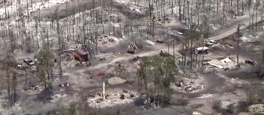
Structures that burned in the Puntzi Fire in British Columbia.
A reporter asked me what needs to be done to keep from repeating disasters like we have seen recently in California at Paradise, Redding, and the Napa Valley. I told him that there is no one thing that needs to be done, such as raking or “forest management”, it requires a comprehensive holistic approach.
The principle of the weakest link in the chain applies here. If one of the categories of improvements to protect a development is sub-par, the individual structures and the entire community in a fire-prone environment is at risk. And if a homeowner does not do their part, it can endanger their neighbors.
Reducing the chances that a fire in a populated area will turn into a disaster that burns thousands of homes involves at least six categories of factors: home spacing, envelope of the structure itself, home ignition zone, community infrastructure, wildland urban interface, and fire codes.
Home spacing/lot size
Cities, counties, and planning boards are often under pressure to approve new housing developments. They want to expand their tax base. Developers try to fit as many homes into a new subdivision as possible to maximize their investment. This too often results in homes that are 20-feet apart. If one is ignited by a burning ember that may have traveled a quarter of a mile from a fire (or a burning home) the radiant heat alone can ignite the homes on both sides. Then you can have a self-powered conflagration spreading house to house through a city. When the structures are that close together, the homeowners have not reduced the fuel in the Home Ignition Zone, and the home itself is not built to FireWise standards, a massive disaster can be the result.
If a homeowner wants, or is required, to reduce the flammable material within 100 feet of their residence, what are they expected to do if there is another home 20 feet away that is really a large assembly of flammable material?
A neighborhood on Debbie Lane in Paradise, California, before and after the Camp Fire that started November 8, 2018. The homes were 14 to 18 feet apart.
Some of the homes in Paradise, California that burned were less than 20 feet apart. According to measurements using Google Earth, we determined that the structures in the photo above were 14 to 18 feet from each other.
The National Institute of Standards and Technology released a report on the 2012 Waldo Canyon Fire that burned 344 homes and killed two people in Colorado Springs, Colorado. They concluded that current concepts of defensible space did not account for hazards of burning primary structures, hazards presented by embers, and the hazards outside of the home ignition zone. In addition, NIST recommended:
High-density structure-to-structure spacing in a community should be identified and considered in [Wildland Urban Interface] fire response plans. In the Waldo Canyon fire, the majority of homes destroyed were ignited by fire and embers coming from other nearby residences already on fire. Based on this observation, the researchers concluded that structure spatial arrangements in a community must be a major consideration when planning for WUI fires.
After studying the Carr Fire that destroyed 1,079 residences at Redding, California earlier this year, retired CAL FIRE Battalion Chief Royal Burnett reached similar conclusions.
It was easy to figure out why the houses on the rim burned — they were looking right down the barrel of a blowtorch. Even though they had fire resistant construction, many had loaded their patios with flammable lawn furniture, tiki bars and flammable ornamental plants. Palm trees became flaming pillars, shredded bark became the fuse, junipers became napalm bombs. Under current standards houses are build 6 to an acre; 10 feet to the property line and only 20 feet between houses. Once one house ignited, radiant heat could easily torch the next one.
2. Envelope of the structure itself
Included in this category are characteristics of the roof, vents, siding, doors, windows, foundation, fences, eaves, and decks. A FEMA publication (13 MB) has excellent detailed recommendations. Headwaters Economics found that the cost of building a fire-resistant home is about the same as a standard home. When implemented, Chapter 7A of the California Building Code, regulates these features.
3. Home Ignition Zone
The NFPA and FireWise programs recommend reducing flammable material within 100 feet of structures and spacing the crowns of trees at least 18 feet apart that are within 30 feet of the home, 12 feet apart at 30 to 60 feet, and 6 feet apart at 60 to 100 feet. Another house that is 15 to 50 feet away is also fuel, and if it ignites will be a serious threat.
Road and driveway width, wide enough for large fire trucks
Turnarounds at the end of roads
Signage, and
Emergency water supply.
Again, the FEMA document has great recommendations.
5. Wildland-Urban Interface
There is of course much that can be done surrounding the places where people live that would reduce the vegetation or fuel and decrease the intensity and ember generation potential of a fire as it approaches an urban area. Large scale fuel management projects including fuel breaks and prescribed fire programs are usually conducted by state and federal agencies.
A fuel break does not have to be devoid of vegetation, but it should have minimal tons per acre that would therefore burn with less intensity and with fewer fire brands being lofted downwind. This could enable firefighters to make a stand and create a place from which to ignite a backfire, perhaps aided by aircraft dropping water or retardant.
6. Fire codes are essential
The only effective way to ensure that residents understand and implement these five tasks is to make them mandatory by establishing Fire Codes at the local and state levels.
Analysts studying the aftermath of the Camp Fire which destroyed much of Paradise, California found that homes built to fire-safe standards had a much higher survival rate than those that were not. Beginning in 2008 new construction in the city was required to follow a standard, Chapter 7A of the California Building Code, designed for the state’s areas at high risk from wildfire. Fifty-one percent of the homes built under the 7A code survived, while only eighteen percent built before 2008 did.
Chapter 7A lays out standards for roofs, exterior walls, vents in exterior walls and attics, windows, exterior doors, decking, and outbuildings. Remember, the cost of building a fire-resistant home is about the same as a standard home.
The warming climate is demonstrating that wildfires are becoming increasingly perilous. It is the responsibility of state and local governments protect their citizens by enacting sensible standards.
The Thomas Fire in December, 2017 burned 281,893 acres near Santa Barbara and Ojai, destroyed 1,063 structures, and caused the death of one civilian and one firefighter.
One of those structures was the music studio of singer-songwriter Rain Perry. Many of her neighbors lost their homes.
Yesterday marked the premiere of a music video by Ms. Perry for her song “Vapor,” from her new album Let’s Be Brave, filmed at the burned ruins of the Ojai, CA landmark Amestoy House. The video features a dozen neighbors who lost homes and studios in the Thomas Fire.
“Vapor” is a song about survival and hope:
“What lasts is metal, glass and clay The rest becomes vapor and burns away We’re here for a minute, so what will it be? I’ll matter to you – you matter to me”
Directed by Micah Van Hove (Shadow of a Gun, Menthol), the video captures the resilience of everyday folks, who each brought to the shoot an object from their home that survived the fire: from a ceramic angel to a wrench to a bicycle.
Ms. Perry’s home, thankfully, survived, but she lost all her instruments, career memorabilia and older recordings that had not been digitized.
Like the burned chaparral around her home, though, Rain’s artistic drive resprouted with a passion, and she wrote and recorded Let’s Be Brave, her fourth album with multi-instrumentalist and Grammy-nominated producer Mark Hallman at the Congress House in Austin, Texas.
With a cover photo by Patricia Houghton Clarke of Rain lying on the burned foundation of her studio, and featuring cameos by Chuck Prophet (“St. Julie of Iowa”) and Jon Dee Graham (Bruce Springsteen’s “Rocky Ground”), with a kickass backup choir by Noelle Hampton, Jaimee Harris, Daisy O’Connor, Shawnee Kilgore and Emily Shirley, “Let’s Be Brave” is a celebration of bravery of all kinds.
A CD Release Celebration is scheduled for April 27th in Ojai– a benefit for the California Community Foundation Wildfire Relief Fund.