Pinery Fire causes evacuation of Chiricahua National Monument in Arizona

Posted on Categories UncategorizedTags ,

Above: Map showing the location of the Pinery Fire in Southeast Arizona. The red dots represent heat detected by a satellite at 3:57 p.m. MDT May 11, 2018.

(Originally published at 8:17 p.m. MDT May 12, 2018)

A fire that started at 1:30 p.m. Saturday has forced the evacuation and closure of Chiricahua National Monument in Southeast Arizona. The cause is under investigation but it started on private land, moved onto the Chiricahua National Monument, and has since spread north onto the Coronado National Forest.

Our very unofficial estimate based on 3:57 p.m satellite data is that at that time it had burned approximately 400 acres. At 8 p.m. local time the National Park Service estimated the size at 675 acres.

Red Flag conditions on Saturday, including wind gusts up to 37 mph, are making containment difficult. The forecast for Sunday includes more Red Flag Warnings for the fire area with 86 degrees, 14 percent relative humidity, mostly sunny skies, and southwest winds of 13 to 25 mph with gusts up to 37 again.

The fire is under joint command of the Arizona Department of Forestry and Fire Management, the National Park Service, and the Coronado National Forest.

Multiple aircraft have been ordered, including 5 single engine air tankers, 4  large air tankers, and 3 helicopters. Seven engines, 2 initial attack crews, and 2 hotshot crews are working on the ground trying to stop forward progress. Additional resources have been ordered, including four more hotshot crews. The fire is 32 miles southeast of Willcox, 20 miles south of Interstate 10, 19 miles west of the Arizona/New Mexico border, and 44 miles north of the international border.


Overwintering fires are a concern in Northern Rockies

Posted on Categories Uncategorized

Above: Satellite photo taken August 2, 2017 showing smoke from some of the wildfires in British Columbia. The red dots represent heat detected by a sensor on the satellite

After the very large wildfires that burned across great swaths of the Northern Rockies last summer in the United States and Canada, firefighters are concerned about those that could have survived the snow-covered ground and be given a new life as the weather warms. Fires that burned extremely hot due to an accumulation of fuels or drier than normal ground cover, may hibernate in organic soils that provide a continuous supply of fuel.

Hot spots that outlive the snow and have access to warmer temperatures and more oxygen will often emerge to find themselves surrounded by thousands of acres of blackened forest. These are not a problem since they can’t spread, but the sudden appearance of smoke where there had not been any for more than half a year can be a distracting nuisance.

Of greater concern are the ones that materialize on the edge of a fire where there is abundant access to unburned vegetation. Firefighters want the public to report all smokes. Yes, there may be some false positives if they are in the middle of a fire from the previous year, but they desperately want to hear about potentially dangerous overwintering fires.

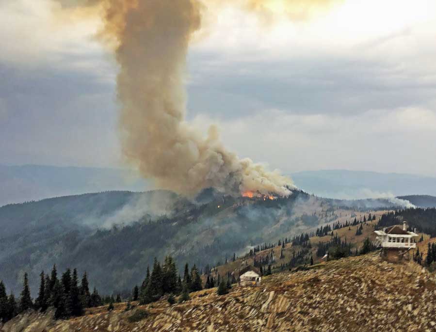
Andy's Hump Fire, Idaho
Andy’s Hump Fire, Idaho, September, 2017. Inciweb.

Viewpoint Fire burns thousands of acres north of Prescott Valley

Above: Map showing heat on the Viewpoint Fire detected by a satellite at 1:40 p.m MDT May 11, 2018.

(UPDATED at 7:40 a.m. MDT May 12, 2018)

Firefighters were able to get forward progress stopped on the Viewpoint Fire around 4:30 p.m MDT, Friday. The fire burned 5,100 acres before crews knocked down the fast moving fire that destroyed two homes and possibly three to four more in the Poquito Valley area. Between 10 and 12 other structures also burned. Once the area is deemed safe officials can get in to better assess the damages. More than 250 fire personnel, along with a very large air tanker and other aircraft, assisted in fire suppression efforts.

****

(UPDATED at 7:13 MDT May 11, 2018)

Arizona State Forestry reports forward progress on the Viewpoint Fire has stopped. They estimate it has burned 2,500 acres.

****
(Originally published at 4:01 p.m. MDT May 11, 2018. Updated at 6:42 p.m. MDT May 11, 2018)

A fire reported at 1 p.m. Friday has burned thousands of acres in Arizona a few miles north of Prescott Valley. Pushed by very strong winds, it was moving through an area with houses Friday afternoon six miles southeast of Chino Valley.

Our very unofficial estimate based on satellite data shows that it has burned at least 2,400 acres.

Mandatory evacuations were lifted in some areas, but are still in effect in others, according to Yavapai County Emergency Management.

Thanks and a tip of the hat go out to Tom.
Typos or errors, report them HERE.

Mallard Fire burns over 30,000 acres southeast of Amarillo, Texas

Above:  GOES 16 satellite image of the Mallard Fire at 3:22 p.m. CDT May 11, 2018.

(Updated at 8:08 p.m. CDT May 11, 2018)

The time-lapse video below is mesmerizing!!

****

(Originally published at 4:37 p.m. CDT May 11, 2018)

A large wildfire is moving through Armstrong County in the Texas panhandle 32 miles southeast of Amarillo and 18 miles southwest of Clarendon. Friday afternoon the Texas Forest Service said it had burned approximately 34,000 acres.

On Thursday the Summer Field Fire merged with the Mallard Fire. Large air tankers, SEATs, and helicopters have been working the fire since Wednesday. A very large air tanker was ordered Thursday.

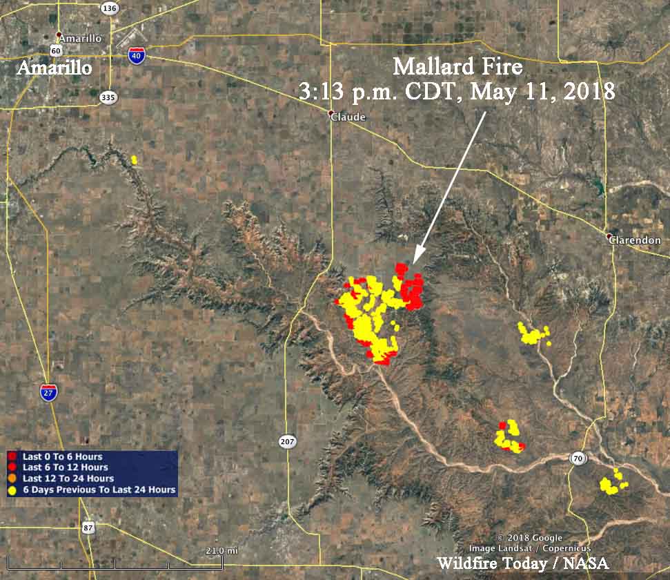
Mallard fire map
Heat detected by a satellite over the Mallard Fire in the Texas panhandle. The most recent, the red dots, are from 3:13 a.m. CDT May 11, 2018.

The photo below is from Friday:

Below is a photo from Thursday:

The fire is putting up a huge column of smoke and is creating a large pyrocumulus cloud blowing off to the east.

California firefighter honored as “unsung hero”

Above: Honoring “unsung heroes” at the Department of Agriculture. USDA photo.

Yesterday the office of Secretary of Agriculture, Sonny Perdue, distributed by Twitter the photo above, saying:

It’s #PublicServiceRecognitionWeek, an occasion to acknowledge the fine work our @USDA career employees do every week of the year. Happy to speak at a ceremony to honor our “Unsung Heroes.” They’re the ones who help fulfill our mission to Do Right and Feed Everyone.

One of the honorees was a firefighter on the Los Padres National Forest in California, Division Chief Peter Harris. On December 11, 2017 he was shot in the neck and ear while driving a USFS vehicle in Monterey County, California.

Here is how the USFS, @R5_Fire_News, in a series of five tweets on May 10 described the incident:

On Dec 11, 2017 @LosPadresNF Div Chief Peter Harris was shot in the head &back while driving back to his station after a fire response. Harris radioed law enforcement & a medi-vac helicopter for himself. Covered in blood, but not knowing the extent of his own injuries, Harris determined it may take as long as 30 min for help to arrive in such a remote area of the forest. Instead of driving from harm, Harris used his vehicle to block the road & prevent the public from entering the area of the shooter. Today, @USDA @SecretarySonny honored Division Chief Harris & others as part of the @USDA “Unsung Hero” awards in Washington, DC.