Firefighters making progress on Detwiler Fire

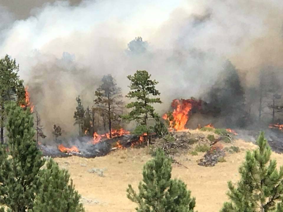
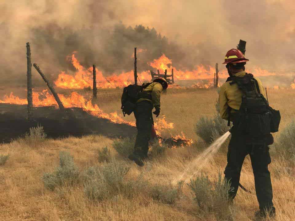
Above: This photo was taken four days ago (July 19, 2017) on the Detwiler Fire off Highway 49 just south of CAL FIRE’s county headquarters in Mariposa. Credit: Randy Johanson, EPN.

(Originally published at 10:10 a.m. PDT July 23, 2017)

On Saturday there was moderate growth on the north and northeast sides of the Detwiler Fire southeast of Coulterville, California. Most of the fire activity was in the northeast one-quarter of the fire.

There has been no change in the reported number of residences destroyed; it remains at 63, but the number of outbuildings increased to 67.

CAL FIRE is saying 76,000 acres have burned.

Evacuation orders for some areas have been lifted; CAL FIRE has the details.

We have not revised the map we published on July 21 because the minor growth of the perimeter would barely be noticeable.
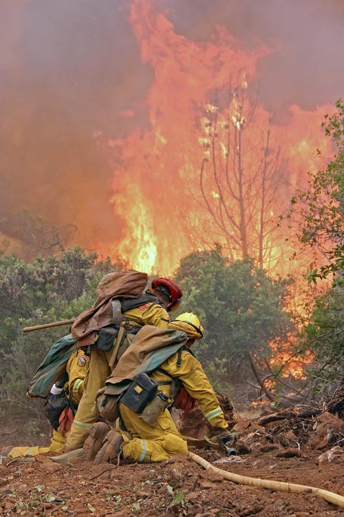
Detwiler Fire
This photo was taken four days ago (July 19, 2017) on the Detwiler Fire off Highway 49 just south of CAL FIRE’s county headquarters in Mariposa. Credit: Randy Johanson, EPN.

It will be hot and dry on the Detwiler Fire Sunday. The forecast for the Coulterville area calls for 101 degrees, 11 percent relative humidity, and winds out of the southwest and west at 6 mph.

Resources assigned to the fire include 501 fire engines, 96 hand crews, 20 helicopters, 88 dozers, and 65 water tenders for a total of 4,756 personnel.

The photos above were from four days ago, but the video below shows much quieter conditions today, Sunday.

All articles about the Detwiler Fire on Wildfire Today can be found here, with the most recent being at the top.

Lodgepole Fire produces large amount of smoke in eastern Montana

Above: Smoke produced by the Lodgepole Complex of fires in Eastern Montana,  July 21, 2017. Click here to see a 5-second animation of the movement of the smoke.

(UPDATED at 5:12 p.m. MDT July 22, 2017)

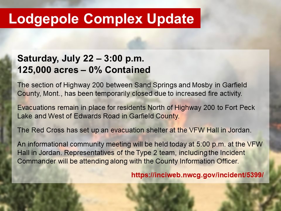
Lodgepole complex fires update

****

(Originally published at 8:58 a.m. MDT July 22, 2017)

The Lodgepole Complex of wildfires in Eastern Montana produced copious quantities of smoke Friday that when mixed with smoke from fires farther west put a haze over areas in Montana, Wyoming, South Dakota, and North Dakota.

(All articles on Wildfire Today about the Lodgepole Fire in Montana are tagged, and can be found at https://wildfiretoday.com/tag/lodgepole-complex/, with the most recent articles at the top.)

The Complex is comprised of four fires in Eastern Montana, according to Inciweb:

  • The Bridge Coulee Fire was discovered Wednesday afternoon, 16 miles north of Mosby, Mont. The fire is estimated at 50,000 acres as of Friday afternoon. This fire has crossed the Musselshell River into Petroleum County.
  • The Barker Fire, 20 miles north of Sand Springs, Mont. is estimated at 12,000 acres as of Friday afternoon.
  • The South Breaks Fire is estimated at 7,000 acres 27 miles northeast of Mosby, Mont.
  • The Square Butte Fire 19 miles north of Sand Springs, Mont., is 808 acres.

Combined, the fires have burned almost 70,000 acres.

Evacuations are taking place.

evacuation notice

The Western Montana Type 2 Incident Management Team will be assuming command of the fires.

Bridge Coulee Fire
Bridge Coulee Fire. Photo by Jonathan Moor July 21, 2017.
Bridge Coulee Fire
Bridge Coulee Fire. Photo by Jonathan Moor July 21, 2017.

Detwiler Fire update, July 22, 2017

(Originally published t 6:40 a.m. PDT July 22, 2017)

The Detwiler Fire in the California Sierra foothills was less active Friday than in previous days but there was growth of the fire on the northeast side 6 miles southeast of Coulterville and also in an area 5 miles south of the community. CAL FIRE is calling it 75,200 acres.

The evacuation order for Mariposa has been lifted but remains in effect for other areas. PG&E has re-energized some of the power lines along Highway 49.

An inversion overnight helped slow the spread of the fire. Friday night a weather station in Mariposa recorded a low of 62 degrees and a relative humidity that reached 65 percent before dawn. But it will be warm and dry on Saturday at Coulterville —  97 degrees, 19 percent RH, with 6 mph winds out of the southwest and west.

Fire officials have almost completed a survey of structures affected by the fire, reporting that 61 residences and 63 “minor structures” have been destroyed and another 13 residences damaged.

All of the articles on Wildfire Today about the Detwiler Fire can be found here.

Red Flag Warnings July 22, 2017

The National Weather Service issued Red Flag Warnings or Fire Weather Watches on Friday for areas in Montana, South Dakota, California, Nevada, and North Dakota.

The Red Flag map was current as of 5:45 a.m. MDT on Saturday. Red Flag Warnings can change throughout the day as the National Weather Service offices around the country update and revise their forecasts.

Services for Trenton Johnson, July 22

A public memorial service to celebrate the life of Trenton M. Johnson will be held in Missoula, Montana Saturday July 22:

3 p.m until 5 p.m.
Fort Missoula Regional Park Bella Vista Pavilion
3501 South Avenue West
Missoula, MT 5980

(This is a change. The gathering at the church earlier in the afternoon is for family and close friends.)

Mr. Johnson was killed July 19 while working on a wildfire in western Montana. He was struck by a falling tree while helping to suppress the Florence Fire, a small fire near Florence Lake on the Lolo National Forest northeast of Seeley Lake.

Below is the link for donations to benefit both the Wildland Firefighter Foundation and the Trenton Johnson Lacrosse Scholarship.

http://bit.ly/2uHnSzr

More information is on a Facebook page established in his honor.