The map above is a forecast for the distribution of smoke from wildfires currently burning in the Southwest United States for 5 p.m. MDT June 16, 2017.
Category: Uncategorized
Cajete Fire west of Los Alamos causes evacuations
The Bonita Fire continues to burn in the Carson National Forest.
Above: Map showing the location of the Cajete Fire in northern New Mexico at 2:04 a.m. MDT June 16, 2017.
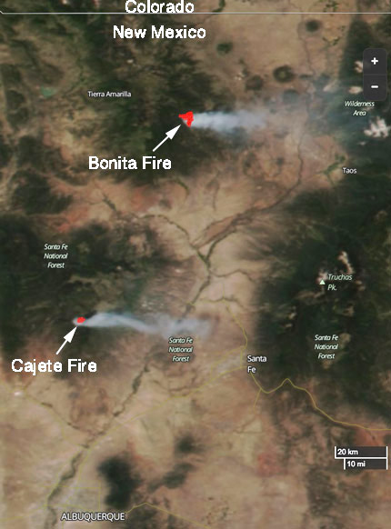
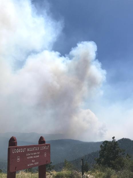
The Cajete Fire in northern New Mexico grew quickly after it was reported on Thursday, burning about 660 acres in the first burning period along the southern boundary of the Valles Caldera National Preserve. The fire has burned on both sides of Highway 4 in the Santa Fe National Forest 7 miles northeast of Jemez Springs and 12 miles west of Los Alamos.
It burned intensely Thursday to the east creating spot fires more than 600 feet ahead of the main fire.
On Thursday approximately 200 people were evacuated from the communities of Los Griegos, Sierra de los Pinos, and the Ruby Holt Plat.
California’s Interagency Incident Management Team #3, a Type 1 team led by Mark von Tillow, was dispatched to the fire Thursday after being staged in Mesa, Arizona. The strategy on the fire is full suppression.

Steve Bassett constructed the map below showing that the Cajeta Fire is partially hemmed in by several large fires that occurred between 2005 and 2016 — the Thompson Ridge, Valle, Big Hat, and Las Conchas Fires. It is possible that if it burns into those fire scars the rate of spread will decrease.
#CajeteFire up to 600 acres (https://t.co/dodQ7HBDE9). This is what 600 acres looks like as a circle centered on the initial point. #nmfire pic.twitter.com/f6YcUpm0vJ
— Steve Bassett (@CartoBassett) June 16, 2017
The Bonita Fire farther to the north in the Carson National Forest has been burning since June 3 and has been very active today and yesterday, spreading across 4,170 acres. It is being managed in both full suppression and confine strategies, depending on the location. It is 4 miles south of highway 64, 9 miles west of Highway 285, and 9 miles southwest of Tres Piedras.
The smoke plume from both the Bonita and Cajeta Fires can be clearly seen in the satellite image above.

Wildfire smoke map, June 14, 2017
Above: Wildfire smoke plumes affected Arizona, New Mexico, Texas, and Oklahoma on June 14. Map from AirNow.
Five fires are burning in the Gila National Forest
Above: A satellite detected smoke from 5 fires in the Gila National Forest in New Mexico on June 14, 2017. The red dots on the map represent heat. The acreages shown were reported within the last 48 hours.
Five wildfires burning in the Gila National Forest in southwest New Mexico are all being managed using a strategy of less than full suppression.
For example, the Round Fire is listed like this:
- Confine (25%)
- Full Suppression (25%)
- Monitor (25%)
- Point Zone Protection (25%)
There are a total of eight large wildfires in New Mexico that are uncontained and are being managed with a less than full suppression strategy. Arizona has 12 large uncontained fires, and 6 are being fully suppressed.
The Southwest Geographic area is in Preparedness Level 4 (5 is the highest possible). The National PL is 2.

NPS official talks about the wildfire that burned into Gatlinburg
Above: Fire Management Officer Greg Salansky points toward the twin peaks (at upper left) where the Chimney Tops 2 Fire burned for five days before it spread into Gatlinburg, Tennessee. Photo by Bill Gabbert.
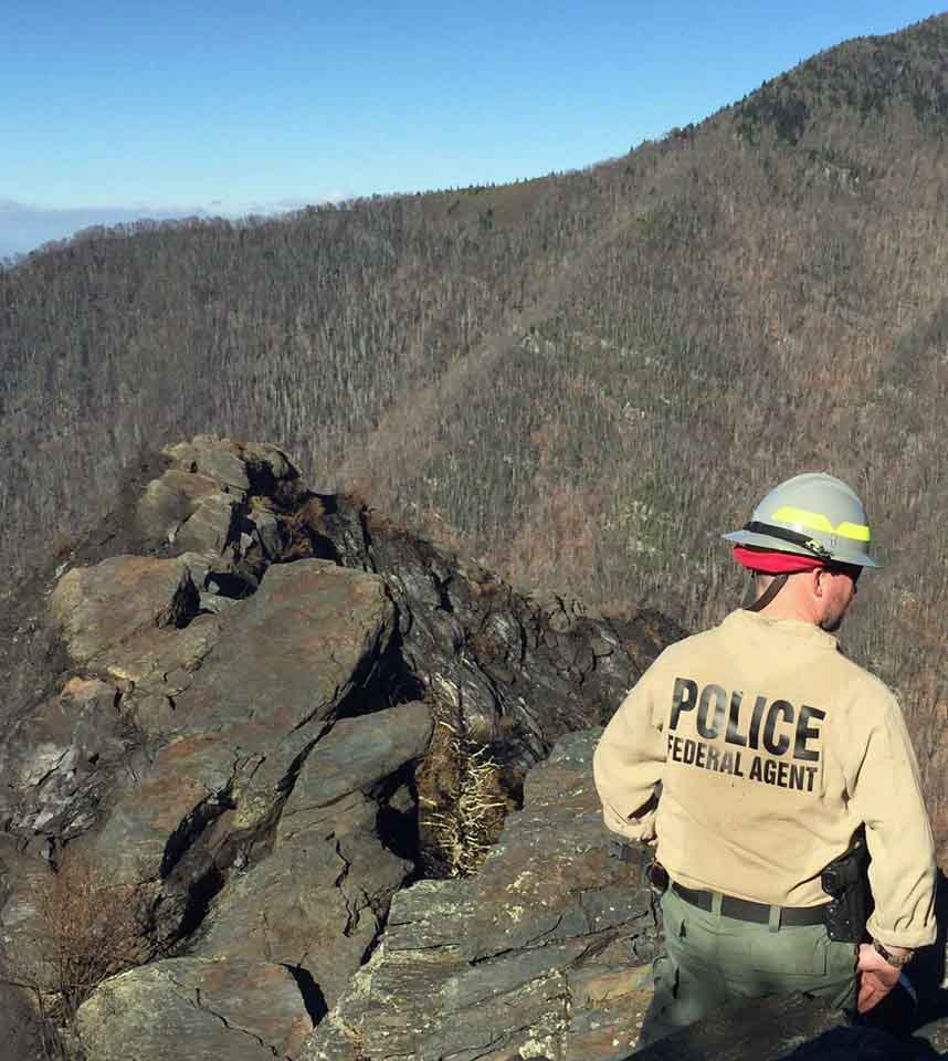
When a group of wildfire professionals visited Great Smoky Mountains National Park on June 7, Fire Management Officer Greg Salansky walked them through the steps he took in evaluating and managing the fire that after six days burned into Gatlinburg, Tennessee killing 14 people, forcing 14,000 to evacuate, destroying or damaging 2,500 structures, and blackening 17,000 acres. In addition to coordinating the wildland fire management activities at that park, Mr. Salansky does the same thing for 20 other National Park Service sites in the Southeast United States
Late in the afternoon on November 23, 2016 firefighters in the Park were responding to a report of a vehicle fire when they spotted a vegetation fire near the top of a steep hill called Chimney Tops. A fire in the same area a week earlier was given the name “Chimney Tops”, so this new fire became “Chimney Tops 2”.
Mr. Salansky and one firefighter hiked up a trail to the fire area but when they got close to the blaze in a very steep area the other firefighter decided that it was unsafe for her to continue so she remained at that location while Mr. Salansky continued. Working his way along a portion of the fire edge he found that the vegetation was very dense making travel through the steep, rocky terrain difficult.

He tried scraping some leaves to begin a fire line, but told the group last week standing in a pull-out on the highway looking up at Chimney Tops, “Well, maybe I can go in on the north side. So I walked that ridge and the smoke laid over about chest high. I’d get in about 20 feet and the wind would let up and the smoke would come up. There was a drop off on both sides. I did that a couple of times before I figured out I shouldn’t even be here. What am I doing here? So I thought I’m done, there’s nothing I can do with it. It’s dark. It’s not safe. So I bailed off and tied in with April who was my safety, since she was smart enough not to go where I went. So we hiked back down. We’ve got a squad coming in the next day, Thanksgiving, welcome to Thanksgiving day.”
The next day, November 24 (day #2), with about six other firefighters he hiked up near the fire that occurred a week before where there is a sign reading, “From this area past it is closed.” Mr. Salansky said. “There’s been one fatality and multiple injuries that cost like $20,000 apiece. So all the folks read that and they’re like, ‘It says it’s closed and dangerous and you want us to go in and fight fire.’ ”
Continue reading “NPS official talks about the wildfire that burned into Gatlinburg”
Report released on dozer burnover in Florida

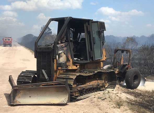
The Florida Forest Service has released a report on the burnover of a dozer that occurred April 16, 2017 in Okeechobee County. As you may remember from our April 17 article, the operator, who was not injured, became entrapped while constructing fire line with the tractor plow and was overrun by the fast-moving fire.
You can read the entire report HERE, but below are some excerpts:
****
Contributing Factors:
- Initial tactics deployed by the first arriving units were based on limited knowledge and experience.
- Incident Commander having minimal initial attack experience.
- Operating equipment beyond its capabilities
- Leaders intent, was not made clear.
- Ineffective transfer of command to experienced leadership positions.
- Loss of situational awareness with crews.
- Lack of effective communication.
- Minimal staffing in Communications Center during high fire danger.
Lessons to Share:
- It is imperative to speak up when you are feeling uneasy, uncomfortable, or unsure.
- Experienced firefighters should be mixed with those who are less experienced. This will necessitate a thorough briefing, ensure instructions are clear and understood and to keep firefighters from working alone when additional units are on scene.
- Personnel accountability is extremely important, especially in complex initial attack circumstances that often require unique tactics and strategies. This helps ensure safety of all crews.
- Operate equipment in appropriate speed settings (1.7-1.9). This will reduce equipment fatigue and failure.
- Turn off air-condition unit if caught in flame front or heavy embers. This will help reduce the likelihood of the filters and cab catching fire.
- Establish properly qualified and experienced leadership.
- Incident Commander should limit his/her hands-on fire suppression activities to maintain effective situational awareness.
- Limit radio traffic to the extent possible. This will improve the possibility that emergency traffic can be transmitted and received successfully.
- Increase staffing in Communications Center on high fire days to help with the additional call volume and radio traffic.
- Know and follow established policy and procedures for emergency radio traffic.
Thanks and a tip of the hat go out to Rob.
Typos or errors, report them HERE.


