West Mims Fire in Georgia sends ash to Jacksonville, Florida

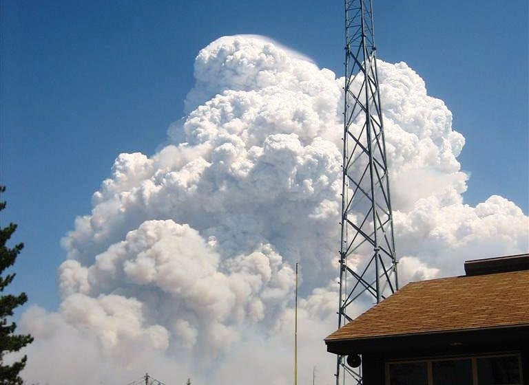
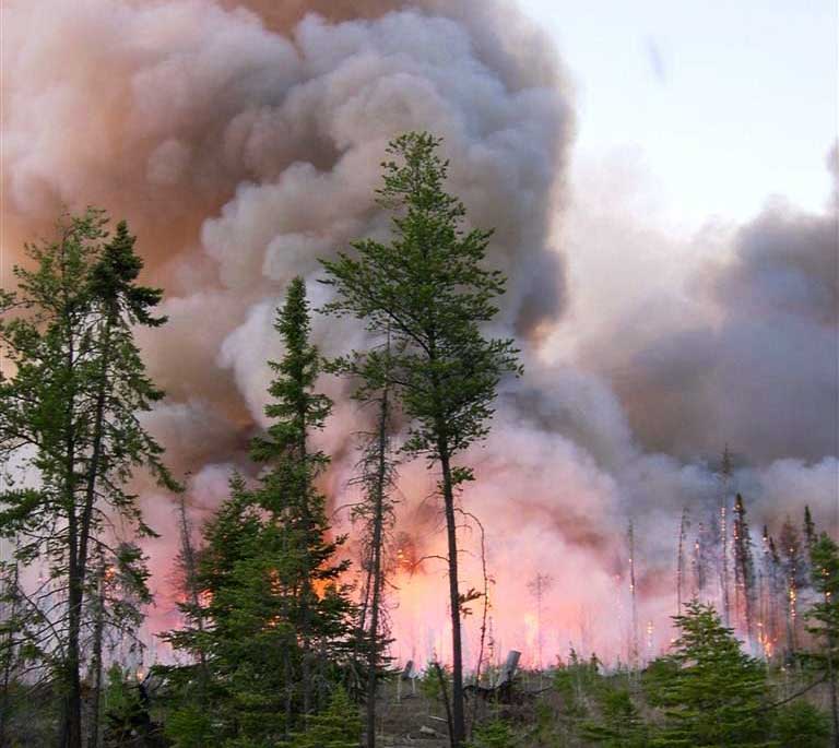
The sprawling West Mims Fire that has been burning since April, largely in a south Georgia swamp, broke containment lines on Saturday and sent ash falling as far away as downtown Jacksonville, Florida. 

The lightning-caused fire was reported on April 6 in the Okefenokee National Wildlife Refuge and has burned more than 135,000 acres. Crews on Saturday dealt with gusty winds and relative humidity levels around 18 percent, which drove the blaze past containment lines and fanned it farther east.

“The fire moved aggressively to the east and southeast against an enhanced air and ground attack today,” officials wrote in a Saturday night InciWeb update. 

The fire and a blanket of falling ash on Saturday unnerved some residents near downtown Jacksonville, the Florida Times-Union reported. 

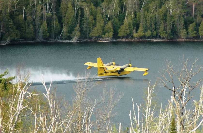
Similar conditions were forecast for Sunday, and evacuation orders remained in place. Additional heavy air tankers were expected to arrive on Sunday from California and Montana to assist the approximately 535 personnel assigned to the incident.

The West Mims Fire remains just 12 percent contained. No injuries have been reported. Full containment isn’t expected until Nov. 1.

Introducing Jason Pohl

Jason PohlToday we’d like to introduce a new member of the Wildfire Today and Fire Aviation team, Jason Pohl. He will be contributing articles beginning May 7 while I am temporarily tied up on a project.

Jason Pohl reports on law enforcement and public safety issues for the Fort Collins Coloradoan newspaper, which is part of the USA TODAY Network. A 2012 graduate of journalism and sociology at Colorado State University, Pohl has reported in Colorado newsrooms including The Denver Post, Greeley Tribune, and, since March 2014, the Coloradoan. Most recently, Pohl — who has been trained as an EMT and wildland firefighter — embedded for two weeks with a team of firefighters and first responders conducting refugee rescues on the Mediterranean Sea, off the coast of Libya. He has also written about wildfire, first responder mental health and other public safety, breaking news and accountability topics.

Pohl in December successfully defended his master’s thesis in sociology at Colorado State University. Through dozens of interviews and extensive fieldwork, Pohl investigated emergency evacuation messaging during natural disasters, specifically the 2013 Colorado Floods that came on the heels of devastating wildfires in the state. Outside of journalism, Pohl is an avid marathon runner who enjoys indulging in a craft beer — or three — and exploring Colorado’s high peaks with his wife and adventure partner.

Adaptive resilience to wildfire

Above: Eiler Fire, northern California, August 6, 2014. Photo by Bill Gabbert.

As the climate shifts and fires become larger, more resistant to control, and occur over longer fire seasons, protecting private property and adapting to a new paradigm can become more challenging.

A recently published paper written by 12 authors has some insights to the issue that are rarely seen. The title is Adapt to more wildfire in western North American forests as climate changes.   The entire 2.7mb paper can be downloaded here.

Below are some excerpts.

****

….In delivering this message, we focus specifically on the distinction between specified, adaptive, and transformative resilience (15, 16). Rigorous definition and critical assessment of resilience to wildfire are needed to develop effective policy and management approaches in the context of climate change. We suggest an approach based on the concept of adaptive resilience, or adjusting to changing fire regimes (e.g., shifts in prevailing fire frequency, severity, and size) to reduce vulnerability and build resilience into social–ecological systems (SESs). Adaptive resilience to wildfire means recognizing the limited impact of past fuels management, acknowledging the important role of wildfire in maintaining many ecosystems and ecosystem services, and embracing new strategies to help human communities live with fire. Our discussion focuses on western North American forests but is relevant to fire-influenced ecosystems across the globe. We emphasize that long-term solutions must integrate relevant natural and social science into policies that successfully foster adaptation to future wildfire.


Fire suppression, in addition to past logging and grazing and invasive species, has led to a build-up of fuels in some ecosystems, increasing their vulnerability to wildfire. For example, drier, historically open coniferous forests in the West (“dry forests”) have experienced gradual fuels build-up in response to decades of fire suppression and other land-use practices (8, 22, 23).

Historically, predominantly frequent, low-severity fires killed smaller, less fire-resistant trees and maintained low-density dry forests of larger, fire-resistant trees. Large, high-severity fires now threaten to convert denser, more structurally homogeneous dry forests to nonforest ecosystems, with attendant loss of ecosystem services (24). However, only forests in the Southwest show a clear trend of increasing fire severity over the last three decades, and only a quarter to a third of the area burned in the western United States experienced high severity during that time (25, 26). Although fuels build-up in dry forests can increase the area burned because of higher contagion, the 462% increase in the frequency of large fires in southwestern forests since the 1970s is also a result of an extension of the fire season by 3.6 mo [the average for the western United States is 2.8 mo (21)]. Overall, dry forests account for about half of the total forest burning in the western United States since 1984.


Management guided by specified resilience often values recent ecological and social dynamics, particularly when the goal is the conservation of particular species or landscapes. Such management is often informed by short temporal windows of HRV, or “recent HRV” (rHRV) (Fig. 3). This approach can be useful for responding to fires in the short term. However, when social and environmental conditions change rapidly, this approach may foster management goals that are unrealistic or unsustainable in the long run (48, 49).


Managing Fuels

Limiting Reliance on Fuels Treatments to Alter Regional Fire Trends. Managing forest fuels is often invoked in policy discussions as a means of minimizing the growing threat of wildfire to ecosystems and WUI communities across the West. However, the effectiveness of this approach at broad scales is limited. Mechanical fuels treatments on US federal lands over the last 15 y (2001–2015) totaled almost 7 million ha (Forests and Rangelands, https://www.forestsandrangelands.gov/), but the annual area burned has continued to set records.

Regionally, the area treated has little relationship to trends in the area burned, which is influenced primarily by patterns of drought and warming (2, 3, 20). Forested areas considerably exceed the area treated, so it is relatively rare that treatments encounter wildfire (73). For example, in agreement with other analyses (74), 10% of the total number of US Forest Service forest fuels treatments completed 2004–2013 in the western United States subsequently burned in the 2005–2014 period (Fig. 6). Therefore, roughly 1% of US Forest Service forest treatments experience wildfire each year, on average.

The effectiveness of forest treatments lasts about 10–20 y (75), suggesting that most treatments have little influence on wildfire. Implementing fuels treatments is challenging and costly (7, 13, 76, 77); funding for US Forest Service hazardous fuels treatments totaled $3.2 billion over the 2006–2015 period (6). Furthermore, forests account for only 40% of the area burned since 1984, with the majority of burning in grasslands and shrublands.

As a consequence of these factors, the prospects for forest fuels treatments to promote adaptive resilience to wildfire at broad scales, by regionally reducing trends in area burned or burn severity, are fairly limited.


Creating Fire-Adapted Communities.

The majority of home building on fire-prone lands occurs in large part because incentives are misaligned, where risks are taken by homeowners and communities but others bear much of the cost if things go wrong. Therefore, getting incentives right is essential, with negative financial consequences for land-management decisions that increase risk and positive financial rewards for decisions that reduce risk. For example, shifting more of the wildfire protection cost and responsibility from federal to state, local, and private jurisdictions would better align wildfire risk with responsibility and provide meaningful incentives to reduce fire hazards and vulnerability before wildfires occur.

Currently, much of the responsibility and financial burden for community protection from wildfire falls on public land-management agencies. This arrangement developed at a time when few residential communities were embedded in fire-prone areas. Land-management agencies cannot continue to protect vulnerable residential communities in a densifying and expanding WUI that faces more wildfire (12).

The US Government Accountability Office questioned the US Forest Service’s prioritizing protection of WUI communities that lie under private and state jurisdictions and has argued for increased financial responsibility for WUI wildfire risk by state and local governments (93). This shift in obligation would enhance adaptive governance and could increase the motivation to pursue adaptive resilience of WUI communities to increasing wildfire (94).


Key aspects of an adaptive resilience approach are:

  1. recognizing that fuels reduction cannot alter regional wildfire trends;
  2. targeting fuels reduction to increase adaptation by some ecosystems and residential communities to more frequent fire;
  3. actively managing more wild and prescribed fires with a range of severities; and
  4. incentivizing and planning residential development to withstand inevitable wildfire.

These strategies represent a shift in policy and management from restoring ecosystems based on historical baselines to adapting to changing fire regimes and from unsustainable defense of the wildland– urban interface to developing fire-adapted communities.


The authors of the paper are: Tania Schoennagel, Jennifer K. Balch, Hannah Brenkert-Smith, Philip E. Dennison, Brian J. Harvey, Meg A. Krawchuk, Nathan Mietkiewiczb, Penelope Morgan, Max A. Moritz, Ray Rasker, Monica G. Turner, and Cathy Whitlock.

Thanks and a tip of the hat go out to Ben.
Typos or errors, report them HERE.

Firefighters faced with wildfire in radioactive area near Fukushima Nuclear Power Plant

Posted on Categories UncategorizedTags ,

Above: wildfire near the Fukushima Nuclear Power Plant. Screengrab from KYODO News video.

Firefighters are struggling to contain a wildfire in an area that is contaminated with radiation near the Fukushima Nuclear Power Plant that melted down after the 2011 earthquake and tsunami off the coast of Japan (map).

The blaze, estimated at about 50 acres, started April 29 near the town of Namie. The video below shows helicopters dropping water on the fire.

10 years ago today: Ham Lake Fire

Ten years ago today an ember blew out of a fire a camper left at Ham Lake in northeast Minnesota and started a blaze that burned 75,000 acres in the Superior National Forest, the Boundary Waters Canoe Area, and Ontario’s Quetico Provincial Park across the Canadian border. A year later Stephen Posniak, the man indicted as being responsible for the fire, died of a self-inflicted gunshot wound at his home. The suicide came a day after a federal magistrate denied motions challenging key aspects of the charges filed.

Below is an article about the fire released by the Minnesota Interagency Fire Center. All of these photos of the Ham Lake Fire are from their archives.

****

Recollections: Tenth anniversary of the Ham Lake Fire

Ten years ago on May 5 Ham Lake residents in northeastern Minnesota watched embers from a small campfire rage into a 75,000-acre inferno destroying structures, costing about $10 million and burning more than 25-square miles. In a recent Minnesota Public Radio interview residents called it the “devil fire” because it blew quickly out of control due to erratic winds and unusual tinder dry conditions. The fire, one of Minnesota’s largest, originated along a 60-mile, two-lane, dead-end road surrounded by the Boundary Canoe Area Wilderness, the Superior National Forest and eventually across the Canadian border.

“We didn’t expect that type of fire activity at that time of year. Often there is still snowpack,” said Tom Lynch, an initial attack responder and 30-year wildland firefighter. “When we got the call most of us were in our civilian clothes. We grabbed what we could and hurried up there,” said Lynch, who recalls prioritizing kayak and canoe removal in the midst of structure protection decisions.

Ham Lake Fire 2007 Minnesota

Strong, ever-changing winds caused rapid, unpredictable growth of the fire. A 30,000-foot smoke plume was visible from hundreds of surrounding cabins, businesses, camps and residences. In the end, about 133 structures, an outfitting business and 61 residences were destroyed. It could have been worse. There were no fatalities.

“The Ham Lake Fire was human-caused and ignited near the Gunflint Trail area of the Superior National Forest,” said Kris Reichenbach, U.S. Forest Service public affairs officer. “The fire spread quickly in areas of extreme fuel loading with dead and downed timber.”

Heavy fuels resulted from a severe 90-mph windstorm in 1999 that downed nearly 500,000 acres of forested land. Seven years later, the lightning-ignited Cavity Lake Fire burned more than 31,500 acres directly west of the 2007 Ham Lake Fire area. A Superior National Forest report indicated that “when the fire reached large prescribed fire treated areas, it was extinguished and became readily suppressed with direct attack. Treatments were concentrated to the west of the Gunflint Trail wildland-urban interface area, resulting in stopping the fire’s progression toward homes.”

Ham Lake Fire 2007 Minnesota

At one time during the weeklong incident, more than 1,000 U.S., Canadian and Minnesota Incident Command System (MNICS) personnel joined forces. The Gunflint Volunteer Fire Department was instrumental in the initial attack phase. Nearly two dozen Minnesota fire departments were involved as unified command came together.

Aside from the magnitude and intensity of the Ham Lake Fire, it became a lessons learned instructional aid. More than 100 homeowners along the Gunflint Trail installed sprinkler systems after the 1999 blow down due to increased fire danger. Estimates are that the sprinklers saved at least 50 structures.

“The big thing that stood out was that it was a super demonstration of proactively planning, preparing and practicing,” said Daria Day, a lead public information officer who was first on the fire. The implementation of those sprinklers saved a lot of structures. It was a very good example of community preparedness and wildfire prevention.”

Ham Lake Fire 2007 Minnesota

The National Monuments being considered for elimination

Above: The Indian Tunnel at Craters of the Moon National Monument. NPS photo.

The Trump administration has narrowed the list of National Monuments being considered for elimination or downsizing to 26 — 22 land areas and 4 marine environments. You would have to assume that they actually want to eliminate them or they would not have put them on the list. But the administration is going through the motions of accepting input from the public before action is taken.

Comments may be submitted online after May 12 at http://www.regulations.gov by entering “DOI-2017-0002” in the Search bar and clicking “Search,” or by mail to Monument Review, MS-1530, U.S. Department of the Interior, 1849 C Street NW, Washington, DC 20240.

DATES: The Department will shortly publish a notice in the Federal Register officially opening the public comment period. Written comments relating to the Bears Ears National Monument must be submitted within 15 days of publication of that notice. Written comments relating to all other designations subject to Executive Order 13792 must be submitted within 60 days of that date.

national monuments hit list national monuments hit list

Giant Sequoia National Monument
Giant Sequoia National Monument. Photo by Jason Hickey.