Progression maps for 5 currently active fires

At least five very large fires are currently active in the United States:

  • Gap in northern California,
  • Pioneer in central Idaho,
  • Maple in Yellowstone National Park,
  • Soberanes on the central coast of California, and,
  • Beaver Creek in northern Colorado and southern Wyoming.

Below we have progression maps of these fires (in that order).

We recently found out about a new website that has developed a very impressive mapping service for wildfires. It was the source of these maps. The site not only shows the locations, but in some cases for large fires it displays the perimeters — which can be animated to see the growth or progression of the fire over time. They have this information going back to 2003. It is on the EcoWest website and was created by a collaboration of the Sea to Snow company and the Bill Lance Center for the American West at Stanford University.

The perimeter data is dependent on what is made available by the agencies managing the fire, so there is not always a perimeter for every day.

You can minimize the Description box by clicking the down arrow at the top-right of the box.

(Update Sept. 22, 2020: the data from EcoWest previously posted below is no longer available.)

Trabuco Fire caused by golfer’s club striking rock

Above: Trabuco Fire, September 6, 2016. Orange County Fire Authority photo.

Investigators with the Orange County Fire Authority have determined that the September 6, 2016 Trabuco Fire started from sparks created when a golf club struck a rock. The fire burned about 20 acres adjacent to the Arroyo Trabuco Golf Club (map) in Mission Viejo in Orange County, California.

From the Orange County Register:

“The golfer had hit the ball into the rough,” Orange County Fire Authority Capt. Larry Kurtz said. “As he was trying to get it out he accidentally hit a rock and it started a fire.”

Kurtz said the golfer was cooperative and tried to put out the sparks but the flames grew fast and “got out of control.”

This is not the first time this has happened. It is at least the third time in Orange County and the second time at Arroyo Trabuco Golf Club.

  • In June, 2011 at the Arroyo Trabuco Golf Club Steve Parsons used a titanium-clad 3-iron to punch his ball out of the rough. The club struck an unexposed rock and seconds later he looked down to see that he was standing in a ring of fire. Mr. Parsons and his golfing partner called 911 and tried putting it out with ice from a cooler and an open beverage, but had no success. Thankfully the fire burned up to a cart path and went out.
  • August, 2010 golfers reported that  a 12-acre fire ignited when a golfer, whose ball was in the rough, struck a rock with his club, causing sparks which started the fire. It took hand crews, helicopters, and 150 firefighters to put out the fire at the Shady Canyon Golf Club in Orange County, California.
  • fire investigator determined that a golf club striking a rock was one of the possible causes for the Poinsettia Fire that burned five homes, 18 apartment units, one commercial building, and 600 acres on May 14, 2014 in Carlsbad, California. The fire started near a cart path on the 7th hole on the Omni La Costa Resort and Spa’s golf course.

In 2014 researchers at the University of California at Irvine studied how golf clubs can cause vegetation fires after two fires in Orange County where golf clubs were suspected as the culprit. Below are excerpts from their report:

Titanium alloy golf clubs can cause dangerous wildfires, according to UC Irvine scientists. When a club coated with the lightweight metal is swung and strikes a rock, it creates sparks that can heat to more than 3,000 degrees Fahrenheit for long enough to ignite dry foliage, according to findings published recently in the peer-reviewed journal Fire and Materials.

The researchers painstakingly re-created in the lab course conditions on the days of the fires. Using high-speed video cameras and powerful scanning electron microscope analysis, they found that when titanium clubs were abraded by striking or grazing hard surfaces, intensely hot sparks flew out of them. In contrast, when standard stainless steel clubs were used, there was no reaction.

“Rocks are often embedded in the ground in these rough areas of dry foliage,” Earthman noted. “When the club strikes a ball, nearby rocks can tear particles of titanium from the sole of the head. Bits of the particle surfaces will react violently with oxygen or nitrogen in the air, and a tremendous amount of heat is produced. The foliage ignites in flames.”

Trabuco fire in Orange Co. Calif. stopped at about 20 acres

(UPDATE September 7, 2016: investigators determined that the fire started from sparks created when a golfer’s club struck a rock.)

Firefighters on the ground and in the air stopped a wildfire in Mission Viejo, California Tuesday afternoon after it burned 20 to 25 acres near the Arroyo Trabuco golf course east of Interstate 5 in Orange County.

Aside from the excellent job by the personnel at the scene, we were interested in this fire because of two photos put on Twitter by Maaike aka Shinobi (@ShinobiHaruka) showing before and after, or, during and after. There is a remarkable change in a short amount of time. The photos are used here with her permission. (We enlarged the flying object and pasted it as an inset.)

Trabuco Fire Trabuco Fire

I think the photos were taken not more than two hours apart.

Firefighters beginning to get a handle on the Gap Fire in northern California

Above: The Gap Fire as seen from the Klamath River. Undated photo from InciWeb.

The Gap Fire has been burning in Seiad Valley 20 miles northwest of Yreka, California for 11 days. It grew quickly during that time to now cover almost 28,000 acres, but firefighters are beginning to get a handle on the blaze. That effort is helped by barriers on at least two sides — the Klamath River on the south, and the two-year old scar from the Beaver Fire.

map Gap Fire California
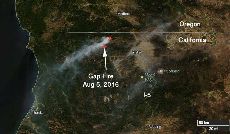
Satellite photo showing smoke from the Gap Fire Sept 5, 2016. NASA image with text by Wildfire Today.

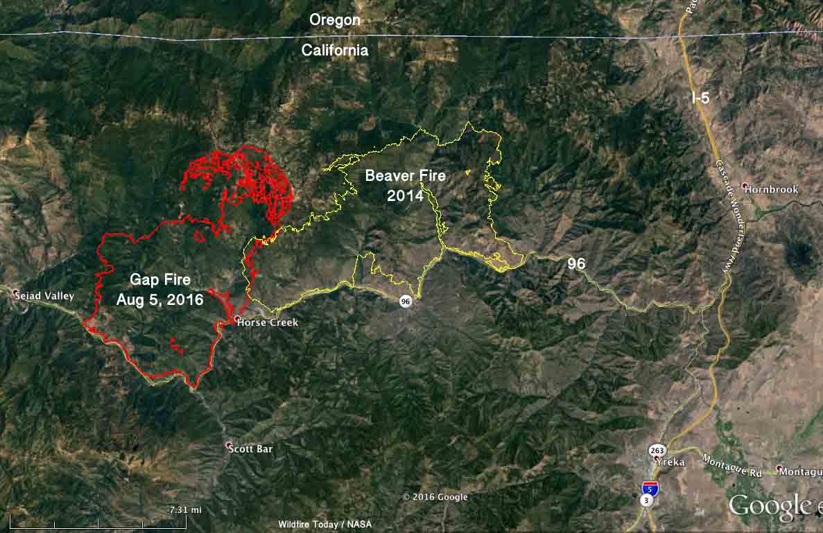
The Gap Fire has burned into the footprint from the Beaver Fire. Burning operations along the river and on the north side are likely to hold those areas. And, the west flank is also looking good.

The photo below was taken August 12, 2014 at the Beaver Fire north of the Klamath River.
Art Prints

Advisory evacuations are in place for some areas along the Klamath River.

On Tuesday firefighters will continue to work on the firing operations on the north and south sides and provide structure protection along the river.

The incident management team reports that two structures were destroyed near Hick’s Gulch on the north side of the Klamath River, but have yet to be assessed on the ground.

map Gap Fire Beaver California
Map of the 2016 Gap Fire at about 11:30 p.m. Sept 5, 2016, and the Beaver Fire of 2014. Click to enlarge.
Gap Fire California
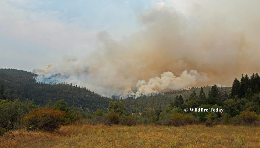
Gap Fire as seen from Highway 96 looking toward Hicks Gulch. Photo by Lisa Cox (undated).
Gap Fire California
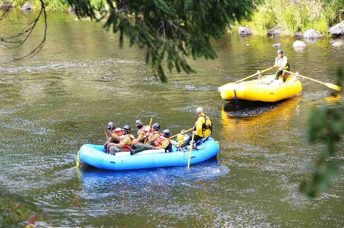
Firefighters on the Gap Fire are taken across the Klamath River by local rafters.
Beaver Fire
This photo was taken near the western edge of the Beaver Fire, August 12, 2014 near the Klamath River. This general area is now the eastern edge of the Gap Fire. Photo by Bill Gabbert.

Yellowstone’s Maple Fire slowed by rain and cool weather

Above: Rainbow over the Maple Fire at 9:50 Monday morning, September 5, 2016, as seen from West Yellowstone, MT. Photo by Ray Mines.

Rain on Sunday and Monday accompanied by cool weather has slowed the spread of the Maple Fire that has come within three miles of West Yellowstone, Montana. Since it started on August 8 it has burned 40,443 acres just north of the west entrance road, Highway 20/191.

The small amount of rain on Sunday was followed by about 0.15″ Monday, as recorded at the weather station east of the fire at Madison Junction.

Ray Mines, who took the photo above from the Incident Command Post at West Yellowstone, said it was 34 degrees Monday morning with a wind chill of 28.

Satellites have not been able to find any large heat sources over the fires in the park for the last couple of days. There are no doubt many small ones that the sensors 200 miles overhead can’t detect. But drier weather later in the week will bring the potential for the fire to become more active.

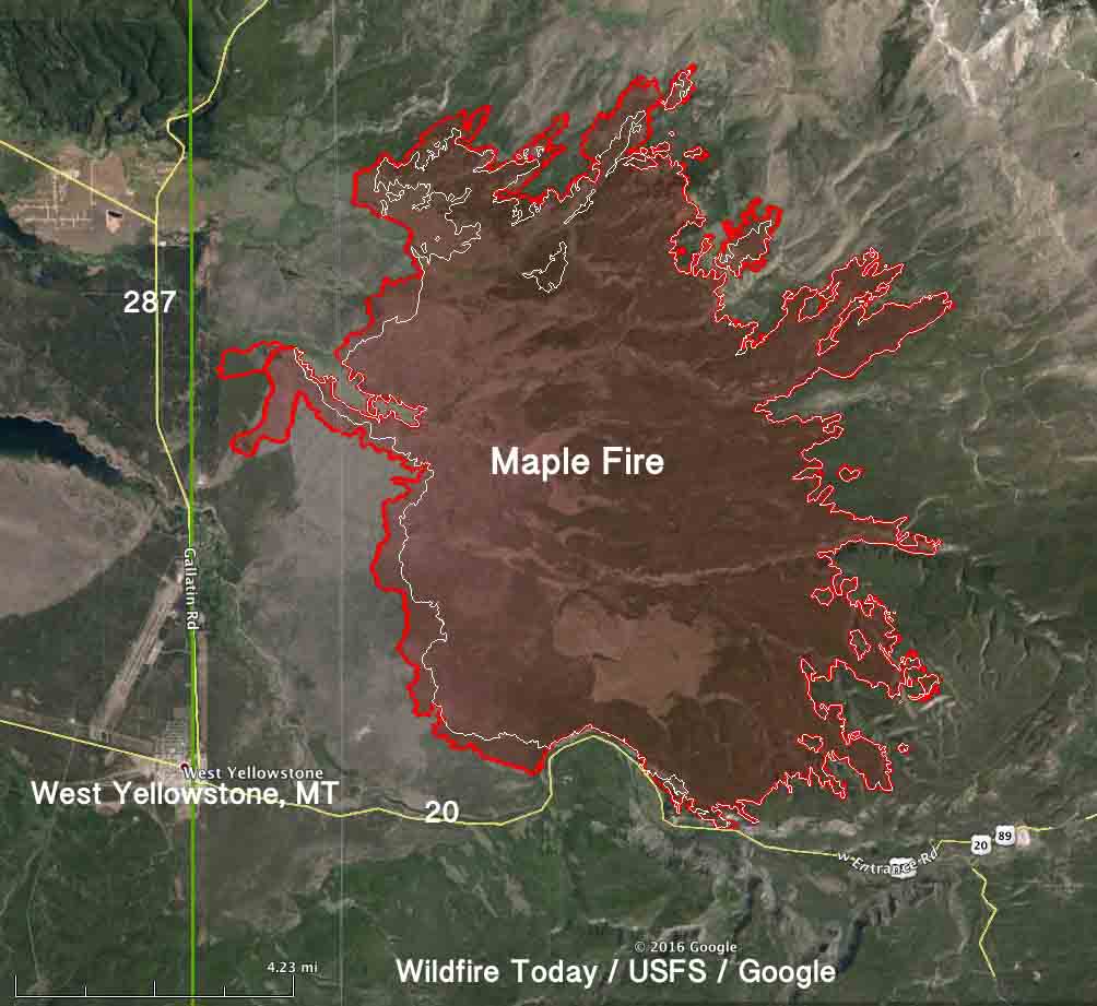
map Maple fire
The red line was the perimeter of the Maple Fire at 9 p.m. MDT Sept 2, 2016. The white line was the perimeter on August 29.

About 200 lightning strikes occurred in the eastern part of Yellowstone Sunday, resulting in at least two new fire starts. The Petrified Fire was near the Petrified Tree west of Tower Junction in a fire suppression zone. Firefighters extinguished the single-tree fire with the help of helicopter water drops. Firefighters are monitoring the one-tenth acre Jasper Fire east of Tower Junction near Specimen Ridge.