Firefighters deploy fire shelters on a wildfire near Bozeman, Montana

Bridger Foothills Fire

September 6, 2020 | 2:03 p.m. MDT
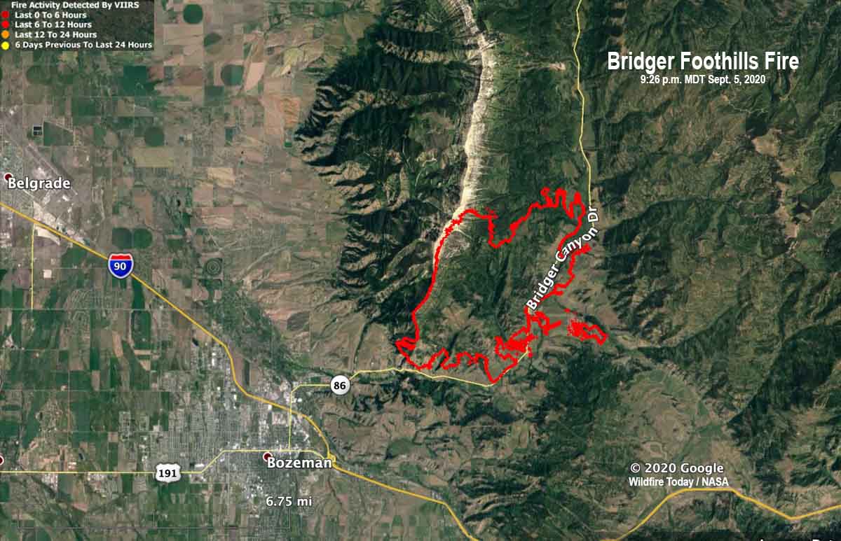
Bridger Foothills Fire map
Bridger Foothills Fire, map current at 9:26 p.m. MDT Sept 5, 2020.

Three firefighters on the Bridger Foothills Fire northeast of Bozeman, Montana were forced to deploy and take refuge in their fire shelters September 5 when their safety became compromised by the proximity of the fire, fire officials said Sunday. After the danger passed they moved to a safety zone and were later treated at Bozeman Health for “smoke inhalation and heat exhaustion” and then released. They are otherwise in good condition and will be rejoining their families as soon as possible.

Fire shelters are small foldable pup tent-like fire resistant devices that a wildland firefighter can unfold and climb into if there is no option for escaping from an approaching inferno. Many firefighters have used the devices successfully, but others have been killed inside them.

The Bridger Foothills Fire is three miles northeast of the intersection of Highway 86 (Bridger Drive) and Interstate 90. Since it was reported September 4 it has burned 7,000 acres, including an unknown number of structures. It exhibited extreme fire behavior Saturday when the passage of a cold front brought sustained winds of 10-20 mph with gusts to 30 mph. A Type 1 Incident Management Team has been ordered.

Resources assigned, according to the incident management team, include 6 helicopters, 4 hand crews, plus engines, smokejumpers, and dozers. Sunday’s National Situation Report said there were a total of 99 personnel assigned (but 23 hand crews, which does not make any sense).

Thanks and a tip of the hat go out to Al.

Valley Fire east of San Diego spreads east across Lyons Valley Road

About 8 miles east of El Cajon

Updated September 7, 2020  |  12:39 p.m. PDT

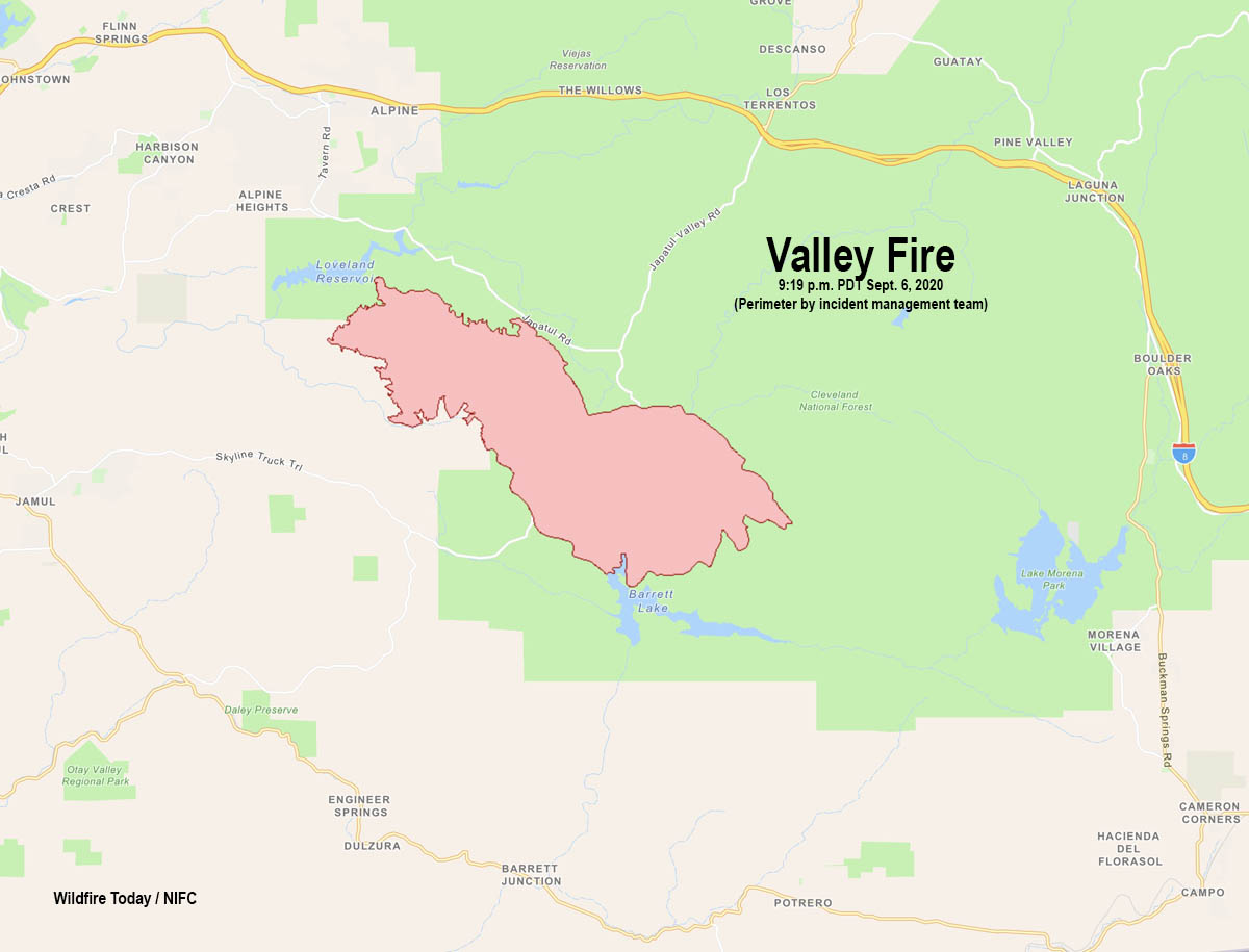
Map of the Valley Fire
Map of the Valley Fire at 9:19 p.m. PDT September 6, 2020. Perimeter provided by the incident management team.

The Valley Fire was very active Sunday especially on the east side where it spread across Lyons Valley Road. At 9:19 p.m. Sunday the head of the fire was four miles east of the road, it had skirted across the north end of Barrett Lake, and was four miles northwest of the dam at Lake Morena. Much of the growth of the blaze was in the Lawson Valley and Carveacre areas.

On Sunday firefighters held the spread to 408 acres, bringing the total to 10,258.  The military has been activated, adding an additional six helicopters to the fire suppression efforts.

The forecasted cooler and lighter winds Monday should provide a slight reduction of fire spread.  However, there are a lot of dead fuels that will continue to be receptive to fire spread. Santa Ana winds are expected to develop Tuesday and continue through Wednesday with gusts over 40 mph.

Evacuations are in effect. San Diego County has more information.


 Updated September 6, 2020  | 6:20 p.m. PDT

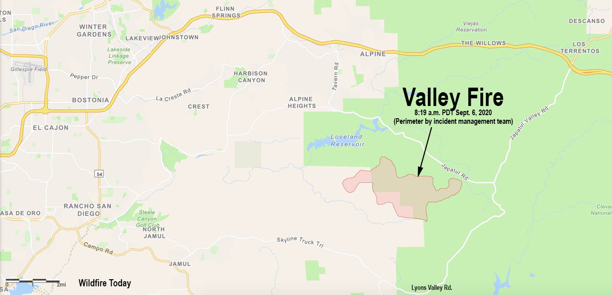
Valley Fire map
Map of the Valley Fire at 8:19 a.m. PDT September 6, 2020. The perimeter was supplied by the incident management team. The fire may have spread significantly on Sunday since it was mapped at 8:10 a.m.

The incident management team reported at 3:48 p.m. that the Valley Fire 8 miles east of El Cajon, California had burned 5,350 acres and was spreading dangerously. Structures are being threatened in the Carveacre, Lawson Valley, Wood Valley, Lyons Valley, and Deer Horn Valley areas.  There is an immediate threat to the Sunrise Power 500 KV power lines supplying a large portion of San Diego County.

There are reports that the fire is moving east or southeast, has crossed Lyons Valley Road, and is approaching Barrett Lake and the nearby Honor Camp. The most accurate fire-mapping satellite confirms this, detecting spot fires very close to the north end of Barrett Lake at 4:20 p.m. Sunday.

Firefighters are working against extreme fire behavior with wind driven runs and long range spotting. 10 Structures have been destroyed. California Incident Command Team 15 transitioned command at 7 a.m. Sunday.

Evacuations are in effect. San Diego County has more information.

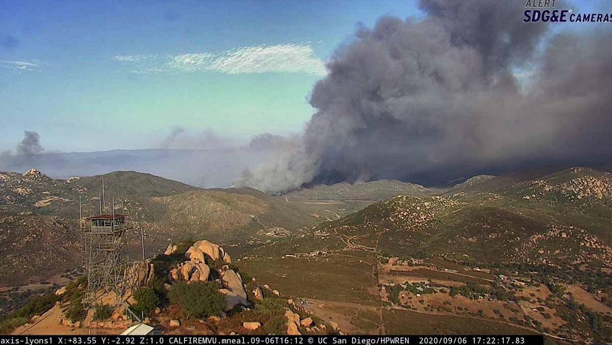
Valley Fire
Valley fire, looking east from Lyons Peak at 5:22 p.m. PDT Sept. 6, 2020.
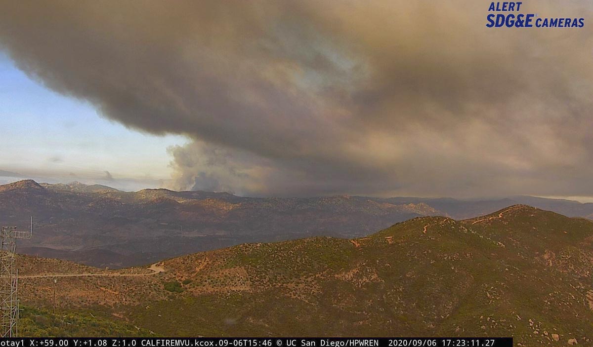
Valley Fire
Valley Fire looking northeast from Otay at 5:23 p.m. PDT Sept. 6, 2020.

Resources assigned include 2 hand crews, 49 fire engines, 4 dozers, 5 water tenders for a total of 355 personnel. In normal times a fire like this would have 15 to 25 hand crews. With only 2 hand crews, firefighters don’t stand much of a chance of stopping the fire unless the weather changes significantly.

Continue reading “Valley Fire east of San Diego spreads east across Lyons Valley Road”

Creek Fire reaches Mammoth Pool Reservoir; military helicopters rescue over 150 people

More than a dozen had critical injuries

Updated September 7, 2020  |  12:41 p.m. PDT

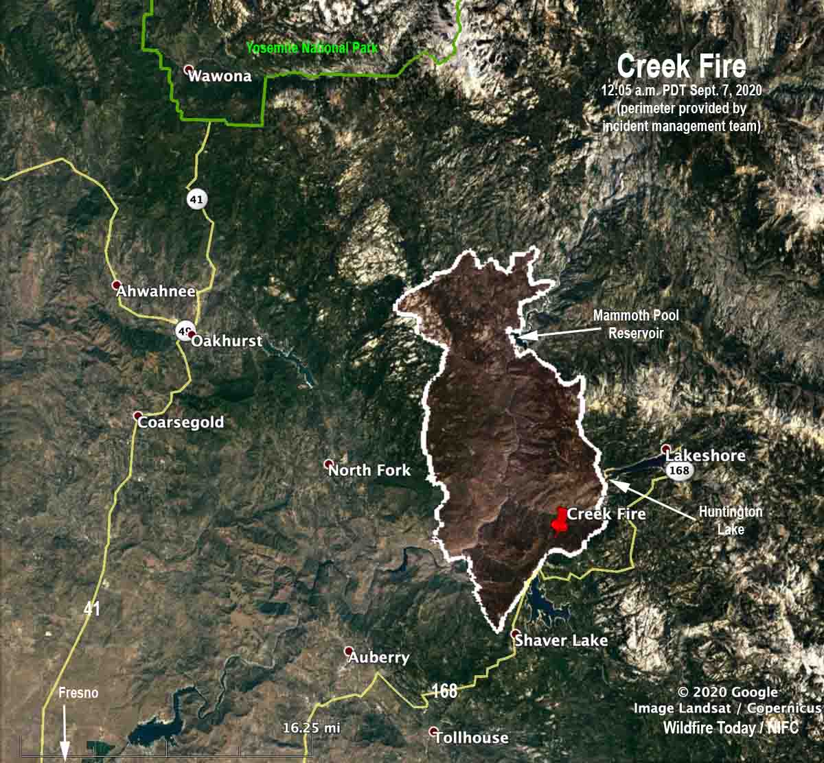
Map of the Creek Fire 12:05 a.m. PDT Sept. 7, 2020
Map of the Creek Fire at 12:05 a.m. PDT Sept. 7, 2020. Perimeter provided by the incident management team.

The Creek Fire Sunday grew in all directions but not as much to the north as might be expected after it ran for over 10 miles in that direction during its first 22 hours. The blaze spread south near the west shore of Shaver Lake but according to mapping at 12:05 a.m. Monday stayed primarily west of Highway 168.

The Incident management team reported at 10:47 a.m. Monday the fire had  burned 78,790 acres.


August 6, 2020  |  4:54 p.m. PDT

Map of the Creek Fire
Map of the Creek Fire at 8:38 a.m. PDT August 6, 2020. The perimeter was supplied by the incident management team.

The perimeter of the Creek Fire on the map above was supplied by the incident management team and is much more accurate than data from satellites. The Forest Service reports it has burned 45,500 acres.

Early Saturday afternoon the fire crossed the San Joaquin River and made a run north to the Mammoth Pool area and beyond. Members of the public sheltered in place near Wagner’s Store and Campground and Mammoth Pool Reservoir. Using helicopters, the California Army National Guard safely evacuated 207 people that were trapped by the fire.

The fire burned actively overnight Saturday and into Sunday morning. Firefighters were challenged Sunday by steep rugged terrain, heavy fuel loading, and high temperatures. Additional resources have been ordered including a Type 1 Incident Management Team. Evacuations and closures remain in effect.

Continue reading “Creek Fire reaches Mammoth Pool Reservoir; military helicopters rescue over 150 people”

Creek Fire grows rapidly near Huntington Lake, California

Burns 36,000 acres in 22 hours

Updated September 5, 2020 | 6:42 p.m. PDT

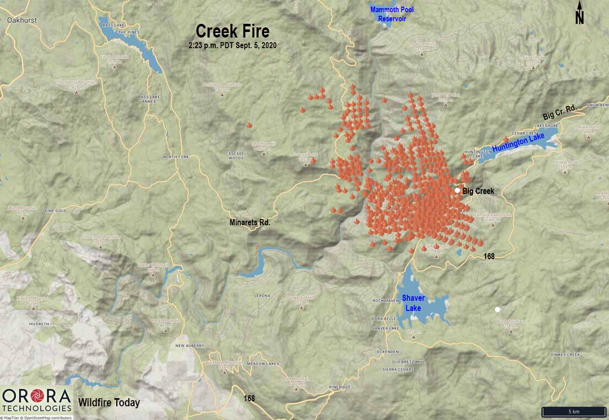
map Creek Fire California Huntington Lake
Map showing heat detected on the Creek Fire by satellites as late as 2:23 p.m. PDT September 5, 2020.

The Creek Fire that has only been burning for about 24 hours in central California is showing explosive growth. The massive multi-layered convection column topped by pyrocumulus is extremely impressive.

(To see all articles on Wildfire Today about the Creek Fire, including the most recent, click HERE.)

The fire is on the Sierra National Forest near the community of Big Creek between Huntington Lake and Shaver Lake, 33 air miles northeast of Fresno.

Creek Fire
Creek Fire September 5, 2020. IMT photo.

At 4 p.m. Saturday afternoon the U.S. Forest Service reported it had burned 36,000 acres and 3,000 structures were threatened — 22 hours after the fire was first reported.

The fire has reached Mammoth Pool Reservoir, 7 miles north of Huntington Lake. People were trapped there with the road blocked by the fire. Click on the photo on the right below.

The smoke has been spreading rapidly north-northwest toward Lake Tahoe.

In the satellite photo taken at 5:21 p.m. PDT the smoke has reached a high enough altitude to clearly show a shadow on the east side.

Satellite photo showing smoke from fires in California
Satellite photo showing smoke from fires in California at 6:01 p.m. PDT Sept 5, 2020. NASA/Wildfire Today.

Firefighters at the scene are challenged by steep rugged terrain, heavy fuel loading, and high temperatures. Additional resources have been ordered including a Type 1 Incident Management Team. Evacuations and closures are in effect.

Creek Fire
The Creek Fire as seen from MeadowLakes, looking northeast at 5:11 p.m. PDT Sept 5, 2020.

West side of the Dolan Fire along California coast is mostly contained

Dolan Fire
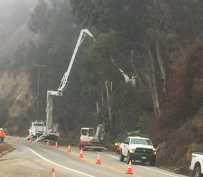
CALTRANS contractors on the Dolan Fire work to make Highway 1 safe for drivers. InciWeb.

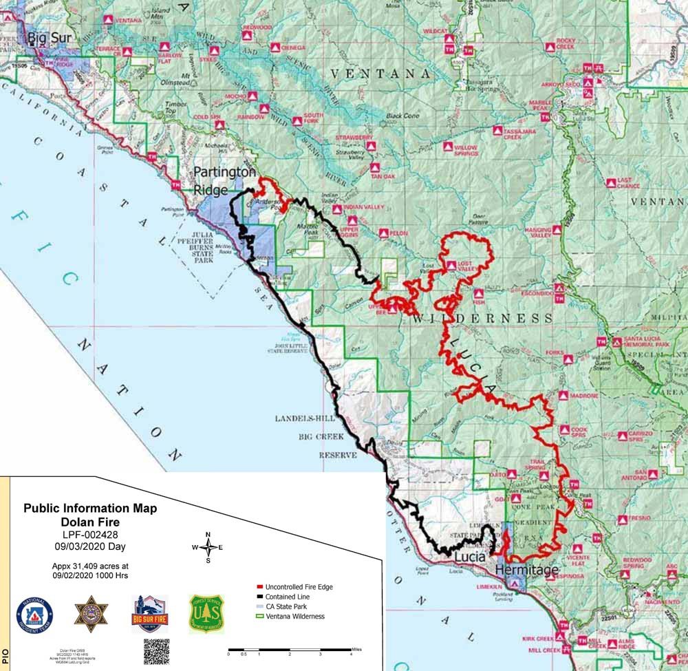
Firefighters have almost half of the 31,409-acre Dolan Fire south of Big Sur contained. The fire’s spread on the western side is stopped, aided by Highway 1, the beach, and the Pacific Ocean, but there is much work left to do on the east side some of which is in very rough terrain.

Below is an update from the Incident Management Team Thursday morning:

“The Pacific Northwest 2 Incident Management Team assumed command of the Dolan Fire this morning following a successful transition with California Incident Management Team 2. Thank you to Incident Commander Mike Minton and his entire team for their expert management and work to date.

“The marine inversion layer kept fire activity minimal overnight, active fire in the east and south ends especially around Cone Peak. Although limited fire spread has occurred over the last few days, the excessive heat watch forecast for this weekend is expected to increase fire behavior. Firefighters continue to bolster containment lines in the northern and southern perimeters, mopping up and increasing the line depth along McWay Ridge and within the Lucia and Hermitage areas. Crews continue to work on the primary containment line north of the Naciemento-Ferguson Road and along the road to Cone Peak. This indirect line will serve as the primary containment line to keep the fire from spreading to the south toward nearby structures. Dozers, hand crews and masticators are also working on additional contingency lines farther south. Overnight crews continued improving lines and patrolling Highway 1 for roll outs and increased fire behavior. Crews began building direct line in the eastern edge of the fire within the Ventana Wilderness yesterday.

“Firefighters continue with structure protection all along Highway 1, in the Partington area north, and in the Lucia and Hermitage areas to the south. Currently on the fire there are: 5 Type 1 Hotshot crews, 8 Type 2 hand crews, 60 engines, 10 dozers, 10 helicopters, 8 water tenders, 2 masticators, and a variety of other equipment to support firefighting efforts.”

Dolan Fire September 2, 2020
Dolan Fire as seen from Plasket Road September 2, 2020. Credit: Scott Babinowich?
Dolan Fire map
Dolan Fire map, September 2, 2020.

August Complex of fires in northern California grows to nearly a quarter million acres

September 1, 2020 | 3:11 p.m. PDT

Map of the August Complex of fires
Map of the August Complex of fires in northern California, 11:45 p.m. PDT August 31, 2020.

The massive August Complex of fires in northern California will soon exceed a quarter million acres. The Forest Service reported Tuesday morning the combined size of the fires had blackened 242,941 acres. Most of the completed fire line is on the east side, outside the Mendocino National Forest boundary, but there is also completed line on much of the south side of the Doe and Hull Fires.

The fires are southwest of Red Bluff and west of Corning, Orland, and Willows.

On Monday two large fires within the complex, the Glad and Tatham Fires, burned into and merged with the largest fire, the Doe Fire.

A firefighter was killed in a vehicle accident on the fire Monday, August 31.

There were strong northeast winds on the Complex in the middle of the day Monday which increased fire activity in the area. There is a potential for the same weather and fire behavior Tuesday.

The number of resources assigned to the fire include 11 hand crews, 3 camp crews, 7 helicopters, 51 engines, 18 dozers, 25 water tenders, and 3 masticators for a total of 690 personnel. Considering the size, those numbers are not large.

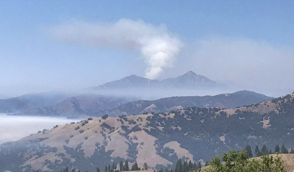
August Complex of fires, August 18, 2020
August Complex of fires, August 18, 2020. InciWeb.