Firefighter killed while working on northern California wildfire

September 1, 2020 | 3:09 p.m. PDT

Diana Jones Cresson Volunteer Fire Department, Texas
Diana Jones (Photo credit, Cresson Volunteer Fire Department)

A firefighter-EMT from Texas died in a vehicle accident Monday August 31 while working on a wildfire in northern California.

Fox4 News reported  the deceased was “…Diana Jones, a firefighter and EMT with the Cresson Volunteer Fire Department, about 25 miles southwest of Fort Worth. Her son was also a member of the department. Each summer, they would work with a company that contracts with the federal government to respond to wildfires in western states.”

A statement from the Mendocino National Forest said two additional firefighters were involved in the accident; one is receiving medical attention for burns to their hand and arm, while the third received no injuries.

The Press Democrat reported that Ms. Jones was widowed and lived in Cresson, Texas. She had been with the Cresson Volunteer Fire Department about five years.

KQED reported Cresson Fire Chief Ron Becker said Tuesday the community was stunned by news of Ms. Jones’ death.

“We’re all numb. We’re shell-shocked. She’ll be sorely missed,” Becker said.

The firefighters were working on the Tatham Fire, part of the August Complex of fires southwest of Red Bluff, when the vehicle accident occurred.

The Cresson Volunteer Fire Department wrote on their Facebook page, “Our department is numbed by the news and we are hurting.”

“This was a tragic incident and our hearts go out to the family, friends, and colleagues of the fallen firefighter,” said Acting Forest Supervisor Sandra Moore. “Right now we are committed to providing support to those involved, while safely continuing firefighting operations.”

California Highway Patrol is currently leading the investigation. Forest Service officials, Federal Southern Area Blue Team Incident Management, and CAL FIRE Incident Management Team 4 are working to support the families, who have been notified.

The August Complex of fires has burned nearly a quarter million acres, 242,941, the Forest Service said Monday morning.

Map of the August Complex of fires
Map of the August Complex of fires in northern California, 11:45 p.m. PDT August 31, 2020.

Our sincere condolences go out to Ms. Jones’ family, friends, and co-workers.

Thanks and a tip of the hat go out to Tom.

Two fires erupt in South Dakota and Nebraska

Posted on Categories WildfireTags ,

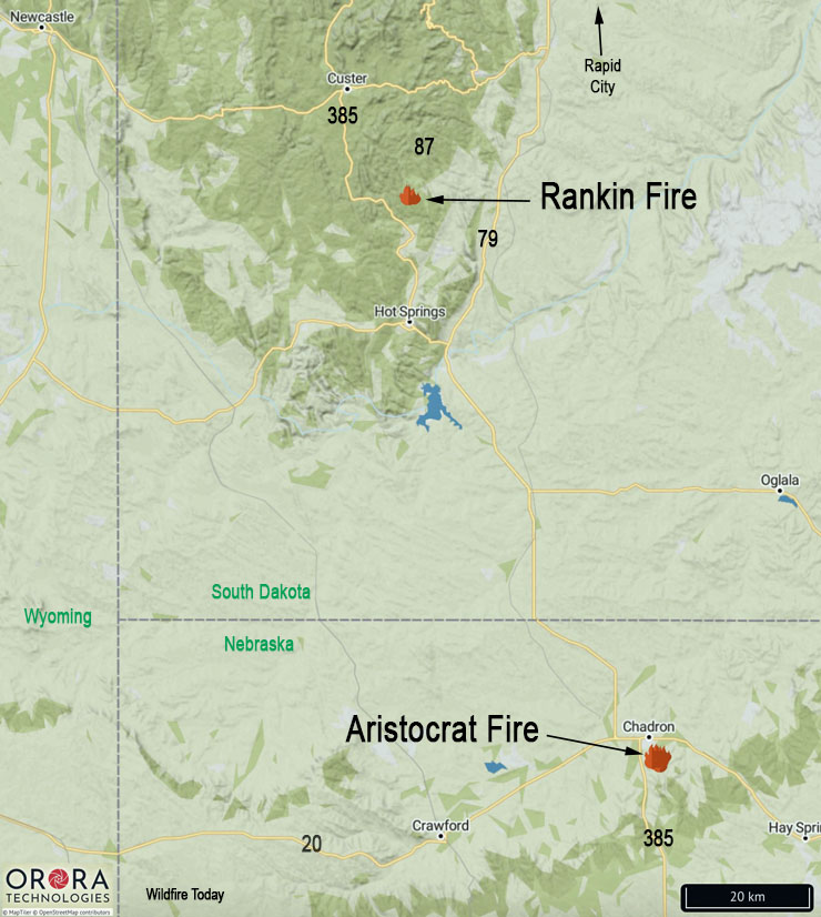
North of Hot Springs, SD and south of Chadron, NE

Black Hills Fires August 28, 2020
Map showing the locations of fires in Nebraska and South Dakota, August 28, 2020.

On Friday firefighters were attacking two new fires in South Dakota and Nebraska.

The Aristocrat Fire is in northwest Nebraska near Chadron three miles southeast of the intersection of highways 385 and 20. Spokesperson for the U.S. Forest Service Tom Buskirk said at 6:30 p.m. MDT Friday it had burned approximately 200 acres and the spread had been mostly stopped. A variety of federal, state, and local fire agencies are working on the blaze. Mr. Buskirk said a large air tanker and a single engine air tanker had assisted firefighters in the afternoon.

At Wildfire Today we noted that Friday at 2:18 a.m. MDT a satellite detected heat in the area of the Aristocrat Fire.

The Rankin Fire in southwest South Dakota is north of Hot Springs in Wind Cave National Park two miles north of the intersection of highways 87 and 385. The lightning-caused fire is east of highway 87 and 1.5 miles south of Rankin Ridge lookout tower. At 6:30 p.m. MDT Friday the 20-acre fire was burning in an area that has been treated with prescribed fires. It is being attacked by engine crews, a  Type 2 hand crew from Oregon, and a wildland fire module from New Jersey. Three single engine air tankers and a Type 3 helicopter are also assisting firefighters.

Engine crew on Cameron Peak Fire tests positive for COVID-19

Beginning next week at the fire west of Fort Collins, Colorado, personnel will be tested as they are demobilized if they request it

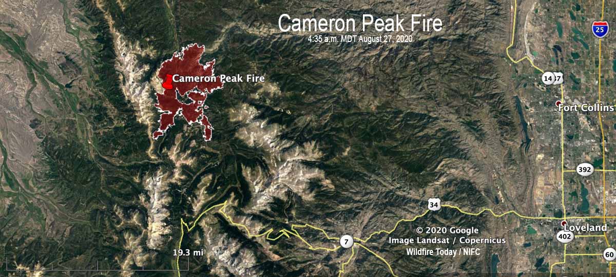
Cameron Peak Fire map
Map of the Cameron Peak Fire at 4:35 a.m. MDT August 27, 2020.

Three engine crew members working the night shift on the Cameron Peak Fire 32 miles west of Fort Collins, Colorado tested positive earlier this week for COVID-19. Five others at the 22,845-acre fire were considered exposed, so all eight were quarantined.

“It was three people off of one engine,” that tested positive, said Kevin Ratzmann the Medical Unit Leader for the fire. “One individual [initially] tested positive for COVID August 24. He started having a little shortness of breath so he was tested at the local hospital.”

The other two members of the engine crew also tested positive.

To see all articles on Wildfire Today about the Cameron Peak Fire, including the most recent, click here.

Before the first person who tested positive received his results, he came back to the fire camp and potentially exposed others, so five more people were put on precautionary quarantine. Local public health personnel determined that those five individuals were exposed within six feet for 15 minutes or longer, so they were quarantined out of an abundance of caution, explained Mr. Ratzmann. “Not one of [those five] have any symptoms,” he said. “They were all tested today [August 28]. We are waiting on the results and will test them again in three days and if they are all clear they will return to work.”

The person on the engine crew that reported symptoms claimed a medical exemption for wearing a mask, but the incident management team is now requiring everyone to wear a mask except when they are actually fighting fire on the fire line.

Many of the activities normally located at the incident command post have been converted to virtual systems or using QR codes, including check-in, demobilization, and meetings.

After contact tracing was completed, no personnel at the fire other than the eight that were isolated or quarantined were tested for COVID-19. However, the incident management team is offering voluntary COVID testing to others on the fire. Mr. Ratzmann said it was mostly because their home unit wanted the testing, not because they have symptoms. He said it took about two days to receive test results on the Pine Gulch Fire, another blaze in Colorado where he was assigned earlier, as the incident management team was tested when they demobilized.

Mr. Ratzmann said that starting early next week anyone at the Cameron Peak Fire who is being demobilized will be tested once if they request it. The national situation report shows 730 personnel assigned to the fire.

There are 38 people working in the Medical Unit at the incident command post, including personnel on the 5 ambulances. That is a larger staff for a Medical Unit on a 730-person fire than in the pre-COVID era.

The Cameron Peak fire has been less active in the last couple of days. Satellites orbiting more than 200 miles overhead have not been able to pick up very many large heat sources. However, there are undoubtably numerous areas on the fire that are still burning and where much still needs to be accomplished by firefighters. Most of the areas detected by satellites were on the northeast side, four to five miles northeast of Chambers Lake.

Pine Gulch Fire could become largest in Colorado history

Pine Gulch Fire Colorado
Pine Gulch Fire August 21, 2020. InciWeb.

If the Pine Gulch Fire 12 miles north of Grand Junction, Colorado continues growing at the pace it has shown for the last couple of days, it will soon become the largest fire in the state’s recorded history, surpassing the Hayman Fire that burned 137,760 acres in 2002. On Wednesday the Pine Gulch Fire was 135,920 acres, an increase of 1,795 in the previous 24 hours.

The area was under a flash flood watch Wednesday afternoon for heavy rain from thunderstorms that could lead to flooding and debris flows.

In the last week the only large heat sources that satellites could detect were on the northwest edge where it has been spreading recently and in the interior. There are undoubtably many smaller hot areas still burning or smoldering that the satellites orbiting over 200 miles overhead could not detect.

map Pine Gulch Fire Colorado August 26, 2020
The red line was the perimeter of the Pine Gulch Fire at 12:09 p.m. MDT August 26, 2020. The white line was the perimeter two days before.
Pine Gulch Fire Colorado
Pine Gulch Fire August 21, 2020. InciWeb.
Pine Gulch Fire Colorado
Pine Gulch Fire August 21, 2020. InciWeb.
Pine Gulch Fire Colorado
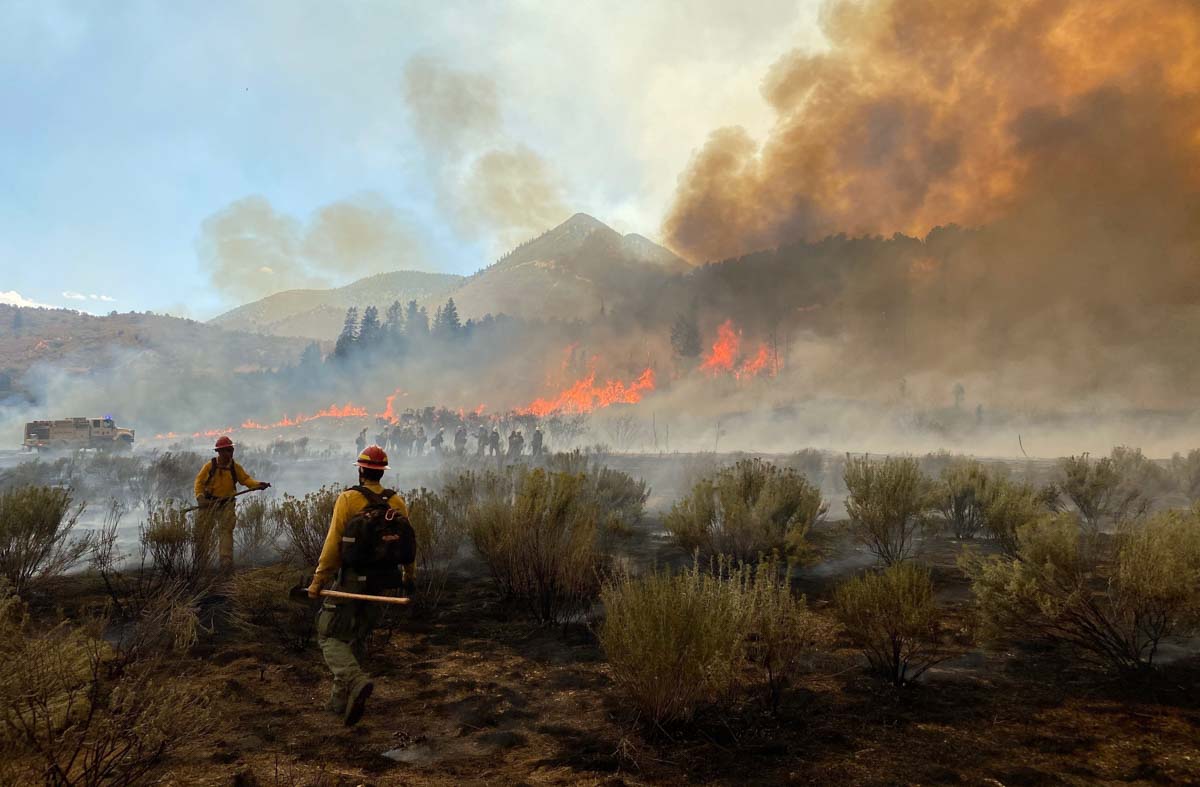
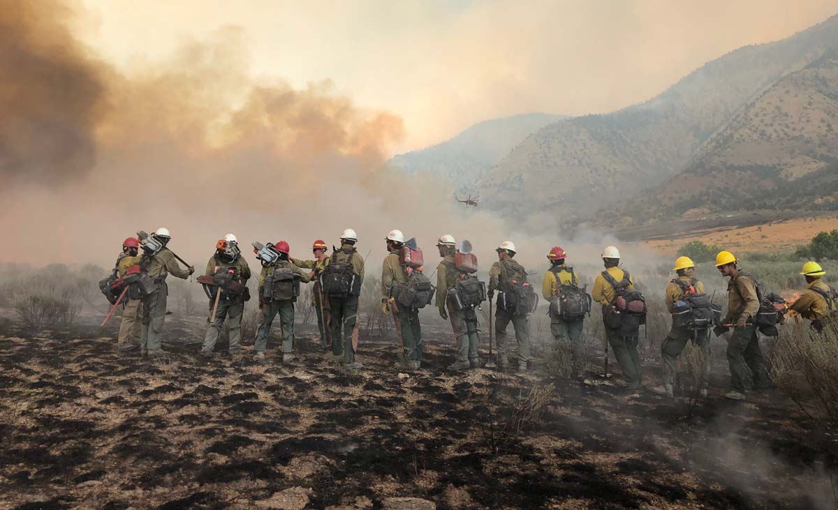
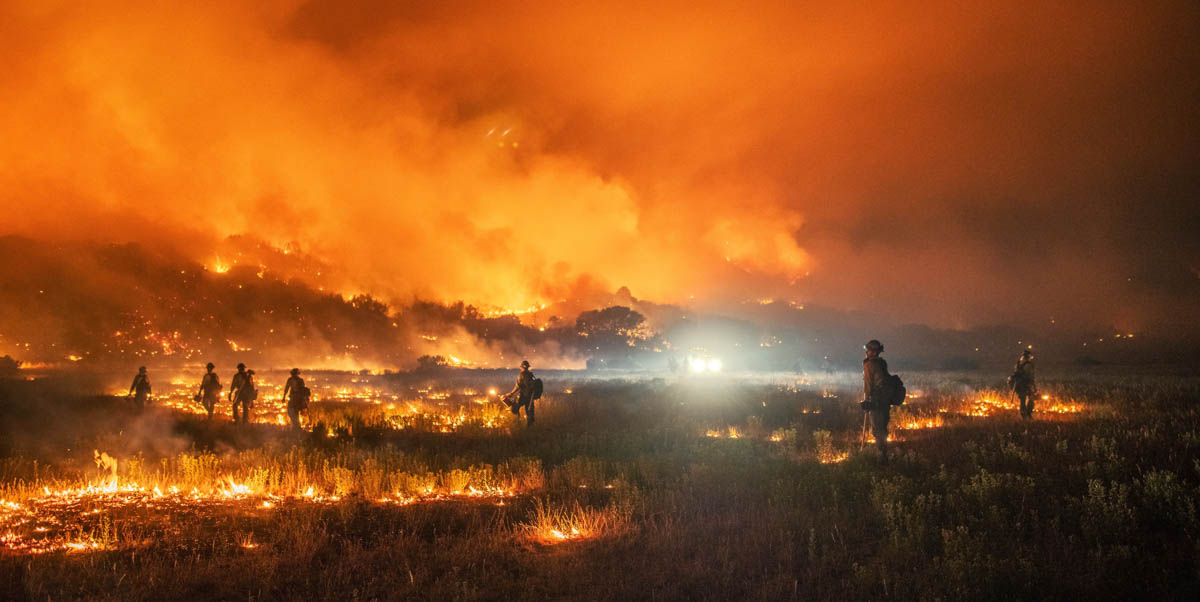
Firefighters on Pine Gulch Fire during night shift, August 17, 2020. InciWeb.
Pine Gulch Fire Colorado single engine air tanker
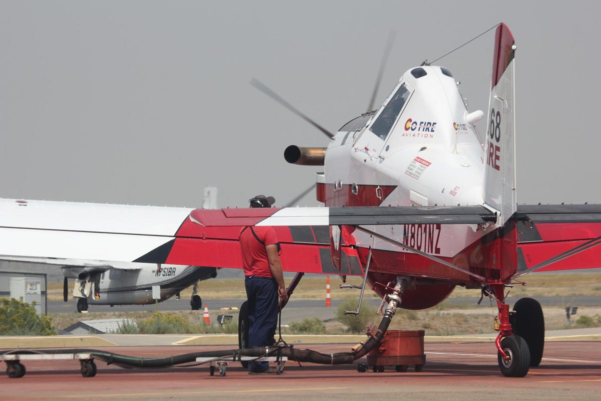
Single engine air tanker reloading while working the Pine Gulch Fire August 24, 2020, InciWeb.

Over 15,000 personnel are battling California fires

Cooler weather has slowed some fires, but the August Complex grew by over 16,000 acres Tuesday

Updated August 26, 2020 | 11:38 a.m. PDT

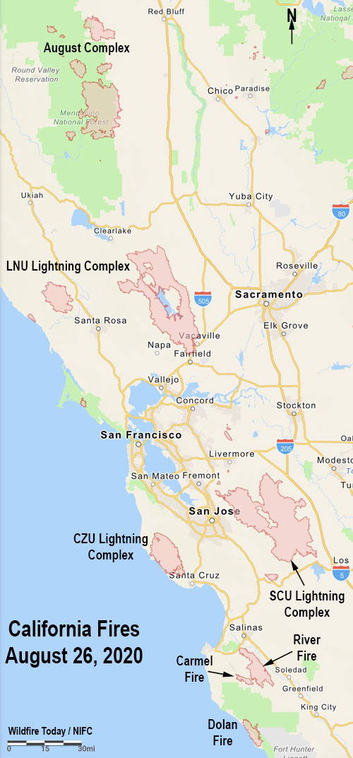
California Fires August 26, 2020
California Fires August 26, 2020.

The  growth of the big complexes of fires in California, LNU, CZU, and SCU, has slowed in recent days, but the LNU and SCU Lightning Complexes still gained 4,509 and 5,717 acres respectively in the last 24 hours. The August Complex southwest of Red Bluff increased by 16,097 acres.

(To see all articles on Wildfire Today about the lightning fires in California, including the most recent, click HERE.)

The blazes have charred more than 1.32 million acres, killed seven people, and destroyed nearly 2,000 structures. The fires are being fought by 280 hand crews, 2,400 fire engines, 300 dozers, and 370 water tenders for a total of 15,000 personnel.

In addition to the National Multi-Agency Coordinating Group working on a request for firefighting assistance from Australia and Canada, California activated the National Guard for help containing the blazes. On August 23 CAL FIRE issued equipment to 270 soldiers as they were beginning basic fire training at Camp Roberts. Another group of 300 soldiers will arrive next week for training. CAL FIRE will embed with each 20-person crew a Captain and two firefighters for supervision.

Below are updates on some of the largest incidents in California, with data from CAL FIRE and the U.S. Forest Service.

LNU Lightning Complex

  • Updated August 26, 2020 at 1:13 p.m. PDT
  • Location: North Bay
  • Counties: Napa, Lake, Yolo, Solano, Sonoma
  • Administrative Unit: CAL FIRE Sonoma-Lake-Napa
  • Acres: 357,046. The largest fire in the complex is the Hennessey Fire, 299,763 . The Walbridge Fire west of Healdsburg is 54,923, and the Meyers Fire on the coast north of Jenner is 2,360.
  • Structures destroyed: 978
  • Personnel assigned: 2,207
  • Evacuation information:  CAL FIRE LNU Twitter page
  • Notes: Fires that merged to become the Hennessey Fire include Gamble, Green, Spanish, 5-10, Morgan, and Markley Fires.

SCU Lightning Complex

  • Updated August 26, 2020 at 1:13 p.m. PDT
  • Location: South Bay
  • Counties: Santa Clara, Alameda, Stanislaus, Contra Costa, San Joaquin
  • Administrative Unit: CAL FIRE Santa Clara
  • Acres: 365,772
  • Structures destroyed: 31
  • Personnel assigned: 1,655
  • Evacuation information:  CAL FIRE SCU Twitter page
  • Notes: Fire activity has lessened due to favorable weather conditions and increased humidity across the complex. Deep seated heat still remains in the bottom of the steep, inaccessible drainages. During the evening fire crews held existing control line around the fire perimeter continuing to both reinforce and add new containment lines. When weather and conditions are favorable there will be a controlled burn operation inside the control line. This controlled burn will widen the buffer and consume fuel between the edge of the fire and the control line.

CZU August Lightning

  • Updated August 26, 2020 at 1:13 p.m. PDT
  • Location: South Bay
  • Counties: San Mateo, Santa Cruz
  • Administrative Unit: CAL FIRE San Mateo-Santa Cruz
  • Acres: 79,640
  • Structures destroyed: 443
  • Personnel assigned: 1,697
  • Evacuation information: CAL FIRE CZU Twitter page
  • Notes: It is burning in Southern San Mateo County and Northern Santa Cruz County actively above the marine layer in the heavy timber and thick undergrowth.  Approximately 77,000 people have been evacuated.

River and Carmel Fires

  • Updated August 26, 2020 at 1:13 p.m. PDT
  • Location: Five miles south of Salinas, near Pine Canyon Rd. and River Rd.
  • Counties: Monterey
  • Administrative Unit: CAL FIRE San Benito-Monterey
  • Acres: 48,424
  • Structures destroyed: 30
  • Personnel assigned: 1,183
  • Evacuation information: CAL FIRE San Benito-Monterey Twitter page, and see maps produced by Monterey County here.
  • Notes: Firefighters patrolling the fire Tuesday confirmed that the fire remained within containment lines. The onshore winds from the northwest allowed the fire to travel very slowly to the south with in containment lines.The Carmel Fire 2 miles southwest of the River Fire has burned 6,901 acres and destroyed 37 structures.

Dolan Fire

  • Updated August 26, 2020 at 1:13 p.m. PDT
  • Location: on the coast 10 miles south of Big Sur
  • Counties: Monterey
  • Administrative Unit: U.S. Forest Service, Los Padres NF
  • Acres: 21,844
  • Structures destroyed: 0
  • Personnel assigned: 880
  • Evacuation information:
  • Notes: Fire behavior was moderate throughout Tuesday night. Crews performed structure defense in the Julia Pfeiffer Burns State Park and continued to protect private property and clear roadways around Partington and along Hwy. 1. Crews continued to secure direct and indirect lines to keep the fire out of Hermitage, Lucia and Morning Glory. Progress is slow due to rough terrain and lack of available crews. On Wednesday, crews will continue to focus on the northern and southern edges of the fire by constructing and enhancing control lines, with the priority being lines along McWay ridge and above Lucia northeast to Twin Peaks.

August Complex

  • Updated August 26, 2020 at 1:13 p.m. PDT
  • Location: 18 miles southwest of Red Bluff
  • Counties: Tehama, Glenn, Lake, Mendocino, Trinity
  • Administrative Unit: Mendocino National Forest and CAL FIRE
  • Acres: 197,148
  • Structures destroyed: 10
  • Personnel assigned: 476
  • Evacuation information:
  • Notes: As of Tuesday evening: firefighters are opening preexisting fire breaks as control lines on the south portion of the Doe fire (160,436 acres 31% contained). Structure protection is continuing when it is safe to do so. Line construction is continuing on the Glade Fire (18,307 acres 0% contained). Firefighters are working in coordination with Crane Mills Timber and using dozers to tie in the north portion of the Tatham fire (8,958 acres 11% contained). .