Two firefighters injured on the Gold Fire east of Redding, California

Two large fires, the Hog and Gold Fires, are burning east of Redding, California

UPDATED at 4:37 p.m. PDT July 22, 2020

The information Wildfire Today received from CAL FIRE about the injuries to the two firefighters that were entrapped on the Gold Fire was that they had been treated at the Mercy Medical Clinic in Redding and released. It turns out that is not correct concerning at least one of them, according to a post by a family member on Facebook and reporting by ABC7 KRCR News.

Doctors were concerned about Chief Paul Lemke of the Adin Fire District who had second degree burns on his face, neck, and arms and experienced swelling, said his daughter. This convinced the doctors to fly him to the UC Davis Burn Center. The burnover occurred Monday July 20 and Chief Lemke was released from the burn center Tuesday “due to COVID and dad’s insisting”, his daughter wrote on Facebook. He will continue treatment at his home.

(To see all articles on Wildfire Today about the Gold Fire including the most recent, CLICK HERE.)

Below is an excerpt from an article at KRCR:

The other injured firefighter Craig Senseney said they had to deploy their fire shelters to shield themselves from the flames.

“We had to deploy, but what really saved us is, in all honesty, was our engine 47-22,. ” Senseney said. “if it wasn’t for it, we would never have gotten to a point where we were able to deploy safely and survive what happened.”

Chief  Lemke is affiliated with a local fire district, but Federal wildland firefighters are required to be treated at a certified Burn Center if one of eight criteria is met. Two of them are, (1)second degree burns to the face, hands, foot, genitalia, perineum, or major joints; or (2) inhalation injury is suspected. More information is in Chapter 7, page 178 of the January, 2020 edition of the “Red Book”  (Interagency Standards for Fire and Fire Aviation Operations).

During my EMT training I got a tour of the Burn Center at University Hospital in San Diego and saw some of the patients, some of whom had been there for weeks. It made a lasting impression. I vowed that I would never make a decision as a firefighter that could lead to someone being admitted to a Burn Center. It is one of the worst injuries a person can suffer.


Originally published at 5 p.m. PDT July 21, 2020
map Gold Fire Hog Fire east of Redding California wildfires
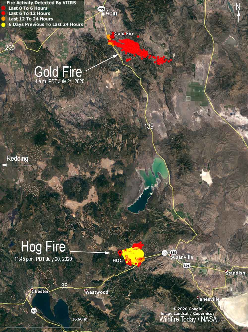
Map showing the approximate locations of the Gold and Hog Fires in northeast California. Both are about 80 air miles from Redding.

Two firefighters were injured Monday afternoon while fighting the Gold Fire about 80 miles east-northeast of Redding, California. Alisha Herring, a spokesperson for the California Department of Forestry and Fire Protection, said they were flown to Mercy Medical Clinic in Redding where they were treated and released the same day. The type, severity, and mechanism of injury were not identified. “I’m sure more with regards to the injury will come out, I just don’t have much more information than that at this time,” Ms. Herring said.

The Gold Fire and another incident in the area, the Hog Fire, are both about 80 miles east of Redding in Lassen County. Coordination and dispatching were affected Monday by a fiber optic cable that burned in the Gold Fire, creating communication difficulties with the CAL FIRE and interagency command centers in Susanville.

The Hog Fire was mapped Monday night at 8,004 acres. It is on both sides of Highway 44 about five miles west of Susanville and has crossed Highway 36. Resources assigned to the Hog Fire Monday night included 21 hand crews, 19 fire engines, 24 dozers, and 21 water tenders for a total of 664 personnel, which is a decrease of 953 personnel in 24 hours.

The Gold Fire is 40 miles north of the Hog Fire five miles south of the community of Adin. It was reported at 12:26 PDT July 20 near Highway 139  and quickly spread for at least eight miles to the southeast. At 10:15 Tuesday morning CAL FIRE said it is the result of two fires burning together and had blackened 4,600 acres. Evacuations are in effect and the strategy is full suppression. The Gold Fire is burning on the Modoc National Forest and land protected by the state. Monday night the resources assigned included 2 hand crews, 5 helicopters, 17 fire engines, 6 dozers, and 5 water tenders for a total of 152 personnel.

These two large wildfires in one CAL FIRE unit are presenting challenges for the suppression organizations. A report filed by firefighters on the Gold Fire Monday night said, “Statewide shortages of resources and competition with other incidents in the state will continue to hamper suppression efforts. Upcoming predicted lightning in the area may add new initial attack incidents.”

“I have not heard that, no,”Ms. Herring said when asked about a possible shortage of resources. “We’re constantly moving resources up and down the state to fulfill any resource needs, so I haven’t heard that.”
Hog Fire Susanville California wildfire 4-09 p.m. July 21, 2020
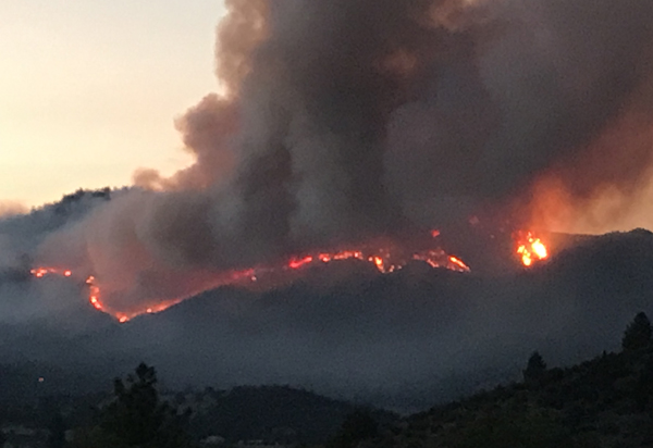
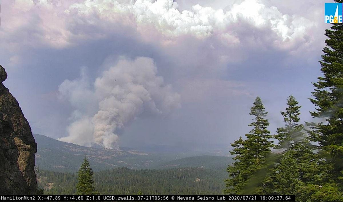
Hog Fire, looking northeast from Hamilton Mountain at 4:09 p.m. July 21, 2020.

Hog Fire burns more than 5,000 acres west of Susanville, CA

Mandatory evacuations are in effect

UPDATED at 4:46 p.m. PDT July 20, 2020

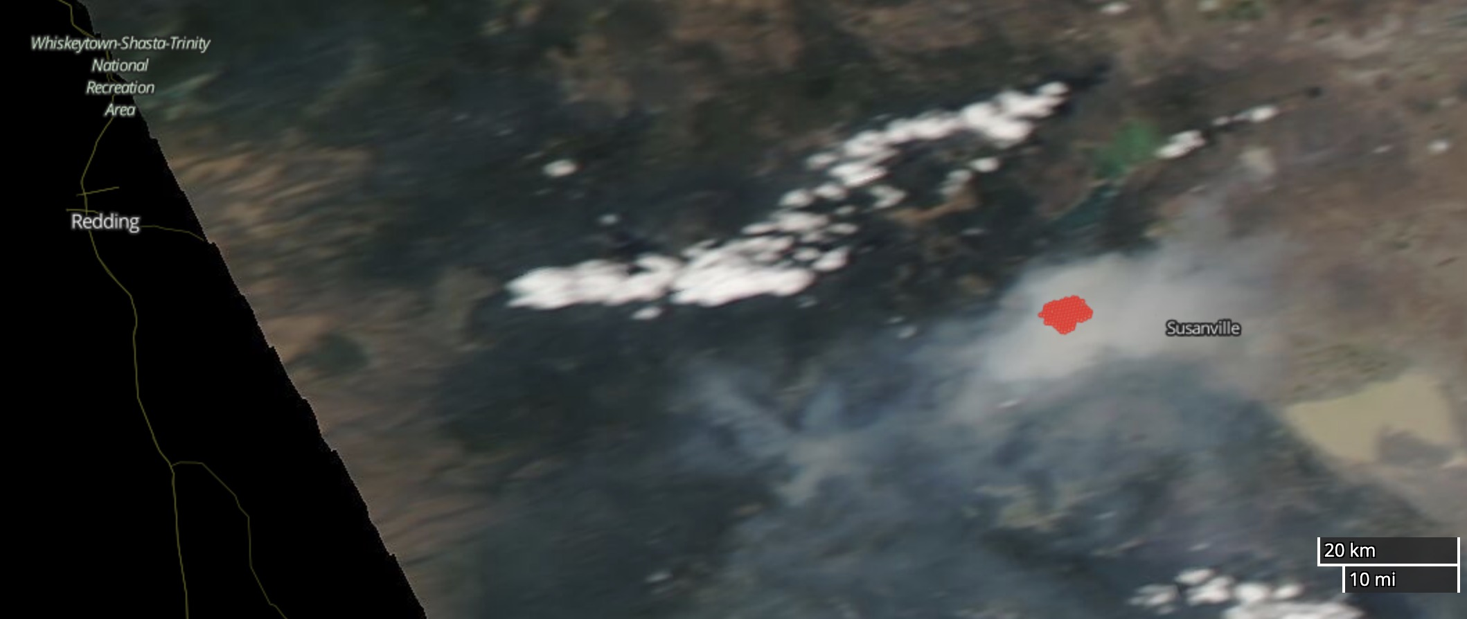
Hog Fire
Satellite photo of the Hog Fire area Monday afternoon. The red area represents heat detected by the satellite. NASA.

Much of the smoke from the Hog Fire west of Susanville, CA is remaining in the general area.


Updated at 4:14 p.m. PDT July 20, 2020

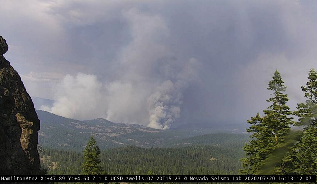
Hog Fire, from Hamilton Mountain Susanville California
Hog Fire west of Susanville, California, as seen from Hamilton Mountain looking northeast at 4:13 p.m. MDT July 20, 2020.

UPDATED at 5:16 p.m. PDT July 20, 2020

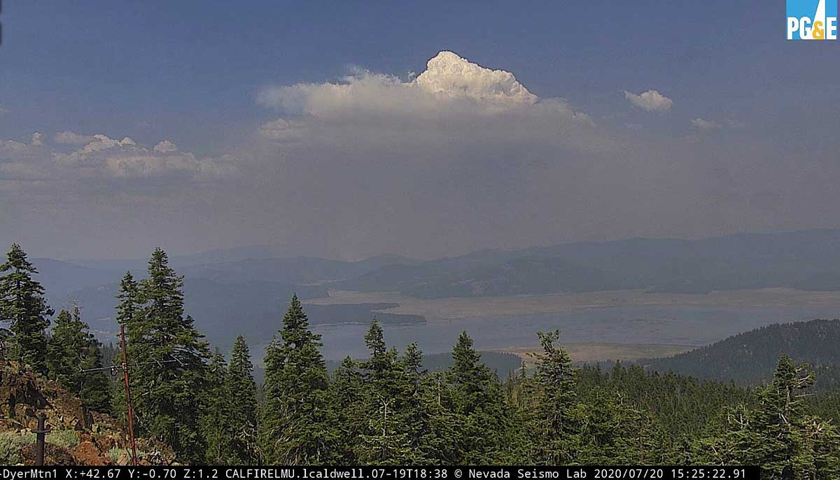
pyrocumulus cloud over the Hog Fire Susanville California
A pyrocumulus cloud created by the Hog Fire, as seen from Dyer Mountain looking northeast at 3:25 p.m. MDT July 20, 2020.

Several of the AlertWildfire cameras near the Hog Fire west of Susanville, California have little to no visibility due to smoke, but the Dyer Mountain 1 cam further to the southwest has a good view of the top of a pyrocumulus cloud generated by the fire.

The weather forecast for the next 24 hours indicates conditions favorable to continued fire spread. The prediction for Monday afternoon is for 95 degrees, relative humidity 13 percent, and winds out of the northwest at 9 to 16 mph. Monday night the wind will continue to be out of the northwest at 5 to 9 mph, the temperature will drop to 64 degrees by sunrise, and there will be poor humidity recovery, rising during the night only to 40 percent.

A Red Flag Warning is predicted for Tuesday when the forecast calls for 95 degrees, 13 percent RH, and 3 to 10 mph winds from the southeast in the morning shifting to come from the southwest and west in the afternoon. There is a chance of thunderstorms in the afternoon.


(Originally published at 10:55 a.m. PDT July 20, 2020)

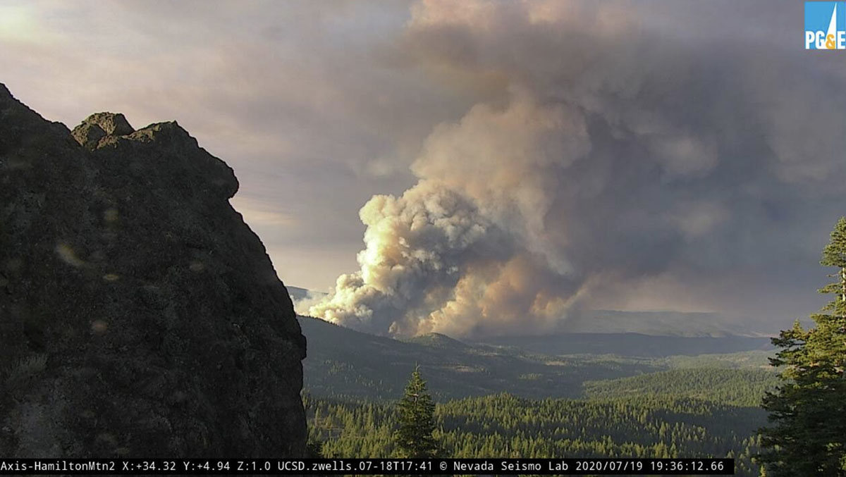
Hog Fire Susanville California
Hog Fire, looking northeast from Hamilton Mountain at 7:36 p.m. PDT July 19, 2020. AlertWildfire photo, via @CAFireScanner.

The Hog Fire has prompted mandatory evacuations in northern California west of Susanville. By Sunday night it had burned 5,800 acres of land protected by the Lassen National Forest and the state of California. At 3:30 a.m. July 20 the fire was about one mile west of a housing development on the west side of the William D. McIntosh Highway (A1) and five miles west of Susanville. It has spread approximately 5 miles to the east since it started and is on both sides of Highway 44. Steep terrain and spot fires ahead of the main fire are complicating efforts of firefighters.

Resources assigned Sunday night included 25 fire engines, 8 hand crews, 15 dozers, 15 water tenders, 4 helicopters, and 6 air tankers.

The Facebook page for the Lassen County Sheriff’s office has details on evacuations. Anyone without internet capabilities can get information by calling (530) 282-5714.

An update from CAL FIRE at 9:30 a.m. Monday stated that no structures had been damaged or destroyed.

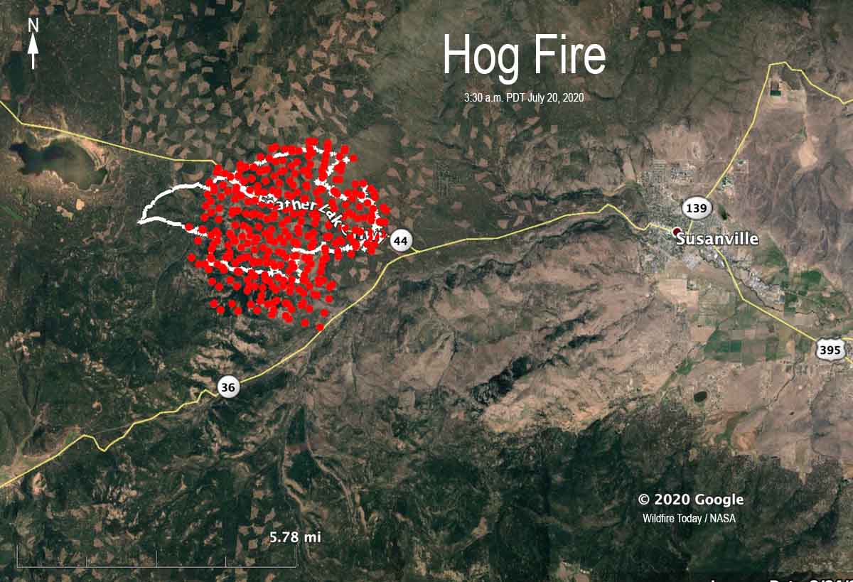
Map of the Hog Fire Susanville California
Map of the Hog Fire. The white line was the perimeter determined during a fixed wing mapping flight at 11:54 p.m. PDT July 19. The red dots represent heat detected by a satellite at 3:30 a.m. July 20, 2020.

After the mapping flight at 11:54 p.m. July 19 a shift in the wind pushed a portion of the southern perimeter to the south toward Highway 36.

Chaos on Interstate 15 as wildfire snarls traffic in Utah

Posted on Categories WildfireTags
Cottonwood Trail Fire
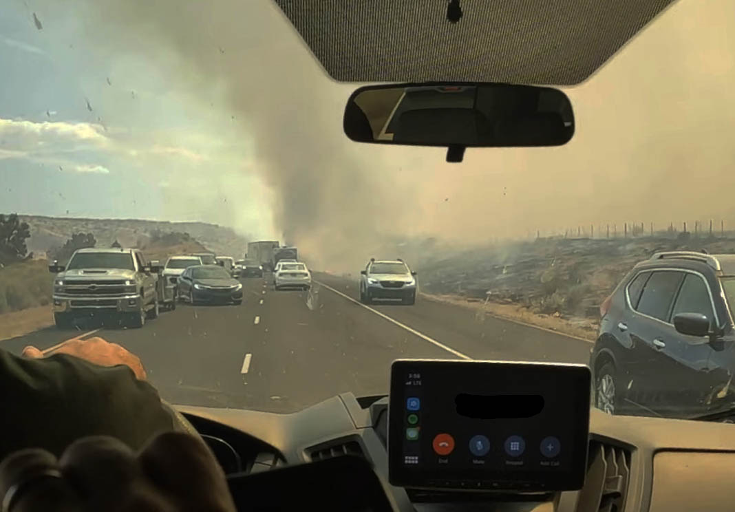
The view from inside a car trapped in a traffic jam caused by the Cottonwood Trail Fire. Screenshot from video by Griffin Hunt.

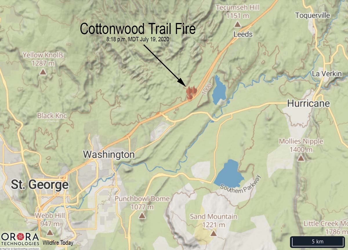
A wildfire that spread across Interstate 15 prompted evacuations and caused a massive traffic jam as motorists drove within feet of a rapidly spreading fire nine miles northeast of St George, Utah Sunday.

The Cottonwood Trail Fire started about 3 p.m. on the west side of the Interstate and burned across the four-lane divided highway blackening 3,000 acres before being stopped by firefighters on the ground and in the air. Resources assigned included three large air tankers, four helicopters, and 30 fire engines.

Cottonwood Trail Fire map
Map showing the location of the Cottonwood Trail Fire at 3:18 p.m. MDT July 19, 2020.

Both northbound and southbound lanes were eventually closed temporarily due to the fire, but perhaps a little too late. All evacuations have been lifted. A Type 3 Incident Management Team was slated to assume command of the fire Monday morning.

Videos showed traffic at times stopped or slowed to a crawl as the fire burned intensely near vehicles. Some were abandoned and the passengers rescued by others.

The video below by Griffin Hunt shows the chaos as vehicles inched past flames and became trapped in the traffic jam, with some turning around on Interstate 15. David Hunt posted the video, saying, “We were driving back from a wrestling tournament and got caught by fire. The other group that was with us had to abandon their vehicle and it burned to the ground. Here’s a video my son  took.”

Badger Fire prompts evacuations north of Yreka, California

(Originally published at 8:42 a.m. PDT July 19, 2020)

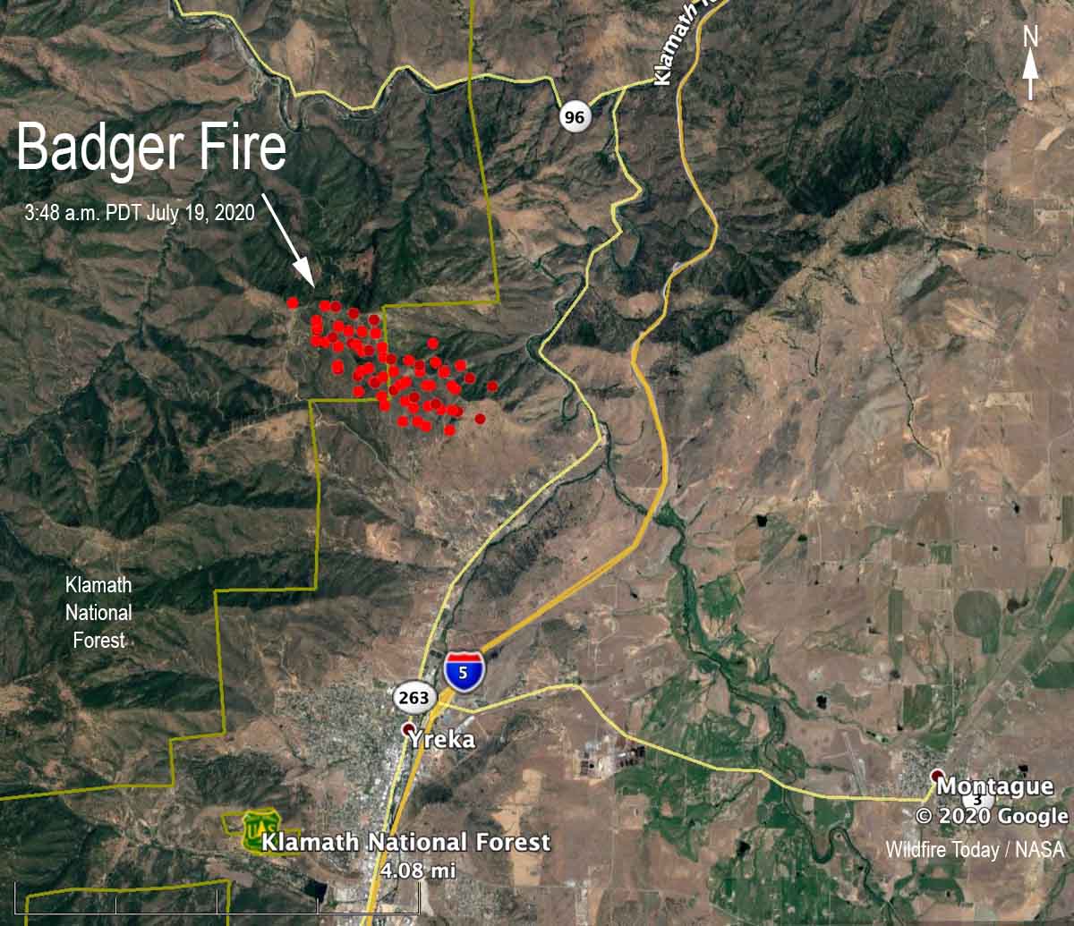
map Badger Fire Yreka California
Map showing heat detected by satellites on the Badger Fire in northern California at 3:48 a.m. PDT July 19, 2020.

Two wildfires that merged about three miles north of Yreka, California are prompting evacuations in some areas west of Highway 263. The Humbug and Badger Fires, near Badger Mountain Road and Hawkinsville Humbug Road, are now identified as the Badger Fire.

The last size estimate released by CAL FIRE Saturday evening was 350 acres, but growth during the night could have added hundreds more. As you can see on the map above it is about 50/50 on the Klamath National Forest and state protected land.

Badger Fire at 8:47 a.m. July 19, 2020
Badger Fire at 8:47 a.m. PDT July 19, 2020.

The Badger Fire was reported Saturday July 19 according to the CAL FIRE Siskiyou Unit, but the agency’s fire information page lists it as starting July 18, which may have been the start date of the Humbug Fire which was the first of the two reported.

Badger Fire Yreka California
Badger Fire July 19, 2020. CAL FIRE photo.
Badger Fire Yreka California
Badger Fire July 19, 2020. CAL FIRE photo.

Sheriff’s Deputy honored for saving lives during a wildfire in Utah

Two people running from a fire were rescued by the Deputy

Knolls Fire rescue
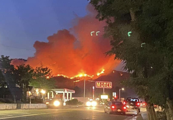
The truck that ignited and started a new fire near the Knolls Fire in Utah County, Utah south of Provo June 28, 2020. Screenshot from video by Utah County Sheriff’s Office.

A Sheriff’s deputy was honored Wednesday for saving the lives of two people who were threatened by a fire that ignited when their truck got stuck near the Knolls Fire south of Provo, Utah.

On June 28, 2020 at about 9 p.m. Utah County Deputy Sheriff John Thomas saw the new fire and two people running from it. One was badly burned and was flown to a hospital after being rescued by Deputy Thomas.

It turns out that during an attempt to cut a fence to bypass a road closed by the Knolls Fire, their truck got stuck and leaked gas which ignited and started the fire south of Saratoga Springs on State Road 68.

Deputy Thomas saved their lives.

The video provides more details. Footage of the incident begins at about 1:20.

Thanks and a tip of the hat go out to Bill. Typos or errors, report them HERE.

And speaking of rescues on a wildfire, here is another one:

Incident Management Team ordered for the Neiber Fire south of Worland, WY

(UPDATED at 12:57 p.m. MDT July 17, 2020)

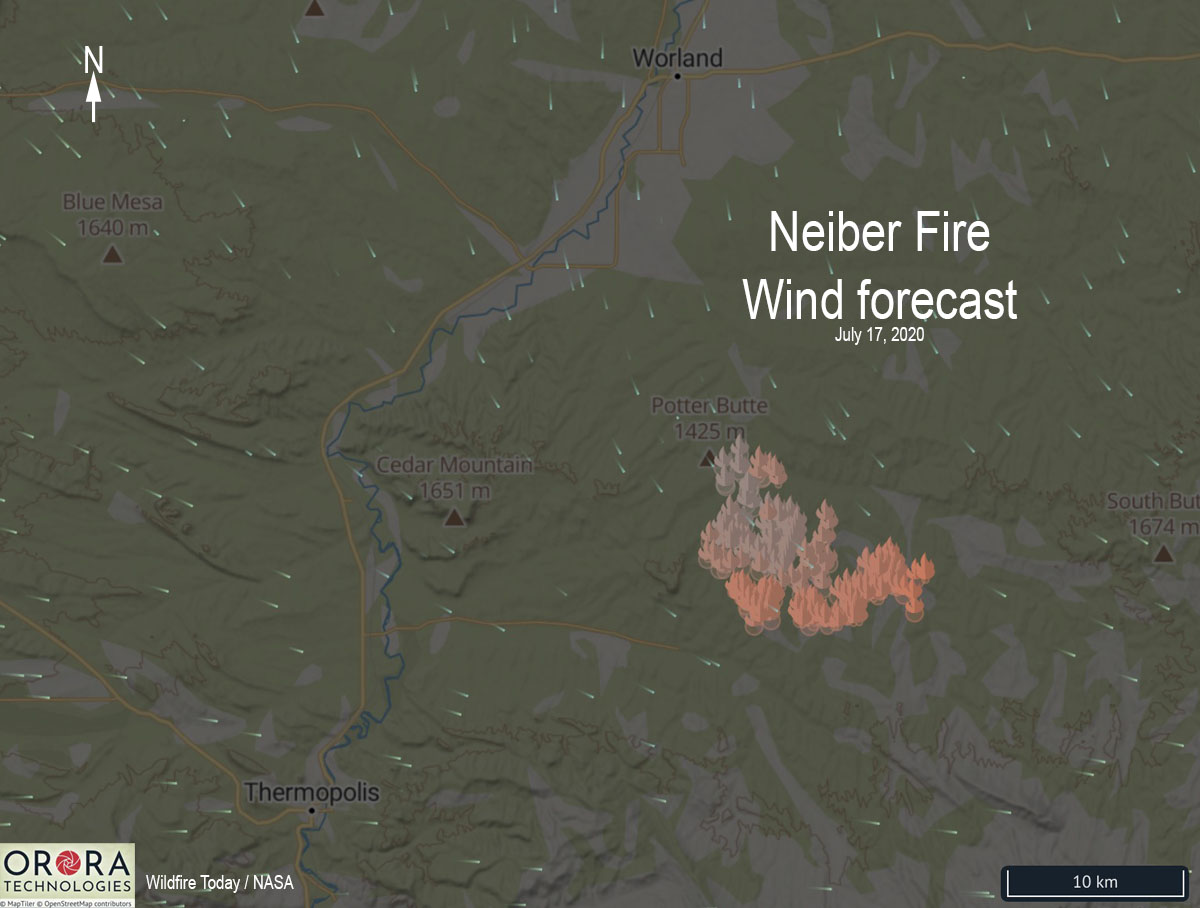
Neiber Fire wind forecast map Worland Wyoming
Neiber Fire wind forecast, July 17, 2020.

Over the last two days the primary growth of the Neiber Fire  13 miles south-southeast of Worland, Wyoming has been to the southeast, pushed by winds out of the northwest. The map above shows the predicted wind direction for Friday.

Neiber Fire map Wyoming Worland
Neiber Fire map showing heat detected by satellites as late as 1 p.m. MDT July 16, 2020.

Thursday evening information from the Type 3 Incident Management Team indicated it had burned 17,545 acres of private and BLM managed land, an increase of almost 10,000 acres in two days.

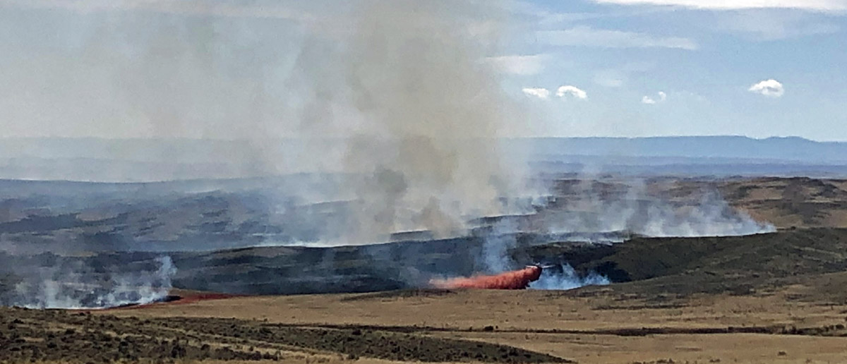
The Neiber Fire is spreading through brush and short grass and is threatening facilities in the Murphy Dome Oil Field.


(Originally published at 7:10 p.m. MDT July 15, 2020)

map Neiber Fire Wyoming Worland
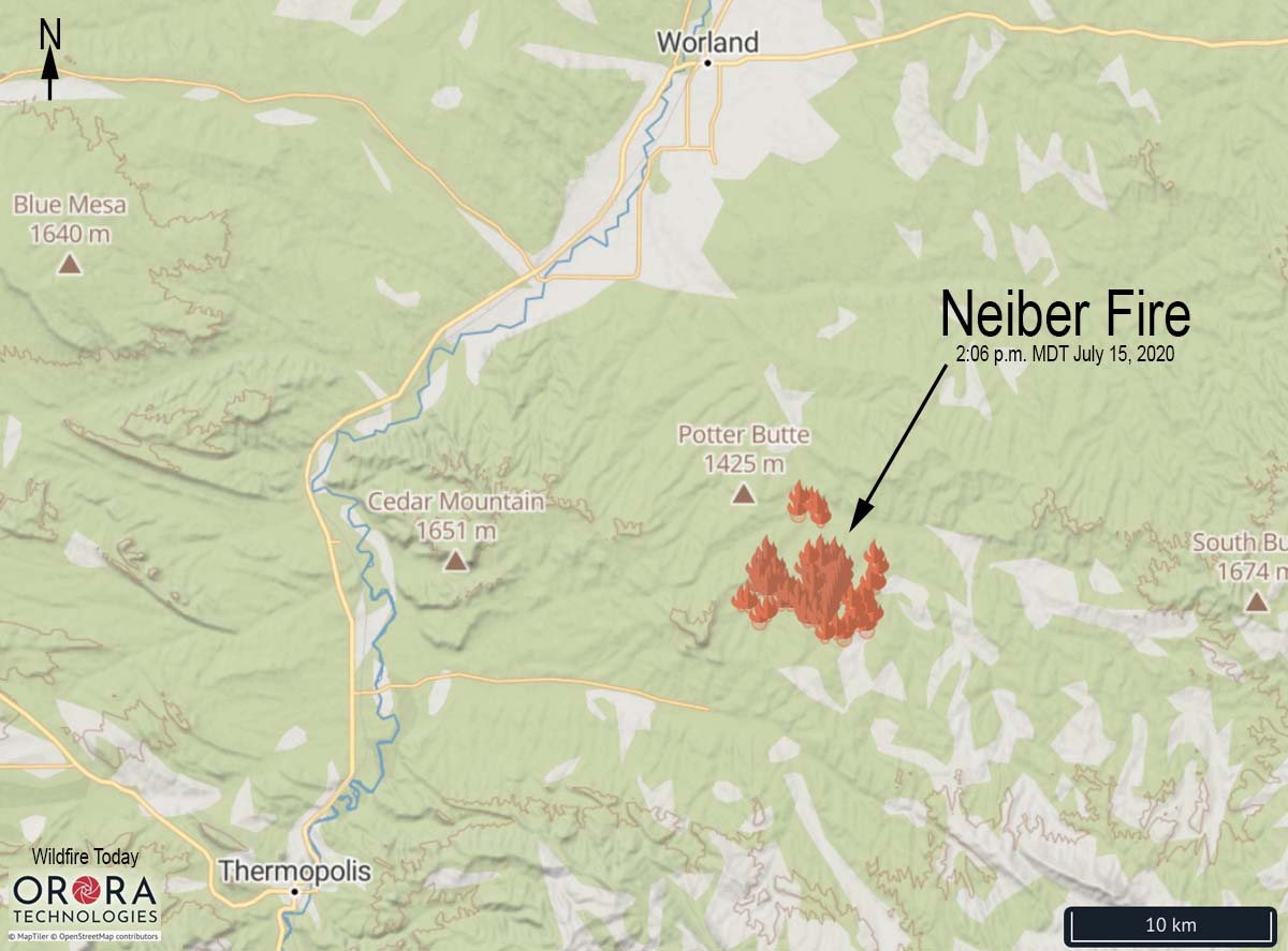
The map shows heat detected on the Neiber Fire by satellites at 2:06 p.m. MDT July 15, 2020.

In the 24 hours since the Neiber Fire was reported Tuesday afternoon, by 4 p.m. Wednesday it had grown to 7,800 acres according to the Bureau of Land Management. The fire is in Pistol Draw .

A Type 3 Incident Management Team has been ordered. The firefighters on the ground, including the Palouse hand crew from Idaho and the Black Hats from South Dakota, are being assisted by a DC-10 very large air tanker, large air tankers, single engine air tankers, and helicopters.

We will update this article as more information becomes available.

Neiber Fire Wyoming Worland
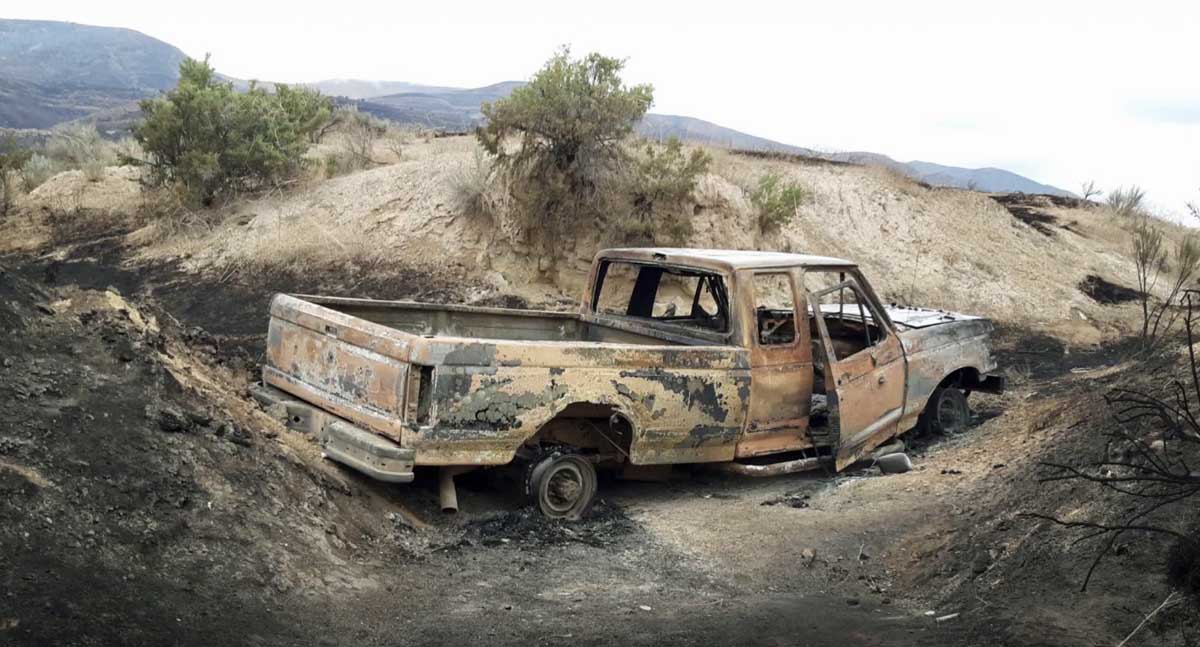
Neiber Fire. BLM photo.