Firefighter dies on Moose Fire

Near Challis, Idaho

On Thursday September 22 the Forest Supervisor of the Salmon-Challis National Forest released a statement about the September 20 death of Gerardo Rincon who passed away while assigned to the Moose Fire in Idaho:


It is with immense sorrow that we share the news of the passing of Gerardo Rincon of North Reforestation Inc. Gerardo suffered a medical emergency during the early morning hours of September 20th. He was a crew boss of a Type 2 crew that was assigned to the Moose Fire.

Gerardo served as a wildland firefighter since 1994. During his 28-year career he was a Type 2 firefighter, engine captain, and crew boss. He was highly recognized for his performance by his employers and crew members enjoyed working for him during many fire assignments.

Tragedies of this nature serve as a reminder of the honorable work and sacrifices made by women and men like Gerardo. They commit themselves daily to supporting and protecting communities around the country.

Our condolences go out to the entire Rincon family, their co-workers at North Reforestation Inc., and the firefighting community, their friends, and all those who knew and loved them. We are beyond grateful for their years of dedication and service to the wildfire community.

The Forest is working closely with the incident management team and the Wildland Firefighter Foundation to return Gerardo to his home in Oregon early Saturday morning, September 24th. There will be a procession from the Jones and Casey Funeral Home though downtown Salmon and to the Lemhi County Airport beginning at 9:00 am.

A viewing is scheduled for Wednesday, September 28th at the Farnstrom’s Mortuary in Independence, Oregon from 5-8 pm. A funeral mass will occur on September 29th at St. Patrick’s Catholic Church followed by a burial at Hilltop Cemetery.

/s/ Charles A. Mark
Forest Supervisor

(end of statement)


North Reforestation wrote on their Facebook page that Mr. Rincon’s remains will arrive on Flight 802 at 11:30 a.m. Saturday at Corvallis Municipal Airport, 5695 SW Airport Ave, Corvallis, OR. They wrote, “If anyone wants to be part of the procession on this Saturday as Gerardo arrives in Oregon, it will start at the airport and end at Farnstroms.”

North Reforestation is based in Monmouth, Oregon, just west of Independence.

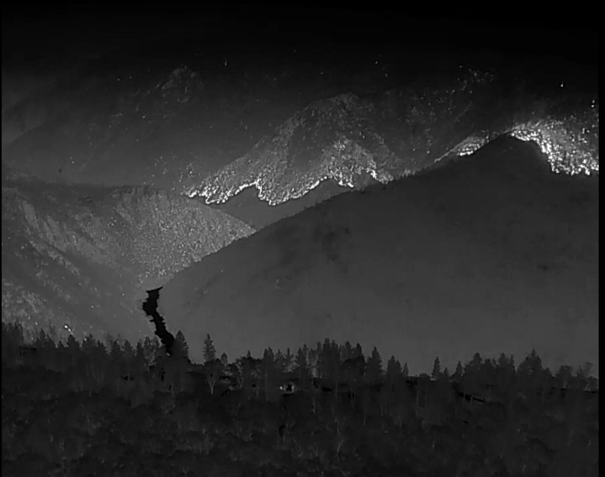
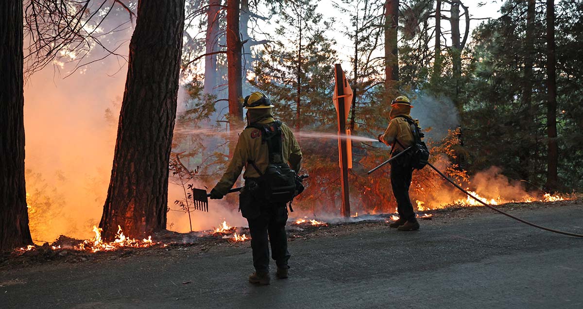
The Moose Fire which started July 17, received rain Wednesday and Thursday. It has burned more than 130,000 acres northwest of Challis, Idaho.

Our sincere condolences go out to the family, friends, and coworkers of Mr. Rincon.


Thanks and a tip of the hat go out to Tom and Pete.

Some areas of Mosquito Fire receive more than an inch of rain

Flash flood watch in effect for the burn scar

Updated 7:15 a.m. PDT Sept. 20, 2022

Heat detected by drone on the Mosquito Fire
Heat detected by drone a on the Mosquito Fire, nighttime mission Sept. 18, 2022. White represents heat. Darker shades are cooler. USFS.

Rain continues to fall on the Mosquito Fire with accumulations in or near the burn area ranging from 0.68″ to 2.22″.  A flash flood watch is in effect until Tuesday evening.

Precipitation accumulated, Mosquito Fire
Precipitation accumulated, Mosquito Fire area, 72 hours ending at 6:48 a.m. PDT Sept 20, 2022.

Firefighters are taking the opportunity to work close to the fire’s edge, constructing direct fire line using hand tools and dozers.

The precipitation is expected to taper off Tuesday and Tuesday night, with a few lingering showers on Wednesday. The forecast for the rest of the week shows no chance of rain, moderate winds, and the relative humidity returning to the 40s and 30s.


7:41 a.m. PDT Sept. 19, 2022

Precipitation, Mosquito Fire area
Precipitation, Mosquito Fire area, 48 hour period ending 7 a.m. PDT Sept 19, 2022. The dark green area is under a flash flood watch.

Several weather stations within or close to the Mosquito Fire have recorded more than an inch of precipitation during the 48-hour period ending at 7 a.m. PDT on Monday. Other stations measured 0.20″ to 0.54″.

The National Weather Service has issued a flash flood watch for the burn scar in effect until Tuesday evening.

Firefighters suppressing the Mosquito Fire
Firefighters suppressing the Mosquito Fire off Michigan Bluff Road, Sept. 7, 2022. Credit- Robert Foxworthy, CAL FIRE.

The forecast from the NWS predicts there is a greater than 50 percent chance the rain will continue at least through Tuesday with additional amounts that could exceed half an inch.

As a result of the rain, both the Placer and El Dorado County Sheriff Offices downgraded many of the Evacuation Orders and Warnings Sunday afternoon. Updated evacuation maps are available for Placer and El Dorado Counties.

Mosquito Fire map, 5 p.m. Sept. 17, 2022.
Mosquito Fire map, 5 p.m. Sept. 17, 2022. FIRIS.

On Monday firefighters took advantage of the favorable fire conditions to construct direct control lines along portions of the fire’s edge on the eastern flank. Firefighters with hand tools and heavy equipment, such as dozers, were out in force. Crews worked in the area of the North Fork of the Middle Fork of the American River as well as Interbay Road. Despite the rain showers, crews were able to successfully conduct firing operations along the Interbay Road due to the sustained dry fuel moisture in the vegetation. Crews were able to continue strengthening and holding control lines around the southeast corner near Stumpy Meadows.

The Mosquito Fire has burned 76,290 acres. More than 3,700 personnel are assigned.

Photos of smoke columns not often seen

Mosquito Fire, September 13, 2022

8:43 p.m. PDT September 13, 2022

Mosquito Fire, September 13, 2022. smoke
The Mosquito Fire, looking NE from the Bald Mtn Eldorado camera, during the afternoon of Sept. 13, 2022. AlertWildfire.

These photos of the Mosquito Fire 35 miles northeast of Sacramento taken by one of the AlertWildfire cameras Tuesday afternoon are unlike those we usually see over fires. Some of them appear to have altocumulus lenticularis clouds embedded or capping the column. Perhaps a meteorologist can weigh in with a more detailed explanation.

To see all of the articles on Wildfire Today about the Mosquito Fire, including the most recent, click HERE.

Mosquito Fire, September 13, 2022. smoke
The Mosquito Fire, looking NE from the Bald Mtn Eldorado camera, during the afternoon of Sept. 13, 2022. AlertWildfire.
Mosquito Fire, September 13, 2022. smoke
The Mosquito Fire, looking NE from the Bald Mtn Eldorado camera, during the afternoon of Sept. 13, 2022. AlertWildfire.
Mosquito Fire, September 13, 2022. smoke
The Mosquito Fire, looking NE from the Bald Mtn Eldorado camera, during the afternoon of Sept. 13, 2022. AlertWildfire.

Updated 6 a.m. PDT Sept. 15, 2022

One of our readers sent us this photo of a lenticular cloud over the Halfway Hill Fire smoke column near Price, Utah, July 11, 2022.

Lenticular cloud over the Halfway Hill Fire
Lenticular cloud over the Halfway Hill Fire smoke column near Price, Utah, July 11, 2022. Contributed.

Activity increases on Mosquito Fire 35 miles northeast of Sacramento

Spot fire approaches the community of Foresthill

Updated at 12:41 p.m. PDT Sept. 14, 2022

In a Wednesday morning briefing on the Mosquito Fire Operations Section Chief Donald Fregulia said the westernmost part of the fire near Foresthill is being lined by fire crews today which should eliminate any further spread near the community. On Tuesday the fire spotted across the Middle Fork of the American River and ran upslope to, but did not cross, Foresthill Road. He did not mention that multiple structures and vehicles were destroyed Tuesday afternoon. However, due to previous work that had been done by property owners and firefighters, many structures were saved.

On the north side Tuesday night, firefighters conducted a defensive firing operation, working north along the Foresthill Divide Road. They reached Deadwood Road and then turned south. The intent is to prevent any further spread to the north in that area.

Mr. Fregullia said the fire had burned 58,544 acres and 3,052 personnel were assigned.


Updated 6:48 a.m. PDT Sept. 14, 2022

Mosquito Fire map, Forest Hill area
Mosquito Fire map, Forest Hill area. The red line was the perimeter at about 5 a.m. Sept. 14, 2022. The white line was the perimeter when mapped at about 7 p.m. Sept. 13, 2022.

The spot fire that ignited across the Middle Fork of the American River below Foresthill, California Tuesday afternoon spread vigorously up the slope toward the community. It reached or came close to Foresthill Road in several places. Multiple structures and vehicles were destroyed across the street from the high school, but it did not cross the road. It could have been worse if not for the efforts of firefighters on the ground and numerous retardant and water drops by air tankers and helicopters.

The FIRIS aircraft mapped the fire at 5 a.m. today and found that it had burned about 61,000 acres.

KCRA, a Sacramento TV station, in recent years has had to cover numerous massive, dangerous wildfires. Their experience shows in the below video that was part of their evening news on Tuesday. Farther down in the article is a Tweet that has almost 90 minutes of the station’s helicopter coverage as the fire was spreading up the slope to Foresthill.

Mosquito Fire map
Mosquito Fire map. The red line was the perimeter at about 5 a.m. Sept. 14, 2022. The white line was the perimeter when mapped at about 7 p.m. Sept. 13, 2022.

Updated 8:18 p.m. PDT Sept. 13, 2022

Mosquito Fire map
Mosquito Fire map. The red line was the perimeter at approximately 7 p.m. Sept 13, 2022. The white line was the perimeter at about 11 a.m. Sept. 12, 2022.

The FIRIS aircraft mapped the Mosquito Fire Tuesday evening. Most of the growth was on the east side, but the new spot fire near Foresthill added more than 1,100 acres. The total size increased to 58,000 acres.

To see all of the articles on Wildfire Today about the Mosquito Fire, including the most recent, click HERE.

It did not spread as rapidly through the fires of 2013 and 2014 as it did in the areas with no recent fire history. But is has spread from 0.5 to 1.0 mile into the footprint of the 2013 American Fire.


Updated 5:35 p.m. PDT Sept. 13, 2022

Mosquito Fire spreads toward Foresthill, California
The Mosquito Fire spreads toward Foresthill, California at 4:59 p.m. PDT Sept. 13, 2022. KCRA-3 image.

KCRA has a live view of the Mosquito Fire as it threatens Foresthill, California. It may be in and out, limited by fuel and other factors; or, may be replaying video shot earlier.

Below, a 737 from New South Wales drops on the Mosquito Fire near Foresthill, CA.


5:19 p.m. PDT Sept. 13, 2022

Spot fire, Mosquito Fire, Foresthill California
Photo showing a spot fire on the Mosquito Fire below Foresthill, CA, 3:39 p.m. PDT Sept. 13, 2022. Looking north. FIRIS.

The activity of the Mosquito Fire at Foresthill, California was subdued Monday due to high humidities in the morning and a few scattered sprinkles. But today, Tuesday, the skies are mostly clear and the humidity has been lower, resulting in multiple convection columns building over the blaze.

Spot fire, Mosquito Fire, Foresthill California
Mosquito Fire, looking southwest from the Forest Hill camera at 2:44 p.m. PDT Sept. 13, 2022.
Spot fire, Mosquito Fire, Foresthill California
An air tanker can be seen at a spot fire on the Mosquito Fire, looking southwest from the Forest Hill camera at 3:20 p.m. PDT Sept. 13, 2022.

At about 2  or 2:30 p.m. a spot fire ignited on the western-most part of the fire south-southwest of Foresthill near the Middle Fork of the American River. It grew very quickly and was soon mapped by the FIRIS aircraft at 93 acres. Then the spot fire created another spot fire uphill and to the north, closer to Foresthill. Air tankers and helicopters were seen by the Foresthill camera working on the spots, but by 3:30 p.m. they had merged into one 300-acre spot fire spreading toward Foresthill.

At about 4:10 p.m. radio traffic indicated that the spot fire was close to reaching the area of the Foresthill Divide school.

Spot fire, Mosquito Fire, Foresthill California
Map showing the location of a spot fire on the Mosquito Fire, ~3:30 p.m. PDT Sept. 13, 2022. Data from FIRIS.
Two convection columns Mosquito Fire
Two convection columns on the Mosquito Fire. Looking northeast from the Auburn camera at 3:20 p.m. Sept. 13, 2022.

We will update this article as more information becomes available.

Hikers who escaped from Bolt Creek Fire documented, and now explain the ordeal

The predicted weather will slow the spread of the fire the rest of this week

8:45 a.m. PDT Sept. 13, 2022

Bolt Creek Fire hikers escape
Bolt Creek Fire Sept. 10, 2022. Image from Path Least Taken video

The two hikers who found themselves nearly entrapped by the rapidly spreading Bolt Creek Fire in northwest Washington near Skykomish have posted a video describing how they escaped.

After nearly reaching their goal of the top of Baring Mountain on Saturday September 10, they realized the smoke noticed earlier was from a fire that started that morning and had become a threat to their lives. The two of them shot video off and on during the entire hike, and on Sunday “Path Least Taken” posted an expertly-edited version on YouTube. He explained that he debated about publishing it, but did so “as an educational tool to point out all of the mistakes we made that ended up putting our lives in danger.”

During the escape they used wayfaring skills and technology tools to figure out how to descend the very steep slopes while avoiding the fire, which was at times exhibiting extreme flame lengths many times the heights of the trees, as you can see in the above image from their video.

When the Bolt Creek Fire was mapped Monday evening it had burned about 9,400 acres. In several places it has spread downhill nearly to US Highway 2. The fire activity was very much diminished Monday by much higher relative humidity. A weather station at Index northwest of the fire recorded very light winds Monday with the RH ranging from 57 to 92 percent, conditions not conducive to rapid fire spread.

Bolt Creek Fire 3-D map
Bolt Creek Fire 3-D map, looking NNW at 7:41 p.m. Sept. 12, 2022.

“It’s been a good day today for firefighters,” said Jim Cahill, a Washington State Department of Natural Resources spokesperson Monday evening.

As of Monday night US Highway 2 was closed from Milepost 32 to Milepost 50 and the community of Index was under a “Go Now” evacuation order.

The spot weather forecast for Tuesday predicts temperatures around 60 degrees, minimum RH of 87 percent, and light winds becoming 5 to 6 mph in the afternoon out of the northwest. Tuesday night the RH will rise to 100 percent and drop to only 86 percent on Wednesday. On Monday and Tuesday there is a 13 to 16 percent chance of very light rain, about 0.03″. The humidity is expected to remain mostly in the 80s and 90s through Sunday. The fire will not spread rapidly under these predicted conditions.

Bolt Creek Fire map
Bolt Creek Fire map. The red line was the perimeter at 7:41 p.m. Sept. 12, 2022. The white line was the perimeter about 48 hours previously.

Thanks and a tip of the hat go out to Patrick.

Light rain observed on parts of the Mosquito Fire

The fire 35 miles northeast of Sacramento was very active Sunday, spreading east up to a mile

3 p.m. September 12, 2022

Mosquito Fire map
Mosquito Fire map. The red line was the perimeter at 1:19 p.m. PDT Sept. 12, 2022. The white line was the perimeter on the morning of September 11, 2022. Three previous fire footprints are also shown.

On Sunday the east side of the Mosquito Fire spread as much as a mile to the east. Having already burned through most of the footprint from the 2007 Ralston Fire, for the first time it moved into the 2013 American Fire and the 2014 King Fire. It did not burn enough of those two more recent fires to get a good picture of how likely it is to spread completely through those eight and nine year old footprints.

At 1:19 p.m. Monday it was mapped by a fixed wing aircraft at about 48,500 acres. The blaze is 35 miles northeast of Sacramento.

Monday afternoon satellite and ground based cameras showed clouds, haze or smoke, and scattered thunderstorms in the general area of the fire. Light showers were reported in some areas. If strong outflow winds from passing thunderstorms hit the fire area without any rain it could increase the rate of spread significantly, sometimes in unexpected directions.

Crews working Sunday night on the southwest side between Foresthill and Volcanoville had to stop a strategic firing operation due to a small amount of rain. If conditions permit they hope to continue the operation today.

The weather forecast for Monday through Wednesday is for light to moderate winds of 2 to 9 mph generally from the southwest during the day  with minimum humidities in the 30s and 40s. Thursday through Saturday the winds will be very light while the humidity will be in the 40s.

In the video below watch how smoke from the Mosquito Fire overtakes Reno, Nevada.