Maybe it wasn’t the hurricane that blew up the Maui wildfires

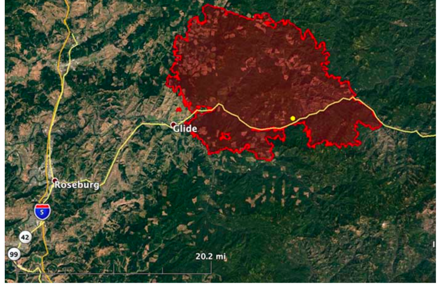
Scientists have introduced a new theory for the cause of the Maui fires in August, and the theory casts doubt on previous assumptions that linked the wildfires to nearby Hurricane Dora. Weather models show the fires were actually blown by the same meteorological phenomenon that’s often behind California’s worst wildfires — a downslope windstorm (see Rattlesnake).

Nearly four months after the Lahaina Fire that devastated Maui — leaving 100 people dead and 6,000 still homeless — scientists have clarified a new theory; according to a report by the Daily Mail, video footage documenting the fire revealed a wind-driven firestorm, but the power outages during the firestorm left scientists uncertain about which factors had caused the fire behavior.

Atmospheric researchers have now simulated the weather and fire trends in western Maui. In Lahaina, the main cause of the fires was a strong high-pressure system north of Hawai’i that intensified the easterly tradewinds, and when those winds ran up against the slopes in West Maui, the speed increased as the winds blew downhill. When they hit Lahaina they’d reached hurricane strength.

Simulations by the University of Nevada-Reno and the State University of New York at Buffalo showed that sustained winds in Lahaina on August 8 were nearly 80 mph with gusts exceeding 90 mph. Studies by the University of Hawaii and the University of Washington simulated similar wind speeds.

Cliff Mass, an atmospheric sciences professor at the University of Washington who simulated the Maui windstorm, said the combination of fuels, strong winds, and ignition sources is a common set-up for destructive wildfires.

“There’s a real story for Californians here because what happened in Maui, what happened in the Marshall Fire, what happened at Paradise … they’re all the same thing,” Mass told the San Francisco Chronicle.

The Chronicle reported that videos from Lahaina showed a wind-driven fire, but that because weather stations in the area had lost power during the fire, researchers could not be certain about exactly which factors had  combined to create the firestorm. Many had initially attributed the disaster to Hurricane Dora near the island.

Below is a  forecast vertical cross-section of the situation on the island at about 11 a.m. Hawaii time. Cliff Mass explains that winds are shown by the color shading and arrows.  “The solid lines are potential temperature. An extraordinarily high amplitude wave had formed, with air descending the western side of  the Maui Mountains, accelerating as it plummeted toward Lahaina. At low elevations, the flow abruptly ascended, in a feature often termed a hydraulic jump.”
Cliff Mass illustration -- Maui Mountains
Cliff Mass illustration — Maui Mountains

He said the Lahaina situation involved a wet winter, followed by a dry summer, causing grasses to grow exceptionally in the spring to create a  dense fuel load, ready to burn.

Nearly 6,200 people still struggle to find housing while residents and their beloved Maui town of Lahaina works to rebuild.

~ Thanks and a tip of the hardhat to Jim. 

August ‘pyrotornado’ in Canada validated by researchers

A video that claimed to show a rarely-seen wildfire phenomenon went viral in August. Now, researchers have confirmed its legitimacy.

An “extensive investigation” led by researchers at Western University’s Northern Tornadoes Project in Ontario started after the video of a vortex above British Columbia’s Gun Lake was shared by numerous news outlets after it was recorded on August 18.

“The Northern Tornadoes Project has been investigating this event since that time — very carefully, given this was potentially the first fire-generated tornado that we have recorded,” researchers said.

Researchers first confirmed the location and date of the video, then had to determine whether the vortex shown in the video met the definition of a tornado. The project was able to determine the tornado’s validity through multiple visual indications from the recording, including the presence of a spray vortex at the base of the tornado, how the vortex formed and the position of the vortex over the fire, all of which matched the scientific research related to fire-generated tornadoes.

“Though the terminology in this area of science is still developing, it should be pointed out that this intense vortex was not a brief, fire-filled ‘fire whirl‘ but an actual tornado that is sometimes referred to as a pyrotornado,” the researchers said. “This is the first such fire-generated tornado recorded by [the Northern Tornadoes Project], and appears to be the most thoroughly documented fire-generated tornado so far in Canada.”

The researchers confirmed that, yes, the event is classified as a tornado. The full extent of the damage from the tornado isn’t yet known, but the project says evidence is trickling in slowly.

The pyrotornado isn’t the only one that’s been thoroughly studied. The “world’s first wildfire tornado” was captured on video in 2003 during a wildfire outside of Canberra, Australia. The fire destroyed 500 homes and killed four people. The damage was worsened when the pyrotornado emerged.

“The Canberra fire tornado of 2003 was rated an EF3 on the Enhanced Fujita Scale, with horizontal winds of 160 miles per hour, roughly equivalent to a Category 5 hurricane,” an article from Smithsonian Magazine reads. “As the first documented example of its kind, it was a milestone — another harbinger of 21st-century fire.”

A similar event was recorded during the 2018 Carr Fire in Redding, California, dubbed “the most destructive fire in National Park System history.” The fire destroyed 1,614 structures, killed seven people, and burned 229,651 acres. The fire also has a place in history for the pyrotornado it generated, which has since helped forecasters’ and scientists’ ability to identify future fire-generated tornadoes. NOAA researchers studied the pyrotornado, which had many similarities to the Gun Lake tornado.

“A key factor in the vortex formation was the development of a fire-generated ice-topped cloud (i.e., a pyrocumulonimbus), which reached as high as 12 km aloft,” NOAA said. “These observations will help forecasters and scientists identify, and potentially warn for, future destructive fire-generated vortices.”

A video that claimed to show a rarely-seen wildfire phenomenon went viral in August. Now, researchers have confirmed its legitimacy.

An “extensive investigation” led by researchers at Western University’s Northern Tornadoes Project in Ontario started after the video of a vortex above British Columbia’s Gun Lake was shared by numerous news outlets after it was recorded on August 18.

Burning Alaskan permafrost increasing methane emissions

Posted on Categories ResearchTags , ,

The flames have died out on Alaska’s largest river delta, but emissions are still seeping out of the tundra’s ground.

A recent NASA study found that methane “hot spots” in the Yukon-Kuskokwim Delta are more likely to be found where wildfires burned into the tundra. The greenhouse gas reportedly originates from decomposing carbon stored in the tundra’s permafrost for thousands of years.

“We find that [methane] hotspots are roughly 29 percent more likely on average in tundra that burned within the last 50 years compared with  unburned areas, and that this effect is nearly tripled along burn scar perimeters that are delineated by surface water features,” the researchers said. “Our results indicate that the changes following tundra fire favor the complex environmental conditions needed to generate emission hotspots.”

Mackenzie Delta, Northwest Territories

The correlation also nearly tripled in areas where fires burned to the edge of a lake, stream, or other body of standing water, according to NASA. The highest ratio of methane hot spots occurred in recently burned wetlands. Researchers detected roughly 2 million hot spots across 11,583 square miles. The team believes more hot spots could soon emerge.

“By some projections, the fire risk in the Yukon-Kuskokwim Delta could quadruple by the end of the century due to warming conditions and increased lightning storms – the leading cause of tundra fires,” they said.

Alaska had two of its largest tundra fires ever in 2022. The East Fork Fire ignited on May 31 after a lightning strike, and burned more than 150,000 acres along the Yukon River. The Apoon Pass Fire, the second largest, burned 84,130 acres.

Previous research found that the majority of yearly methane emissions from Alaska’s tundra occur during the cold season between September and May, indicating that total emissions are sensitive to soil climate and snow depth.

Another $250 million for PacifiCorp’s 2020 firestorm liability

PacifiCorp has settled with 10 timber companies in Oregon for $250 million after the utility company was found liable for starting many of the 2020 Labor Day fires.

Oregon Public Broadcasting (OPB) reported that for the second time this month, the utility provider will pay out hundreds of millions to end a lawsuit over its negligence in the wind-driven wildfires that started over Labor Day weekend in 2020 in western Oregon.

The settlement will resolve a lawsuit the timber companies brought against the utility for the Archie Creek Complex in west-central Oregon.

2020 Archie Creek Fire
Archie Creek Fire map, 2:35 p.m. PDT Sept. 22, 2020.

On December 5, the Berkshire Hathaway-owned company paid $299 million to settle another lawsuit brought by Oregon residents who lost their homes and property in the same fire, bringing PacifiCorp’s payouts this month to more than a half billion dollars.

[UPDATE 12/21/2023: How much Pacific Power rates are increasing.]

This lawsuit alleged that PacifiCorp’s employees ignored warnings from the National Weather Service and others on Labor Day weekend and decided to not power down its electrical equipment — or fall hazard trees and clear vegetation around powerlines.

“The 2020 wildfires were undeniably tragic,” the company said in a statement, “and PacifiCorp is pleased to resolve this matter on behalf of our impacted customers and communities.”

“I am proud to have recovered fair and full damages for Oregon’s timber industry,” said attorney Mikal Watts. He said that after the Archie Creek Fire had started, a lineman mistakenly re-energized a line after a tree had fallen into it, which ignited another separate fire. He said the timber companies lost of thousands of acres of timberlands in the fires. Watts explained that he hopes to work with PacifiCorp, along with Oregon lawmakers and utility regulators, to create a statewide risk pool for utilities, which would allow people to receive payouts without the need to file lawsuits after a fire. California created a  similar fund in 2019 after the bankruptcy of Pacific Gas & Electric caused by its wildfire payouts. A risk pool would be funded up front by utility customers and utilities themselves.

“The Public Utilities Commission ought to work together with this utility to try to recoup these costs to make it go away,” said Watts.

2020 fires aftermath

According to a KATU-TV report, PacifiCorp said this settlement is in addition to others with individuals and businesses that lost homes and other property, plus hundreds of insurance claims that PacifiCorp settled in which homeowners and businesses received insurance payments for damages.

Hackberry Fire burning near Prescott

Posted on Categories WildfireTags ,

Fire crews are fighting the Hackberry Fire, burning seven miles west of Prescott, Arizona since Monday morning, according to the Arizona Emergency Information Network.

The fire had burned 30 acres as of Monday afternoon, Prescott NF firefighters said.

Hackberry Fire 12/18/2023

Updates:

  • Fire crews report there are no values at risk or threatened.
  • The cause of the fire is unknown and under investigation.

How many acres has it burned?
The Hackberry Fire has burned 30 acres and is zero percent contained.  Infrared imaging has not yet been done to get an accurate estimate of acres burned. Recreationists should avoid camping, biking, and hiking near the fires and use caution while driving the roads as firefighters will be traveling to and from the fire.

Are there any evacuations?
There are no evacuations yet announced, nor any communities warned to prepare for evacuation.

What roads or highways have been closed?
Authorities have not announced any road closures.

Wildfire Go-Kit:
Residents in wildfire-prone areas are urged to have an emergency supplies kit to bring with them if they are evacuated from their homes. An emergency supply kit, a “go bag,” should be put together long before a wildfire or other disaster occurs. Make sure to keep it easily accessible so you can take it with you when you have to evacuate.

The National Fire Protection Association (NFPA) recommends that residents store emergency supplies in a plastic tub, small suitcase, trash can, backpack, or other container. Residents should make sure they have the necessities, such as three gallons of water per person and a three-day supply of ready-to-eat food, the NFPA said. A first aid kit, prescription medications, contact lenses, and non-prescription drugs should also be taken into account.

Copies of important family documents, including insurance policies, identification, bank account records, and emergency contact numbers should also be put into a waterproof portable container in your kit.

The NFPA lists other items that would help in a disaster, including:

  • Sleeping bag or warm blanket for each person
  • Battery-powered or hand-cranked radio and a NOAA weather radio to receive up-to-date information
  • Dust mask or cotton T-shirt to filter air
  • Matches in a waterproof container
  • Complete change of clothing including long pants, long-sleeve shirts, and sturdy shoes stored in a waterproof container
  • Signal flare

The entire NFPA checklist of supplies can be found here.

near a disaster