CAL FIRE to hire more than 1,000 additional firefighters

More seasonal and permanent firefighters

(Revised at 11:15 a.m. PDT July 10, 2020)
Inmate crew carrier vehicles
Approximately 19 inmate crew carrier vehicles at the Eagle fire in San Diego County, which burned between Warner Springs and Borrego Springs, California. CAL FIRE photo, July 25, 2011.

With the COVID-19 pandemic reducing the number of inmate firefighters, the California Department of Forestry and Fire Protection is scrambling to find enough personnel to handle the all important job of cutting fireline and mopping up wildfires.

COVID spreading through inmate crew camps and prisons has cut the number of inmate crews available from 192 to 94. Thursday California Governor Gavin Newsom said 12 inmate camps had to be quarantined last month due to the virus. Compounding the firefighter shortage was the early release of thousands of state inmates to create more space in the facilities during the pandemic, and before that, the state’s initiative to reduce the incarceration of those jailed for lower-level offenses.

The Governor announced the state intends to hire an additional 858 seasonal and 172 permanent firefighters. The agency has also changed the mission of six California Conservation Camp (CCC) crews to exclusively perform fire related tasks, two in the south and four in the north.

Lynnette Round, a CAL FIRE Education and Information Officer, said the $72 million needed to hire the firefighters will come from the already allocated Emergency fund.

CAL FIRE expects to begin hiring the firefighters immediately using current eligibility lists. They anticipate that a recruitment process will occur to increase the number of candidates beyond the current lists.

The increase in the number of employed state firefighters is part of  the agency’s effort to keep 95 percent of all fires to 10 acres or less.


(This article was edited July 10 to show that 172 permanent firefighters are being hired, in addition to the 858 seasonals.)

COVID takes us back to our fire suppression roots, for now anyway

South Idaho Hotshots
South Idaho Hotshots on the Chatanika River on the Shovel Creek Fire in Alaska, June, 2019. Before the pandemic. InciWeb.

The precautions wildland firefighters have to take to reduce or prevent spreading the dangerous COVID-19 virus has affected the suppression of wildfires. The new procedures include keeping crews together and as isolated as possible, transporting fewer firefighters in each vehicle, avoiding fire camps when possible, sanitizing everything, physical distancing, reducing travel, and limiting contacts and interactions. These policies may reduce the efficiency and output of crews.

Another effect of the pandemic is the re-adopted strategy from 110 years ago of putting out almost all new fires as quickly as possible. Managing a fire for “resource benefits”, formerly called “let burn”, can result in huge fires that burn for months, tying up hundreds of firefighters. They produce smoke that can be especially harmful to those with lung damage caused by COVID.

Below is an excerpt from an article by Jeanne Dorin McDowell published July 7, 2020 in Smithsonian Magazine.

With COVID, firefighting is hearkening back to the more-antiquated style. For example, firefighters will respond quickly to suppress small fires quickly rather than letting them burn, using local resources instead of bringing in firefighters from other areas. Controlled burns, fires set intentionally to eliminate dead growth and pave the way for new healthy growth, will be reduced if not canceled for the 2020 fire season because the accompanying smoke can seep into surrounding communities and harm individuals who have acquired the COVID-19 virus.

“We need to go back to the original Smokey Bear model, for this year anyway,” says California state forester and fire chief Thom Porter, director of CAL FIRE (California Department of Forestry and Fire Protection). “While we are in the COVID pandemic, we have to reduce smoke impacts to communities from long burning wildfires, even in exposure to our firefighters. We have to keep fires small. Yes, it’s a throwback and not what I want in the future. But it’s something we need to do this year.”

Towards that end, aerial firefighting will be beefed up and helicopters added to fleets to douse fires with flame retardant or water in advance of firefighters trekking into locations to fight wildfires. Says the Forest Service’s Hahnenberg: “We will mount aerial attacks, even in remote areas where fires might have been allowed to burn in the past, to reduce risks to ground crews and the public from smoke that could make them more vulnerable to severe COVID-19 illness.”

This is the first time I have seen a quote from a high-ranking person in the U.S. Forest Service saying out loud, so to speak, that they were beefing up the number of fire aviation resources due to the pandemic.

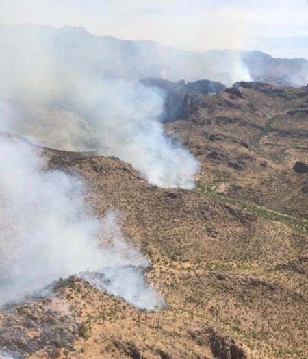
Sawtooth Fire Arizona
Sawtooth Fire southeast of Phoenix, May 31, 2020. Photo by Tonto National Forest.

Numbers Fire grows to over 18,000 acres south of Carson City, Nevada

Six miles southeast of Minden

(UPDATED at 12:02 p.m. MDT July 9, 2020)

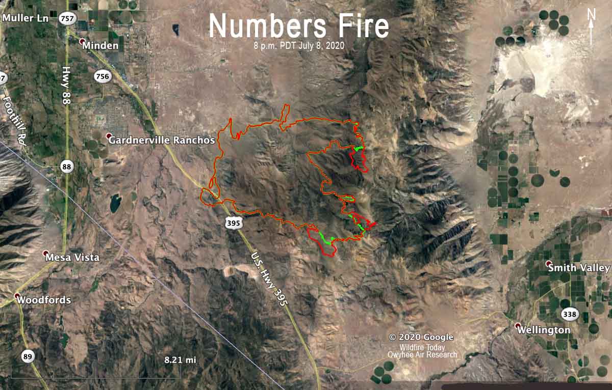
Map of the Numbers Fire
Map of the Numbers Fire. The red line was the perimeter at 8 p.m. MDT July 8, 2020. The green line was the perimeter 24 hours earlier.

The spread of the Numbers Fire south of Carson City, Nevada slowed Wednesday, but a mapping flight at 8 p.m. MDT July 8 determined that it added an additional 1,025 acres to bring the total up to 18,321.

Information from the Incident Management Team Thursday, July 9:

“Great Basin Team 4, a Type 2 Incident Management Team, assumed command of the Numbers Fire this morning.

“[Thursday], crews are being flown to the upper ridgeline of the Pine Nut Mountains to limit fire spread over the ridge to the east and into Smith Valley.  Right now, this is the area of greatest concern for additional fire growth.  Helicopters will support these crews by dropping water from buckets and delivering supplies.

“Additional firefighting resources will continue to secure and patrol existing firelines and respond to any adjacent fire activity.  In some areas, where containment is certain, crews and equipment will begin to repair suppression actions.  This includes rehabilitation of ground moved by dozers to create fireline.”


(Revised at 8:10 a.m. MDT July 8, 2020)

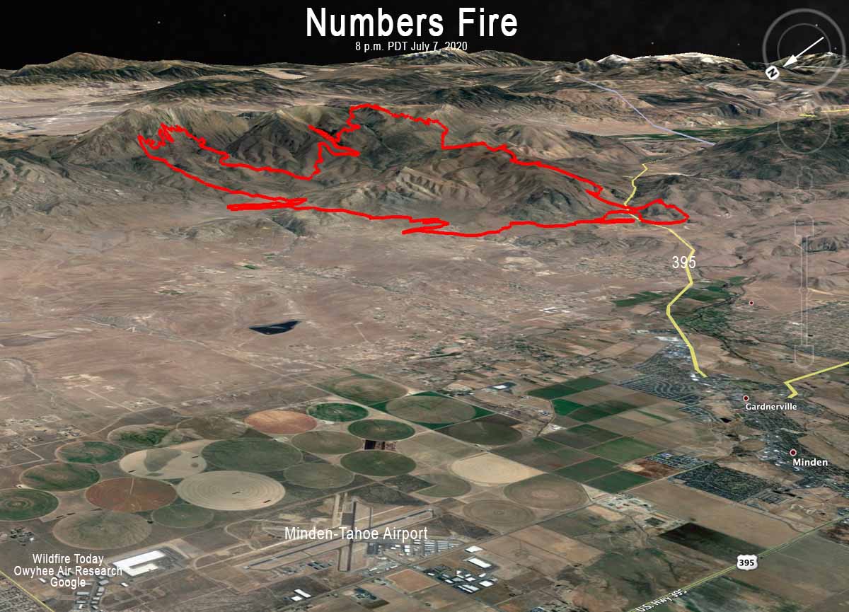
Map of the Numbers Fire at 8 pm MDT July 7, 2020
3-D map of the Numbers Fire at 8 pm MDT July 7, 2020. Looking southeast.

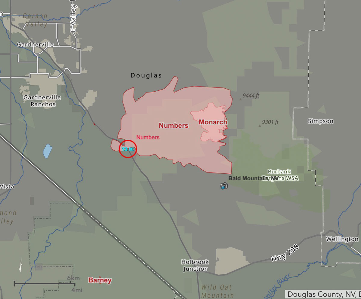
The Numbers Fire 17 miles south of Carson City, Nevada burned 17,296 acres during the first 24 hours after being reported at 9:01 p.m. MDT July 6, 2020. A mapping flight at 8 p.m. July 7 showed that it had burned into the 2,323-acre Monarch Fire that started June 26, 2020.

A Type 2 Incident Management Team, Great Basin Team 4, is organizing the efforts of 11 hand crews, 38 fire engines, and 9 helicopters, for a total of 450 personnel. The fire behavior is described as extreme and threatens 350 residences.

(To see all articles on Wildfire Today about the Numbers Fire, including the most recent, click here.)

Numbers Fire map
Numbers Fire map, July 8 2020. The Numbers Fire has burned into the Monarch Fire that started June 26, 2020.

Wednesday afternoon firefighters on the Numbers Fire can expect sunny skies with no chance of rain, temperature around 80, relative humidity of 10 percent, and wind out of the northwest at 12 to 17 mph gusting to 25 — conditions similar to Tuesday.

Wednesday morning fire officials said evacuations had been lifted for Pine View Estates, Bodie Flat, Out our Way Area, Blue Bird, and Lena Way.

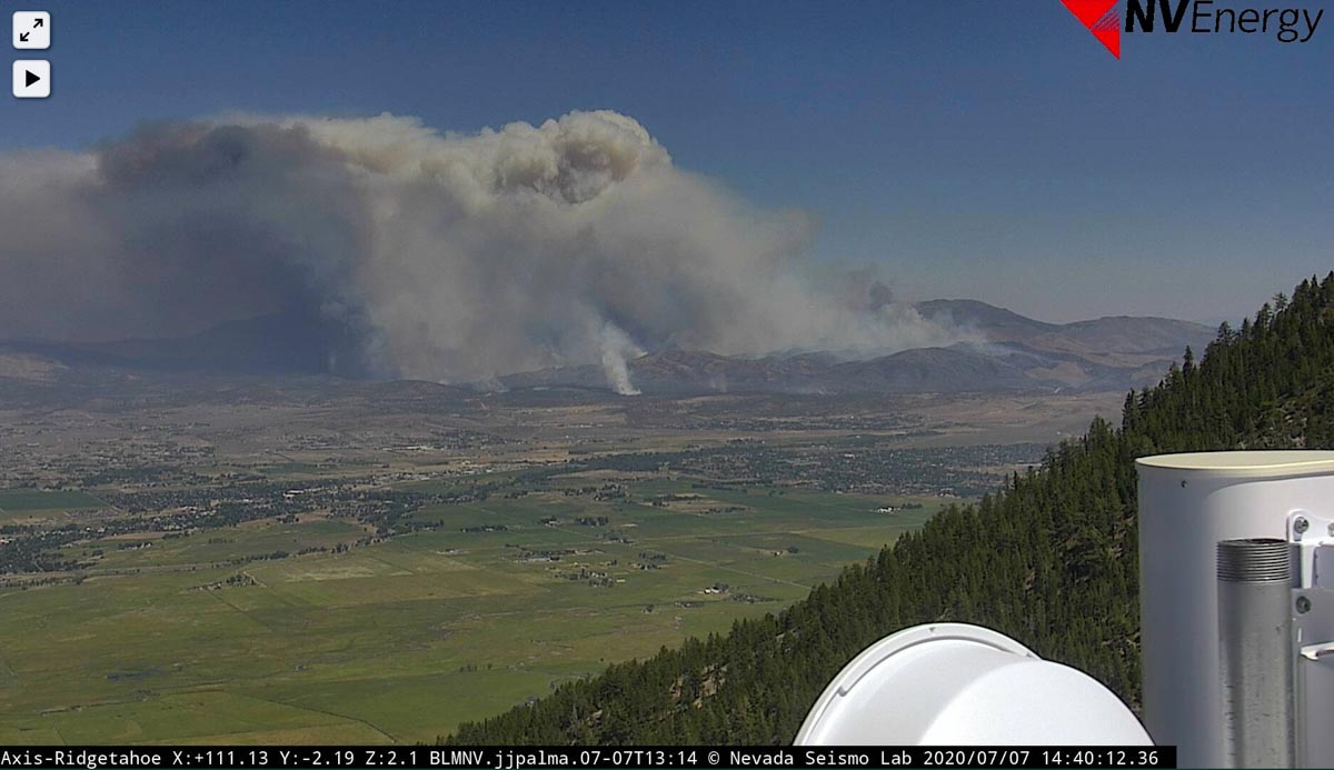
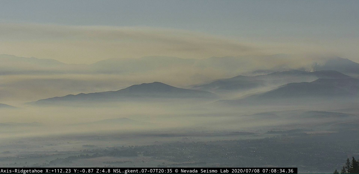
The two photos below were taken from the same camera at Ridge Tahoe. The first is from 2:40 p.m. June 7, and the second, 7:08 a.m. June 8.

Numbers Fire Nevada wildfire Carson City Minden
Numbers Fire, Ridge Tahoe cam at 2:40 p.m. June 7, 2020. Looking southeast.
Numbers Fire
The Numbers Fire as seen from Ridge Tahoe at 7:08 a.m. July 8, 2020. Looking southeast.

Helicopter crashes while working on the Polles Fire in Arizona

(Updated at 8:18 p.m. MDT July 7, 2020)

Map helicopter crash Arizona Payson Polles Fire
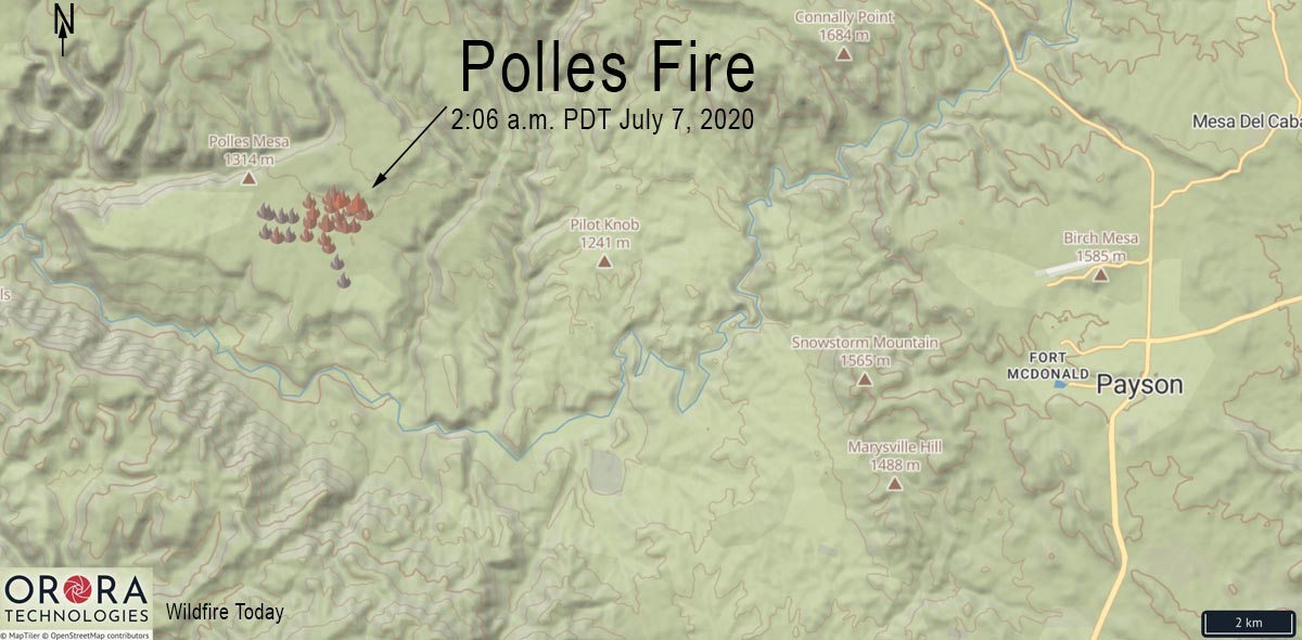
Map showing heat detected on the Polles Fire by satellites at 2:06 a.m. MDT July 7, 2020.

Officials from the Tonto National Forest confirmed that a helicopter crashed today while working on the Polles Fire in central Arizona. The only person on board was the pilot, who was deceased. He was identified in a press conference as Bryan Boatman, 37, with Airwest Helicopters out of Glendale, Arizona. He leaves behind a wife and 8-year-old child.

The Chief of the Pine-Strawberry Fire District said the pilot’s wife arrived at the Payson Airport as the body was being retrieved from the accident scene.

The helicopter crashed north of the main fire in a remote area only accessible on foot or by helicopter while transporting supplies for hand crews. After the crash was reported to the fire’s Incident Commander at 12:22 p.m. Tuesday, a Sergeant with Sheriff’s office was transported to the scene via short haul, suspended on a rope under a helicopter. He began the process of the investigation and removing the pilot’s remains.

A Federal Aviation Administration spokesman said the UH-1H helicopter went down about 10 miles west of Payson.

A Temporary Flight Restriction (TFR) has been issued at the Payson airport due to the crash, Airport Coordinator Dennis Dueker said. All flights in the area will be grounded until the TFR is lifted.

As of Monday night the Polles Fire had burned 580 acres 11 miles west of Payson, Arizona.

The Southwest Area Type 1 Incident Management Team (IMT) #2 led by John Pierson was scheduled to assume command of the fire July 6 at 6 a.m.

Six hotshot crews and three other hand crews are working in conditions described by the incident management team as extreme. They have been working shifts late into the evening for the last few nights, spiked out in remote locations relying on helicopters to fly in their food, drinking water, and supplies.

The IMT said there are no current threats from the fire to the communities of Pine-Strawberry or Payson.

The fire started July 3 from lightning. It is only accessible by helicopter.

Polles Fire
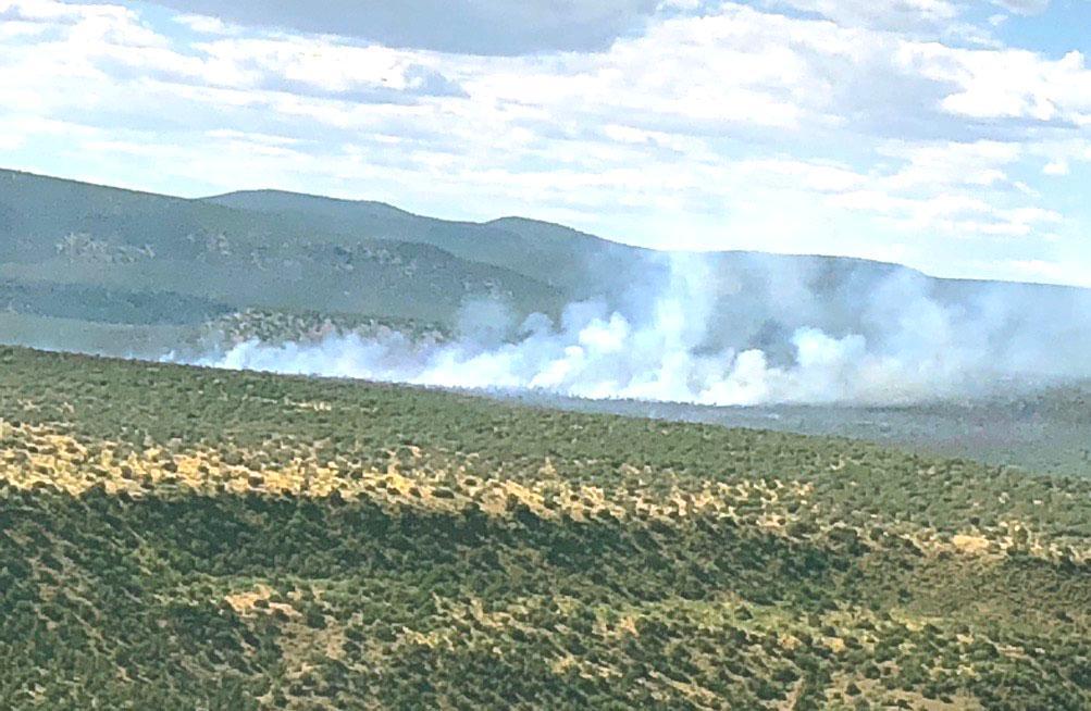
Smoke from the Polles Fire. InciWeb photo posted July 6, 2020.

Our sincere condolences go out to the family and friends of the pilot, and the firefighters that were working on the Polles Fire.

Thanks and tips of the hat go out to Tom, Eric, and Kelly. Typos or errors, report them HERE.

Evacuations southeast of Minden, NV for Numbers Fire

17 miles south of Carson City

(UPDATED at 9:22 p.m. MDT July 7, 2020)

Numbers Fire map Minden Nevada
Numbers Fire map, showing heat detected by a satellite as late as 3:48 p.m. MDT July 7, 2020.

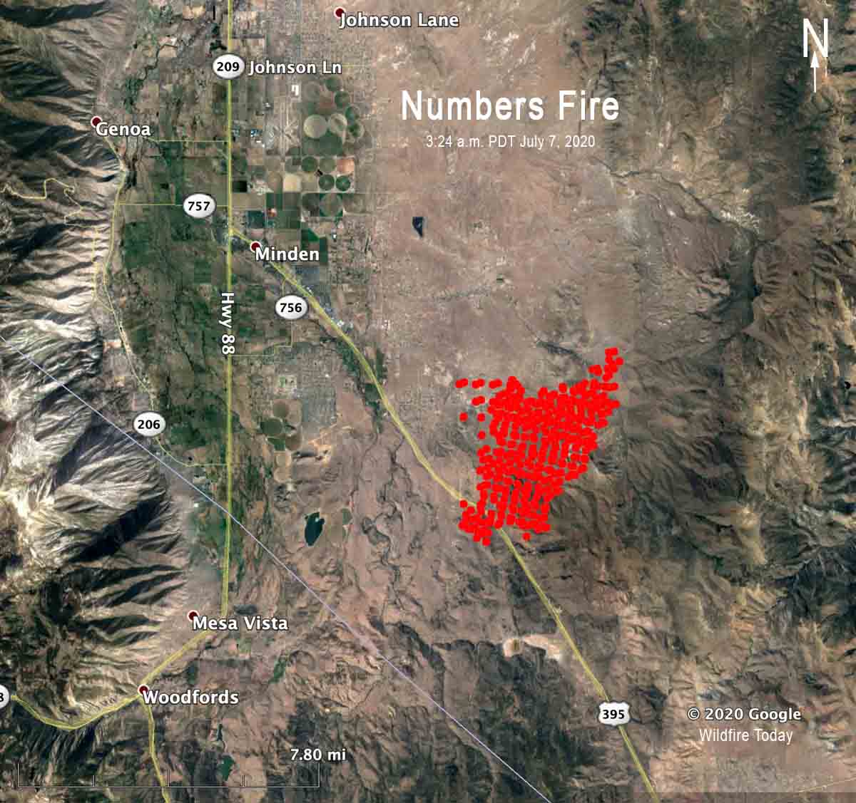
On Tuesday afternoon the Numbers fire six miles southeast of Minden, Nevada spread an additional two miles to the east, pushed by strong winds. Our very unofficial estimate based on satellite data is that by 4 p.m. Tuesday it had burned approximately 12,000 acres.

(To see all articles on Wildfire Today about the Numbers Fire, including the most recent, click here.)


(Updated at 3 p.m. MDT July 7, 2020)

Numbers Fire Nevada wildfire Carson City Minden
Numbers Fire, Bald Mountain cam.

Residents directed to evacuate from the Numbers Fire are being directed to motels, rather than more conventional evacuation centers such as fairgrounds or sports facilities, due to the COVID-19 pandemic.

The fire has burned 7,500 acres 17 miles south of Carson City, Nevada and 6 miles southeast of Minden. The area is described as the Pine Nuts, in the Pine View area of Gardnerville.

Numbers Fire map
Numbers Fire map, showing heat detected by a satellite at 3:24 a.m. MDT July 7, 2020.

Fire officials said one “structure” has burned in addition to 10 outbuildings.

Tow ALERT Wildfire cameras have good views of the fire, Ridge Tahoe and Bald Mountain. The fire appears to be close to the latter camera.

Numbers Fire Nevada wildfire Carson City Minden
Numbers Fire, Ridge Tahoe cam.
Numbers Fire Nevada wildfire Carson City Minden
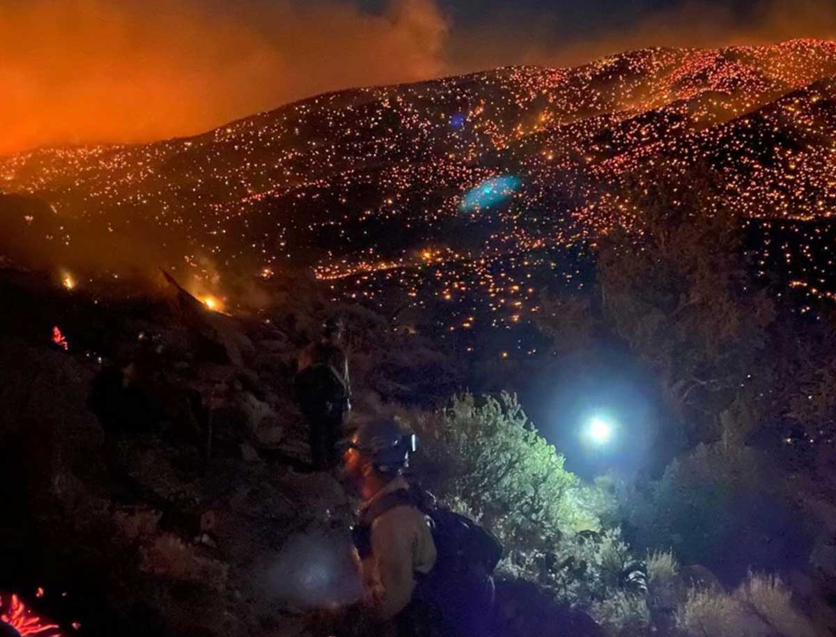
Numbers Fire, July 6, 2020. Photo by Tallac Hotshots.
Numbers Fire Nevada wildfire Carson City Minden
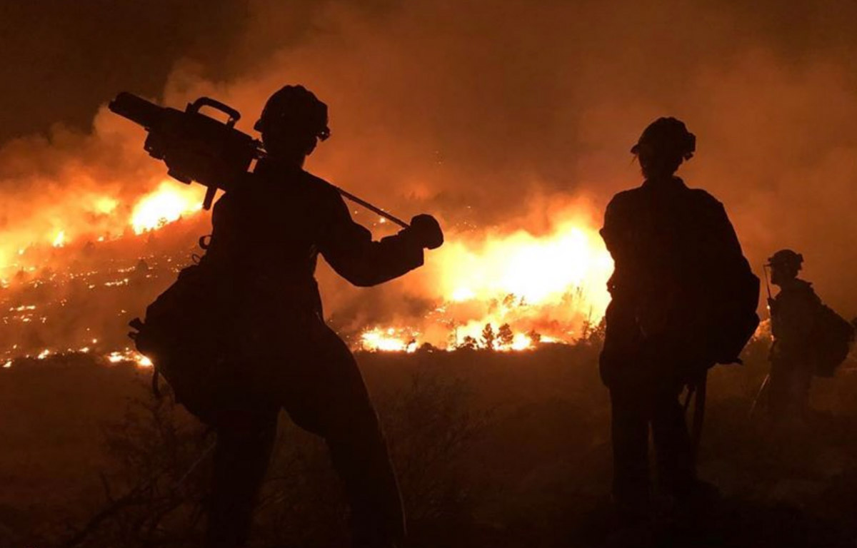
Numbers Fire, July 6, 2020. Photo by Tallac Hotshots.

Thanks and a tip of the hat go out to Dan. Typos or errors, report them HERE.