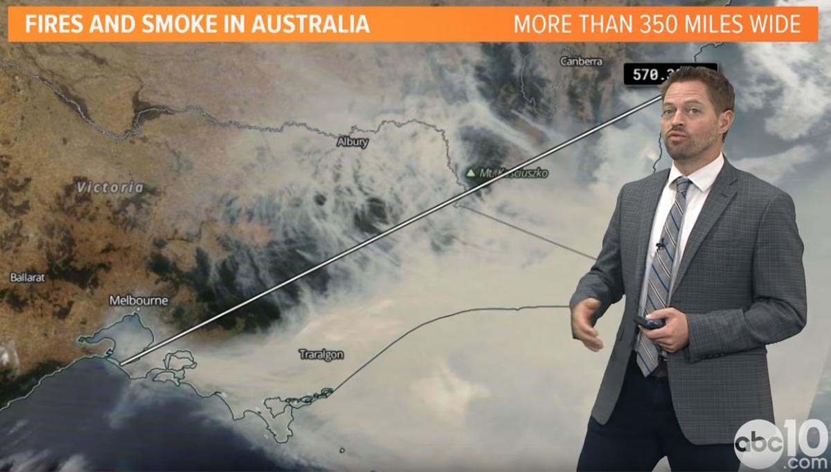
Rob Carlmark, a meteorologist at Sacramento TV station ABC10, explains the weather that has created the current unprecedented bushfire situation in Australia.
You can follow Mr. Carlmark on Twitter: @rcalrmark
News and opinion about wildland fire

Rob Carlmark, a meteorologist at Sacramento TV station ABC10, explains the weather that has created the current unprecedented bushfire situation in Australia.
You can follow Mr. Carlmark on Twitter: @rcalrmark
Temperatures in the New South Wales inland areas on Friday will be over 100F accompanied by strong winds
On Monday and Tuesday local time in New South Wales some areas west of Sydney received rain, which with the higher humidities and lower temperatures slowed the spread of fires in the area. The cooler weather will continue until Friday when the inland areas of NSW will experience temperatures over 100F, 15 percent relative humidity, 15 mph northwest winds, and a chance of dry lightning which could ignite even more fires. The hot, dry, windy weather is expected to last just for the day after which temperatures should drop back into the 80s for several days.

In other bushfire news, Australia’s government is committing an additional $2 billion over two years to a new agency tasked with rebuilding bushfire-ravaged communities.
One source for informing the public and gathering information about mitigating the emergencies, providing relief, managing transportation corridors, electrical power grids, and evacuations
After the 2019-2020 southern hemisphere bushfire season, emergency management personnel in both the United States and Australia should take the opportunity to evaluate the fire season and determine if there is a better way of distributing information to the public and emergency management agencies. In neither country is there one key source for information where the public, the media, and the responsible agencies can quickly and efficiently obtain important real-time intelligence and predictive models that they need to make decisions about informing the public, mitigating the emergencies, providing relief, managing transportation corridors, and gathering information about electrical power grids and evacuations.
The military calls this information source a common operating picture (COP).
All of this information is available at hundreds if not thousands of sources, but not everyone that could benefit from the data have access. It needs to be pulled together for safety and efficiency.
In the United States if a citizen needs current information about a wildfire how do they get it? From the county sheriff, local fire department, or a county, state, or federal agency? It makes a difference about where to look if the fire is on federal land, state protected land, city, county, national or state park. They can try social media, but which application and which account? InciWeb sometimes has information about wildfires managed by federal agencies, but not all. And since law enforcement is responsible for evacuation, InciWeb does not always have current information about the status of evacuations. Information on the website about individual fires may not have been updated for 12 to 18 hours, however some incident management teams are better than others. And InciWeb rarely provides projections of fire spread in a timely manner, if at all. When someone is threatened by a rapidly spreading wildfire they don’t have time to randomly check an alphabet soup of acronyms on dozens of web sites or social media accounts, even if they know the names, handles, or web addresses.
A COP would need to have a sign-in option that would make it possible for authorized personnel to see detailed data that should not be distributed to the whole world, such as exact locations of resources.
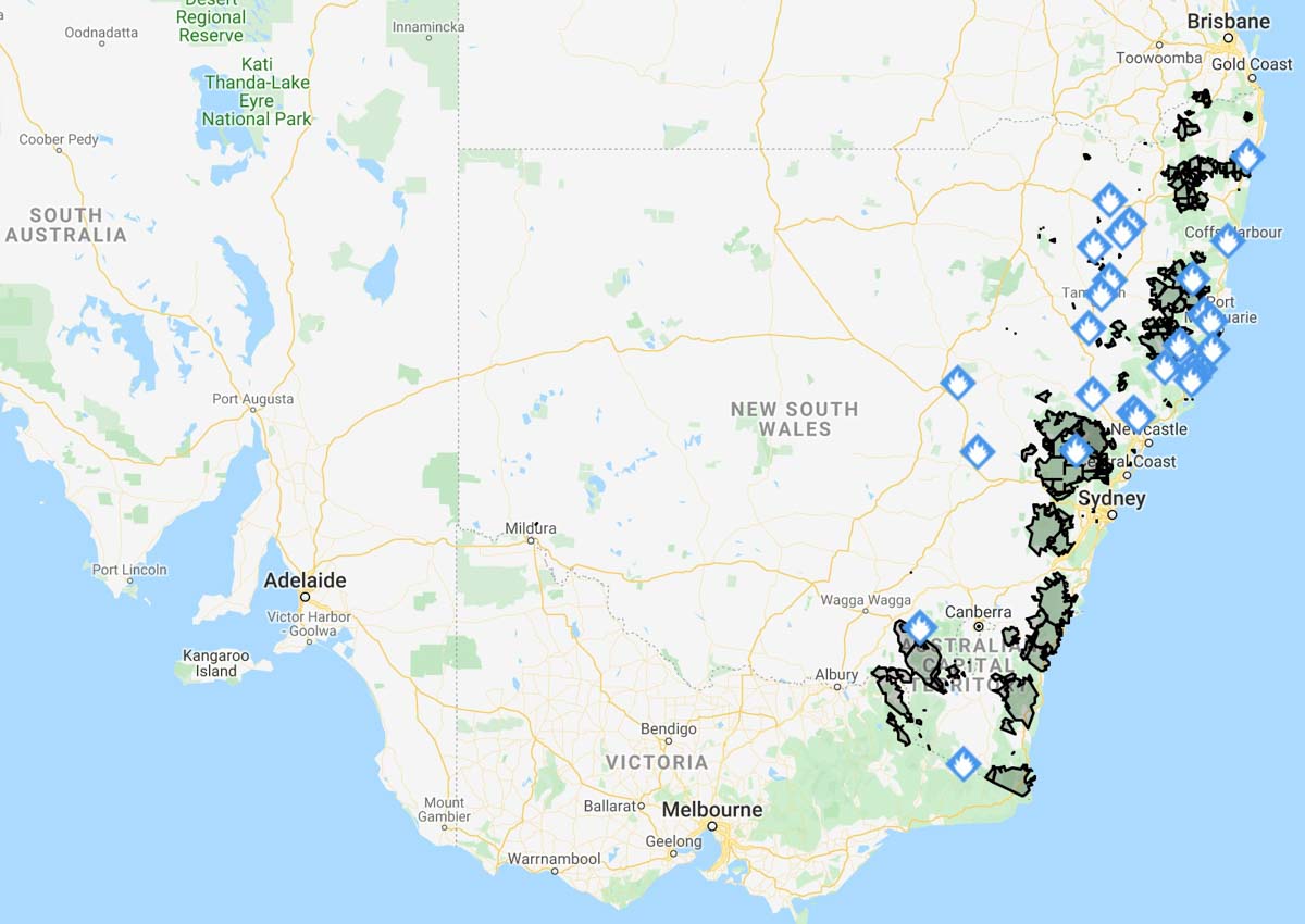
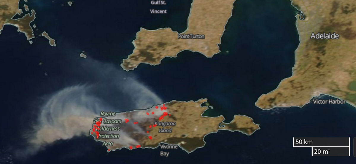
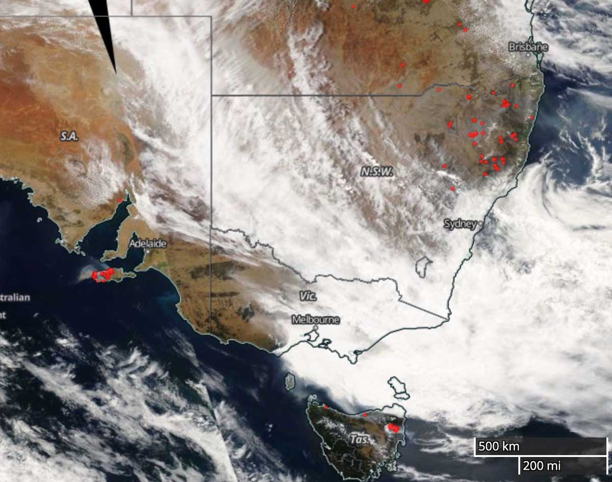
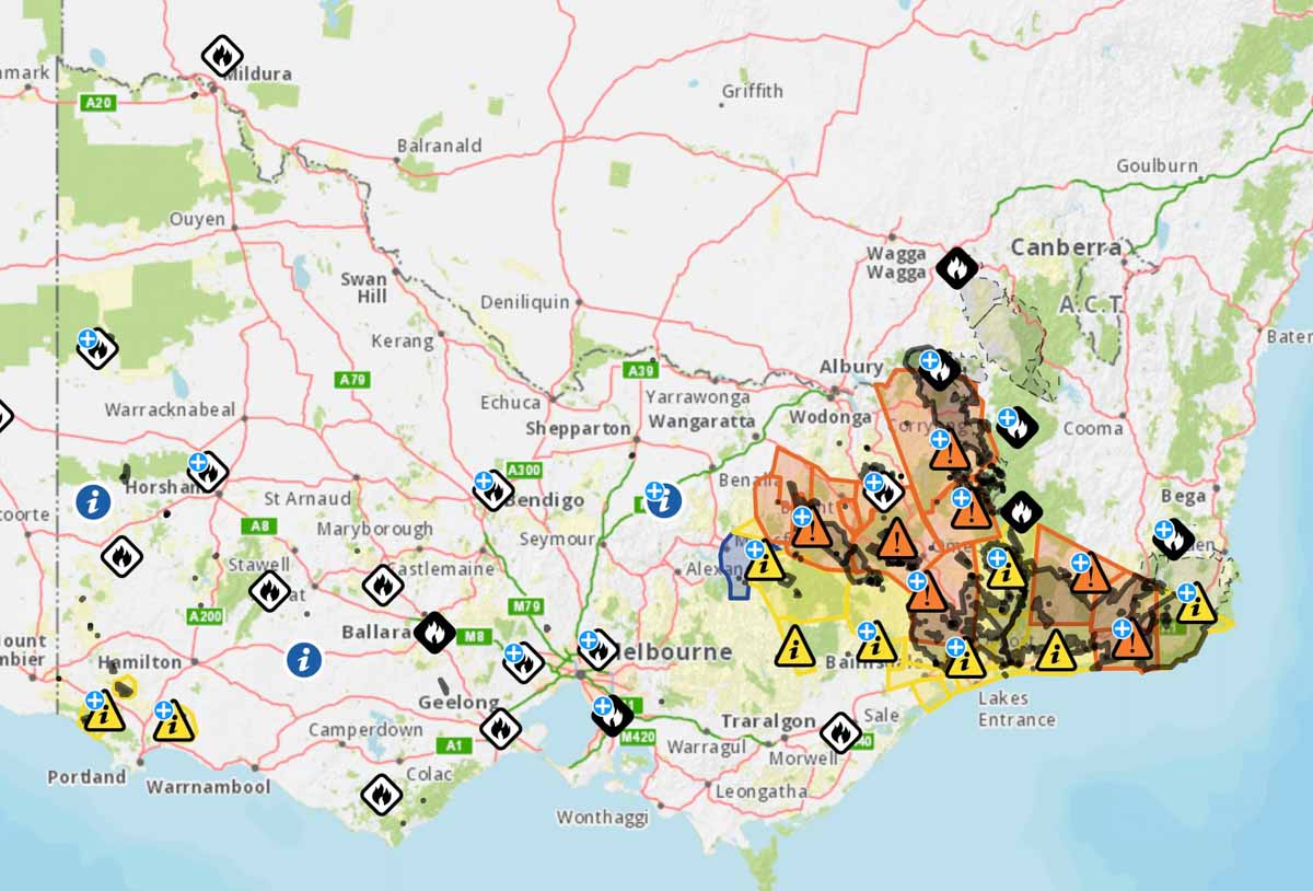
Below are examples of fire location information in Australia on January 6, 2020 United States time, in addition to the Victoria map at the top of the page.

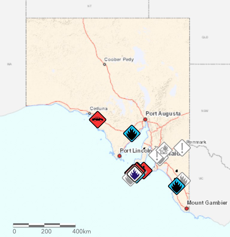
The maps produced for New South Wales and South Australia can be more useful upon zooming in, but occasionally they are so cluttered with multiple polygons and symbols that they are difficult to decipher. The Victoria map improves after zooming in, but it tries to include too much information.
The data on these three maps stops at the imaginary line separating the states. This could give someone the false impression that there are no fires just across the state border. If you need information about a location near a state line you need to know how to access the data for both states.
The three Australian states all use different symbology, so an icon or polygon on one map may have a completely different meaning in the neighboring state.
The New South Wales Rural Fire Service occasionally produces detailed maps showing the perimeter of a single fire and the predicted spread, but it is not done on a regular basis and may be difficult to find when it does exist.
But these Australian state maps attempt to include at least some information about all large bushfires in their state. In the United States no agency to my knowledge even attempts this. InciWeb produces a map of the country that shows the location of every fire on federally managed land that is being tracked on the website, but does not include federal fires that are not on the site, or state or locally managed fires.
For both Australia and the U.S. creating a national map for wildfire information would be a great first step toward a common operating picture.
Check out Ellen Broad’s thread on this mapping topic. She has some excellent observations.
This should be a priority…. https://t.co/IXvmL6LTHu
— Wildfire Today ? (@wildfiretoday) January 4, 2020

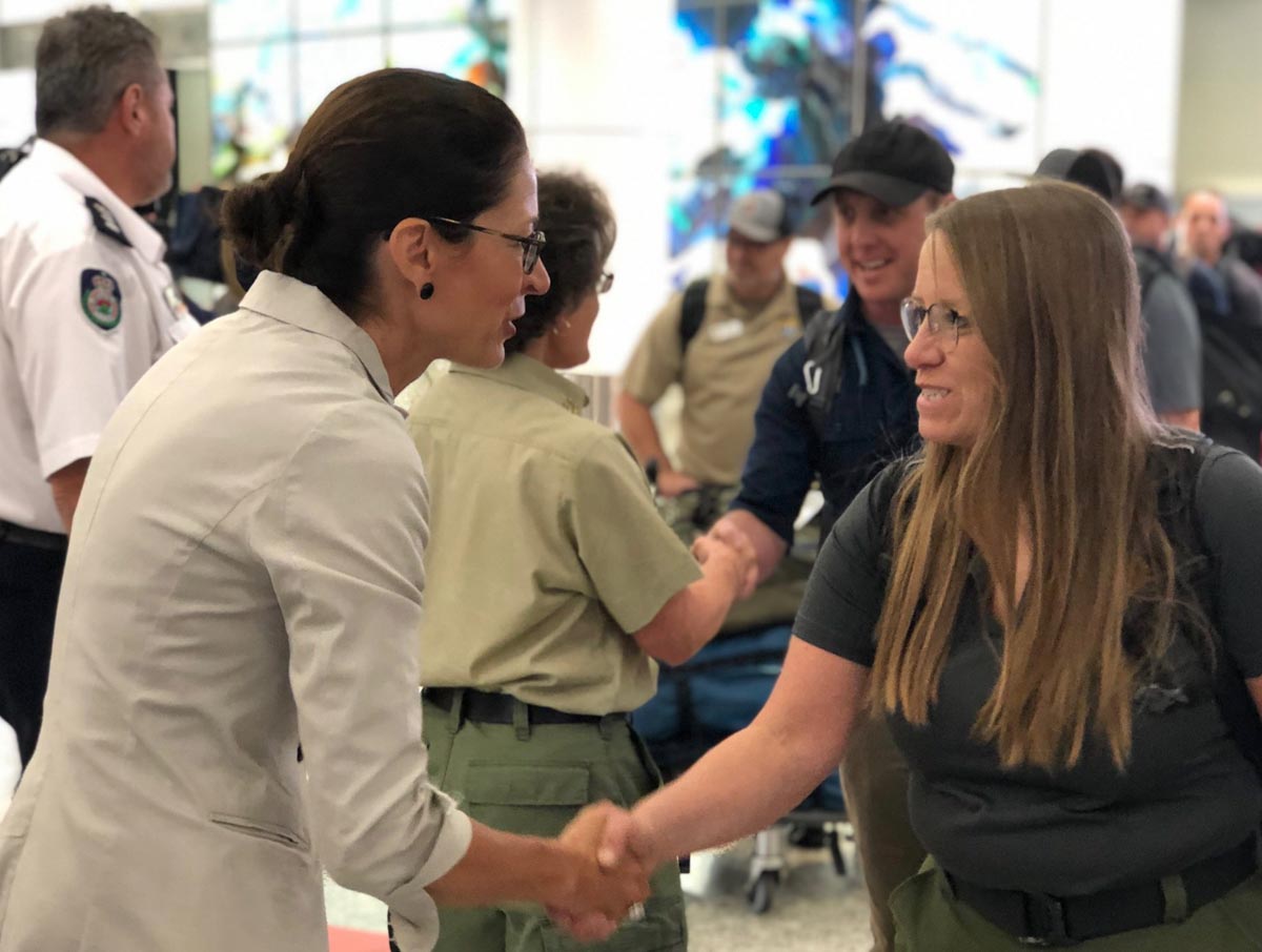
By mid-week 155 firefighters will have deployed from the United States to assist with the fires in Australia, including a group of 71 (61 from the U.S. and 10 from Canada) that is expected to arrive Wednesday.

Wildfire Today was established January 6, 2008
Like the sign says, welcome to the beginning of the twelfth year of Wildfire Today!
Twelve years ago, on January 6, 2008, I started a little niche web site called Wildfire Today. It began on Blogger, Google’s free blogging service, and has grown to a body of work that now includes 8,890 articles.
We are still covering news and issues related to wildland fire. And not simply that a fire occurred somewhere, but we prefer to write about topics and events that have an impact and are interesting, not only to firefighters but to anyone concerned about wildland fire, or who may live in a fire-prone environment. We don’t attempt to cover every fire, or even every very large fire, but if an event or news item interests us, we hope that you will also find it to be worth your while. We are especially keen on covering issues related to the heath and safety of those who are dedicated to helping others — who manage land and respond to incidents while everyone else is heading in the other direction.
The success of the site would not have been possible without the loyal readers who come back on a regular basis, read the articles, leave insightful comments, and occasionally send us a message informing us of breaking news in the world of wildland fire. And the supporters who allow us to keep the doors open by placing ads. Thank you!
The two ships unloaded their passengers at Hastings near Melbourne on Saturday
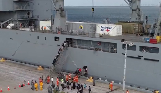
Over 1,000 people who were forced by the bushfires in Australia to take refuge on coastal beaches have been rescued by the Navy and transported to the Melbourne area. Friday morning the evacuees at Mallacoota in northeast Victoria were moved from the community center to the pier by buses and then transported to ships using five landing craft.
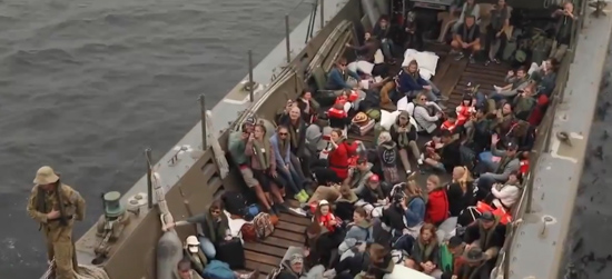
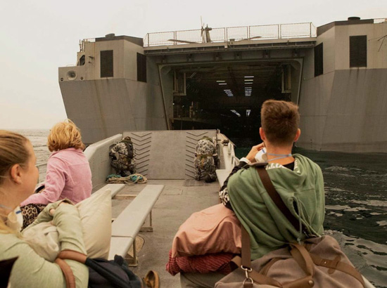
Two ships took part in the mission. The smaller of the two was the MV Sycamore, a 308-foot 2,400-ton training ship first launched in 2016. It normally operates with a 22-person crew, can accommodate up to 71 Australian Defense Force personnel overnight, and has a multi-use space which can be configured to help cope with disasters. The Sycamore picked up 58 evacuees at Mallacoota on the northeast coast of Victoria and transported them on a 20-hour voyage about 320 miles to Hastings near Melbourne.
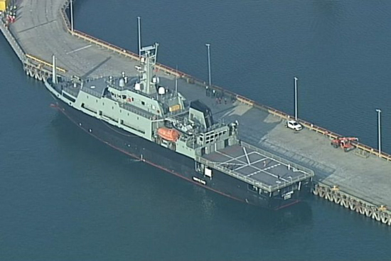
The HMAS Choules is much larger than the Sycamore — 579 feet and 16,160 tons. It is classified as an “auxiliary landing ship logistics”, designed for hauling cargo. It operates with a 158-person crew and can carry 32 M1A1 Abrams tanks or 150 light trucks. According to Wikipedia it can transport 700 soldiers “in overload conditions.” On Friday it loaded 1,025 evacuees at Mallacoota and took them on the same 20-hour voyage to the Melbourne area. Army staff on the ship served approximately 3,500 meals during the trip.
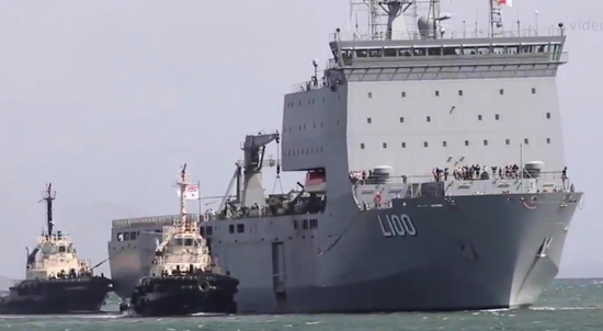
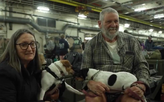
Both ships docked at the Port of Hastings Saturday and the passengers were transferred to a disaster relief center at the Melbourne convention center. They brought with them 135 dogs and several cats.
Evacuees who were very sick were flown from Mallacoota on Blackhawk helicopters.
In interviews with the Australian Broadcasting Corporation and the Department of Defense, the evacuees spoke glowingly of how they were treated by the crews on the ships. A 16-year-old girl who had just disembarked from the Sycamore said, “It was so comfortable on the ship. The crew was amazing, food amazing, the beds — perfect. I’m very thankful for it.”
The two ships were scheduled to return to Mallacoota.
