Findings about the fluid dynamics of wildfires

That ambient winds influence fire behavior is well known. Less understood is how fire influences the winds and how the feedback affects the fire’s evolution.

wildfire dynamics wind fields
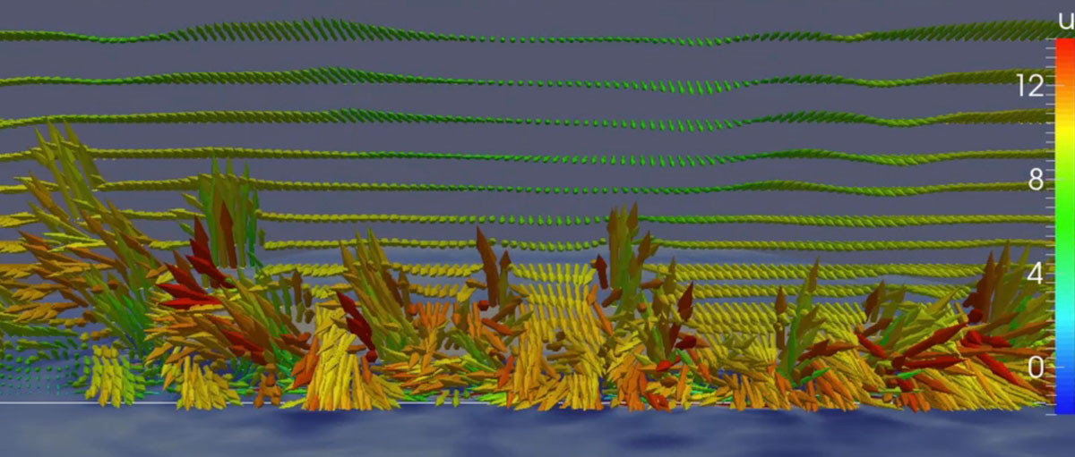
One freeze-frame moment in a simulation illustrating the dynamics of wind fields in a vertical plane as a wildfire approaches — towers and troughs. From the video.
wildfire dynamics wind fields
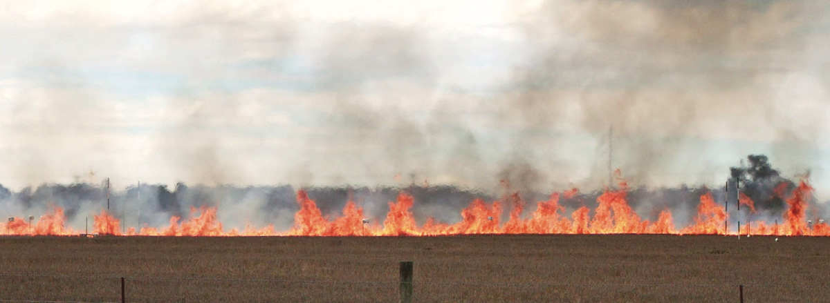
Towers and troughs, in reality. In this experimental grass fire, the few visible peaks are separated by gaps in which the wind currents sweep downward between the flames and feed the peaks on opposite sides. (Courtesy of Mark Finney, US Forest Service, Missoula Fire Sciences Laboratory.)

The more knowledge firefighters have about the fluid dynamics of wildfires the better equipped they will be to take on the tasks of igniting prescribed fires and suppressing wildfires.

Below is an article written by Rod Linn, who leads development, implementation, testing, and application of computational models of wildfire behavior in the Earth and environmental sciences division at Los Alamos National Laboratory in New Mexico. From Physics Today 72, 11, 70 (2019).  https://doi.org/10.1063/PT.3.4350


Fluid dynamics of wildfires

Wildland fires are an unavoidable and essential feature of the natural environment. They’re also increasingly dangerous as communities continue to spread away from urban areas. Unfortunately, a century of wildfire exclusion—the strategy of putting out fires as fast as they start—has led to a significant buildup of fuel in the form of overgrown forests. Continuing to keep wildfires at bay is simply not sustainable. In 2018, nearly 60,000 fires scorched parts of the continental US. California wildfires exemplify what can happen when they burn through communities: In November alone that year fires killed more than 90 people and destroyed some 14,000 homes and businesses.

Decision makers are striving to find ways to manage the consequences of those fires and yet still allow them to thin out dense, fuel-heavy forests and reset ecosystems. Among other things, the goal requires that land managers be able to predict the behavior of wildland fires and their sensitivity to ever-changing conditions. Many factors, including the interactions between fire, surrounding winds, vegetation, and terrain, complicate those predictions.

That ambient winds influence fire behavior is well known. Less understood is how fire influences the winds and how the feedback affects the fire’s evolution. As the fire rages, it releases energy and heats the air. The rising air draws in air below it to fill the gap in much the same way as air is drawn into a fireplace and rises up a chimney. The interaction between rising air and ambient winds controls the rate at which surrounding vegetation heats up and whether it ignites. The interaction thus determines how quickly a fire spreads.

FUEL MATTERS
The influence of the fire–atmosphere coupling is much greater in wildland fires than in building fires. Wildland fires are fed by fine fuels—typically grasses, needles, leaves, and twigs; often, tree trunks and large branches do not even burn. Buildings burn thicker fuels, such as boards, furniture, and stacks of books. The difference matters because fine fuels exchange energy more efficiently with surrounding hot air and gases. In those hot, fast-moving gases, the fuels’ temperature rises quickly to the point where they ignite.

But the converse is also true. Because wildland fuels are primarily fine, they are also efficiently cooled when the surrounding ambient air is cooler than they are. That means that the indraft of air caused by a fire may actually impede its spread. A rising plume can draw cool air over foliage and litter near a fire line and prevent those fine fuels from heating. The grasses just outside a campfire ring are a case in point: They are continuously exposed to the fire’s radiant heat, but the cool indraft effectively prevents them from reaching the point of ignition.

The spread of a wildfire is sometimes conceptualized as an advancing wall of flame that the wind forces to lean toward unburned fuels that then ignite in front of the fire. Although that wall-of-flame paradigm simplifies models of fire behavior, it is not correct. Convective cooling would prevent the wall of flame from spreading by radiation alone, and for convective heating to spread the fire, the wind would have to be strong enough to lean the flame to the point where it touches the unburned fuel. Were that true, the fires would be unable to spread in low-wind conditions because the buoyancy-driven updrafts would keep the flames too upright.

If you were to look upon an advancing wildfire from the front, you would actually see a series of strong updrafts, visible as towers of flame that are separated by gaps, as shown in figures 1 and 2. The towers are regions where the buoyancy-driven updrafts carry heat upward. They are fed by ambient wind drawn into the gaps between them, as described earlier. When the ambient wind is strong enough, it pushes air through the gaps between the towers, but that air is heated as it blows over burning vegetation. The motion of hot gases through the fire line disrupts the indraft of cool ambient air and ignites grasses and foliage in front of the fire. That’s the primary way a wildfire spreads.

A second factor that influences the spread is the shape of the fire line, because different parts of the blaze compete for wind. The headfire, the portion moving the fastest, often has trailing flanking fires that form a horseshoe shape and open up to the ambient wind. Part of that wind gets redirected toward the flanks of the horseshoe. The strength, length, and proximity of the flanking fires to each other thus help determine how much wind reaches the headfire. The narrower the horseshoe is, the larger the fraction of wind diverted to the flanks, the lower the wind speed reaching the headfire, and the slower it spreads.

Another factor to be considered is the spatial arrangements of fuels. The potential for wildfires spreading from the crown of one tree to another is reduced when the spacing between trees increases. In that case more horizontal wind is required for flames to jump between trees. Indeed, removing trees is a common fire-risk-management practice. But the strategy behind it is more complex than just removing fuel. Gaps in a forest canopy also make it easier for high-speed winds above the canopy to reach fires on the ground. So although reducing the number of trees might reduce the crown-to-crown fire activity, it might increase the spread rate of a surface fire.

PRESCRIBED FIRE
In some regions of the US, land managers counter the threat of wildfires and promote ecosystem sustainability by purposefully lighting fires. Carefully controlled, prescribed burns, which clear duff and deadwood on the forest floor, are often lit at multiple locations; fire-induced indrafts at one location influence fires at other locations. For example, a single line of fire under moderate winds might reach spread rates and intensities that are undesirable or uncontrollable, but the addition of another line of fire upwind can influence how much ambient wind reaches the original fire and thus reduces its intensity.

The spread of the upstream fire line, ignited second, is purposefully limited, as it converges on the area downwind where the first fire has burned off fuel. Practitioners can manipulate the flow of wind between fire lines by adjusting the spacing between ignitions. Fire managers might tie the various ignition lines together—reducing the fresh-air ventilation, increasing the interaction between the lines, and causing fire lines to rapidly pull together—to give themselves more control over the spread.
The interaction between multiple fire lines can even stop a wildfire in its tracks. When firefighters place a new fire line downwind of a fire, they often hope that the indrafts will pull the so-called “counter fire” toward the wildfire and remove fuel in front of it. Unfortunately, the maneuver requires a good understanding of the wildfire’s indraft strength. Too weak an indraft could turn the counter fire into a second wildfire.

After realizing the huge significance of the wind interactions in wildfires over the past two decades, the science community is striving to better account for them. Those efforts should improve predictions of how a wildfire will behave in various conditions. To that end, some researchers, including me, use computer models to explicitly account for the motion of the atmosphere, wildfire processes, and the two-way feedbacks between them. Others perform experiments at scales ranging from meters (such as in wind tunnels) to kilometers (such as in high-intensity fires on rugged topography) for new insight on the nature of those fire–atmosphere interactions or to confirm existing models.

SIMULATION VIDEO

(If you’re having trouble playing the video, you can see it on YouTube)

The [above] simulation illustrates the dynamics of wind fields in a vertical plane, located at the white horizontal line, as a wildfire approaches it. The colors mark the speed u of the wind perpendicular to the plane, with red indicating motion toward the viewer (out of the screen), and blue indicating motion away from the viewer. As the clip shows, the fire starts to influence the winds long before it reaches the plane, and the wind patterns change in scale and character as the fire approaches. As the fire crosses the plane, the towers and trough flow patterns become apparent. Some locations show strong upward motion, whereas others have strong horizontal or even slightly downward motion. The colors on the ground surface illustrate the convective cooling (blue) that occurs as a result of the movement of cool air over the fuel— grasses in this simulation—and locations in front of the fire where the fuels are being convectively heated (red).

One NSW firefighter killed and two suffer burns in truck rollover

It is believed that the truck rolled when hit by extreme winds associated with the fire

Map Green Valley Fire
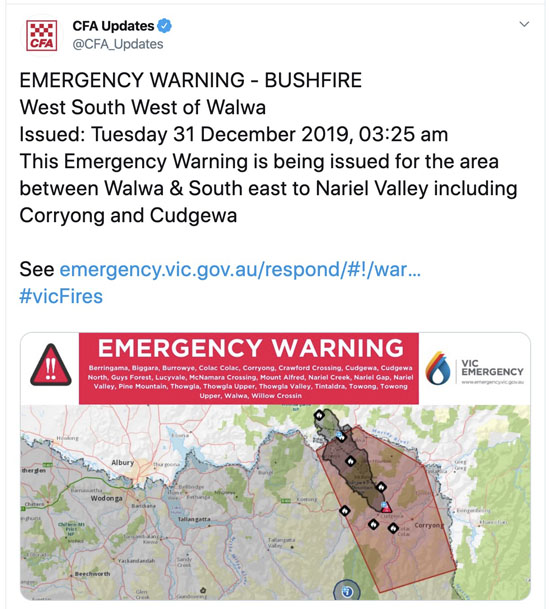
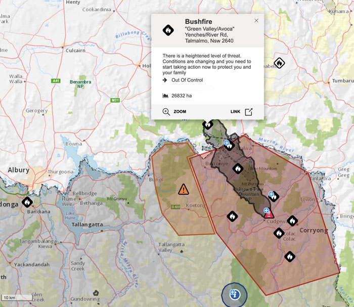
Map showing the Green Valley Fire, produced at 4 a.m. local time December 31, 2019. The fire is 43 miles east of Albury, NSW. Map by Victoria Emergency.

UPDATE: The New South Wales Rural Fire Service has identified the firefighter killed at the Green Valley Fire as Samuel McPaul from the Morven Brigade of the Southern Border Team. Today Service flags will be flown at half-mast as a mark of respect.

Samuel McPaul
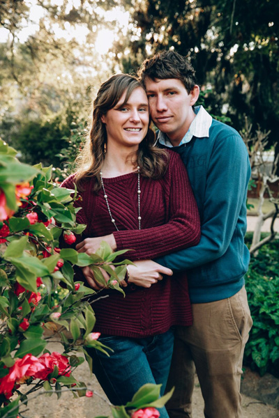
Samuel McPaul. Photo supplied by NSW RFS.

The New South Wales Rural Fire Service confirmed December 30 that a RFS volunteer firefighter died Monday evening near Jingellic. Two other firefighters on the same truck suffered burns and were transported to a hospital.

The firefighters were working on the Green Valley, Talmalmo Fire, approximately 70km (43 miles) east of Albury NSW when it is believed that “the truck rolled when hit by extreme winds associated with the fire” according to information released by the RFS. The incident occurred in NSW near the Victoria/NSW border 150km (93 miles) southwest of Canberra.

A second vehicle working in the same area was also blown over and the firefighter on board is being treated in a hospital.

Our sincere condolences go out to the family, friends, and coworkers of the firefighters.

New  South Wales has been experiencing numerous large bushfires for the last month and in recent days Victoria has as well.

On the day two firefighters were killed on the Carr Fire near Redding, California July 26, 2018 winds associated with the fire were estimated at 136-165 mph (EF-3 tornado strength), as indicated by wind damage to large oak trees, scouring of the ground surface, damage to roofs of houses, and lofting of large steel power line support towers, vehicles, and a steel marine shipping container. Multiple fire vehicles were damaged by flying debris and had their windows blown out.

Map Green Valley Fire
Map showing the Green Valley Fire

Thanks and a tip of the hat go out to Tom. Typos or errors, report them HERE.

More help from North America arrives in Australia

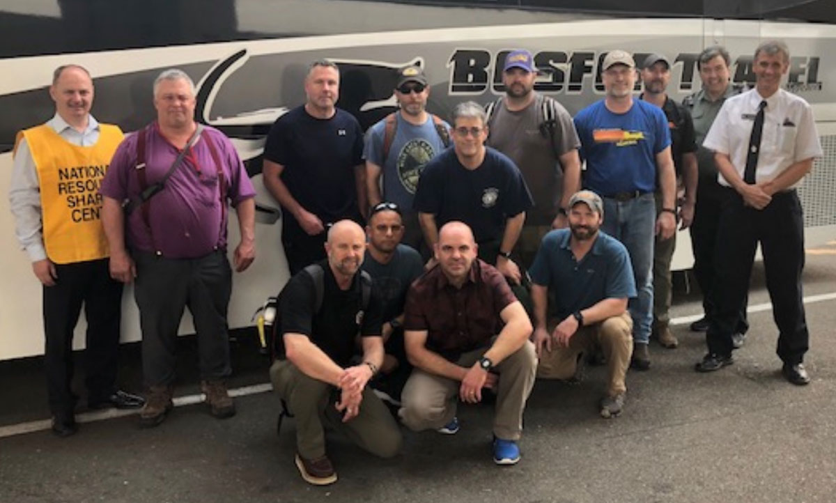
At least 40 additional fire personnel and several Meteorologists traveled across the equator recently

United States Incident Meteorologists in Australia
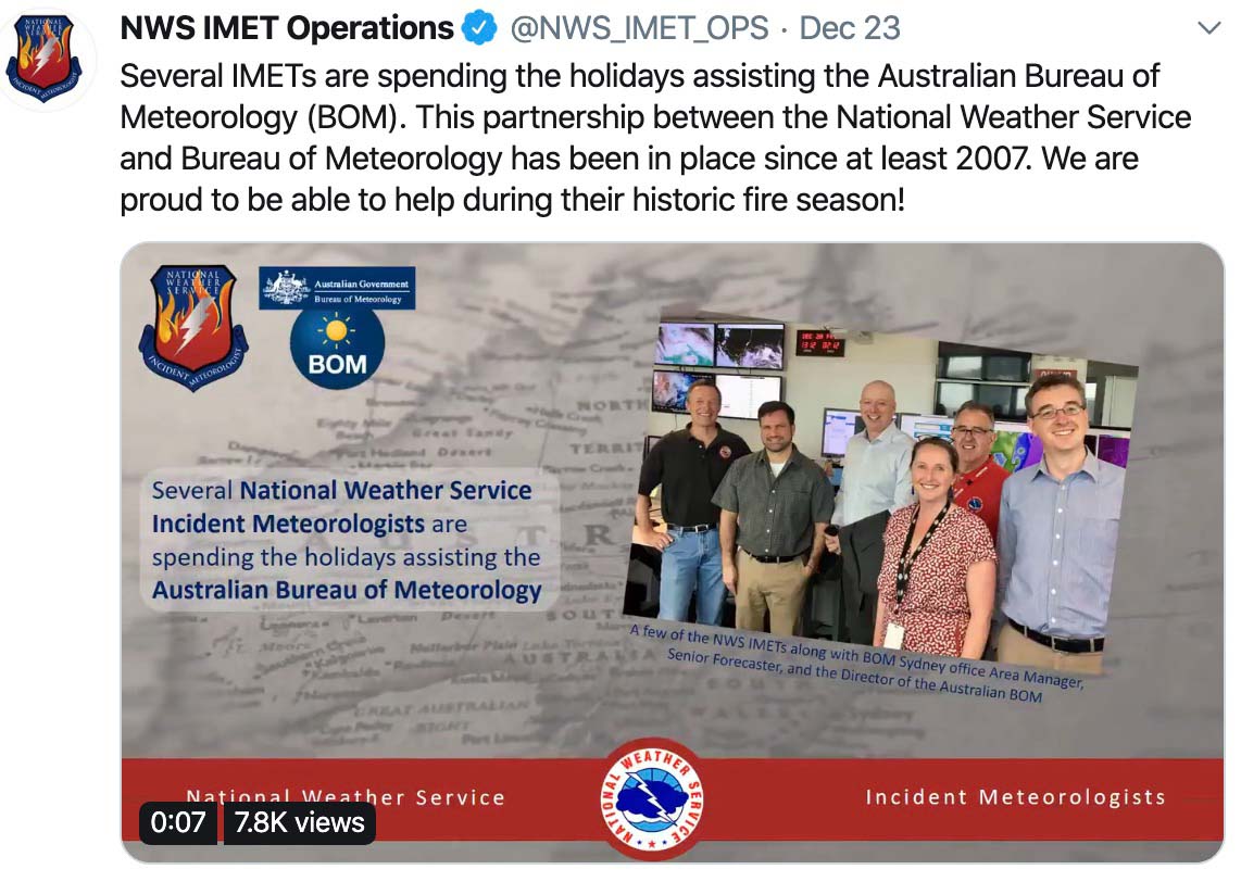
United States Incident Meteorologists in Australia.

Several dozen more firefighters and support personnel from North American arrived in Australia at the end of last week to assist in the bushfire campaigns that have been ongoing in the western part of the country for weeks. Earlier this month Canada and the United States each sent 21 firefighters. Those were followed up around December 20 with another 30 from Canada and 9 from the United States. In addition “several ” Incident Meteorologists from the U.S. are in the country to help provide weather forecasts for the firefighters.

The U.S. National Interagency Fire Center reported December 20 that a total of 33 personnel had been deployed from the U.S. to Australia. (UPDATE: on December 27 NIFC revised that number to 32.)

Canada firefighters in Australia assist
Thirty fire personnel from Canada arrived in Australia December 20. Photo: @NSWRFS
U.S. fire personnel in Australia
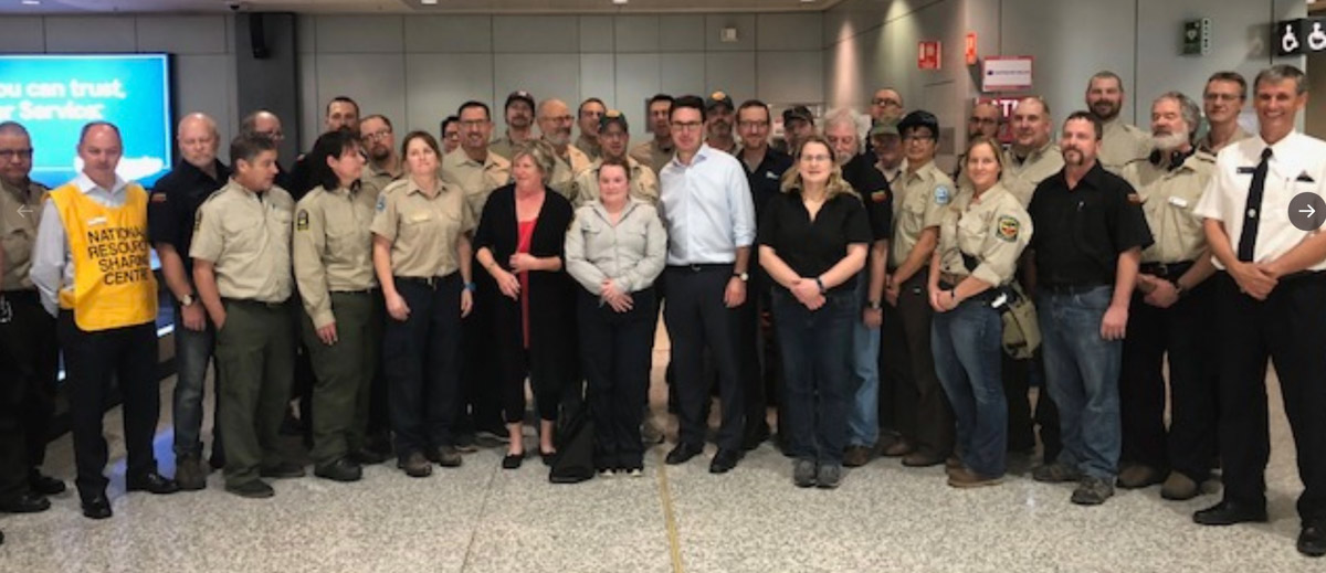
U.S. fire personnel in Australia December 20, 2019. Photo: @NSWRFS

NSW Premier says “there isn’t much left” of Balmoral

A survivor rode out the fire storm in a coffin-sized kiln

kiln survived bushfire coffin

Many structures have been destroyed by the rapidly spreading Green Wattle Creek bushfire in the small community of Balmoral, New South Wales. Prime Minister Gladys Berejiklian said “there isn’t much left” of the town in the Southern Highlands 49 air miles southwest of Sydney, Australia.

The fire burned through Balmoral twice, once on Thursday and again Saturday when it was pushed by strong winds that accompanied a frontal passage. The town, population 426 in the 2016 census, has about 150 homes.

The New South Wales Rural Fire Service reports that the Green Wattle Creek Bushfire has burned 474,000 acres. About 12km to the north is a huge blaze that is the product of four bushfires burning together — Gospers Mountain, Kerry Ridge, Little L Complex, and Three Mile. These five fires southwest and northwest of Sydney have burned a total of 2,228,000 acres (926,000 hectares).

Satellite photo of Balmoral, NSW.
Satellite photo of Balmoral, NSW. Google Earth. Jan. 3, 2019

As the Green Wattel Creek Bushfire burned through Balmoral Steve Harrison, a 67-year old artist, a potter, survived by climbing into a small kiln.

The day before I had actually built myself a small kiln down the back — a coffin-sized kiln — just big enough for me to crawl inside. I was in there for half an hour while the firestorm went over. That was my plan B.

Previously he had installed pumps and sprinklers to protect his home. Before the fire approached he and his wife wrapped their home in aluminum foil. The house survived, but his potting shed was destroyed.

Aviation rescue crews from the military have been checking homes and removing people at risk when there is no other option.

Military Assistance Australia bushfires

Thanks and a tip of the hat go out to Tom. Typos or errors, report them HERE.

Changes at Wildfire Today

You might have noticed that there have been some changes at Wildfire Today over the last week. I wanted the site to load faster and it needed a facelift so I hired a graphic artist and a software developer to tweak the layout, the back end, and the header at the top of the page .

workerWe didn’t shut down the site to do this, so you might have seen some unusual behavior off and on. It was kind of like changing the oil strainer on a Martin Mars while in flight.

I think it’s very close to complete, but if you run across something that appears to be broken or does not work well, let us know in a comment on this article, or contact us by email.

Here is a list of what has changed:

  • Faster. The site loads more quickly.
  • New Site Search. The previous Google-powered search function that showed ads is replaced by a customized advanced search with filters; pull-down lists that can help zero in on what you’re searching for. You don’t have to select any of the filter items; you can simply enter a term in the search box. You may restrict the search to a particular year or a month. On the “Countries” list the United States is not listed, so if that’s where you think the target may be, just leave that at “Countries”. If you want to narrow the search to one of the other 10 countries in the pull-down list, you’re free to do that. Provinces in Canada and Australia are in the “States/Pr” list along with the 50 U.S. states. “Topics” is a selection of 21 of the most commonly used tags (what the article is about). Tags make it easier for you (and Google) to search for a topic. To date we have used over 1,500 different tags. Some are obviously used more often than others.
  • Sort by seven commonly used topics. In main navigation at the top  of the page you can click on “Articles” to see posts on one of seven of the most-frequent topics, including recent fires. It uses tags that are applied to articles. Not all articles on Wildfire Today are represented by these seven tags.
  • Lazy Loading of images. The images “lazy load”. That is, the ones that are lower down don’t load into your browser until it appears that you are about to scroll down to display that image. So initially you only load what you need, then the loading stops. As you scroll down, more images download. You don’t have to download six articles if you’re only going to view one or two.
  • New Header. The header image at the top of the page is new and consumes less vertical real estate.
  • The main navigation (Home, Articles, Documents, etc.) was moved to the very top of the page and embedded in a dark background. It now remains visible as you scroll down the page.
  • Less white space. There is less empty space at the top of the home page, and the mostly empty column on the left is gone.
  • Info at top of article. Below the headline for each article you will now see the original posting date for the article, the category if applicable, tags, and a link to view or leave comments.

Fires west of Sydney burn over 2 million acres

The Gospers Mountain Fire northwest of Sydney, Australia has burned 1.1 million acres

bushfires New South Wales map satellite photo
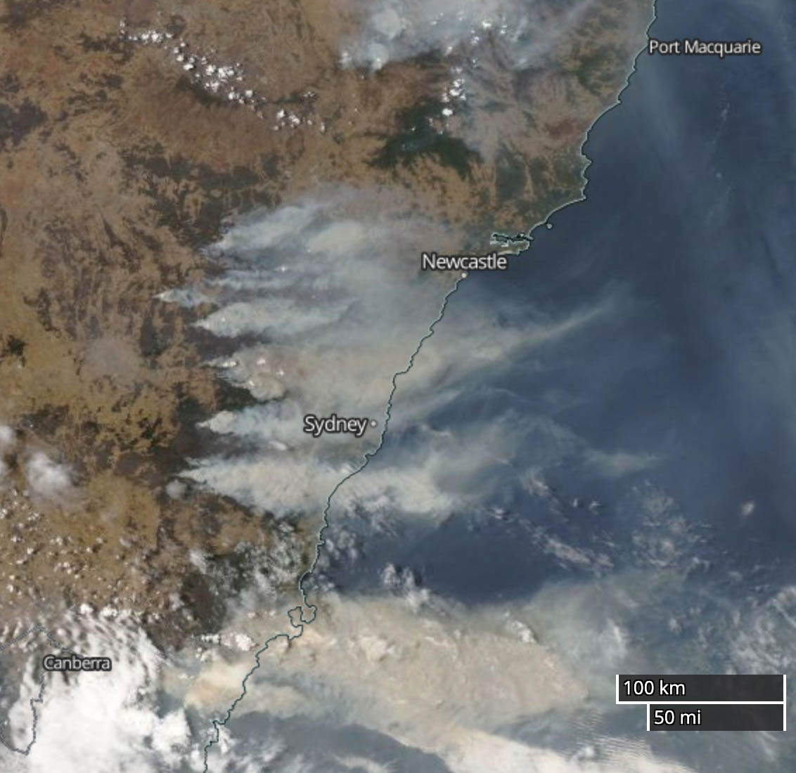
Satellite photo showing smoke from bushfires in New South Wales, Australia Dec. 21, 2019 local time.

Firefighters in New South Wales, Australia had another challenging day Saturday as a weather front came through which changed the wind direction. The 17 mph northeast wind shifted at about 5 p.m. local time to come out of the south at 36 gusting to 45.  The only factor that was in their favor was the relative humidity was not extremely low —  46 percent rising to 80 percent after the frontal passage.

Major changes in wind direction can force a wildfire to begin spreading in a different direction. If it is unexpected, firefighters at the heel of a fire can suddenly be facing a fire spreading toward them. On the Yarnell Hill Fire in 2013 a passing thunderstorm forced a wind direction change that entrapped and killed 19 members of the Granite Mountain Hotshots. The wind shift in New South Wales Saturday was predicted — as was the passage of the thunderstorm at Yarnell Hill.

Very early Sunday morning local time the New South Wales Rural Fire service provided updated information: “Both the Gospers Mountain fire in the Hawkesbury area and the Currowan fire in the Shoalhaven area have been downgraded to Watch and Act. The winds from the southerly change have now eased, reducing the erratic fire behaviour.”

The largest fire in NSW started two months ago. The huge Gospers Mountain Fire northwest of Sydney has burned 1,156,000 acres. It has merged with three other fires, Kerry Ridge, Little L Complex, and Three Mile, to cover a total of 1,742,000 acres. The Green Wattle Creek Fire southwest of Sydney has been mapped at 467,000 acres to bring the five-fire total to 2,209,000. If they continue spreading as they have for weeks, the Green Wattle Creek Fire could merge with the other four.

We tend to call fires that reach 100,000 acres “megafires”. We need a new term for million-acre fires.

This is not normal.

bushfires New South Wales map
Map of bushfires in New South Wales showing projected spread and ember attack, Dec. 21, 2019.

There are other large fires north and south of Sydney and also in Eastern Victoria.

And then there is Western Australia. Last weekend the country’s new-to-them 737 air tanker, N137CG, flew 2,000 miles west across the continent to assist firefighters dealing with a fire about 100 miles south of Perth.

There were more injuries to firefighters Saturday, including one who was hit by a car during very smoky conditions. Thankfully he was not seriously injured.

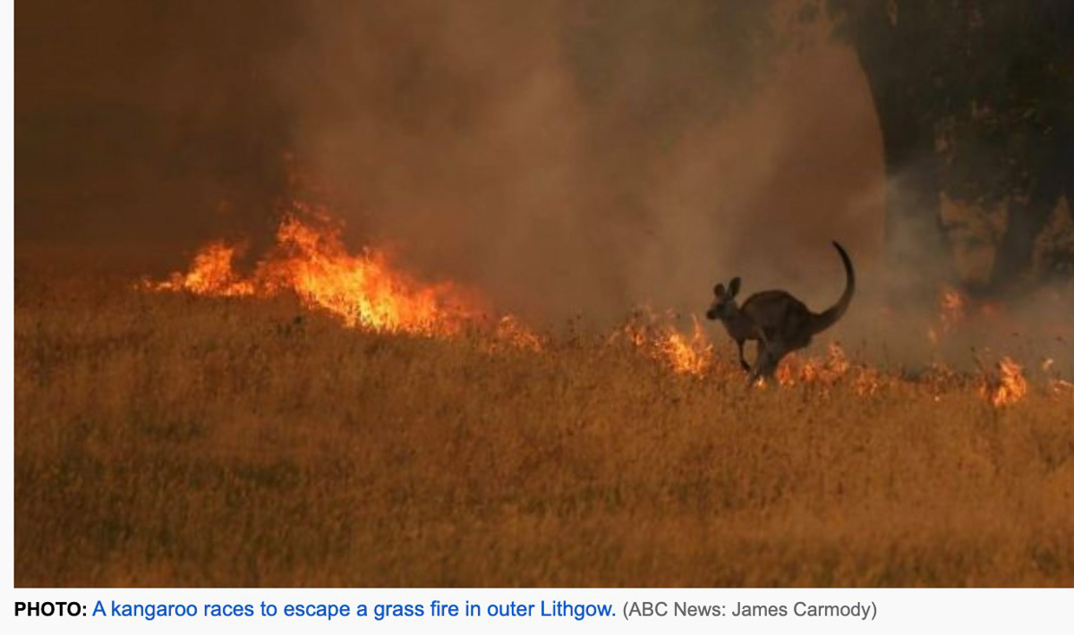
kangaroo bushfire