Many of us had not heard of Draper City, Utah before their fire department Battalion Chief Matthew Burchett was killed by a falling tree while fighting the Mendocino Complex of Fires in Northern California August 13, 2018. That was, of course, a tragedy, but now the city and department are in the news for a different reason. One of their firefighters found and has adopted a dog they found while fighting the same fire.
Firefighters meet at international border
The Horns Mountain / Santa Rosa Fire is burning in Washington and British Columbia
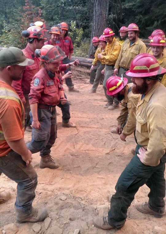
(Originally published at 4:15 p.m PDT August 28, 2018)
The 5,500-acre Horns Mountain Fire is burning in both Canada and the United States — Washington and British Columbia — east of the Laurier Port of Entry border crossing. In Canada the fire is named Santa Rosa.
In the photo above firefighters from both countries had a good natured meeting at the international border. I would wager that the topics discussed did not include tariffs or trade agreements.
Due to numerous large fires in Washington and British Columbia, both sides experienced a shortage of resources. According to an update from the incident management team, “working together was a benefit to both”.
The fire is winding down thanks in part to favorable weather in the last few days. Some resources on both sides are being demobilized.
UPDATE: August 29, 2018: When we posted this on our Facebook page Eric Haberin wrote, “Very much West Side Story”. I found the fight scene on YouTube and got a screenshot:

The big difference is that the firefighters are smiling.
Britania Mountain Fire burns USFS and private land west of Wheatland, WY
(UPDATED at 3:06 p.m. MDT August 29, 2018)
(To see all of the articles on Wildfire Today about the Britania Mountain Fire, including the most recent, click HERE.)
The incident management team on the Britania Mountain Fire 8 miles northeast of Wheatland, Wyoming has released a map of the fire:
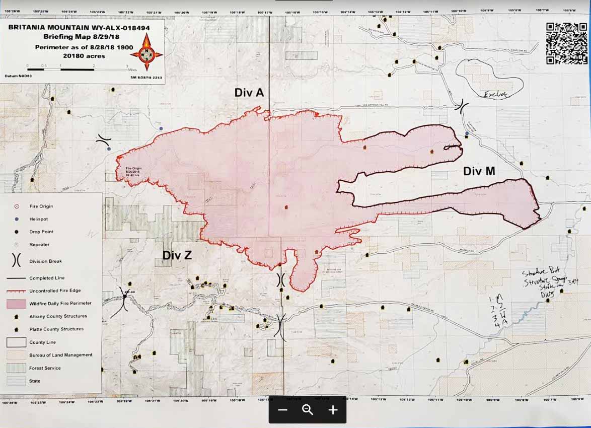
Mandatory evacuations have been issued for Palmer canyon. The Red Cross set up an evacuation center in Wheatland at the Services for Seniors Annex, 809 16th St. They are asking those evacuating to call (307) 322-3279.
(UPDATED at 11:04 a.m. MDT August 29, 2018)
The Britania Mountain Fire 8 miles northwest of Wheatland, Wyoming has burned at least 20,180 acres and 16 structures according to information released by fire officials Wednesday morning. It is not clear how many of the structures are outbuildings or residences, or how current the data is. Very little official information has been released about the fire since it started on August 26.
On Tuesday the Britania Mountain Fire spread to the south into even more rugged terrain.
The area is under a Red Flag Warning through Thursday. The forecast calls for southwest winds of 15 to 25 with gusts to 35 mph and relative humidity of 10 to 15 percent in the afternoons on both days. This could spread the fire farther to the east and northeast if receptive fuels are available.
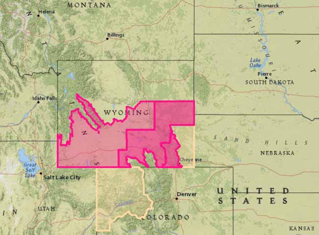
A Type 2 Incident Management Team with Incident Commander Shane Greer was scheduled to in-brief Wednesday morning at 8 a.m. Tuesday evening 259 personnel were assigned.
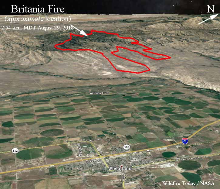
The maps below show the APPROXIMATE location of the Britania Mountain Fire. It is based on heat sensing data from a satellite at 2:54 a.m. MDT August 29 and a map created by fire personnel that used data from 7:46 p.m. August 27.

During the satellite overflight at 2:54 a.m. MDT Wednesday the only large heat sources detected were on the southern-most perimeter and the southwest side. At about 200 miles above the Earth smaller heat sources scattered across the fire can’t be “seen” by the sensors. On the map above the heat stretched across the south edge for 4 miles west of the County line (the green line) and one mile to the east. The fire spread further to the south in this area.
(Originally published at 11:30 a.m. MDT August 28, 2018)
The Britania Fire west of Wheatland, Wyoming has grown to approximately 18,800 acres. Shifting winds and rugged terrain are creating challenges for the 150 to 200 firefighters on scene, including one crew from Florida. More resources will be arriving today (Tuesday). The fire is approximately 8 to 12 miles west of Wheatland, Wyoming and 68 miles north of Cheyenne.
Continue reading “Britania Mountain Fire burns USFS and private land west of Wheatland, WY”
Rain reduces smoke in Northwestern U.S.
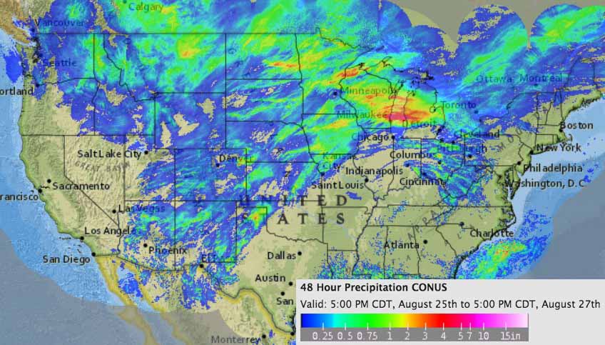
The precipitation that is occurring over portions of Washington, Oregon, Idaho, and Montana, which is expected to continue into Tuesday, will most likely slow the large wildfires in those areas.
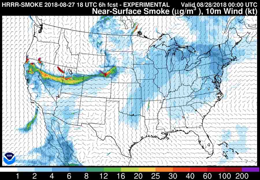
Another benefit is the forecast for smoke in the Northwest is greatly reduced, but the fires in Northern California are still producing large quantities.
Holy Fire spots across fireline in Southern California
(Originally published at 1:09 p.m. PDT August 27, 2018)
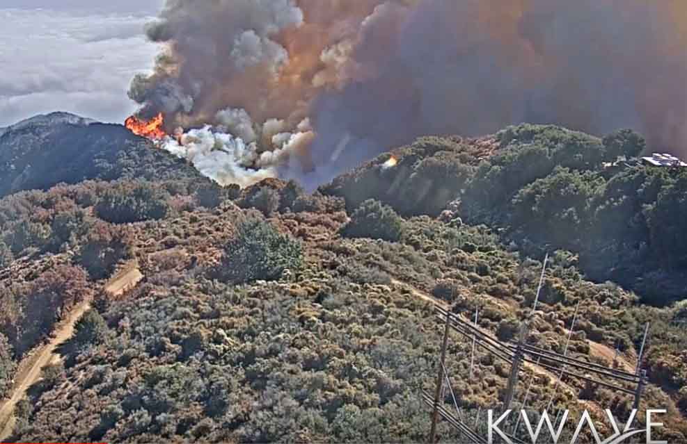
The Holy Fire has been relatively quiet for the last 12 days, with the reported size of 22,986 acres remaining the same since August 15.
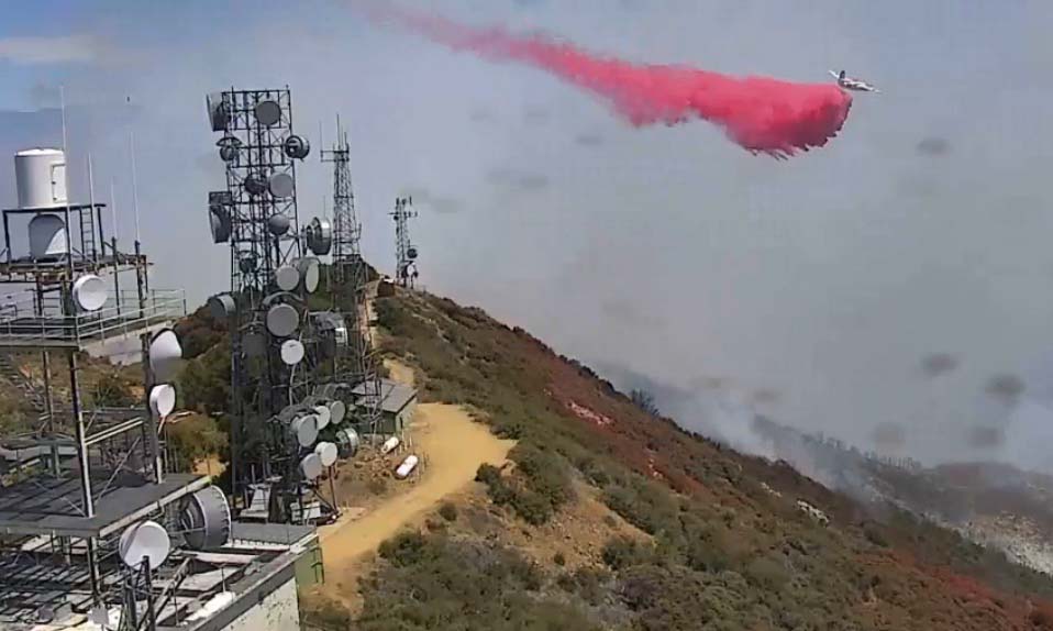
But that changed today when a spot fire ignited across the fireline and once again threatened the numerous electronic sites at Santiago Peak. Those facilities supply many of the television, radio, and communications links for the greater Los Angeles area, along with other sites in the area.
The fire originally started August 6 near Holy Jim Canyon in the Santa Ana Mountains southeast of Los Angeles.
The #HolyFire flareup has slopped outside of containment lines and has grown to 40 acres. 5 air tankers and 4 helicopters have been assigned. Ground resources will be utilized when it is safe to do so.
— Cleveland NF (@ClevelandNF) August 27, 2018
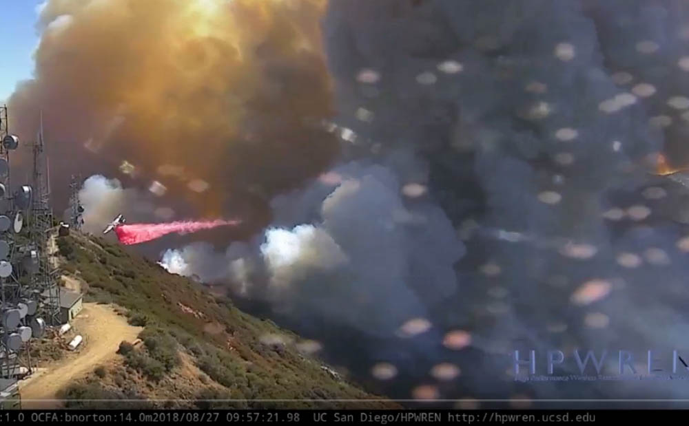
The fire was burning quiet well, as you can see in these photos, but by noon or 12:30 p.m. local time the intensity had decreased, due in part to drops by air tankers and helicopters.
These images were captured from live cameras on Santiago Peak, HPWREN and KWAVE.
(To see all of the articles on Wildfire Today about the Holy Fire, including the most recent, click HERE.)


After one month the Ranch Fire has burned over 400,000 acres
It is one of four megafires currently burning in the U.S., all larger than 100,000 acres
(Originally published at 9:32 a.m. PDT August 27, 2018)
The Ranch Fire started east of Ukiah, California a month ago on July 27, 2018. About two weeks later it broke the previous record for the largest in California’s recorded history, the 281,893 acres attributed to last December’s Thomas Fire near Santa Barbara. Today CAL FIRE said the Ranch Fire has grown to 402,468 acres, exceeding by 120,575 acres the record set only eight months earlier. The other fire in the Complex is the 49,920-acre River Fire which has not spread for a couple of weeks.
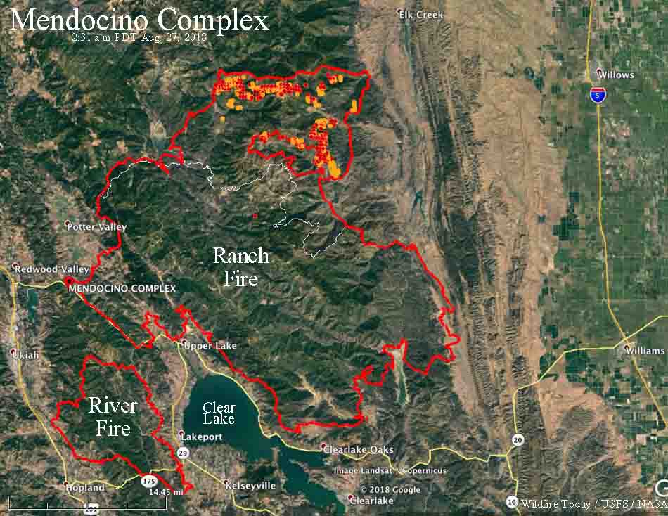
Firefighters are making progress on the Ranch Fire after having backed off on the north and northeast sides to ignite backfires from dirt roads and dozer lines on ridge tops in the Mendocino National Forest. The rest of the fire is looking pretty good, so if this tactic is successful and the weather cooperates it would be a big step toward stopping the spread.
(To see all articles on Wildfire Today about the Mendocino Complex of Fires, including the most recent, click HERE.)
A couple of decades ago it was rare for a fire outside of Alaska to exceed the threshold to become what we call a megafire, 100,000 acres. Now we seem to have multiple megafires each year. Presently there are three others that are presently active in the lower 48 states:
- Carr, in Northern California: 229,651 acres
- South Sugarloaf, in northern Nevada: 200,692 acres
- Spring Creek, in southern Colorado: 108,085 acres
Fire seasons are longer. The U.S. Forest Service has abandoned the term, preferring “fire year” instead. The Thomas Fire broke the previous record in December. DECEMBER! Megafires are not supposed to occur in the dead of winter.
Not only do the fires burn vegetation, destroy homes, change the landscape, require evacuations, disrupt lives, and cause massive air pollution problems, they also kill. Just on the megafires in California this year eight people have died, four firefighters, a power company employee, and three other civilians.
The article was revised to correct the number of fatalities on the two megafires in California this year.
