Wildfire potential, September through December

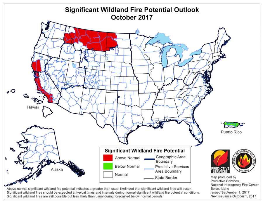
The prediction for October shows enhanced fire potential for the Northern Rockies and much of western California.

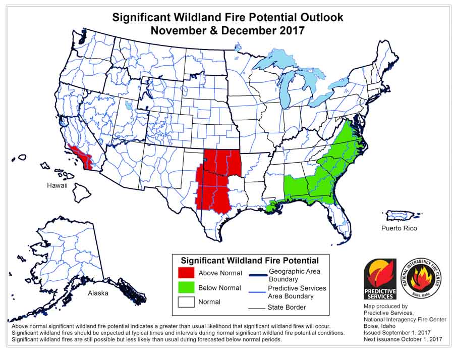
On September 1 the Predictive Services section at the National Interagency Fire Center issued their Wildland Fire Potential Outlook for September through December. The data represents the cumulative forecasts of the ten Geographic Area Predictive Services Units and the National Predictive Services Unit.

Below are:

  • the highlights of the NIFC report;
  • NIFC’s graphical outlooks for September through November;
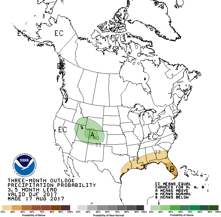
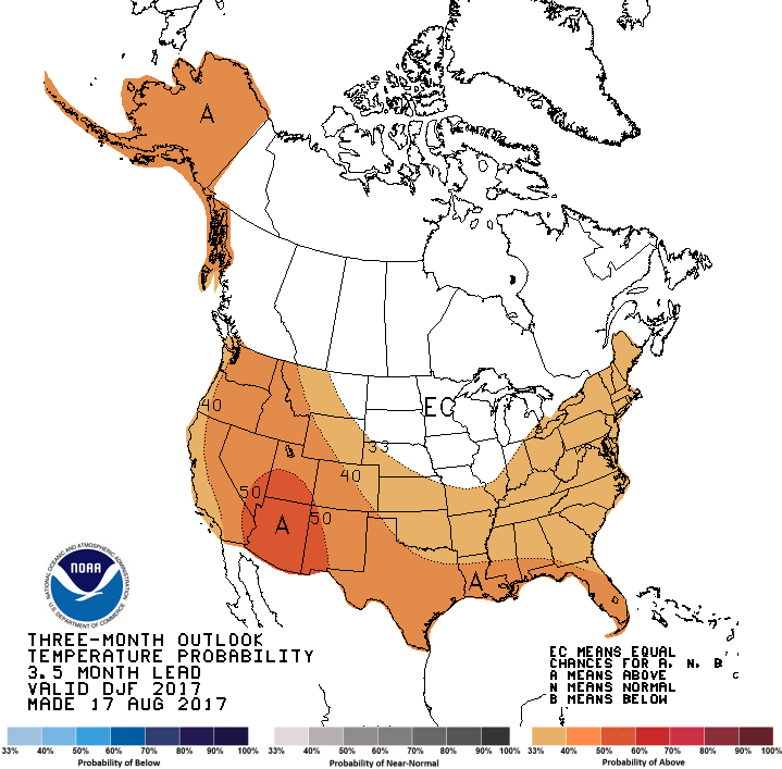
  • NOAA’s long range temperature and precipitation forecasts; and
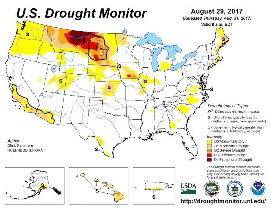
  • Drought Monitor

****

“The Western fire season is reaching its peak for 2017 as it enters September. While an active southwestern monsoon has curtailed activity in the Southwest and across portions of the central Rockies, above normal significant fire activity continues to be observed across portions of the Pacific Northwest, Northern Rockies, northern Great Basin and northern California. Fuel moisture levels and fire danger indices in these areas are at near-record to record levels for severity. While the frequency and density of lightning occurrence has begun its seasonal decline, occasional lightning bursts are still being observed. Most of the new lightning-caused fire starts are being effectively handled with initial attack, but a few are still developing into larger incidents that require additional resources. Drier and warmer than average conditions across the central Great Basin and Southern California are allowing for the fine fuels to become more receptive to fire activity. A slight upturn in initial attack activity is being observed in both areas. Cool and wet conditions have arrived in Alaska. Its season has effectively ended.

Precipitation received was generally well below average across the Pacific Northwest, Northern Rockies, Great Basin and California in August as most areas received less than 25 percent of normal rainfall. Once exception to this was the Sierra Mountains in California where several episodes of wet convection produced rainfall amounts that were above average. Across the central Rockies and the Southwest, precipitation amounts were near average. Temperature extremes were less frequent in August than in July. For the month, average temperatures were only a few degrees above average.

Fire season will peak by mid-September as the fuels remain much drier than average and as existing precipitation trends continue. By mid-September decreasing solar radiation received and longer nights will allow for fuel moistures to begin recovering. Should a season-slowing weather event not occur, this will be sufficient to allow for the fire activity across the northwestern states to begin to decrease significantly late in the month. Significant large fire activity will remain possible in foehn wind-prone areas like the Rocky Mountain Front and across Southern California through November and will be event-driven should they occur.”

wildfire potential wildfire potential

weather forecast weather forecast weather forecast

Diamond Creek Fire burns into Canada

Above: The image shows heat detected by a satellite August 31 and September 1, 2017. The red dots are the most recent, early Friday morning.

The Diamond Creek Fire in the Pasayten Wilderness in the Okanogan/Wenatchee National Forest has crossed the Washington/British Columbia border and spread three miles into Canada. The Incident Management Team reports the total size of the fire is over 52,000 acres.

Report released about wildfire that burned into Gatllinburg

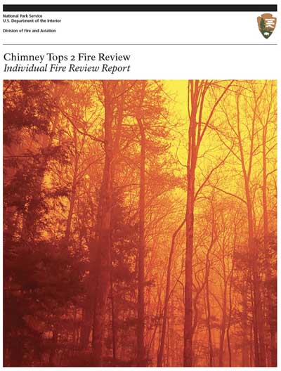
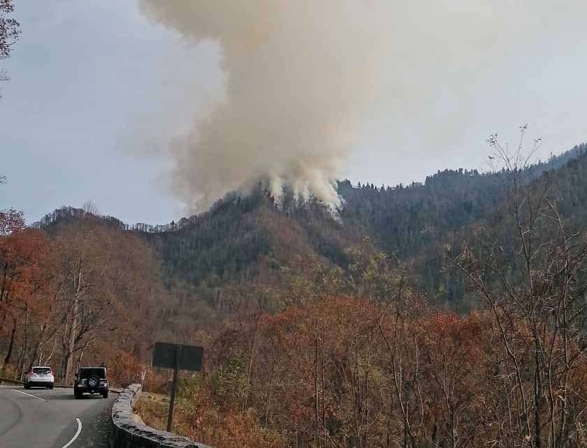
Gatlinburg fire reportOn August 31 the National Park Service released the long anticipated report (12 Mb file) about the wildfire that burned from Great Smoky Mountains National Park into the city of Gatlinburg, Tennessee. Five days after it started on November 23, 2016, the Chimney Tops 2 Fire spread into the eastern Tennessee city killing 14 people, forcing 14,000 to evacuate, destroying or damaging 2,400 structures, and blackening 17,000 acres.

The strategy used to manage the fire was controversial because very little direct action was taken to suppress the fire during those first five days until a predicted wind event caused it to spread very rapidly out of the park and into the city.

The report was presented to the public during a live Facebook feed which you can see below.

One of the first speakers was Secretary of the Interior Ryan Zinke who reminded the audience that he served in combat and then mentioned some recommendations:

  • The National Park Service should be more proactive about removing “dead and dying timber”;
  • The dozer lines built during the suppression of the fire could be put to good use, possibly as bike paths;
  • The interoperability of communications systems needs to be improved so that firefighters from different divisions within the NPS and also between other agencies can more easily communicate during an emergency.

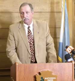
Joe Stutler, qualified as a Type 1 Incident Commander and Area Commander, positions at the pinnacle of the incident management structure, read a lengthy statement that included what he and his team of investigators deemed to be the pertinent facts of the fire and the investigation.

Gatlinburg fire report Joe Stutler
Joe Stutler presents information in the report about the Chimney Tops 2 Fire that burned into Gatlinburg, Tennessee.
Mr. Stutler began by saying the report was intended to not place blame on anyone, and would “avoid should have, could have, and would have, statements that frankly inhibit sensemaking and also inhibit continuing to learn from the event.”

Describing the actions taken or not taken on the fire, he said, “the review team found no evidence of negligence of anyone at the park. They did the very best they could when it came to their duty. They did the very best they could based on what was loaded in their hard drive”, he said as he pointed to his head.

Chimney Tops 2 Fire August 27, 2016
Chimney Tops 2 Fire November 27, 2016. Photo by Brett Bevill.
“Never in the history of this park or even in the surrounding area”, Mr. Stutler said, “had anyone seen the combination of severe drought, fire on the landscape, and an extreme wind event” occurring at the same time.

Combined with a wildland/urban interface, it was the “perfect storm”, he explained. The review team concluded that the fire management officials did not see the potential for the low-frequency, high-risk event.

The report made recommendations, including:

  • Revise the park’s fire management plan to reflect more aggressive strategies and tactics during extreme fire weather conditions.
  • Expand communications capacity to allow interoperability with responders outside the federal system.
  • The Fire Management Officer should be supervised by a single individual, not two.
  • Since no Red Flag Warnings were issued around the time of the fire, evaluate current Red Flag Warning and advisory criteria to reflect conditions experienced during the 2016 fire season.
  • The National Park Service leadership should embrace and institute change to create wildland fire management organizations that have the capacity and resilience to meet the realities of this “new normal” fire behavior.
  • Institute formal fire management officer and agency administrator mentoring and/or development programs.

Florida man billed $50,000 for wildfire that started from his book fire

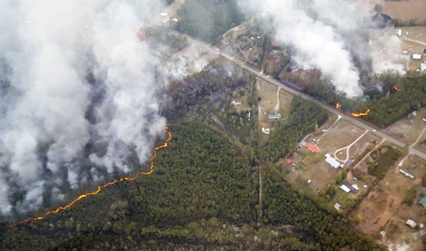
On March 23 in Nassau County, Florida a fire escaped from Brian Sparks’ yard while he was burning books. The Garfield Road Wildfire burned 705 acres and two homes.

Monday he received an invoice from the Florida Department of Agriculture for the costs of suppressing the fire — $59,403.38. The bill includes the costs incurred by a dozer/plow, rangers, five hours for a fixed wing aircraft, and other firefighters from several counties.

Florida Garfield Road Fire
Garfield Road Fire, March 23, 2017. Florida Forest Service photo.

Mr. Sparks is also facing a misdemeanor criminal citation for failure to obtain a department permit and reckless land burning which included paperback books and other clutter.

Thanks and a tip of the hat go out to Robin.
Typos or errors, report them HERE.

Elk Run Fire causes evacuations in the Black Hills

Residents near Argyle south of Pringle were asked to leave their homes.

(Updated at 2:15 p.m. MDT August 31, 2017)

After more accurate mapping using GPS equipment, the size of the Elk Run Fire was determined to be 225 acres. All evacuation orders have been lifted.

****

Within a few hours after it was reported on private land at 3:16 p.m. MDT Wednesday, the Elk Run Fire near Argyle, South Dakota burned approximately 400 acres. Fire officials said two structures were damaged and some homes in the community of Argyle were evacuated.

On Wednesday the blaze was attacked by firefighters on the ground as well as three single engine air tankers, one heavy air tanker, and a South Dakota National Guard Blackhawk helicopter.

Elk Run Fire map
Map showing the approximate location of the Elk Run Fire in South Dakota, 7:56 p.m. MDT August 31, 2017

Fire officials hope to have a more accurate measurement of the number of acres burned later on Thursday.