Sawmill Fire causes evacuations east of Green Valley, AZ

Above: A satellite photographed the darkened outline of the Sawmill Fire east of Green Valley, Arizona on April 26, 2017. The red dots represent heat.

(UPDATED at 9:10 a.m. MDT April 27, 2017)

The growth of the Sawmill Fire east of Green Valley, Arizona slowed Wednesday as decreasing winds allowed air tankers and helicopters to drop water and retardant to assist the firefighters on the ground. The only significant spread that we found on satellite images was an additional 400 acres on the northeast corner of the fire.

As of Wednesday night fire managers were still calling it 40,356 acres.

An evacuation order remains in place for Rain Valley. Since evacuation orders were lifted for Greaterville and Singing Valley, residents of those areas are being allowed through the Arizona Highway 83 closure to access their homes. Arizona Highway 83 remains closed to public traffic.

The area is under a Red Flag Warning on Thursday and Friday for relative humidities in the teens and strong winds. One of the priorities on Thursday is to use aircraft to help secure the firelines before the winds increase.

Today, April 27, a Type 1 Incident Management Team will assume command of the 606 personnel on the Sawmill Fire.

****

(UPDATED at 7:47 p.m. MDT April 26, 2017)

At about 2 p.m. MDT the Incident Management Team said the Sawmill Fire had grown to 40,350 acres. At that time there were seven helicopters and three fixed wing aircraft assisting the firefighters on the ground.

On Wednesday morning the incident management team called it 20,000 acres.

At 2:03 p.m. MDT on Wednesday a heat detecting satellite mapped growth of the fire on the south and northeast sides.

map Sawmill Fire Arizona
The red area shows the approximate location of the Sawmill Fire at 2:03 p.m. MDT on April 26, 2017. The white line was the approximate perimeter about 12 hours earlier.

The weather station near the fire at Empire recorded on Wednesday a high temperature of 75, a minimum relative humidity of 12 percent, and wind in the afternoon out of the northwest at 8-12 mph gusting at 20-24.
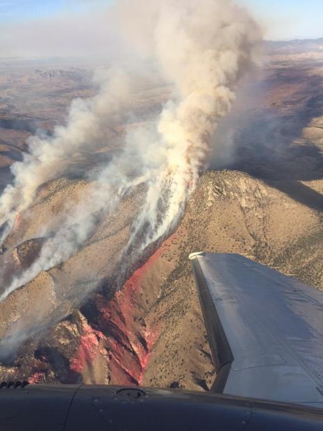
Sawmill Fire
Undated and uncredited photo of the Sawmill fire. Inciweb photo.

****

(UPDATED at 11:16 a.m. MDT April 26, 2017)

A fire that started Sunday morning, April 23 eight miles east of Green Valley, Arizona, has burned (we estimate) about 28,000 acres as of 2:38 a.m. MDT on Wednesday, April 26, 2017, and required evacuations for the communities of Greaterville, Singing Valley, and Rain Valley. It has spread to the east 21 miles, has a perimeter of approximately 63 miles, and crossed Arizona Highway 83 in multiple places.

Sawmill fire map
Sawmill fire map, approximate perimeter 2:38 a.m. MDT April 26, 2017.

The fire is burning on lands protected by the Coronado National Forest, Bureau of Land Management and the Arizona Department of Forestry and Fire Management.
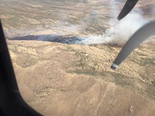
Sawmill Fire, April 23
Sawmill Fire, April 23, 2017. Inciweb photo.

On Tuesday the temperature in the fire area was in the low 70’s, the relative humidity was in the 30’s, and the wind was 12-18 gusting at 25-33 mph out of the west. The forecast for the fire area on Wednesday calls for conditions that could lead to significant additional fire spread toward the east and southeast, with temperatures in the mid-70’s, humidity dipping into the single digits, and winds out of the northwest at 10-20 mph gusting to 29.

Tuesday evening Jeff Andrews’ Type 2 Incident Management Team assumed command. Due to the increasing complexity, management will transition to a Type 1 Team on Thursday, April 27.
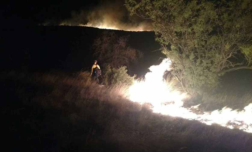
Sawmill Fire
Sawmill Fire. Photo by Arizona Dept. of Corrections’ Florence Inmate Crew.

A full suppression strategy is being employed to protect nearby values at risk including homes, ranches and outbuildings, communications facilities, power lines, and the Arizona National Scenic Trail.
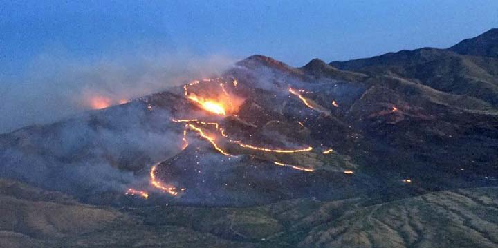
Sawmill Fire
Sawmill Fire, early in the morning on April 24, 2017. Photo by Arizona Department of Forestry and Fire Management.

Laura Ward named Fire Management Officer of the year.

Posted on Categories Uncategorized

Above: Laura Ward. Courtesy photo.

Laura Ward, the Fire Management Officer (FMO) of the Lolo National Forest in Montana, was recently named Forest Service Fire Management Officer of the Year by a national committee and was honored in a ceremony in Missoula on April, 19.

The FMO of the Year Committee selected Ms. Ward from a field of nominees from across the nation, representing all other Forest Service Regions and National Forests.

Ms. Ward, who has worked in western Montana for 18 years, is responsible for managing and implementing the fire operations across the five Ranger Districts and approximately two million acres of the Lolo National Forest. She helped develop and implement several regional and national programs in 2016 as well as provided oversight and leadership for the Lolo National Forest’s Critical Incident Management Plan, an organizational framework that identifies roles, responsibilities and required actions for responding to critical incidents. Ward was recognized in the award for her professional skills and leadership in working closely with multiple partners and agencies to manage a complex program involving fire operations, fuels management and air quality.

“Laura has made significant contributions at the local, regional and national level to advance the fire program,” said Tim Garcia, Forest Supervisor for the Lolo National Forest. “Her leadership is exceptional and the strength of the relationships she has developed with our local and state partners has been instrumental in our success.

Ms. Ward began her Forest Service career in Lowell, Oregon as a GS-1 employee on a Brush Disposal crew on the Willamette National Forest in 1985 and later worked as a firefighter on three Districts on that Forest until 1989. She then worked on the Umpqua National Forest as a fuels technician and then with the Wolf Creek Job Corps in a “detailed overhead position” with the Job Corps Hotshot Crew.  She was promoted to the Fuels Assistant Fire management Officer (AFMO) in the mid-nineties and later worked as the Fuels/Suppression AFMO for the Umpqua National Forest. In 1999 she was selected as a District FMO for the Ninemile Ranger District on the Lolo National Forest and worked on that district for 11 years.  In 2010 Ms. Ward was selected as the Lolo National Forest FMO, located at the Forest Supervisor’s Office at Fort Missoula.

“The award was a total surprise,” she said. “I’m honored to have been nominated and selected.  The best part of the job is all the great people you get to work with and there are many individuals deserving of this type of recognition.”

Prescribed fire video from Texas

Above: screen shot from the video.

The Texas Department of Parks and Wildlife has distributed a six-minute video about prescribed fire with an interesting title: The Business of Burning. It is beautifully photographed and is apparently intended to introduce good fire to those who are unfamiliar with the concept.

Some may think the repeated use of the term “grunt” to describe young firefighters is politically incorrect.

Chris Schenck, the department’s Statewide Fire Program Leader, said the video has been in production for a year. Their goal is each year to treat with prescribed fire 30,000 acres of Public Lands Wildlife Management Areas.

Revisiting the Norbeck prescribed fire

In case you missed it, here is the video we shot at a prescribed fire in South Dakota in 2014.

The Alpine Hotshots, a National Park Service hotshot crew from Colorado, is shown using drip torches to ignite vegetation on the Norbeck Section 2 prescribed fire. The project which began October 20, 2014 involved almost 2,000 acres in Custer State Park, Wind Cave National Park, Black Hills National Forest, and private land.

*****

Sell Art Online

Interview with Dan Buckley, NPS Fire Director

In this interview with Dan Buckley, the National Fire Director for the National Park Service, he talked about Unmanned Aerial Systems, 75 drone pilots in the BLM, extending the terms of seasonal firefighters, prescribed fire, air tankers, tracking the fire and firefighters, and the work environment in the National Park Service.

It was recorded April 20, 2017 at the National Interagency Fire Center in Boise.