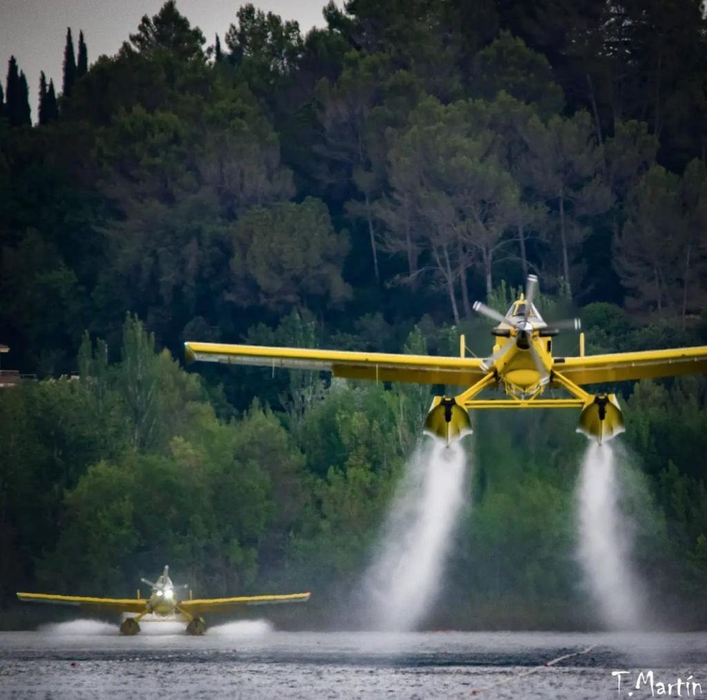
A pilot died Friday in the crash of an air tanker in Northeast Portugal.
In a message on his official Twitter account, Portuguese Prime Minister António Costa said, “It was with great dismay that I became aware of the death of the pilot who operated an aircraft that crashed this afternoon….I send my deepest condolences to family and friends.”
The Air Tractor AT-802AF Fire Boss went down near the town of Torre de Moncorvo after scooping water on the Douro river. The pilot was the only person on board the single engine air tanker that had departed from Viseu-Gonçalves Lobato Airport (VSE/LPVZ). Photos show that the aircraft was severely damaged. Joao Sousa, mayor of the town of Foz Coa where the incident took place, told Lusa news agency the pilot was pronounced dead at the scene.
The aircraft was operated by Titan Aerial Firefighting which has offices in Spain. The company announced on Saturday that the pilot was André Serra, from Agromontiar.
“On behalf of the whole company, friends and colleagues say goodbye to you,” they wrote. “We offer our deepest condolences to the relatives of André, a great professional and better person who has left us too soon. Rest in peace.”
Our sincere condolences go out to the family, friends, and co-workers of Mr. Serra.
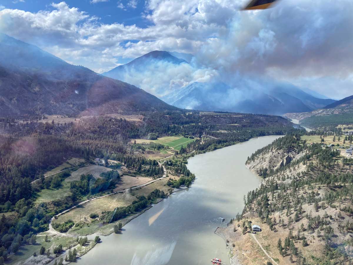
Nohomin Creek Fire, looking north up the Fraser River towards the Stein Valley. BC Fire Service photo, 3:39 p.m. MDT July 16, 2022.
The British Columbia Fire Service reported at 4:02 p.m. Saturday that the fire activity on the Nohomin Creek Fire northwest of Lytton, BC has been stable today and no major growth was observed. Ground crews and aviation resources are working on the south, east, and north flanks. The western flank is moving upslope in steep, difficult to access terrain, the agency said.
The Stein Valley Nlaka’pamux Heritage Park is partially closed. Currently, there are no impacts to Highway 1 or Highway 12. The Lytton Ferry is closed in both directions.
There was no update on the size, and it is still reported at 1,500 hectares (3,700 acres).
10:32 a.m. MDT July 16, 2022
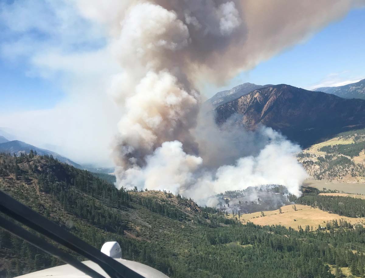
Nohomin Creek Fire Lytton, BC, July 14, 2022. BC Wildfire Service.
The Nohomin Creek Fire on the west side of the Fraser River northwest of Lytton, British Columbia has burned approximately 1,500 hectares (3,700 acres) since it was reported Thursday July 14. Judging from these photos shot that day it spread very rapidly.
Fire officials said Friday that at least six homes have been destroyed, and that number could rise.
The BC Wildfire Service reports that the fire behavior is rank four and rank five, meaning it is crowning, has a moderate to fast rate of spread, and is exhibiting short-range spotting.
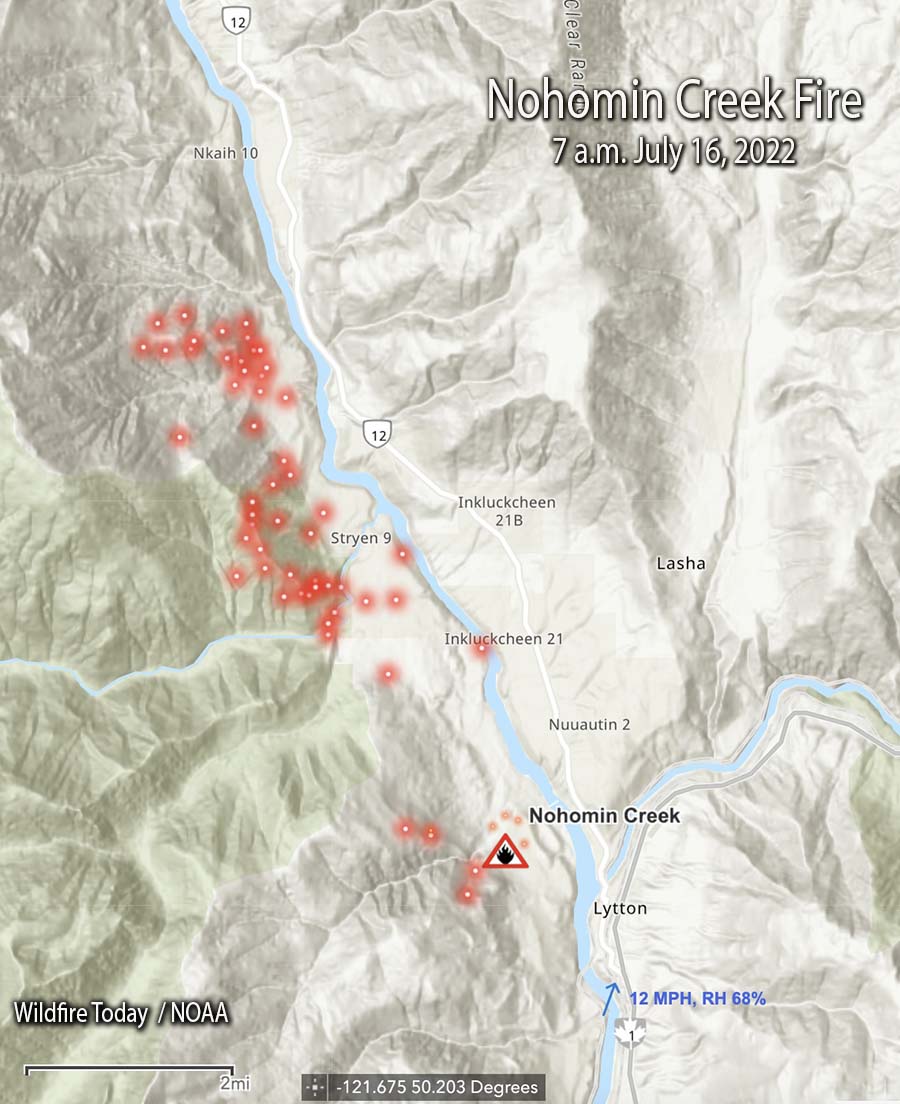
Nohomin Creek Fire map. The red dots represent heat detected by satellites as late as 7 a.m. MDT July 16, 2022.
Winds of 30 to 40 kilometers per hour (19 to 26 miles per hour) are pushing the fire west away from communities, according to the BC Wildfire Service in a Friday evening update. At that time there were no impacts to Highway 1 or Highway 12. The Lytton Ferry is closed in both directions.
The two photos below were taken the day the fire started.
(1) Nohomin Creek Fire across the river from Lytton, BC, July 14, 2022.(2) Nohomin Creek Fire across the river from Lytton, BC, at 3 p.m. July 14, 2022.
In late June of 2021 the Lytton Creek Fire burned more than 83,700 hectares (206,000 acres) and destroyed 90 percent of the village of Lytton. Two civilians were killed in the fire.
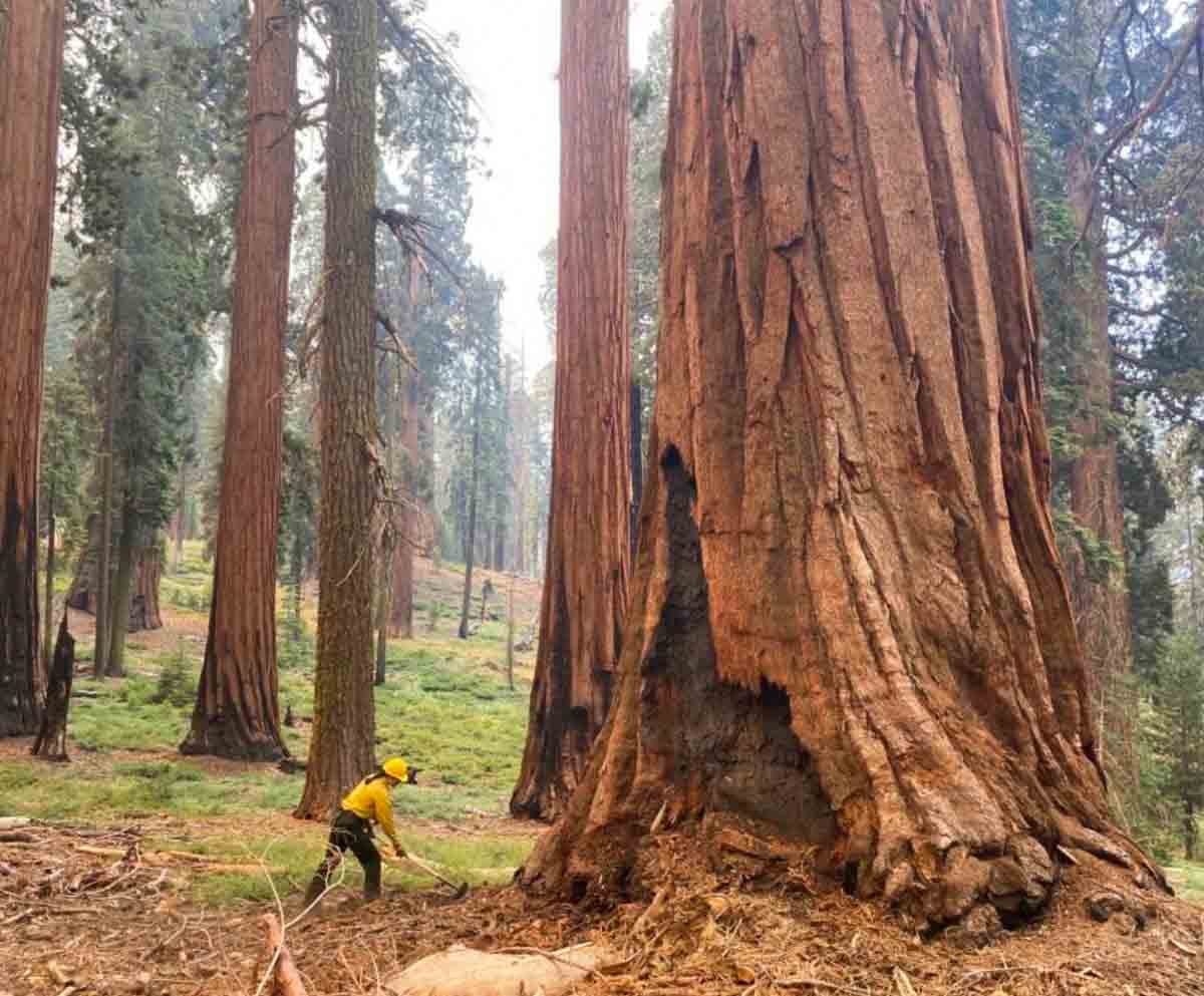
A firefighter in Yosemite National Park scrapes material away from a giant sequoia during the Washburn Fire in July 2022. NPS photo by Garrett Dickman.
Kyle Dickman has written a must-read article for Outside magazine about how the largest trees on Earth which can live for more than 3,000 years, are being increasingly affected in recent years by fire. It was published this week at the magazine and covers how management of the giant sequoias in Yosemite National Park and other areas in the Sierras has affected the vulnerability of the huge mature specimens in the groves.
The article frequently mentions Mr. Dickman’s brother, Garrett, who is the Forest Ecologist at Yosemite and has been heavily involved in managing and attempting to save the giant sequoias. The piece is extremely well written. You can read the entire article at Outside.
Below are a few excerpts:
“What nature’s doing isn’t natural,” [said Joe Suarez, the Arrowhead Hotshots superintendent]
Garrett [Dickman] and Christy Brigham, the director of science at Sequoia and Kings Canyon National Park, are standing in front of an outhouse that firefighters saved from the Castle Fire, sitting in the patchy shade of a 2,000-year-old dead tree that they did not. Firefighters protect life and property before all else—even holes to shit in, so long as they have walls around them. Listening to the two compare notes on their jobs makes clear that the fate of giant sequoias is almost entirely in the hands of a few middle managers, working at a few select parks, who navigate arcane environmental laws and a financing system cobbled together with public grants. If sequoia death is a product of American gridlock, sequoia survival will happen because of the tenacity of a few individuals.
The current drought is more intense than any experienced in California in 1,200 years.
“These next couple of years could be bad in ways we haven’t experienced yet,” Garrett says. The Park Service knows what’s coming. After 60 years trying to walk backward by managing their lands to be what conservationist Starker Leopold, who devised the agency’s guiding philosophy from the late 1960s until 2021, called “vignettes of primitive America,” the Park Service has changed course to officially recognize that park managers must intervene in ways considered antithetical to their mission two years earlier. The new policy asks the public to open its mind to everything from mechanical thinning to very limited logging. “We saw how it goes when you don’t do anything,” Christy says. “It goes terribly. It goes thousands of 2,000 year old trees burned up in an instant.”
“We don’t get to have nice things anymore,” Garrett says.”
“The Clean Water Act. The National Environmental Policy Act. The National Historic Preservation Act. The Threatened and Endangered Species Act. Fantastic laws all of them,” Christy says. “But they were built at a time when the main threat was people doing bad things—logging, mining. Now the main threat is inaction. Bureaucracy is slow. Wildfire is fast. And bureaucracy needs to get a hell of a lot faster if we want to persist and not lose everything we’ve got left.”
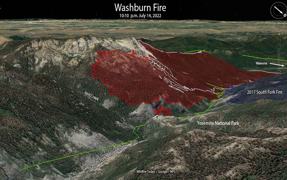
The red line on the 3-D map (looking southeast) was the perimeter of the Washburn Fire at 10:10 p.m. PDT July 14, 2022. The white line was the perimeter about 48 hours before.
The challenge remaining on the 4,759-acre Washburn Fire in Yosemite National Park is to corral the east side where it has spread into the Sierra National Forest, a very steep area with large rock outcroppings.
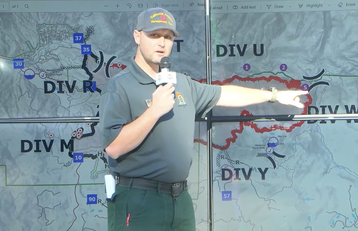
They have established three helispots on the north side of the South Fork of the Merced River and one on the south side that could be used for inserting firefighters. Their plan is to insert a small group of hotshots on the east side of the fire south of the river at Helispot 5 on the map below, being pointed to by Planning Operations Section Chief Matt Ahern. Their task will be to construct fire line on that corner, west of Iron Creek, working downhill and uphill to anchor and stabilize the fire at that point. This would then enable hotshot crews to “come off the top”, said Mr. Ahern.
Washburn Fire briefing by Operations Planning Section Chief Matt Ahern, July 15, 2022. He is pointing to Helispot 5 where a small group of Hotshots will be inserted to establish an anchor point on the northeast corner of the fire above the South Fork of the Merced River.
Contingency fire lines are being constructed some distance from the fire on the south and east sides in case extreme weather drives the fire in those directions.
The Buck Cabin east of the fire built in 1931, was recently rehabilitated at great expense. The wood shake shingle roof was replaced with — another wood shake shingle roof. Since it is very, very vulnerable to fire, and in a roadless area, firefighters will be flown by helicopter to the area, rappel to the ground, and wrap it in foil-based structure wrap.
Most of the fire edge near the Mariposa Grove of giant sequoias has been secured with fire line, Mr. Ahern said.
The red line on the map was the perimeter of the Washburn Fire at 10:10 p.m. PDT July 14, 2022. The white line was the perimeter about 48 hours before.
“Overall the incident is in a very good place,” said Mr. Ahern. “We still have a tremendous amount of work and a heavy commitment of hotshot crews and aerial resources to pinch off Iron Creek.”
The infrared video below shot at 10:39 p.m. July 14 shows the east side of the fire.
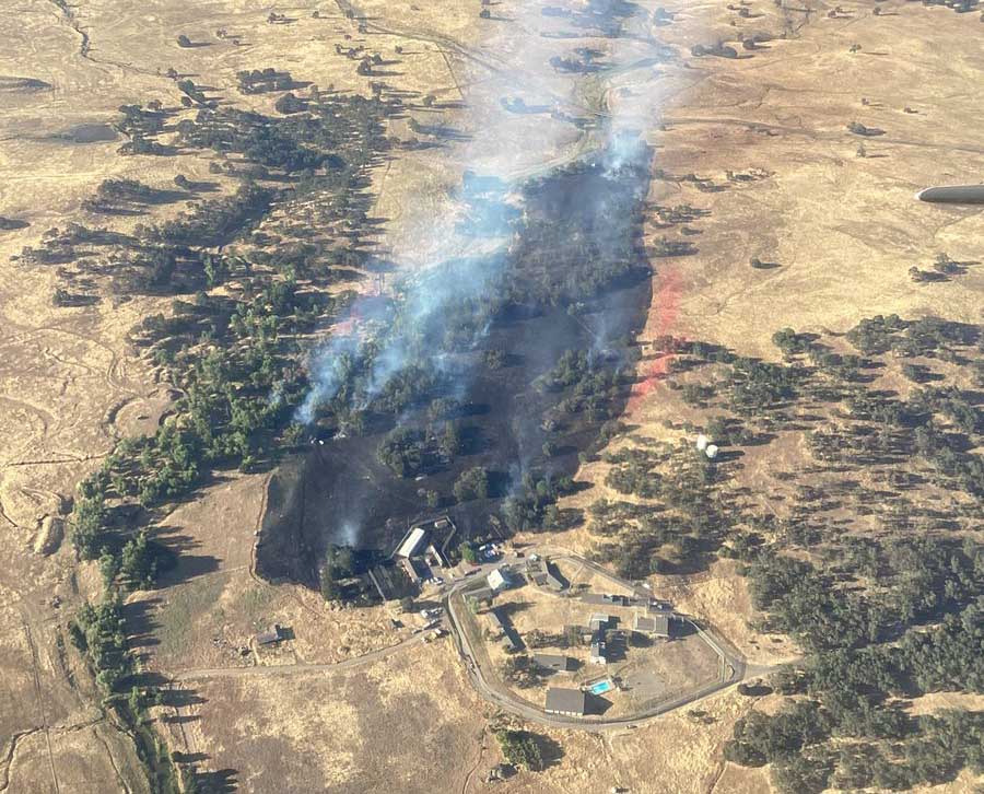
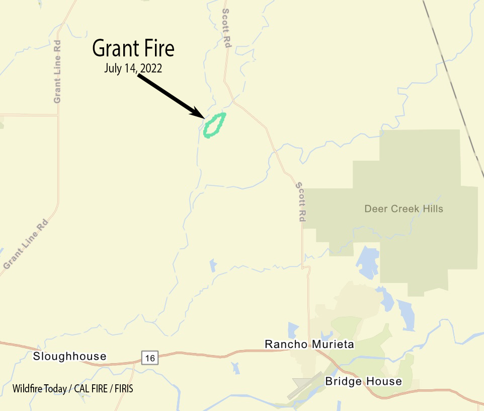
Thursday afternoon firefighters stopped the spread of the Grant Fire after it burned 74 acres about 15 miles southeast of Sacramento, California. The blaze was reported at 5:44 p.m. 4 miles northwest of Rancho Murieta just west of Scott Road. CAL FIRE reports that one outbuilding was destroyed.
Firefighters worked throughout Thursday night patrolling and building containment lines. On Friday they will continue mopping up hot spots and smoldering areas within oak groves and strengthening containment lines.
CAL FIRE reported at 9 p.m. that the Peter Fire at Anderson, CA has destroyed 12 structures and has burned 304 acres. They did not specify how many of the structures were residences.
Firefighting resources assigned include 51 engines, 18 water tenders, 15 hand crews, 6 helicopters, and 7 dozers for a total of 497 personnel.
UPDATE. All residents in homes east of the intersection of Third Street and Missouri Lane to Highway 273 can return to their homes. All roads connected to Spring Gulch Road west of Missouri Lane remain under evacuation order. Residences on Diamond Street west of Franklin remain under an evacuation order. The evacuation warning for all streets off Parallel Road and Jacqueline Street remain in effect.
Updated at 6:01 p.m. PDT July 14, 2022
Air Attack reports that the Peter Fire at Anderson, California is looking good, and they have a retardant line around most of the perimeter. They are keeping two air tankers to be able to pick up spot fires as they occur. The other tankers have been released, including a Very Large Air Tanker.
The fire is believed to have started from a structure fire that spread into the vegetation. At 6 p.m. there were no engines available to work on a burning structure, so helicopters were dropping water on it.
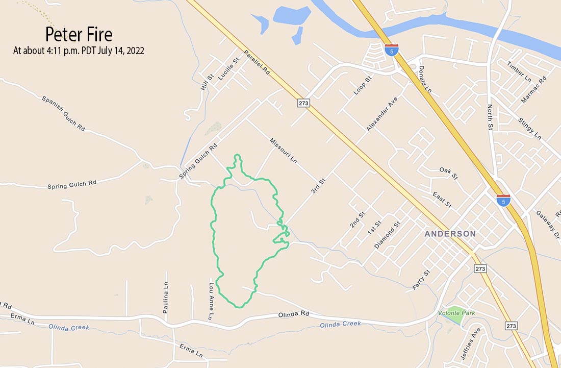
Peter Fire mapped by FIRIS at approximately 4:11 p.m. PDT July 14, 2022.
FIRIS mapped the Peter Fire at 248 acres at approximately 4:11 p.m. PDT Thursday. At 5:25 p.m. it was mapped again at 303 acres.
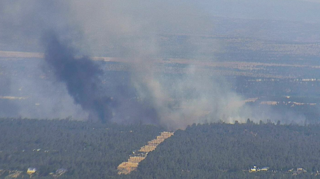
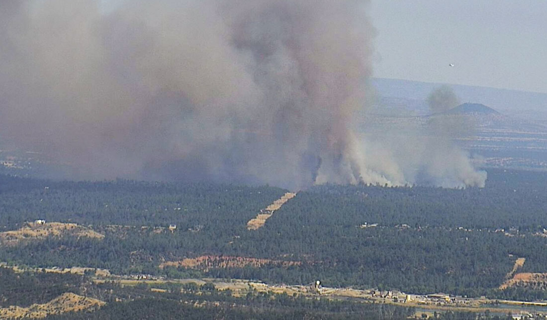
Peter Fire, looking southeast from the Falcon camera at 5:11 p.m. PDT July 14, 2022. AlertWildfire.
4:58 p.m. PDT July 14, 2022
Aircraft near the Peter Fire at 4:16 p.m. July 14, 2022. FlightRadar24
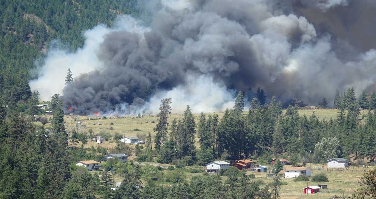
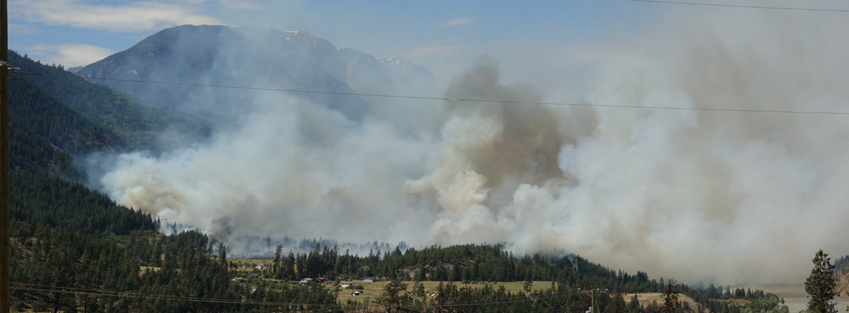
A new fire south of Redding, California is prompting evacuations west of Anderson. The Peter Fire was reported at around 3 p.m. PDT and at last report had burned at least 50 acres. It is four miles south-southwest of the Redding Air Attack base which results in quick turnarounds for air tankers reloading with retardant.
Firefighters on scene have reported 30 structures that are threatened and several times have requested additional engines and aircraft. There are reports that the fire has reached some structures and air tankers are making retardant drops near them attempting to lessen the damage. At least half a dozen air tankers are on scene or en route.
The evacuation center is at West Valley High School, 3805 Happy V Road, Cottonwood, CA.
Peter Fire, looking southeast from the Falcon camera at 4:23 p.m. PDT July 14, 2022. AlertWildfire.
Weather
Since the fire started the Howard Street weather station in Anderson has recorded 88 degrees, 13 percent relative humidity, and 10 to 12 mph winds out of the south and south-southeast gusting to 12 mph. The forecast for the rest of the afternoon calls for winds increasing to 14 mph out of the south, then slowing after sunset to 3 mph for the rest of the night. The nighttime humidity should rise to 52 percent then on Friday drop to 10 percent in the afternoon with 6 mph winds out of the south.