County Commissioners urge USFS to conduct EIS on 50,000-acre fuel treatment project in New Mexico

Santa Fe National Forest

Map Santa Fe Mountains Landscape Resiliency Project
Map of the Santa Fe Mountains Landscape Resiliency Project.

The Board of County Commissioners of Santa Fe County in New Mexico passed a resolution Tuesday urging the U.S. Forest Service and the Santa Fe National Forest to conduct a full Environmental Impact Statement (EIS) for a planned very large fuel management project.

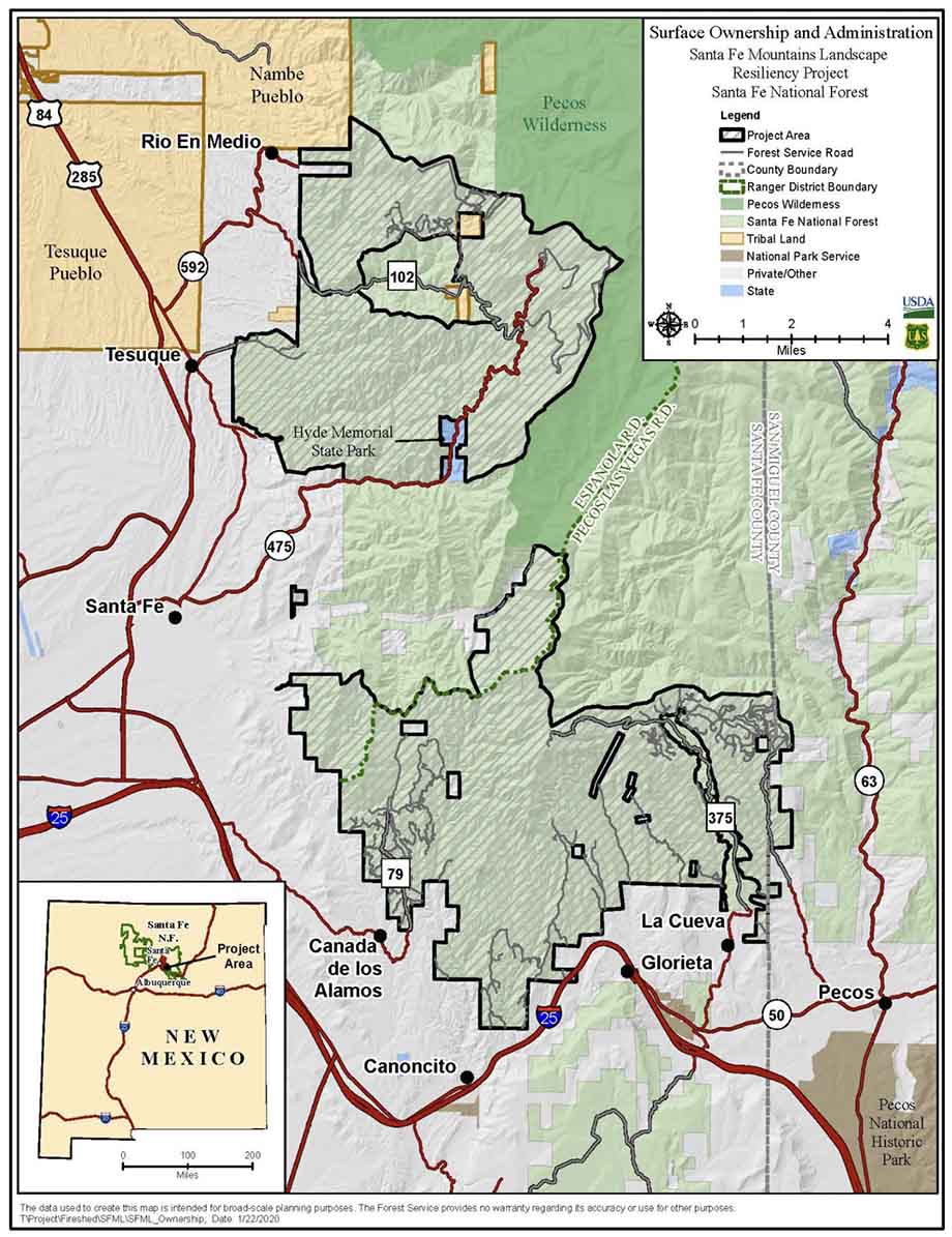
The 50,566-acre Santa Fe Mountains Landscape Resiliency Project would involve prescribed fire and vegetation thinning treatments on 36,680 acres to improve ecosystem resilience by reducing stand density, stand continuity, and stand homogeneity and increase a diverse forest structure at a landscape scale. At least 750 acres would be treated each year with manual or mechanical vegetation thinning and no more than 4,000 acres per year would be treated by the use of prescribed fire during a 15- to 20-year project time frame.

The Forest Service went through the much less complicated Environmental Assessment (EA) process, which included the draft EA, public outreach, and accepting comments, then issued the Finding of No Significant Impact (FONSI) which they feel enables the implementation of the project.

But after three prescribed burning projects on the Santa Fe National Forest got out of control since 2018 and had to be converted to wildfires, some of the locals are worried about future projects on the forest.

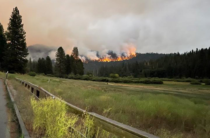
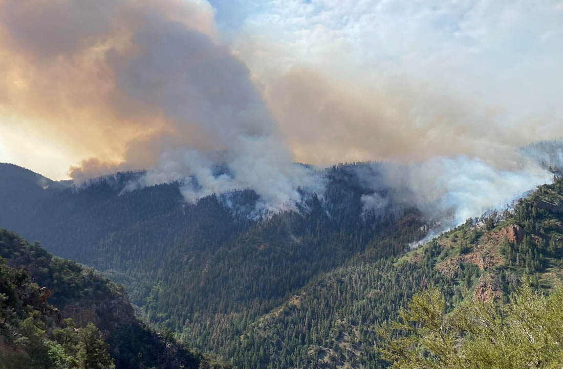
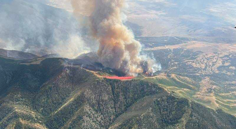
The current 341,735-acre Calf Canyon / Hermits Peak Fire is the result of two prescribed fires that escaped control earlier this year on the Santa Fe National Forest. One was a broadcast burn that crossed control lines during strong winds. The other originated from slash piles that were ignited in late January that continued burning for months. In mid-April one or more of those piles became very active during strong winds and merged with the other escaped fire on April 22. The fire has destroyed at least 400 homes, forced up to 18,000 people to evacuate their properties, and cost more than $248 million in firefighting expenses.

In 2018 another pile burning project on the Santa Fe escaped months after it was ignited and had to be converted to a wildfire. A Facilitated Learning Analysis found that “communication” and “prescribed fire preparation and risk” were common themes.

The Commissioners voted unanimously Tuesday for the USFS to go through the EIS procedure, which takes much longer than an EA and can be a costly process.

“Unacceptable risks are taken by personnel conducting planned burns because they are pressured to accomplish the mission,” the resolution states. “An EIS is appropriate because the EA … did not disclose or analyze the significant impacts to resources of an escaped intentional burn resulting from global heating and increased fine fuels.”

The resolution Requests the USFS cease all prescribed burns on the proposed project area “until the greater understanding and concomitant risk reduction provided by these reviews is in place.”

The USFS documents regarding the project can be found here.

Thanks and a tip of the hat go out to Sarah.

Sir Charles assists in campaign to get firefighting helicopters for Lake Tahoe

Charles Barkley, Tahoe helicopters
Charles Barkley and Tahoe Douglas Fire Chief Scott Lindgren are helping to spread the word about a campaign to acquire two firefighting helicopters for the Lake Tahoe area. Still image from South Lake Tahoe Now video.

NBA legend Charles Barkley is helping the Tahoe Douglas Fire Department spread the word about a campaign to acquire two firefighting helicopters for the Lake Tahoe area in Northern California, which according to the Fire Chief is devoid of permanent helicopter coverage.

From the description and amount of funds being sought, it appears their hope is to purchase two Sikorsky S-70i Firehawk helicopters capable of carrying up to 1,000 gallons of water and also capable of responding to medical incidents with a paramedic and full advanced life support equipment. In order to have continuous coverage with a helicopter, you need at least two in a fleet to account for scheduled and unexpected maintenance.

The article below by Paula Peterson was first published on SouthTahoeNow.com.


STATELINE, Nev. – Charles Barkley remembers the American Century Championship in July 2007 very well. He and the other celebrities had arrived at Lake Tahoe to golf in the annual tournament at Edgewood Tahoe, but that year it was different.

The devastating Angora Fire started off of North Upper Truckee Road on June 24, and before it was done on July 2 it had burned through 3,100 acres, destroyed 242 residences and 67 commercial structures, damaged 35 other homes, and engaged 2,180 firefighters.

Barkley said they couldn’t “yuck” it up at celebrity golf across the lake and have fun while nearby residents were dealing with such a catastrophe. He asked NBC if he could take a camera crew into the fire-damaged area.

“I came up here 15 years ago and saw catastrophic damage. It broke my heart. I’d actually never seen fire damage before,” said Barkley.

He donated $190,000 to recovery efforts for residents over the following two years and treated firefighters and their spouses to dinner at Harrahs Tahoe.

At Edgewood Tahoe Saturday, during the 33rd annual American Century Championship, Tahoe Douglas Fire Chief Scott Lindgren held a press conference with Barkley to highlight his agency’s Operation Save Lake Tahoe.

Lindgren has said there is a giant hole in the middle of the Sierra without firefighting helicopter coverage, and that is the Lake Tahoe Basin and surrounding mountains. He wants to change that with a $60 million plan that would bring two helicopters, a station, and training to not only Douglas County, but to the whole Lake Tahoe Basin and surrounding Sierra.

Fundraising efforts have been underway for months, but much more needs to be raised.

“So anything you can do to help, please help these guys get their helicopter, please, because, hey, we can’t let nothing happen to this place,” said Barkley.

“We can’t let it happen again,” Barkley said of the Angora Fire.

For more information or to donate, visit https://tahoefire.org/helicopter.

Firefighters make progress on Washburn Fire

Threatens 3,000-year-old giant sequoia trees in Yosemite National Park

Updated 5:00 p.m. PDT July 13, 2022

Washburn Fire, photo looking NNE from Miami Peak at 4:45 p.m. July 13, 2022
Washburn Fire, photo looking NNE from Miami Peak at 4:45 p.m. July 13, 2022. AlertWildfire.

The Washburn fire in Yosemite National Park has kicked up Wednesday afternoon like it has every afternoon since it started July 7.

Helicopters have been assisting ground-based firefighters on the east side of the fire today, but due to spot fires and increased fire activity in the afternoon they called in two large and one very large air tanker to slow the spread.

A community meeting about the fire will be streamed live on Facebook at 7 p.m PDT on July 14.

The FIRIS aircraft shot video of the fire earlier today:


Updated 6:04 a.m. PDT July 13, 2022

Washburn Fire map, 3-D, 1045 p.m. July 12, 2022
Washburn Fire map in 3-D looking west. The red line was the perimeter at 10:45 p.m. July 12, 2022. The white line was the perimeter about 24 hours before. The orange areas had extreme heat at the time of the mapping flight.

Most of the fire activity on the Washburn Fire over the last 24 hours has been on the east side where it has burned out of Yosemite National Park and into the Sierra National Forest. So far crews have been able to suppress all of the spot fires on the north side that crossed the South Fork of the Merced River and ignited the five-year-old vegetation in the footprint of the 2017 South Fork Fire.

Washburn Fire map, 1045 p.m. July 12, 2022
Washburn Fire map. The red line was the perimeter at 10:45 p.m. July 12, 2022. The white line was the perimeter about 24 hours before. The orange areas had extreme heat at the time of the mapping flight.

The incident management team is evaluating the feasibility of building a fireline on the east side between Raymond Mountain and the river in order to stop the movement beyond that point.

On a flight at 10:45 p.m. an infrared line-scanning aircraft mapped the fire. An infrared analyst interpreted the data and found that it had burned 3,772 acres.

Below, another aircraft using a different system, FIRIS, reported it was 3,843 acres at 10:06 p.m. July 12. Their infrared video, looking east, is below.


Washburn Fire map 12:53 p.m. July 12, 2022
Washburn Fire map 12:53 p.m. July 12, 2022. The green lines represent all of the mapping flights by the FIRIS aircraft.

Fire crews are making progress on the Washburn Fire in Yosemite National Park — the south and west sides are starting to look more secure. At 12:53 p.m. Tuesday it was mapped at 3,516 acres.

Approximately 340 acres of the blaze is within the Mariposa grove of giant sequoias, some of which are close to 3,000 years old. The more than 500 mature giant sequoias are adjacent to heavy fuels and have so far avoided serious damage from the fire, the National Park Service reported Tuesday.

On Monday, firefighters suppressed about 15 spot fires on the west side of the fire that were across Highway 41. They now have a fire line around the Wawona community and have structure defense equipment in place.

Washburn Fire, July 10, 2022
Washburn Fire, July 10, 2022. InciWeb.

On the northeast side the line is complete from the highway down to the South Fork of the Merced River and around the community. On the north side the fire has reached the river in most places and crews are putting out spot fires as they occur across the river in the fire scar from the 2017 South Fork Fire.

The east side continues to spread. Firefighters assisted by air tankers have constructed fire line along the ridge east of Wawona Point and so far that is holding. About a mile to the east hotshot crews are evaluating the feasibility of building a fireline between Raymond Mountain and the river in order to arrest the movement beyond that point.

Yosemite Superintendent Cicely Muldoon said the fire was caused by humans.

“As you all know there was no lightning on that day so it is a human start,” Muldoon said Monday night. “It’s under investigation. That’s all I can say about that right now. We’re looking at that really hard.”

The weather for this week will continue to be warm and dry due to a strengthening high pressure system. Winds should remain light to moderate and mostly terrain driven. Temperatures will reach the low-90s and relative humidity will be in the 20-30 percent range.

Washburn Fire 4:21 p.m. July 12, 2022
Washburn Fire — looking north-northeast from the Deadwood camera at 4:21 p.m. July 12, 2022. AlertWildfire.

FBI using system to detect drones over wildfires, and the pilots

Lakeview IHC drone Operation
Lakeview Hotshots using a drone to assist with a burn operation in Alaska in 2019.

This article was first published at Fire Aviation.

The Federal Bureau of Investigation is using a new system to help wildland firefighters by detecting, identifying, and neutralizing drones that are illegally interfering with firefighting activities.

It is very dangerous to fly a drone near a fire at which helicopters or fixed wing aircraft are operating. A collision could impact the windscreen or damage the engine, props, rotors, or flight control surfaces, causing a crash. If a drone is seen near a fire the standard operating procedure is to remove all aircraft from the fire area until it is confirmed that the drone has left the scene. In other words, it interferes with firefighting efforts.

The FBI is working with the Los Angeles County Fire Department to use a system that can detect a drone flying over a fire within 30 seconds of it being launched.

From CNN:

“When the detection equipment finds the drone and identifies the operator’s location, we can very rapidly get that information to a ground intercept team who can then go make contact with that drone operator and essentially get them to stop flying that drone,” said James Peaco III, the weapons of mass destruction coordinator for the FBI’s Los Angeles field office.

With a special sensor, the team can set up a boundary as large or as small as desired and get notified if a drone flies into that area, instantly obtaining precise details such as elevation, direction, speed as well as where the drone took off from and where the controller is currently standing.

“The first thing we do is order them to bring the drone back, explain to him that there’s a wildfire and flying that drone during a wildland fire is actually a federal felony,” Peaco said.

It’s a federal crime punishable by up to 12 months in prison to interfere with firefighting efforts on public lands. Additionally, Congress has authorized the FAA to impose a civil penalty of up to $20,000 against any drone pilot who interferes with wildfire suppression, law enforcement, or emergency response operations. The FAA treats these violations seriously, and will immediately consider swift enforcement action for these offenses.

According to the US Forest Service, in 2019 at least 20 documented instances of unauthorized drone flights over or near wildfires in seven states (Arizona, California, Colorado, Nevada, New Mexico, Utah, Washington and Minnesota) resulted in aerial firefighting operations being temporarily shut down nine times. There is no centralized national mechanism to report unauthorized UAS flights over wildfires, so these are only the incidents that wildfire management agencies have become aware of, there are likely more that are not known about.

Suspending air operations could decrease the effectiveness of wildfire suppression operations, allowing wildfires to grow larger, and in some cases, unduly threaten lives, property, and valuable natural and cultural resources. The effects of lost aircraft time could be compounded by flames moving into untreated terrain.

Thanks and a tip of the hat go out to Tom and Gerald.

Jacob City and Halfway Hill fires burn thousands of acres in Utah

11:04 a.m. MDT July 11, 2022

Halfway Hill Fire 3-D map 10:34 p.m. July 10, 2022
Halfway Hill Fire 3-D map looking south at 10:34 p.m. July 10, 2022.

Two wildfires in Utah are burning in steep, rugged terrain.

The Halfway Hill Fire is in the Fishlake National Forest two miles southeast of Fillmore east of Interstate 15. The activity on the fire Sunday was more moderate than the previous two days as the wind speeds lessened. It was mapped Sunday night at 10,417 acres. Most of the heat detected by the sensors on the aircraft was on the eastern side.

Halfway Hill Fire, July 10, 2022. Utah Fire Info
Halfway Hill Fire, July 10, 2022. Utah Fire Info.

Residents of the Virginia Hills subdivision are still under an evacuation notice.

Map of the Halfway Hill Fire 10:34 p.m. July 10, 2022
Map of the Halfway Hill Fire. The red line was the perimeter at 10:34 p.m. July 10, 2022. The white line was the perimeter about 24 hours before.

The Jacob City Fire has burned 4,094 acres 2 miles east of Stockton. When it was mapped at 10 p.m. Sunday it was very active on the northwest and southeast sides. As of Sunday evening no communities are imminently threatened, according to Utah Fire Info.

Jacob City Fire map 10:09 p.m. July 10, 2022
Map showing the location of the Jacob City Fire at 10:09 p.m. July 10, 2022.
Jacob City Fire, July 10, 2022
Jacob City Fire, July 10, 2022. Utah Fire Info
Jacob City Fire 3-D map 10:09 p.m. July 10, 2022
Jacob City Fire 3-D map looking east, 10:09 p.m. July 10, 2022