
The government is seeking to recover $25 million in costs for the 54,000-acre fire
Continue readingRailroad only pays half of cost of fires caused by their steam engines
Coal-burning trains operated by D&SNG in Colorado have started multiple wildfires in the San Juan National Forest
Continue readingLawsuit filed alleging steam engine train started 416 Fire
The fire burned over 54,000 acres north of Durango, Colorado in June, 2018
Continue readingMultiple wildfires burning in Colorado

Above: Colorado Fires. Heat detected at 1:01 p.m. MDT June 30, 2018.
(UPDATED at 6:11 p.m. MDT June 30, 2018)
Colorado has been the location where much of the firefighting action has taken place during the last couple of weeks and that continues as at least five large blazes burn across the state.
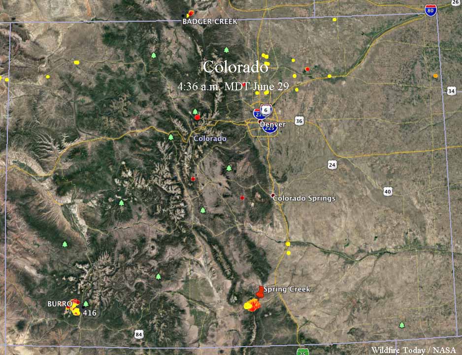
The map above shows the locations of the largest and most active fires. The heat data on the map is from 1:01 p.m. MDT June 30.
Here is the list:
- 416 Fire, 9 miles north of Durango. 47,000 acres. It started June 1.
- Spring Creek Fire, between La Veta and Fort Garland along Highway 160. 38,000 acres. CDOT reports that the closure of US 160 between Fort Garland and La Veta and the closure of CO 12 between Cuchara and La Veta, will continue. The fire is now pretty well established on the north sides of Highway 160 and Mt. Maestas. (More information.)
- Chateau Fire, 7 miles northwest of Cripple Creek. Our VERY UNOFFICIAL estimate puts it at 1,300 acres early Saturday afternoon. (More information)
- Weston Pass Fire, 16 miles southeast of Leadville. Our VERY UNOFFICIAL estimate puts it at 3,400 acres early Saturday afternoon. US 285, in Park County, is closed between Fairplay and Antero Junction (mp 188 to mp 163) in both directions. A Type 1 Incident Management Team has been ordered and will assume command 7/1. This team will manage both the Weston Pass Fire and the High Chateau Fire. (More information)
- Sugarloaf Fire, 13 miles northeast of Silverthorne. The Forest Service estimates it has burned about 1,300 acres. This fire is not being fully suppressed.
Satellite imagery of Colorado fires

These photos show the location of the wildfires in Colorado, via the heat sensors on satellites. The one above was taken at 1:57 p.m. MDT June 29 when the 416 Fire looked quite active. The Spring Creek Fire was mostly obscured by clouds, but the heat sensor was able to get a peek at it when a hole in the clouds passed over. The data in the map below was from 4:36 a.m. MDT June 29.
More information about the 416 and Spring Creek Fires.
Incident Commander on the 416 Fire interviewed as the team’s assignment ends

Since the fire started June 1 about 10 miles north of Durango, CO., it has burned over 34,000 acres west of Highway 550
Continue readingWeather slows fire activity in Western United States

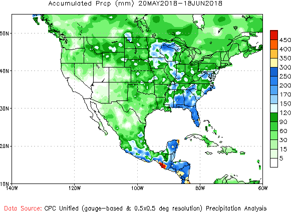
Above: Accumulated precipitation over the last seven days, June 12-18, 2018.
Moderating weather over the last seven days has helped firefighters make progress on some of the fires in Colorado, Wyoming, New Mexico, and Utah. Today’s national Situation Report showed little or no increase in the size of wildfires in those four states. The 416 Fire in southwest Colorado and the Badger Creek Fire in southern Wyoming released a total of 345 personnel over the last 24 hours.
Todd Pechota’s Type 1 Incident Management Team is currently assigned to the 416 Fire, but Joe Reinarz’s NIMO team has been mobilized for the fire, which could be an indication that they expect it to be a long term incident. The west side of the fire has spread into steep, remote terrain above 8,000 feet as it grows closer to an 11,000 to 12,000-foot ridge five miles away. Much of the ridge is above the timber line and may eventually, with patience over time, serve as a barrier. Mr. Reinarz’s team team will transition on Friday.
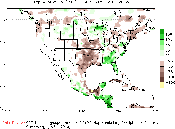
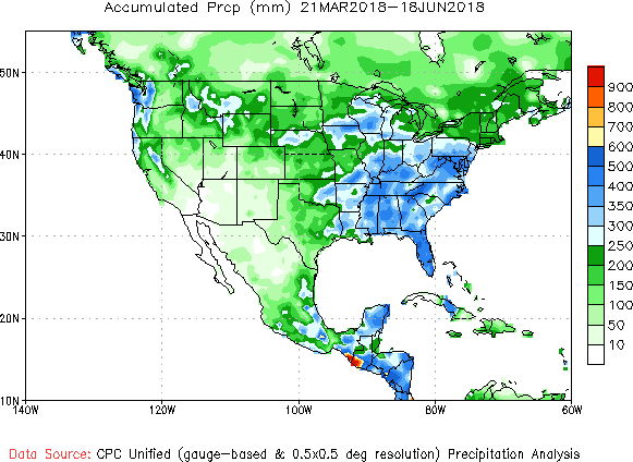
Below, National Weather Service graphics show the observed precipitation and the departure from normal for the last 30 and 90 days.

Video of Air Tanker 850 working the “416 Fire” near Durango, Colorado
Filmed by pilot Jim Watson of GB Aerial Applications, this is a video of Air Tanker 850 on the “416 Fire” near Durango, CO June 13, 2018, working with John Ponts, Lead 51 trainee.
Jim said, “The Heavies did the long runs while the Single Engine Air Tankers offered close air support by reinforcing weak areas such as this drop in the bottom of a drainage.”
Fire north of Durango continues westward expansion
(UPDATED at 7:03 a.m. MDT June 13, 2018)
Most of the spread of the 416 Fire north of Durango, Colorado Tuesday and Tuesday night was on the west side where it continues to grow onto the higher slopes in terrain that becomes increasingly difficult for ground-based firefighters. The fire ate up about 1,500 acres to bring the total to 25,900 acres.
It was announced Tuesday night that the evacuation order for residents in San Juan County will lift at 8 a.m. on June 13. Residents will need to present a Rapid Tag resident credentials to return. The residences in San Juan County will remain on pre-evacuation notice.
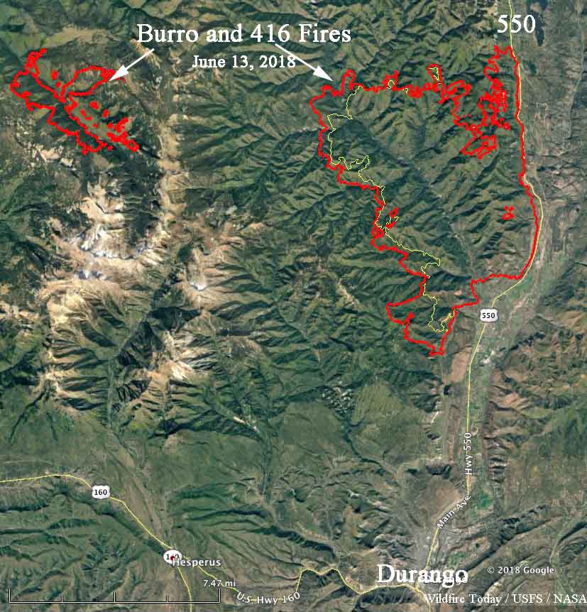
Resources on the 416 Fire include 9 Type 1 hand crews, 14 Type 2 hand crews, 55 engines, 3 dozers, and 4 water tenders for a total of 1,028 personnel. There are 203 personnel on the Burro Fire.
There was very little growth or activity on the Burro Fire Tuesday.
Fire management authorities are not releasing the cause of either fire.
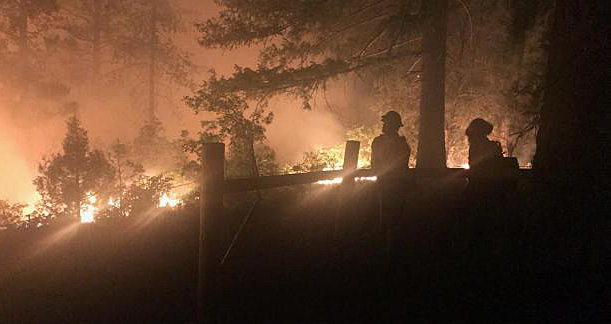
A photo I took two days ago from the 416 Fire. If you look at the photo with the flames ripping the hillside, you can see the little white dots right in front of the fire. Those are the helmets of the the Hotshots, an elite team that battle high priority fires. #416Fire pic.twitter.com/XWYxuluGzJ
— Hank Blum (@hankblum) June 13, 2018
(Originally published at 12:12 p.m. MDT June 12, 2018)
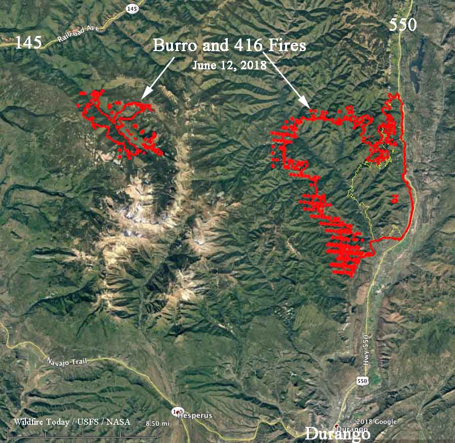
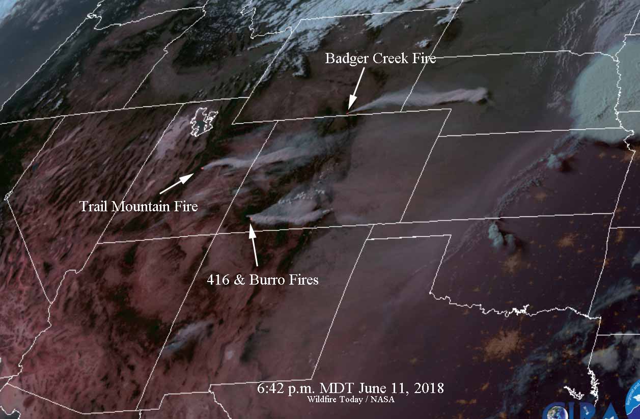
The wildfire with the odd name, “416”, continues to be very active especially on the west side. Over the past two days it has grown two miles closer to Durango, Colorado on the south side and is now seven miles from the north edge of the city, covering a total of 23,378 acres.
The west side of the 416 Fire has been the location of most of the activity recently where it has spread seven miles west of Highway 550 and to within six miles of another blaze, the 2,337-acre Burro Fire.
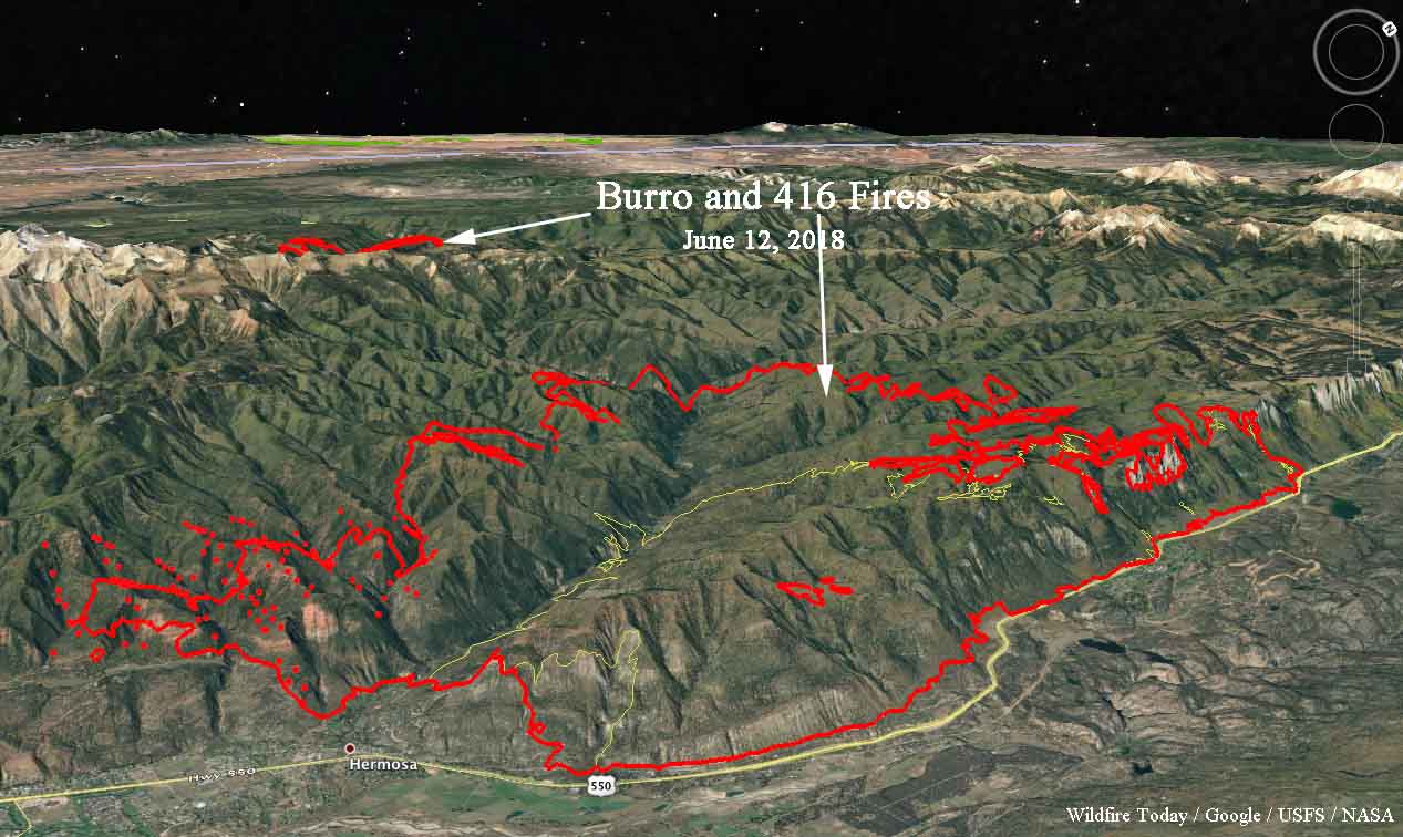
The west side of the 416 Fire is burning at over 8,000 feet in terrain that is difficult for ground resources. An 11,000 foot ridge separates the two fires and in normal times should serve as a barrier preventing them from merging, but the way wildfires have been behaving in recent years is anything but “normal”.
Todd Pechota’s Type 1 Incident Management Team is handling both fires.
The weather forecast for the fire area through Thursday calls for south and southwest winds of less than 10 mph, temperatures in the low 80’s, and 9 to 12 percent relative humidity. Beginning Thursday there is a chance of thunderstorms.
More evacuations ordered for the “416 Fire” north of Durango

Friday afternoon a new fire broke out 22 miles northwest of Durango, and northwest of the 416 fire.
Continue reading