Hot, dry, windy conditions spread wildfires east of Melbourne, Australia

A blaze in Bunyip State Park has burned over 15,000 acres

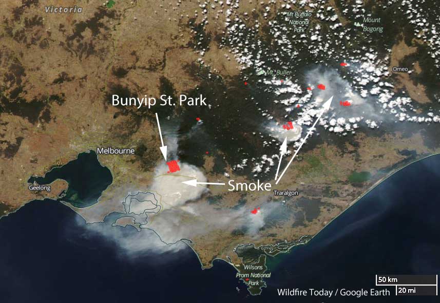
Wildfires in Victoria
Wildfires in Victoria east of Melbourne, March 3, 2019 local time. The red dots represent heat detected by a satellite.

The weather in Victoria, Australia is causing multiple wildfires to spread rapidly endangering residents in some areas east of Melbourne. Presently there are 25 fires burning in the state. Fifteen of them are in eastern Victoria.

Four fires near Bunyip State Park, near Tonumbik, about 65km east of Melbourne, merged on Saturday into one blaze that has burned 6,280 hectares (15,500 acres) as of Sunday afternoon local time.
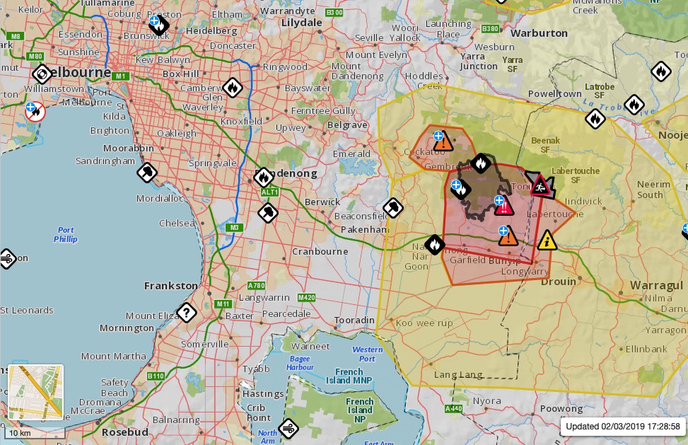
map wildfire Bunyip State Park in Victoria, Australia
Map showing the location of the wildfire in Bunyip State Park in Victoria, Australia. Vic Emergency map.

Officials warn that the fire in the state park is expected, after a wind shift, to move closer to Labertouche North and warned residents to be prepared to evacuate. Three homes have been destroyed in the fire so far.
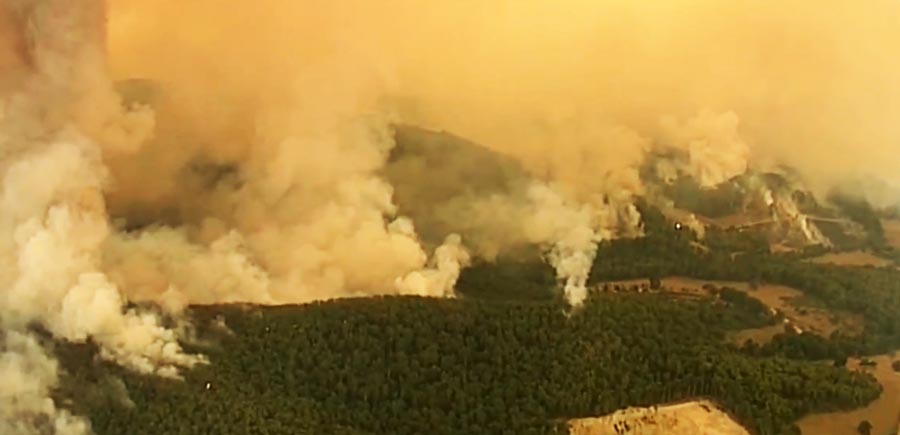
Wildfire in Bunrip State Park
Wildfire in Bunyip State Park. Screengrab from 7 News Melbourne video.

At least one night-flying helicopter dropped water on the fire Saturday night until 3 a.m. local time. About 850 people, 120 fire trucks, and 20 aircraft will be working on the state park blaze Sunday.

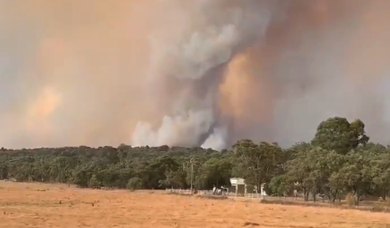
Video of rotating convection column

rotating convection column
Screenshot from @StormCatMedia video below.

Most large convection columns of smoke rising over large or intense wildfires rotate to some degree. In the video below filmed near Melbourne, Australia, the speed of the playback has been increased, making it easier to notice the rotation. To confirm this, check out the car driving by at what appears to be over 250 miles per hour.

Thanks Mike. Very interesting!

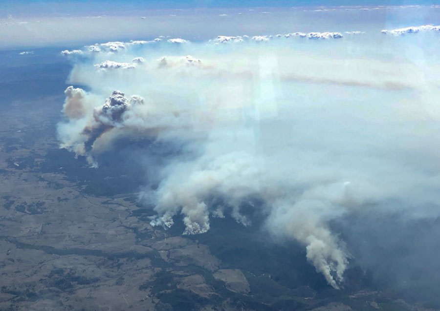
As a bonus, here is another recent convection column in Australia — a very large one with condensation on top, referred to as a pyrocumulus cloud.

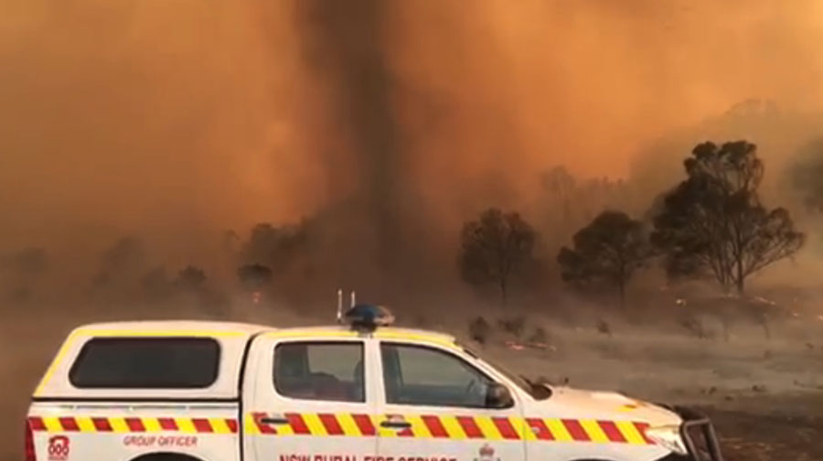
Impressive fire whirl in Australia

fire whirl
A still image from the video below of a fire whirl in New South Wales, Australia, February, 2019.

This video, below, of extreme fire behavior was posted by Shane Fitzsimmons, the Commissioner of the New South Wales Rural Fire Service in Australia. It shows a fire whirl, sometimes incorrectly called a fire tornado. Fire tornados exist, but they are much, much larger and can last for up to an hour or so and average 100 to 1,000 feet in diameter with rotational velocities up to 90 MPH.

Wallangarra bushfire burns over 100,000 acres in NSW

It is burning in both Queensland and New South Wales, Australia

Wallangarra bushfire NSW Australia
A bushfire in New South Wales and Queensland is near Wallangarra, Tenterfield, Stanthorpe, and Jennings. NSW RFS photo.

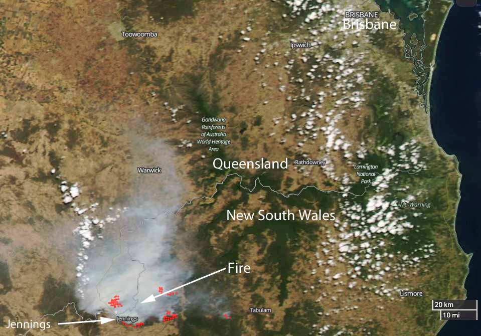
A very large bushfire has burned at least 43,800ha (108,232 acres) in Queensland and New South Wales in Australia. Smoke from the fire is affecting Wallangarra, Tenterfield, Stanthorpe, and Jennings.

At 8:55 a.m. local time on February 19 the New South Wales Rural Fire Service reported that the fire continues to burn west of the Bruxner Highway in the Girraween, Bald Rock, Boonoo areas.

Most activity overnight was on the southwest side of the fire near Sunnyside, on the northwestern side of the fire in Girraween National Park (Queensland), north of Wallangarra, and on the southeast side near the Bruxner Highway.

During the night crews conducted backburning operations which increased the fire activity and the production of smoke. This smoke is likely to settle around the areas of Tenterfield, Jennings, Wallangarra and Stanthorpe (QLD), but will begin to clear late Tuesday morning.

Wallangarra Fire map
Satellite photo of the Wallangarra Fire burning in Queensland and New South Wales. The red dots indicate heat. NASA photo.

Tingha, New South Wales isolated as fire closes roads and burns homes

Tingha Fire map bushfire new south wales
The red dots near Tingha, New South Wales represent heat detected by a satellite. NASA image.

Winds in Australia that have changed directions several times in recent days have been pushing a large bushfire in multiple directions. The Tingha Fire that started Sunday in New South Wales has burned around the community of Tingha closing roads in and out of the community. The blaze is between Inverell and Guyra.

NSW Rural Fire Service Commissioner Shane Fitzsimmons said firefighters indicate “numerous properties” including homes, sheds and other outbuildings were damaged or destroyed Wednesday afternoon.

ABC Australia reported that a 40-year old woman was charged with allowing her trash fire to escape, which ignited what has developed into a 30,600-acre (12,400 ha) wildfire.

The Rural Fire Service said winds on Thursday are expected to push the fire closer to Gilgai. Other areas threatened include Old Mill, Stannifer, Guyra Road east of Tingha, and the Howell Road area. But weather conditions on Thursday should be more favorable for firefighters.

On the map below, Tingha is in the center — where two major roads intersect.

Climate change brings less rain with more dry lightning and wildfires to Tasmania

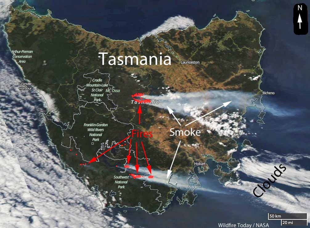
wildfires in Tasmania satellite photo
Satellite photo of smoke from wildfires in Tasmania, January 21, 2019. The red dots represent heat detected by the satellite. NASA & Wildfire Today.

Climate change has already brought alarming change to Tasmania, the huge island south of the Australian mainland. Until recently it was assumed that the climate differences would not be massive since it was thought by some that the ocean surrounding the island would not be heating as quickly as it was in other areas.

Now the southwest area of the state, the heart of its world heritage area, is being described as dying — the rainforest and heathlands are beginning to disappear. The nearby seas, it turns out, are warming at two to three times the global rate.

Richard Flanagan writes about this issue in an opinion article at The Guardian. Below is an excerpt:

…Then there was the startlingly new phenomenon of widespread dry lightning storms. Almost unknown in Tasmania until this century they had increased exponentially since 2000, leading to a greatly increased rate of fire in a rapidly drying south-west. Compounding all this, winds were also growing in duration, further drying the environment and fuelling the fires’ spread and ferocity.

Such a future would see these fires destroy Tasmania’s globally unique rainforests and mesmerizing alpine heathlands. Unlike mainland eucalyptus forest these ecosystems do not regenerate after fire: they would vanish forever. Tasmania’s world heritage area was our Great Barrier Reef, and, like the Great Barrier Reef, it seemed doomed by climate change.

Later [Prof Peter] Davies [an eminent water scientist] took me on a research trip into a remote part of the south-west to show me the deeply upsetting sight of an area that was once peatland and forest and was now, after repeated burning, wet gravel. The news was hard to comprehend – the enemies of Tasmania’s wild lands had always had local addresses: the Hydro Electricity Commission, Gunns, various tourism ventures. They could be named and they could be fought, and, in some cases, beaten.

Six weeks ago, the future that Davies and others had been predicting arrived in Tasmania. Lightning strikes ignited what would become known as the Gell River fire in the island’s south-west. In later weeks more lightning strikes led to more fires, every major one of which is still burning.