Firefighters from NSW assist with Tasmania bushfire

Gell River Fire Tasmania
Gell River Fire. Photo by Andrew MacDonald

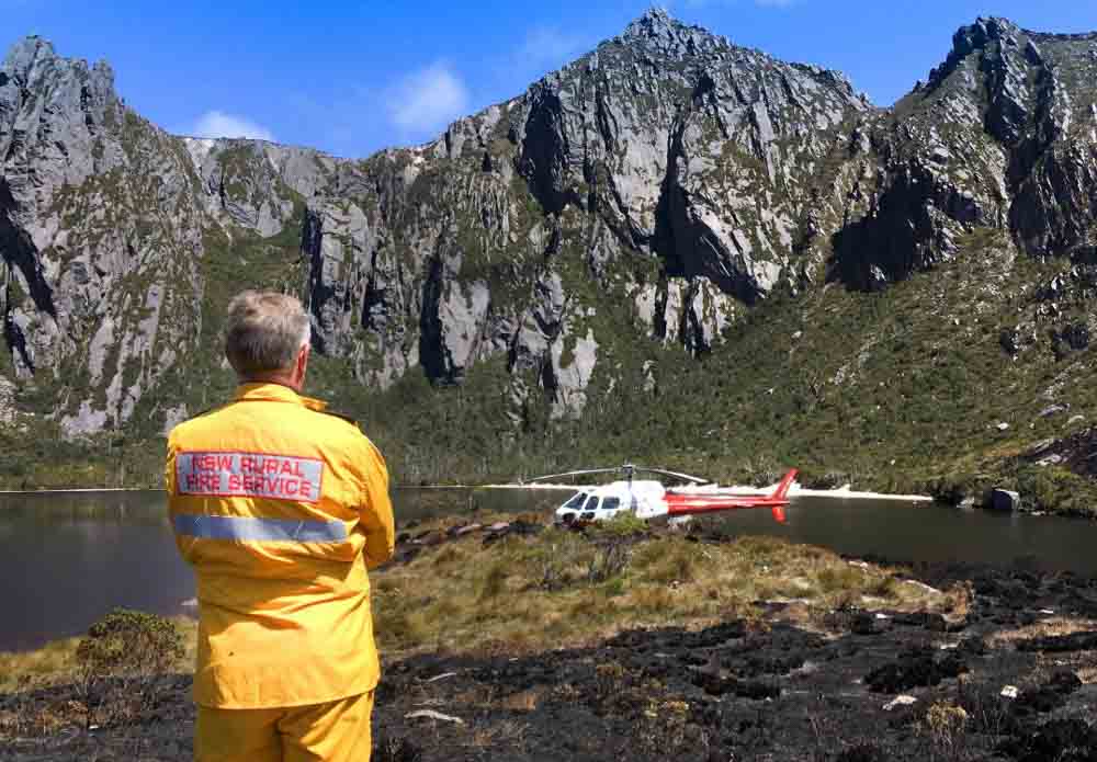
Firefighters in New South Wales have traveled across the Bass Strait to assist their brothers and sisters in Tasmania. The five personnel will be working with the Tasmania Fire Service, specifically on the Gell River Fire in the southwest part of the state. The deployment of five arrived Sunday to assume specialist aviation roles operating out of Hobart and Strathgordon.

Map Gell River Fire in Tasmania, Australia
Map showing the location of the Gell River Fire in Tasmania, Australia.

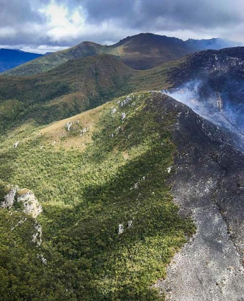
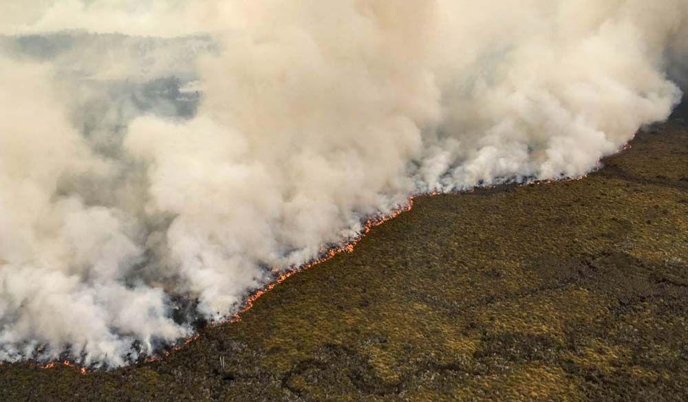
The Gell River Fire has burned 50,600 acres (20,500 ha) primarily in Franklin-Gordon Wild Rivers National Park. Portions of the fire are burning in peat, which means the deep-seated blaze will likely persist for months and continue to produce smoke.

Below is an update on the fire from the Tasmania Fire Service:

The fire continues to burn in buttongrass and mixed forest vegetation in the Vale of Rasselas, approximately 10 kilometres northwest of Tim Shea and along the Denison Range and Gordon Range. A sprinkler line around the northern side of Lake Rhona was successful in protecting fire-sensitive vegetation communities. Fire fighters and aerial water-bombing also managed to protect these vegetation communities in other areas. Specialist remote area fire fighters are working in rugged terrain to extinguish the fire. Although the fire is still uncontained, suppression operations conducted by fire fighters and water bombing aircraft have been successful to date, with many active fire edges minimised. An increase in smoke may be visible in the Greater Hobart area, Derwent Valley and Huon Valley on Tuesday evening and Wednesday due to increased fire activity, particularly at the southern end of the fire. Resources currently deployed to the Gell River bushfire include 60 personnel and eight aircraft. Tasmania Fire Service
This image of smoke from the Gell River Fire was captured by a satellite on January 4, 2019. Since then the activity has decreased due to a change in the weather. The red dots indicate heat detected by the satellite.
Gell River Fire Tasmania helicopter
Photo by Andrew MacDonald
Gell River Fire Tasmania helicopter
Photo by Andrew MacDonald
Gell River Fire Tasmania
Gell River Fire. Photo by Andrew MacDonald
This image of smoke from the Gell River Fire was captured by a satellite on January 4, 2019. Since then the activity has decreased due to a change in the weather. The red dots indicate heat detected by the satellite.

Large wildfire in Tasmania sends smoke into Hobart

The fire near Gell River has burned over 37,000 acres

A large wildfire that started in the Gell River area in the Australian state of Tasmania has burned more than 37,000 acres (15,000 Ha) mostly in the Franklin-Gordon Wild Rivers National Park. The fire is approaching Lake Rhona and Gordon River and has sent embers into Mount Field National Park. The blaze was burning button grass but has moved into timber and peat areas, which could result in it persisting for months.

Dense smoke that spread toward the southeast heavily impacted Hobart as you can see in this satellite photo.

Tasmania Fire Gell River
Wildfire in southwest Tasmania that started near Gell River, currently burning in Franklin-Gordon Wild Rivers National Park. The red dots indicate heat detected by the satellite. Photo, January 4, 2018.

Paul Black of the Parks and Wildlife Service said, “We’ll be considering further retardant drops, back-burning operations, a lot of water bombing, and hot and cold trailing of the active edge of the fire.”

Clouds and cooler weather moved in and slowed the spread of the fire on January 4.

smoke Hobart Tasmania Fire Gell River
Wildfire smoke from the Gell River Fire impacts Hobart, Tasmania, Australia. Photo by Olivia Hicks.

Setting up a containerized Incident Command Post in Australia

Container Fire Camp
Screenshot from the video.

When agencies in the Western United States set up a large Incident Command Post many fire organizations haul in trailers of one type or another, but this video shows how the Parks and Wildlife Service in Western Australia gets it done.

I imagine the units are quite a bit less expensive to procure than rolling stock, and it looks like they could be set up rather quickly on flat ground. If the units have to be leveled, I suppose you could raise them with the fork lift and slip concrete blocks and/or layers of 2″ x 12″ boards under them.

Hay shed fire in New South Wales

hay shed fire new south wales
Photo credit: NSW RFS. Click to enlarge.

On December 12 firefighters from New South Wales Rural Fire Service and Victoria Country Fire Authority responded to a fire in a hay shed on Howlong-Balldale Road northwest of Howlong, NSW.

In a tweet the NSW RFS warned about spontaneous combustion:

With warmer weather the risk of hay stack fires increases. This fire attended by crews between Howlong & Corowa. With hot weather on the way landholders should check the temperature in stored hay & if possible ensure that farm machinery is kept in a separate shed.

hay shed fire new south wales
Photo credit: Fire and Rescue NSW Station 206 Albury North

hay shed fire new south wales
Photo credit: Fire and Rescue NSW Station 206 Albury North

The University of Montana has information about spontaneous combustion in hay:


“Oddly enough, wet hay is more likely to lead to a spontaneous combustion fire than dry hay. If hay is put into a barn or stack when it has more than about 22 percent moisture, not only does the hay loose forage quality, but it has an increased risk of spontaneous combustion.

“High moisture hay stacks can have chemical reactions that build heat. Hay insulates, so the larger the haystack, the less cooling there is to offset the heat.

“When the internal temperature of hay rises above 130 degrees Fahrenheit (55 degrees C), a chemical reaction begins to produce flammable gas that can ignite if the temperature goes high enough.

“Hay fires generally occur within six weeks of baling. Heating occurs in all hay above 15 percent moisture, but generally it peaks at 125 to130 degrees F, within three to seven days, with minimal risk of combustion or forage quality losses. Temperature within a stack then declines to safe levels in the next 15 to 60 days, depending on bale and stack density, ambient temperature and humidity, and rainfall absorbed by the hay.

“To avoid hay fires, small, rectangular bales should not exceed 18 to 22 percent moisture, and large round or rectangular bales should not exceed 16 to 18 percent moisture for safe storage.

“In addition, you should check your hay regularly. If you detect a slight caramel odor or a distinct musty smell, chances are your hay is heating. At this point, checking the moisture is too late, and you’ll need to keep monitoring the hay’s temperature.”

A success story at Tarrawingee

Victoria Bushfire
Screenshot from video by Tarrawingee Rural Fire Brigade.

Quick work by firefighters in Victoria, Australia drew praise from the daughter of a landowner whose property was burning near Tarrawingee northeast of Melbourne.

The Country Fire Authority reported that firefighters from Eldorado, Everton, Springhurst, Tarrawingee, Wangaratta, and Wangaratt North responded to the fire on the Tarrawingee-Eldorado Road at around midday on Saturday December 1. The fire was brought under control by 12:25 P.M.

Posting on Facebook, Brooke Sheppard Ross said: “For one hour these selfless people assisted by DSE and Forestry members battled the dry grass and intermittent wind that fanned the flames into our bush land paddocks.”

From The Guardian on November 28:

While parts of the drought-stricken eastern [Australian] states have enjoyed some recent rain and there have been huge downpours along the NSW coast during this week’s storms, experts are warning it won’t be long before the hot summer temperatures dry out ground vegetation.

“Above-normal fire potential remains across large parts of southern Australia,” the Bushfire and Natural Hazards Cooperative Research Centre said in its seasonal bushfire outlook, also released on Thursday.

As part of its summer outlook, the Bureau of Meteorology has forecast a drier-than-average summer for large parts of Queensland, Western Australia and the Northern Territory.

“Having said that, locally heavy rainfall events similar to what we have seen in NSW in the last two days are always a possibility during summer, no matter what the outlook is showing,” Watkins said.

NSW has recorded its eighth driest and fourth hottest April-November on record, with Queensland and Victoria having experienced similar conditions.