Smoke produced by large wildfires can be equal to a volcano

Above: Satellite photo taken August 2, 2017 showing smoke from some of the wildfires in British Columbia. The red dots represent heat detected by a sensor on the satellite.

It is not easy to measure and quantify the composition of the smoke and the amount of particulate matter that a huge wildfire produces when intense, large-scale burning forms towering pyrocumulus clouds that climb tens of thousands of feet into the sky. This launches the byproducts of combustion into the  stratosphere — the second layer of Earth’s atmosphere, above the troposphere. Once introduced at that level they have been tracked while circling the planet multiple times.

Below is an excerpt from an article by Megan Gannon at Live Science, which points out similarities between large wildfire events and volcanos.

For comparison, the explosive 2008 eruption of Mount Kasatochi, an island volcano in Alaska, sent about 0.7 to 0.9 teragrams (nearly 1 million tons) of aerosols — tiny, suspended particles — into the stratosphere, Peterson said. For months afterward, people around the Northern Hemisphere documented unusually colored sunsets, thanks to the sulfate aerosols and ash the volcano injected into the atmosphere.

Peterson’s team estimated that the British Columbia pyroCb event sent about 0.1 to 0.3 teragrams (about 200,000 tons) of aerosols into the stratosphere — which is comparable to the amount seen with a moderate volcanic event, and more than the total stratospheric impact of the entire 2013 fire season in North America, he said.

It’s well known that catastrophic volcanoes can influence the global climate. The huge 1991 eruption of Mount Pinatubo in the Philippines, one of the largest in living memory, lowered temperatures around the world by an average of 0.9 degrees Fahrenheit (0.5 degrees Celsius).

As an example of the wildfire activity in British Columbia last year, here is an excerpt from an article posted August 9 at Wildfire Today:

The wildfire situation in British Columbia has not gotten any better in the last several days. Currently there are 128 active wildfires in the province, with four of them being larger than 50,000 hectares (123,000 acres). The largest, the Hanceville Riske Creek Fire, is getting closer to half a million acres each day.

Since April 1, approximately 591,280 hectares (1,461,082 acres) have burned in 900 fires in BC.

  • Hanceville Riske Creek, 172,000 hectares (425,000 acres) approximately 60 km southwest of Williams Lake.
  • Elephant Hill, 117,000 hectares (289,000 acres), near Ashcroft.
  • Tautri Lake, 76,000 hectares (188,000 acres), 80 km northwest of Williams Lake.
  • Baezaeko River-Quesnel West, 53,000 hectares (131,000 acres).

More than 400 additional firefighters from Australia, New Zealand, Mexico and the US are expected to arrive in BC this week. Other firefighters from Australia have been in the province for a couple of weeks. More than 100 firefighters arrived from Mexico since Saturday of last week…


It is burning season in British Columbia

The map above shows the number of current registrations for Category 3 open fires in British Columbia. Registrations are required for a fire that burns material in piles larger than two meters high and three meters wide, windrows, or grass over an area larger than 0.2 hectares (0.49 acres) in size.

Most areas in southern British Columbia are expecting to receive precipitation over the next couple of days, so landowners are probably wanting to get the burns in before the rain or snow.

The BC Wildfire Service sent out a notice Friday morning saying, “Burn Registration line is currently receiving a high volume of calls. Pls be patient if you are waiting in queue.”

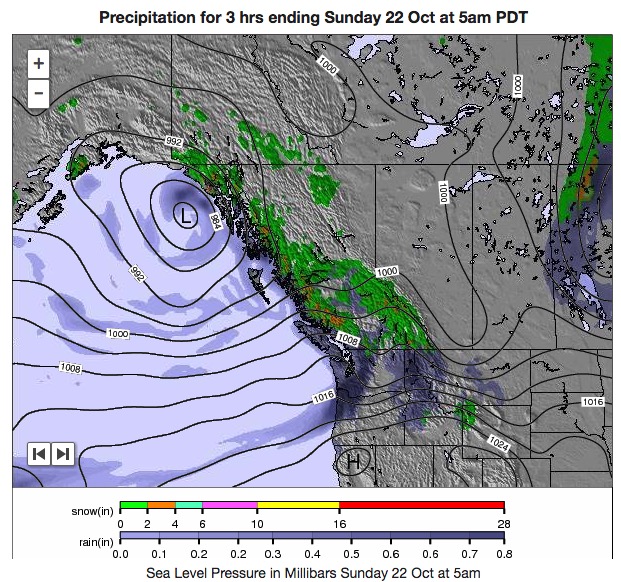
bc weather forecast

Diamond Creek Fire burns into Canada

Above: The image shows heat detected by a satellite August 31 and September 1, 2017. The red dots are the most recent, early Friday morning.

The Diamond Creek Fire in the Pasayten Wilderness in the Okanogan/Wenatchee National Forest has crossed the Washington/British Columbia border and spread three miles into Canada. The Incident Management Team reports the total size of the fire is over 52,000 acres.

128 active wildfires in British Columbia as firefighters from North America and Australia arrive to help

Above: Map showing heat detected by a satellite in southern British Columbia at 2:51 a.m. MDT August 9, 2017.

(Updated at 5 p.m. MDT August 9, 2017)

The wildfire situation in British Columbia has not gotten any better in the last several days. Currently there are 128 active wildfires in the province, with four of them being larger than 50,000 hectares (123,000 acres). The largest, the Hanceville Riske Creek Fire, is getting closer to half a million acres each day.

Since April 1, approximately 591,280 hectares (1,461,082 acres) have burned in 900 fires in BC.

  • Hanceville Riske Creek, 172,000 hectares (425,000 acres) approximately 60 km southwest of Williams Lake.
  • Elephant Hill, 117,000 hectares (289,000 acres), near Ashcroft.
  • Tautri Lake, 76,000 hectares (188,000 acres), 80 km northwest of Williams Lake.
  • Baezaeko River-Quesnel West, 53,000 hectares (131,000 acres).

More than 400 additional firefighters from Australia, New Zealand, Mexico and the US are expected to arrive in BC this week. Other firefighters from Australia have been in the province for a couple of weeks. More than 100 firefighters arrived from Mexico since Saturday of last week. No resources have been ordered or dispatched to Canada through the United States National Interagency Coordination Center, but   the Great Lakes Interstate Forest Fire Compact mobilized a crew to Ontario that is now in British Columbia, and Massachusetts sent personnel across the border. Of course the northwestern one-quarter of the United States is pretty busy with their own fires.

Massachusetts firefighters British Columbia
Firefighters from Massachusetts board an aircraft on the way to the Elephant Hill Fire near Ashcroft, British Columbia. Photo by Mass. Department of Conservation and Recreation.
NSWRFS firefighters British Columbia
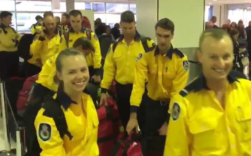
On Tuesday U.S. time 40 firefighters from Australia’s New South Wales Rural Fire Service joined 60 others from across the continent as they began their travel to British Columbia. Screenshot from NSWRFS video.

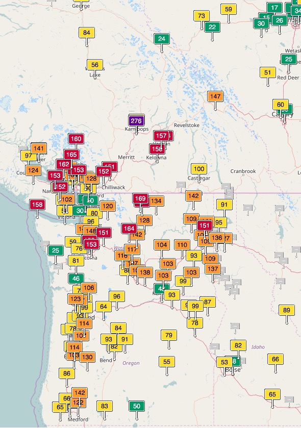
Smoke from wildfires in British Columbia, Washington, Oregon, Idaho, and Montana has created seriously degraded air quality off and on in those areas, at times reaching the “unhealthy” level according to air quality officials.

Air quality southern BC Washington Oregon
Air quality, southern BC, Washington, and Oregon.
Air Quality map
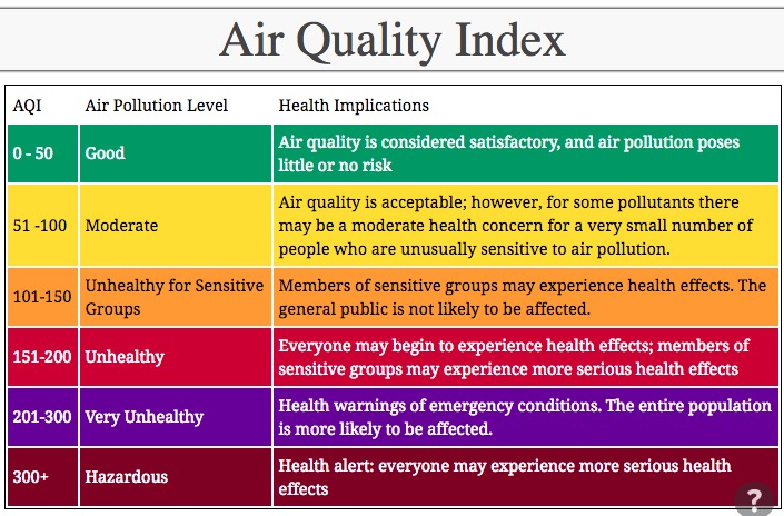
Legend for the above Air Quality map.

Maps of wildfires and smoke in the U.S. Northwest and British Columbia

Above: Satellite photo showing wildfire smoke in the northwestern United States and British Columbia August 6, 2017. The red dots represent heat.

wildfire smoke map
Graphic representation of the distribution of wildfire smoke in the U.S. and Canada, August 6, 2017. Click to enlarge.

Wildfire smoke produces haze over much of British Columbia and the U.S. Northwest

Above: Satellite photo of smoke from wildfires in the U.S. Northwest and Southern British Columbia, August 5, 2017. The red dots represent heat detected by the satellite.

(Updated at 6:50 p.m. MDT August 5, 2017 to add the more current satellite photo above.)

Smoke from wildfires in Southern British Columbia continues to pour across the border into Washington and other states in the U.S. Northwest. The air quality in Washington is the worst that residents have seen in recent years, reaching unhealthy levels in some areas according to agencies that monitor particulates and other pollutants.

Currently there are 110 active wildfires in British Columbia — four of them are larger than 50,000 hectares (123,000 acres):

  • Hanceville Riske Creek, 148,000 hectares (365,000 acres) approximately 60 km southwest of Williams Lake.
  • Elephant Hill, 110,000 hectares (272,000 acres), near Ashcroft.
  • Tautri Lake, 73,000 hectares (180,000 acres), 80 km northwest of Williams Lake.
  • Baezaeko River-Quesnel West, 55,000 hectares (135,000 acres).

Below is a gallery of maps and graphics showing the location of the fires, air quality, and smoke. Click on an image to see a larger version and start a slide show. Captions are in the top-left corner.