Updated at 12:15 p.m. MDT May 9, 2022
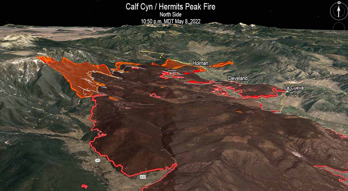
Updated to add the 3-D map of the north end of the Calf Canyon / Hermits Peak Fire.
To see all articles on Wildfire Today about the Calf Canyon / Hermits Peak Fire, including the most recent, click here.
Updated at 9:23 a.m. MDT May 9, 2022
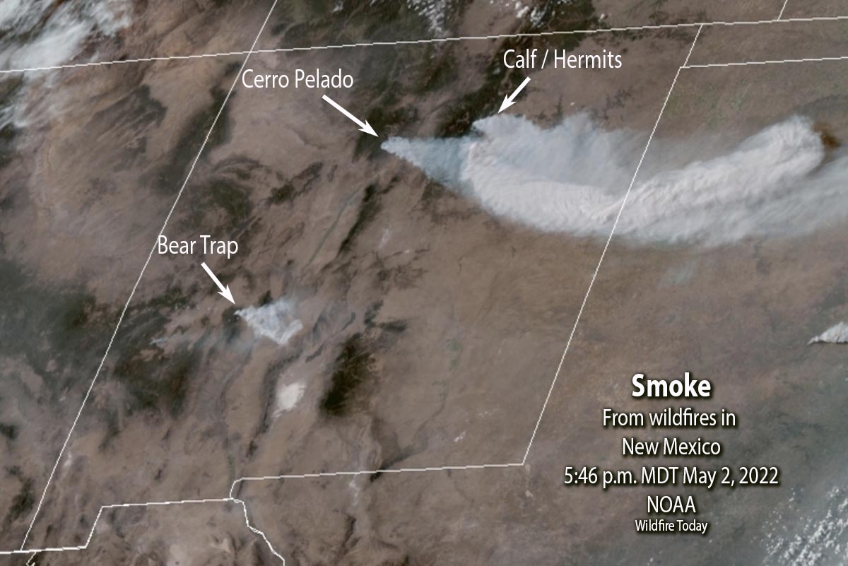
Both of the large wildfires in Northern New Mexico were very active Sunday, pushed by the very strong winds.
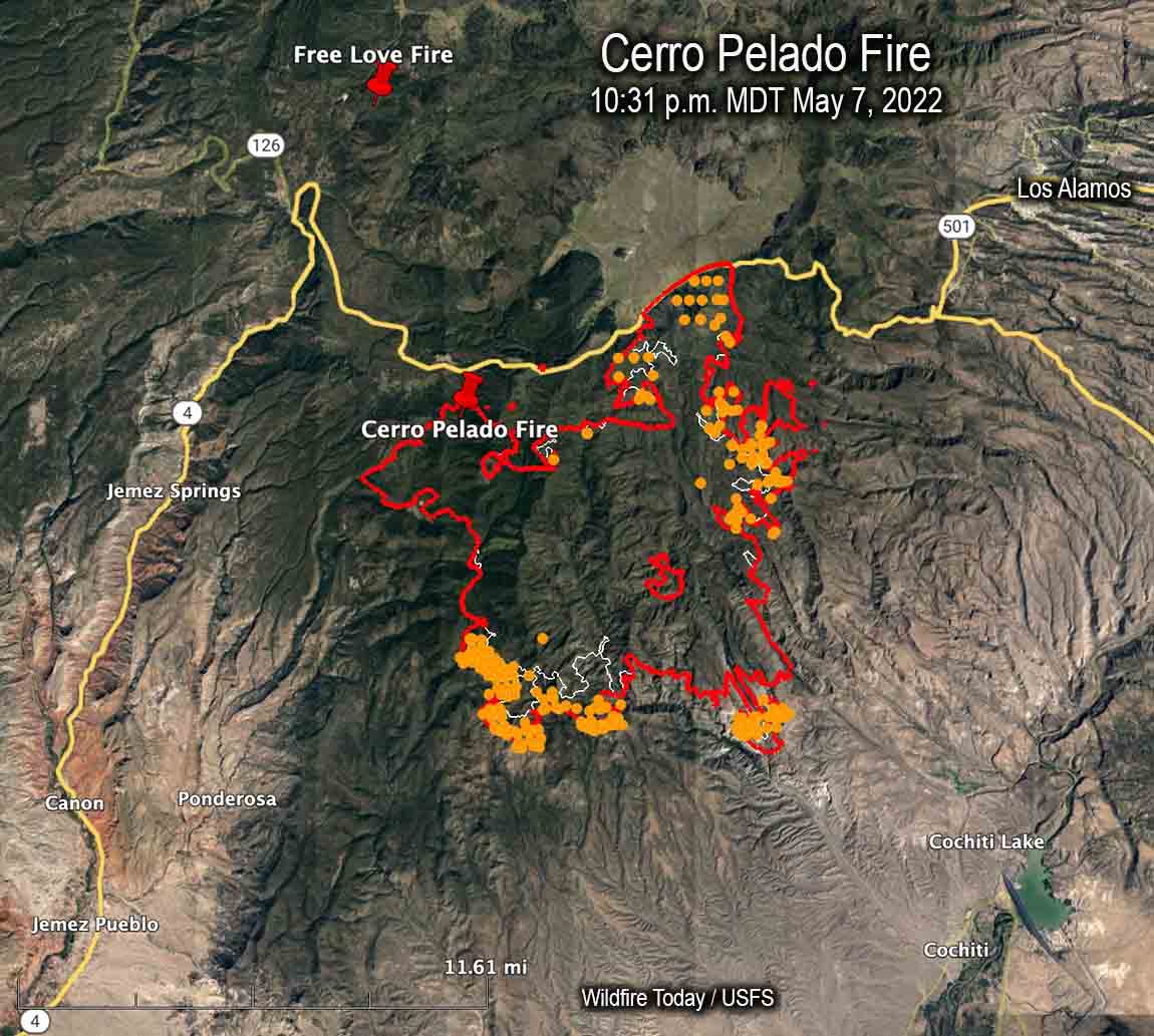
Cerro Pelado Fire
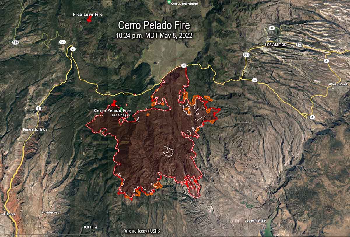
The most significant spread of the Cerro Pelado Fire Sunday was on the northeast side south of Highway 4 where it spread for about a mile east and crossed the FR 289 road. When the fire was mapped at 10:24 p.m. Sunday a large spot fire had come very close to crossing the next road to the east, FR 287. The fire grew by more than 3,000 acres Sunday to bring the size up to 40,958 acres.
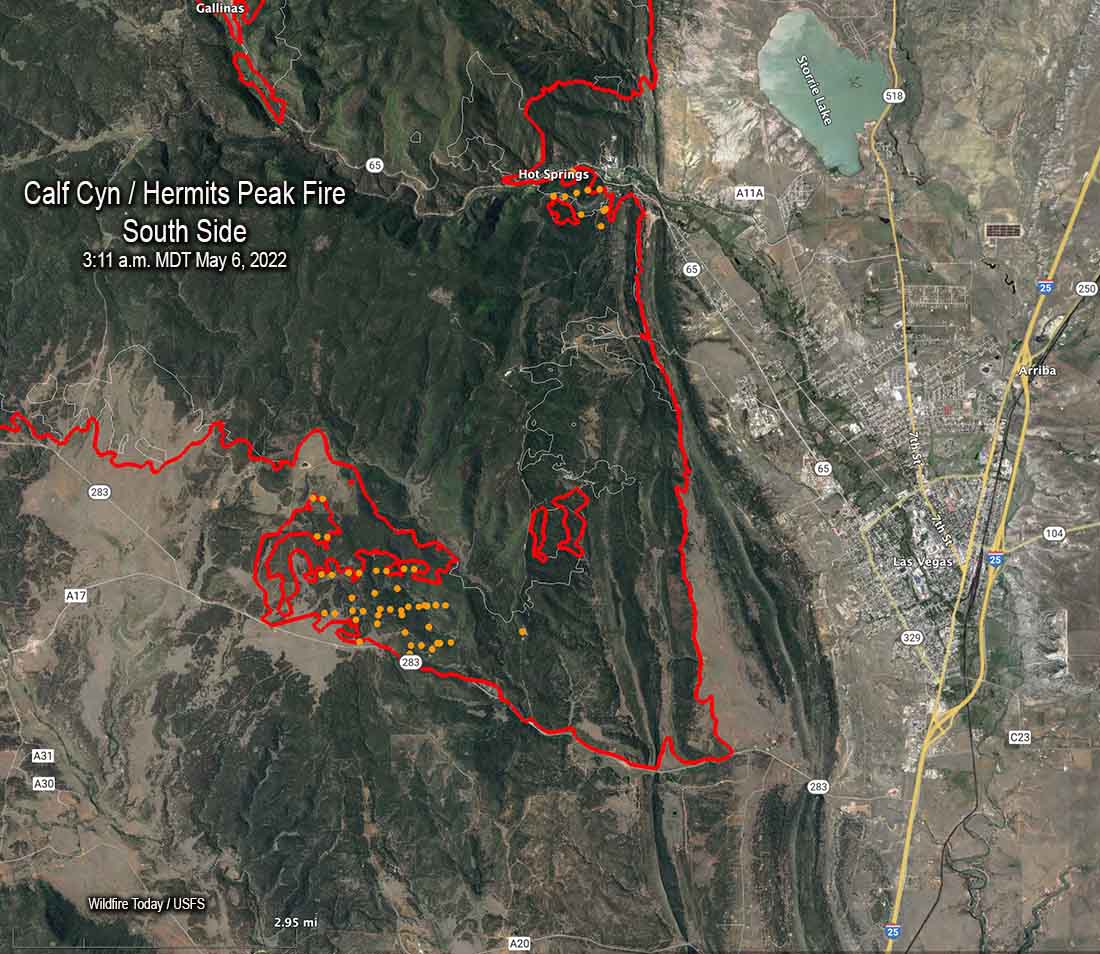
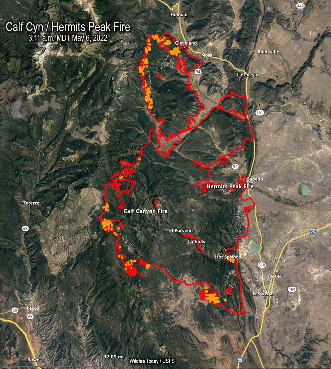
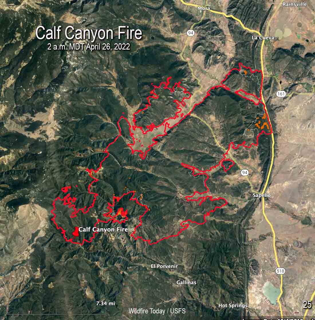
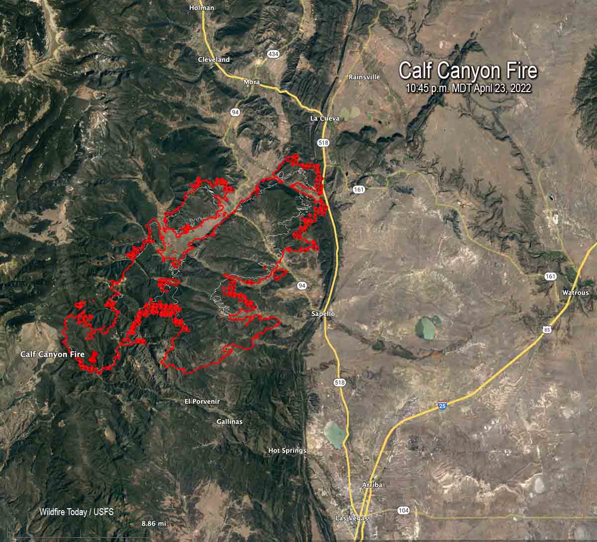
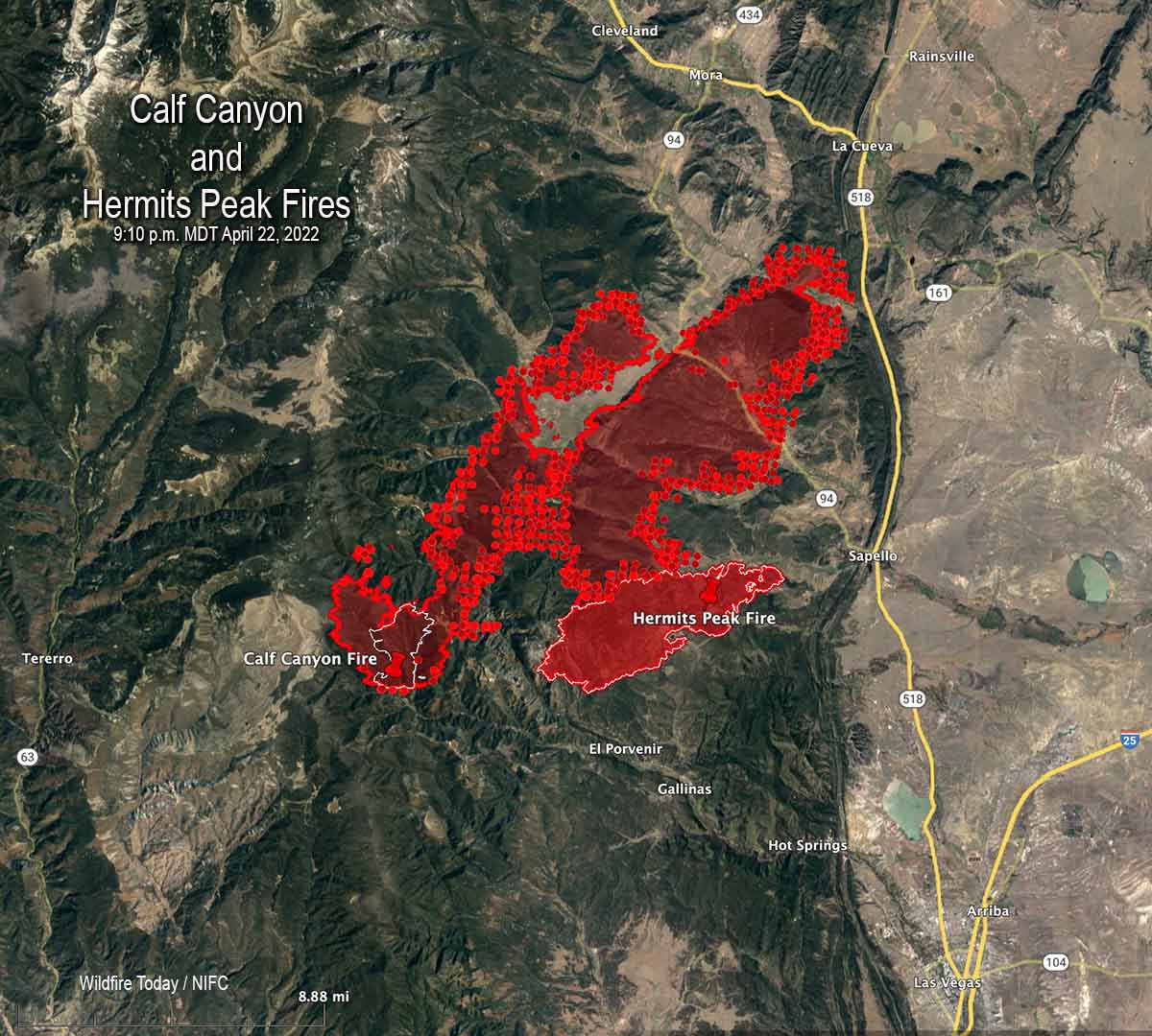
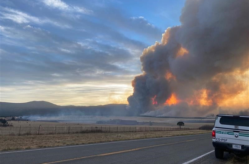
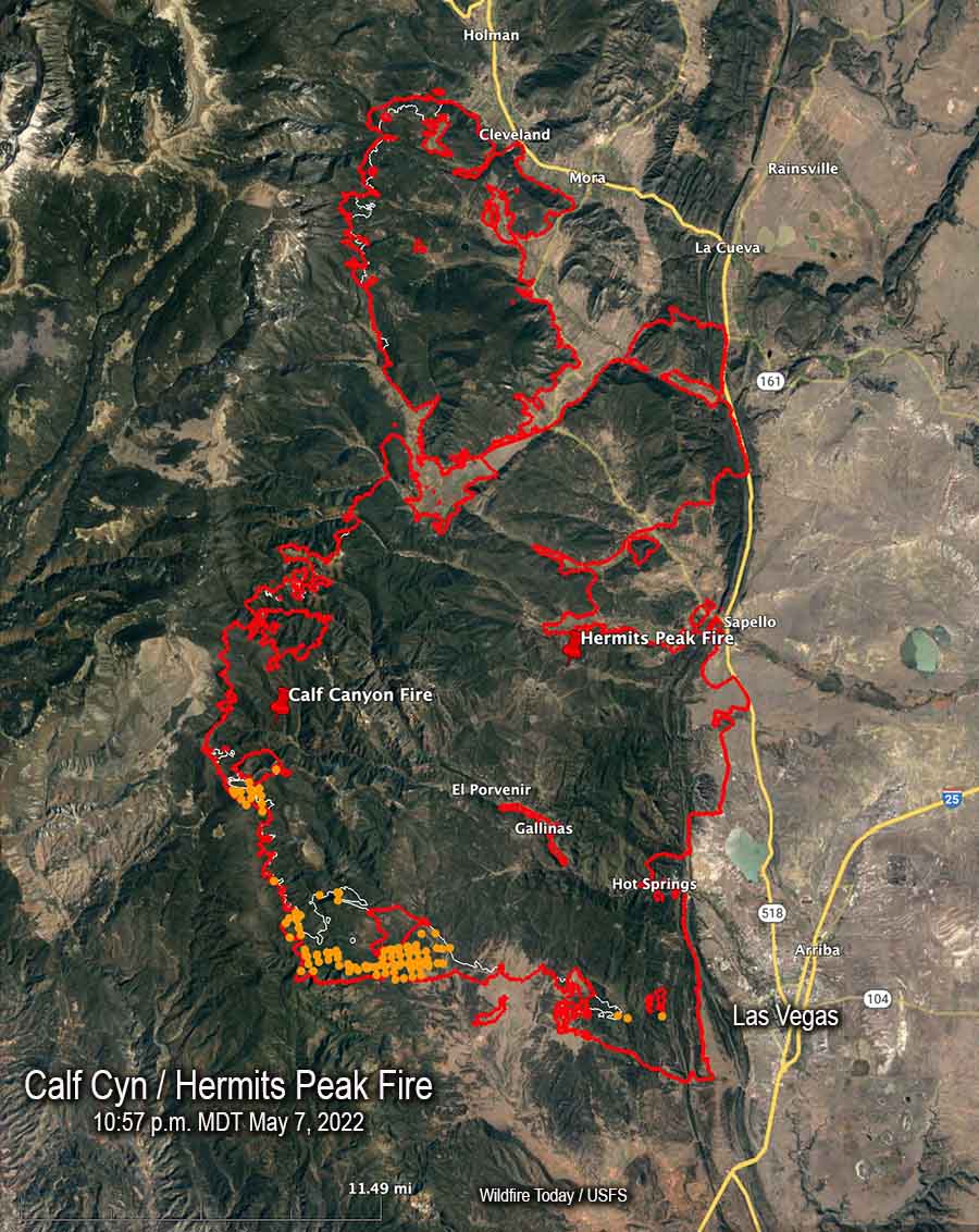
Calf Canyon / Hermits Peak Fire
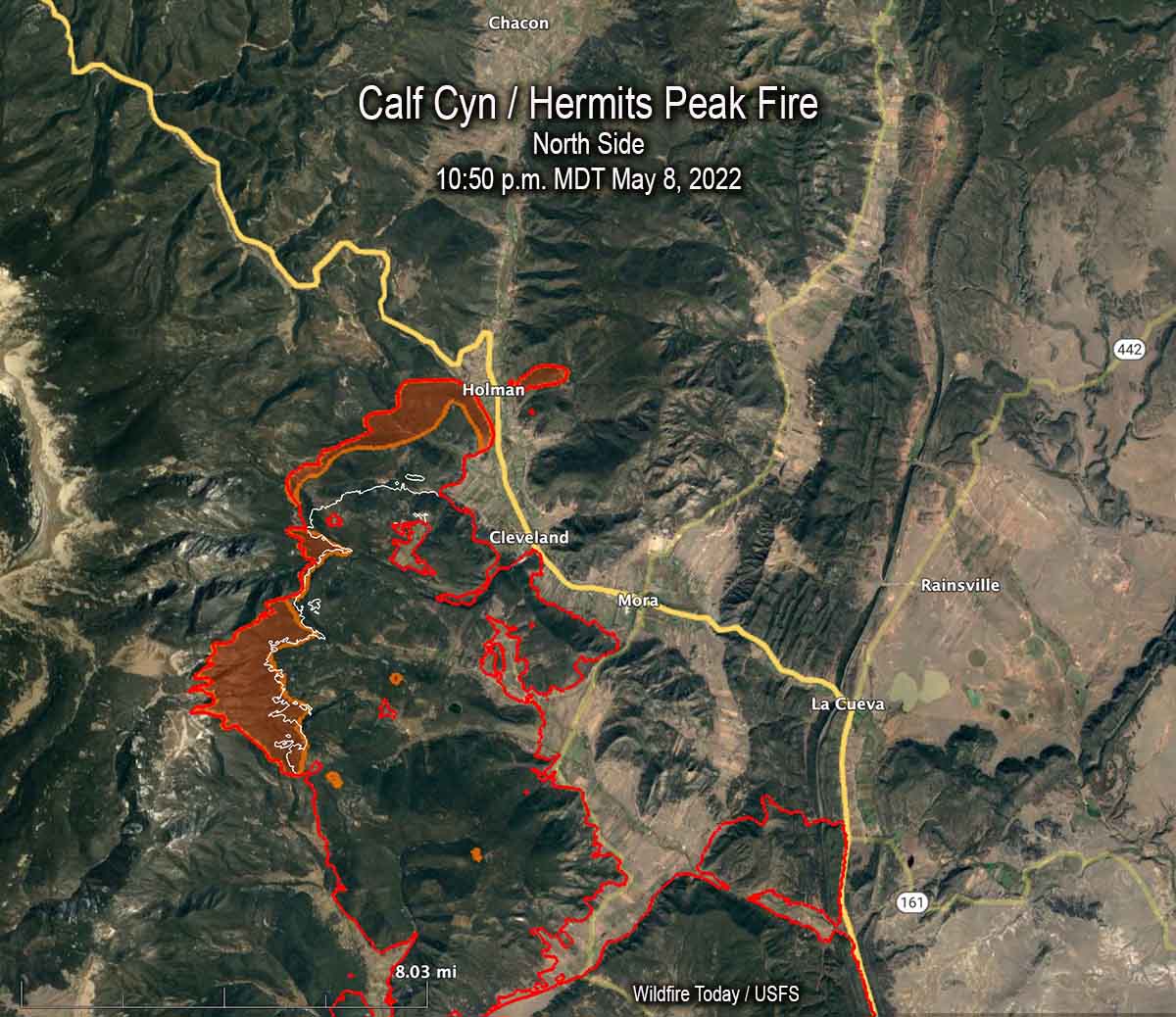
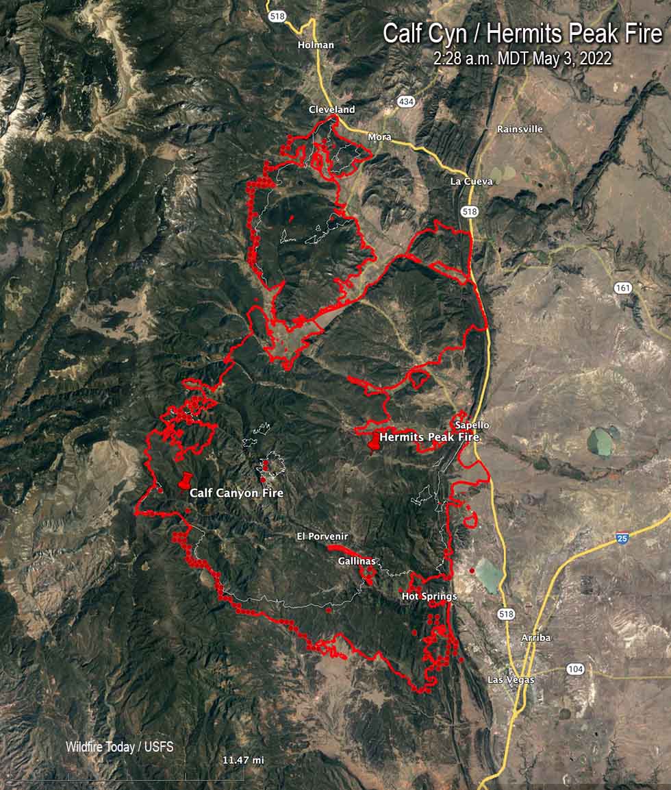
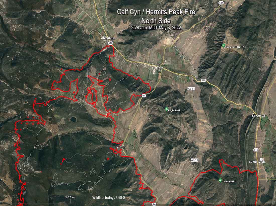
Most of the significant growth on the Calf Canyon / Hermits Peak Fire was on the north and south sides. When it was mapped at 10:50 p.m. on Sunday the north side, northwest of Cleveland, had advanced for about two miles further north coming close to Holman. There was a large 200-acre spot fire across Highway 518 east of Homan.
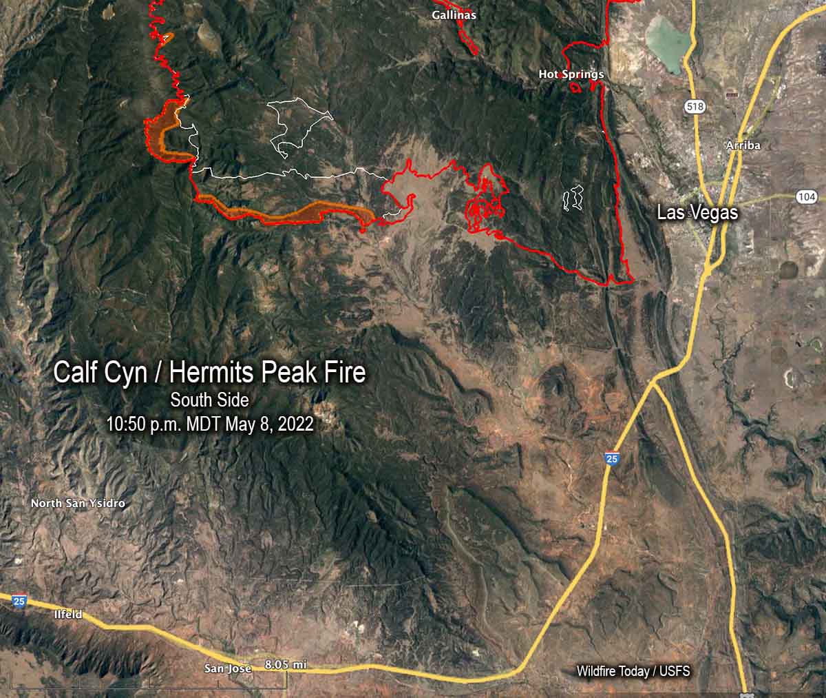
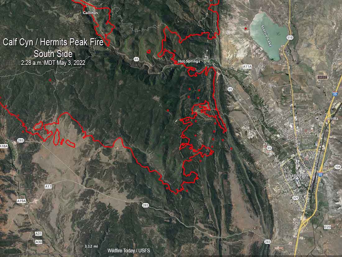
The east side of the Calf Canyon / Hermits Peak Fire still appears to be secure and the Sunday night map showed no change south of Mora and La Cueva near Highway 518. There was also no change near Las Vegas. But about 8 miles west of Las Vegas south of Highway 283 it spread south for an additional mile.
The fire grew by more than 13,000 acres Sunday to bring the size up to 189,767 acres.
Updated at 7:13 p.m. MDT May 8, 2022
Calf Canyon / Hermits Peak Fire
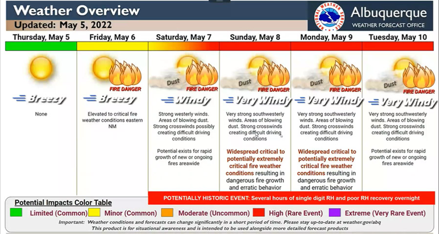
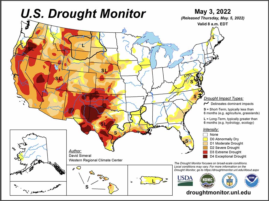
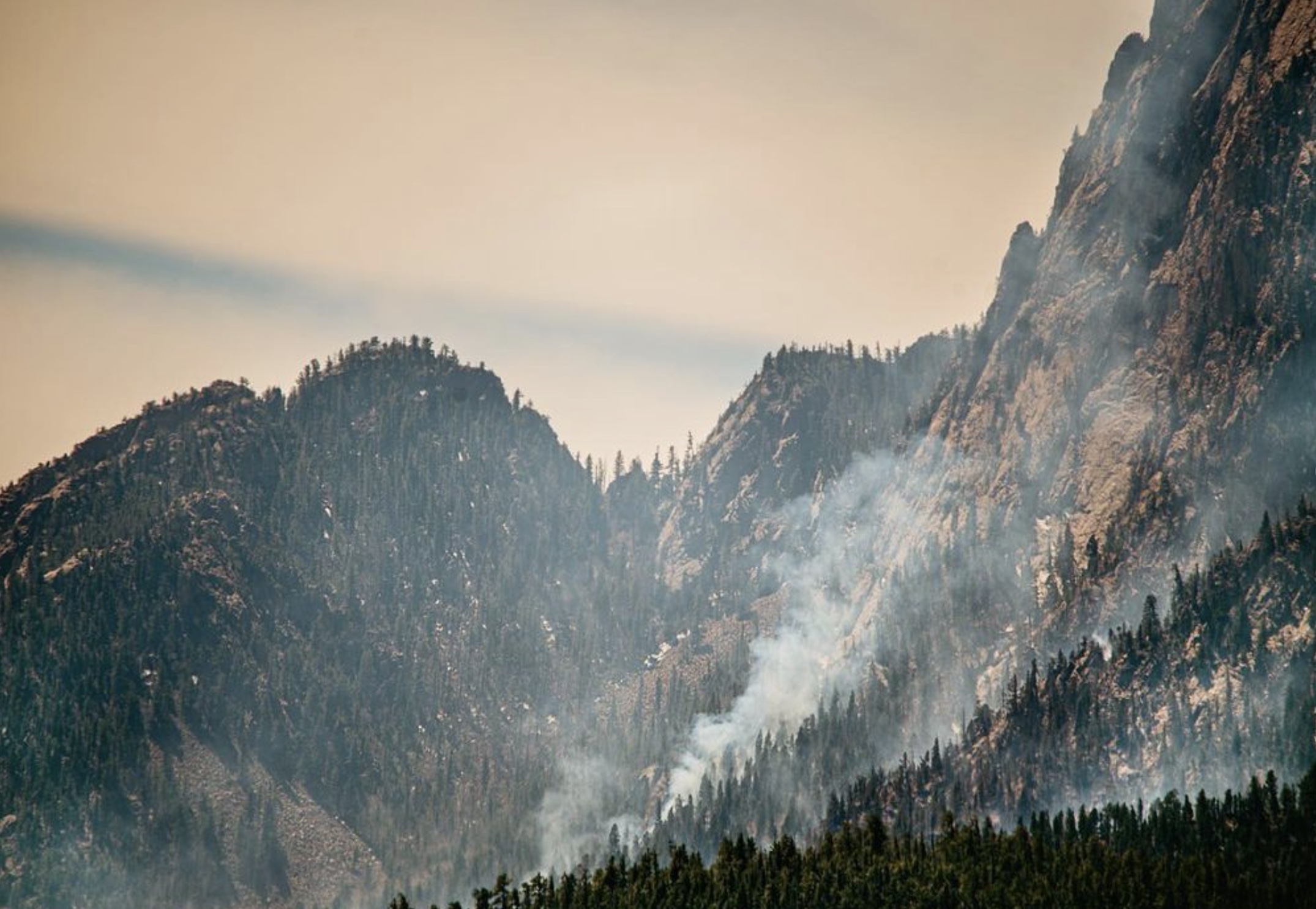
The Calf Canyon / Hermits Peak Fire near Las Vegas, New Mexico made it through Saturday’s wind event without any major devastating runs beyond the existing firelines, but it is not over yet. Red Flag Warnings are again in place Sunday for strong winds, low humidity, and very dry vegetation. The forecast for Sunday and Monday is for sustained 32 mph winds gusting out of the west-southwest at 40 to 48 mph with 8 percent relative humidity.
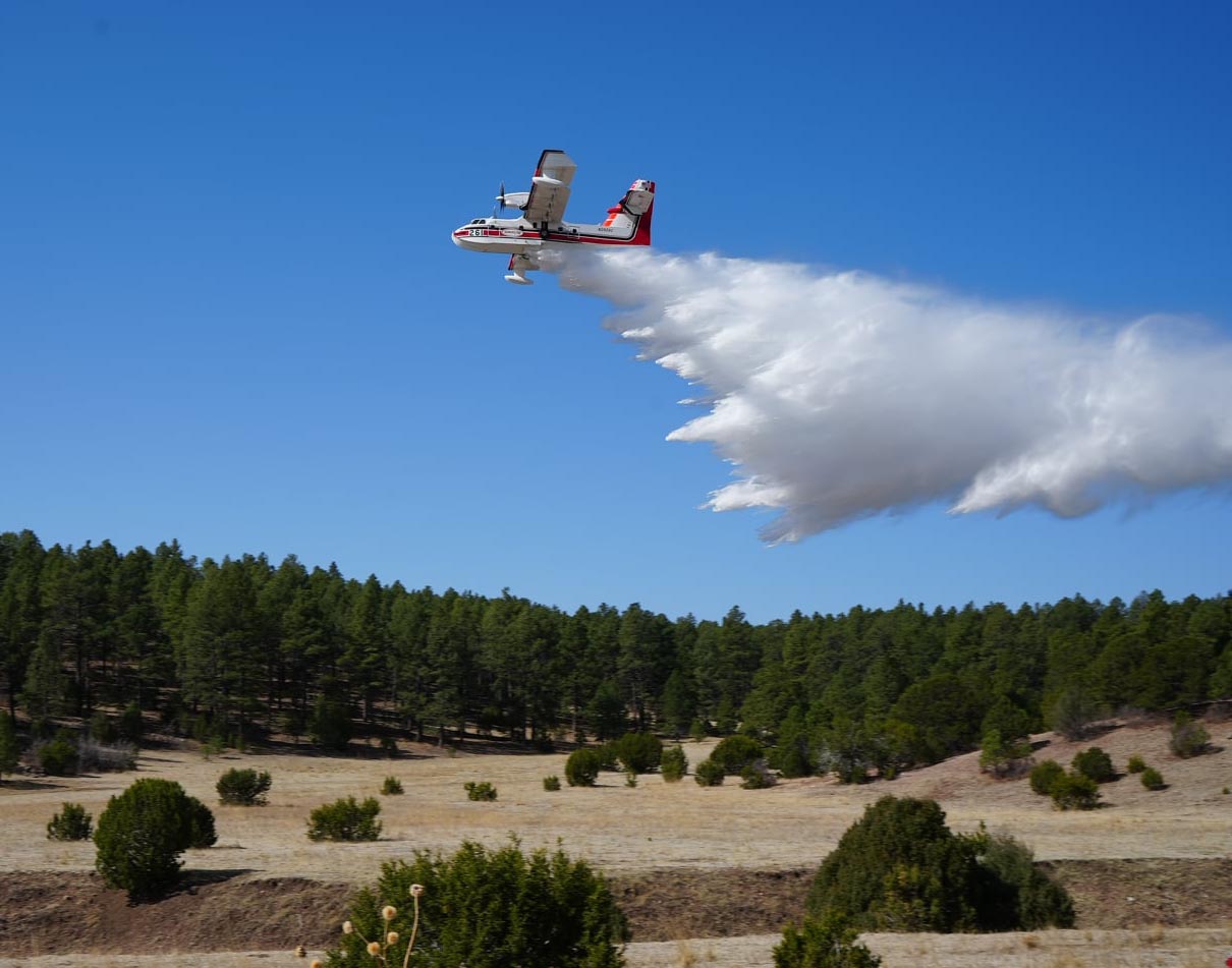
Operations Section Chief Todd Abel said Saturday evening that one of the most active areas on the fire was on the southwest side near Highway 283. He also said all aircraft working on the fire had to be shut down around noon Saturday when the winds became too turbulent.
The fire has burned 176,000 acres.
Cerro Pelado Fire
On Friday and Saturday most of the spread of the Cerro Pelado Fire was on the northeast side south of Highway 4, and on the southwest side. The 37,525-acre blaze is seven miles west-southwest of Los Alamos, New Mexico.
On the eastern side of the fire the FR 289 road is considered a primary line as the fire continued to advance in that direction pushed by 35 mph winds. A spot fire crossed the road late Saturday afternoon. Crews working that night shift described conditions in the area as “unbearable” due to wind, dust, smoke, and heat. Crews later engaged the spot fire at 3:00 a.m. Sunday when visibility had improved. Most of the movement to the east occurred in steep canyons. FR 289 has been prepped and plumbed with extensive hose lines.
Crews are coordinating with the National Park Service for structure protection in Bandelier National Monument and Valles Caldera National Preserve.
A Red Flag Warning is in effect for Sunday. The forecast for the fire area is for 39 mph winds gusting out of the west-southwest at up to 55 mph with relative humidity as low as 9 percent. On Monday the wind speeds will drop to 24 mph with gusts of 31 to 39 mph from the west-southwest.
Most of the blaze is in the footprint of the Las Conchas Fire that burned 156,593 acres in 2011. In a trial jurors found that two power companies were 95 percent responsible for starting that fire and the U.S. Forest Service was 5 percent responsible. The cause of the current Cerro Pelado Fire is listed as unknown.