Friday afternoon and early Saturday morning firefighters responded to multiple fires near Interstate 5 in the Grapevine area north of Los Angeles. The Grape Fire on Friday was mapped at 19 acres, according to @barkflight. Then at about 4 a.m. Saturday firefighters responded to the Plant Fire close to the freeway. @CAFireScanner noted that Engine 345 reported there were three separate fires on the west side of I-5 that would likely burn together, and then merge with the earlier Grape Fire.
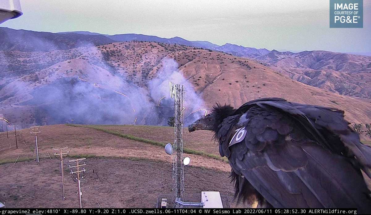
Plant Fire at 5:10 a.m. June 11, 2022.
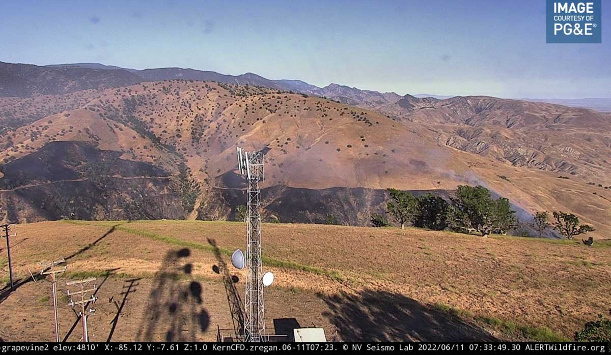
At 7:33 a.m. PDT the Grapevine 2 AlertWildfire camera showed very little activity on the Plant Fire.
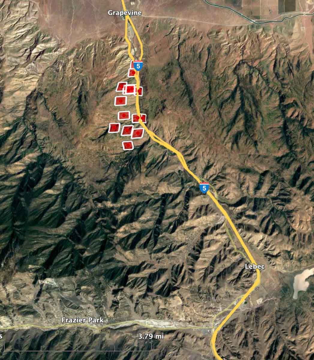
Plant Fire at 7:33 a.m. PDT June 11, 2022.The red squares represent the APPROXIMATE location of heat detected by a satellite as late as 3:28 a.m. PDT June 11, 2022.
Judging from the video below the fire was very active in the predawn hours.
The inmate firefighters who suffered burn injuries June 7 in Southern California were all in stable condition when the LA County Fire Department posted an update on Twitter at 3:11 p.m. PDT June 7, 2022.
“A flash fire occurred in the back of an inmate camp crew vehicle,” the tweet said. “Six patients were transported to hospitals w/mild to moderate burns & all are currently in stable condition. Incident is under investigation.”
One inmate was treated for critical injuries at a burn center with burns covering over 12% of his body, but officials say he is expected to be ok. The other five inmates suffered minor injuries.
The inmate firefighters were in the back of a transport vehicle leaving a training exercise when the fire started, authorities say. Authorities confirm that the fire was not related to the training exercises they were performing and was not apart of any escape plan.
Inmate firefighters are not allowed to have an flammable materials in the back of the trucks which include cigarettes, lighters, and liquids. It is unclear what started the fire and officials are still investigating it.
2:57 p.m. PDT June 7, 2022
Firefighters injured, June 7, 2022. Still image from ABC7 video.
Six firefighters were injured near Castaic, California Tuesday morning. Not all the details are known but initial reports, which can change, is that they were taking part in a training exercise and had burn injuries.
Four were transported to hospitals in two helicopters and two went by ground ambulance.
All six patients were inmate firefighters from the California Department of Corrections and Rehabilitation, said Los Angeles County Fire Department spokesperson Geovanni Sanchez. Emergency crews responded shortly after 11 a.m. following reports of burned patients on Templin Highway near Castaic, said Esteban Benitez, another spokesman for the county.
A person is in a Northern California jail, charged with 10 counts of arson
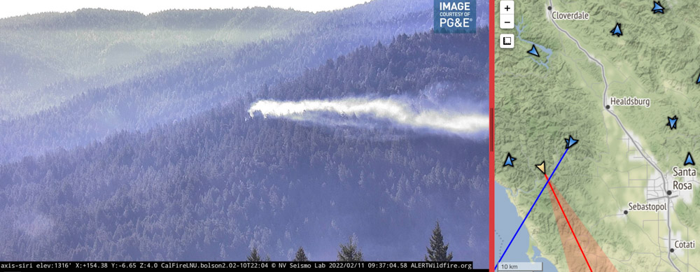
Image of smoke from a fire in Sonoma County near Monte Rio as seen from the Alert Wildfire camera at Siri, at 9:37 a.m PT Feb. 11, 2022. The intersection of the lines from the two camera locations indicate the approximate location of the fire. More information about this fire.
Two women who were fed up with multiple arson fires set in the woods near Monte Rio in Northern California began an investigation that resulted in the arrest of Jack Stanley Seprish, a transient who was charged with 10 counts of arson in Sonoma County Superior Court. His bail was set by the judge at $920,000.
With the help of donations from the community of money and labor, they bought or borrowed and installed more than 50 motion-detecting cameras, with many of them mounted high up on trees in the forest around Monte Rio. Some of them could be monitored remotely and sent notifications to phones when motion was detected.
For [Kari] Morrissey, a criminal defense attorney, and her collaborator, Sara Paul, Seprish’s arrest marks the culmination of an intensive, three-month partnership with local fire officials — one undertaken on behalf of the community and with its support.
Funding for more than 50 cameras placed strategically near encampments and pathways that seemed likely to elicit hits, came largely from Friends of Villa Grande, as well as the private Bohemian Grove. Random citizens also dropped off money and cameras at the Monte Rio firehouse.
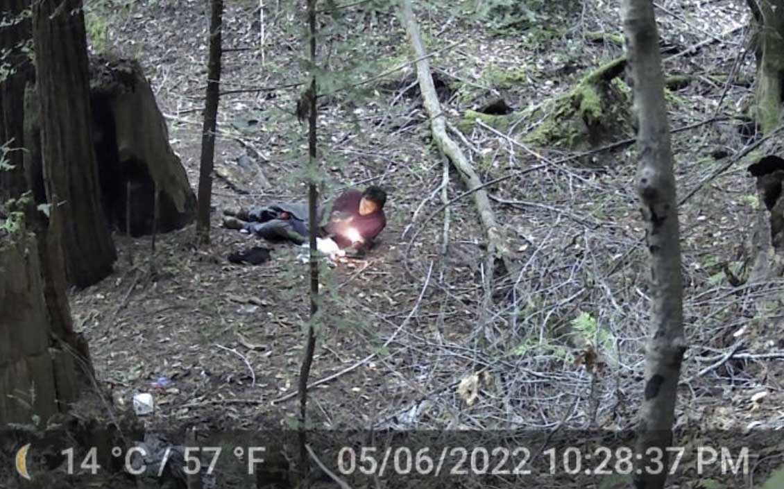
As a defense lawyer, Morrissey said she was not prepared to assume he was responsible for the fires “for quite along time,” however. Then May 6, a photo came across her phone of Seprish lying in the forest using some kind of torch that cast flames larger than a cigarette lighter.
It’s one of hundreds of photos she has turned over to Cal Fire, she said.
Person starting a fire. Kari Morrissey & Sara Paul.
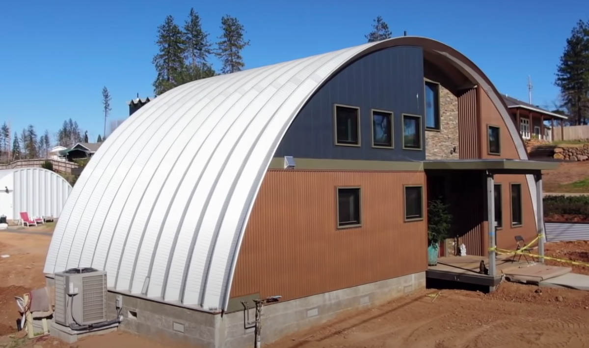
Based on the quonset hut design used extensively by the US military in World War II
A quonset hut style home, via CBS News.
A few of the 13,861 homes destroyed in the Camp Fire are being rebuilt using a particular design that is much more fire resistant than a typical structure. In 2018 the northern California fire burned most of the houses in Paradise after a failure on a Pacific Gas and Electric powerline ignited the blaze that raced through the town, doing much of its damage in just a few hours.
During World War II the US military purchased and installed thousands of quonset huts, a lightweight prefabricated structure of corrugated galvanized steel with a semi-cylindrical cross-section.
Design for a quonset hut style structure, via CBS News.
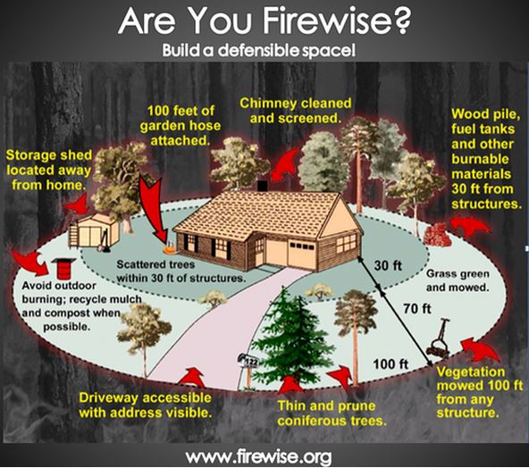
The steel itself is non-combustible of course, and if the rest of the exterior building materials are also, the structure should be very resistant to ignition during a wildfire. But it is important that everything within the home ignition zone is consistent with Firewise principles.
CBS News Sunday Morning produced the video story below of how this quonset hut concept is being used in Paradise.
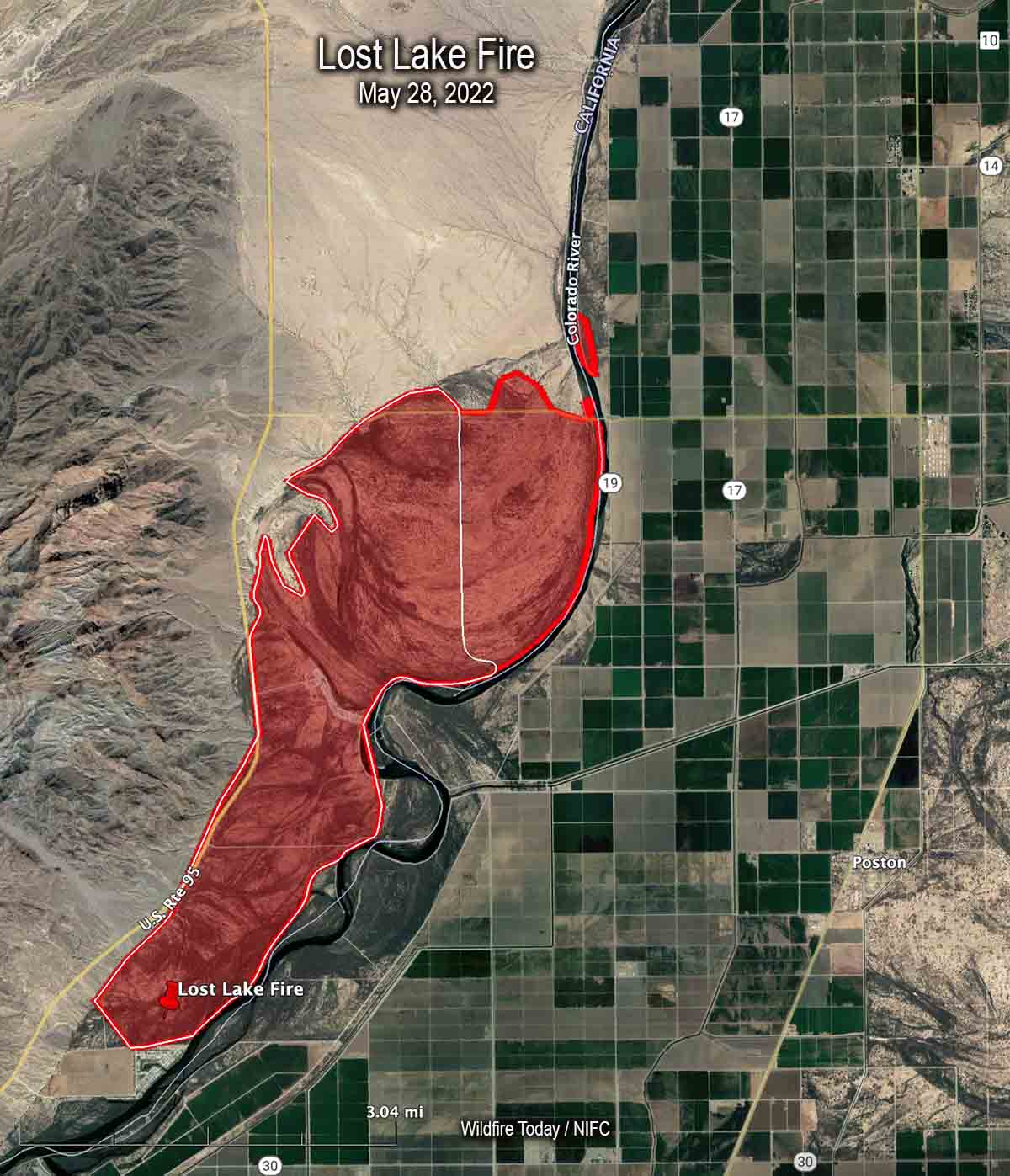
Map of the Lost Lake Fire. The red line was the perimeter late in the afternoon of May 28, 2022. The white line was the perimeter earlier in the day.
The Lost Lake Fire along the Colorado River on the California/Arizona border was mapped late in the afternoon on Saturday May 28 at about 5,300 acres. At that time about 30 acres had burned on the Arizona side, north of Agnes Wilson Road and west of 19.
Saturday evening resources assigned to the fire included two hand crews, eight fire engines, and one helicopter for a total of 150 personnel.
3:44 p.m. PDT May 28, 2022
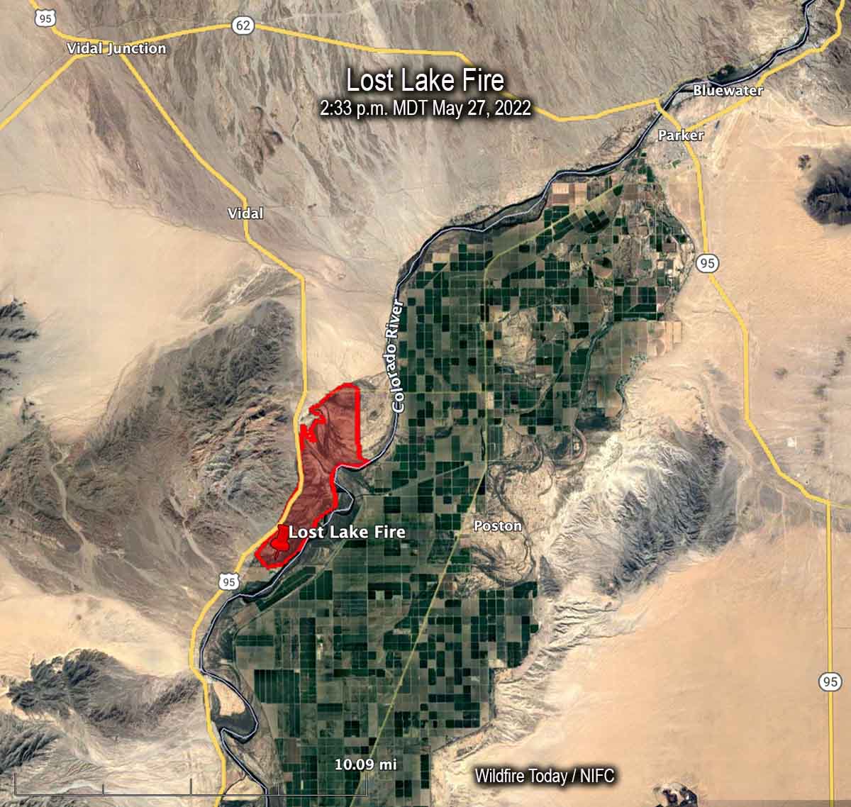
Map of the Lost Lake Fire at 2:33 p.m. PDT May 27, 2022.
The Lost Lake Fire which had been burning in California on the west side of the Colorado River, crossed the river Saturday prompting evacuations of about a dozen homes of the Colorado River Indian Tribes near Poston, Arizona.
It started Thursday morning but strong winds Saturday afternoon caused spot fires on the Arizona side of the river, which is the boundary between the two states.
The blaze is 11 air miles southwest of Parker, AZ and until it crossed the river it was 3 miles west of Poston. Saturday morning it had burned 5,900 acres but the afternoon growth is adding to that total.
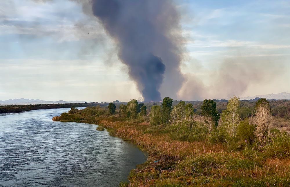
Lost Lake Fire. Photo by Incident Management Team.Lost Lake Fire. Photo by Incident Management Team.This appears to be a briefing at the beginning of a shift on the Lost Lake Fire. In case any of the firefighters forget the name of the fire, they have a handy reference.
At briefing Thursday morning at 8:30 fire officials said one firefighter working on the Coastal Fire in Orange County, California was injured and transported to a hospital. The evacuation orders are still in place, affecting about 900 homes. The Orange County Sheriff’s office has current information about evacuations.
The estimate of homes destroyed is still at least 20, said Orange County Fire Authority Chief Brian Fennessy. The fire has burned 199 acres.
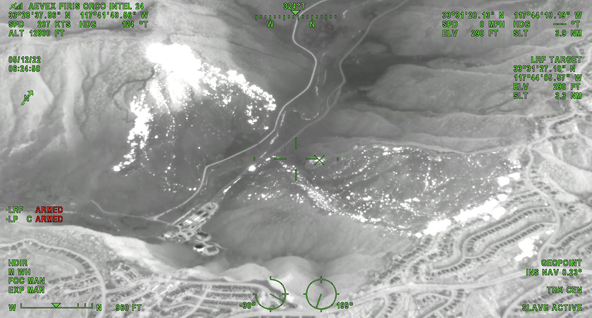
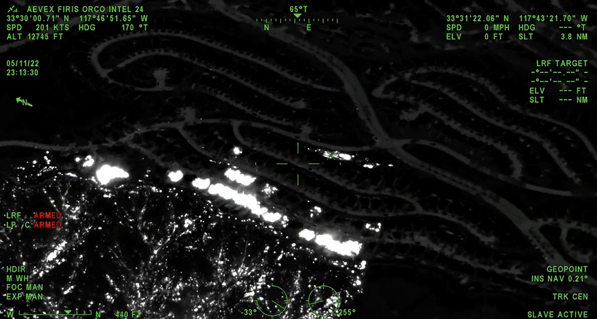
The white areas represent heat on the Coastal Fire detected by FIRIS, 6:24 a.m. May 12, 2022.
10 News reported that Southern California Edison sent a letter to the Public Utilities Commission regarding “circuit activity occurring close in time to the reported time” of the fire, according to the company’s spokesperson David Song.
“We submitted an initial Electric Safety Incident Report to the California Public Utilities Commission,” Mr. Song said. “SCE is required to submit an ESIR to the CPUC on certain types of incidents. … Our information reflects circuit activity occurring close in time to the reported time of the fire. …The submission of this report to the CPUC is intended to put them on notice of an incident so that it can conduct its own investigation.”
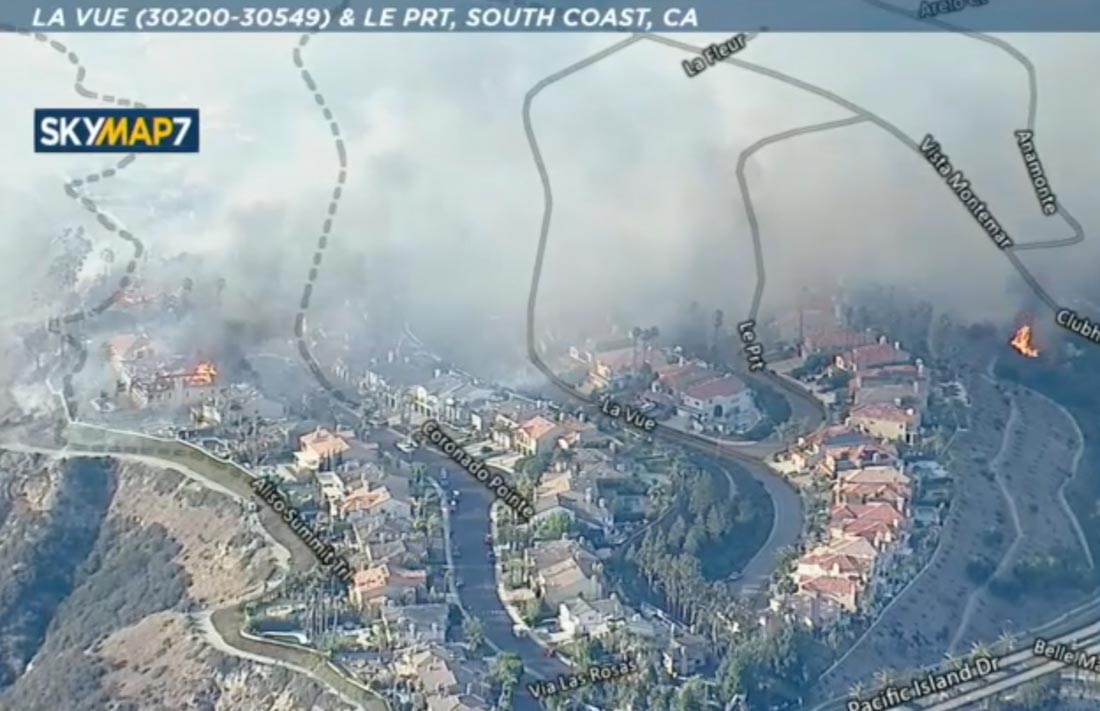
Coastal Fire, Orange County, CA, May 11, 2022. ABC7.
Updated at 4:50 a.m. PDT May 12, 2022
Map of the Coastal Fire, 9:57 p.m. May 11, 2022. FIRIS.
Below is a thermal image of the Coastal Fire at 11:13 p.m. May 11. The white areas represent heat.
Thermal image of Coastal Fire, 11:13 p.m. May 11, 2022. FIRIS.
OCFA’s FIRIS Intel 24 on the Costal Incident. Second video of the incident showing the impacted structures along Aliso canyon trail and Coronado point road with the spot fires on top by the club house. Fire is holding at 195 acres. pic.twitter.com/NBMPorYRgD
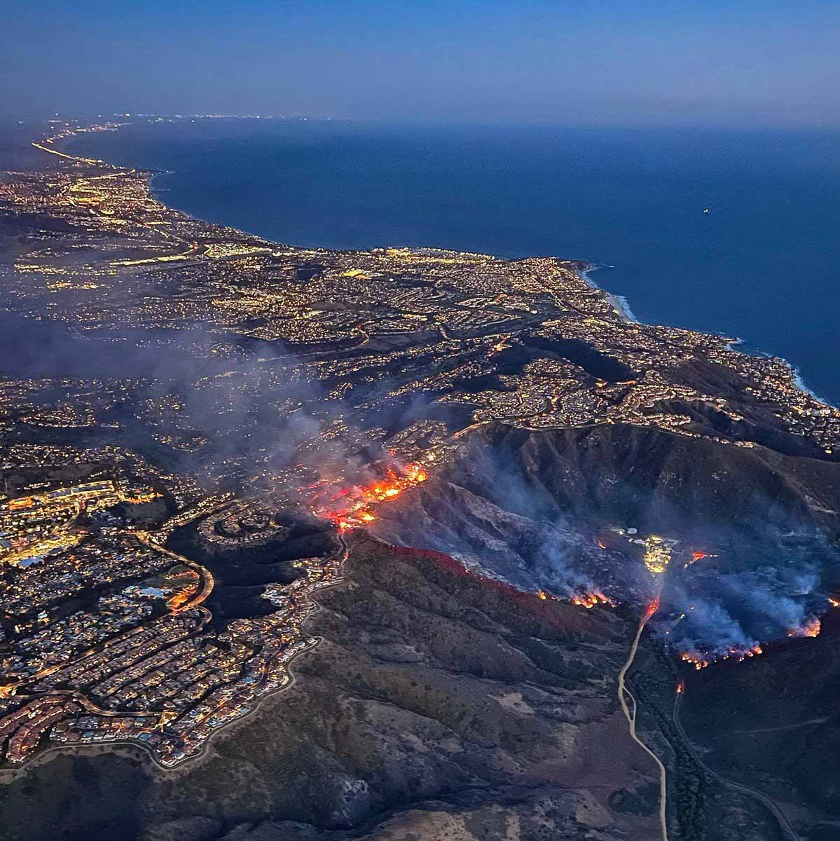
A brush fire in the Laguna Niguel community of Orange County in Southern California spread into homes Wednesday. It was named “Coastal Fire.”
Brian Fennessy, Chief of the Orange County Fire Authority, said at 7:54 p.m. that the fire had burned about 200 acres and he was aware of approximately 20 homes that were destroyed or damaged. The Chief said some of the homes appeared to have been ignited not by direct flame impingement, but from the ember shower, possibly passing through unscreened attic vents.
Image from ABC7 showing the Coastal Fire at 6:10 p.m. May 11, 2022. Looking north.
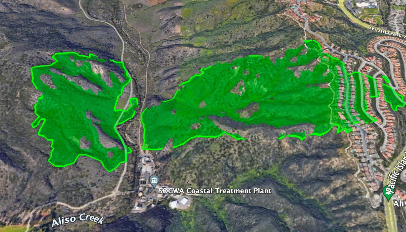
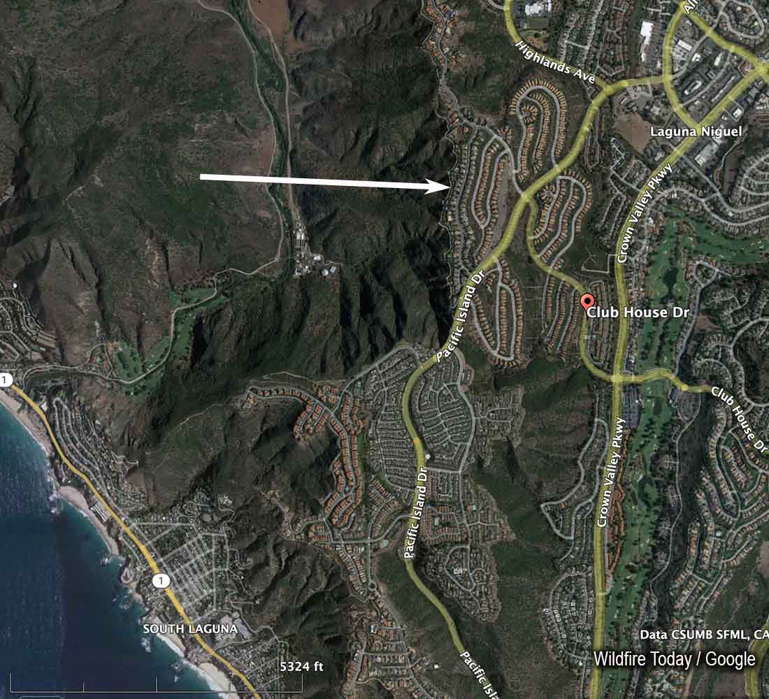
The fire started at about 2:45 p.m. Wednesday approximately a mile east of the coast, west of Aliso Creek, and was pushed by a moderately strong wind out of the west. It burned downhill to the creek, crossed it near a water treatment plant and ran uphill another half mile to rows of large, densely packed homes. By 6:20 p.m. the fire had crossed Pacific Island Drive near Clubhouse Drive.
There was a firebreak below the first structures that were in the path of the fire. It appeared to have prevented flames from the burning brush from directly impacting the homes, but the ember shower and then house to house spread did much of the damage in the community. As homes burned, radiant heat may have ignited the nearby neighboring structures. More embers were generated as each house went up in flames.