Canyon Fire grows to 10K acres, delays launch of satellite

Above: Canyon Fire at Vandenberg Air Force Base on the southern California coast, September 18, 2016. Photo by Michael Peterson.

(UPDATED at 12:11 p.m. PDT September 20, 2016)

The Canyon wildfire on Vandenberg Air Force Base on the southern California coast grew by over 5,000 acres on Monday and has now burned 10,542 acres according to officials on the base Monday morning.
map Canyon Fire
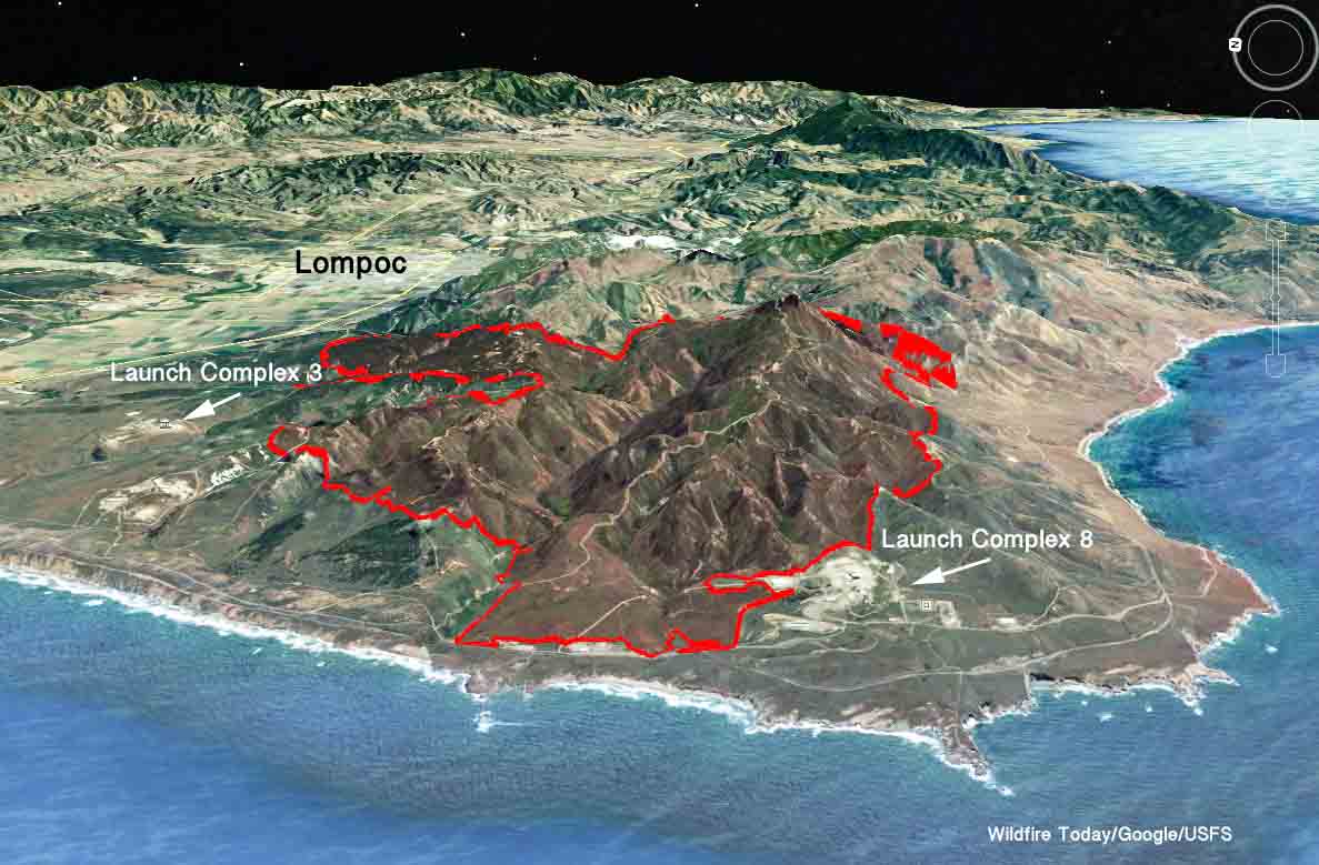
Map of the perimeter of the Canyon Fire at 11 p.m. PDT September 19, 2016. Click to enlarge.

Launch complexes for rockets and liquid oxygen facilities are currently threatened. Evacuations have occurred for some areas on the south side of the base.

The fire has spread to within less than a mile of Space Launch Complex 3 north of the perimeter where the launch of a Saturn V rocket scheduled for September 18 had to be postponed. The fire has also burned very close to Space Launch Complex 8 on the southwest side of the blaze.
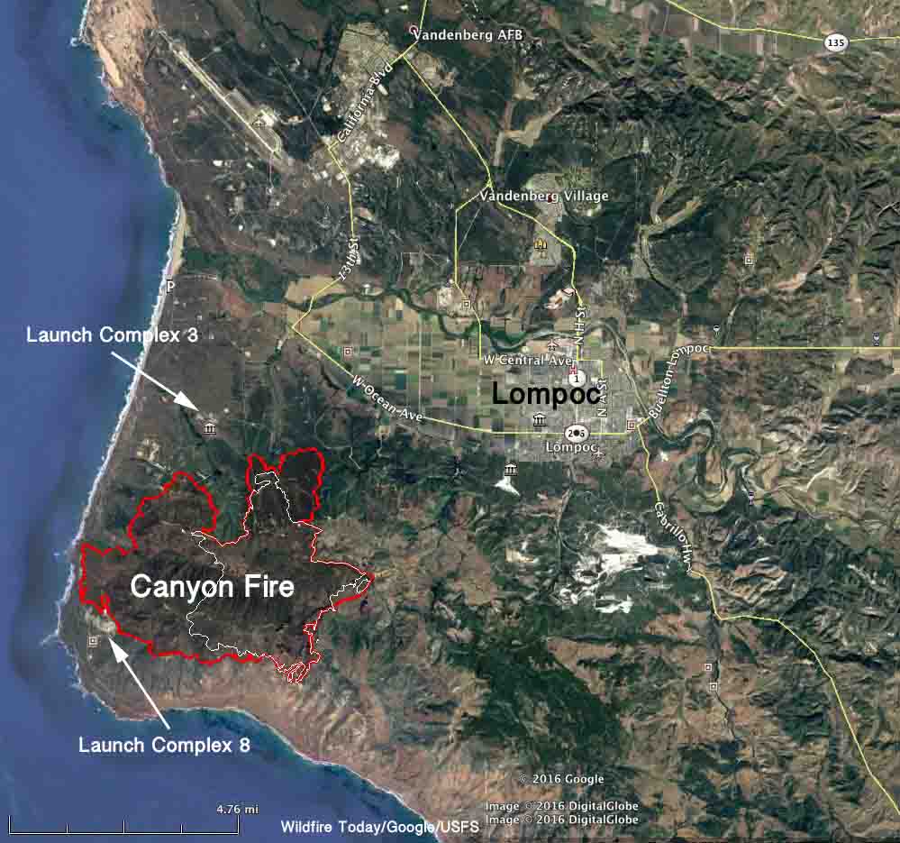
map Canyon Fire
The red line was the perimeter of the Canyon Fire at 11 p.m. PDT September 19, 2016. The white line was the perimeter approximately 24 hours before. Click to enlarge.

The weather on the fire varies greatly due to the proximity to the Pacific Ocean. Where the fire is burning adjacent to Space Launch Complex 8 it is only a few thousand feet from the coast at 400 feet above sea level. The ridge in the interior of the fire is at 1,500 feet. The relative humidity, wind direction, wind speed, and temperature have been very different along the coast, the interior of the fire, and at Lompoc. The minimum humidity ranged from 12 to 30 percent in these areas on Monday. On the west side of the fire, which was the most active area, the wind was variable but mostly from the south during the day, but switched to come out of the north after 9 p.m.

The photo below illustrates the variable weather in the area. While there is fog and high humidity in a low-lying area, the fire hauls ass just beyond.

The weather is difficult to forecast because of the above issues, but on Tuesday firefighters should expect more favorable conditions, with temperatures around 70, RH of 30 to 60 percent, and west winds at 9 mph.

****

(Originally published at 2:20 p.m. PDT September 19, 2016)

A wildfire burning on Vandenberg Air Force Base on the southern California coast delayed the launch of a satellite. As of very early Monday morning the Canyon Fire was approximately a mile from Launch Complex 3, where an Atlas V rocket was scheduled on Sunday to send a WorldView-4 payload into orbit. The satellite will capture high-resolution images of Earth from space.

“Our procedures require stand-by firefighting crews for every launch to ensure safety of our personnel and facility protection,” said Col. Paul Nosek, Emergency Operations Center commander. “We’ve delayed the launch in order to concentrate our resources on the situation at hand.”

No facilities have been damaged by the fire in the remote canyon between Arguello and Santa Ynez Roads.

According to Col. Paul Nosek, no space launch complexes or critical range assets are in immediate danger.
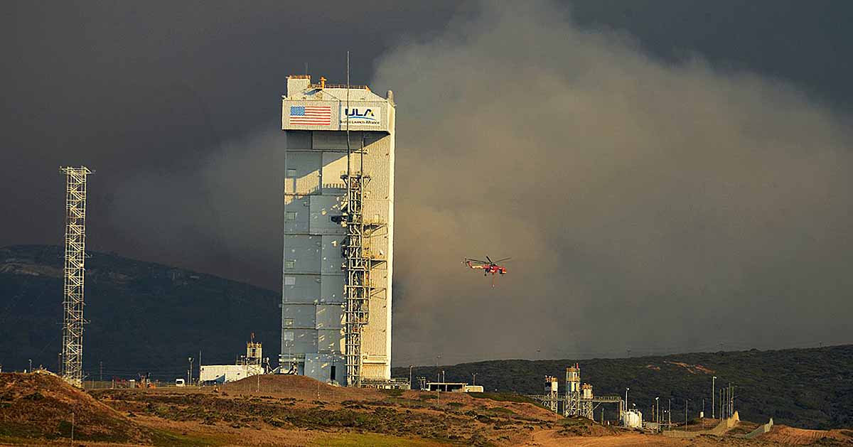
Canyon Fire on Vandenberg Air Force Base
The Canyon Fire on Vandenberg Air Force Base burns about a mile from Launch Complex 3. Inside is the Atlas V rocket. Santa Barbara County Fire photo.

The fire has been burning since September 17. The cause has not been released. Monday morning it was mapped at 4,528 acres.  It has caused power outages in several facilities on the south part of the base. Those buildings are currently operating on generator power. The base’s Civil Engineers will sustain the generators until downed electrical lines can be repaired and commercial power is restored to the facilities.

Firefighters are fighting the fire with air tankers, helicopters, dozers from Santa Barbara County Fire, and personnel from federal, state, and local fire agencies. The aircraft are flying out of Santa Maria and Paso Robles airports.
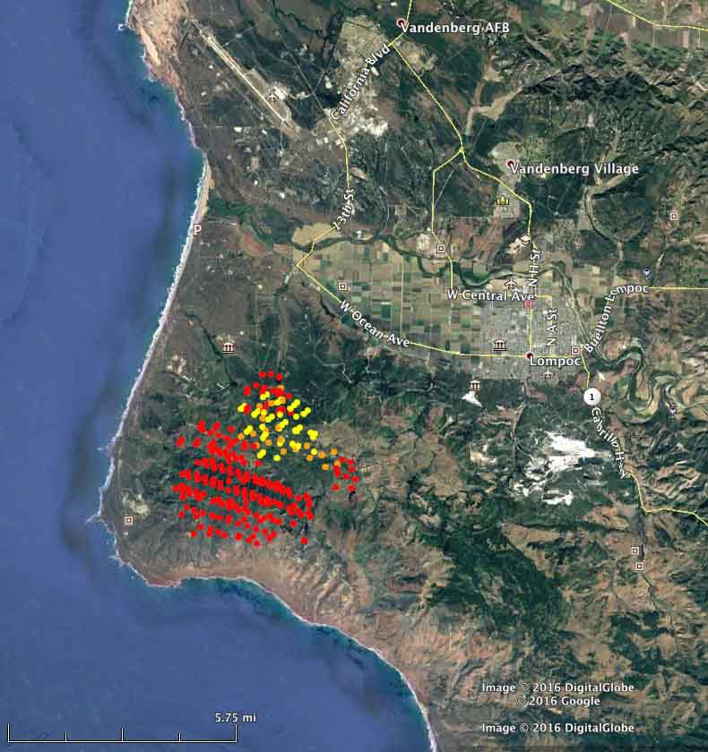
The red dots represent heat detected by a satellite over the Canyon Fire at 1:50 a.m. PDT September 19, 2016. The yellow dots were from 5:50 a.m. on Sept. 18.
The red dots represent heat detected by a satellite flying over the Canyon Fire at 1:50 a.m. PDT September 19, 2016. The yellow dots were from 5:50 a.m. on Sept. 18. Wildfire Today, MODIS, Google.

The photos below are courtesy of Santa Barbara County Fire.
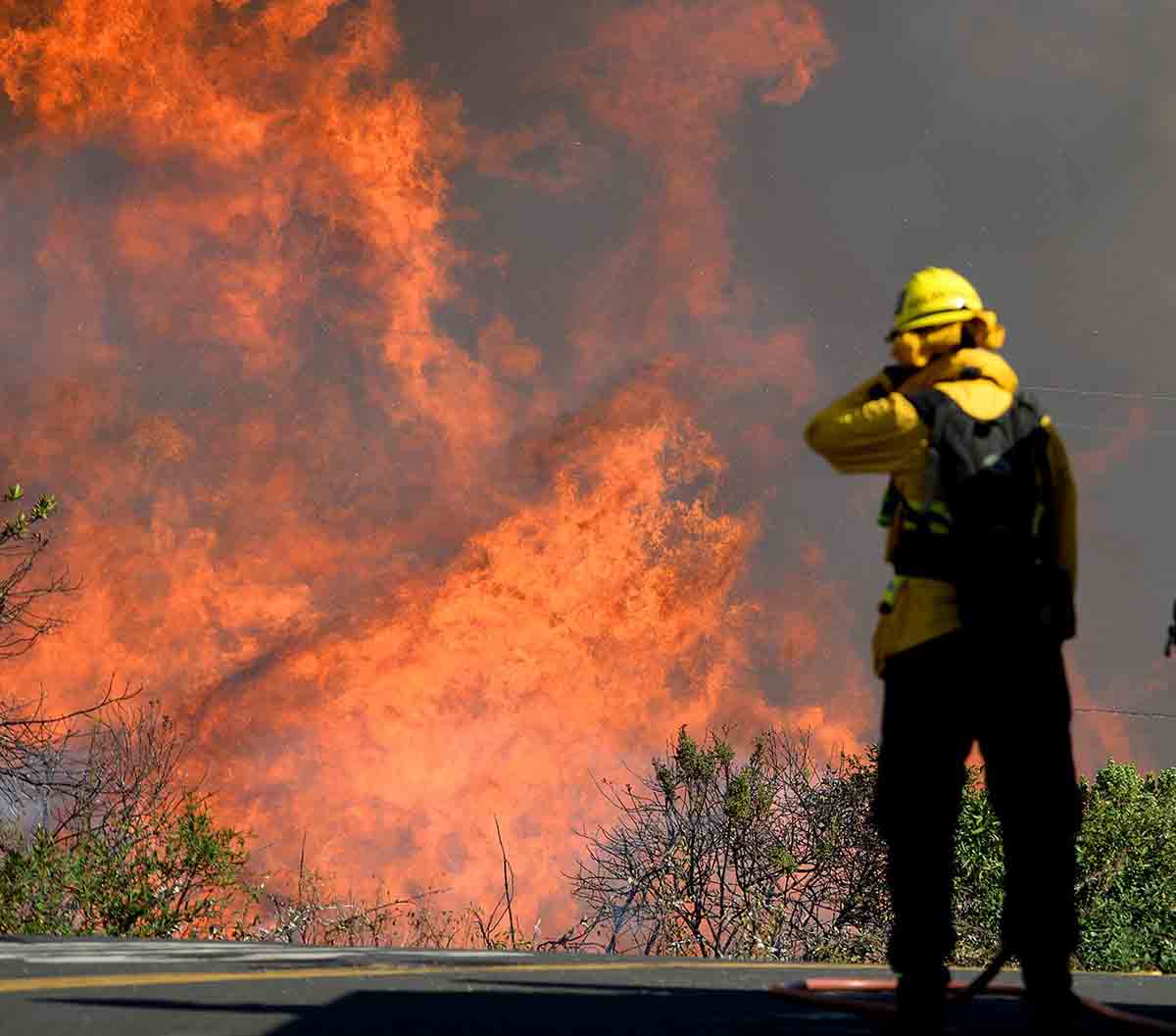
canyon fire
A firefighter on the Canyon Fire shields his face from the heat.
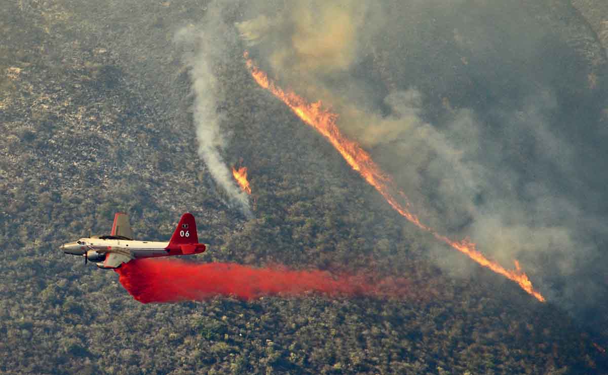
Tanker 06 P2V
Tanker 06, a P2V, drops on the Canyon Fire.
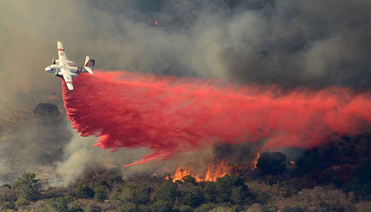
S2T canyon fire
An S2T drops on the Canyon Fire.

Thanks and a tip of the hat go out to Walt.

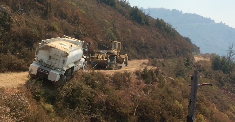
Water tender close call

water tender near miss
Photo from the report.

A water tender working on the Soberanes Fire south of Monterey, California last month had a very close call. While driving on a dirt road the right-rear tires slipped off the edge of the road as the soft dirt gave way. Luckily it did not continue sliding or roll down the steep slope.

A dozer and a Rapid Extraction Module responded, and after stabilizing the large truck, the dozer began to pull it out using a tow strap and for backup, a chain, both connected at the same time. As the strap stretched, some of the stress was transferred to the chain. Since the driver, who was in the truck to steer and maintain control after it was pulled out, had not yet let the clutch out, the chain quickly snapped. But they eventually extracted the truck using the tow strap.

The video below shows it being pulled out.

The Rapid Extraction Module probably didn’t anticipate they’d be assisting with THAT type of extraction. An article on Wildfire Today from September of 2015 has more information about what they normally do.

More details about this recent incident are in the Rapid Lessons Sharing report.

Wildfire news, September 14, 2016

Highlights of recent news about wildland fire.

California has fewer inmates available for fighting wildfires

With fewer inmates available for fighting fires, the state of California is turning to civilian crews within their Conservation Corps.

From KCRA:

…But the number of available inmates is declining because counties now oversee most lower-level felons under a law aimed at easing prison overcrowding. In addition, there are fewer incentives for inmates to risk their lives since a federal court broadened an early release program for firefighters to include other inmates.

The state is about 600 inmates short of the 4,300 prisoners who could be available for fire lines. So this year, the California Conservation Corps reopened a camp to train three crews of young civilians to do the same backbreaking work as the inmates. Corps Director Bruce Saito expects to create at least four more fire crews with roughly 15 members each by next summer and a half-dozen new crews during each of the next two years.

The corps has more than 1,400 members, but fewer than 200 currently work alongside local, state and federal firefighters battling blazes in rural areas.

The members include both men and women and range in age from 18 to 25. They enlist for one year and earn the state’s minimum wage of $10 an hour. Military veterans can enroll until they turn 30…

Oregon sues 3 people responsible for starting the Ferguson Fire

Oregon hopes to recover $892,082 from three individuals who they say are responsible for starting the Ferguson Fire that burned 200 acres and destroyed two structures in Klamath County in July 2014.

The suit alleges that Joe Askins started a campfire, then took a nap. When he awoke, the campfire had escaped. Askins also said “I’ll take all the blame for the fire,” according to the lawsuit.

More evidence that beetle-killed forests do not increase the risk of catastrophic wildfires.

An article at News Deeply summarizes several research studies which mostly concluded that beetle-killed forests do not burn more severely than forests that have not been attacked by the insects. This is in spite of statements to the contrary by the Secretary of Agriculture, a spokesperson for CAL FIRE, and media stories about trees that are now part of a “tinder box”.

Air tanker 132 starts contract in Australia

air tanker 132 australia
Air Tanker 132 is reintroduced to the media in New South Wales, Australia. Photo by Sgt. Brett Sherriff, Royal Australian Air Force.

Fire Aviation reports that Coulson’s Air Tanker 132 started its contract with New South Wales on September 6, helping to provide air support for wildland firefighters in Australia. This is the second year in a row that the L-382G, a variant of the C-130 platform, has worked down under during their summer bushfire season.

Cheyenne is concerned about the effects of the Snake Fire on their water system

“The location of the fire is close proximity to our major watershed collection area for the Hog Park Reservoir” said Dena Egenhoff, the Board of Public Utilities’ (BOPU) Water Conservation Manager. “We are unable to know the impact of the Snake Fire at this time, but the location suggests there may be some adverse impacts to the City of Cheyenne’s water collection system.” As of September 11, 2016, the Hog Park Reservoir is 91.8% full

For Cheyenne, BOPU collects water in the Little Snake River drainage from snow melt and streams and transports it under a mountain by a tunnel to the eastside of the Continental Divide. That water is then stored in Hog Park Reservoir. From there, the collected water from Hog Park Reservoir is traded for water in Rob Roy Reservoir which can more easily be transported without pumping to Cheyenne. “In this way, the amount of water can be exchanged between the two different Mountain Ranges with all water rights being satisfied,” said Dena Egenhoff.

The Snake fire is in south-central Wyoming just north of the Colorado border. It is 115 air miles miles west of Cheyenne, and 20 miles west of the 38,000-acre Beaver Creek Fire that has been burning in Colorado and Wyoming since July 19, 2016.

Trabuco Fire caused by golfer’s club striking rock

Above: Trabuco Fire, September 6, 2016. Orange County Fire Authority photo.

Investigators with the Orange County Fire Authority have determined that the September 6, 2016 Trabuco Fire started from sparks created when a golf club struck a rock. The fire burned about 20 acres adjacent to the Arroyo Trabuco Golf Club (map) in Mission Viejo in Orange County, California.

From the Orange County Register:

“The golfer had hit the ball into the rough,” Orange County Fire Authority Capt. Larry Kurtz said. “As he was trying to get it out he accidentally hit a rock and it started a fire.”

Kurtz said the golfer was cooperative and tried to put out the sparks but the flames grew fast and “got out of control.”

This is not the first time this has happened. It is at least the third time in Orange County and the second time at Arroyo Trabuco Golf Club.

  • In June, 2011 at the Arroyo Trabuco Golf Club Steve Parsons used a titanium-clad 3-iron to punch his ball out of the rough. The club struck an unexposed rock and seconds later he looked down to see that he was standing in a ring of fire. Mr. Parsons and his golfing partner called 911 and tried putting it out with ice from a cooler and an open beverage, but had no success. Thankfully the fire burned up to a cart path and went out.
  • August, 2010 golfers reported that  a 12-acre fire ignited when a golfer, whose ball was in the rough, struck a rock with his club, causing sparks which started the fire. It took hand crews, helicopters, and 150 firefighters to put out the fire at the Shady Canyon Golf Club in Orange County, California.
  • fire investigator determined that a golf club striking a rock was one of the possible causes for the Poinsettia Fire that burned five homes, 18 apartment units, one commercial building, and 600 acres on May 14, 2014 in Carlsbad, California. The fire started near a cart path on the 7th hole on the Omni La Costa Resort and Spa’s golf course.

In 2014 researchers at the University of California at Irvine studied how golf clubs can cause vegetation fires after two fires in Orange County where golf clubs were suspected as the culprit. Below are excerpts from their report:

Titanium alloy golf clubs can cause dangerous wildfires, according to UC Irvine scientists. When a club coated with the lightweight metal is swung and strikes a rock, it creates sparks that can heat to more than 3,000 degrees Fahrenheit for long enough to ignite dry foliage, according to findings published recently in the peer-reviewed journal Fire and Materials.

The researchers painstakingly re-created in the lab course conditions on the days of the fires. Using high-speed video cameras and powerful scanning electron microscope analysis, they found that when titanium clubs were abraded by striking or grazing hard surfaces, intensely hot sparks flew out of them. In contrast, when standard stainless steel clubs were used, there was no reaction.

“Rocks are often embedded in the ground in these rough areas of dry foliage,” Earthman noted. “When the club strikes a ball, nearby rocks can tear particles of titanium from the sole of the head. Bits of the particle surfaces will react violently with oxygen or nitrogen in the air, and a tremendous amount of heat is produced. The foliage ignites in flames.”

Trabuco fire in Orange Co. Calif. stopped at about 20 acres

(UPDATE September 7, 2016: investigators determined that the fire started from sparks created when a golfer’s club struck a rock.)

Firefighters on the ground and in the air stopped a wildfire in Mission Viejo, California Tuesday afternoon after it burned 20 to 25 acres near the Arroyo Trabuco golf course east of Interstate 5 in Orange County.

Aside from the excellent job by the personnel at the scene, we were interested in this fire because of two photos put on Twitter by Maaike aka Shinobi (@ShinobiHaruka) showing before and after, or, during and after. There is a remarkable change in a short amount of time. The photos are used here with her permission. (We enlarged the flying object and pasted it as an inset.)

Trabuco Fire Trabuco Fire

I think the photos were taken not more than two hours apart.

Firefighters beginning to get a handle on the Gap Fire in northern California

Above: The Gap Fire as seen from the Klamath River. Undated photo from InciWeb.

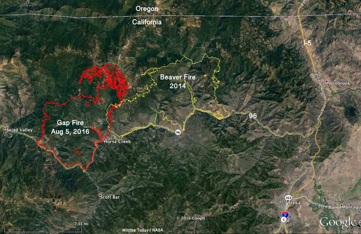
The Gap Fire has been burning in Seiad Valley 20 miles northwest of Yreka, California for 11 days. It grew quickly during that time to now cover almost 28,000 acres, but firefighters are beginning to get a handle on the blaze. That effort is helped by barriers on at least two sides — the Klamath River on the south, and the two-year old scar from the Beaver Fire.

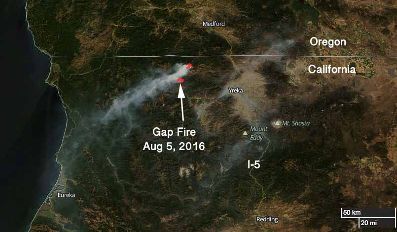
map Gap Fire California
Satellite photo showing smoke from the Gap Fire Sept 5, 2016. NASA image with text by Wildfire Today.

The Gap Fire has burned into the footprint from the Beaver Fire. Burning operations along the river and on the north side are likely to hold those areas. And, the west flank is also looking good.

The photo below was taken August 12, 2014 at the Beaver Fire north of the Klamath River.
Art Prints

Advisory evacuations are in place for some areas along the Klamath River.

On Tuesday firefighters will continue to work on the firing operations on the north and south sides and provide structure protection along the river.

The incident management team reports that two structures were destroyed near Hick’s Gulch on the north side of the Klamath River, but have yet to be assessed on the ground.

map Gap Fire Beaver California
Map of the 2016 Gap Fire at about 11:30 p.m. Sept 5, 2016, and the Beaver Fire of 2014. Click to enlarge.
Gap Fire California
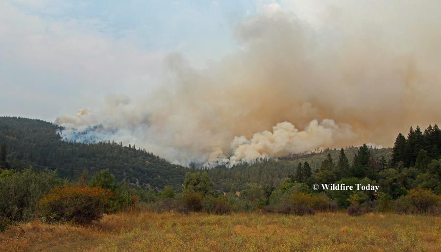
Gap Fire as seen from Highway 96 looking toward Hicks Gulch. Photo by Lisa Cox (undated).
Gap Fire California
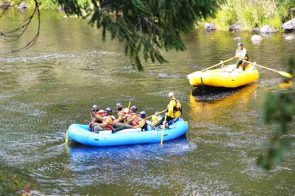
Firefighters on the Gap Fire are taken across the Klamath River by local rafters.
Beaver Fire
This photo was taken near the western edge of the Beaver Fire, August 12, 2014 near the Klamath River. This general area is now the eastern edge of the Gap Fire. Photo by Bill Gabbert.