Winter Valley Fire closes Highway 40 in Colorado

By Thursday night the Winter Valley Fire had burned 5,200 acres.

(UPDATED at 3:11 p.m. MDT September 22, 2017)

U.S. Highway 40 that was closed by the Winter Valley Fire in northwest Colorado has opened, according to the Bureau of Land Management.

****
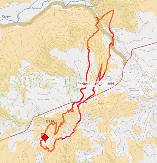
Winter Valley Fire map
Map showing the perimeter of the Winter Valley Fire at 6:55 p.m. MDT September 21, 2017. BLM.

(Originally published at 11:28 a.m. MDT September 22, 2017)

A fire that was reported around noon Thursday just southeast of Elk Springs, Colorado spread quickly during the afternoon pushed by very strong winds gusting up to 50 mph. During the afternoon and night the wind was out of the south and southwest as the fire crossed Highway 40 and marched 10 miles to Cross Mountain to come within 15 miles of Maybell, Colorado.

The Calico weather station northwest of Elk Springs where these wind readings were recorded detected a major shift in conditions Friday morning. At 7 a.m. the wind had calmed to a slight breeze from the west and the relative humidity that had plummeted to 14 percent on Thursday had risen by 9:53 a.m. to 79 percent. The station also measured 0.02″ of precipitation at that time. A weather station in Dinosaur National Monument about 30 miles to the northwest of the fire recorded 0.15″ of precipitation Friday morning.

At about 9 p.m. on Thursday the Bureau of Land Management reported that the fire had burned 5,200 acres and was actively burning on Cross Mountain.

The incident closed U.S. Highway 40 in both directions after 2 p.m. from Maybell to Elk Springs, according to the Colorado State Patrol.

A BLM spokesperson said about 25 to 30 residences in the Deerlodge area were threatened by the fire and evacuations took place Thursday.
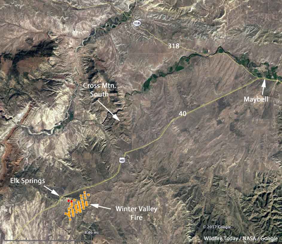
map winter valley fire
The brown and red dots represent heat detected by a satellite as late as 2:47 a.m. (the red dots) September 22, 2017. The brown dots were detected at 2:30 p.m. September 21. However, the fire is many times larger than shown here because the light fuels in the area burn quickly and can cool before the next satellite overpass, which happens about twice a day.

The fire, in BLM jurisdiction, is being managed by a Type 3 Incident Management Team. The agency reports that about half a dozen gas wells were within the perimeter of the blaze. A Federal Aviation Administration tower was also threatened.

U.S. Highway 40 photo
Photo from Google Maps in the general area where the Winter Valley Fire crossed U.S. Highway 40.

About 150 personnel, including two Hotshot crews, are assigned or en route to the fire Friday.

Maybell, Colorado
Downtown Maybell, Colorado, about 15 miles northeast of the fire. Photo from Google Maps.

Arrowhead Hotshots on the Peekaboo Fire

(Originally published at 3 p.m. MDT July 18, 2017)

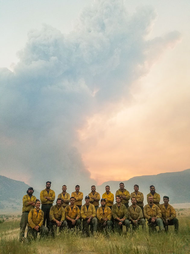
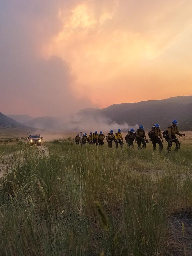
The Arrowhead Hotshots sent us these photos that were taken during their assignment on the Peekaboo Fire in northwest Colorado near Maybell. (Thanks guys!)

Arrowhead, first established in 1981, is a National Park Service crew based in Kings Canyon National Park in California.

Arrowhead Hotshots Peekaboo Fire

Arrowhead Hotshots Peekaboo Fire

Evacuation lifted for Peak 2 Fire near Breckenridge

Above: 3-D map of the Peak 2 Fire, July 7, 2017.

(Originally published at 7 a.m. MDT July 8, 2017)

Residents of the 463 homes in the Peak 7 neighborhood near the Peak 2 Fire north of Breckenridge, Colorado were able to return to their homes Friday night for the first time since the fire started July 5. The fire has burned 74 to 84 acres, about the size of an 18-hole golf course, but no one would ever build a golf course on terrain this steep (see map above).

Todd Pechota’s Type 1 Incident Management Team assumed command at 6 a.m. Friday.

The resources assigned to the fire include 8 hand crews, 15 engines, and 8 helicopters for a total of 362 personnel.

Peak 2 Fire near Breckenridge slowed overnight

Above: Map of the Peak 2 Fire (shown in pink) created by the incident management team at 9:03 p.m. MDT July 5, 2017.

(Originally published at 7:55 a.m. MDT July 6, 2017)

The Peak 2 Fire two miles north of the ski runs at Breckenridge, Colorado slowed late Wednesday afternoon and at 7 a.m. Thursday showed very little vigorous fire activity.

At 7 p.m. Wednesday Colorado’s Multi Mission Aircraft mapped it at 84 acres.

Structures are threatened and evacuations are in effect for the Peak 7 housing development.

The photo below was posted at 6:41 a.m. Thursday by Carol McKinley.

The fire was reported at about 11 a.m. Wednesday near the ski resort 50 air miles west of Denver. Aircraft worked the fire that afternoon, along with eight Boise smokejumpers and a hotshot crew. Additional resources have been ordered.

At a media briefing Wednesday it was announced that a Type 1 Incident Management Team would arrive at the fire on Thursday.

The weather forecast for the fire area at 10,000 feet calls for 78 degrees, 26 percent relative humidity, and northwest winds of 8 mph gusting to 13.

The video below was shot Wednesday before the fire activity slowed late in the afternoon.


And below, another photo shot during the height of activity on the Peak 2 Fire near Breckenridge at 3 p.m.

Peak 2 Fire causes evacuations north of Breckenridge, Colorado

In the map above of the Peak 2 Fire, the red dots represent heat detected by a satellite at 3:54 p.m. MDT July 5, 2017.

(Originally published at 6:41 p.m. MDT July 5, 2017)
(Updated at 7:25 p.m. MDT July 5, 2017)

The Peak 2 Fire spread rapidly after it was reported just after 11 a.m. Wednesday morning between Breckenridge and Frisco near popular ski areas 50 air miles west of Denver. It is 2 miles north of the northernmost ski runs at Breckenridge.

At 5 p.m. fire officials estimated the size at 80 acres. According to Summit County the community of Peak 7, approximately 463 residences, is under evacuation. Residents of Breckenridge, Gold Hill and Silver Shekel have been asked to prepare for evacuation.

No structures have been destroyed and Highway 9 is open.

Aircraft have been working the fire, as well as eight Boise smokejumpers and a hotshot crew. Additional resources have been ordered.

The fire is being managed under the Unified Command of the US Forest Service, the Summit County Sheriff, and the Red, White and Blue Fire Protection District. Bill Jackson the local US Forest Service District Ranger on the White River National Forest said in a 7 p.m. briefing that a Type 1 Incident Management Team will assume command at noon on Thursday.

There are reports that late in the afternoon the fire activity decreased, but below are photos from earlier in the day as the fire was spreading more rapidly.

Tree falling on dozer starts fire in Colorado

Above: Air Tanker 02, a BAe-146, makes a drop on the Mill Creek Fire. Screen shot from the Joel Reichenberger video below.

(Originally published t 9:34 a.m. MDT July 2, 2017)

The Mill Creek Fire in Colorado started Saturday when a tree fell on a bulldozer that was working in the area, according to a spokesperson from the West Routt Fire Protection District. The dozer was destroyed as the blaze spread northwest of Pilot Knob near Routt County Road 80.

The fire is 13 miles northeast of Hayden and 20 miles northwest of Steamboat Springs.

Map Mill Creek Fire Colorado
Map showing the location of the Mill Creek Fire at 3:24 a.m. MDT July 2, 2017.

As of Saturday night 116 acres had burned. Steamboat Today reported that two hotshot crews will be assigned on Sunday.