Colorado: Hayden Pass Fire causes evacuations south of Salida

(UPDATE at 8:40 a.m. MDT July 15, 2016)
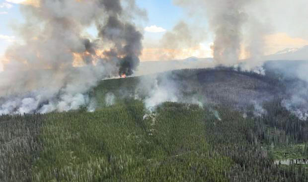
Hayden Pass Fire
Hayden Pass Fire at noon July 14, 2016. InciWeb photo.

The Hayden Pass Fire near Coaldale, Colorado grew by about 1,000 acres on Thursday and has now burned approximately 15,700 acres.

The incident management team reported Thursday night that they received more helicopters and seemed to imply that suppression of the fire had been hampered by a shortage of aircraft:

Additional helicopters arrived, enabling firefighters to utilize seven ships this afternoon, performing water drops and vital reconnaissance for fires that begin outside the fire perimeter.

Evacuations, road, area and trail closures are in effect and one structure has been destroyed.

The fire has spread south towards the Lake Creek drainage and west of the Duckett fire scar of 2011. Structural protection teams are installing sprinkler systems and removing vegetation around some structures out ahead of the fire.
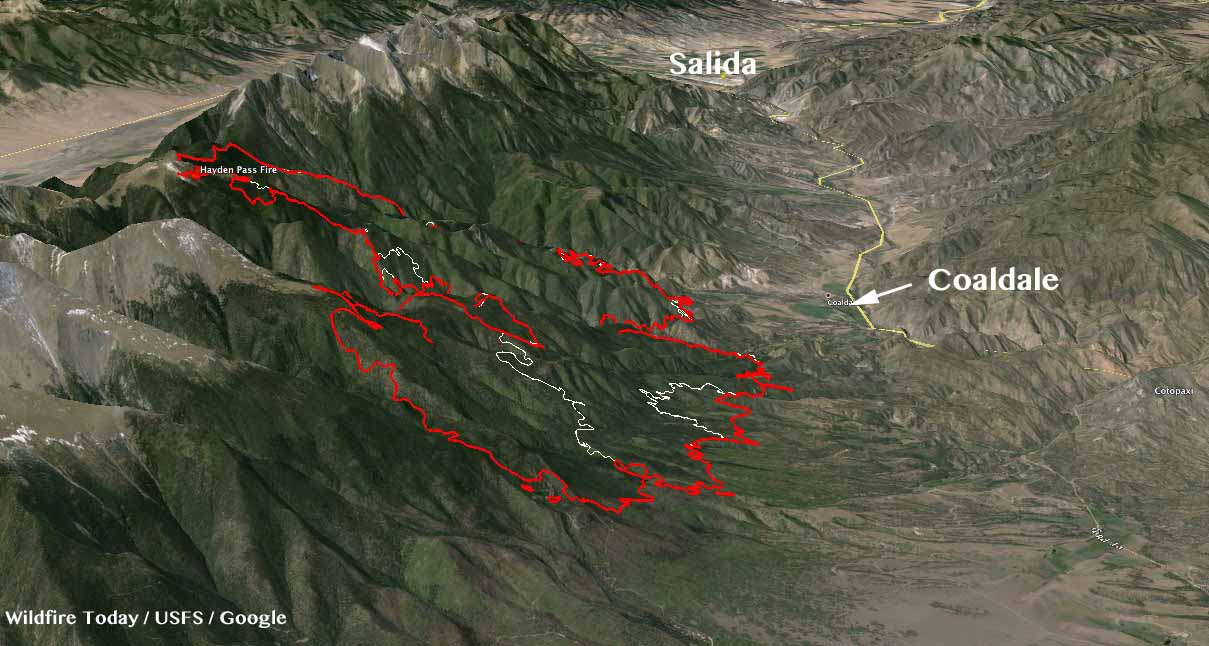
3-D Map Hayden Pass Fire
3-D Map of the Hayden Pass Fire looking northwest toward Salida. The red line was the perimeter at 10 p.m. MDT July 14, 2016. The white line was the perimeter two days earlier. Click to enlarge.

The weather forecast for the Coaldale area for Friday and Saturday predicts temperatures in the low to mid-80s, southwest winds at 8 to 10 mph, and relative humidities in the low teens with very little chance of rain. Parts of Colorado will be under Red Flag Warnings or Fire Weather Watches Friday and Saturday.

****

(UPDATE at 1:30 p.m. MDT July 14, 2016)
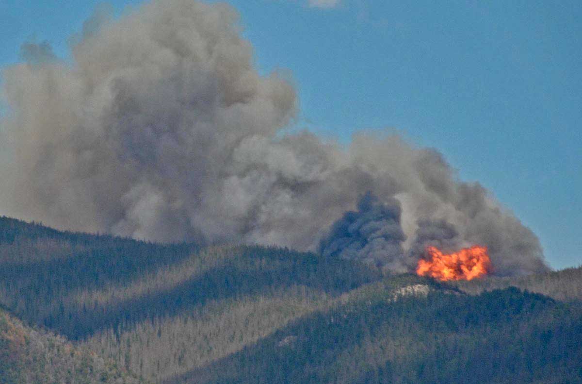
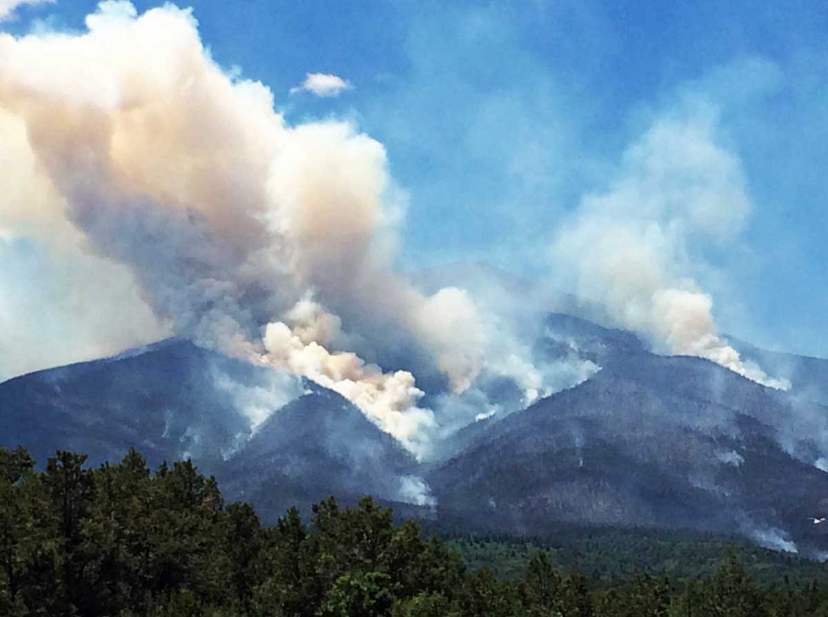
Hayden Pass Fire
Hayden Pass Fire at 3 p.m. July 10, 2016. InciWeb photo.

The incident management team for the Hayden Pass Fire issued the information below as part of a Thursday morning update:

…Crews are actively suppressing the fire outside of the Sangre de Cristo Wilderness utilizing structure defense, direct and indirect fire control strategies. Helicopters and air tankers are supporting these strategies, to include retardant drops for structural protection. Firefighting resources are shifting as priorities are completed and new risks are prioritized. Firefighters will continue to suppress the fire using resources and tactics to minimize firefighter risk with the highest probability of success.
The fire continues to burn in the Sangre de Cristo Wilderness. Crews are not currently engaging the fire within the wilderness due to complex terrain causing safety concerns; rather, they will closely monitor fire movement and assist Forest Service staff by informing recreationists of area closures…

The update on the fire posted today at InciWeb did not include the revised size of the fire. Members of the media who attended a press conference this morning reported it had grown to more than 14,500 acres.

The way the U.S. Forest Service describes the management strategy of these less-than-full-suppression wildfires is confusing — to the public and even some firefighters. Officially the Hayden Pass Fire is listed as a “monitor/confine/contain” fire rather than “full suppression” like most fires. But the agency and the Information Officers communicating with citizens do not like to discuss that publicly. It can be scary to some when they hear that the government is not pulling out all the stops in order to put out a fire quickly. And it can be disconcerting to think about a fire within sight of hundreds of homes burning from early July until October 1, which is the “completion” date for the Hayden Pass Fire listed in the excerpt below from the National Situation Report. (See “Cnt/Comp” which refers to Contain or Complete, with Contain being suppression, and Complete referring to less-than-full-suppression.)

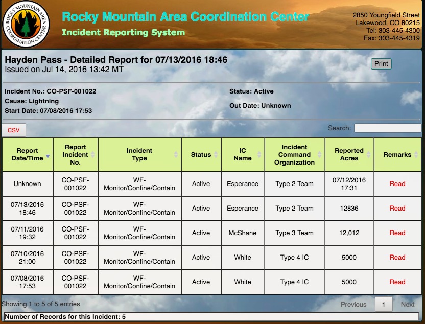
Hayden Pass Fire information
Information about the Hayden Pass Fire from the National Situation Report, July 14, 2016.
Hayden Pass Fire information
Information about the Hayden Pass Fire, from the Rocky Mountain Coordination Center, July 14, 2016.
Cold Springs Fire information
For comparison, this is information about the Cold Springs Fire, from the Rocky Mountain Coordination Center, July 14, 2016.

Below are two video briefings that were posted on Thursday. The first features Incident Commander Jay Esperance. Following that is Operations Section Chief Travis Lipp. Click on the full screen icons to see larger versions.

****

(UPDATE at 21:20 p.m. MDT July 13, 2016)

At a 10 a.m. press briefing today a spokesperson for the Hayden Pass Fire said it grew yesterday by about 600 acres to just under 13,000 acres

****

(UPDATED at 8:20 a.m. MDT July 13, 2016)
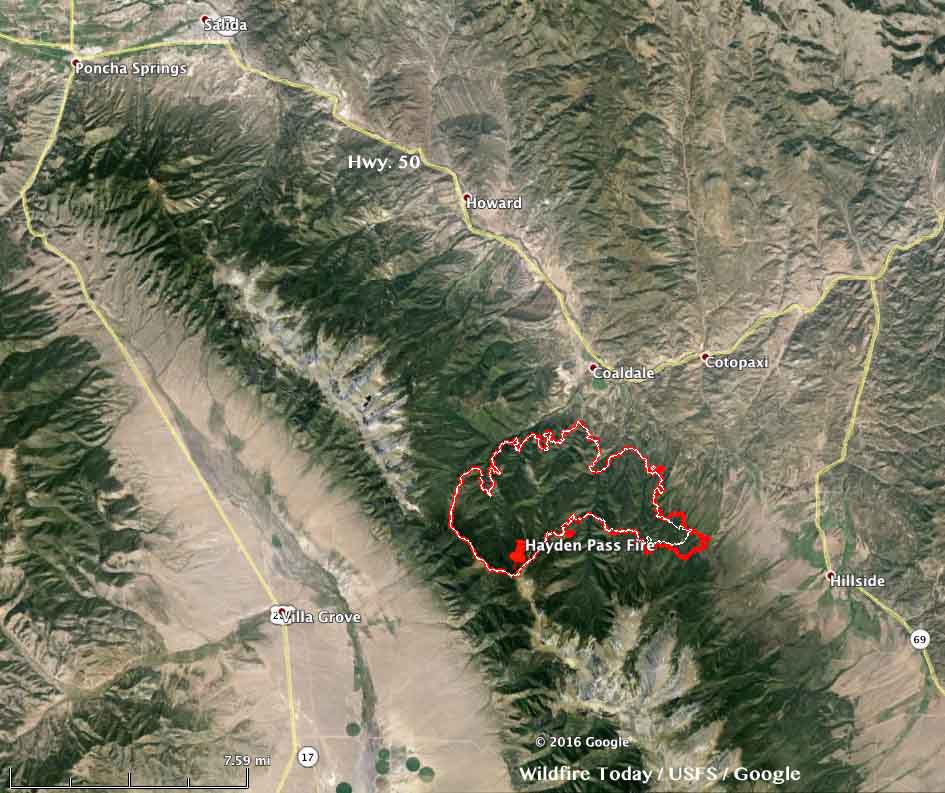
map Hayden Pass Fire
The red line was the perimeter of the Hayden Pass Fire at 11 p.m. MDT July 12, 2016. The white line was the perimeter 25 hours before. Click to enlarge.

The Hayden Pass Fire 17 air miles southeast of Salida, Colorado added less than 1,000 acres on Tuesday mostly through activity on the southeast side but also on the north side. Dozers constructed fireline from Hayden Creek toward Big Cottonwood drainage while a hotshot crew built line from Big Cottonwood drainage toward Hayden Creek and the dozer line. Aircraft were used in those areas to slow the fire and support firefighters on the ground.

The fire is still 1 to 2 miles southwest of Coaldale.

The weather on Wednesday could be conducive to additional fire spread. The forecast for the fire area 3 miles south-southwest of Coaldale predicts 85 degrees, relative humidity in the low teens, and a west wind at 10 to 13 mph.

Evacuation information is at the Fremont County Sheriff’s Facebook page.

Continue reading “Colorado: Hayden Pass Fire causes evacuations south of Salida”

Cold Springs Fire burns hundreds of acres west of Boulder, Colorado

(Originally published at 12:18 MDT July 11, 2016)

Cold Springs Fire map
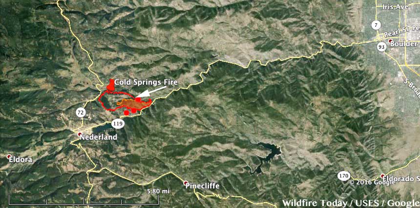
Map showing the perimeter of the Cold Springs Fire at 1 a.m. MDT July 11, 2016. Click to enlarge.

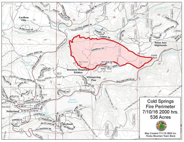
The Cold Springs Fire has caused evacuations of about 2,000 residents near Nederland, Colorado, 10 miles west of Boulder. The fire, now 606 acres, started at about 1:30 p.m. on July 9 from an escaped campfire. Three transients were camping on private property and failed to extinguish the campfire they had Thursday night, according to the Boulder County Sheriff personnel, who arrested two of the three people Sunday, Jimmy Andrew Suggs, 28, and Zackary Ryan Kuykendall, 26, both of Vinemont, Alabama.

The Daily Camera interviewed the campers before they were arrested for fourth-degree arson, a Class 4 felony.

Cold Springs Fire
Screen shot from the Daily Camera interview.
Booking photos
Booking photos of Jimmy Andrew Suggs (left), 28, and Zackary Ryan Kuykendall (right), 26. Photo by Boulder County Sheriff’s Office.

On Sunday strong winds pushed the Cold Springs Fire toward Highway 119 and Boulder Creek Canyon, but firefighters worked overnight to construct fire lines and protect newly-threatened homes. Two very small spot fires on the south side of Boulder Creek Canyon were fully contained. At least 17 engines crews and four 20-person Hotshot crews worked overnight to build fire lines from Highway 119 along the fire’s edge. Crews also conducted burnout operations along Highway 119 to strengthen fire lines.

A damage assessment team confirmed on Monday that five homes have been destroyed.

Aircraft dropped 85,206 gallons of retardant on Saturday and 84,555 gallons on Sunday.

The weather forecast for the fire area on Monday could present problems for firefighters. It predicts 10 to 18 mph west winds gusting at 20 to 30 mph and a relative humidity of 16 percent. Conditions will be more benign on Tuesday.

Rocky Mountain Incident Management Team 2 with Incident Commander Shane Greer assumed command of the fire at 8:30 p.m. Sunday.

Weather Cold Springs Fire 7-11-2016

Map Cold Springs Fire
Map of the Cold Springs Fire at 8 p.m. MDT July 10, 2016.

Thanks and a tip of the hat go out to Jeffrey.

The spread of the Beaver Creek Fire in northern Colorado slows

Above: Varying burn intensities on the Beaver Creek Fire.

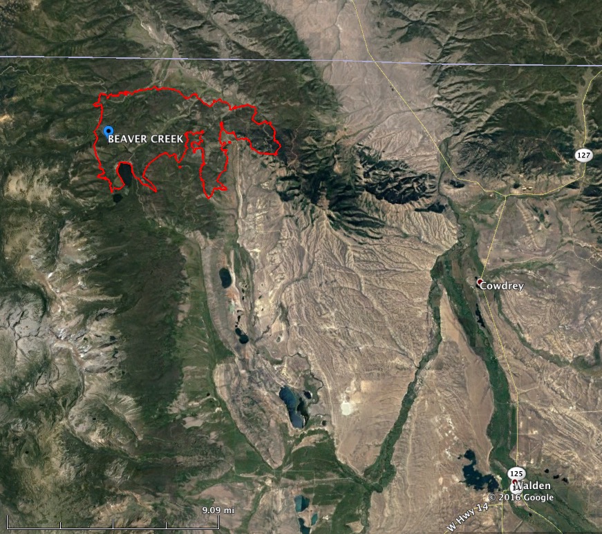
The spread of the Beaver Creek Fire in northern Colorado one mile south of the Wyoming border has slowed over the last week. It has been listed at 13,275 acres since June 30 and according to the incident commander is 5 percent conplete after burning for 18 days. The strategy is not to put it out, but to manage it for “multiple objectives”.

The fire is 17 miles northwest of Walden, Colorado and 52 miles southwest of Laramie, Wyoming.

Within the last 48 hours the fire received about 0.2 inches of rain but the fuels should dry out today, aided by a 9 mph southwest wind gusting up to 23 mph.

Beaver Creek Fire beetles intensity
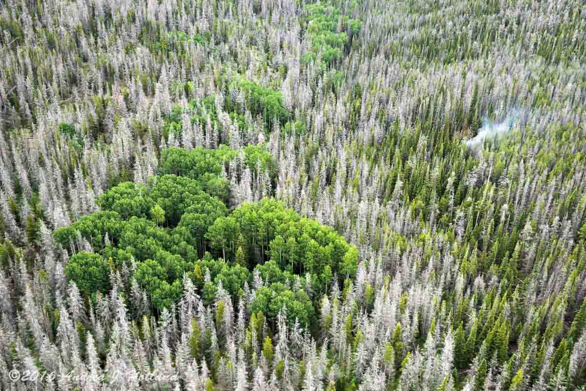
Photo of a portion of the Beaver Creek Fire in an area with heavy beetle kill. One smoke is visible. USFS photo by Andrea Holland.

People who are extremely worried about forests attacked by beetles and assume fire intensity will be greatly enhanced in those areas, should examine the photo above that was taken within the fire area.

Jay Esperance’s Type 2 incident management team will transition to the West Slope Type 3 Team B on Thursday.

The photos were provided by the Medicine Bow-Routt National Forests and Thunder Basin National Grassland. Except as noted the photographer and dates taken were not given.

More information about the Beaver Creek Fire.

Beaver Creek Fire map
Map of the Beaver Creek Fire July 3, 2016. USFS.
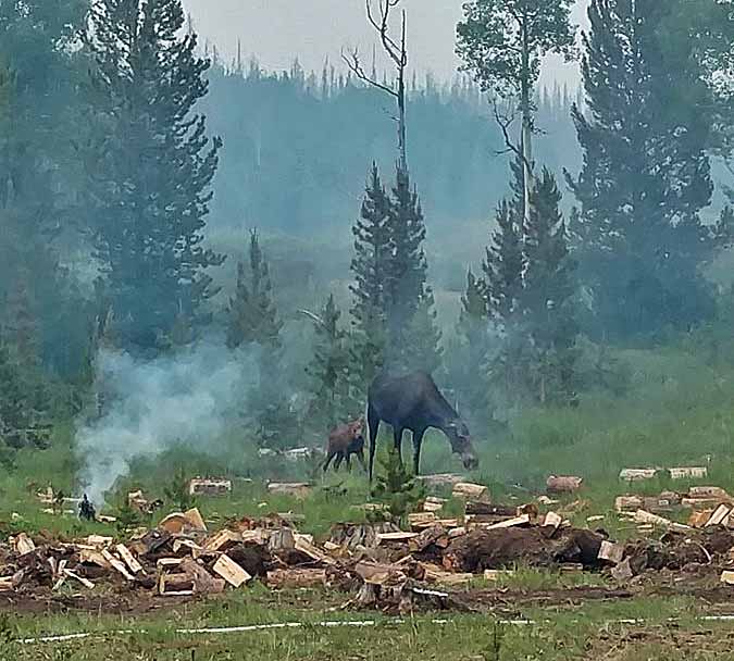
Beaver Creek Fire moose
A moose and her calf investigate evidence of firefighter activity on the Beaver Creek Fire.
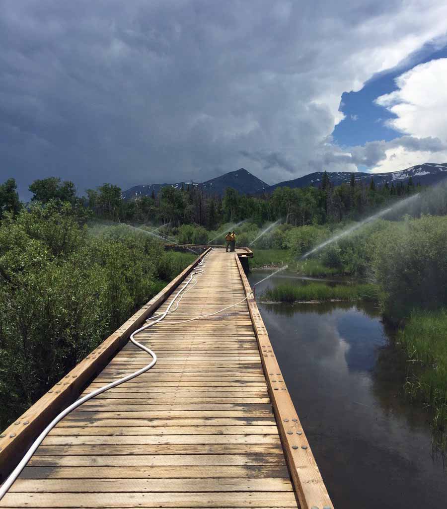
Beaver Creek Fire sprinklers
Sprinklers are set up on an ATV bridge near the Beaver Creek Fire.
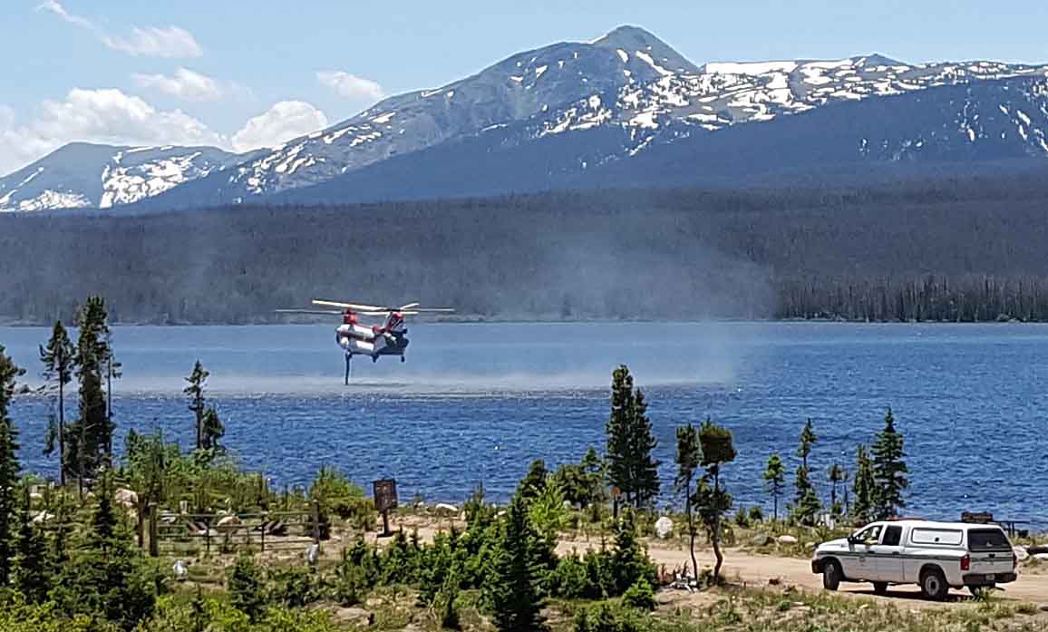
Beaver Creek Fire Chinook
A Chinook helicopter uses its snorkle to refill its internal water tank while working on the Beaver Creek Fire.
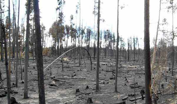
Beaver Creek Fire
AN area of high burn intensity on the Beaver Creek Fire.

Beaver Creek Fire in northern Colorado threatens structures

Beaver Creek Fire
Beaver Creek Fire approaches structures. Undated, uncredited photo on InciWeb.

(Click here to see updated information on the Beaver Creek Fire as of July 6, 2016)

****

June 28, 2016

The Incident Management Team on the Beaver Creek Fire northwest of Walden, Colorado released this information today.

****

Consecutive days of low humidity and north by northwest winds greatly increased fire growth on the Beaver Creek Fire yesterday afternoon and through the night. Group torching and crowning continued into the early morning hours, a period when fires usually burn with less intensity.

The fire grew to 9114 acres with the fire edge expanding on the south and west. The north and east edge of the fire did not significantly grow yesterday.

Firefighters protected structures overnight, mopping up hot spots left behind after the fire passed.

The fire continues to move through heavy dead timber burning with high intensity. As the inversion moves out this morning fire activity will increase. Operations Section Trainee Chief Aaron Thompson briefed firefighters, “the fire is going to stand up and move. There is a lot of new fire edge but the mission remains the same, defend structures and build contingency line. Keep your heads up and keep safety a top priority.”

The fire located south of the Wyoming border and 15 miles northwest of Walden, Colorado and has spread onto wilderness lands.

Air attack began watching the fire this morning and ground crews will have helicopters available to them for cooling spot fires and hot spots.

Structure protection engines will again prepare by setting up sprinkler systems, removing fuel and defending structures threatened by the fire.

Dozers are working to build and improve on contingency fire lines.

Last night firefighters assisted with a civilian injury near a contingency fireline. Firefighters were able to use their “incident within an incident” protocol to assist with transporting the citizen to a hospital utilizing medical staff and equipment to communicate effectively with non-fire personnel.

All residential structures within and near the fire perimeter have been saved to date. The Jackson County Sheriff’s Office will provide information to residence and cabin owners in the evacuation/closure area. To obtain a picture of their property, affected owners can call (970)723-4242 to make a formal request with the Sheriff.

Existing evacuation orders remain in place due to the hazardous conditions near the fire perimeter. Closures remain in place and specific information can be found at http://inciweb.nwcg.gov/incident/4797/.

The cause of the Beaver Creek Fire remains under investigation. Anyone with information on suspicious activity should contact U.S. Forest Service Officer Hannah Nadeau, 307-343-2335.

****

Map Beaver Fire June 28, 2016

Colorado: Beaver Creek Fire

Campers are being evacuated from dispersed areas.

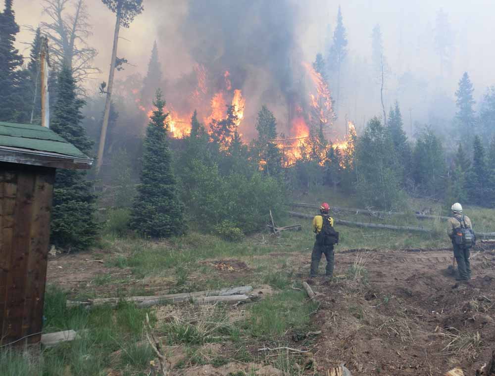
Above: Beaver Creek Fire June 20, 2016. USFS photo by Alison Richards.

(Click here to see updated information on the Beaver Creek Fire as of July 6, 2016)

****

(UPDATE at 10:42 p.m. MDT June 22, 2016)

On Wednesday afternoon the Beaver Creek Fire northwest of Walden, Colorado was very active again, almost doubling in size to 7,000 acres. The fire spread further to the east, becoming well established on Independence Mountain.

The evacuation orders implemented on Tuesday are still in place.

The “Blue” Rocky Mountain Incident Management Team with Incident Commander Jay Esperance will assume command of the fire at 6:00 a.m. on Thursday.

****

(Originally published at 2:48 p.m. MDT June 22, 2016)

In the four days that the Beaver Creek Fire has been burning 20 miles northwest of Walden, Colorado it has grown to 3,800 acres. Most of those acres were accumulated on Tuesday.

A wind shift on Tuesday afternoon drove the fire to the east, pushing it across two main roads and establishing spot fires on BLM-managed Independence Mountain. The majority of the Beaver Creek Fire remains on the Routt National Forest in northwest Jackson County, Colo about 1 mile south of the Wyoming border.

Local fire staff were working late Tuesday with Jackson County and the BLM to evacuate dispersed campers on Independence Mountain.

(Click on the images below to see larger versions.)

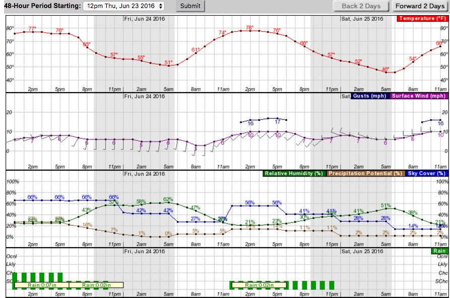
weather Beaver Creek Fire
Weather forecast for the area of the Beaver Creek Fire. NWS.

The weather on Wednesday and Thursday will be moderate, but will become more problematic on Friday and Saturday with humidities around 20 percent, 10 mph southwest or west winds gusting up to 17 mph, and a chance of thunderstorms.

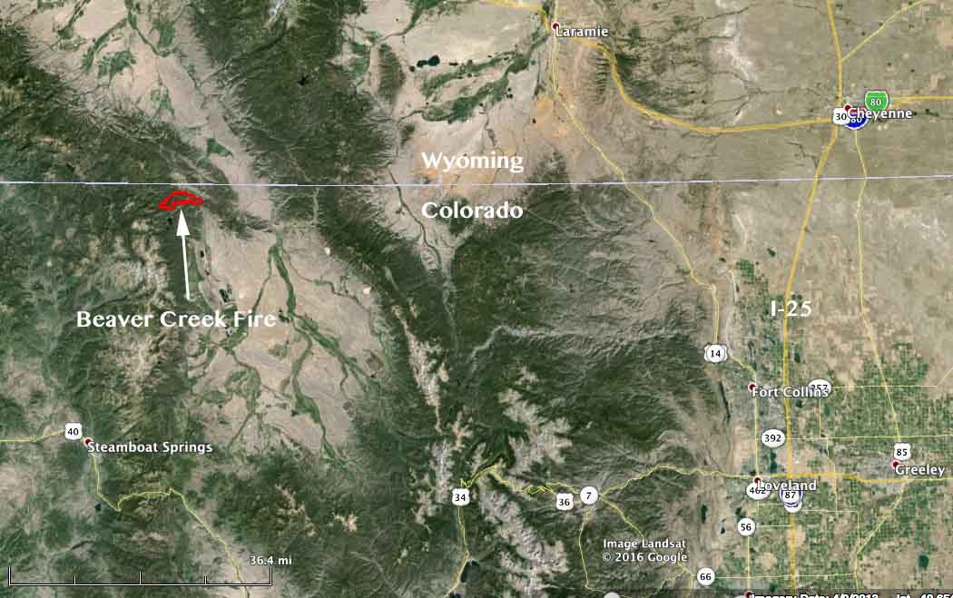
map Beaver Creek Fire
Vicinity map of the Beaver Creek Fire.
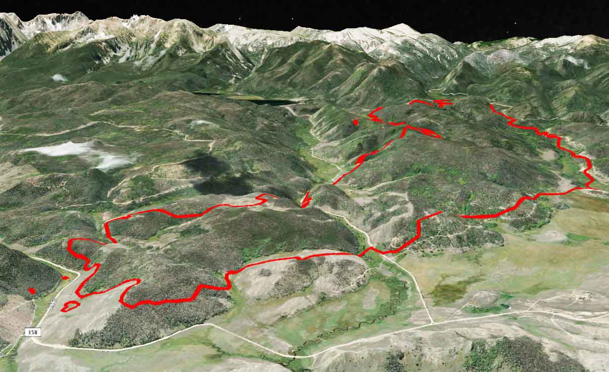
Beaver Creek Fire 3-D map
3-D map of the Beaver Creek looking SW. Perimeter data from 9 p.m. June 21, 2016. CO Div. Fire Prev. & Control.
Beaver Creek Fire
Beaver Creek Fire June 20, 2016. USFS photo by Alison Richards.

Thanks and a tip of the hat go out to Chris.

Fire mapping plane assists in rescue of 10 military personnel

Search and rescue operation underway in Rocky Mountain National Park in Colorado.

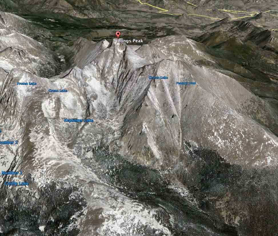
Longs Peak map
3-D map of Longs Peak in Rocky Mountain National Park, 10 miles southwest of Estes Park, Colorado. Google Earth.

(UPDATED at 2:10 p.m. MDT, June 3, 2016)

Helicopter rescue hikers
A helicopter extracts military personnel from the summit of Longs Peak at 1:42 p.m. MDT, June 3, 2016. Screen grab from TheDenverChannel video.

Ten soldiers, some of them with the 10th Special Forces Group based at Fort Carson, are being rescued from Longs Peak in Rocky Mountain National Park. Between 1:30 and 2 p.m. MDT TheDenverChannel streamed live video of a helicopter extracting personnel from the summit of the peak which is about 48 miles northwest of downtown Denver.

Kyle Patterson, a public affairs officer for the Park, said the state’s Pilatus PC-12 Multi-Mission Aircraft was used for reconnaissance. At 12:19 p.m. MDT she stated:

Late last night, Rocky Mountain National Park staff were notified that a group of ten people were requesting assistance on Kiener’s Route on Longs Peak.  The group consists of a variety of military personnel affiliated with Fort Carson.  This group was involved in a climbing training.  A few members reported having some degree of distress and were having difficulty continuing up the route. The group was not planning to over-night in the area.  The group continues to self-rescue by assisting each other to climb to the summit of Longs Peak.

Park rangers are planning evacuation efforts from the summit of Longs Peak via helicopter, weather and conditions permitting.  Rangers are also planning to assist the group to the summit, if needed.  There are forty-three park personnel affiliated with this incident.  Helicopter operations have taken place within the last hour to help with reconnaissance efforts.

Lt. Colonel Sean Ryan, a spokesman for the 10th Special Forces Group based at Fort Carson, confirmed this is a Green Beret unit.

Ryan said two members of the group got altitude sickness. He stressed that no one is missing and that altitude sickness can be a factor in mountain training.

****

(Originally published at 12:11 p.m. MDT, June 3, 2016)

An aircraft normally used for detecting and mapping wildfires has been mobilized to assist in the rescue of 10 overdue military personnel in Rocky Mountain National Park. The location is centered around Longs Peak which is 10 miles southwest of Estes Park, Colorado and about 48 miles northwest of downtown Denver.

This is a developing story which we will update as more information is available.

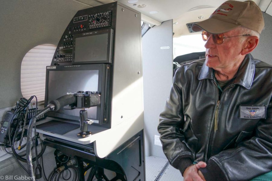
According to the Colorado Division of Fire Prevention and Control, one of their recently acquired Pilatus PC-12 Multi-Mission Aircraft is being used in the search. Sensors on the planes can detect and map the location of fires and transmit near real-time spatial data, still images, and short video clips to the Colorado Wildfire Information Management System (CO-WIMS), a web-based situational awareness platform. The infrared sensors may be able to detect the heat signatures given off by the overdue personnel. As you can see by the 3-D map above, the Longs Peak area is very steep and rugged, a difficult area for ground searchers to cover.

PIlatus PC-12 Colorado
One of Colorado’s two Pilatus PC-12 “Multi-mission Aircraft” at McClellan Air Field, March 23, 2016. Photo by Bill Gabbert.

Colorado's Pilatus PC-12 "Multi-mission Aircraft"
Guy Jones, one of the pilots for Colorado’s Pilatus PC-12 “Multi-mission Aircraft”, explains the sensing capabilities of the aircraft’s equipment at McClellan Air Field, March 23, 2016. Photo by Bill Gabbert.