Senators ask Forest Service Chief about firefighter pay, fuels treatment, and firefighting aircraft

Chief Randy Moore said the agency has 10,184 firefighters on board

Updated at 9:04 EDT June 10, 2022

Senate Committee on Energy & Natural Resources June 9, 2022

In Washington today Senators questioned Chief of the US Forest Service Randy Moore about a number of issues during a hearing before the Senate Committee on Energy and Natural Resources. Some the key topics included firefighter pay, fuel treatments, prescribed fire, escaped prescribed fire, hiring and retention, the number of firefighters in the agency, and firefighting aircraft. We’ll touch on some of them here, in the order they appeared in the hearing. An archived video of the entire hearing is available at the Committee’s website. Embedded below are clips created by the Grassroots Wildland Firefighters.

48:29 — Senator Ron Wyden (OR) said, “The shortage of permanent wildland fire positions, if not addressed, is on it’s way to becoming a four-alarmer…What’s the most important response? Better pay, decent benefits for these firefighters so they can pay their rent and buy groceries. That is not the case today according to firefighters talking to me.”

Forest Service Chief Randy Moore
Forest Service Chief Randy Moore, during June 9, 2022 hearing

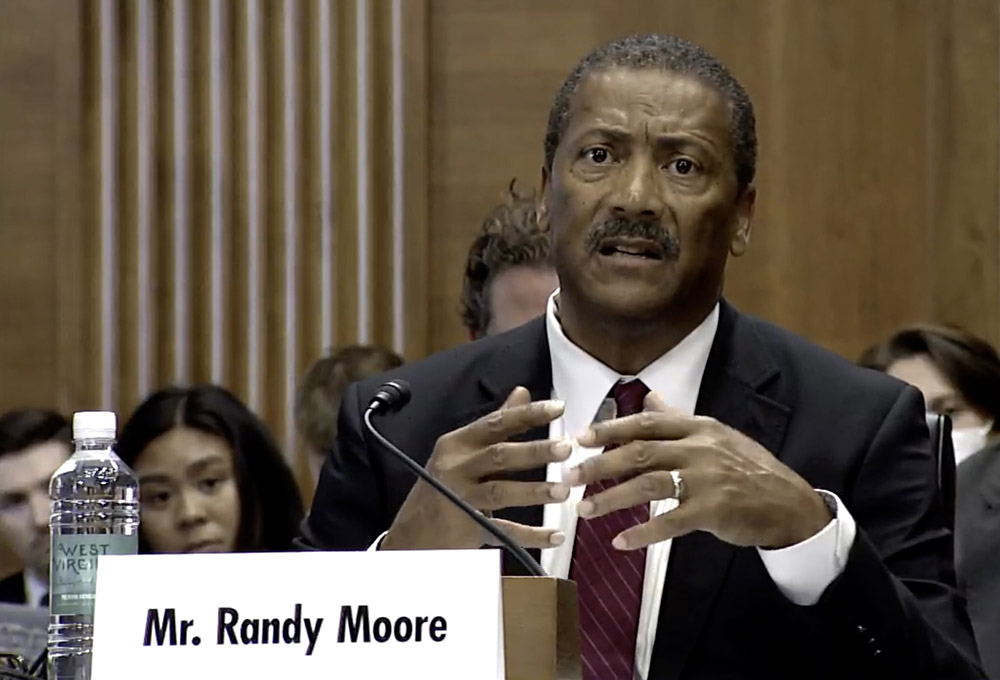
Chief Moore replied, “You know Senator, if I had the ability to set the pay for my firefighters I would certainly do that. I am left with trying to implement direction that is given through legislation…We are going to use every tool in that legislation to pay our firefighters more because they are very deserving of it. It’s dirty, nasty, hard work and they do deserve better pay, they deserve better benefits, they deserve better care in terms of mental and physical health conditions out there.”

48:29 — Senator Wyden got a commitment from the Chief to respond within two weeks to the issues he listed in a June 7, 2022 letter sent to the Secretaries of the Interior and Agriculture about how the funds in the Bipartisan Infrastructure Legislation (BIL) are being allocated and dispersed to the field, strategy for filling vacant positions, how to retain employees, progress on establishing the new Wildland Firefighter job series, and how to reduce the number of unfilled orders fires place for firefighting crews and engines.

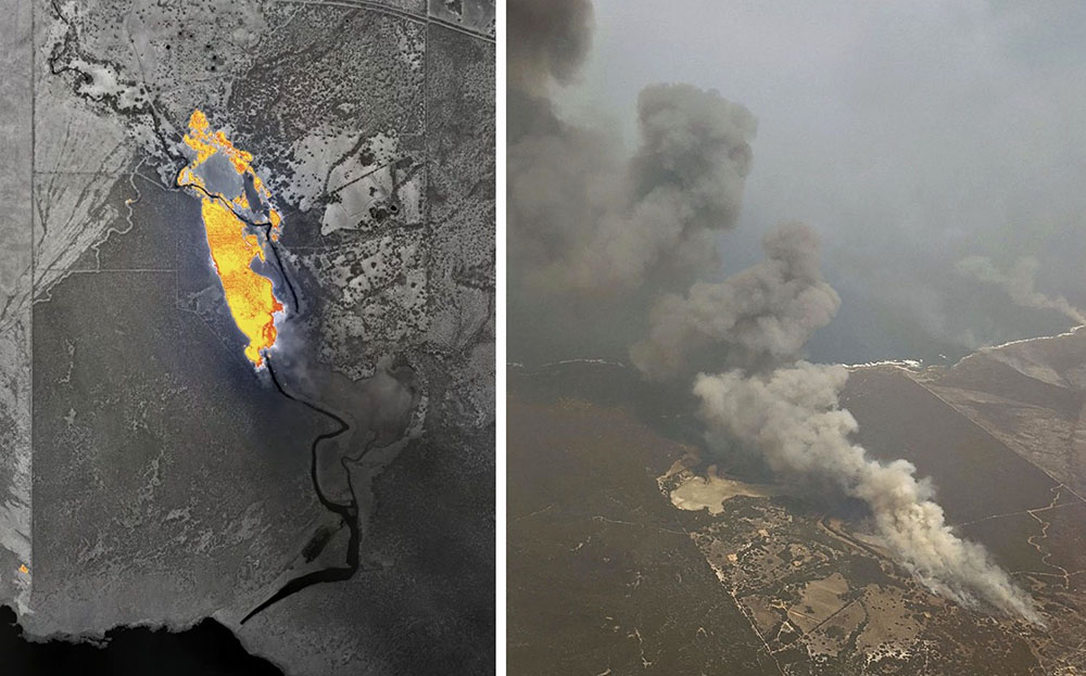
1:02:09 — Senator Martin Heinrich (NM) asked questions about the escaped prescribed fires that led to the currently burning Hermits Peak/Calf Canyon Fire.

1:15:50  — Senator Angus King (ME) gave an impassioned plea to implement the pay raises that were signed into law by President Biden eight months ago as part of the BIL.

“Eisenhower retook Europe in 11 months”, Senator King said. “You can’t do a pay raise in seven months? Come on!”

Senator John Barrasso (WY) also called for a pay raise.

1:18:45 — Senator Cortez Masto asked about what may be a temporary pay raise required by the legislation which would increase the salary of wildland firefighters by $20,000, or 50 percent of their base salary, whichever is less. Chief Moore said it will occur in “a couple of weeks”, and later said, “by the end of this month…That’s the goal. That’s what we’re shooting for.” Senator Masto was persistent, seeking facts and clarity, asking follow up questions, and getting details.

1:21:45 — Chief Moore discussed fuel treatments and emphasized that the treated areas must be large in order to effectively slow the spread of a very large fire. As far as accomplishing that, he  said, “… Based on the fires we are having now, we do not have enough firefighters to really successfully stop fires the way they are behaving because they are behaving in a catastrophic manner.

1:27:10 — Senator Martin Heinrich (NM) questioned the trend toward closing fire lookout towers staffed by humans, and replacing them with technology. The Chief did not take the bait or respond directly.

1:55:50 — Senator Maria Cantwell threw Chief Moore what could have been a softball question. “Where we are with our [firefighting] air capacity,” she said. “We previously had this discussion with the Forest Service wanting them to have more ready resources. The Forest Service I think at that time didn’t want to be in the fleet management business and said we’d rather contract. How are you viewing those air resources now that we know that we have so many more fire starts…We want to know that we have that early phase retardant or water…How is the Forest Service managing that given the huge increase in fire starts?”

Chief Moore responded: “You may know now that we have access to about 27 VLATS, Very large air tankers, also the large air tankers and so far we are not running across a need for additional tankers in this particular case at this particular time. We also — I don’t know why these decisions were made in the past about the aircraft but we do know that they are expensive to maintain if Forest Service had ownership of them. But you know there are pros and cons about that so I won’t really go into that, I’m not familiar with what went into that many years ago. In terms of our aircraft, we certainly need aircraft to help us with fire suppression. We also know that there are limitations with aircraft as well because aircraft don’t put out fires. It’s boots on the ground is where the fires are really put out.”

His predecessor in April 2021 squandered a softball opportunity to tell the House Appropriations Subcommittee on Interior, Environment, and Related Agencies that the Forest Service needed more funding in two very important inadequately budgeted areas, fuels treatment and aerial firefighting. Today Chief Moore squandered a similar opportunity, giving an incoherent response when basically asked, “Do you have enough firefighting aircraft?”

The facts are, there are 2 Very Large Air Tankers (VLAT) and 16 Large Air Tankers (LAT) on exclusive use (EU) contracts, working for 160 days. To say “We have access to 27” VLATs and/or LATs is intentionally misleading. The Forest Service assumes that the additional tankers on Call When Needed (CWN) contracts that may or may not ever be used, are always available at private companies, with flight crews and mechanics that are available and ready to quickly activate if the phone rings. And, it assumes that those companies are still in business and the very expensive aircraft which may have been idle for months are fully maintained and airworthy.

There are only a total of four VLATs in the Western Hemisphere that could be used on fires in the United States, all DC-10s. Two are on 160-day Forest Service EU contracts and the other two were recently activated on 120-day “surge” contracts. It is also usually possible to activate up to eight military C-130s temporarily converted to air tankers by carrying a Modular Airborne FireFighting System (MAFFS). But after hearing some chatter, we are checking to see if those will be available this year.

Two studies conducted for the Forest Service made recommendations for the number of air tankers that are needed on exclusive use contracts. One said 35 and the other said 41.

2:00:30 — The very last topic covered was what we have called the Holy Grail of wildland firefighting safety; knowing the real time location of the fire and firefighters. Senator Manchin pointed out that “15 months past the deadline in the statute the Forest Service has not equipped firefighters with the safety gear despite the technology having been commercially available on the shelf for many, many years, and despite Congress having appropriated $15 million for this, so maybe you have an explanation for that.”

Chief Moore said “No one believes in this more than I do”, but he said his staff told him it was not funded. The Senator said he understood it was funded. The two sides agreed to get together and figure it out.

The John D. Dingell, Jr. Conservation, Management, and Recreation Act required that by March 12, 2021 the five federal land management agencies “…develop consistent protocols and plans for the use on wildland fires of unmanned aircraft system technologies, including for the development of real-time maps of the location of wildland fires.”

While this technology has been demonstrated, real time mapping appears to be far from being used routinely.

The Dingell Act also mandated that the five federal land management agencies “jointly develop and operate a tracking system to remotely locate the positions of fire resources for use by wildland firefighters, including, at a minimum, any fire resources assigned to Federal type 1 wildland fire incident management teams”, due by the same date.

The US Bureau of Land Management has installed hardware for Location Based Services (LBS) which are now operational on more than 700 wildland fire engines, crew transports, and support vehicles. Vehicle position and utilization data are visually displayed via a web-based portal or mobile device application.

Fifteen months after it was required by Congress the US Forest Service has made very little progress on this mandate.

Whether or not the technology was specifically funded, it should be considered that the lack of situational awareness had led to dozens of fatalities on wildland fires and must be addressed.


We asked Kelly Martin, President of Grassroots Wildland Firefighters, for their impression of today’s hearing:

Federal Wildland Firefighter Pay has been a priority for our elected officials since the BIL was passed last October. We are still waiting. We are hopeful this increase in pay will be delivered to firefighters in the next two weeks.


The article was updated to include the question and answer about the requirement for the five federal land management agencies to provide technology for the real time location of the fire and firefighters.

Australian company develops system for real time mapping of wildfires

Part of the Holy Grail of Wildland Firefighter Safety

Map of a fire near Vivonne Bay, Kangaroo Island
Map of a fire near Vivonne Bay, Kangaroo Island, Australia, Jan. 9, 2020. FireFlight image.

At Wildfire Today we have often advocated for what we call the Holy Grail of Wildland Firefighter Safety — making available to fire personnel the real time location of the fire and firefighting resources. Several systems for tracking the fire or resources have been demonstrated or used on a small scale by federal land management agencies in the United States. Hundreds if not thousands of law enforcement agencies, fire departments, and private corporations have been using tracking systems for years.

A company in Australia has developed a system to deliver half of the Holy Grail, the real time position of a wildfire. FireFlight Technologies, with CEO Dr. Paul Dare, a long-term South Australian Country Fire Services (CFS) volunteer, has been awarded a $100,000 grant to demonstrate its real time mapping system.

Using infrared thermal sensing equipment in an aircraft it can see through smoke to detect the location of a wildfire.

Below is an excerpt from an article at Cosmos Magazine, January 7, 2022:

…“The other live information we get from the camera system is contextual,” says Dare. “We can see features such as trees, creeks, roads, buildings – even cars. Anyone looking at the map would recognize these features and understand the implications.”

“There are two ways of thinking about it. First, the chief is back at headquarters with a strategic view. They can move a dozen fire appliances from one side of the fire front to the other. This can take hours to achieve.

“Then there are the people on the fire trucks. They’re approaching the fire much more tactically. Their decision making is going to be based on seconds and minutes.”

This summer, Dare’s system will transmit rapidly updating high-resolution images onto a web-based portal. From there, CFS officers can interpret the bushfire’s behavior to reposition ground crews, deploy fire bombers and issue evacuation alerts accordingly.

The technology has already been put through its paces. Data from the sensor was relayed to defense personnel during the 2019–2020 Kangaroo Island bushfires. It’s also been used during recent wildfires in Montana and California.

“We build and supply our own hardware,” Dare said. “We make a set of equipment work together and put it in a box that can be bolted on a helicopter or plane. We give the pilot a portable computer to control it. That way, we know it’s all going to work.”

What’s happening in the United States?

In the US, the John D. Dingell, Jr. Conservation, Management, and Recreation Act required that by March 12, 2021 the five federal land management agencies “…develop consistent protocols and plans for the use on wildland fires of unmanned aircraft system technologies, including for the development of real-time maps of the location of wildland fires.”

While this technology has been demonstrated, real time mapping appears to be far from being used routinely.

The Dingell Act also mandated that the five federal land management agencies “jointly develop and operate a tracking system to remotely locate the positions of fire resources for use by wildland firefighters, including, at a minimum, any fire resources assigned to Federal type 1 wildland fire incident management teams”, due by March 12, 2021.

The US Bureau of Land Management has installed hardware for Location Based Services (LBS) which are now operational on more than 700 wildland fire engines, crew transports, and support vehicles. Vehicle position and utilization data are visually displayed via a web-based portal or mobile device application.

Ten months after it was required by Congress the US Forest Service has made very little progress on this mandate.

Thanks and a tip of the hat go out to Gerald.

Pilot project on Caldor Fire tested resource tracking and mesh communications

Real-time mapping was also demonstrated

satellite-based resource tracking, Caldor Fire
Example of data from satellite-based location reports, Caldor Fire, September, 2021. Dingell Act Resource Tracking (DART) team image.

In September during the late stages of the Caldor Fire which burned about a quarter-million acres near South Lake Tahoe, California an interagency team conducted a pilot deployment of location tracking and common operating picture technologies. They tested three different systems that track hardware mounted on vehicles or carried by personnel. They also evaluated real time video shot by an aircraft and made instantly available to firefighters. Other pilot projects were conducted on the Tussock Fire in Arizona in May, and the Tamarack Fire which burned from California into Nevada in July.

These two categories of information comprise what we have called the Holy Grail of Wildland Firefighter Safety — knowing the real time location of the fire and firefighters. Dozens, if not more, firefighters have been killed when this information was not known. If you think about firefighter entrapments, many could have been prevented if, for example, the Crew Boss, Division Supervisor, or Safety Officer had access to this real time situational awareness information.

Tracking fire resources

Legislation passed March 12, 2019 addressed this issue. The John D. Dingell, Jr. Conservation, Management, and Recreation Act mandated that the *five federal land management agencies “jointly develop and operate a tracking system to remotely locate the positions of fire resources for use by wildland firefighters, including, at a minimum, any fire resources assigned to Federal type 1 wildland fire incident management teams”, due by March 12, 2021.

BLM tracker
Tracker (white box) installed on BLM engine. BLM photo.

The Bureau of Land Management has installed hardware for Location Based Services (LBS) which are now operational on more than 700 wildland fire engines, crew transports, and support vehicles. Vehicle position and utilization data are visually displayed via a web-based portal or mobile device application.

“The LBS system has been implemented program wide and used successfully during the 2021 fire year by wildland fire managers and dispatchers to view nearly real time locations of BLM firefighting vehicles,” said Jessica Gardetto, BLM Chief of External Affairs. “The system and its viewer are gaining widespread use, especially as LBS data is visible in the Enterprise Geospatial Portal (EGP). EGP is widely used in dispatch centers and by fire managers to display wildland fire information viewable by multiple agencies and accessible by all cooperators.”

The US Forest Service is thinking about it.

“Based on the results of these pilot programs, strategies are being prepared for the adoption of tracking units for all agency-owned or operated incident vehicles and interagency hotshot crews,” said Stanton Florea, Fire Communications Specialist for the Forest Service.

We asked the Forest Service if they had installed any tracking units, and if so how many, and did not receive an answer by publication.

(UPDATE December 10, 2021. Wildfire Today received additional information from Mr. Florea today. He said the Angeles National Forest in Southern California has installed location trackers on engines and other fire vehicles. He explained that, “The USDA Forest Service and its Dept. of Interior partners are working on developing an investment proposal to support the acquisition and operation of a system.”)

Real time mapping or video

A requirement of the Dingell Act was that was due by September 12, 2019 was to “…develop consistent protocols and plans for the use on wildland fires of unmanned aircraft system technologies, including for the development of real-time maps of the location of wildland fires.”

The first part of the requirement appears to have been largely met, Mr. Florea told Wildfire Today, with interagency policies, Certificates of Authorization (waivers) with the FAA, and NWCG standardized procedures for UAS utilization on incidents.

We asked Ms. Gardetto about the status of real time mapping. She said the agency has developed plans and protocols for real-time mapping processes, “but they remain constrained by connectivity in remote locations. Real-time mapping capacity is dependent on the availability of technology and subsequent deliverables, though again, real-time mapping services by UAS are not generally requested by incident management teams or fire management personnel.”

If the service does not exist, it is unlikely that any firefighting resources are going to request it during an incident.

We asked the US Forest Service about the status of providing real time mapping to firefighters on the ground and did not receive an answer by the time of publication.

(UPDATE December 10, 2021. Wildfire Today received additional information from Mr. Florea today. He mentioned, as we described below, the pilot deployment on the Caldor Fire of a military aircraft with Distributed Real Time Infrared (DRTI) live video. There was no indication of widespread or routine deployment of real time video.)

Findings from the pilot deployment on the Caldor Fire

The pilot deployment on the Caldor Fire of common operating picture technologies showed that the technology exists, and it is a matter of selecting the hardware and support systems that can make the information available to firefighters.

It is impressive from a technological perspective. The three tracking systems they worked with were:

  • Everywhere Hub devices: Garmin inReach® Mini and inReach® SE+ send the data to the Enterprise Geospatial Portal (EGP) for viewing in a variety of tracking systems.
  • Team Awareness Kit (TAK). A smartphone app that uses a phone’s GPS to track its user’s location, and displays the locations of other TAK app users.
  • Vehicle trackers on BLM fire apparatus. Uses both cellular and satellite connections to send the vehicle’s location to the EGP.

On the Caldor Fire a military aircraft with Distributed Real Time Infrared (DRTI) program also was deployed and provided fire managers with the only source of live aerial video. DRTI is a collaboration between the U.S. Forest Service and the Air National Guard. This program provides real-time intelligence to fire managers using Air National Guard RC-26 aircraft equipped with high resolution thermal infrared and visible light cameras. These aircraft downlink a live video stream of wildland fires to National Guard soldiers on the ground, who can receive the video on a handheld military ROVER radio and display it on a tablet or television screen for fire managers to view.

Data flow of video and TAK data, Caldor Fire
DART team.

Devices were issued on the east zone of the Caldor Fire, which hosted the pilot project by the Dingell Act Resource Tracking (DART) team. DART also conducted a pilot project deployment of location tracking and common operating picture technologies on the Tamarack Fire in northern California and Nevada in July, 2021.

DART focused on issuing Everywhere Hub devices to specific divisions on the east zone of the Caldor Fire in an attempt to saturate areas of fireline, ensuring that as many resources as possible in the areas were tracked. A total of 185,382 position reports were received during the 14-day DART deployment on the Caldor Fire.

Elon Musk’s Starlink system

Starlink satellite dish providing internet service on the Caldor Fire. BLM photo.

The new technologies used included Starlink, a system developed by an Elon Musk company to eventually provide internet connectivity virtually anywhere in the world via a 23-inch satellite dish. (There is a newer version that is smaller and lighter, 12 by 19 inches weighing in at only 9.2 pounds.) The dish was tested by DART as a means to provide high-speed, low-latency internet service to remote areas of the Caldor Fire. They also used a Jagwire Server, which serves the aircraft’s live video stream to firefighters over cellular internet, and the Android Team Awareness Kit (ATAK) with an Unmanned Aerial System (UAS) Tool plugin. Speeds of 100-200 mbps down and 30 mbps up were found at the Starlink Dish.

*Five federal land management agencies involved in wildland fire are National Park Service, Fish and Wildlife Service, Bureau of Indian Affairs, Bureau of Land Management, and Forest Service.

Congress passes funding bill for federal firefighting agencies

The legislation pushes, again, for the implementation of tracking system for fire resources, due by March 12, 2021

Washington, DC
Washington, DC

Both houses of Congress passed a 5,600-page omnibus spending package Monday night to fund numerous programs that included the Departments of Agriculture and Interior along with COVID-19 relief. It the bill is signed by the President it will fund the agencies during the fiscal year that began October 1, 2020.

There are no major changes in the appropriations for wildland fire activities that employ approximately 15,000 forestry and range technicians whose primary duties are fighting wildfires. But there are some interesting issues that were highlighted, not in the text of the bill itself, but in the “explanatory statement” that elaborates on Congress’ oversight of the fire programs in the Forest Service, Bureau of Land Management, National Park Service, Fish and Wildlife Service, and Bureau of Indian Affairs.

Firefighting Technologies

Congress reminded the five agencies that the John D. Dingell, Jr. Natural Resources Management Act that passed overwhelmingly in both houses almost two years ago requires that by March 12, 2021 they develop and operate a tracking system to remotely locate the positions of fire resources. According to a press release by Senator Maria Cantwell at the time, by the 2021 fire season all firefighting crews – regardless of whether they are federal, state, or local – working on large wildfires will be equipped with GPS locators. By September 8, 2019 they were also supposed to develop plans for providing real-time maps of the location of fires. We have referred to knowing the real time location of both the fire and firefighters working on the fire as the “Holy Grail of Wildland Firefighter Safety.”

Apparently worried that the five agencies may be dragging their feet in following the requirements in the bill (which became law), Congress very, very politely issued a reminder in the explanatory statement:

The Committee encourages increased investment in these technologies within the funds provided for Forest and Rangeland Research and for preparedness activities in Wildland Fire Management. The Committee encourages prioritizing the use of commercial, off-the-shelf solutions, including mobile MESH networking technology, that provide situational awareness and interoperable communications between federal, state, and local firefighting agencies.

Longer contracts for firefighting aircraft?

The explanatory statement has a surprisingly lengthy section that directs the Forest Service and the DOI to submit a report within 90 days that lays out the considerations of awarding 10-year contracts for aircraft available for wildland fire suppression activities. If the President signs the bill today, the report would be due March 22, 2021.

The Next Generation 3.0 contracts for five large air tankers announced in October are for only one year with the possibility of up to four more years at the discretion of the FS.

Fire Aviation has more details about the possibility of longer contracts.

Move the Forest Service Fire and Aviation section out of State and Private Forestry

More than half of the entire budget of the Forest Service goes to Fire and Aviation Management (FAM). But if you were trying to find FAM on the agency’s organization chart, it may take a while.

Organization Chart, USFS
Organization Chart, US Forest Service. (From USFS website, December, 22, 2020)

The first version of the appropriations bill introduced in the Senate required that FAM be moved out of State and Private Forestry and put in it’s own branch, with the Director of FAM becoming a Deputy Chief:

Commensurate with the modernized budget structure included in this Act, the Forest Service shall realign its Deputy Chief Areas to conform to the appropriations provided herein, including the creation of a Deputy Chief for Fire and Aviation to administer the Wildland Fire Management appropriation, within one year of enactment of this Act.

In November the National Association of State Foresters wrote a letter to the House and Senate appropriations leadership opposing the concept:

While we agree more must be done to minimize the threat of catastrophic wildfire, we are concerned that establishing a Deputy Chief for Fire and Aviation would divert valuable resources  from land management activities that reduce the threat of wildfire, only to establish additional bureaucracy around wildfire suppression… Establishing a Deputy Chief for Fire and Aviation is tantamount to building a “fire agency” and therefore contrary to the intent of the “Wildfire Funding Fix,” which Congress passed to free up funding for more active forest management.

The final version of the bill that passed Monday night eased off on that requirement, suggesting the agency just think about it:

The Committees are interested in data and recommendations relating to any changes that could be made to improve the representation of Wildland Fire Management leadership under this structure and the potential creation of a new Deputy Chief for Fire and Aviation. The Committees recognize that wildland fire related activities touch every aspect of the agency and believe that providing the fire function with a senior leadership role at the Service will improve coordination and better represents the role fire plays in agency budgeting and decision making.

Last week before the new language became available Monday night I checked with some fire management folks, asking their thoughts about the requirement, at the time, of promoting FAM to be their own branch with a Deputy Chief for Fire and Aviation. Here are their responses, in some cases edited for brevity:

Tom Harbour, former Director of FAM for the Forest Service:

The language is controversial. Specific organizational language like this is not popular with any federal organization. Based on just budget, the FAM program has been “Deputy Chief eligible” for a couple decades, but more goes into significant organization change decisions than budget. Five different Chiefs (Bosworth, Kimball, Tidwell, Tooke, Christiansen) have had the budget facts in front of them and have decided NOT to make a change.  The most obvious immediate question is what would happen with S&PF programs, and what happens with the important relationships with State Foresters?

Greg Greenhoe, former Deputy Director of Fire and Aviation Management for the Northern Region, USFS

I really don’t know enough about the issue to have an opinion. I can understand the concern of the State Foresters with Fire Management leaving State and Private. But even when I was still working I always thought it was strange that Fire was under State and Private. I can see that some folks would be concerned that the largest single budgeted function in the FS doesn’t have its own Deputy Chief.

Kelly Martin, former Fire Chief of Yosemite National Park, National Park Service

Due to the fact that the wildland fire budget for suppression and preparedness is an overwhelming part of the entire USFS budget, this new proposed Deputy Chief of Fire and Aviation Management (FAM) position reporting directly to the Chief of the USFS leads to better accountability between the Chief of the USFS and the Fire and Aviation program.  Much needed modern reforms and developing a “National Fire Plan 2.0” will need to be closely linked between the Chief of the USFS and the Dep Chief of FAM. State and Private Forestry will continue to be an important part of the USFS overall program with or without the Fire Director working directly for the Deputy Chief of SPF.

Department of the Interior collaborated on 2,500 fuel treatment projects last year

s2t airtanker holy fire
An S-2T air tanker comes out of the smoke to drop retardant near the communication towers on Santiago Peak in Southern California August 8, 2018 as the Holy Fire approaches. HPWREN image.

Opinion: by David L. Bernhardt, Secretary of the U.S. Department of the Interior

Last year’s wildfire season was one of the worst on record as more than 58,000 wildfires burned more than 8.8 million acres across the United States. Nearly 26,000 structures were destroyed — more than double the previous annual record — and 19 valiant members of America’s firefighting community lost their lives.

Across the country, more than 98 million people live within or adjacent to lands susceptible to wildfires. As more and more people move into or near wildfire-prone areas, it’s paramount that federal, state, and local partners collaborate on ways to effectively protect local communities.

At the Department of the Interior, we have made wildfire preparedness a top priority. Our national wildfire reduction strategy is guided by President Donald Trump’s executive order and furthered by my order. These orders guide the active management of our lands and forests and encourage managers to think about reducing fire risk in their land management actions. Implementation of both orders is a priority for reducing the risks of deadly and destructive wildfires.

This coordinated framework will help ensure the protection of people, communities, and natural resources. We are also harnessing state of the art technology and robust intergovernmental partnerships to keep our communities and wildlands safe from the kinds of devastation we have seen in the past, but this is no easy task.

Our Wildland Fire Management program uses innovative, informed approaches to minimize wildfires. While topography, terrain, and weather are often external factors that spark a wildfire, we can control the fuel that allows fires to spread, as excess vegetation leads to increased wildfire frequency, size and intensity.

Vegetation treatment methods include thinning and timber harvest; controlled burns — quite literally, fighting fire with fire — chemical treatments; targeted grazing; mechanical removal; mowing or cutting; logging; and fuel breaks, or gaps in vegetation that limit the spreading of fires. When a wildfire burns into a fuel break, the flame lengths decrease, and its progress slows, making it safer and easier for firefighters to control.

We’ve used all of these methods to try to mitigate the damage caused by wildfires, as we collaborated with federal, tribal, state and local partners on nearly 2,500 treatment projects over the past year. Leveraging these partnerships, we removed excess burnable vegetation on more than 1.2 million acres of Interior and tribally administered lands, which is 17 percent more treated acreage than in 2016, to reduce the intensity and frequency of fires in high-risk areas. Helping lead these efforts, we conducted 1,552 drone missions on 200 individual wildfires, more than double those of the previous year.

This wildfire season, we have ramped up our efforts and mobilized an array of resources by land and air.

By the season’s end, the department will have deployed approximately 4,500 firefighting personnel — including an all-female fire crew that battled blazes in Alaska — 500 tribal firefighters, 151 smokejumpers, 18 interagency hotshot crews and four tribal hotshot crews. Wildland firefighters have at their disposal more than 600 pieces of specialized equipment, including engines, water tenders and dozers. Aviation assets also continue to play a critical role in efforts to manage wildfires, as the department employs 23 single-engine air tankers, six water scoopers, helicopters, and drones.

We are using everything at our disposal to protect Western communities from wildfires; and, with the help from the John D. Dingell, Jr. Conservation, Management, and Recreation Act’s provisions on wildfire technology modernization, we will continue to use advanced and emerging technologies to stay on the cutting edge of firefighting and fire prevention. The department is also actively harnessing state-of-the-art technology to improve real-time communication and tracking for incidents to increase firefighter safety.

In Colorado, more than 27,000 acres of land will be treated by the end of this fiscal year. One specific project completed already by the Bureau of Land Management is a 286-acre prescribed fire near Bayfield called the Rabbit Mountain Project Prescribed Fire. It was completed to restore and maintain a healthy ecosystem and reduce the risk of wildfire to private lands in the area. The prescribed fire will reinvigorate grasses, forbs, and shrubs and improve deer and elk habitat. Numerous other areas around the state are being treated, in addition to the active wildfire management that is ongoing to contain and extinguish current wildfires.

Under President Trump’s leadership, the Department of the Interior is pursuing innovative and effective wildfire management efforts, and we have made significant progress so far to deliver on the president’s goals for wildfire prevention and treatment. More work can and must be done, and we will continue to find new and improved ways to keep our people, communities, lands and resources safe and secure — now and in the years ahead.

Bill to provide real-time location of fires and firefighters sent to the President

The legislation passed both the House and the Senate with overwhelming bipartisan support

firefighter radio White Draw Fire
A firefighter on the White Draw Fire uses a radio to coordinate with other firefighters. July 29, 2012. Photo by Bill Gabbert.

A bill that directs the federal land management agencies to begin implementing a system that would enhance the situational awareness of wildland firefighters has passed both the House and the Senate and is awaiting the signature of the President.

On February 12 the Senate passed the John D. Dingell, Jr. Natural Resources Management Act with a vote of 92 to 8, and yesterday the House passed it 363 to 62. (Update: it became law March 12, 2019 when it was signed by the President.)

The bill also includes numerous other actions related to public lands including creating more than 1.3 million acres of wilderness out West, adding three national park units, and expanding eight others.

If the bill passes and is actually implemented by the federal land management agencies it would generate progress toward what we have called the Holy Grail of Wildland Firefighter Safety, knowing the real time location of a fire and the resources assigned. Too many firefighters have been killed when the exact location of one or both of these critical aspects of situational awareness were unknown. Recent examples with a total of 24 line of duty deaths were on the Yarnell Hill and Esperanza Fires.

The technology to monitor in real time a fire and firefighting resources has existed for years. Various systems are being used already by a few state and local agencies. The military does it for their war fighters, monitoring the enemy and their own forces. If implemented on fires, it will save lives.

Firefighters lives are as important as soldiers.

“I am proud that our Public Lands package passed the House yesterday and that we were able to include in it Senator Cantwell and Senator Gardner’s seminal bill to better equip our firefighters”, said Senator Joe Manchin, Ranking Member of the Senate Energy and Natural Resources Committee. “It is plain to see that wildfires are getting worse not better, and I want to ensure these brave men and women have access to the tools available that will keep them safe, as they work to keep us safe.”

The key points, below, in the legislation have requirements for the Secretaries of Interior and Agriculture. The completion dates will be established from the time the legislation is signed. (UPDATE: the bill was signed by the President March 12, 2019)

    • Establish a research, development, and testing program, or expand an applicable existing program, to assess unmanned aircraft system technologies, including optionally piloted aircraft, across the full range of wildland fire management operations. (within 180 days)
    • Develop consistent protocols and plans for the use on wildland fires of unmanned aircraft system technologies, including for the development of real-time maps of the location of wildland fires. (within 180 days)
    • Develop and operate a tracking system to remotely locate the positions of fire resources, including, at a minimum, any fire resources assigned to Federal Type 1 wildland fire incident management teams. (within 2 years)  According to a press release by Senator Maria Cantwell, by the 2021 fire season, all firefighting crews – regardless of whether they are federal, state, or local – working on large wildfires will be equipped with GPS locators.
    • Establish a system to track and monitor decisions made by state and federal wildland firefighting agencies to flag unusual costs, and those that endanger firefighters or deviate from an applicable fire management plan. (no time requirement)
    • Assign air quality resource advisors to Type 1 incidents managing a fire on federal land. (no time requirement)
    • Establish a system to collect data on firefighter injuries that were treated by a doctor, and all deaths during the Work Capacity Test, vehicle crashes, and aircraft accidents. (no time requirement)
    • The two Secretaries will work with NASA to establish a “Rapid Response Erosion Database” and maps that would make it possible to evaluate changes in land cover and soil properties caused by wildland fires. (no time requirement)
    • The two Secretaries, NASA, the Secretary of Energy, and the National Laboratories shall establish and maintain a system to predict the locations of future wildfires for fire-prone areas of the United States. (no time requirement)

The bill does not appropriate any additional funding to implement the real-time tracking provision. A study by the Congressional Budget Office concluded that the estimated $8 million cost is “insignificant” in the overall billions of dollars spent on wildland fire. Discussions behind the scenes in Washington are centered around small tracking devices being included in kits available from the wildland fire warehouse system which can be ordered by incident management teams the same way they order radio kits. The devices could then be distributed to personnel and other resources on fires. The newer Bendix-King radios used by firefighters already have GPS receivers which could be used to provide location data in a tracking system.

Now the question becomes, will the federal land management agencies actually implement the program to track the real-time location of fires and firefighters, or will they slow-walk it into oblivion like the Congressional orders to purchase a new air tanker, convert seven HC-130H Coast Guard aircraft into air tankers, and the repeated requests from the GAO and Inspector General to provide data about the effectiveness of firefighting aircraft?


(UPDATE February 28, 2019)